| PalestineRemembered | About Us | Oral History | العربية | |
| Pictures | Zionist FAQs | Haavara | Maps | |
| Search |
| Camps |
| Districts |
| Acre |
| Baysan |
| Beersheba |
| Bethlehem |
| Gaza |
| Haifa |
| Hebron |
| Jaffa |
| Jericho |
| Jerusalem |
| Jinin |
| Nablus |
| Nazareth |
| Ramallah |
| al-Ramla |
| Safad |
| Tiberias |
| Tulkarm |
| Donate |
| Contact |
| Profile |
| Videos |
Welcome To Qula - قولة (קולה)
|
District of al-Ramla
Ethnically cleansed days ago |
العربية Google Earth |
 |
Gallery (50) |
- Statistics & Facts
-
Before & After

- Satellite View
- Articles 11
- Pictures 50
- Aerial Views 1
- Mayrters & Prisoners 1
- Oral History 2
- Members 52
- All That Remains
- Wikipedia
- Videos 3
- Guest Book 35
- Links 1
| Statistic & Fact | Value | |||||||||||||||||||||
| Occupation Date | July 10, 1948 | |||||||||||||||||||||
| Distance From District | 14.5 (km) Northeast of al-Ramla | |||||||||||||||||||||
| Elevation | 125 (meters) | |||||||||||||||||||||
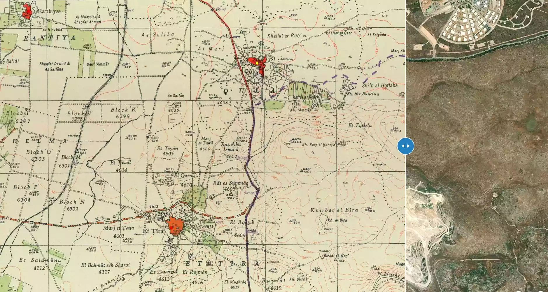
| Before & After Nakba, Click Map For Details |
||||||||||||||||||||||
|
||||||||||||||||||||||
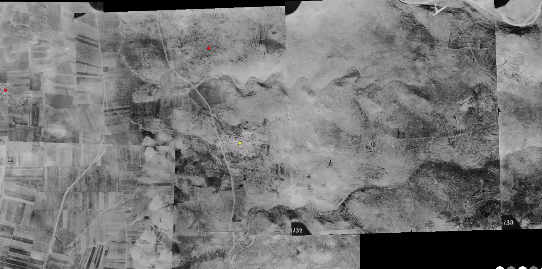
| Pre-Nakba Aerial View |
||||||||||||||||||||||
|
||||||||||||||||||||||
| Map Location | See location #3 on the map View from satellite |
|||||||||||||||||||||
| Attacking Units | Armored and Alexandroni Brigades | |||||||||||||||||||||
| Defenders | Jordanian Army | |||||||||||||||||||||
| Acts of Terror | Massacre occured by Zionist troops against the town's inhabitants. | |||||||||||||||||||||
| Exodus Cause | Military assault by Zionist troops | |||||||||||||||||||||
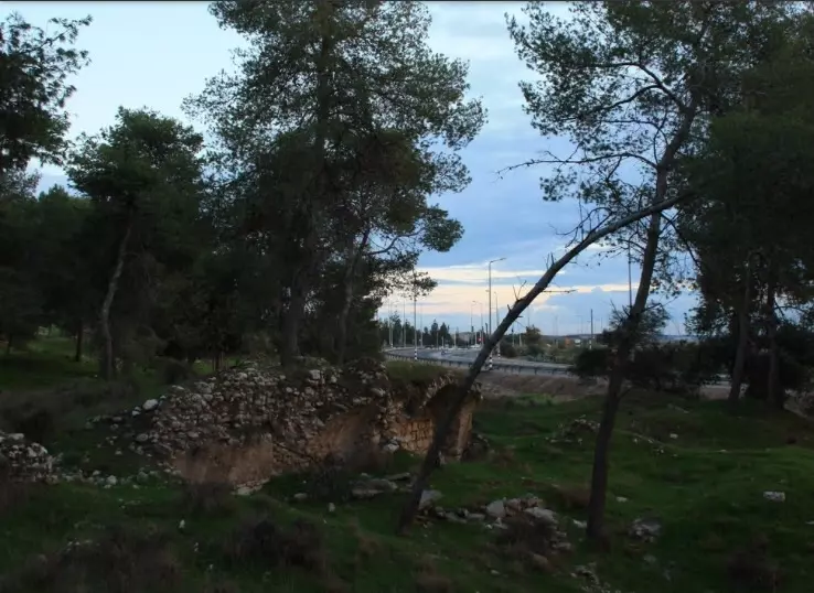
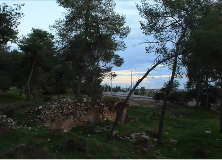
| Village Temains | On September 13th, 1948, Qula was completely obliterated and only house rubble left behind. | |||||||||||||||||||||
| Ethnically Cleansing | Qula inhabitants were completely ethnically cleansed. | |||||||||||||||||||||
| Pre-Nakba Land Ownership |
**Town Lands' Demarcation Maps |
|||||||||||||||||||||
| Land Usage As of 1945 |
|
|||||||||||||||||||||
| Population |
|
|||||||||||||||||||||
| Number of Houses |
|
|||||||||||||||||||||
| Near By Towns |
||||||||||||||||||||||
|
||||||||||||||||||||||
| Town's Name Through History | Qula may have picked its name from the nearby Crusades' fortress, Cola or Chola. | |||||||||||||||||||||
| Schools | An elementary school for boys was founded in 1919, and in 1945 it had an enrollment of 134 students. | |||||||||||||||||||||
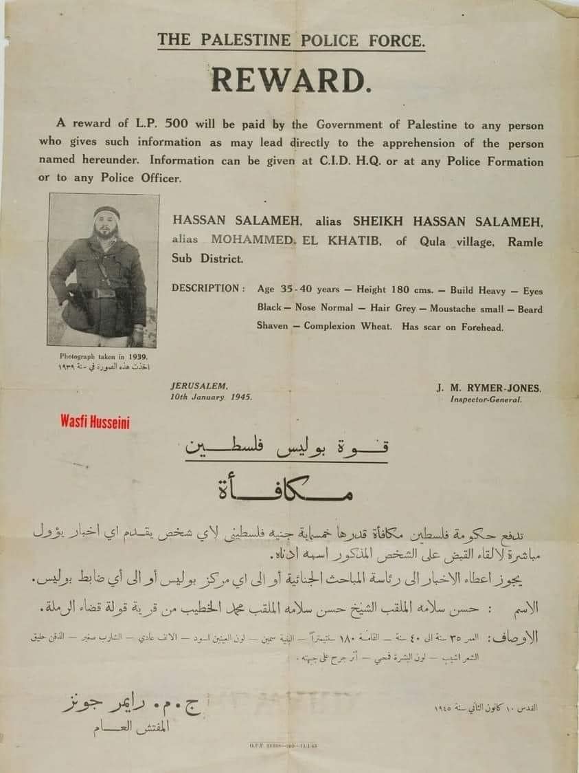
| Town's Notable People | Qula was the birthplace of the famous Palestinian leader Hasan Salameh, who commanded the defences of al-Lydd and al-Ramla cities during the 1948 war. This Palestinian hero was shot and killed during the battle of Ras al-'Ayn, northwest of Jaffa, in early June 1948. | |||||||||||||||||||||
| Places of Warship | One Mosque | |||||||||||||||||||||
| Exculsive Jewish Colonies Who Usurped Village Lands |
No Israeli settlements on village lands. | |||||||||||||||||||||
| Featured Video | ||||||||||||||||||||||
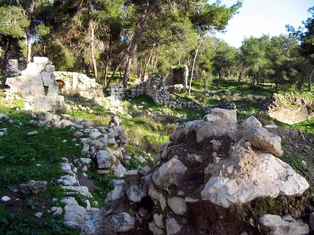
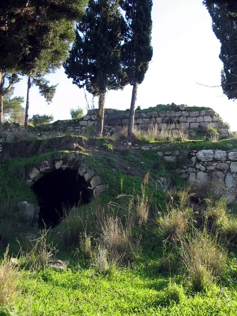
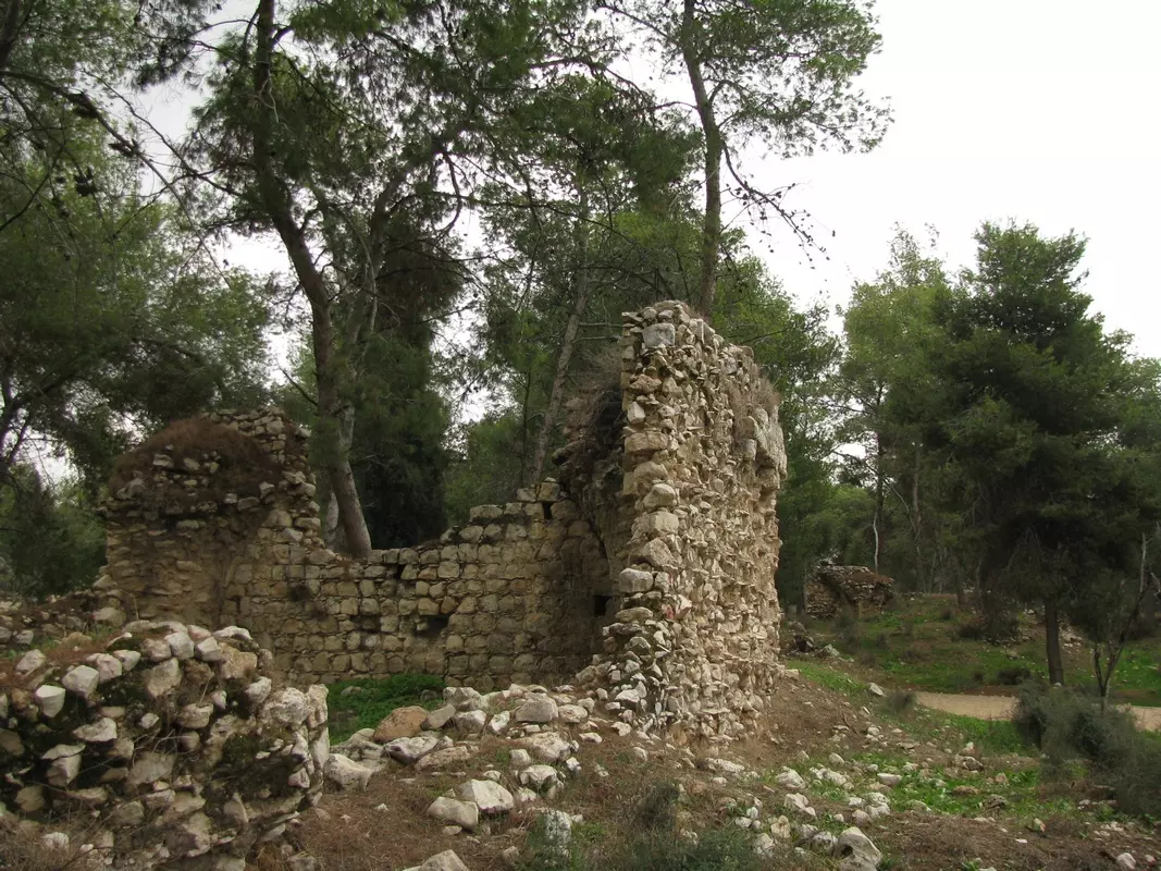
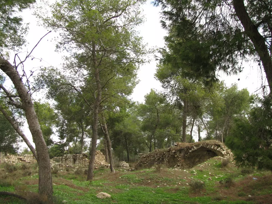
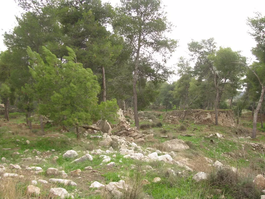
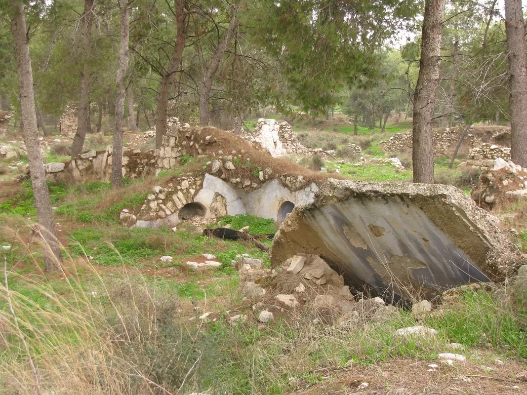
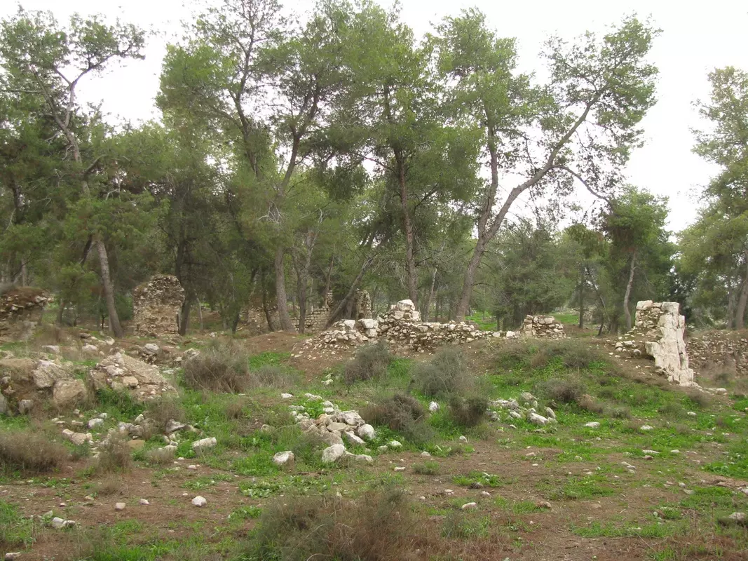
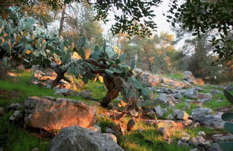
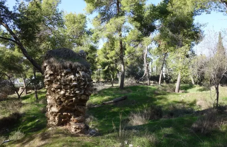
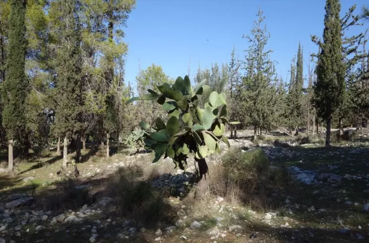
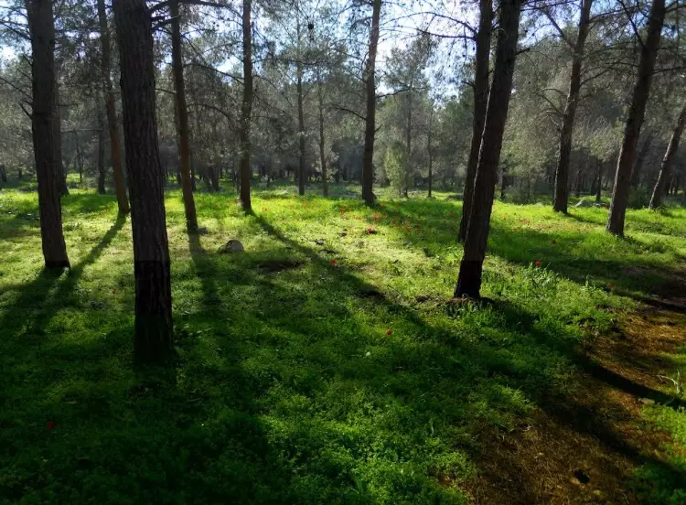
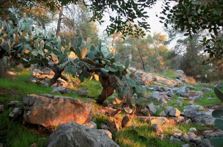
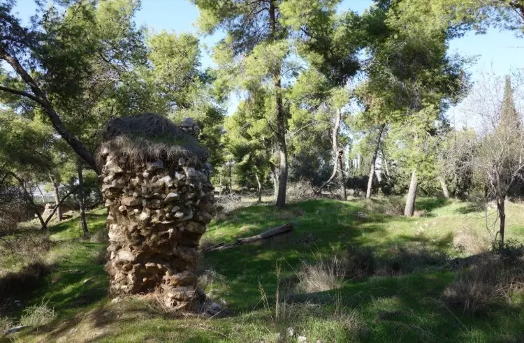
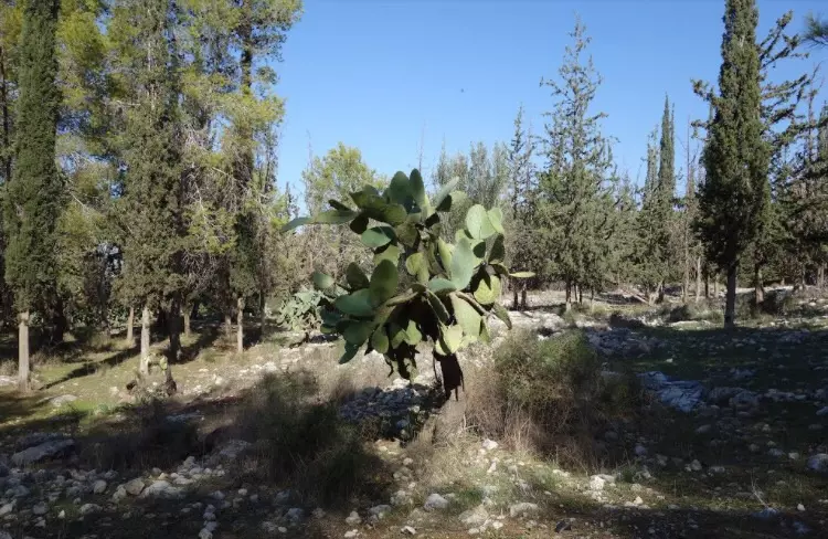
Village Before NakbaThe village was situated on a limestone hill on the western slope of the Ramallah Mountains, overlooking the coastal plain. A highway from Ramla that led north toward Tulkarm passed 0.5 km west of it, linking it to Tulkarm and other urban centers as well. A number of secondary roads connected it to neighboring villages. QuIa was constructed on the site of a Crusader fortress known as Cola or Chola. In 1596, Qula was a village in the nahiya of Ramla (liwa' of Gaza) with a population of 380. It paid taxes on goats and beehives and a press that was used for processing either olives or grapes. In the late nineteenth century, the village of QuIa was situated on a slope at the edge of a plain; its historical relics dated back to medieval times.Most of the houses were made of adobe and were scattered along the network of roads that crossed the village, giving it a star-like shape. During the Mandate, however, house construction expanded along the highway above. Qula's population was predominantly Muslim. At the village center was a mosque, a number of small shops, and a school, founded in 1919, in which 134 students were enrolled in the mid-1940s. The villagers cultivated grain, vegetables, and fruit and olive trees; their crops depended for the most part on rainfall. In 1944/45 a total of 2,842 dunums was allotted to cereals; 105 dunums were irrigated or used for orchards. The orchards were planted chiefly in the southeast and southwest. The village contained ruins from pre-Ottoman times, and four khirbas lay east of it. Village Occupation and Ethnic CleaningQuIa changed hands a total of four times before being held by Israeli forces. It was first occupied by units of the Armored and Alexandroni Brigades of the Israeli army after a 'heated battle' on 10 July 1948, according to the History of the War of Independence. At the time, the New York Times correspondent wrote that QuIa was 'situated at an important crossroads north of Lydda on the Arab supply lines from Ramallah and Nablus.' The village was briefly regained a few days later, on 16 July, by an armored column and infantry unit of the Arab Legion (which lost three men in the process), according to Palestinian historian 'Arif al-'Arif. That same afternoon, Israeli units of the Armored Brigade and two infantry platoons recaptured it in a counterattack. However, it fell back into Arab hands the following day, only to be lost again to units of the Alexandroni Brigade. The History of the War of Independence states that Israeli forces incurred 'heavy losses' in the battles over the village.Qula was one of fourteen villages designated for partial destruction by Israeli prime minister David Ben-Gurion on 13 September 1948. Zionists Colonies on Village LandsThere are no Israeli settlements on village land. The settlement of Giv'at Koach (144159) was established in 1950 on the lands of al-Tira, 2 km southwest of the village site.Village TodayA forest covers much of the village site. The rubble of crumbled houses and terraces lies among the trees, and cactuses and fig, mulberry, and eucalyptus trees grow there as well. The only remaining landmark is the school, on the west side of the site. The hilly parts of the surrounding land are used for grazing animals; the rest of the land is cultivated.SourceDr. Walid al-Khalidi, 1992: All That Remains. |
||||||||||||||||||||||
| Related Maps | Town Lands' Demarcation Maps خرائط للقضاء توضح حدود القرى والاودية Town's map on MapQuest View from satellite Help us map this town at WikiMapia |
|||||||||||||||||||||
| Related Links | Wikipedia's Page Facebook Page Google Search Google For Images Google For Videos |
|||||||||||||||||||||
| More Information | في كتاب كي لا ننسى في كتاب بلادنا فلسطين المزيد من موقع هوية |
|||||||||||||||||||||
- قصة اهل قوليه
- تاريخ البلده
- نبذة عن الشيخ الشهيد حسن سلامة (أسفل الصفحة) - 29 أيار 1948 - للأستاذ عارف العارف
- جمعية ديرتنا تزور مدينة اللد وقرى قولة والمزيرعة
- وطنٌ لا يُزار إلا بجواز أميركي
- Visit in Qule village
- ص ب 50710 ، الرياض - 11533 / السعودية
- استشهاد والدي
- نبذة تاريخية عن قرية قولة (قضاء الرملة) من كتاب (كي لا ننسى)
- من أعلام قولية: الشيخ عباس الحنداش
- نبذة عن الشيخ الشهيد حسن سلامة #2
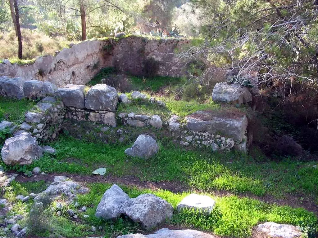
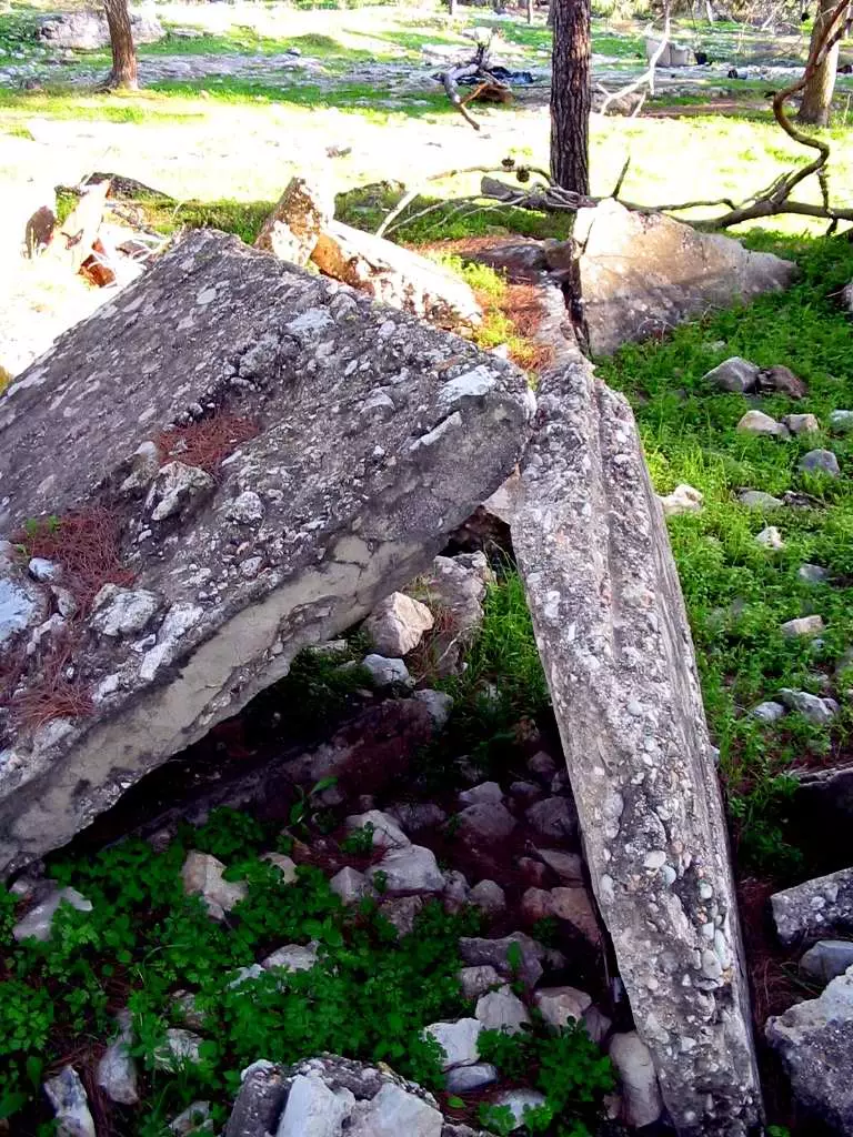
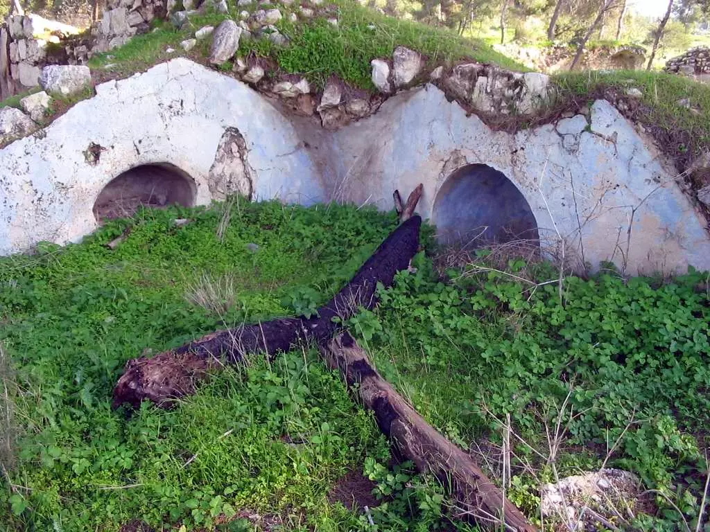
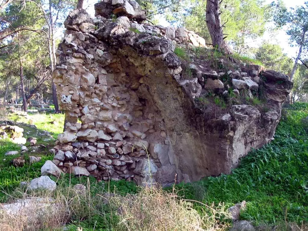
- Some of Qula's ruins, 2002
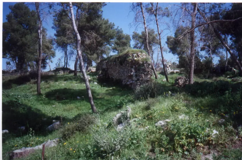
Posted by Uri Zackhem 5 - More of Qula's ruins and rubble #3, March 2002
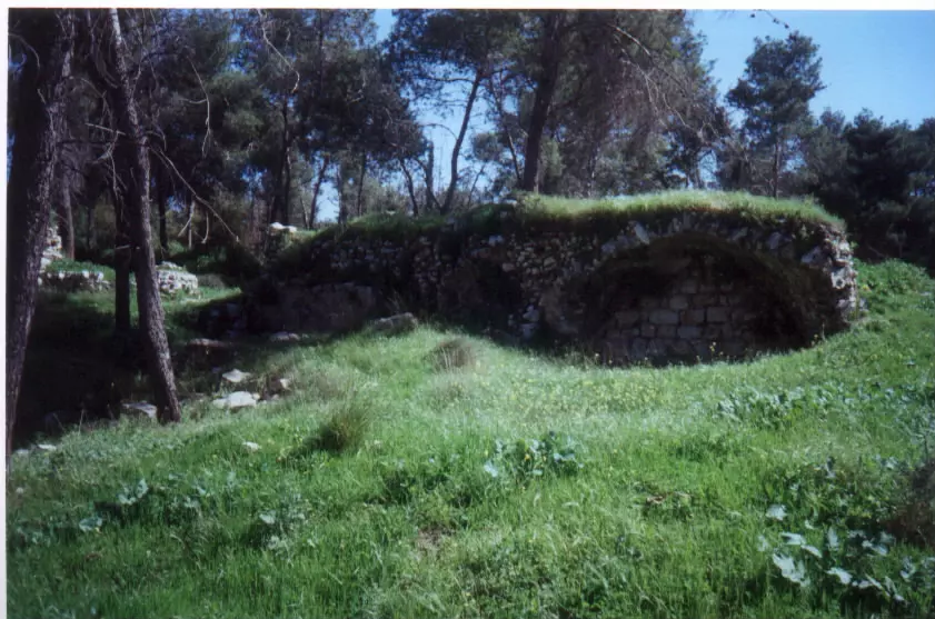
Posted by Uri Zackhem - Some of Qula's ruins #2, 2002
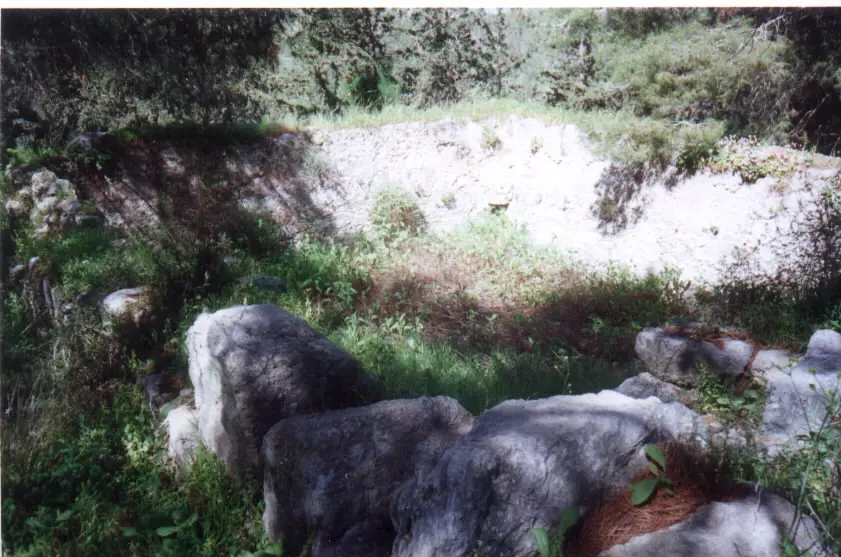
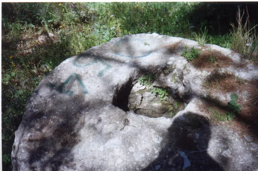
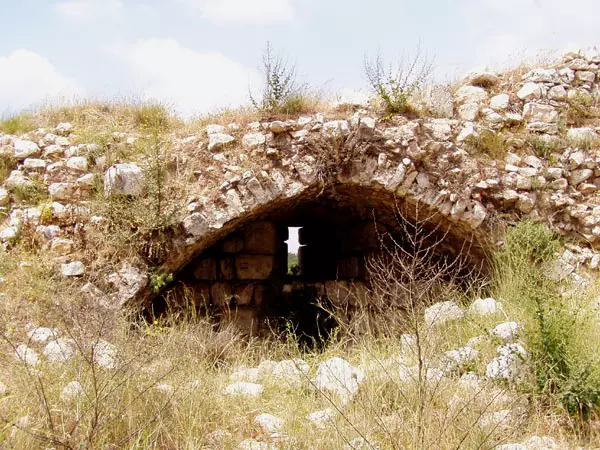
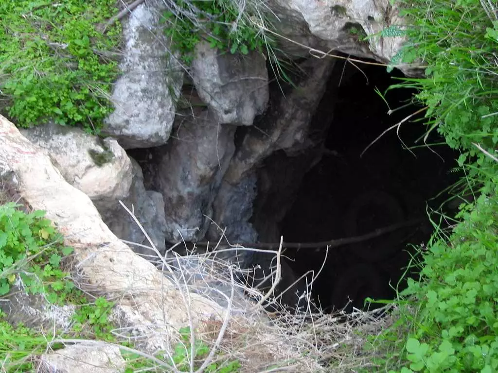
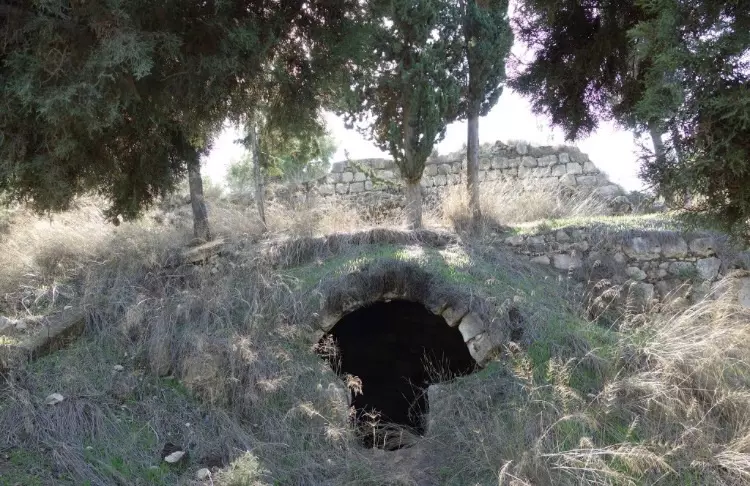
Posted by Uri Zackhem - Possible an abandand water cistern or well, 2002
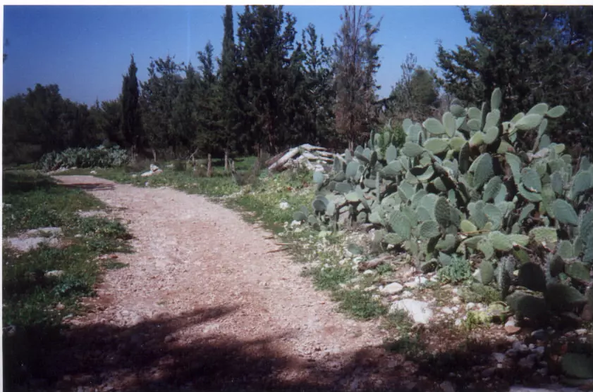
Posted by Uri Zackhem - Village dirt street, some rubble, Cactus trees, March 2002
Posted by Uri Zackhem - More of Qula's ruins and rubble #4, March 2002
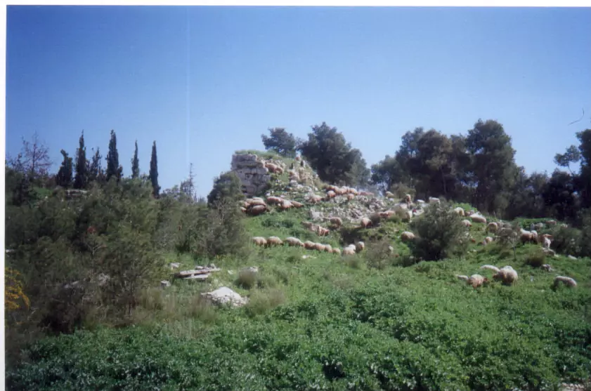
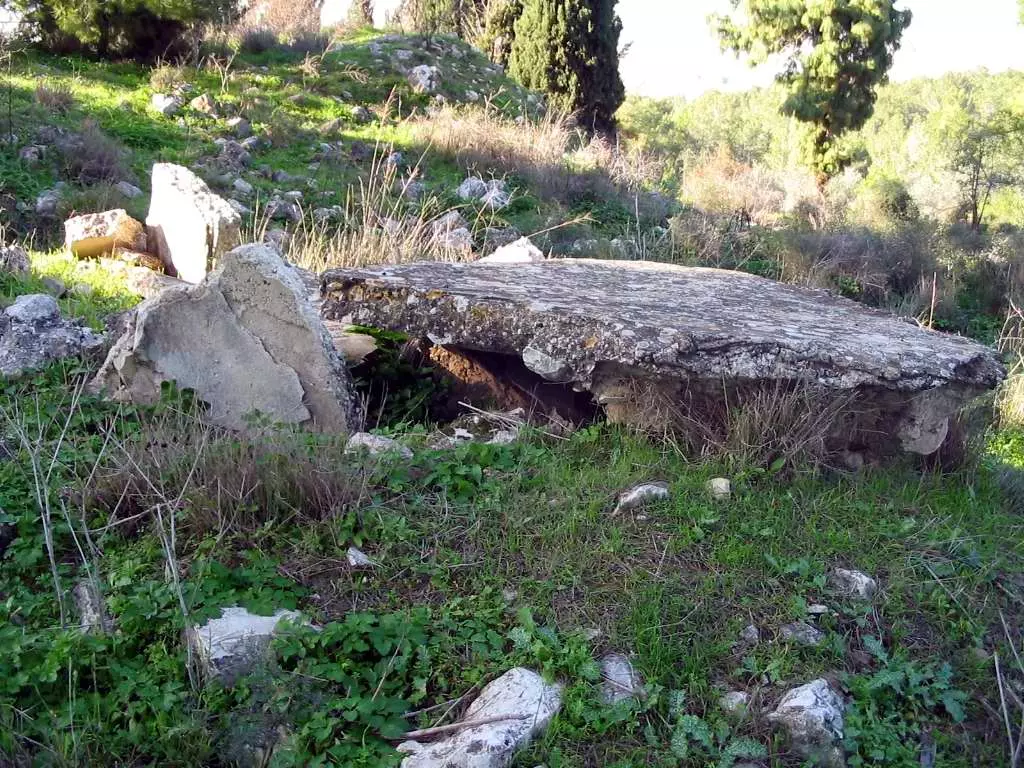
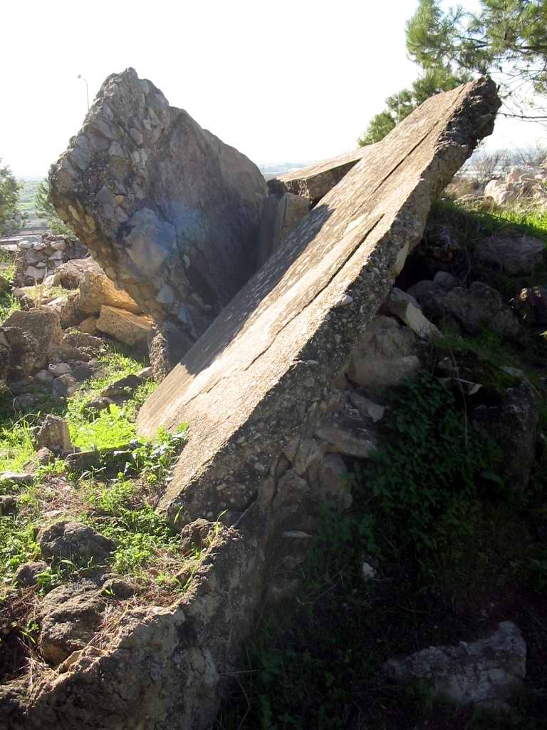
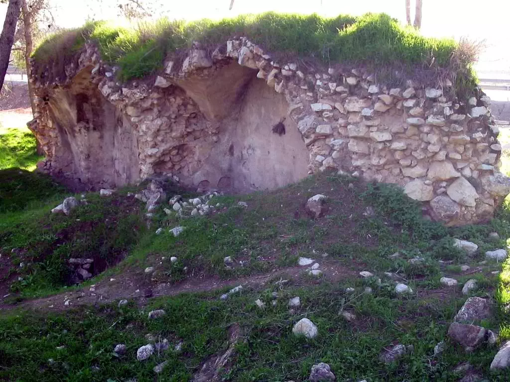
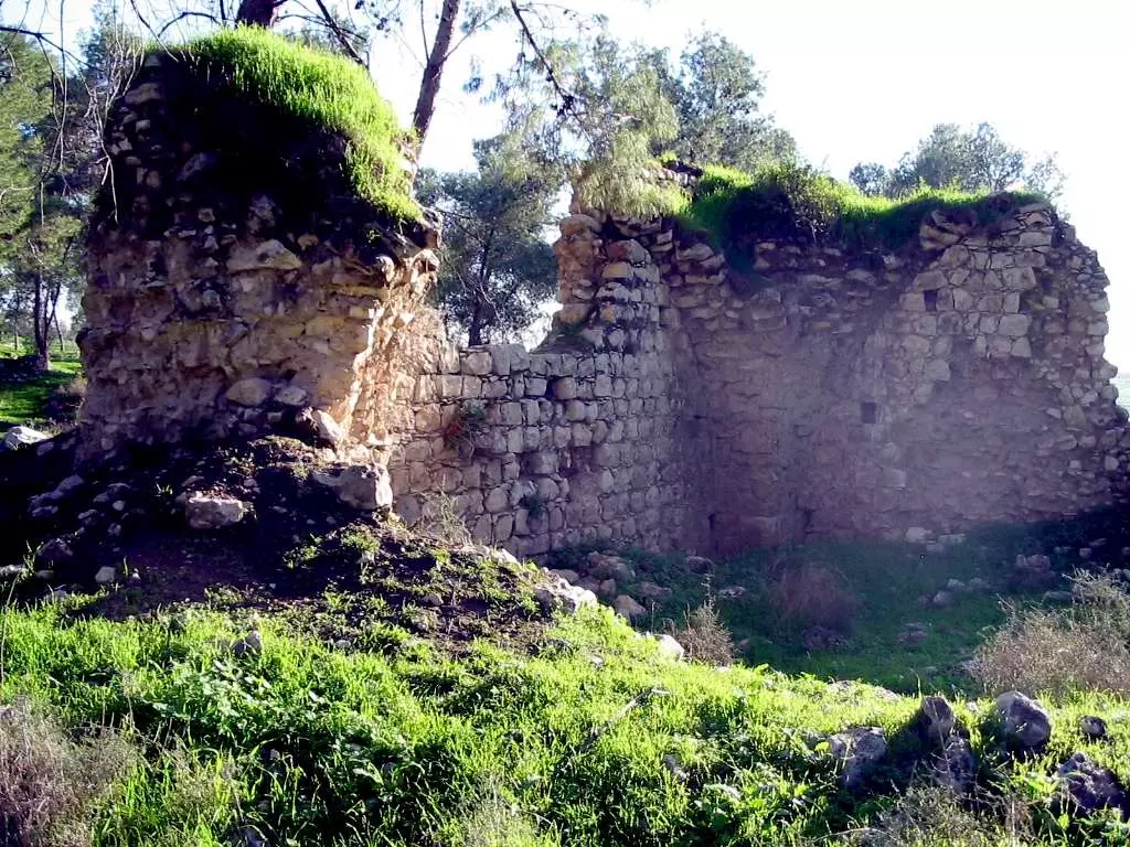
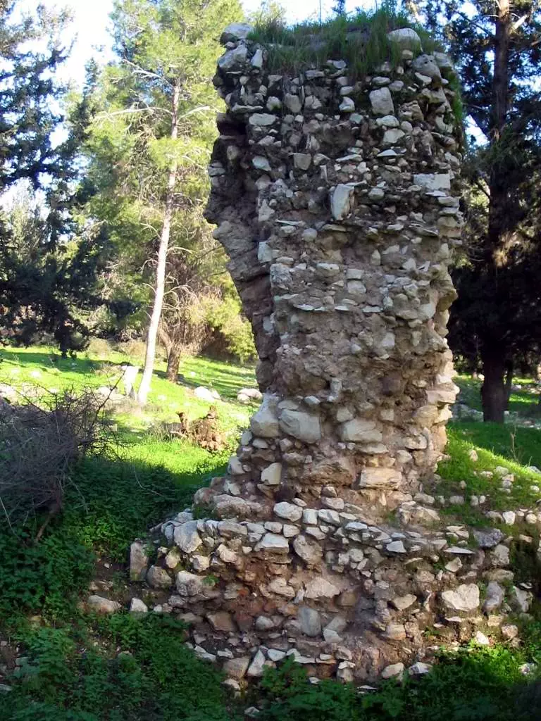
Posted by Uri Zackhem - Remains of the Crusade fortress #1, March 2002
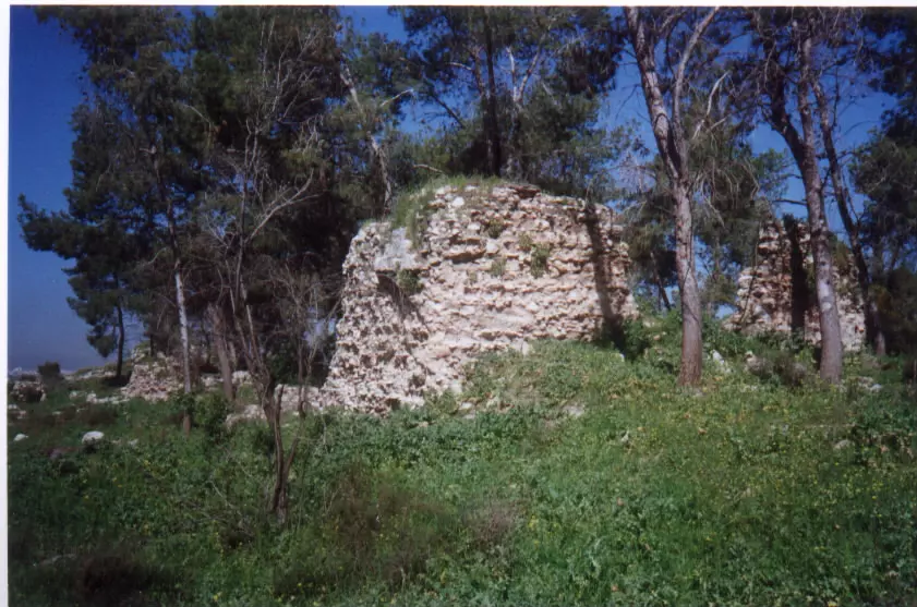
Posted by Uri Zackhem 1 - Remains of the Crusade fortress #2, March 2002
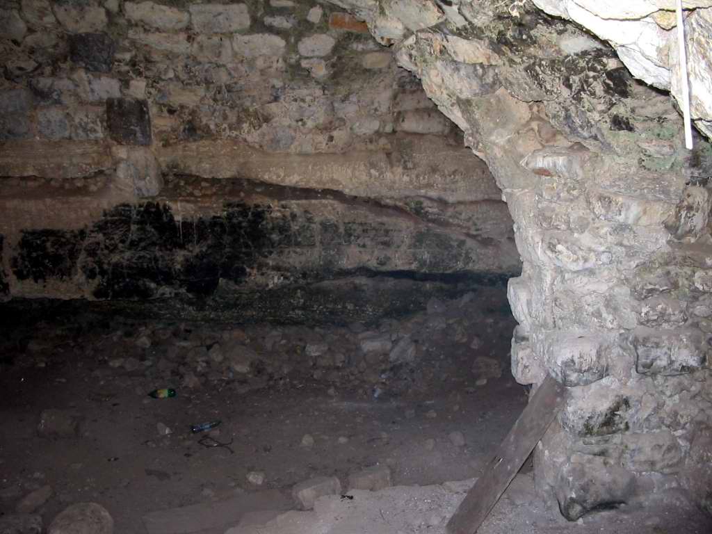
Posted by Uri Zackhem 1 - House remains in Qula
- مدرسة القرية المغتصبة. 1987
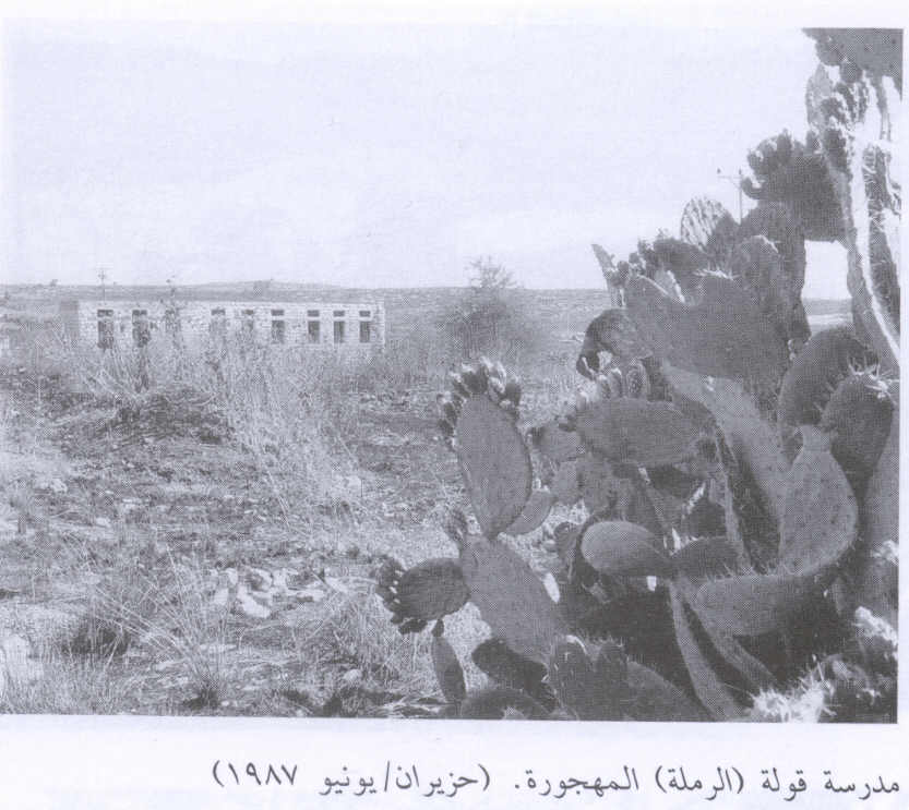
Scanned from "All That Remains" by Dr. Walid Khalidi 1 - الشهيد حسن سلامة

Posted by د.جمال ميدور 3 - قولية
Posted by د.جمال ميدور 1 - قولية
Posted by د.جمال ميدور 1 - قولية
Posted by د.جمال ميدور - قولية
Posted by د.جمال ميدور - قولية
Posted by د.جمال ميدور - قولية
Posted by د.جمال ميدور - قولية
Posted by د.جمال ميدور - قولية
Posted by د.جمال ميدور - قولية
Posted by د.جمال ميدور - قولية
Posted by د.جمال ميدور - قولية
Posted by د.جمال ميدور - قولية

Posted by د.جمال ميدور 2 - قولية
Posted by د.جمال ميدور - قولية
Posted by د.جمال ميدور - Ruins of Qula, december 2008
Posted by Paul Tieman 2 - Ruins of Qula, 31 december 2008
Posted by Paul Tieman 1 - Ruins of Qula, 31 december 2008
Posted by Paul Tieman - Ruins of Qula, 31 december 2008
Posted by Paul Tieman 1 - Ruins of Qula, 31 december 2008
Posted by Paul Tieman 2 - شجرة التوت في كولا تكرم ضيوفها من جمعية ديرتنا
Posted by محمد سلامة يونس - قولة منظر عام
Posted by جمال سالم - علي حسن سلامة

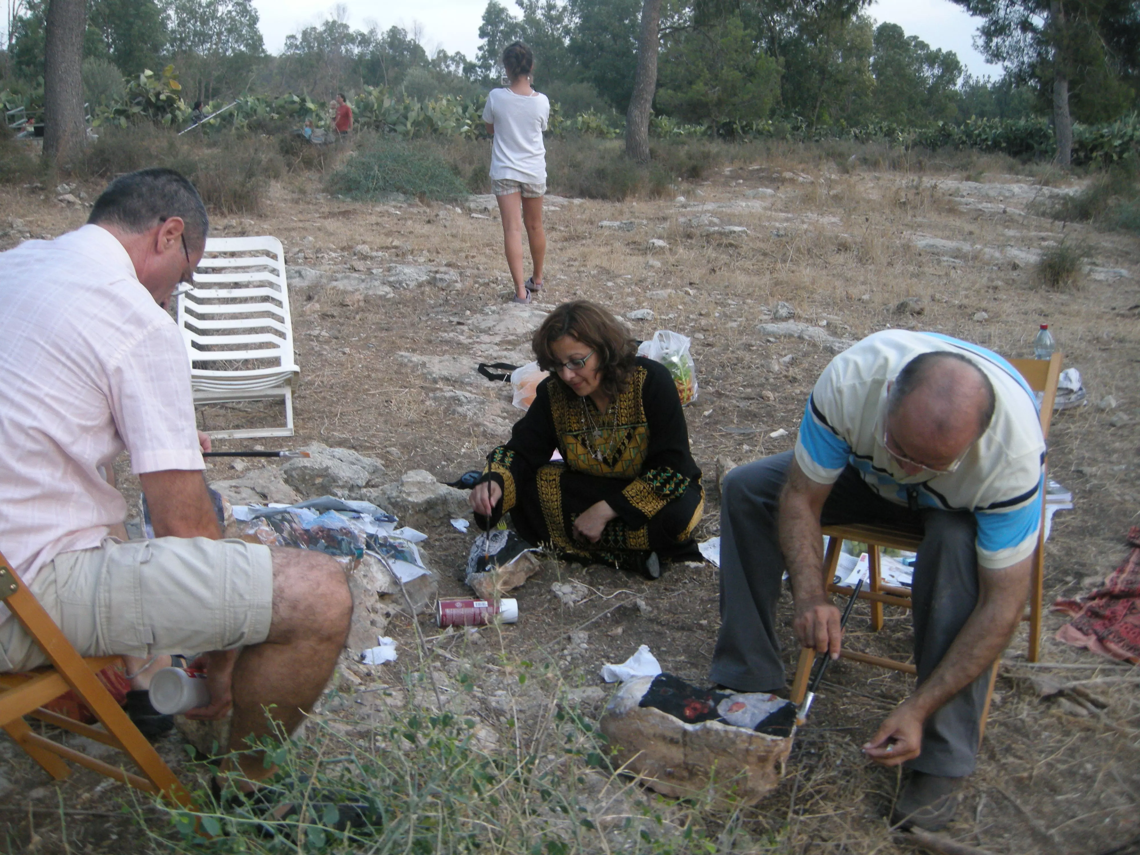
Posted by جمال سالم 4 - د. رلى زهير عواد , خالد محاميد وايتان بورنشطاين يرسمون اسماء العائلات على حجارة بيت جدها الحاج المرحوم محمود احمد حسن ؟ ابو فهمي -- في قرية قولة المهجره

Posted by خالد كساب محاميد 4 - د رلى زهير عواد ترسم صور أبناء عائلتها على حجارة بيت جدها المهدم في قرية قولة الفلسطينية المهرة
Posted by خالد كساب محاميد 1 - اطلال القريه
Posted by abu raya - اثار بيوت القريه
Posted by abu raya - موقع القريه وردم بيوتها
Posted by abu raya - حيطان بيوت القريه
Posted by abu raya - موقع القريه مغطى بالاحراش
Posted by abu raya - قوله
Posted by abu raya - قوله
Posted by abu raya - قوله
Posted by abu raya 1 - قوله
Posted by abu raya - قوله
Posted by abu raya - قوله
Posted by abu raya - Pre-Nakba Aerial view of the village / صورة من الجو للقرية اخذت قبل النكبة
- حكومة الانتداب الظالمة والمغتصبة للأرض ترصد مكافأة لمن يدلي بمعلومات حول القائد حسن سلامة من قرية قوله قضاء الرملة من قادة الجهاد المقدس
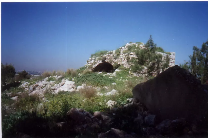
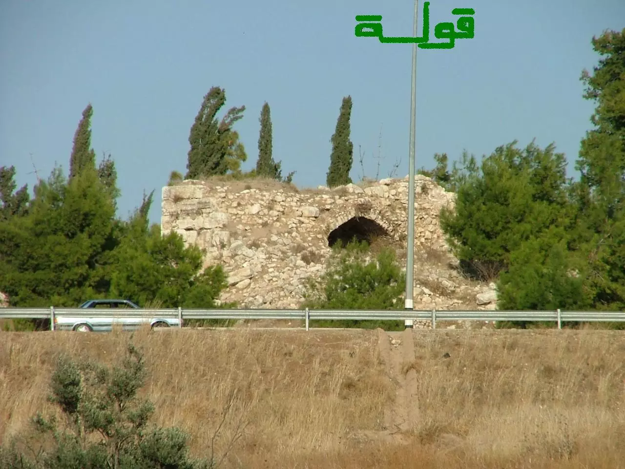
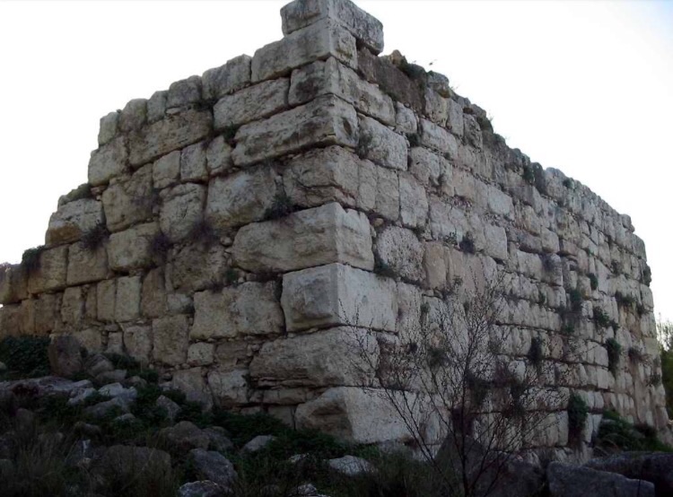
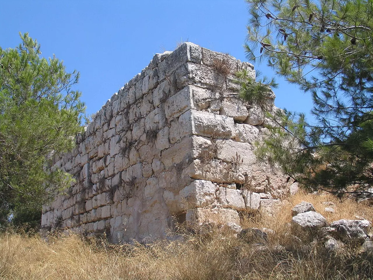
- The remains of the Crusader tower at Qula. The village mosque was located about 10m to the east of it.
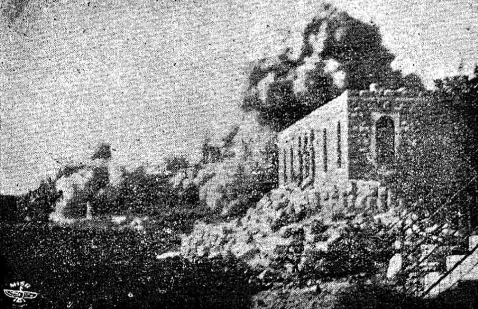
- The destruction of Qula during the 1936 Great Revolt by the British
Want to browse more? 80,000 pictures were grouped in these gallaries:
| Display Name | Clan/Hamolah | Country of Residence |
| Abdullateef Abu Joher | - | Palestine |
| ابو حسن | الحسن | جده |
| ابو جهاد | علي عودة | رام الله, قولة |
| سيف الله يوسف | - | - |
| أبوسيف الله | دار عبد الهادي | المنطقة الشرقية , السعودية |
| ابوسيف الزغل | الزغل | العقبه |
| amori | العموري | عمان |
| ابو اسماعيل | - | عمان, الأردن |
| Ramzi Amawi | Hassan (Amawi) | Ohio, USA |
| خضر العم ابو اياد | - | الاردن , الاردن الزرقاء |
| ابو نعمان | ابراهيم | رام الله والبيرة, فلسطين |
| عبدالله جميل الزغل | الزغل | , السعودية |
| ايوب العم | العم | - |
| Fadi A. Ghanim | Ghanim | Kuwait, Kuwait |
| خالد شريف | - | - |
| صلاح محمد عبدالله الزغل | الزغل | عمان, الاردن |
| جميل الزغل | الزغل | جدة, السعودية |
| غسان الزغل | الزغل | - |
| إياد العم | العم | عمان, الأردن |
| العموري | العموري | DUBAI, UAE |
| سامر ابو العم | العم | فلسطين , فلسطين |
| جمال سالم | سالم | رام الله, عارورة |
| waleed | - | amman, jordan |
| محمد مصطفى عبدالرحيم بشير عباس | عباس | اربد , الاردن - اربد |
| ابواحمد | - | - |
| Ihab Mohammad Hassan Assaleh | - | Pest, Hungary |
| فواز علي السالم | علي السالم | الرياض, السعودية |
| احمد يوسف عبد المجيد سعيد علي عودة | عودة | amman, Jordan |
| Mohammad Maydor | - | - |
| اسامة سعيد اسعد محمد علي عودة | علي عودة | رام الله, فلسطين |
| سعيد اسعد محمد علي عودة | علي عودة | رام الله, فلسطين |
| eman | ali odeh | amman, jordan |
| مهند الحاج محمود | - | - |
| Al-Hassan | Hassan | - |
| فراس منصور دبور | دبور | - |
| ابو عمر | دبور | - |
| moath ghanem | - | - |
| احمد غانم | - | - |
| محمد صبري | علي عودة | الاردن, الاردن |
| حسام العموري | العموري | Dubai, UAE |
| كريستينا داود | الحسن | صويلح, الاردن |
| أبو عمر | غانم | صويلح |
| العم عزمي | العم | جده, جدة |
| THE GOD FATHER | ALAMMOURI | - |
| ibh | ibrahim | amman, jordan |
| loveorang555 | - | - |
| samer zaghal | Zaghal | - |
| Jaml Maidour | - | Jordan |
| salim ali | ali odeh | male, qatar |
| Ahmad Odeh | Odeh | - |
| د.جمال ميدور | ميدور | Amman, Jordan |
| ahmed | hasan | UAE |
- في حوش سلامة الخطيب في قرية قوليا المهجرة (قضاء الرملة) . Duration: 2 min 42 sec
- قولية أو قولة (قضاء الرملة): بلدة حسن سلامة. زيارة للقرية بمناسبة ثلاث سنوات لإنشاء الصفحة. زيارة للكروم والمدرسة والبيادر والساحات والمسا.جد والبيوت وبرج دار الفار الصل.يبي. علامات تدل على الانتماء وتاريخ منخرط بالحيز Duration: 15 min 43 sec
- ما تبقى من مسجد قرية قولة او قولية قضاء الرملة Duration: 36 sec
 Fake Valor: Why Did Zionist Jews Hoist Nazis Flag on Their Ships in the 1930s?
What is new?
-
Facts About Oct. 7th Gaza Raid
-
Remined Us Please:: Who Did Rape Who? Palestinians Raped Israelis? Or, was the other way around?
-
When Prof. Edward Said was invited to debate Bibi Netanyahu in the 1980s, watch what happened!
-
Abusing Blood Libel!
-
Zionist FAQ: Isn't it true that Palestinians don't want peace? Palestinians never accepted the two-state solution
- Facts about Haavara (Transfer) Agreement between Ben-Gurion & Hitler
-
Haavara FAQs: Why Did Zionist Jews Hoist Nazis' Flags on Their Ships in the 1930s?
-
Dear ChatGPT: Why did the Jewish Agency suppress news of the Holocaust during WWII?
-
Video Playlist: Jews share their DNA tests to end the conflict for good.
-
How Ronald Reagan would have framed the genocide in Gaza if he was still alive?
-
Haavara FAQs: Let us do the math: how many German Jews did The Haavara Agreement save?
-
Zionist FAQs: The Hebron Massacre of 1929, "clearly proves" that Palestinians are antisemitic, how could you deny it?
-
Zionist FAQs: Why Anti-Zionist Is Not Antisemitism?
-
Zionist FAQs: Isn't it true that the KGB create Palestinian Nationalism in the early 1960s?
- Zionist FAQs: Muslims are killing Muslims all the time; why are Israeli Jews being singled out in the media?
- Zionist FAQs: How is Israel an apartheid state when 20% of its citizens are Arabs who enjoy full rights?
-
Haavara FAQs: Analysis of Herzl's Uganda Scheme and how it could have saved millions of Jews.
-
Haavara FAQs: Why did Hayim Greenberg describe American Jewry as "morally bankrupt" in early 1943?
-
Haavara FAQs: What if the Evian Conference was a resounding success? What would have been the impact of saving European Jewry on Zionism?
- Haavara FAQs: What if the six million were saved, how that would have impacted the Zionist project?
-
Haavara FAQs: How did Zionist leaders react when Europe's Jews lingered in the DP camps after WWII ended?
-
Why does the American Jewish community repeat lies that David Ben-Gurion had debunked before he died?
-
Who has the power to rename the Tatar/Khazar Gene Marker to Jewish IV?
-
Zionist FAQs: Why won't Egypt, Syria, and Jordan take their people back? Jews are indigenous to Palestine, and Arabs immigrated after Jews developed the country. Arabs should leave.
-
Haavara FAQs: Did Hitler and the Nazis conflate between Judaism and Zionist? If that wasn't case, then why?
-
Haavara FAQs: Winston Churchill and antisemitism, a collection of articles written Churchill.
-
Haavara FAQs: Broken by country, how many Jews survived vs. killed during the Holocaust?
-
Haavara FAQs: Why did European Jews vote with their feet and to immigrated to the Americas, not Palestine, after WWII?
-
Watch this American Jewish Girl describing Israeli Jews' cognitive dissonance like no other in under two minutes
-
Haavara FAQs: When the Nazis went out of their way to hide the Holocaust, Israeli Jews did the exact opposite by broadcasting their genocide of Gazans. But why?
-
Haavara FAQs: How Zionist Jews went out of their to show their appreciation to Nazism and Fascism?
- Haavara FAQs: Why Zionist leaders were against bombing the death camps & the Railroads leading to them?
-
Haavara FAQs: Hitler's message to the British and American people: If Jews are such noble citizens and you care about them, how come you're not letting them in? I will gladly ship them to you at my expense, even on luxury liners!
-
A shortlist of Zionist and Israeli false flag operations in the name Jews.
-
The Most Moral Army
- The Land of Kapos (Israel): Where the brave are boycotted and Kapos walk free.
- Why did early Zionists often named their communal enterprises "colonial"?
- Zionist Relations with Nazi Germany by Faris Glubb
-
Two NY Times advertisements by Zionists in the early 1943 that exposes Zionists' treason at the height of the calamity
- Facts Not Lies about the Palestinian-Israeli Conflict.
- Site's pictures have been categorized
- Campgain Against Lice
- A Survey of Palestine, the official source about Palestine before Nakba produced by the British Mandate; over 1200 pages.
- Satellite View & Google Earth: Over 6,000 placemarks identifying all destroyed towns, W. Bank & Gaza Strip Towns, & refugee camps.
- PalestineRemembered.com and its Nakba Oral History Project were featured on al-Jazeera Satellite TV.
- Nakba Oral History Video Podcast:
 Over 700 Oral History interviews (including 3,500+ hours of recording) can be viewed online.
 - Palestine Village Statistics Project
- Gaza Jail Break
- النسخة العربية للموقع الان متوفرة
- Videos: Documenting the destroyed villages in video: Tracing all that remains since Nakba.
- Videos: Responding to Zionist Propaganda
- Interview: The ethnic cleansing of Palestine: George Galloway interviews Israeli Historian Ilan Pappe.
- For Palestinians, memory matters. It provides a blueprint for their future By George Bisharat.
- Zionist FAQ now available in Hebrew שאלות שציונים שואלים, עכשיו בעברית
- Video: The Stephen Walt and John Mearsheimer report on the influence of the Israel Lobby on U.S. Foreign Policy
- The Palestinian-Israeli conflict for beginners
