| PalestineRemembered | About Us | Oral History | العربية | |
| Pictures | Zionist FAQs | Haavara | Maps | |
| Search |
| Camps |
| Districts |
| Acre |
| Baysan |
| Beersheba |
| Bethlehem |
| Gaza |
| Haifa |
| Hebron |
| Jaffa |
| Jericho |
| Jerusalem |
| Jinin |
| Nablus |
| Nazareth |
| Ramallah |
| al-Ramla |
| Safad |
| Tiberias |
| Tulkarm |
| Donate |
| Contact |
| Profile |
| Videos |
Welcome To al-Bassa - البصة (אל-בצה)
|
District of Acre
Ethnically cleansed days ago |
العربية Google Earth |
 |
Gallery (184) |
- Statistics & Facts
-
Before & After

- Satellite View
- Articles 18
- Pictures 184
- Aerial Views 3
- Oral History 14
- Members 73
- Families
- All That Remains
- Town's Map
- Wikipedia
- Videos 13
- Guest Book 50
- Links 4
| Statistic & Fact | Value | ||||||||||||||||||||||||
| Occupation Date | May 14, 1948 | ||||||||||||||||||||||||
| Distance From District | 19 (km) North of Acre | ||||||||||||||||||||||||
| Elevation | 65 (meters) | ||||||||||||||||||||||||
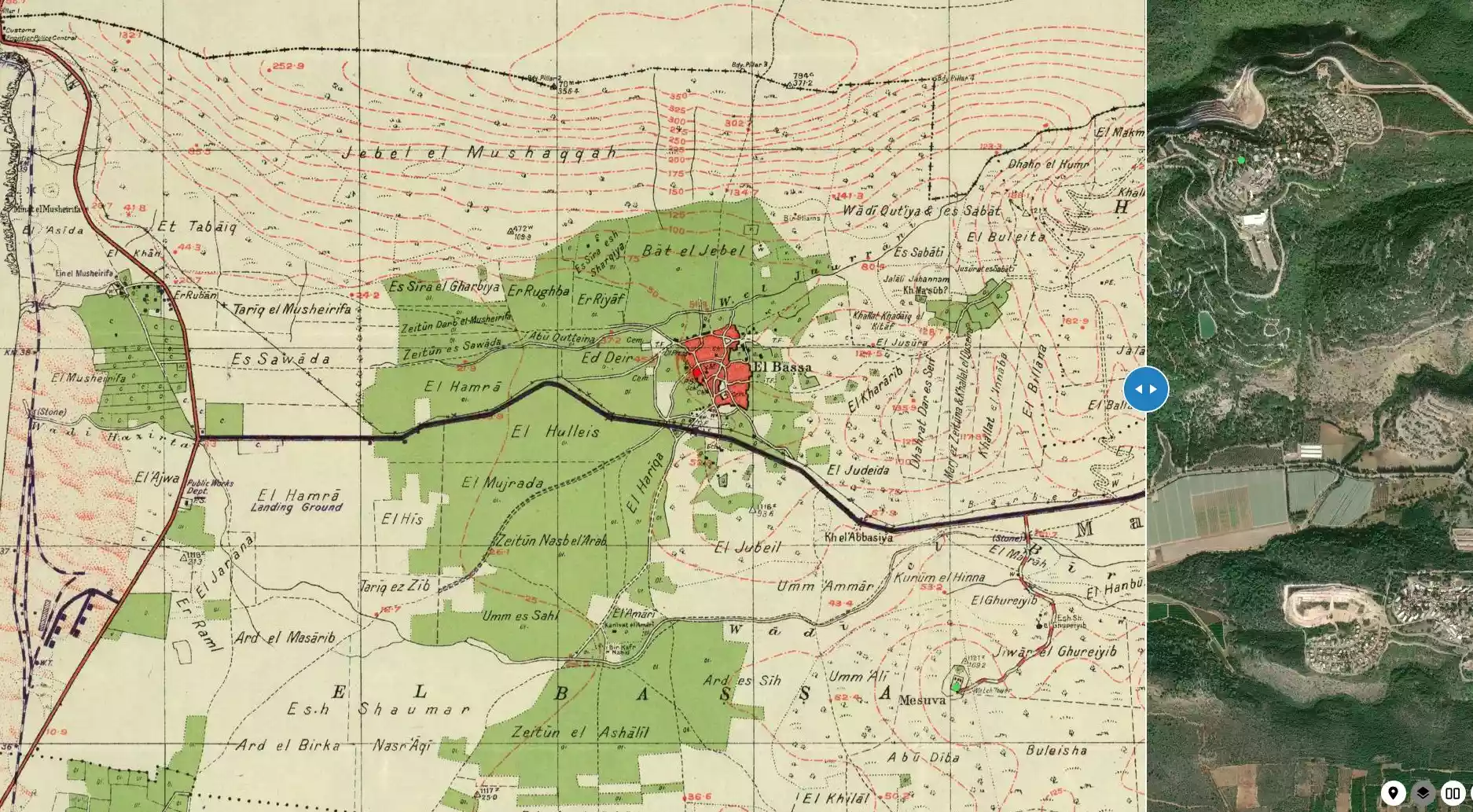
| Before & After Nakba, Click Map For Details |
|||||||||||||||||||||||||
|
|||||||||||||||||||||||||
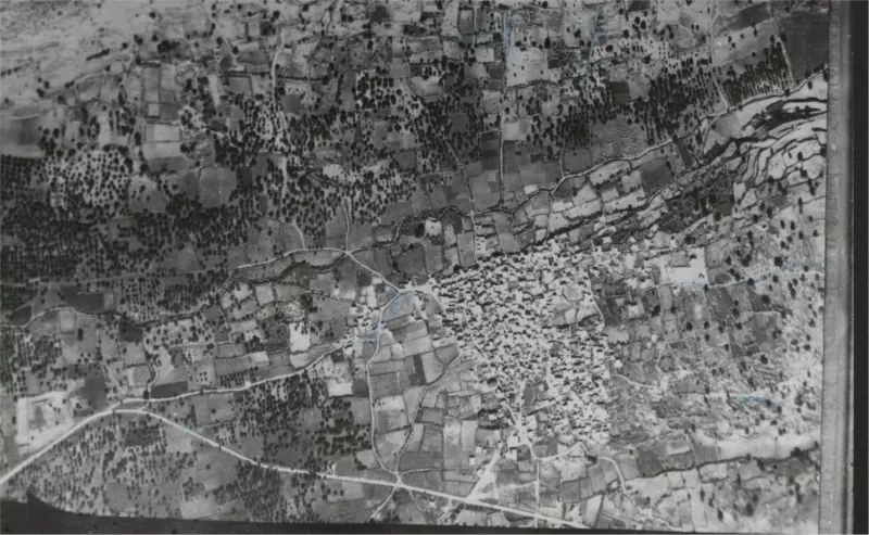
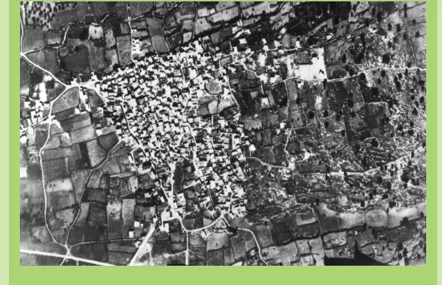
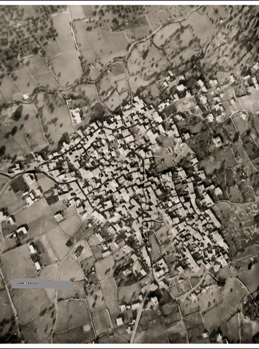
| Pre-Nakba Aerial View |
|||||||||||||||||||||||||
|
|||||||||||||||||||||||||
| Map Location | See location #1 on the map View from satellite |
||||||||||||||||||||||||
| Military Operation | Operation Ben-Ami | ||||||||||||||||||||||||
| Defenders | Village militiamen and possibly some ALA. | ||||||||||||||||||||||||
| Acts of Terror | See Stories & Memories section for an eye witness account of a cold blooded execution style murder by the Haganah. | ||||||||||||||||||||||||
| Exodus Cause | Expulsion by Zionist troops | ||||||||||||||||||||||||
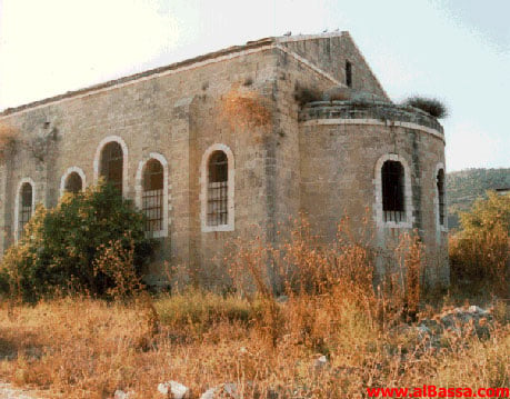
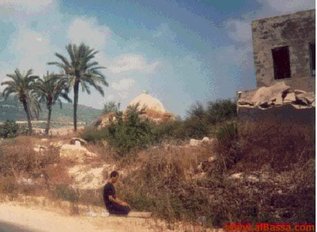
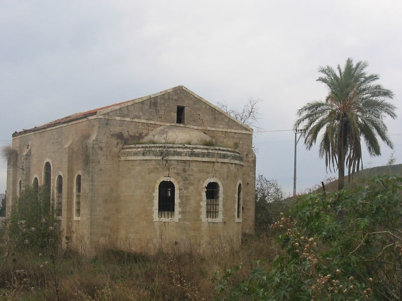
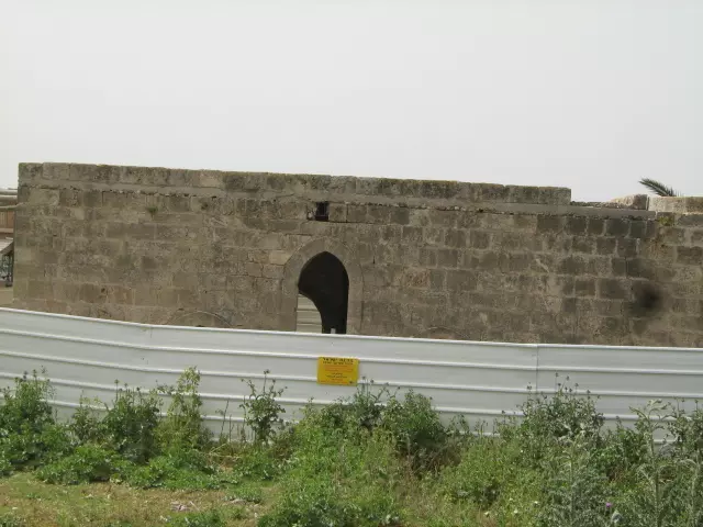
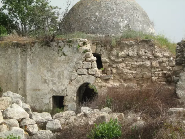
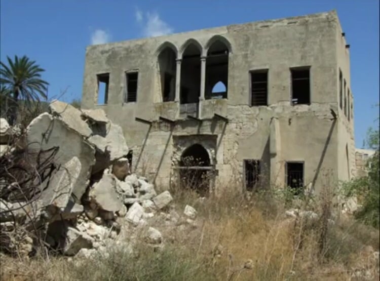
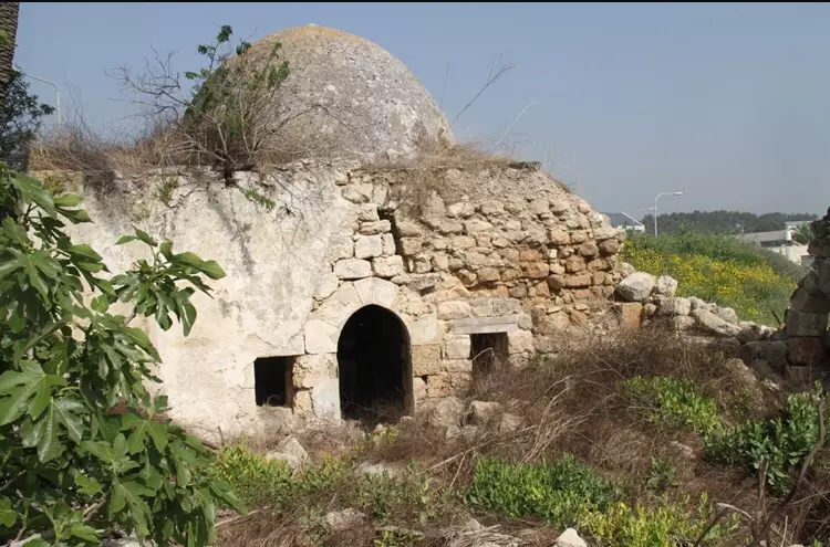
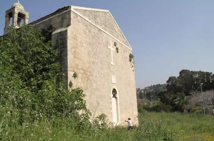
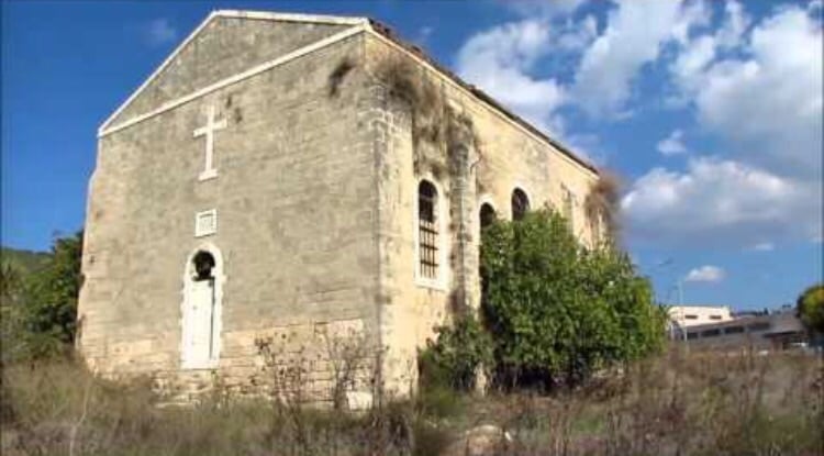
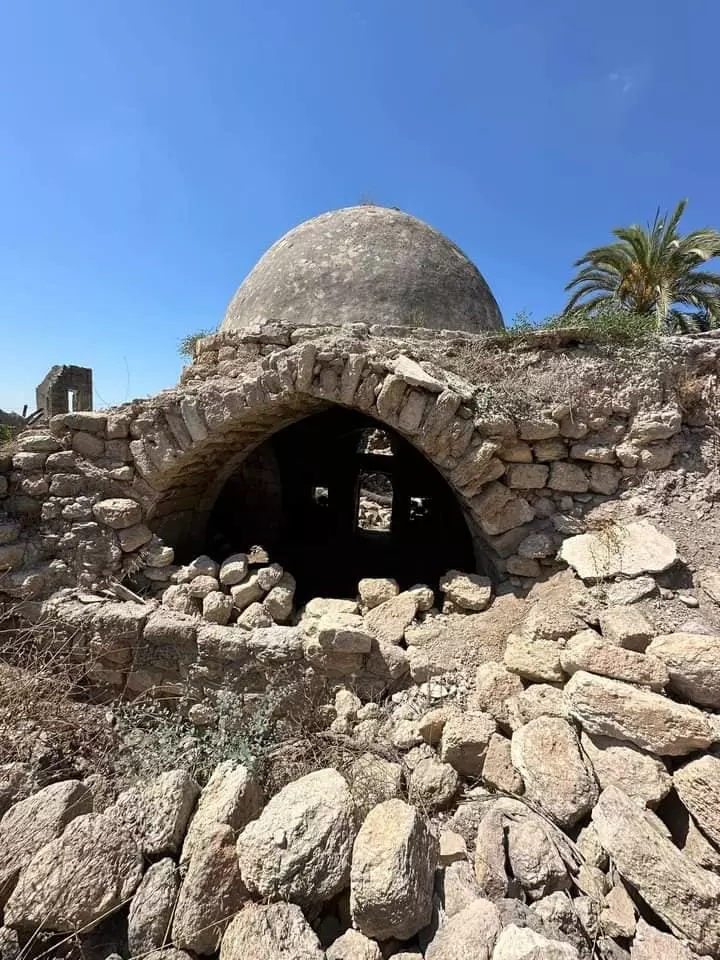
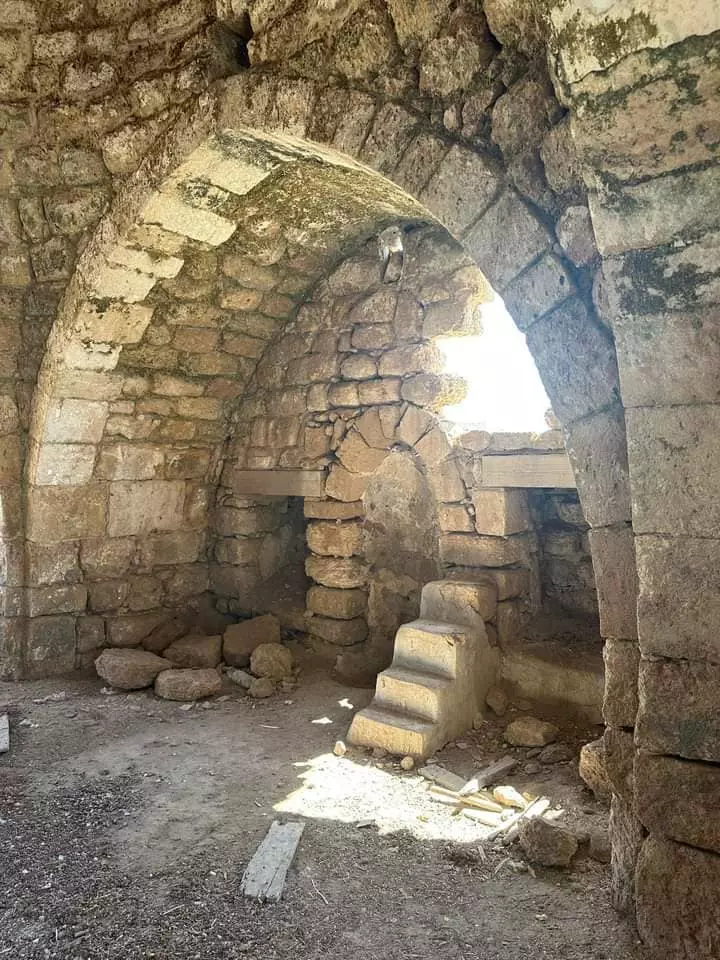
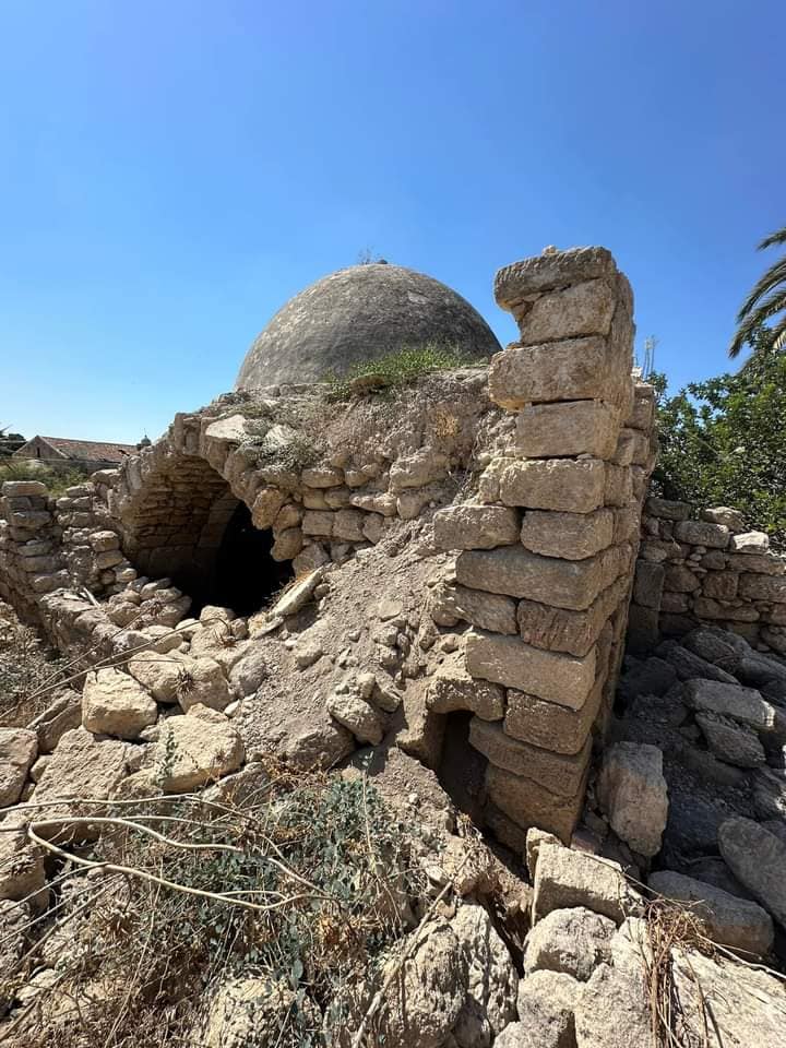
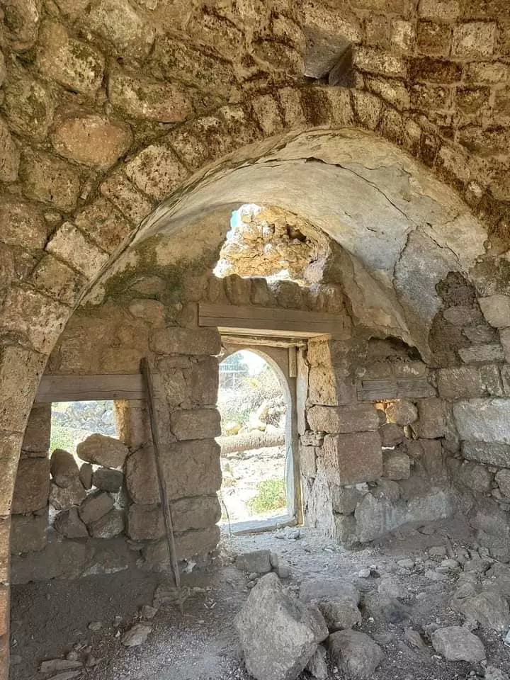
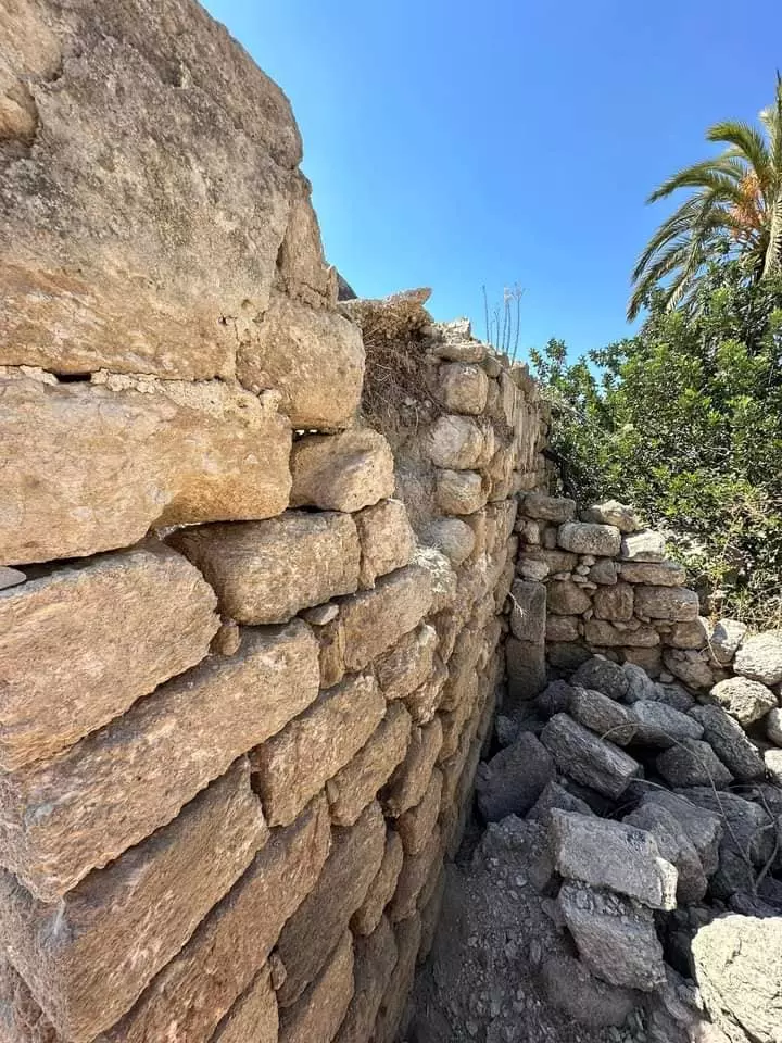
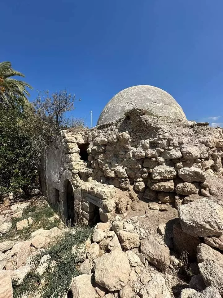
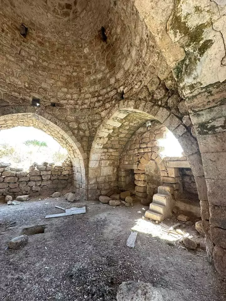
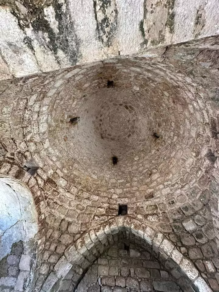
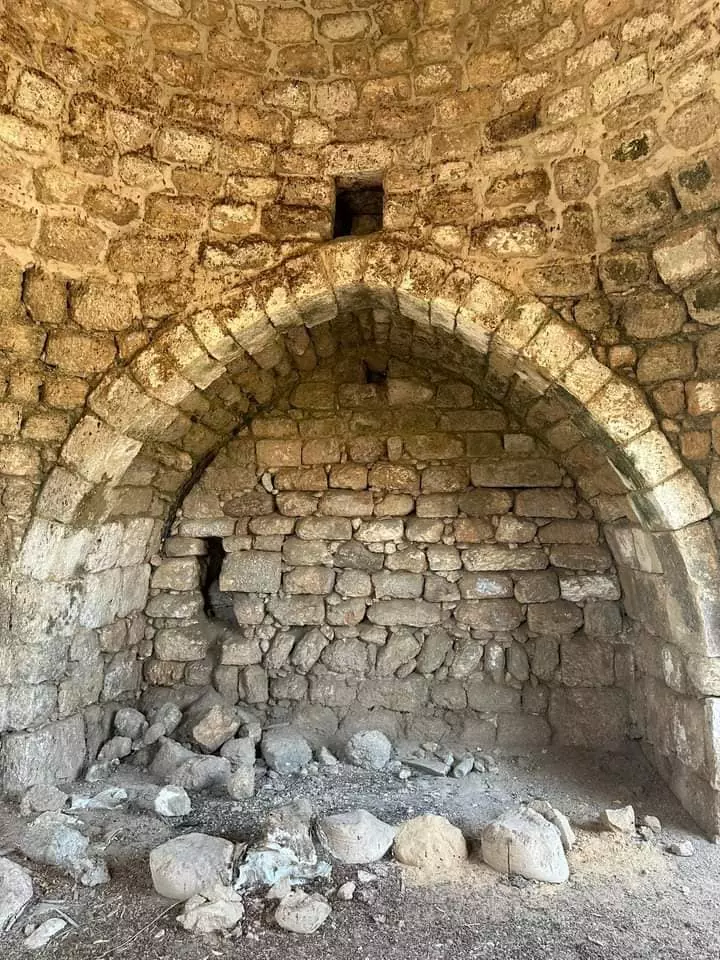
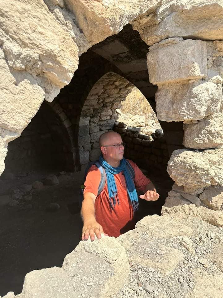
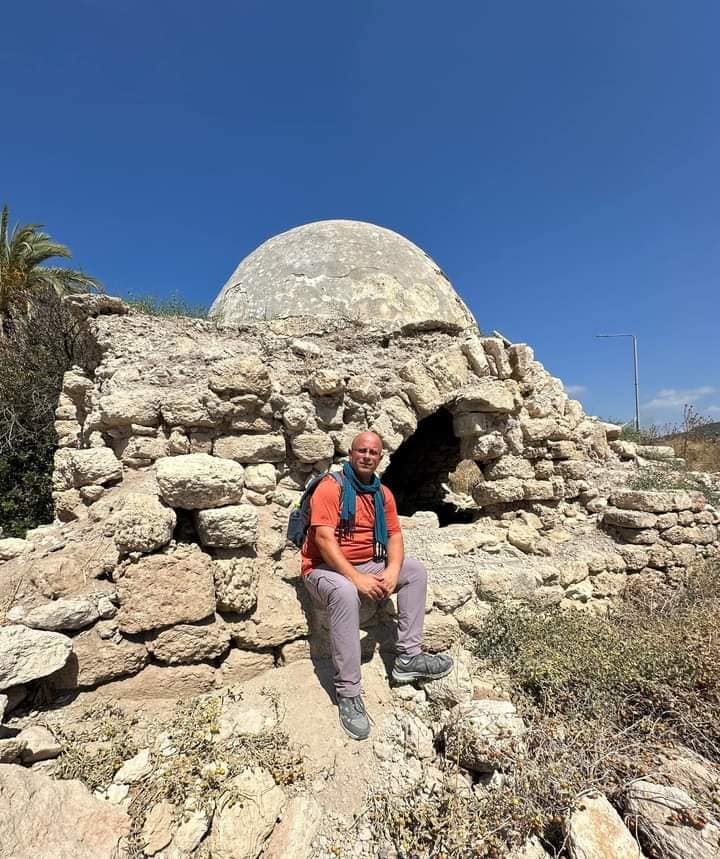
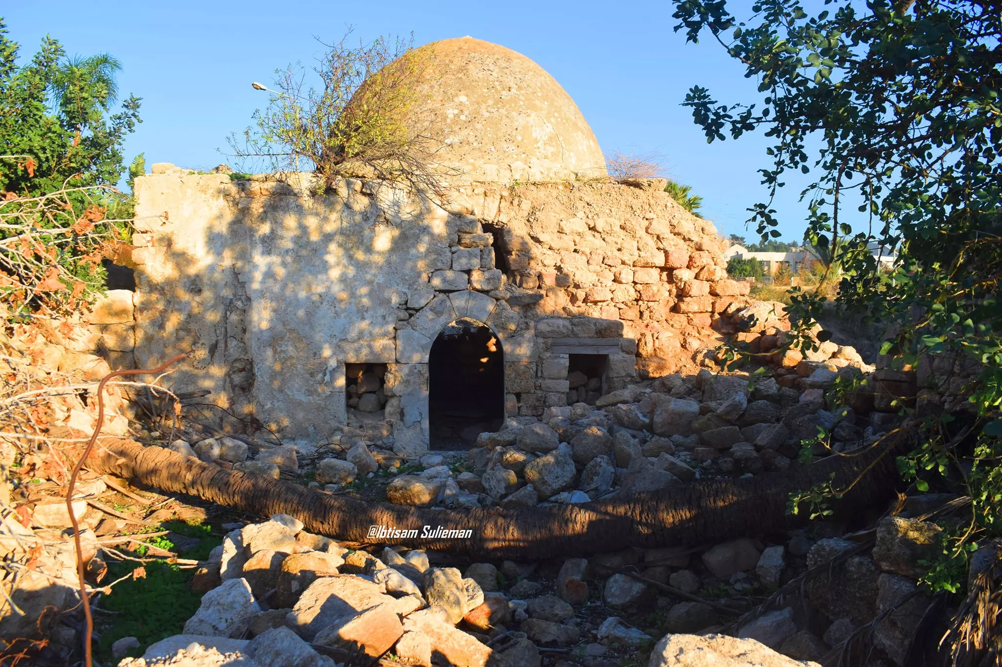
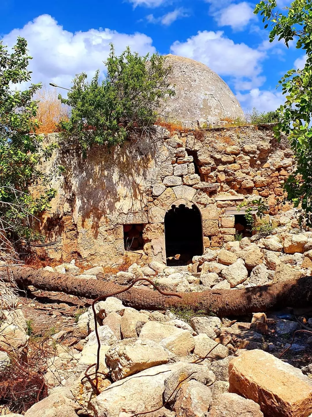
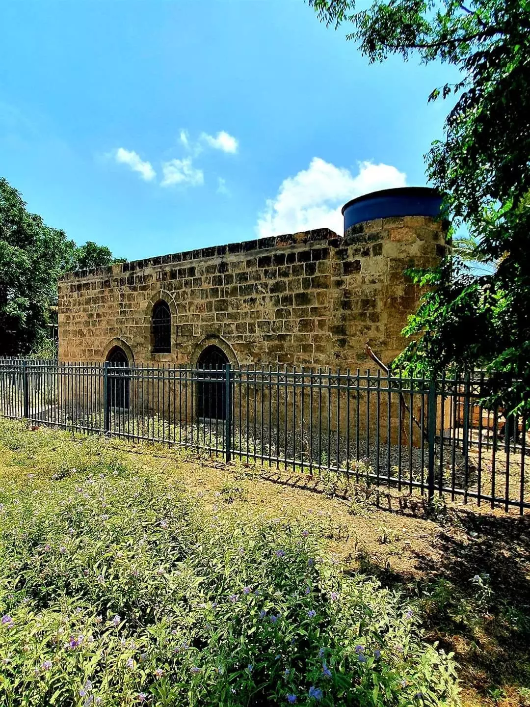
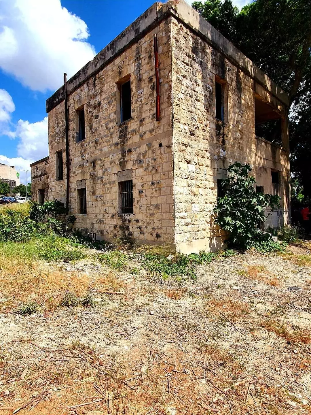
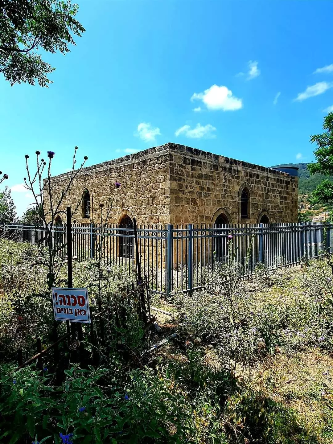
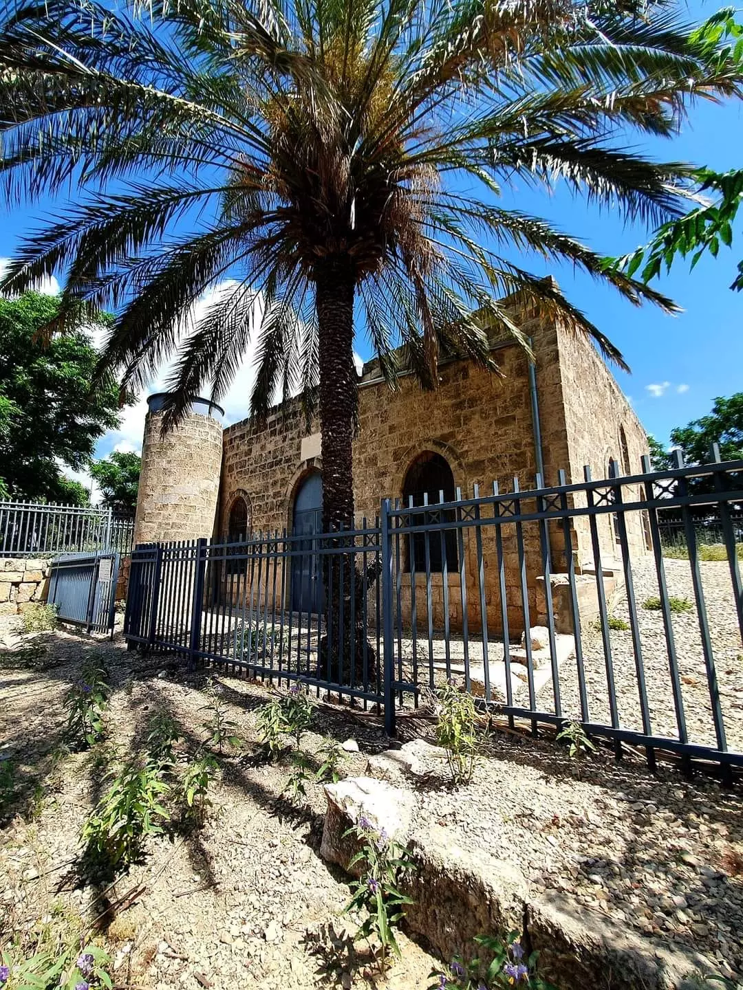
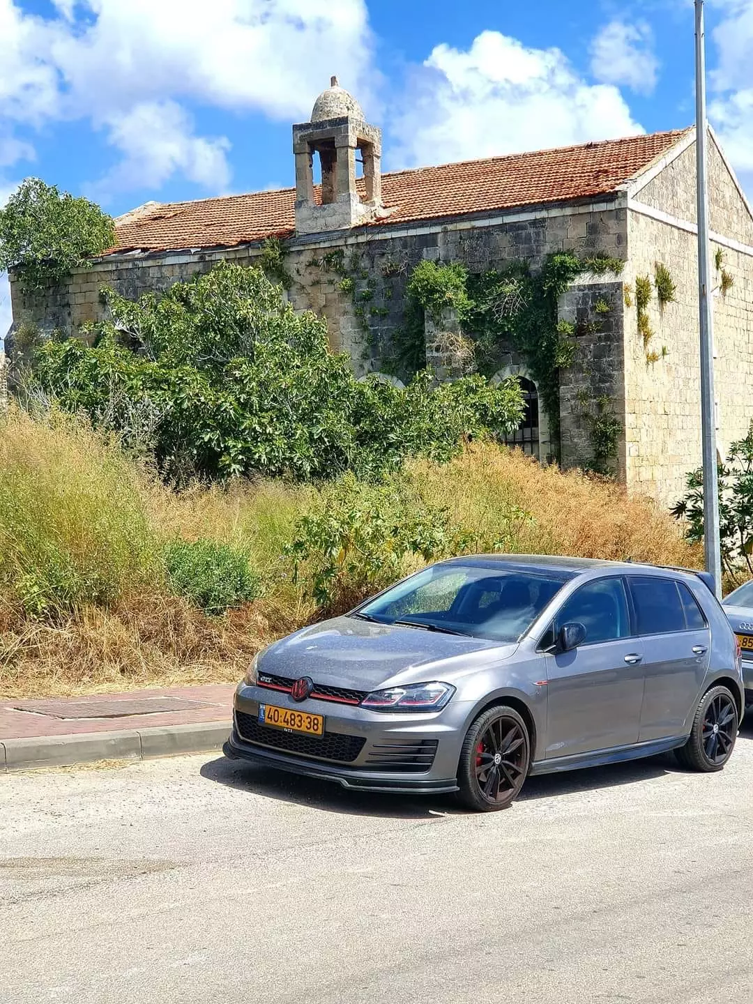
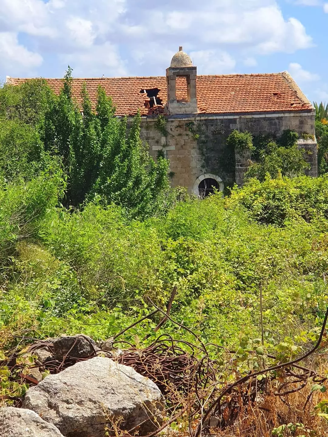
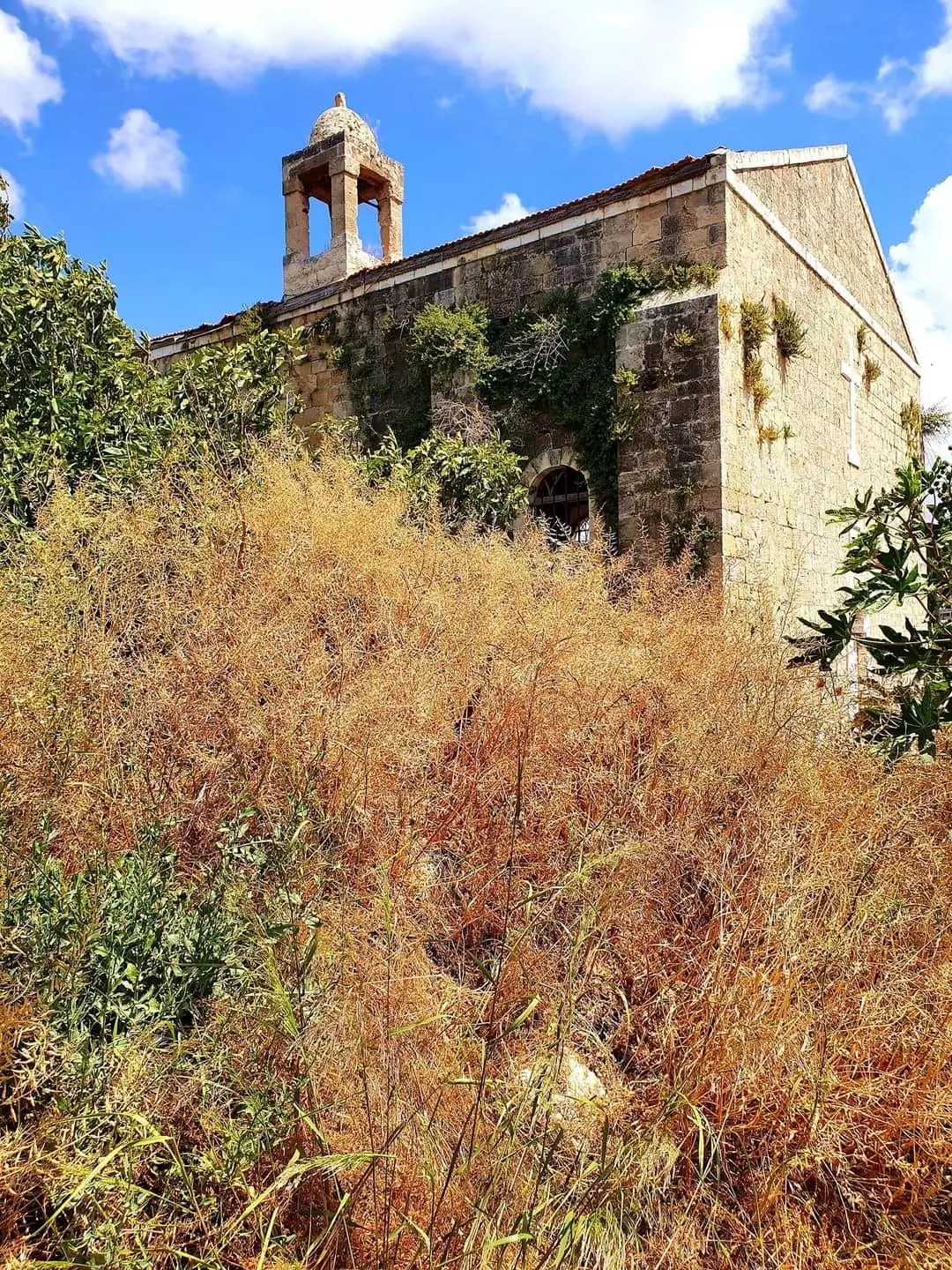
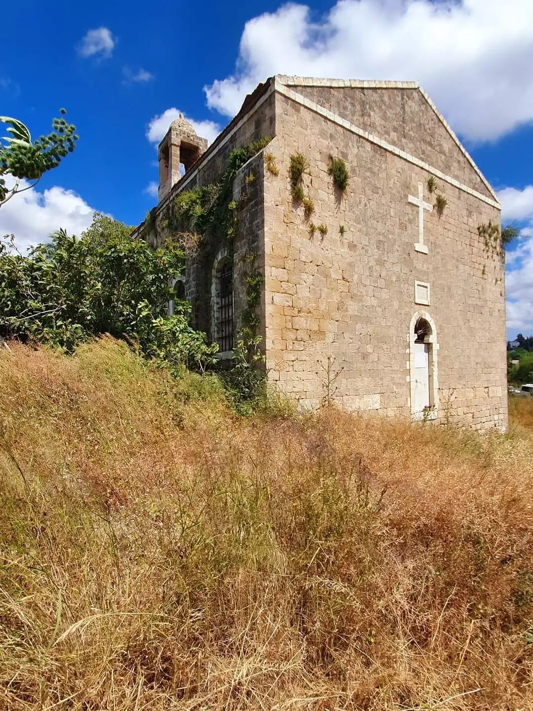
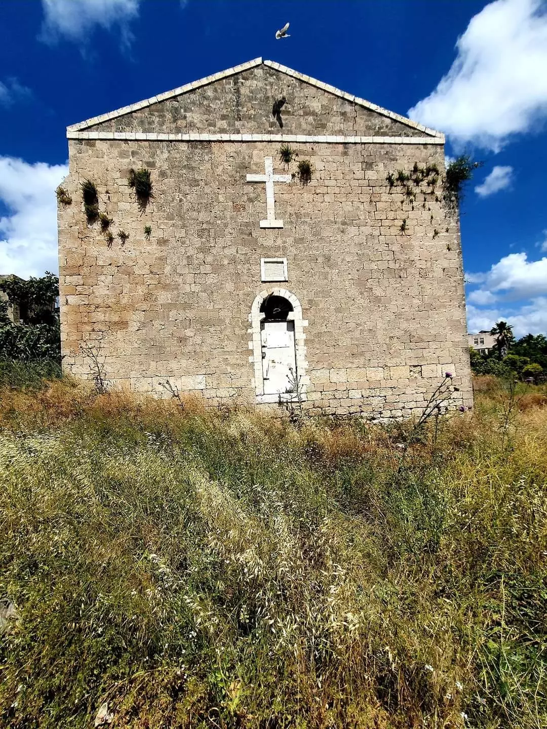
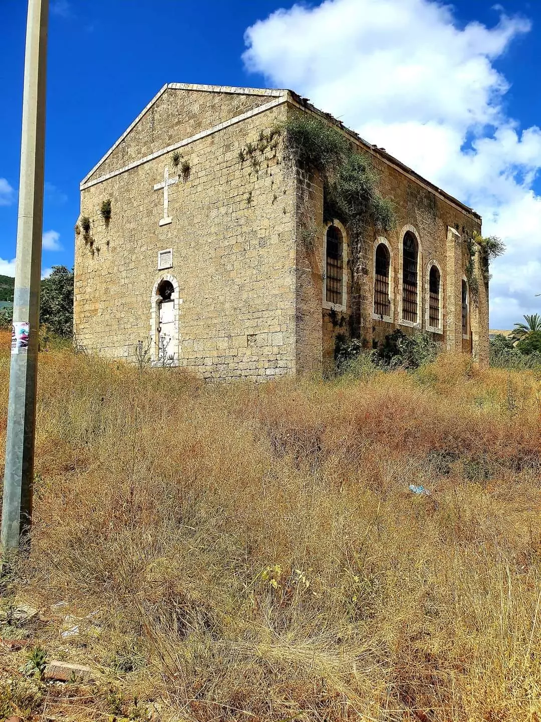
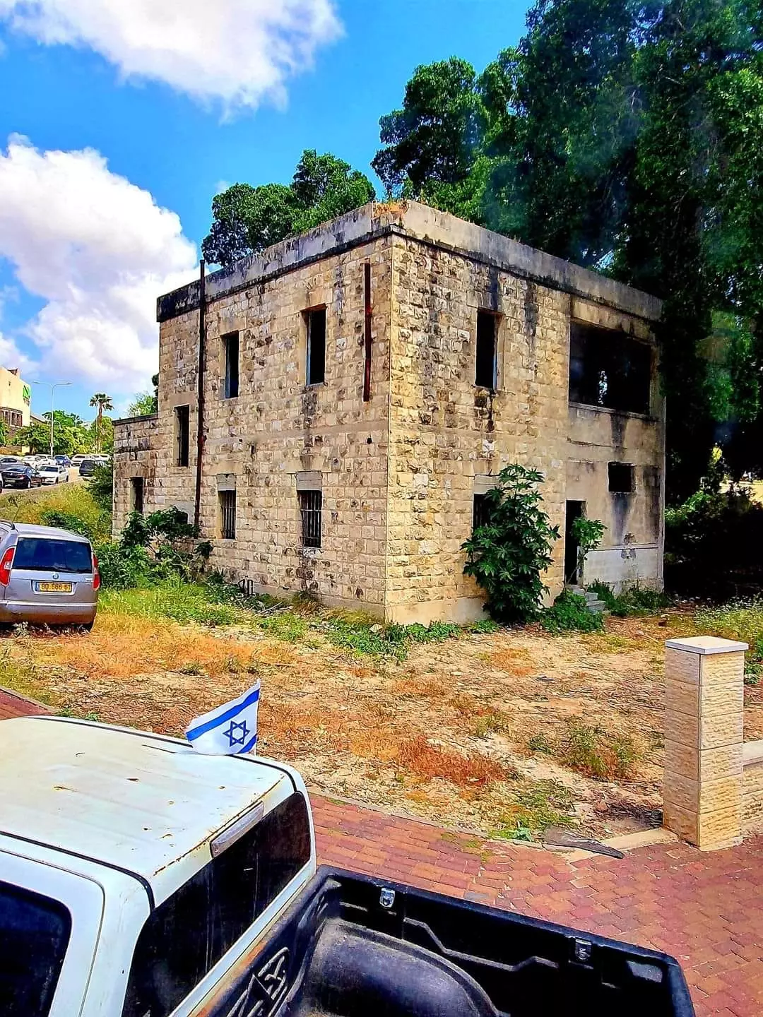
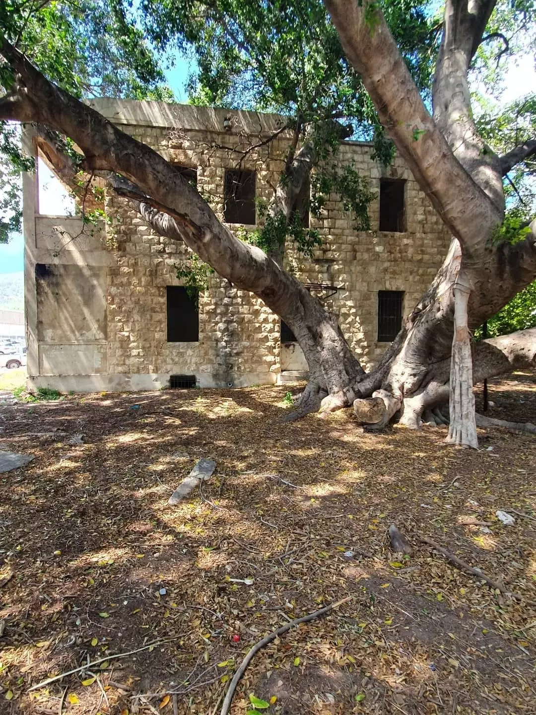
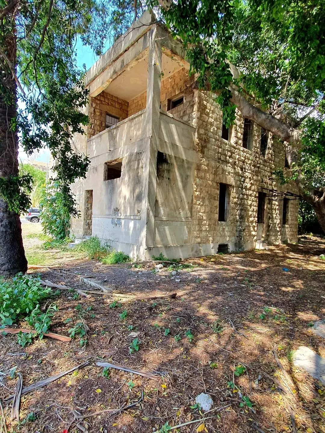
| Village Temains | al-Bassa was mostly destroyed with the exception of few houses, the church, and a Muslim shrine. | ||||||||||||||||||||||||
| Ethnically Cleansing | All remaining residents of al-Bassa inhabitants were completely ethnically cleansed on May 27th, 1949, who mostly were pushed north towards Lebanon. However, few were ethnically cleansed to Arab Nazareth (see Stories & Memories section for more details). | ||||||||||||||||||||||||
| Terminating Refugee Camps | al-Bassa inhabitants were mostly concentrated in Dbyha refugee camp nearby Junyah, Lebanon. However, at the outbreak of the civil war in 1975, this camp was mostly ethnically cleansed by the Maronites Militias. | ||||||||||||||||||||||||
| Pre-Nakba Land Ownership |
**Town Lands' Demarcation Maps |
||||||||||||||||||||||||
| Land Usage As of 1945 |
|
||||||||||||||||||||||||
| Population |
|
||||||||||||||||||||||||
| Number of Houses | In (1931): 479, and in (1948): 700 | ||||||||||||||||||||||||
| Near By Towns |
|||||||||||||||||||||||||
|
|||||||||||||||||||||||||
| Town's Name Through History | The Canaanites referred to al-Bassa by Bissah (meaning swamp), the Romans called it as Bezeth, and soon after the Crusades defeat in the 13th century the village was known by 'Ayn al-Bassa. | ||||||||||||||||||||||||
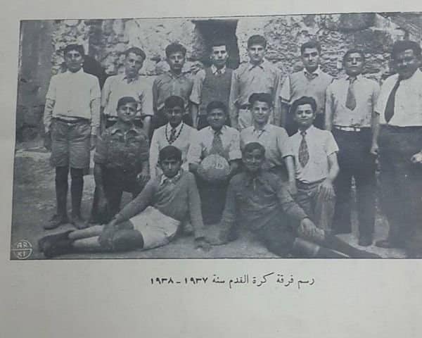
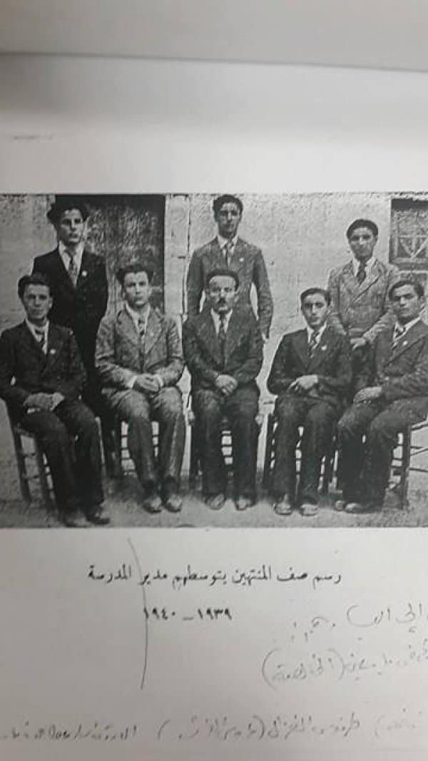
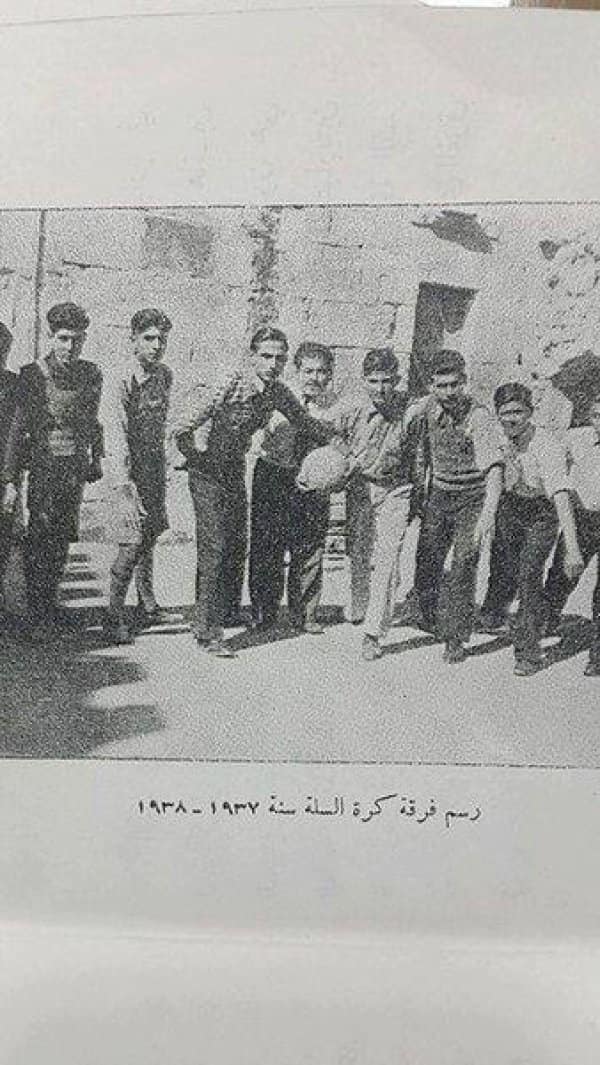
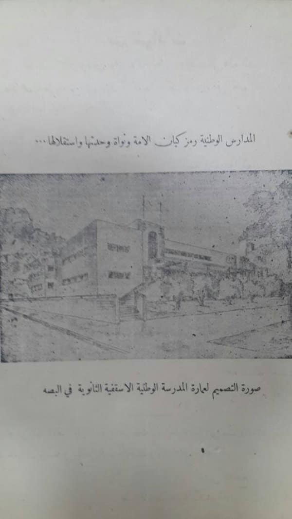
| Schools | The village had a public elementary school for boys (built by the Ottomans in 1882), a private secondary school, and a public elementary school for girls. | ||||||||||||||||||||||||
| Local Council | In 1922, the people of al-Bassa founded a local council which was responsible for managing its local affairs. | ||||||||||||||||||||||||
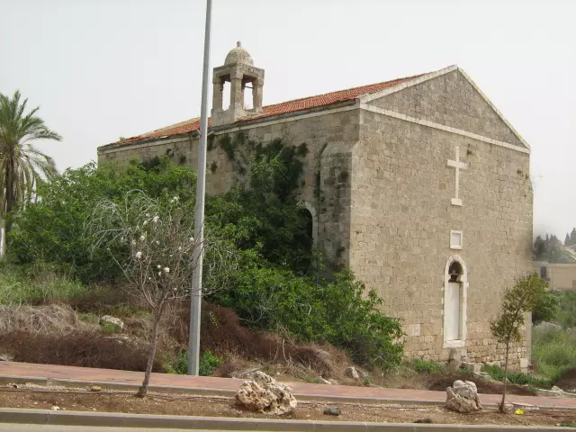
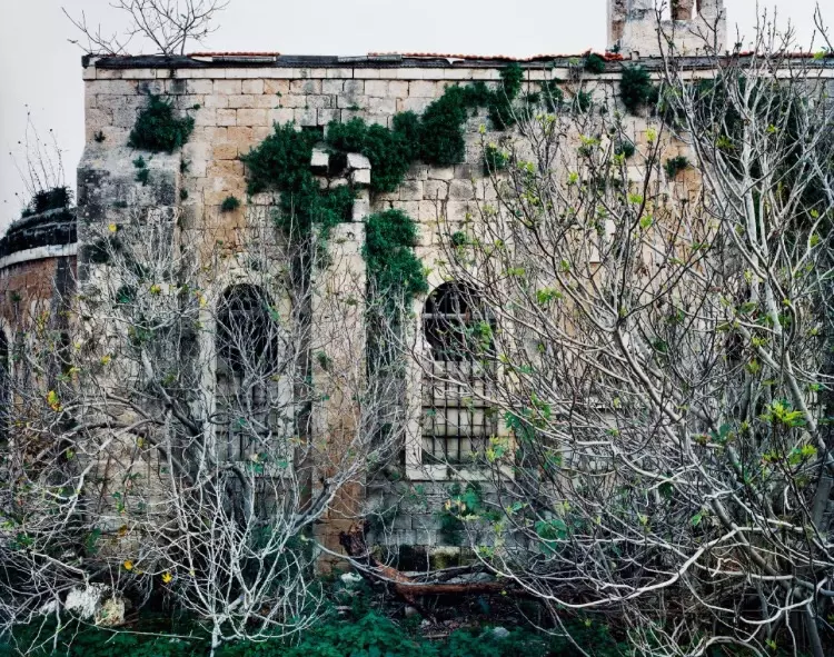
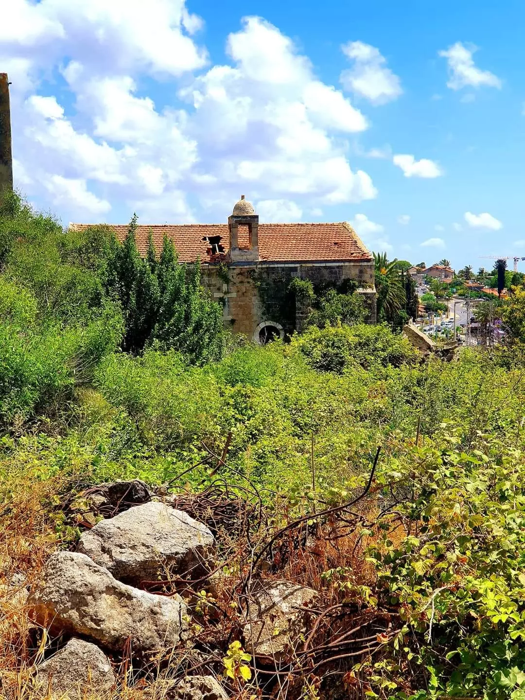
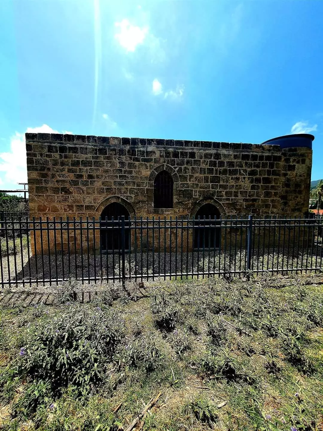
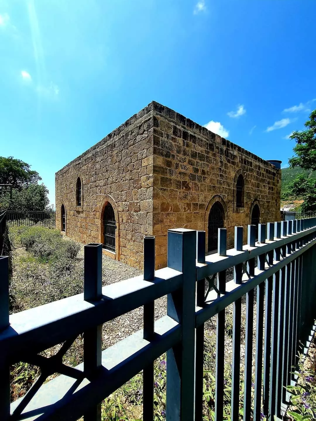
| Places of Warship | Two mosques and two churches (one of the churches remains standing, but it needs renovations guys) | ||||||||||||||||||||||||
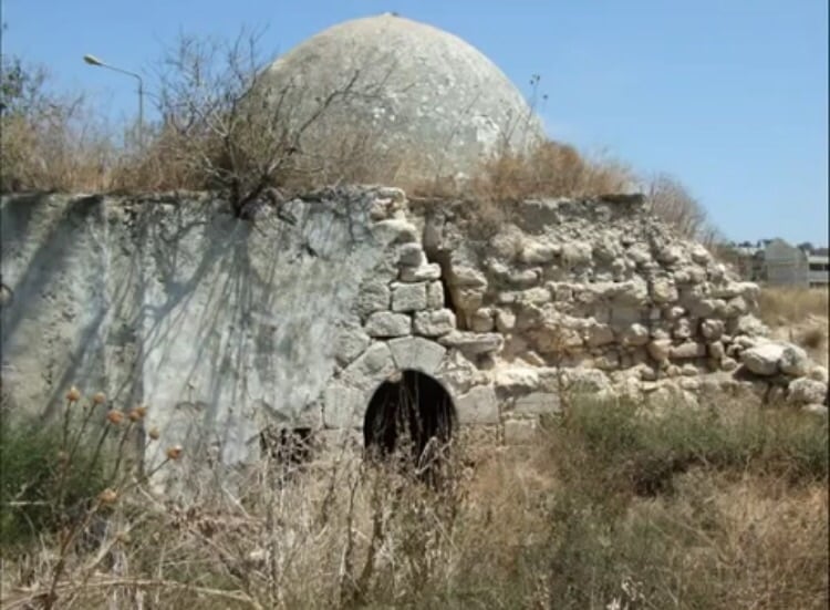
| Shrines / Maqams | al-Bassa had several shrines, some were holy for Muslims (one shrine remain standing), some were for Christians, and two other shrines were considered holy by both groups. | ||||||||||||||||||||||||
| Water Supply | The village local council constructed a water network that secured potable water for the village homes. | ||||||||||||||||||||||||
| Archeological Sites | al-Bassa contains an ancient Christian burial place and 18 other archeological sites. | ||||||||||||||||||||||||
| Exculsive Jewish Colonies Who Usurped Village Lands |
A military airport, Kefar Ro'sh ha-Niqra, Leman, Shelomi, Matzuva, Betset, & Khanita. | ||||||||||||||||||||||||
| Featured Video | |||||||||||||||||||||||||
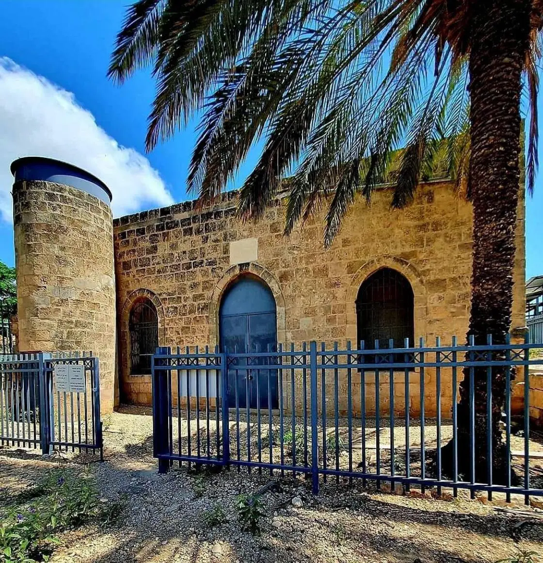
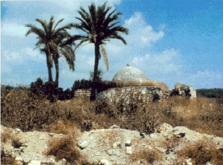
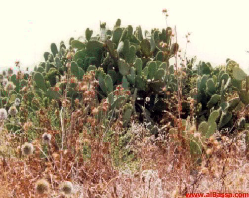
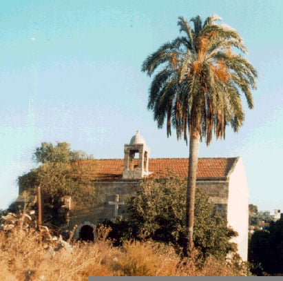
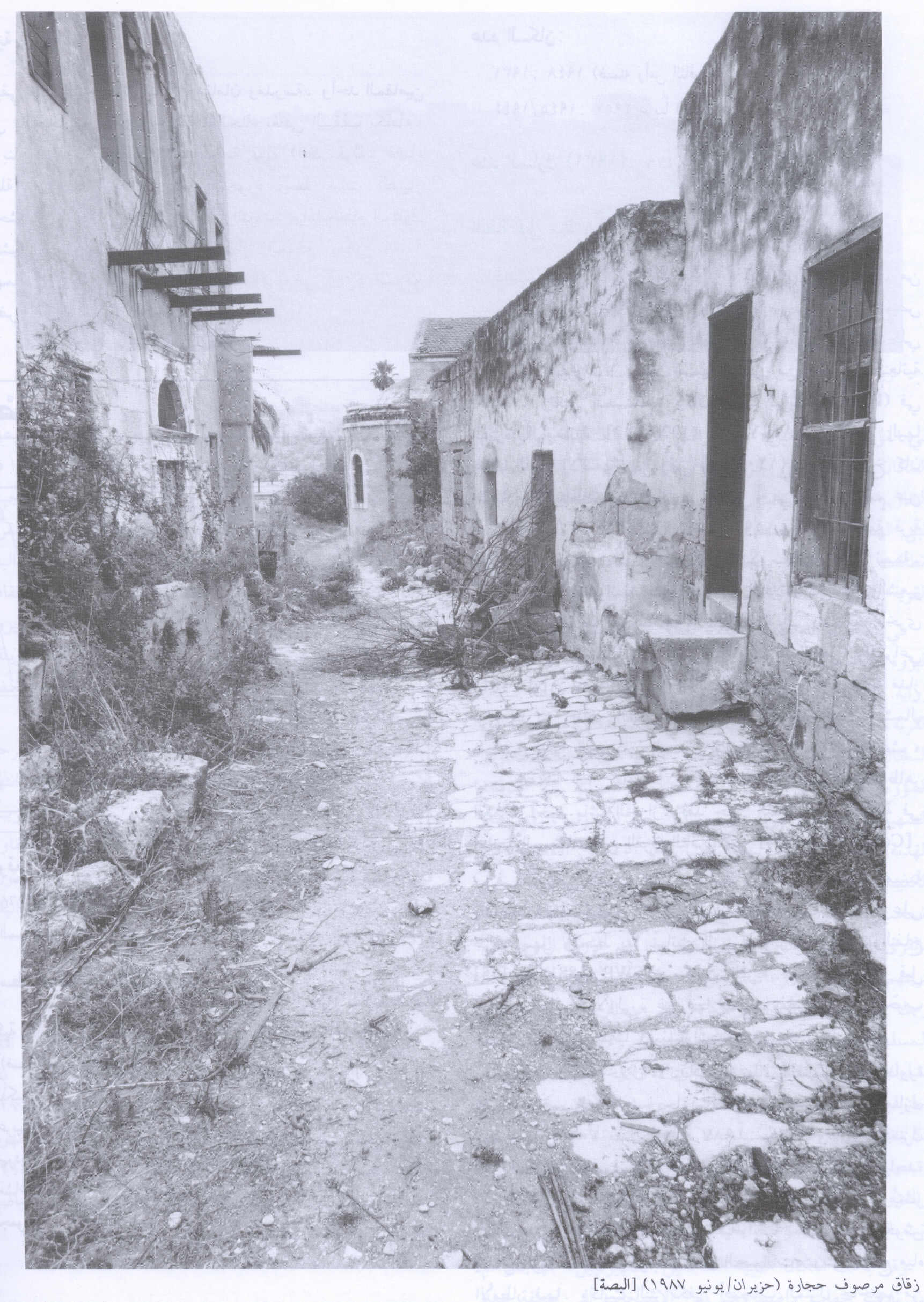
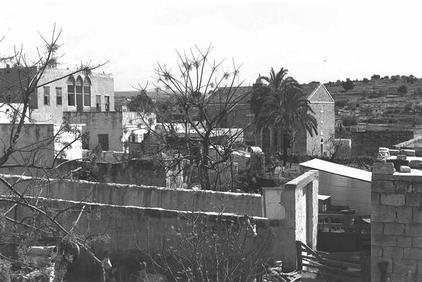
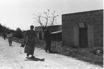
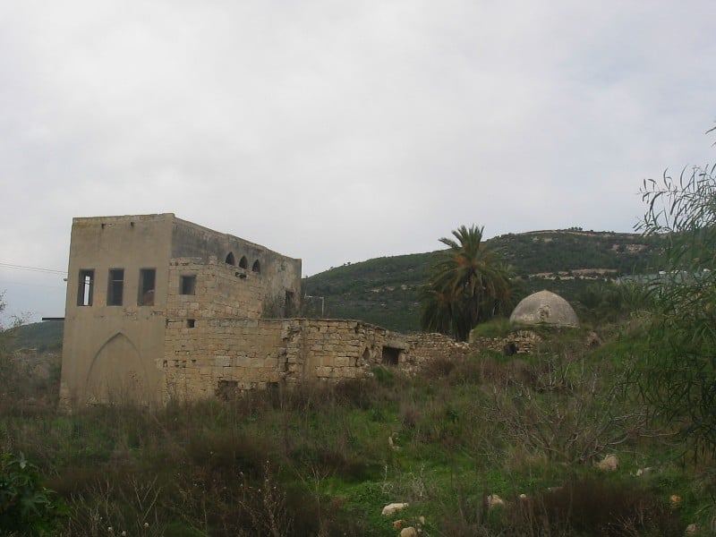
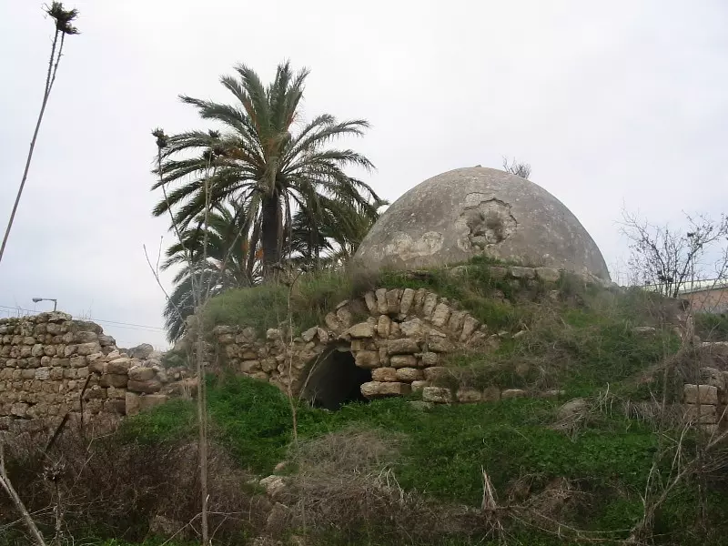
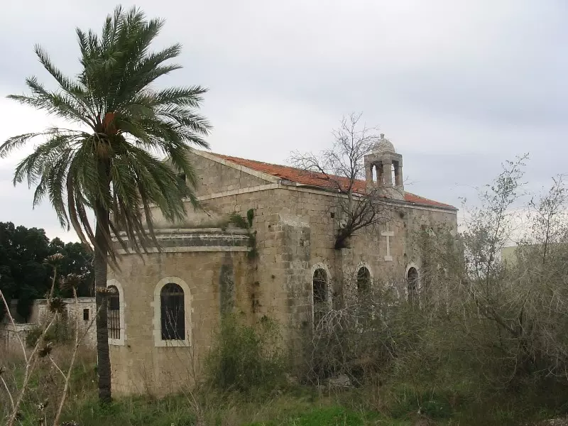
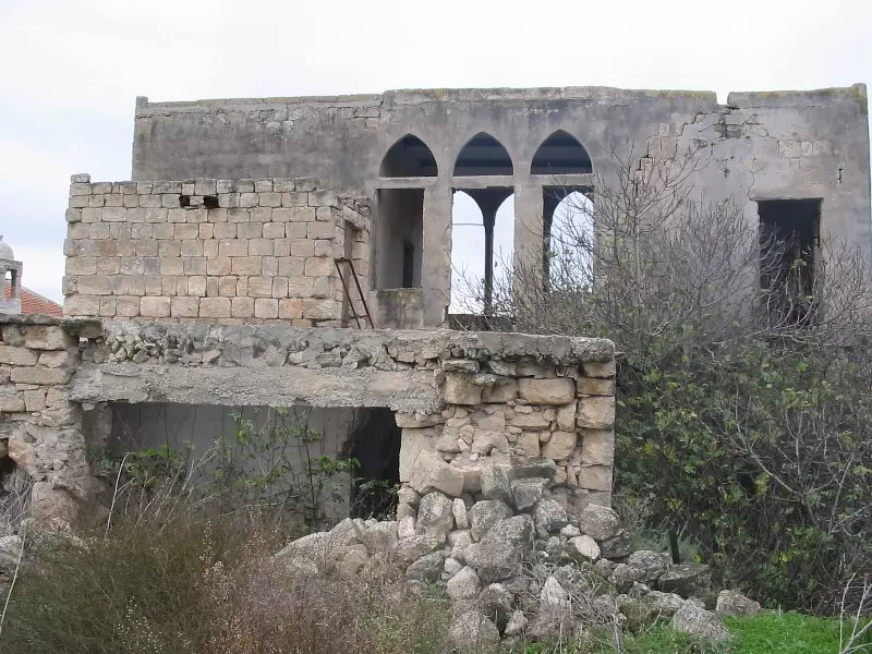
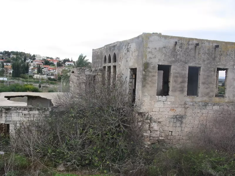
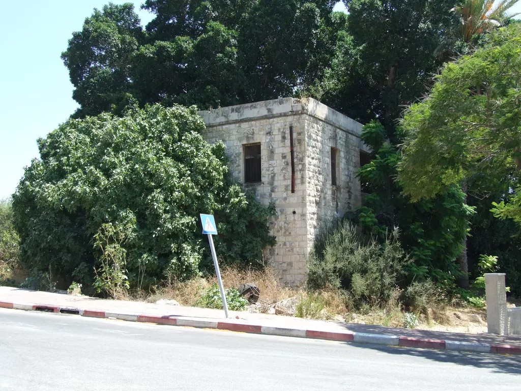
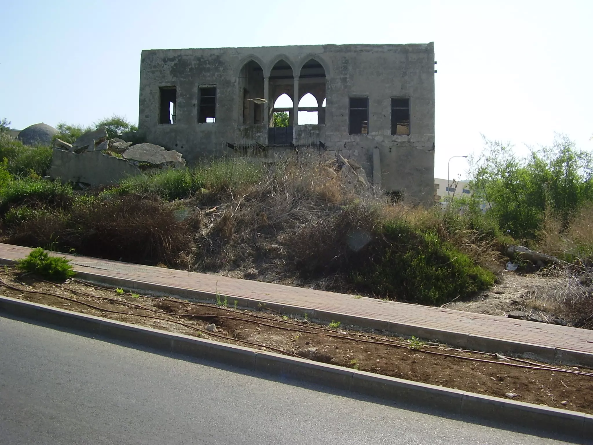
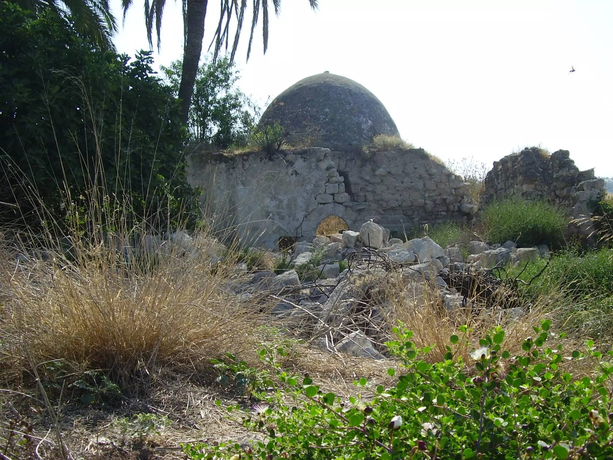
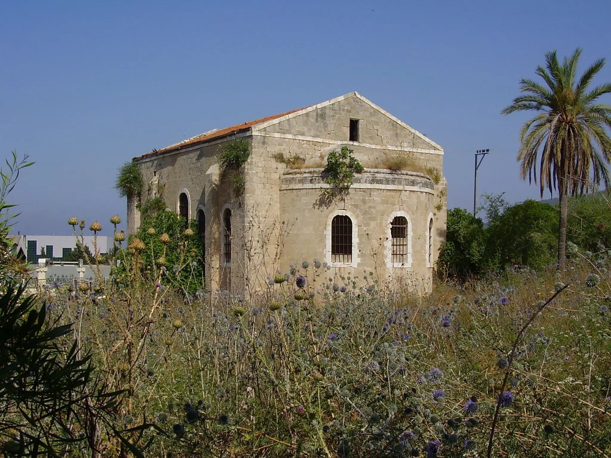
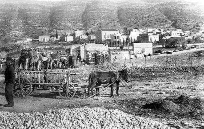
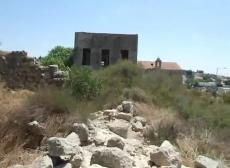
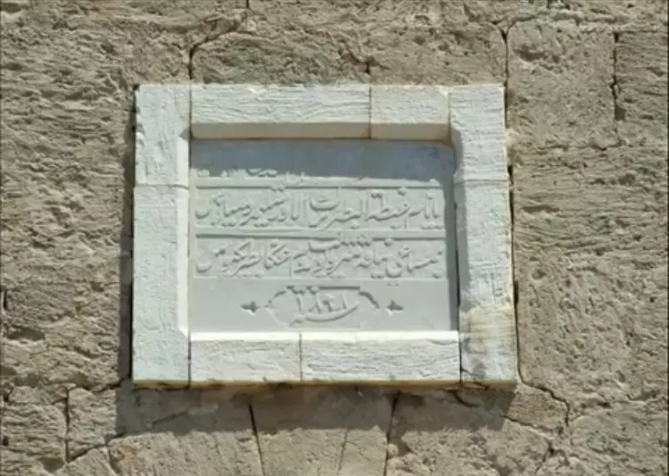
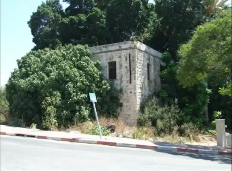
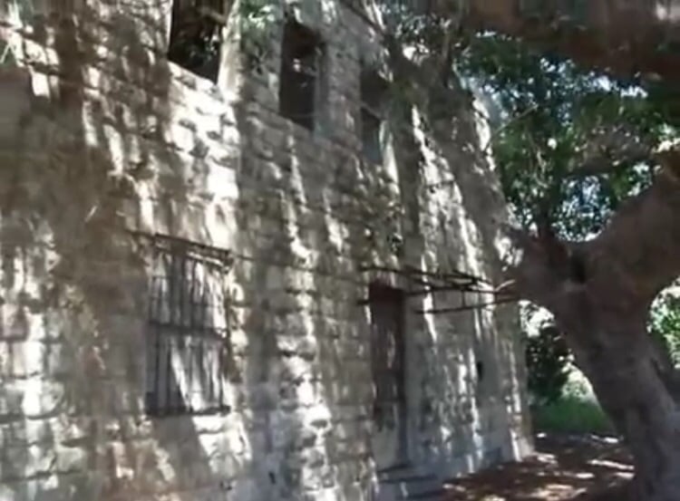
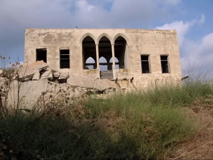
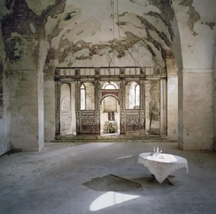
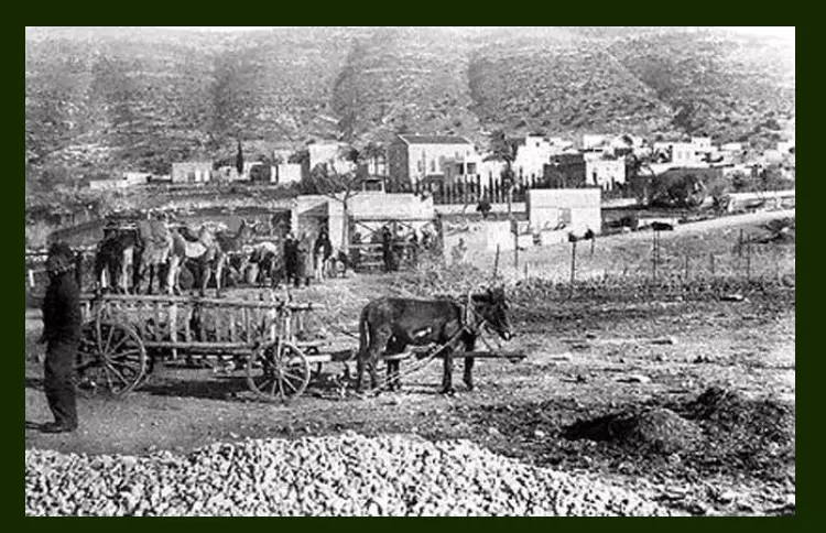
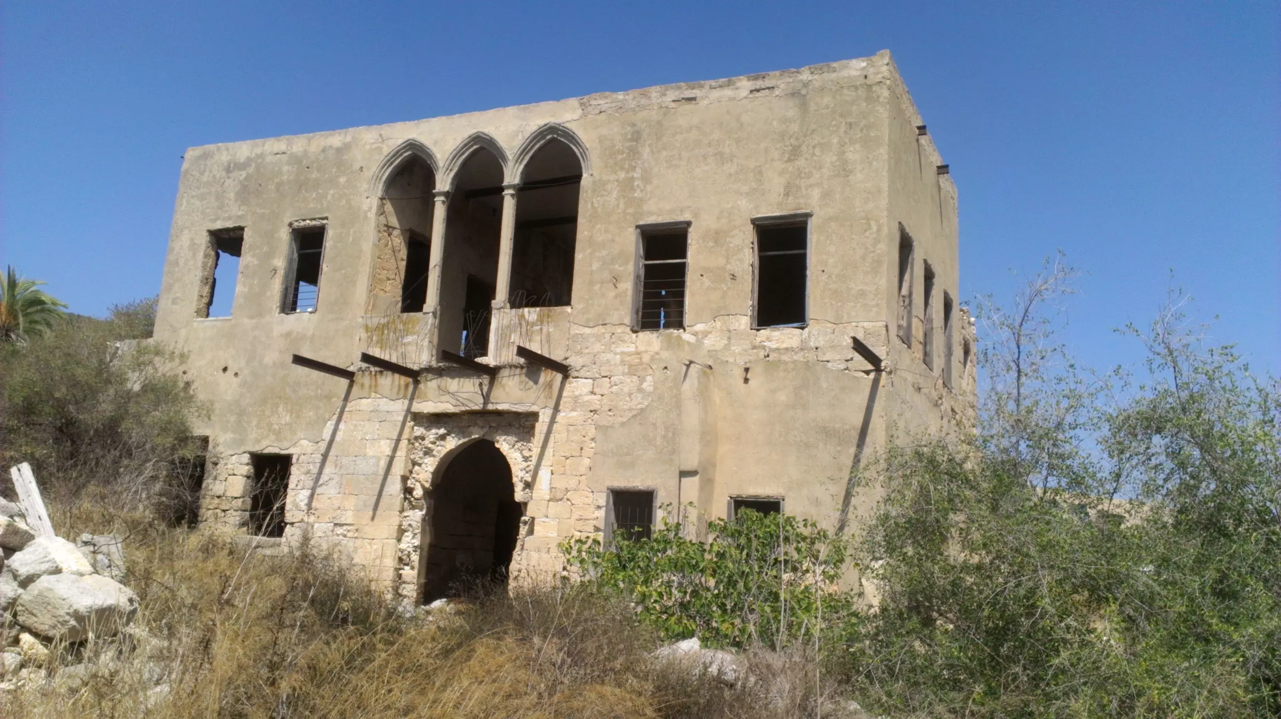
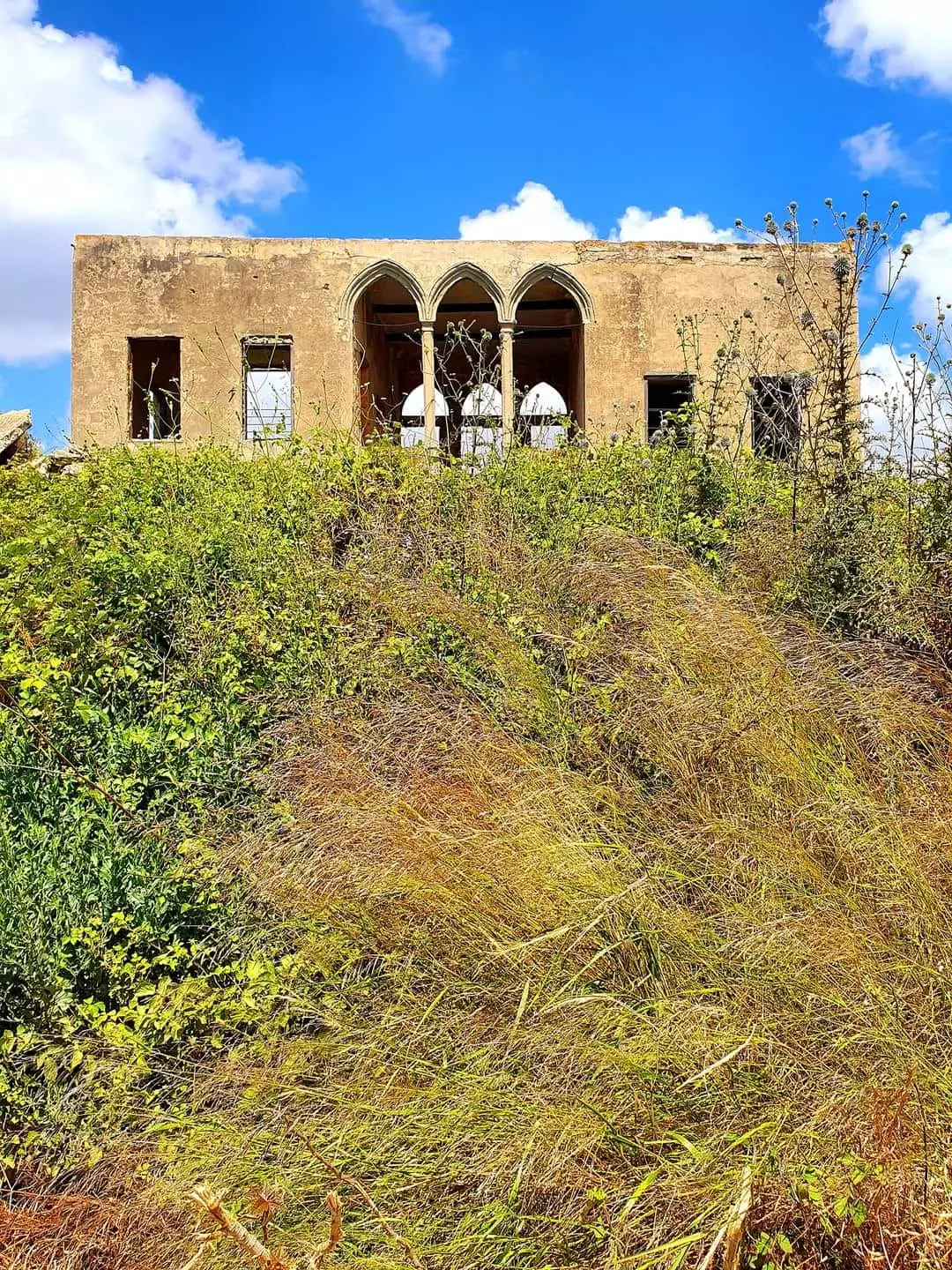
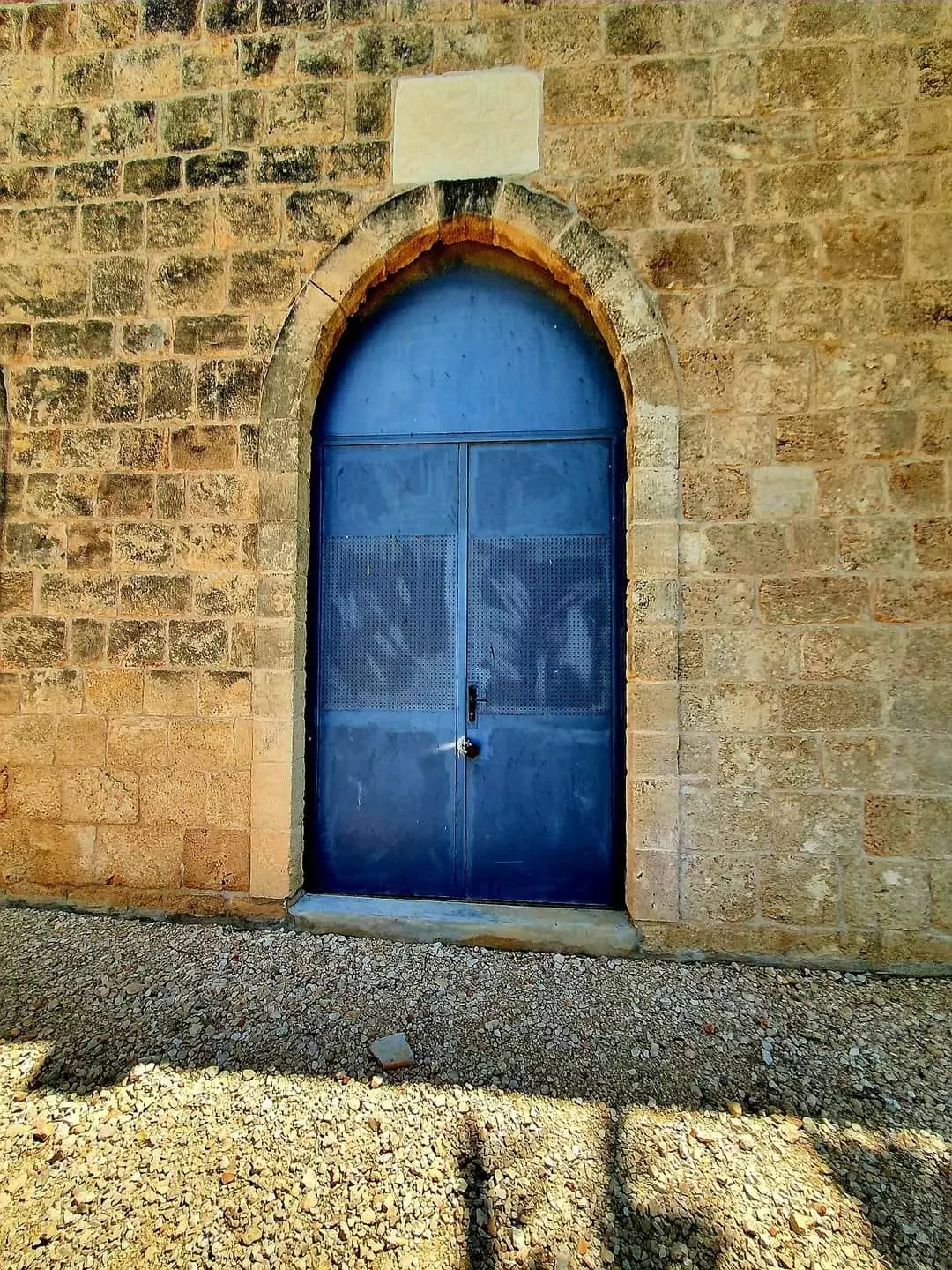
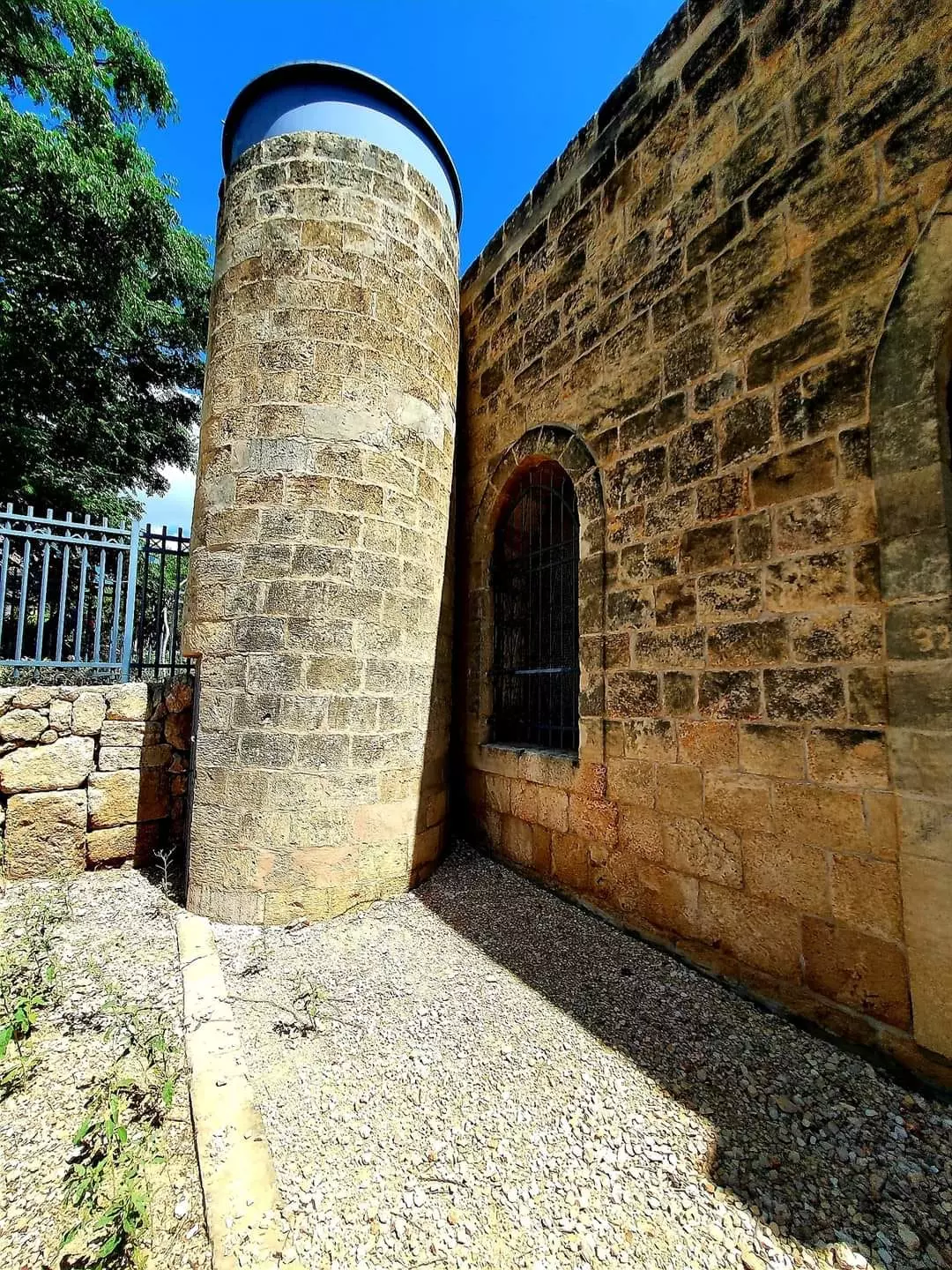
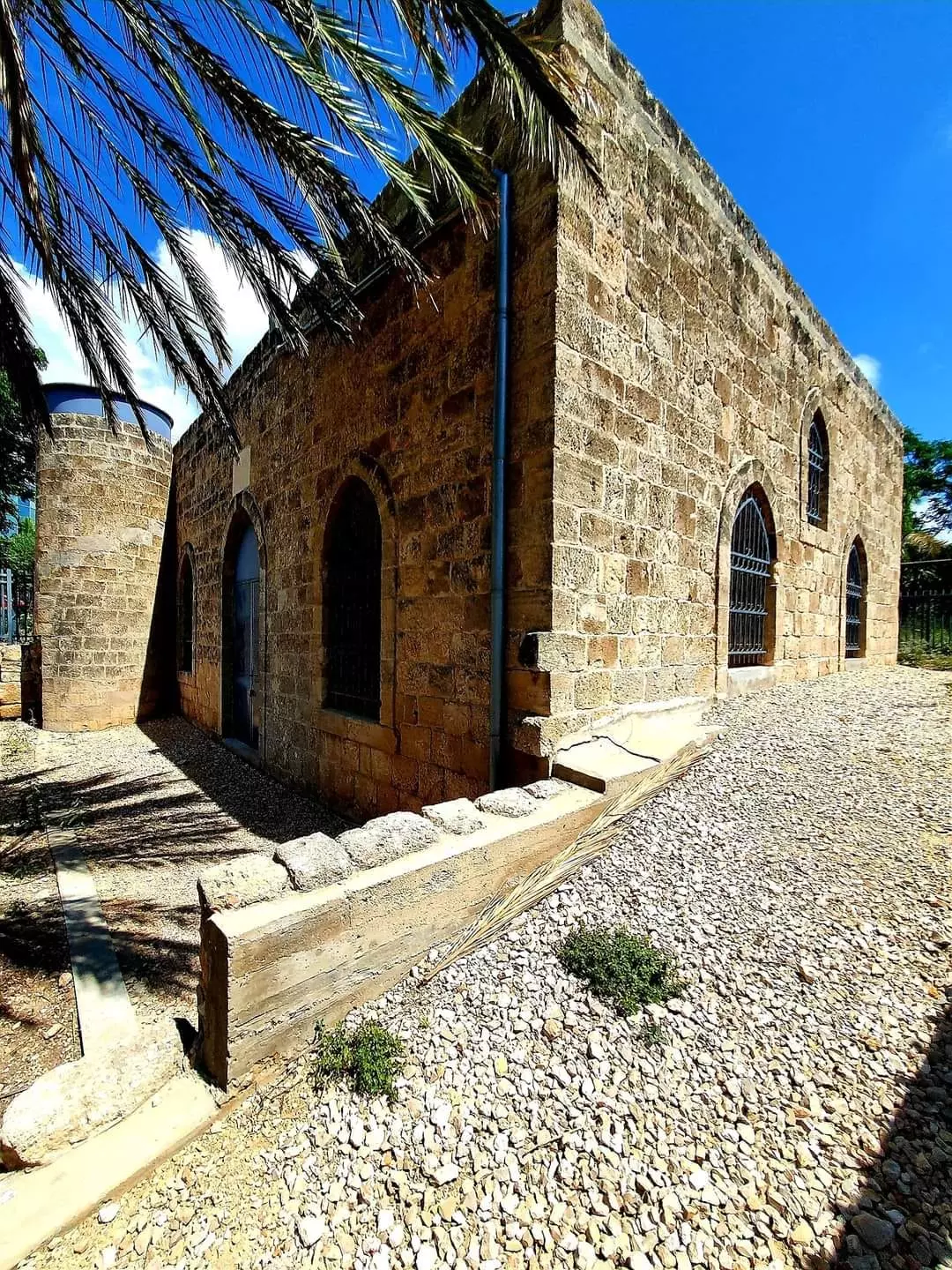
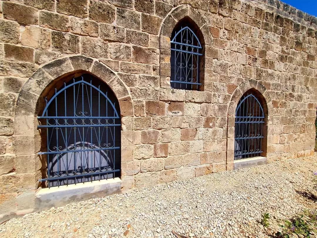
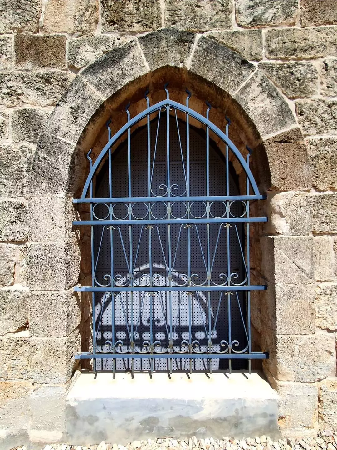
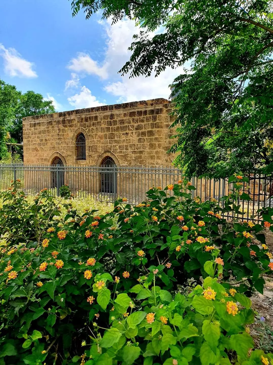
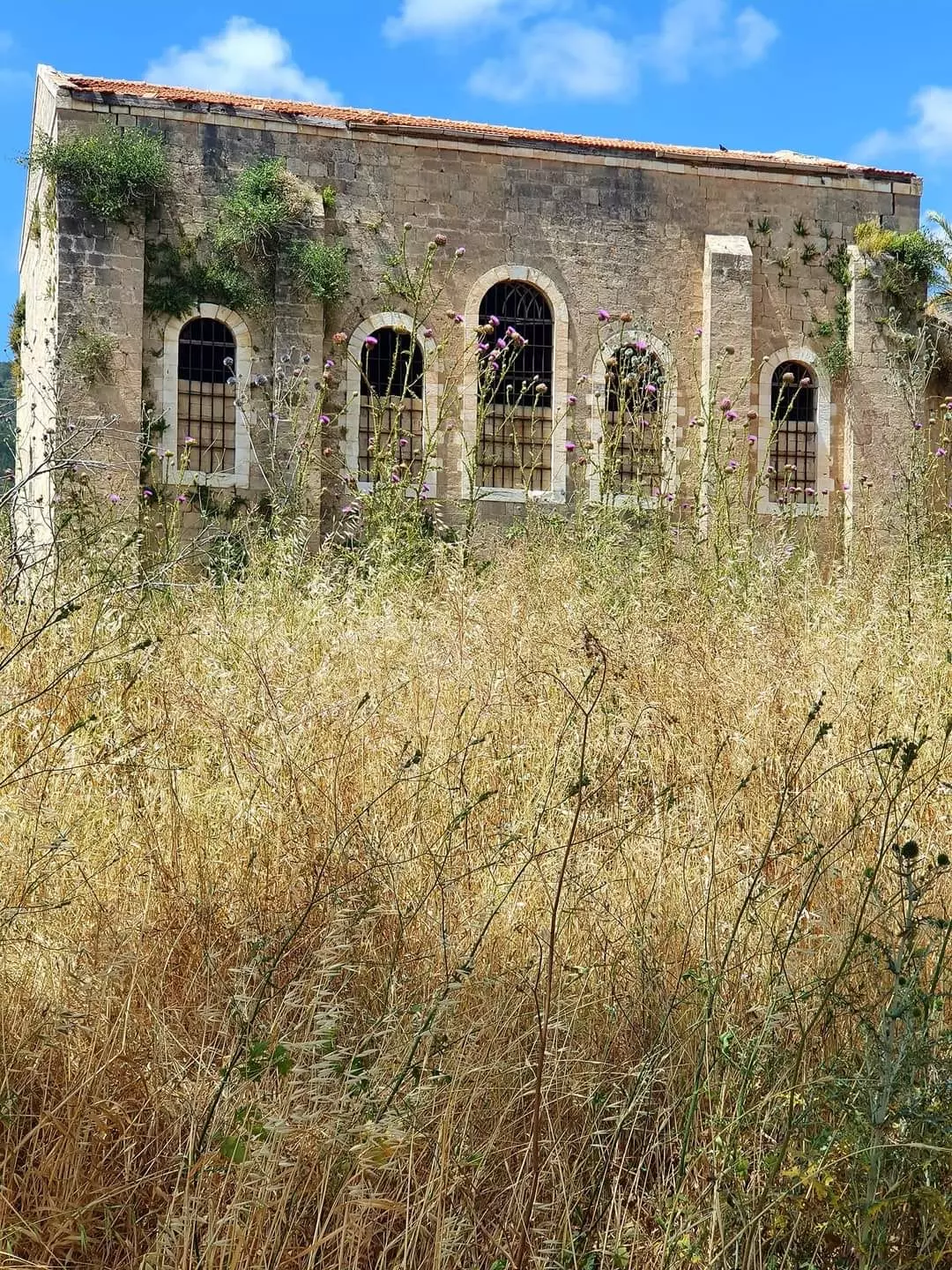
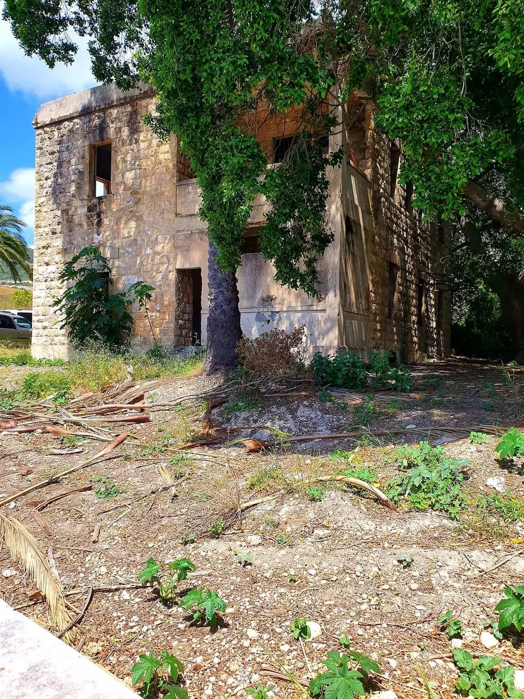
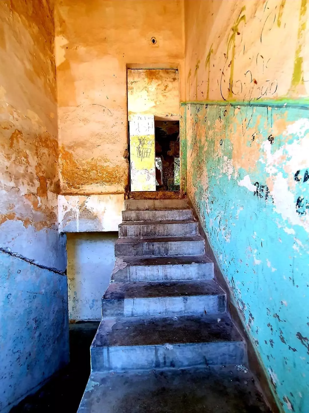
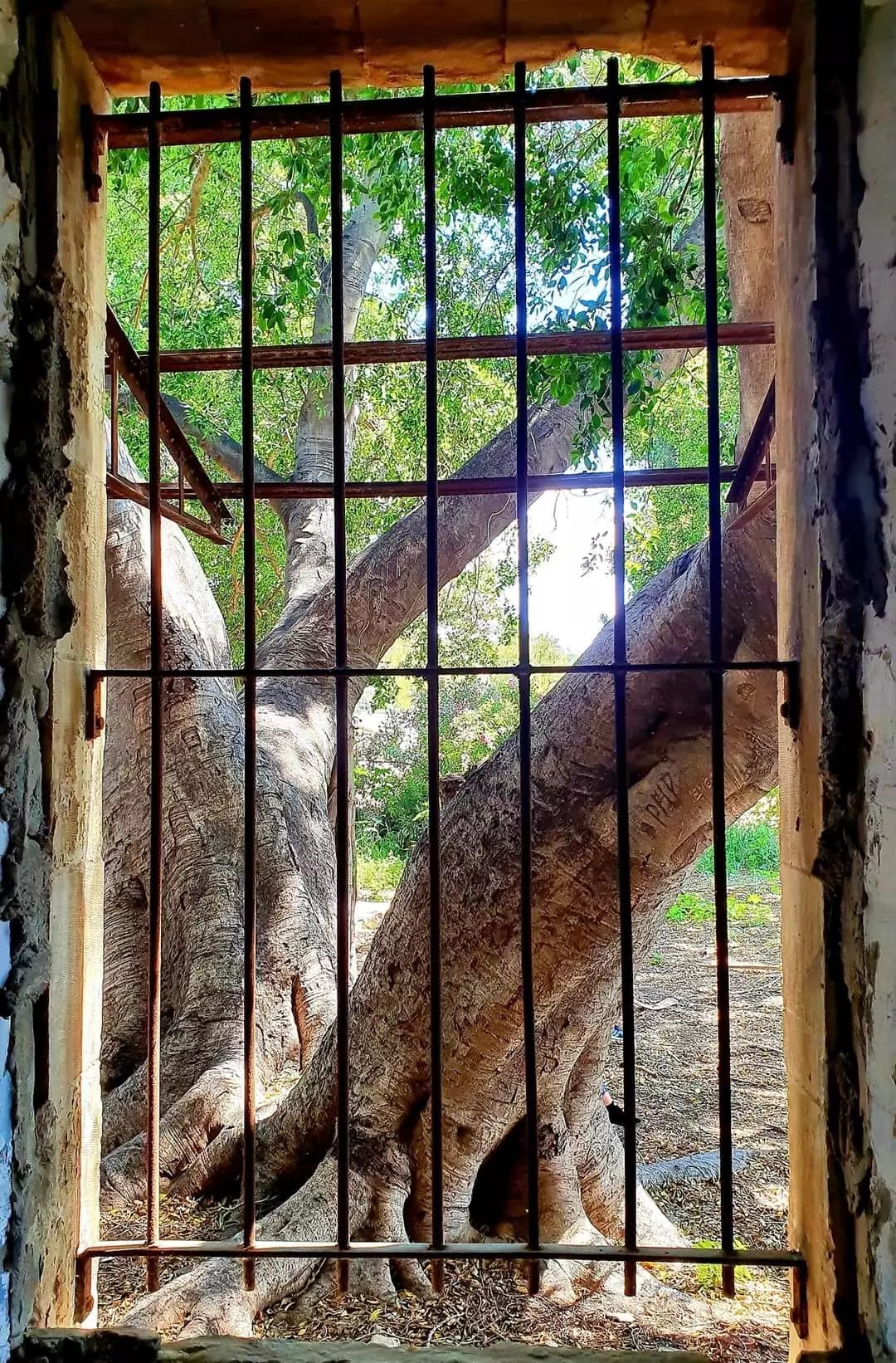
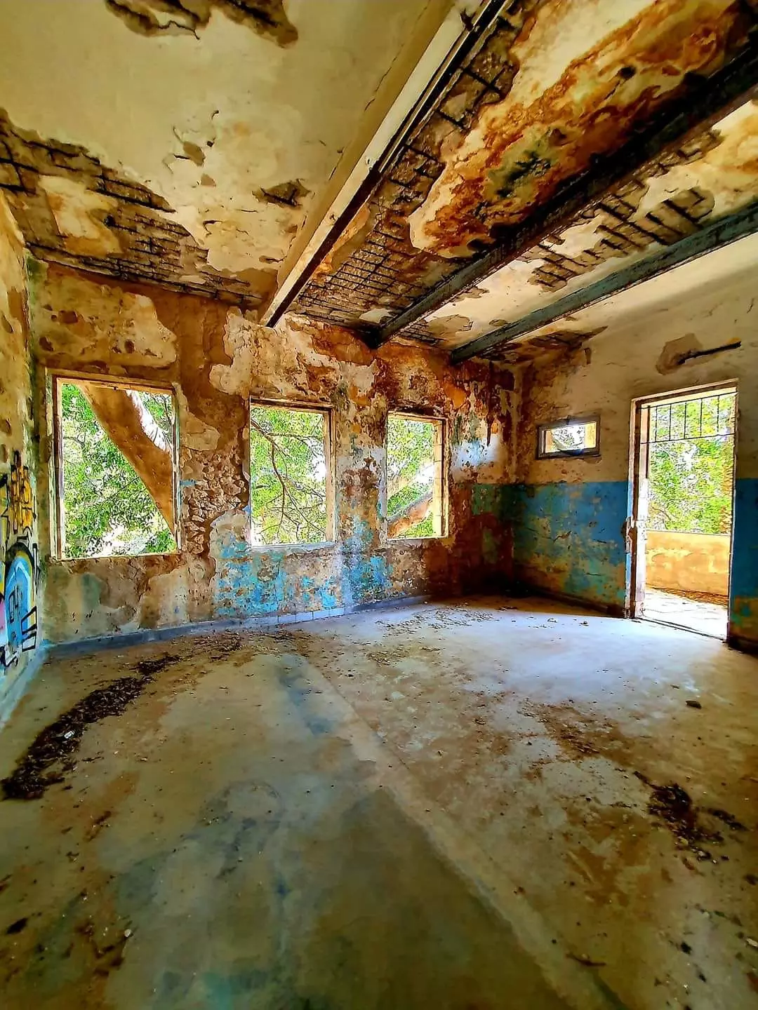
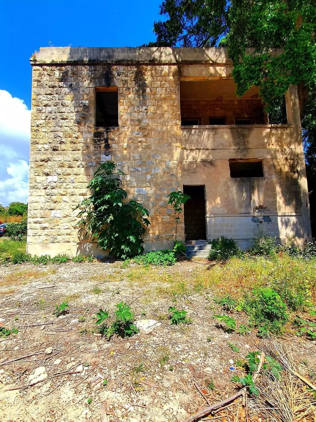
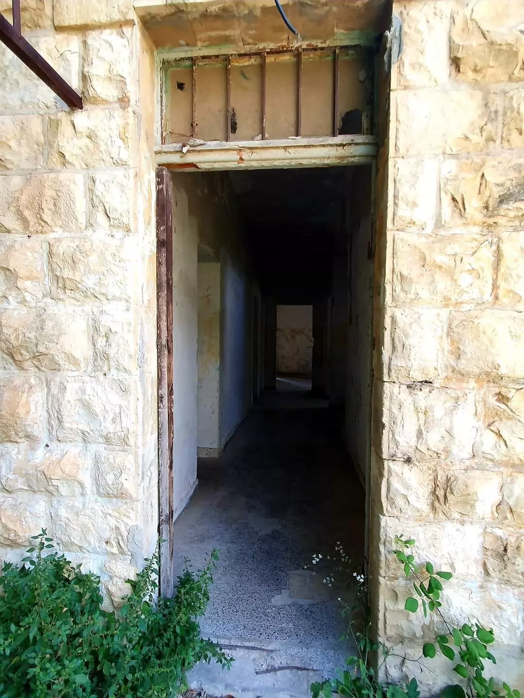
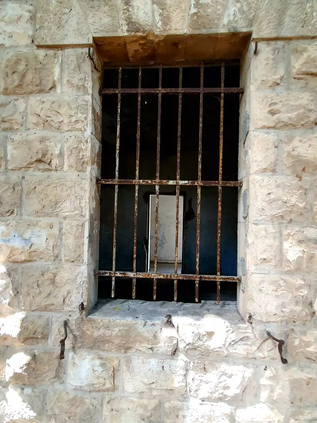
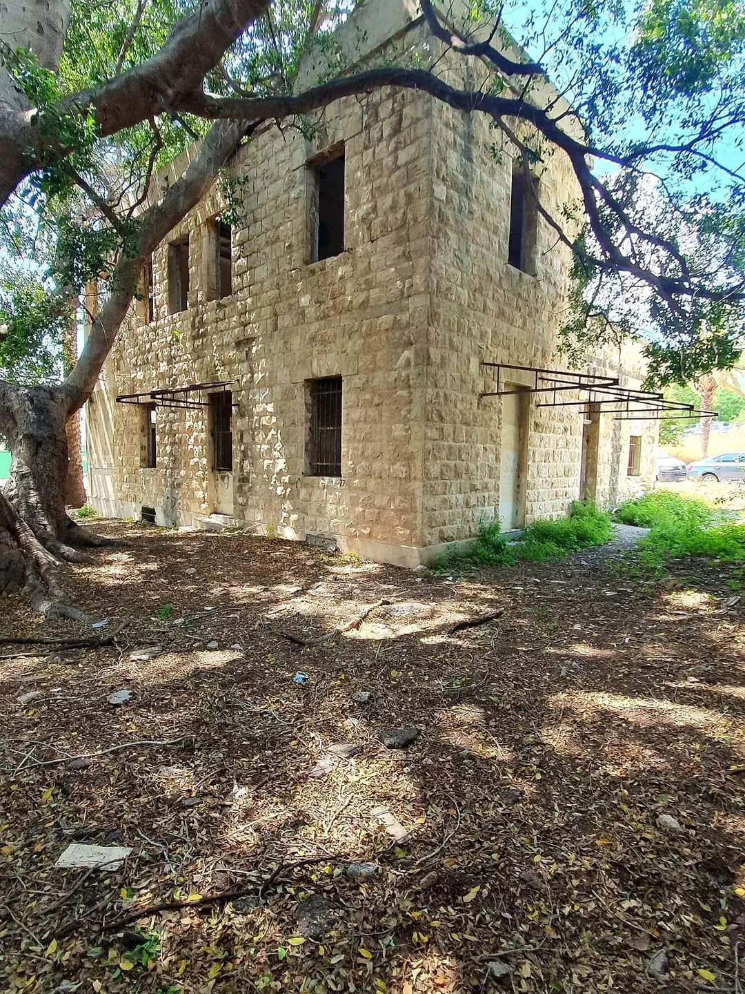
Village Before NakbaThe village stood on the slopes of a rocky hill north of Wadi al-Bassa, and faced west toward the Mediterranean coast. A secondary road linked it to the Acre-Beirut coastal highway. Its name may have been derived from the Canaanite bissah, 'swamp.' It was called Bezeth during the Roman period. Imad al-Din al-Isfahani(d.1201), a chronicler and advisor to Salah al-Din al-Ayyubi (Saladin), referred to it in his writings as Ayn al-Bassa. In 1596, al-Bassa was a village in the nahiya of Tibnin (liwa' of Safad), with a population of 572. It paid taxes on a number of crops, including wheat, barley, olives, cotton, and fruits. Taxes were also paid on other types of produce and property, such as goats, beehives, and pasture land. Al-Bassa was in a zone of contention between Zahir al-'Umar, who became the de facto ruler of northern Palestine for a short period in the second half of the eighteenth century, and the chiefs of Jabal Amil. Zahir's successor, Ahmad Pasha al-Jazzar, made al-Bassa the administrative center of the nahiya in about 1770.In the late nineteenth century, al-Bassa was built of stone and had about 1,050 residents. It was situated on the edge of a plain, surrounded by large groves of olives and gardens of pomegranates, figs, and apples. The village was part of Lebanon before World War I but was incorporated into Palestine after the war when the borders between the two countries were drawn by the British and the French. Al-Bassa expanded during the British Mandate to include an adjacent hill that was known as al-Jubayl. By 1948 the number of houses in al-Bassa exceeded 700. Each of the older houses usually consisted of one large (500-600 square meters) room with a high ceiling. Each house had a large hawsh (courtyard) where laundry was hung and animals were kept. The yard also included a storage room for grain and animal fodder and a well in which rainwater collected; the well supplied the household's water needs. These older houses were made of stone, clustered together and separated by stone-paved streets and alleys. The newer houses that began to appear after World War I were often farther apart and were made of concrete; a few of them had two storeys. The courtyards in these houses served more frequently as home gardens, with a variety of fruit trees and vegetables. The residents of this village and of the neighboring village of Khirbat Ma'sub were counted together in the population statistics of 1944/45; at that time they consisted of 1,590 Christians and 1,360 Muslims. In 1948 the population was estimated at 4,000 but no breakdown along religious lines was made. This increase in population was attributed to an influx of migrants from other areas (who found jobs in the nearby British military bases) as well as to the low level of emigration from the village. Al-Bassa was the second largest of the district villages in terms of population. A local council was established in al-Bassa in 1922 whose revenues amounted to 121 Palestinian Pounds (LP) in 1929, and LP1,407 in 1944. Its expenditures were approximately one-half of the council's annual revenues in both years. After 1946 the council's budget began to suffer a deficit as a result of the construction of a network of water pipes that secured potable water for the village homes. (Prior to the construction of this pipe network, each household had obtained its drinking water from wells that collected rainwater during the winter, from a spring inside the village perimeter, and from an artesian well, drilled in the 1940s, some 1.5 km west of the village.) The local council also assisted the villagers in agricultural matters, such as hiring watchmen for the fields (who were paid by the peasants) and guiding the villagers on planting and scheduling the harvest times for various crops. The village had a public elementary school for boys, built by the Ottomans in 1882, a private secondary school, and a public elementary school for girls. The villagers themselves established two athletic clubs, two mosques, two churches, and several shrines; some shrines were for Muslims, some were for Christians, and two were considered holy by both groups. Workers in al-Bassa formed a local branch of the national Palestinian labor union. This union defended workers' interests and established a cooperative store in the village. Al-Bassa had over twenty stores, which served other villages as well, and a hisba (an open wholesale and retail produce market) in the center of the village. The hisba was opened for business on Sundays. The villagers also worked in a variety of other occupations, including crafts, soap-making and, as stated above, wage employment in British military bases. Some villagers raised animals, including cattle, during the Mandate period. At least ten families depended on their flocks of goats and sheep for their livelihood. Village agriculture was both rainfed and irrigated. Irrigation was usually restricted to fruit trees and vegetables, most of which were planted about 2 km west of the village in an area that also had parks and coffee shops. In the early 1940s the village had a peasant cooperative that owned agricultural implements, a truck, and a harvester. While the main crops were wheat and other grains, the land was also planted in vegetables, fruits, and nuts. In 1944/45 a total of 614 dunums of the land of al-Bassa and Khirbat Ma'sub was devoted to citrus or bananas; 10,437 dunums were allotted to cereals, and 4,699 dunums were irrigated or used for orchards. Antiquities were found inside and outside the village. Inside were the remains of an ancient village, mosaic floors, cisterns, and rock-hewn tombs. A Christian burial place was unearthed in 1932 by the Palestine Department of Antiquities; it contained coins and glass that dated back to the fourth century A.D. Apart from these, over eighteen khirbas were located close to the village. Village Occupation and Ethnic CleaningAccording to two Israeli sources and a United Press dispatch, al-Bassa was occupied on 14 May 1948, during Operation Ben-Ami. Palestinian historian 'Arif al-'Arif puts it three days earlier, however, on 11 May. The History of the Haganah relates that Zionist forces landed at this coastal village in boats, so that 'this was in a certain sense the first operation by the naval forces.' It adds that the inhabitants fled 'at the appearance of Jewish forces.' But eyewitnesses, later interviewed by Palestinian historian Nafez Nazzal, related a different set of events. They said that many women and children had been evacuated earlier in anticipation of an attack, but that some stayed put. On the day of the attack, the village militiamen were taken by surprise and retreated northwards. Villagers recalled that the occupying forces ordered all those who remained, mostly old people, to gather in the village church. There, they took a few of the younger people (including at least one woman) and shot them dead outside the church, ordering the others to bury them. Israeli historian Benny Morris does not mention this incident; he states that the majority of villagers had already been evacuated and most of the rest 'fled during the assault.' He adds that some were then 'ordered or 'advised' to go northwards, to Lebanon,' and that another 100 or so villagers (mainly old people and Christians) were transported to the village of al-Mazra'a, along with other displaced villagers from Galilee. According to Nazzal, a few villagers were later killed as they tried to return to the village to salvage their belongings.Zionists Colonies on Village LandsIsraelis founded the settlement of Betzet in 1949 on the village site and populated it with Jewish immigrants from Romania and Yugoslavia. A military airport of the same name was built near the settlement. In the same year, settlers from the Yiftach Brigade of the Palmach established the settlement of Kefar Ro'sh ha-Niqra on village lands. Leman, also built in 1949, was established to the east of the site on village land. Leman was originally a military base called Tzahal , but it was renamed after U.S. Senator Herbert Lehman visited the settlement in 1959. Shelomi, a development city, was established in 1950 on village lands and is located slightly to the south of the original village site; it now has a population of about 2,200. Matzuva , originally founded in 1940, has expanded, and now some of its buildings are on village land.Village TodayOnly two of the main buildings of the village, a Greek Catholic church and a Muslim shrine, are extant. The church, made of stone, is rich in architectural features, including one high window with a circular arch, flanked by two smaller ones with similar arches. The pulpit area, at one end of the structure, is half-cylindrical and also has high arched windows. The belfry rises from a gabled, tiled roof. This church is now collapsing on one side and its walls are cracking. The Muslim shrine is domed and stands deserted in the midst of many trees, including two palms. A number of village houses remain, some occupied by Israelis. One of them is a large two-storey building that has both rectangular and arched doors and windows. The frame of one door is made up of four circular columns, two on each side, and a lintel, with decorative carvings. Above the lintel there is an additional decorative arch.Fig trees, thorns, cactuses, and piles of stones from destroyed houses are scattered across other parts of the site. The lands around the village are cultivated. SourceDr. Walid al-Khalidi, 1992: All That Remains. |
|||||||||||||||||||||||||
| Related Maps | Town Lands' Demarcation Maps خرائط للقضاء توضح حدود القرى والاودية Town's map on MapQuest View from satellite Help us map this town at WikiMapia |
||||||||||||||||||||||||
| Related Links | Wikipedia's Page Facebook Page Google Search Google For Images Google For Videos |
||||||||||||||||||||||||
| More Information | مخطط البلد في كتاب كي لا ننسى في كتاب بلادنا فلسطين المزيد من موقع هوية |
||||||||||||||||||||||||
- The Cleansing of Al Bassa
- عائلات البصة عمر عصفور
- عائلات البصة ونبذة عن تاريخ بعضها
- Hiding in Al Bassa from the ottoman soldiers
- The Beasts of Al Bassa
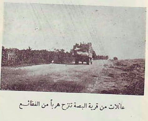
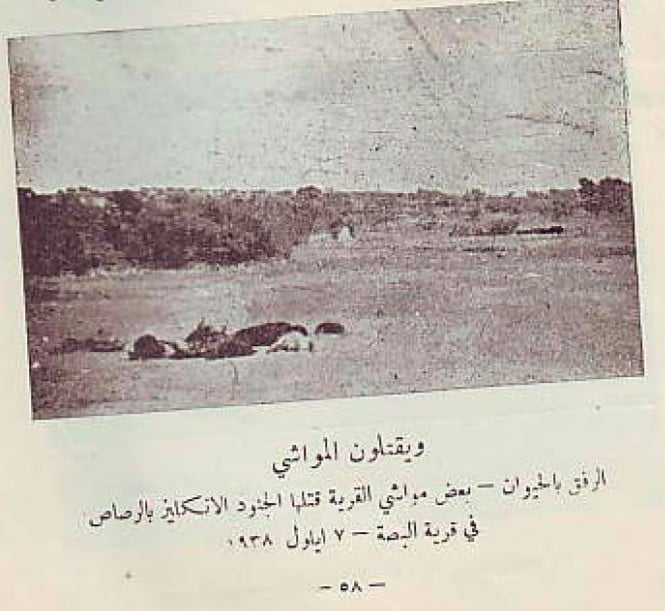
- The 1938 al-Bassa Massacre and the Royal Ulster Rifles
- Miracle in Al Bassa
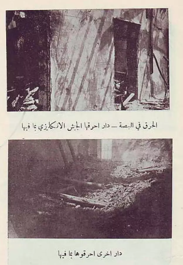
- Fire in Al Bassa
- A legend from Al Bassa
- The snake of Al Bassa
- Painful memories from Al Bassa
- Hyena stories from Al Bassa
- We love Palestine despite we didn't see it...
- نبذة تاريخية عن قرية البصة (قضاء عكا) من كتاب (كي لا ننسى)
- قرية البصة بفلسطين.. هبة لإحياء دور العبادة-وديع عواودة-الجزيرة
- Identity is complex for Lebanon’s Christian Palestinian camp By ABBY SEWELL (News editor of the Associated Press)
- The lives upended by colonial rule in the Middle East. By Tom Bateman, Middle East Correspondent.
- تحقيق لبي بي سي: قصص حيوات حطّمها الانتدابان البريطاني والفرنسي
- Al Bassa Mosque
Posted by Nizar El Hanna 4 - Cactus in Al Bassa
Posted by Nizar El Hanna 1 - Al Bassa Church 1
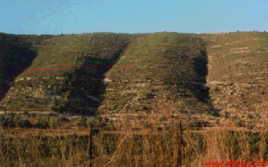
Posted by Nizar El Hanna 1 - Al Mushaqah hills
Posted by Nizar El Hanna 1 - Al Bassa Church 2
Posted by Nizar El Hanna 1 - A Bassawi Muslim Prays for the Return
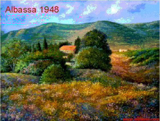
Posted by Nizar El Hanna - Portrait of Al Bassa in 1948
Posted by Nizar El Hanna - Village Street In 1987
Scanned from "All That Remains" by Dr. Walid Khalidi 4 - Al-Bassa Soon After Occupation. It was mostly populated by Bulgarian Jews, 1950
Posted by Prince, Peaceful Israeli 4 - Newly Settled Bulgarian Jews Enjoying The New Loot, 1950
Posted by Prince, Peaceful Israeli 5 - Newly Settled Bulgarian Girls Studying Were Palestinian Arabs Used To Study, 1950

Posted by Prince, Peaceful Israeli 3 - مسجد البصة واحد البيوت الباقية - 14-1-2005
Posted by Makbula Nassar 18 - مقام البصة 14-1-2005
Posted by Makbula Nassar 4 - كنيسة البصة 14-1-2005
Posted by Makbula Nassar - كنيسة البصة 14-1-2005
Posted by Makbula Nassar - البيت الواقع بين الكنيسة والجامع 14-1-2005
Posted by Makbula Nassar 3 - البيت الواقع بين الكنيسة والجامع 14-1-2005
Posted by Makbula Nassar 1 - مسجد البصة -السبت 29-3--2008
Posted by farid haj yahya - مقام القرية -السبت 29-3-2008
Posted by farid haj yahya 1 - كنيسة البصة - السبت 29-3-2008
Posted by farid haj yahya - The entrance to the church in Basa 22-08-09
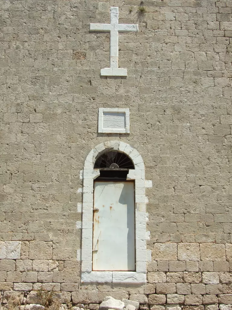
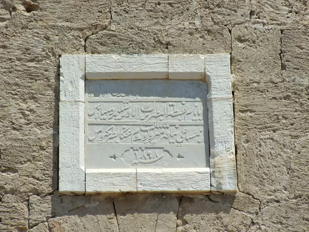
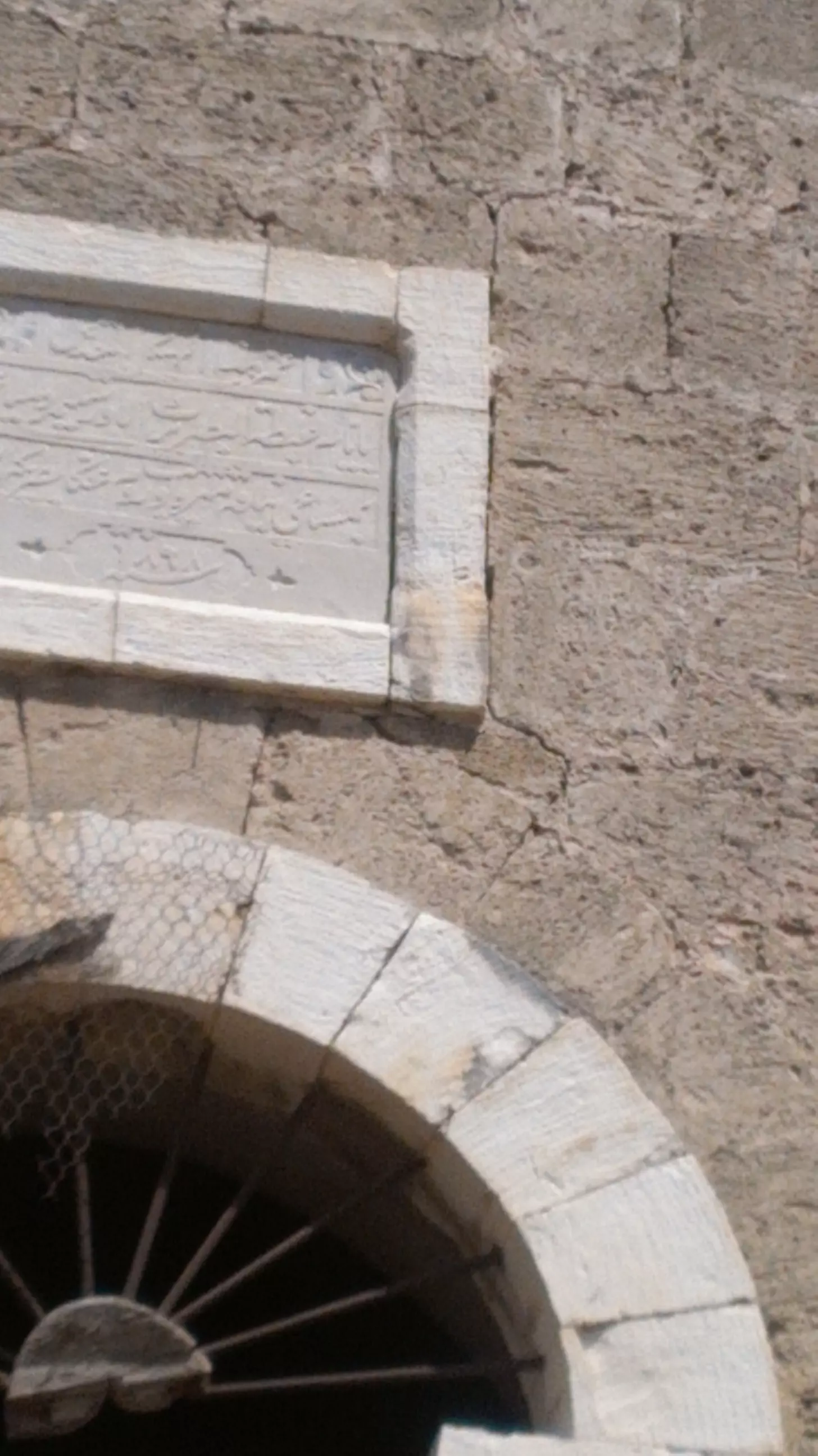
Posted by Uri Zackhem 1 - The plaque above the entrance mentions 1898
Posted by Uri Zackhem - This house is located to the south of the church 23-08-09
Posted by Uri Zackhem 1 - One of the remaing few houses, 2008
2 - The Maqam, 2008
- The Church, 2008
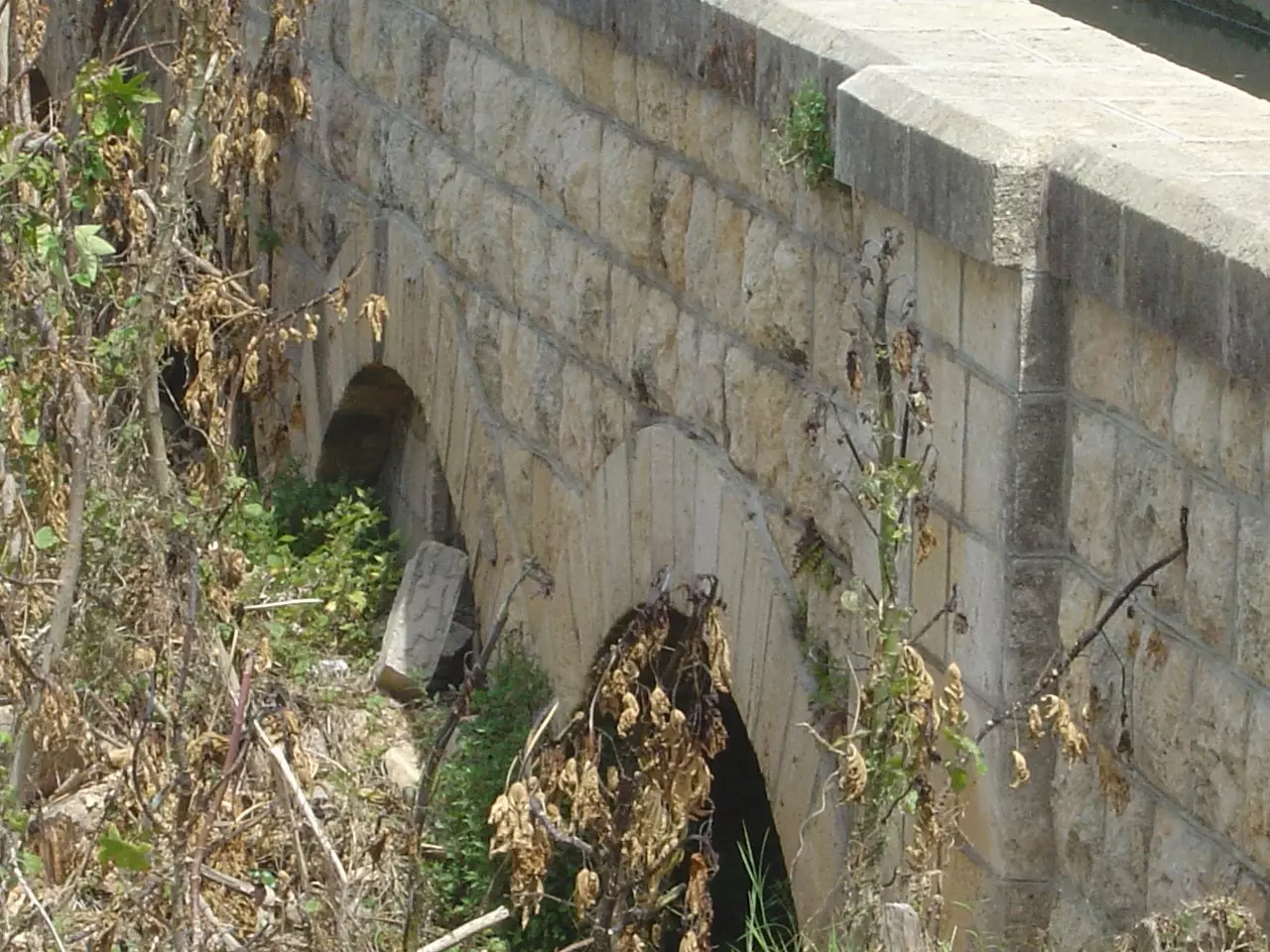
Posted by Abu Sous - القناطر منطقة تقع على مفرق الحنية قرب مفرق القليلة في جنوب لبنان يمر من فوق هذه القناطر مجرى مياه لتزويد البستين الزراعية بالماء
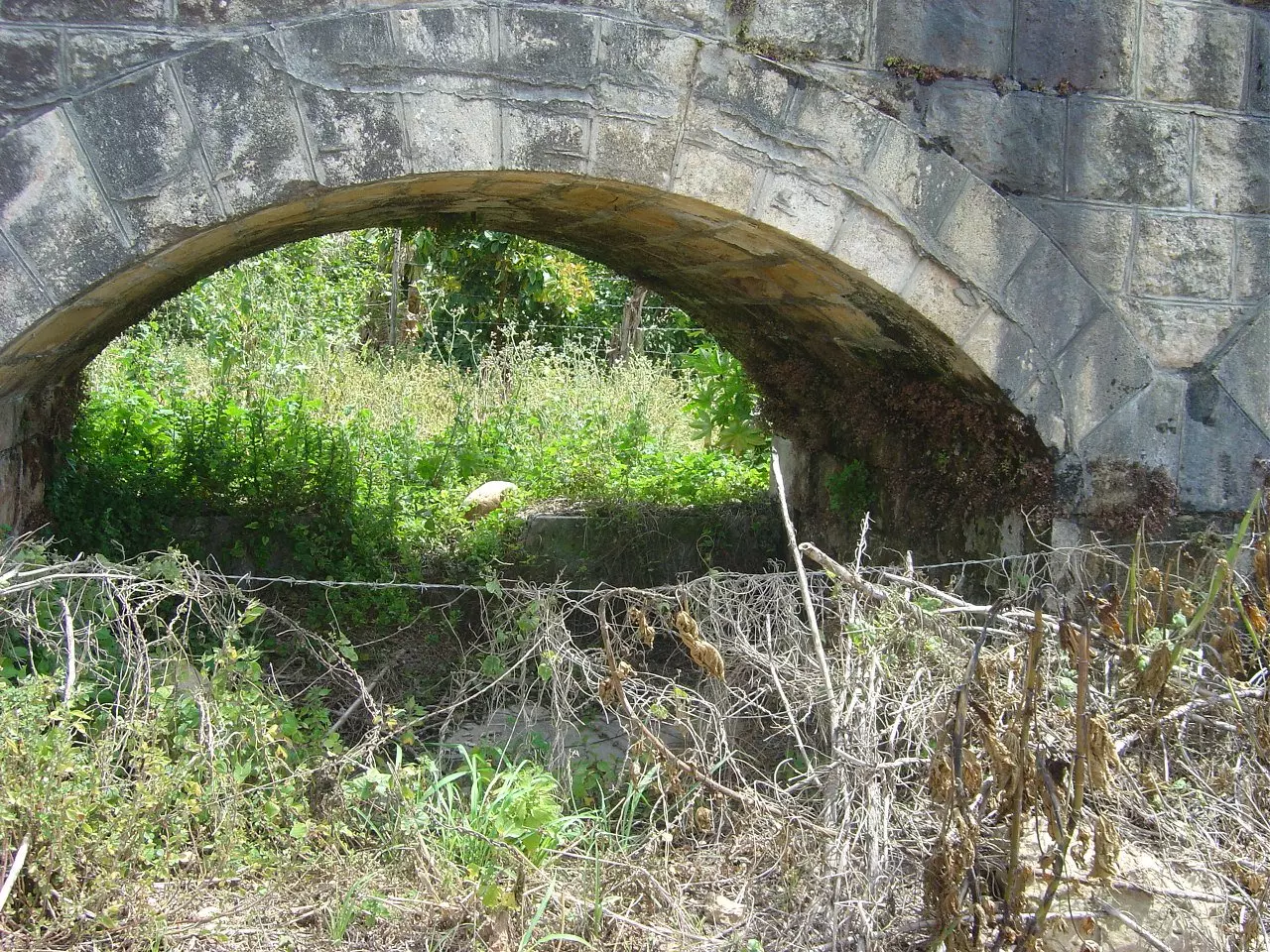
1 - القناطر منطقة تقع على مفرق الحنية قرب مفرق القليلة في جنوب لبنان يمر من فوق هذه القناطر مجرى مياه لتزويد البستين الزراعية بالماء - 2
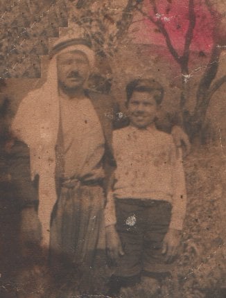
- هذه الصورة اخذت في البصة قبل عام 1948 في الصورة ابو محمود شبيب "شبيب الخليل" وابنه محمــود شبيب، منقول من صفحة البصة على الفيسبوك
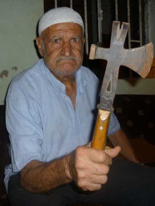
- الحــــاج أبــــو أحمــــد ومجـــزرة صبــرا وشــــاتيـــلا
1 - منظر عام ....١٩٣٩
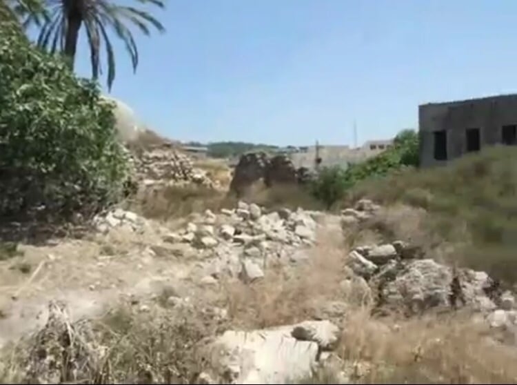
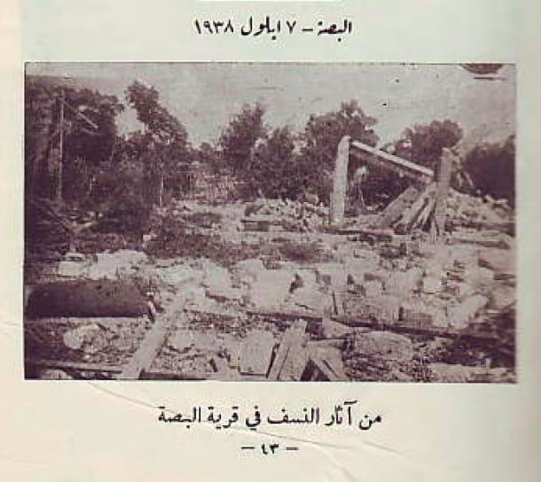
1 - بقايا بيوت البصه
Posted by abu raya - مسجد البصه
Posted by abu raya - اثار بيوت البصه
Posted by abu raya - من بيوت البصه
Posted by abu raya - لوحه من خارج الكنيسه
Posted by abu raya - من بيوت القريه
Posted by abu raya - بيت باقي في القريه
Posted by abu raya - جامع القريه
Posted by abu raya - من بيوت القريه
Posted by abu raya - كنيسه القريه
Posted by abu raya - الكنيسه من الداخل
Posted by abu raya - كنيسه البصه
Posted by abu raya - كنيسه القريه
Posted by abu raya - منظر من الجو لقريه البصه قبل النكبه
Posted by abu raya - صوره قديمه لقريه البصه سنه 1939
Posted by abu raya - سنة 1898 تم بناء كنيسة البصة
Posted by سهيل مخول - بيت بالقرب من كنيسة البصة - ممكن أن يكون بيت الراهبات - تصوير سهيل مخول يوم 23.08.2016
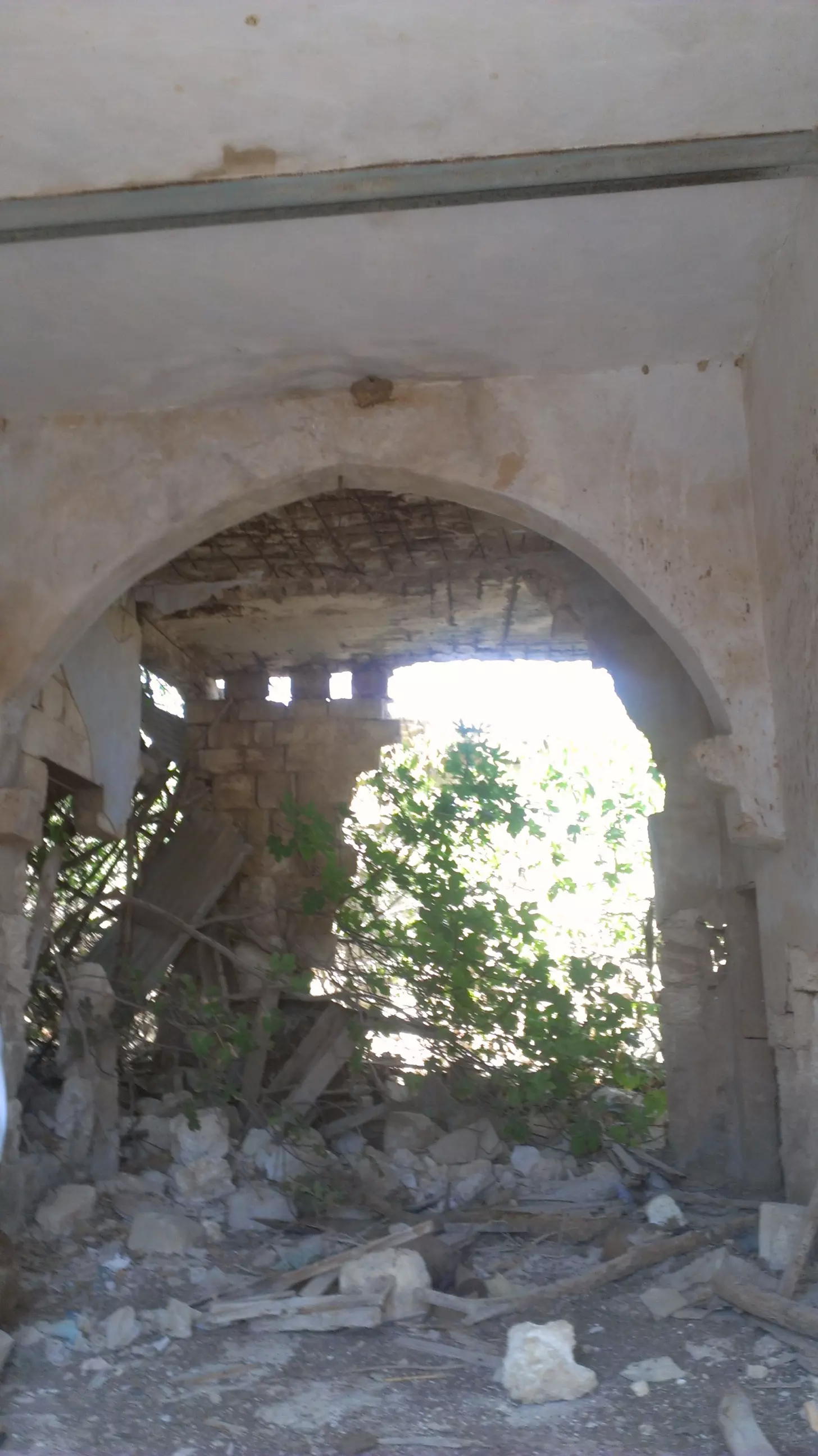
Posted by سهيل مخول - داخل البيت - بيت الراهبات كما يظهر يوم 23.08.2016 تصوير سهيل مخول
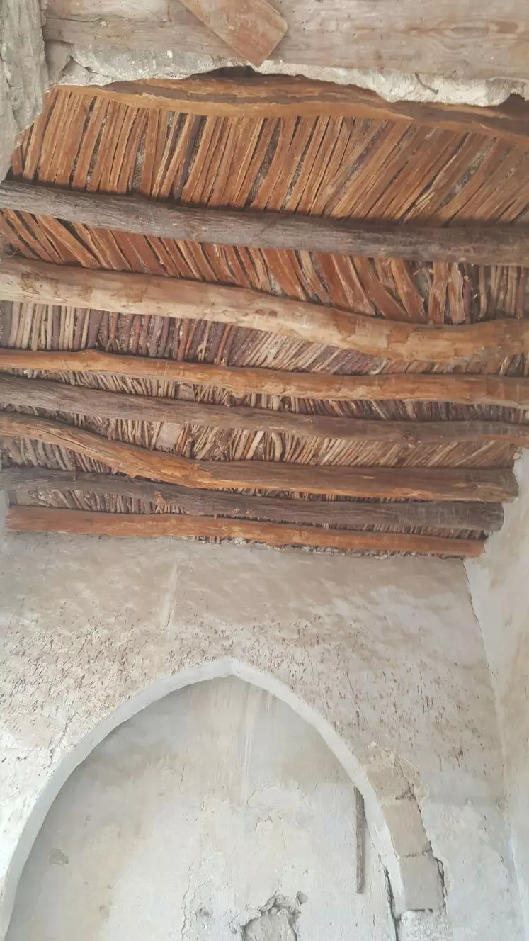
Posted by سهيل مخول - صورة اضافية للمبنى والسقف
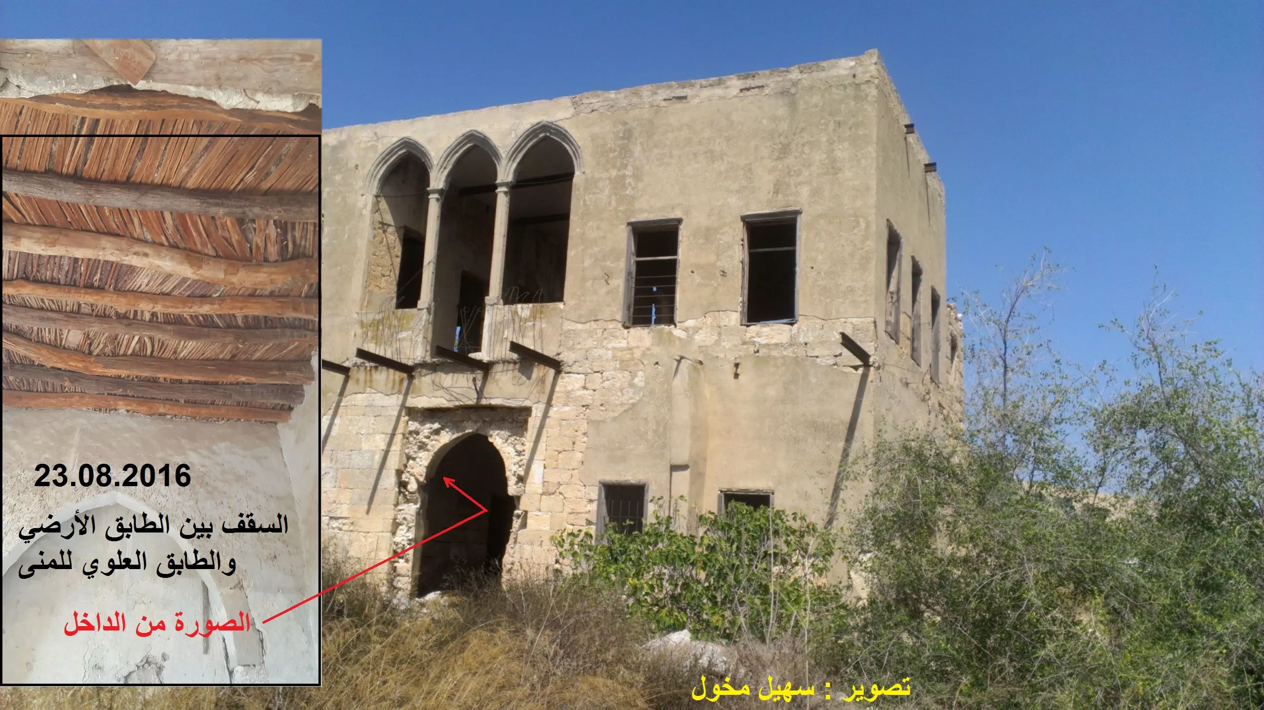
Posted by سهيل مخول - سقف داخلي
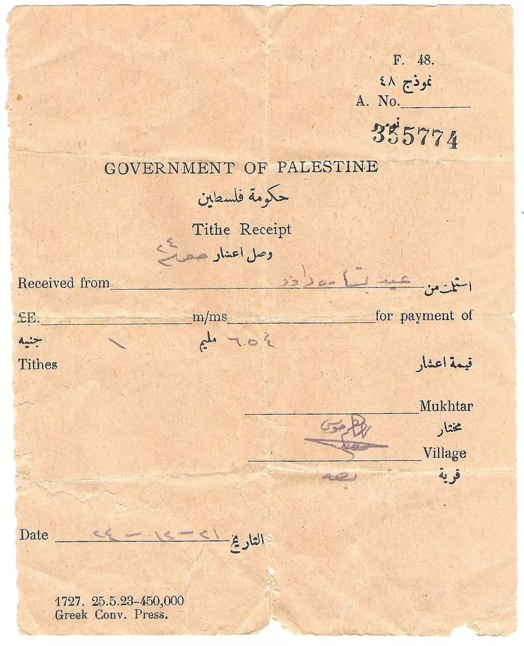
Posted by سهيل مخول - Here is a preview of one my family´s old documents from al-Bassa, which are in my possession.

Posted by Eid Haddad - Here is a preview of one my family´s old documents from al-Bassa, which are in my possession.
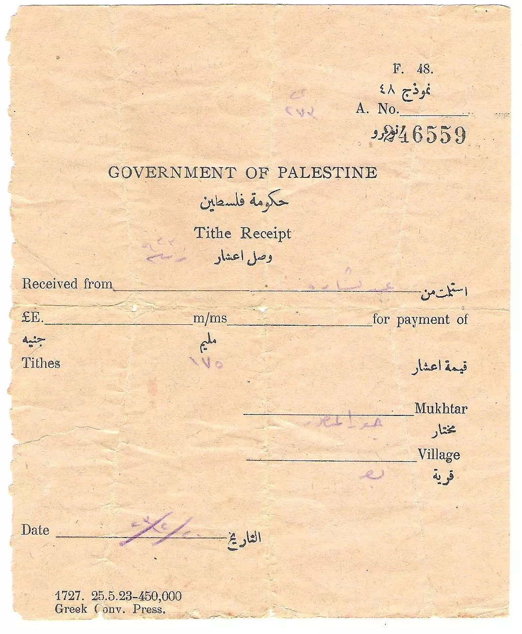
Posted by Eid Haddad - وصل اعشار من مختار البصة سنة ١٩٢٤
Posted by Eid Haddad - وصل مجلس محلي (بلدية) البصة سنة ١٩٣٢
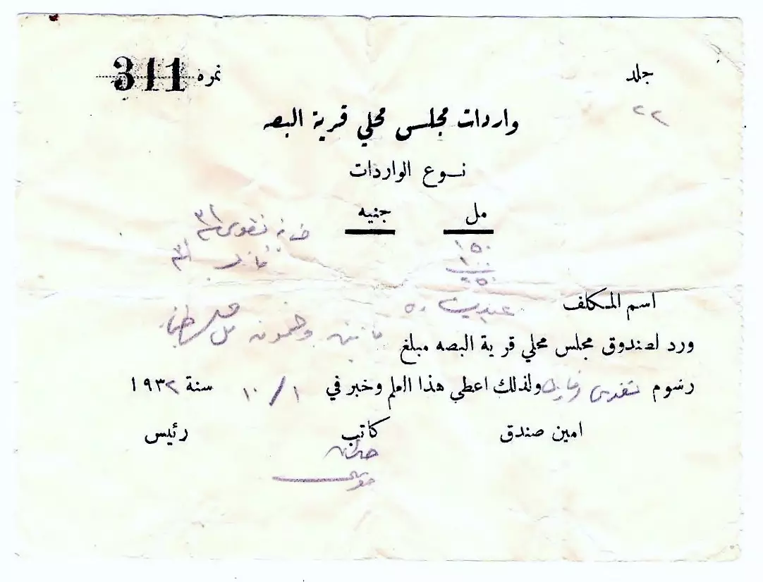
Posted by Eid Haddad - وصل مجلس محلي (بلدية) البصة سنة ١٩٣٢

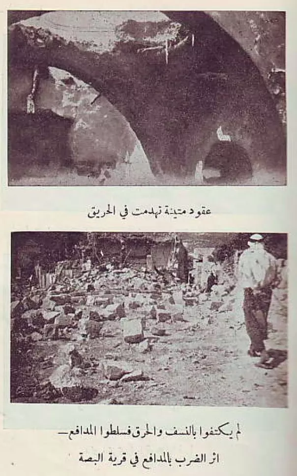
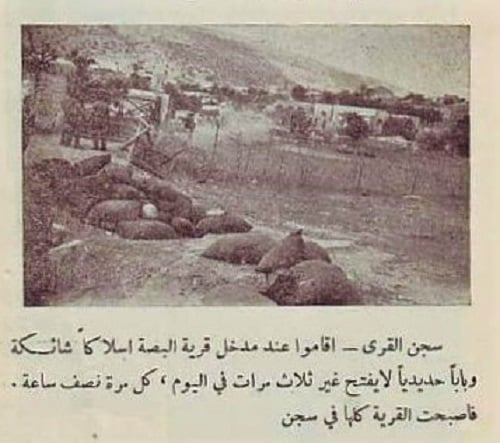
Posted by Eid Haddad - مشاهد نادر لعمليات الهدم والتخريب التي قام بها الاحتلال البريطاني في البصة غضون ثورة 1936
- مشاهد نادر لعمليات الهدم والتخريب التي قام بها الاحتلال البريطاني في البصة غضون ثورة 1936 #2
- مشاهد نادر لعمليات الهدم والتخريب التي قام بها الاحتلال البريطاني في البصة غضون ثورة 1936 #3
- مشاهد نادر لعمليات الهدم والتخريب التي قام بها الاحتلال البريطاني في البصة غضون ثورة 1936 #4
- مشاهد نادر لعمليات الهدم والتخريب التي قام بها الاحتلال البريطاني في البصة غضون ثورة 1936 #5
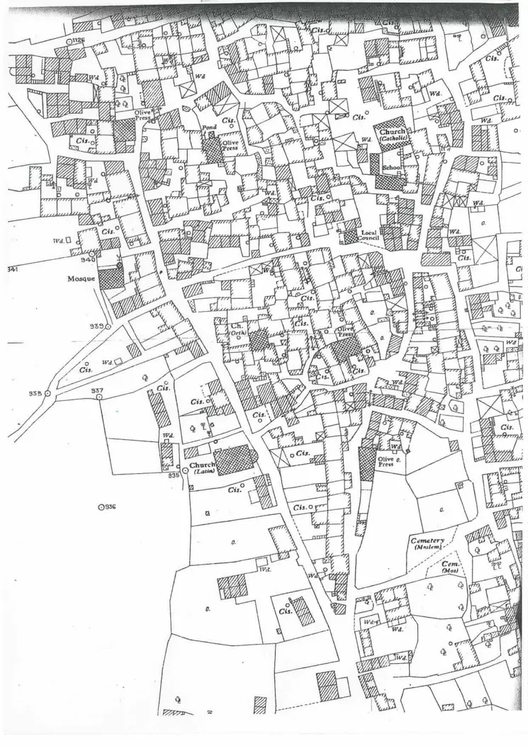
- خريطة هيكلية للبصة قبل النكبة
- صورة للبصة من الجوة عام 1947
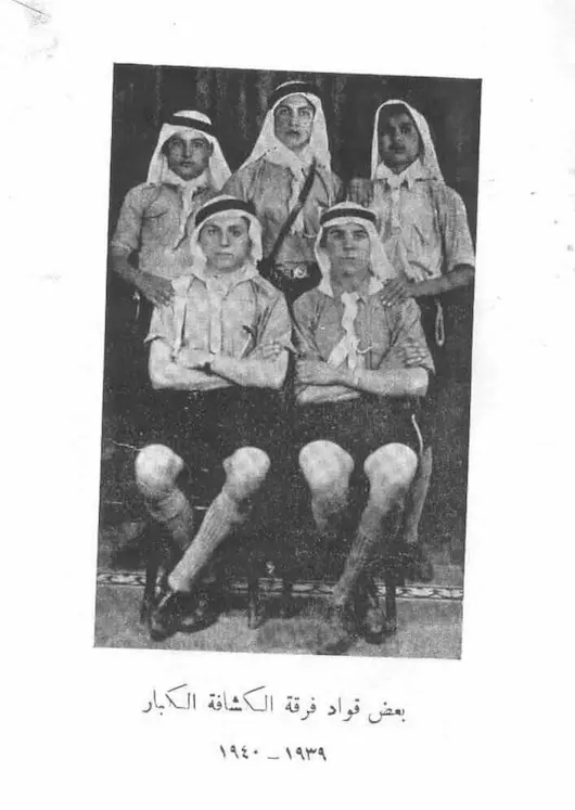
- الكشافة في البصة عام 1939-40
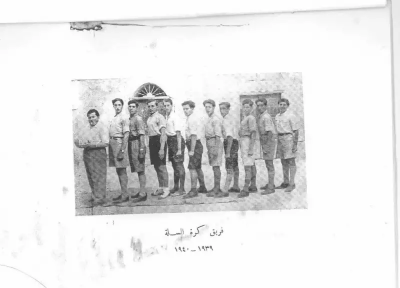
- صورة لفريق كرة السلة في البصة قبل النكبة
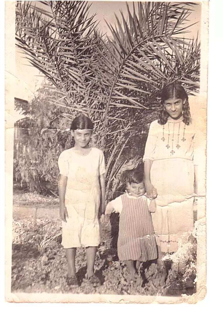
- صورة عائلية في البصة تعود لفترة قبل النكبة
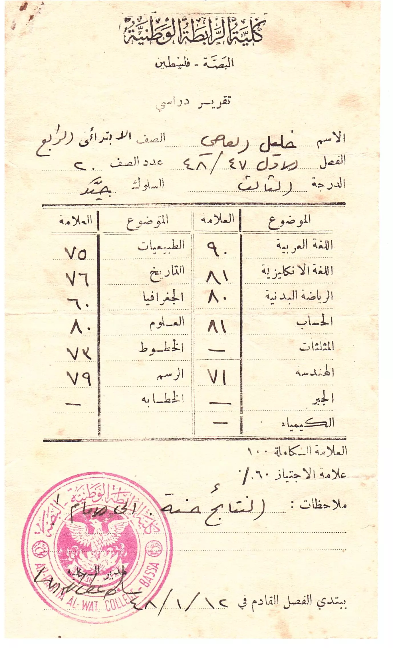
- شهادة الصف الرابع لخليل العاصي من كلية الرابطة الوطنية - البصة
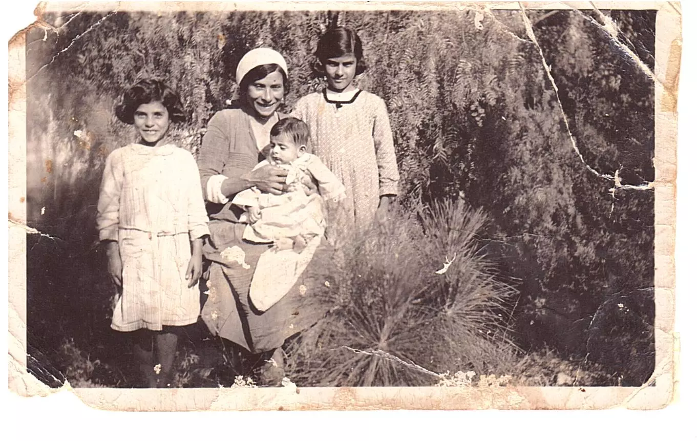
- صورة عائلية في البصة لعائلة خليل العاصي 1939
- Al Bassa under siege of british soldiers 1937
Posted by Eid Haddad - شهادات لمجزرة البصة من رسائل جُمعت في كتاب وثائق الحركة الوطنية الفلسطينية 1918-1939: من أوراق أكرم زعيتر Testimonies to al Bassa massacre
Posted by Eid Haddad - مقام الخضر يقرية البصة المهجرة \عكا

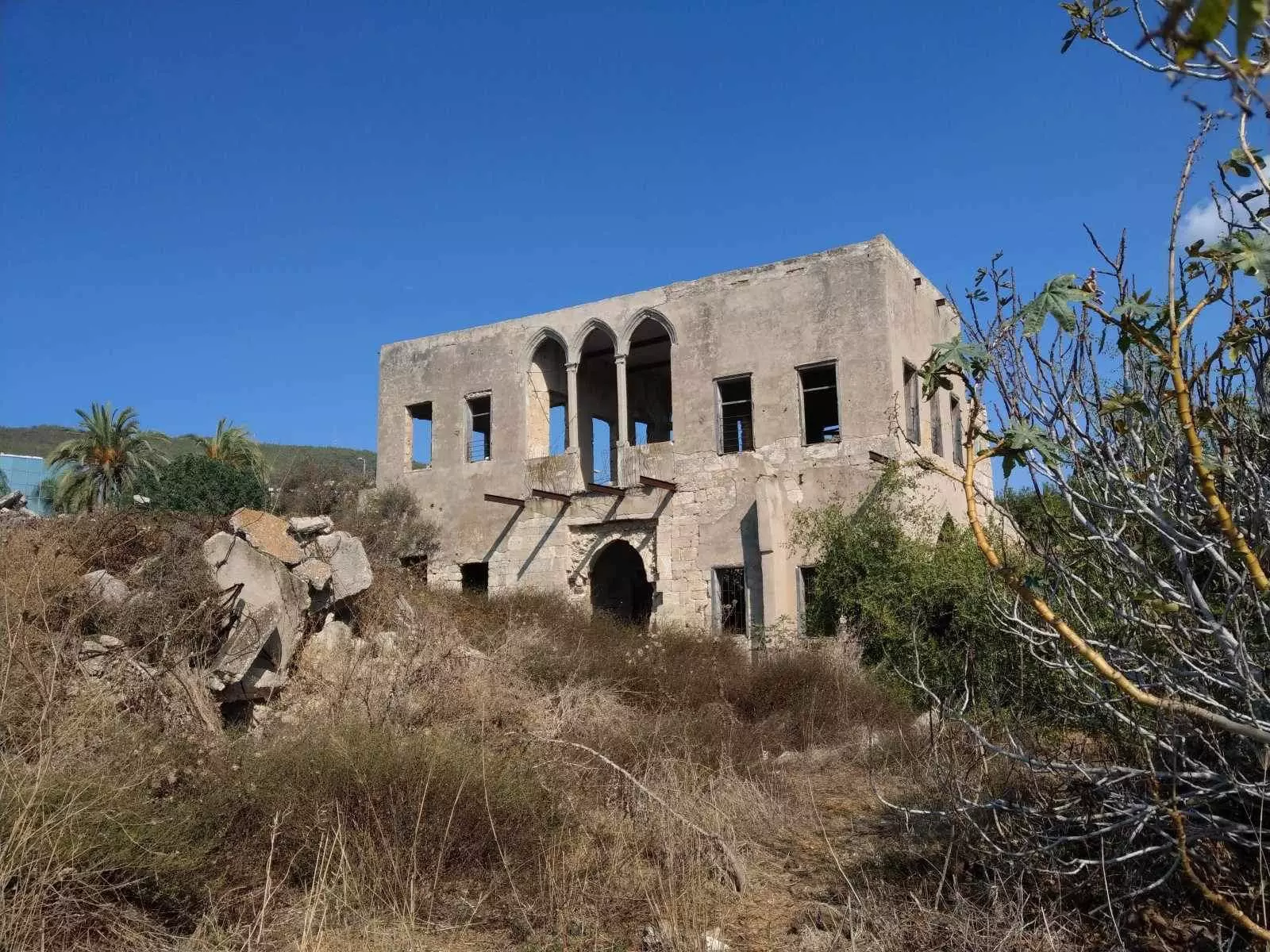
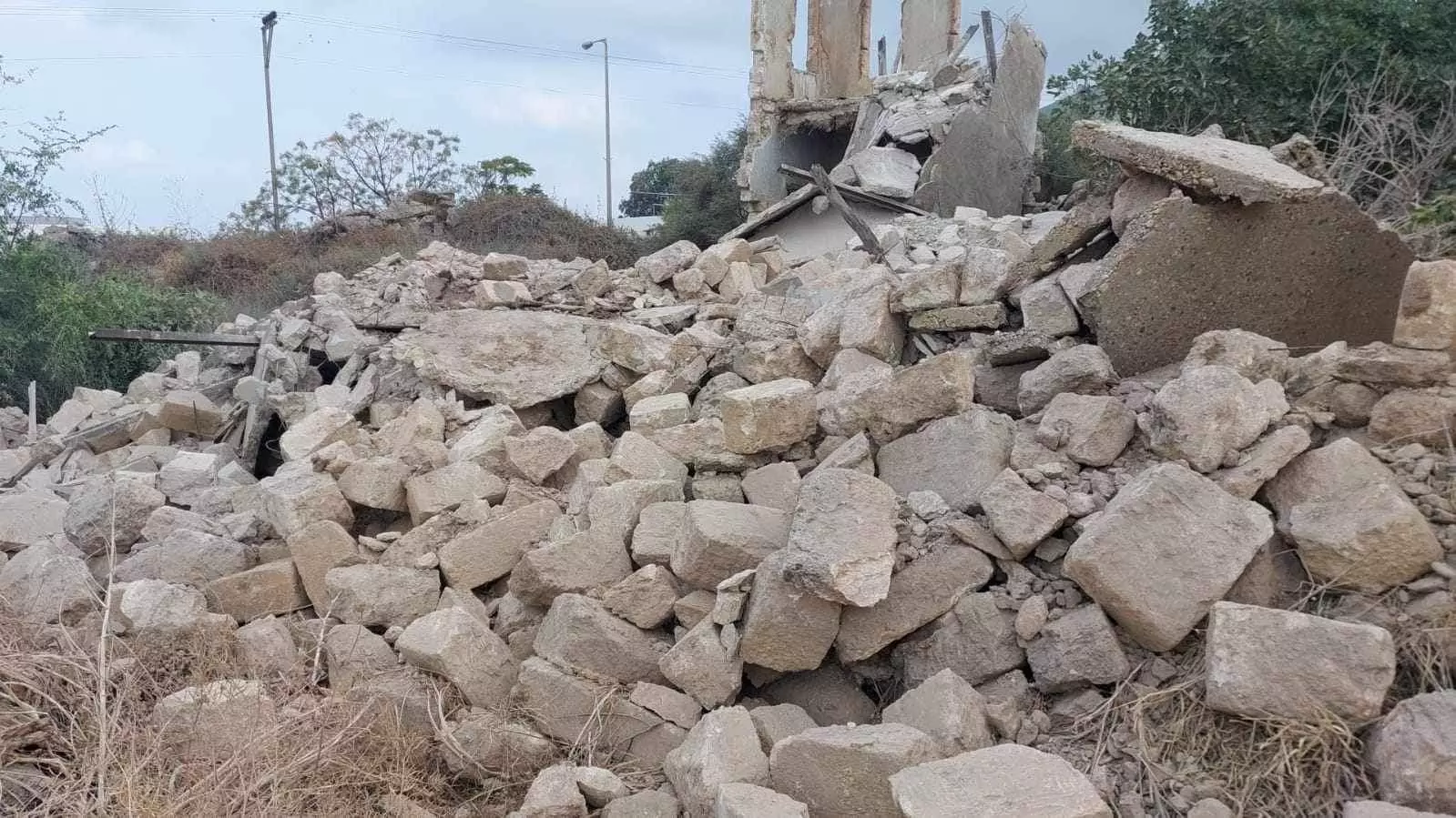
- Israeli forces demolished my grandfather’s home. The only thing left that linked my family to their hometown.
They’re claiming it collapsed by itself but there is a plan to build a new Zionist project on top of the place--Elias Khoury
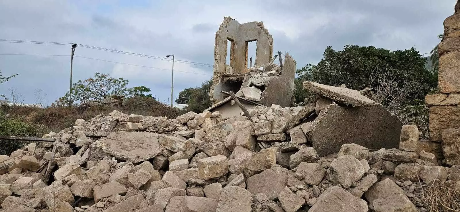
- Israeli forces demolished my grandfather’s home. The only thing left that linked my family to their hometown.
They’re claiming it collapsed by itself but there is a plan to build a new Zionist project on top of the place--Elias Khoury #2
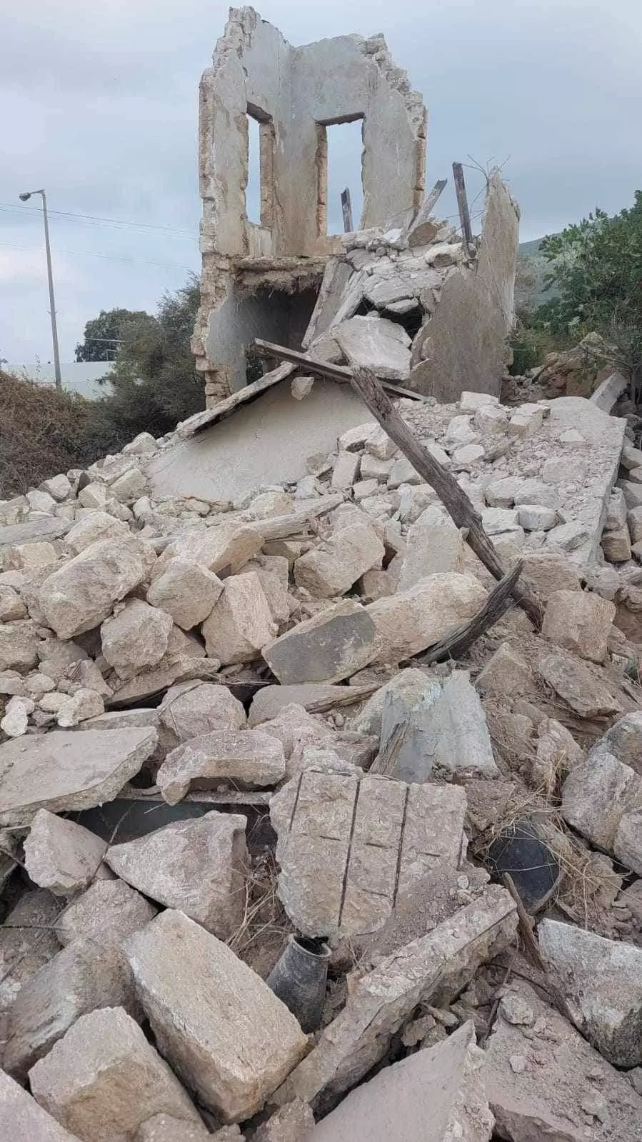
- Israeli forces demolished my grandfather’s home. The only thing left that linked my family to their hometown.
They’re claiming it collapsed by itself but there is a plan to build a new Zionist project on top of the place--Elias Khoury #3
- Israeli forces demolished my grandfather’s home. The only thing left that linked my family to their hometown.
They’re claiming it collapsed by itself but there is a plan to build a new Zionist project on top of the place--Elias Khoury #4
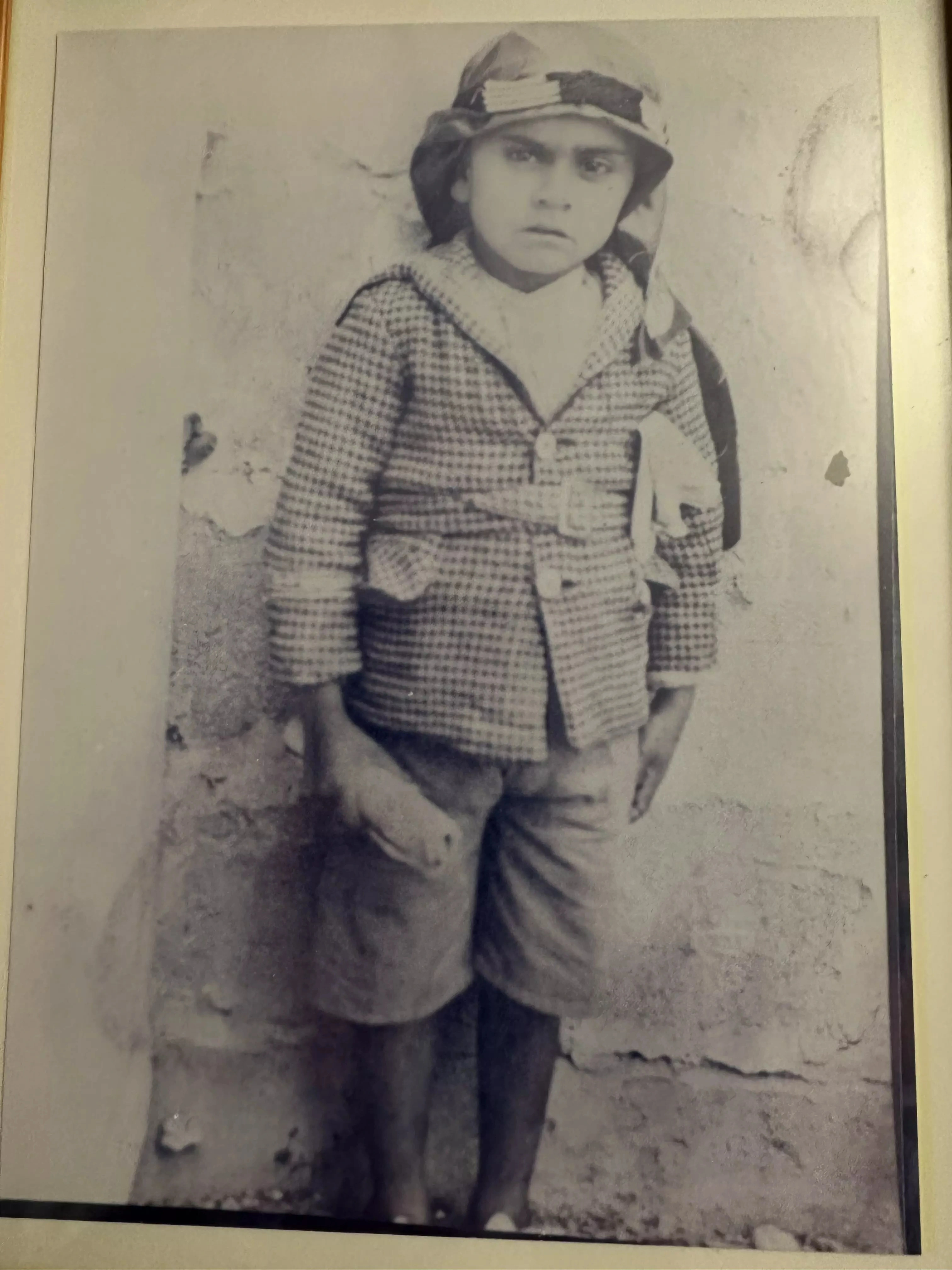
- My father Fadl Amin Mohsen going to school at Al Bassa a sandwich in his hand
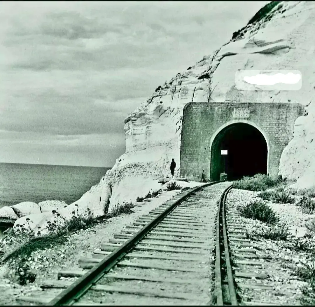
Posted by Alix - نفق سكة القطار بين حيفا وبيروت 1942..
- Palestinian artist, son of Al Bassa Eid Haddad. الفنان الفلسطيني ابن البصة عيد حداد
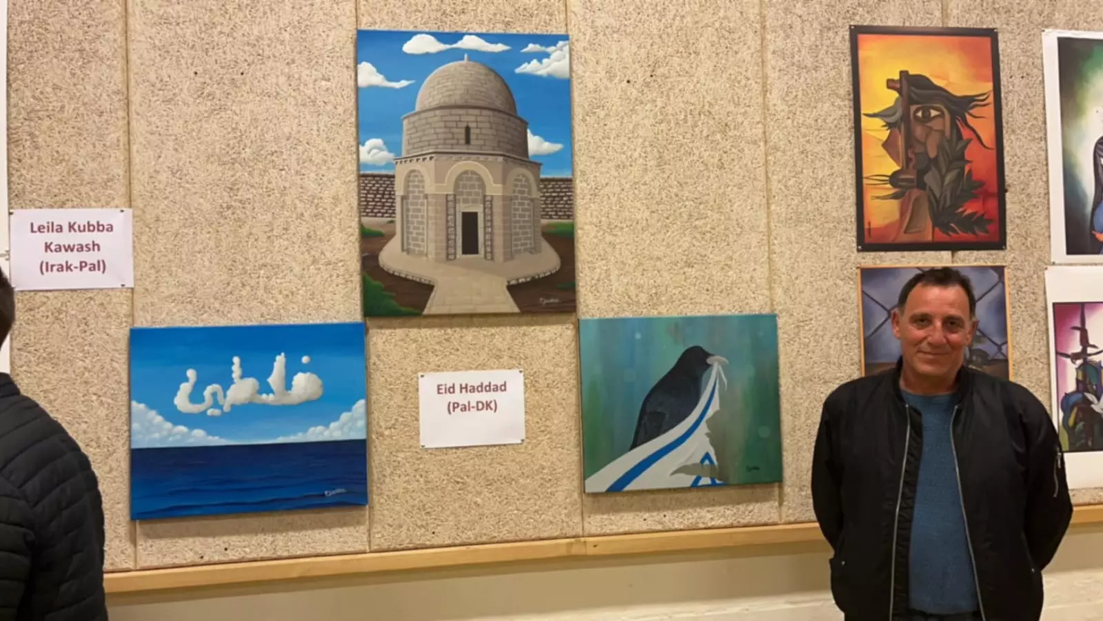
Posted by Eid Haddad - مقام الخضر...في القرية
- مقام الخضر...في القرية #2
- مقام الخضر...في القرية #3
- مقام الخضر...في القرية #4
- مقام الخضر...في القرية #5
- مقام الخضر...في القرية #6
- مقام الخضر...في القرية #7
- مقام الخضر...في القرية #8
- مقام الخضر...في القرية #9
- مقام الخضر...في القرية #10
- مقام الخضر...في القرية #11
- صورة من الجو لقرية البصة قضاء عكا عام 1917..
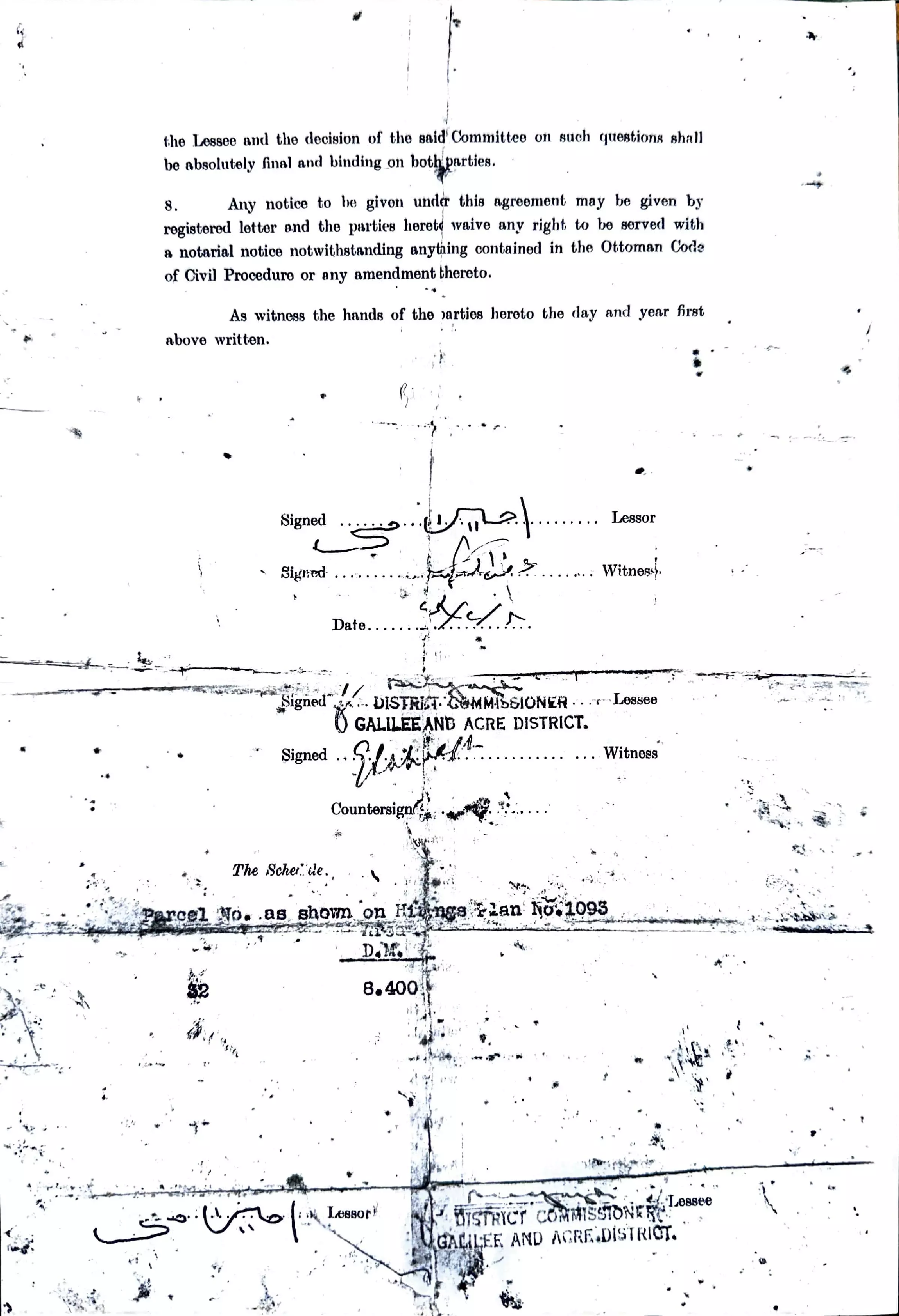
- HIRING AGREEMENT
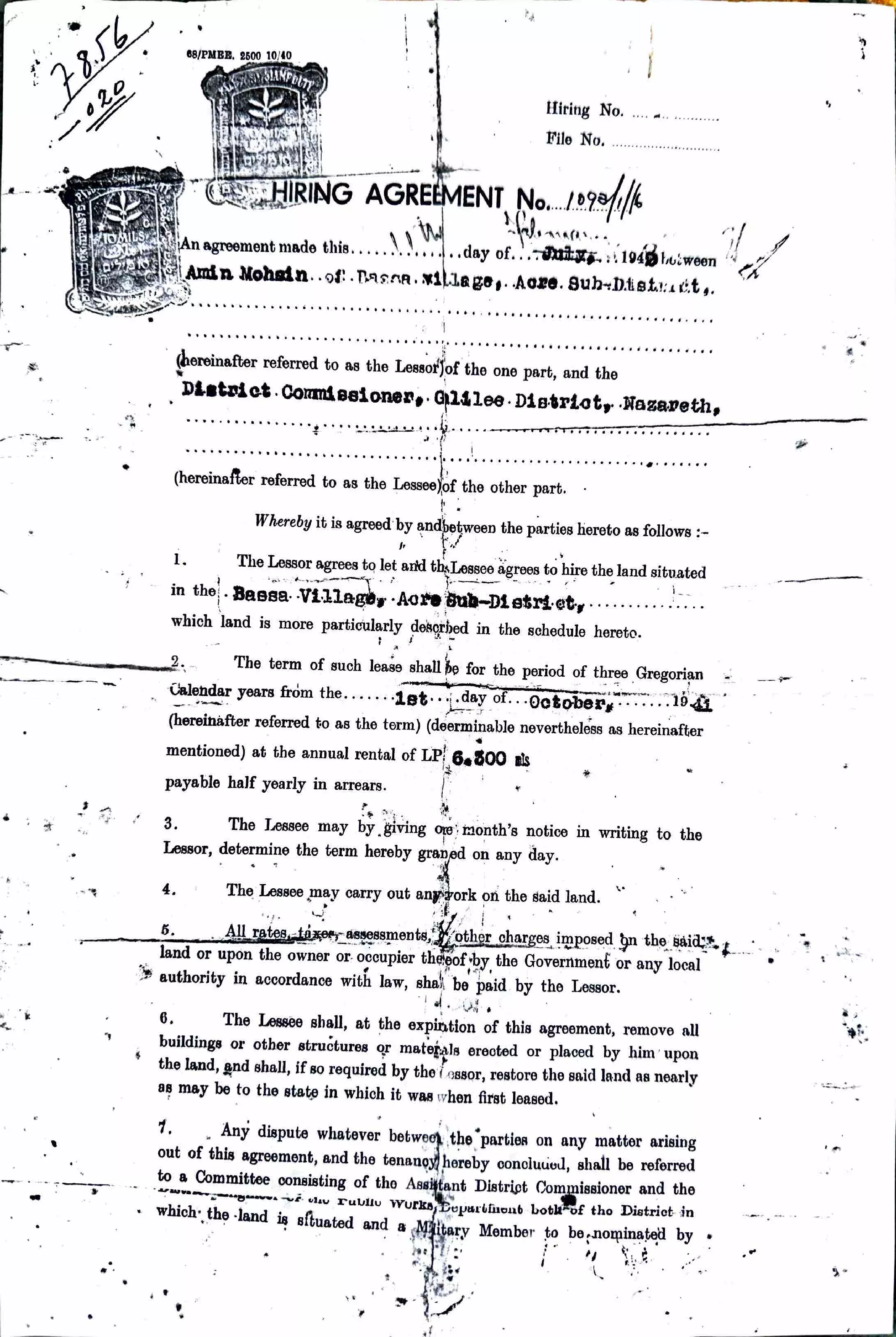
Posted by Alix - HIRING AGREEMENT #2
Posted by Alix - Maqam/Shrine of al-Khidr in al-Bassa
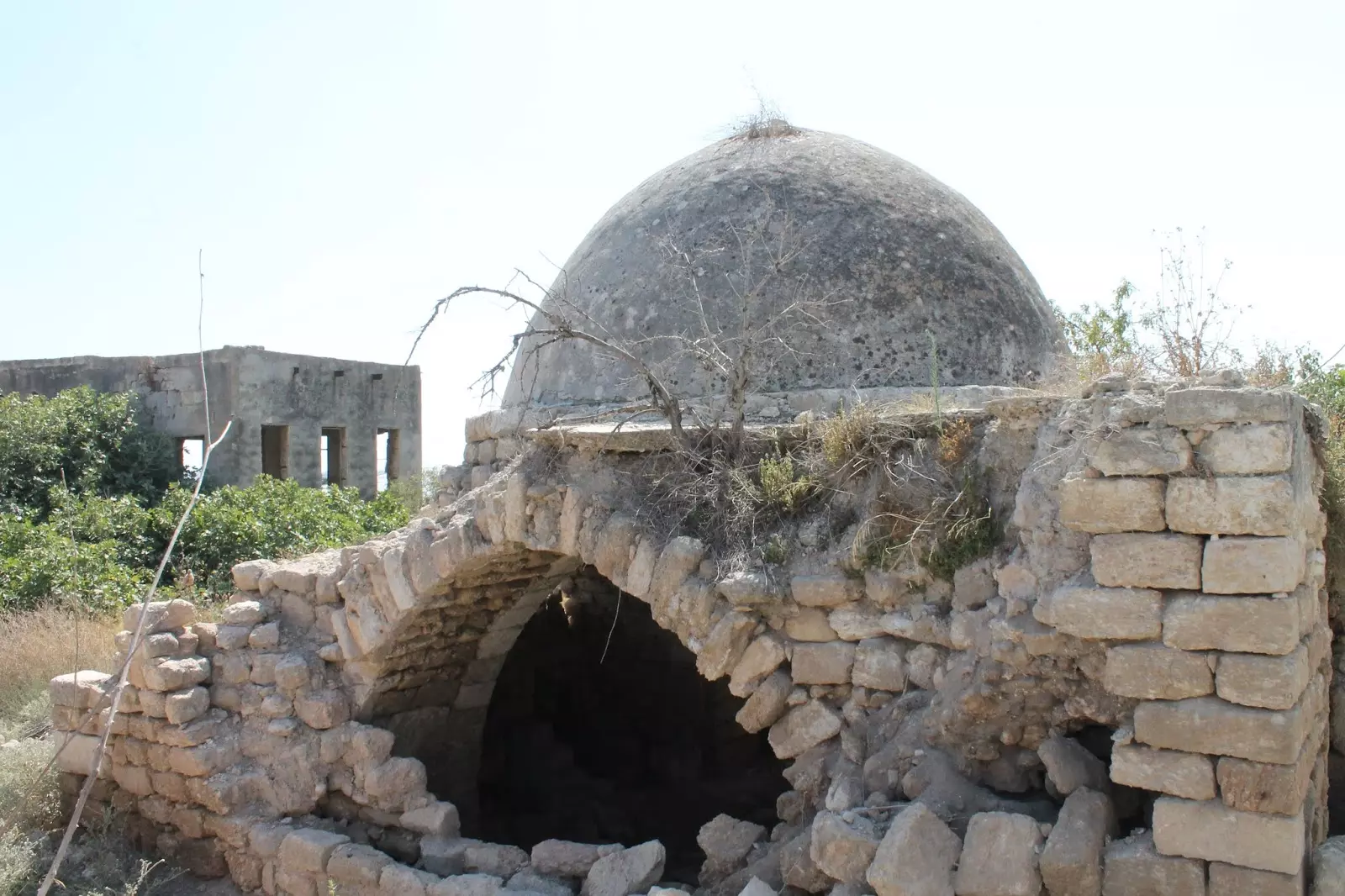
Posted by Ziad Alotleh - Maqam/Shrine of al-Khidr in al-Bassa #2
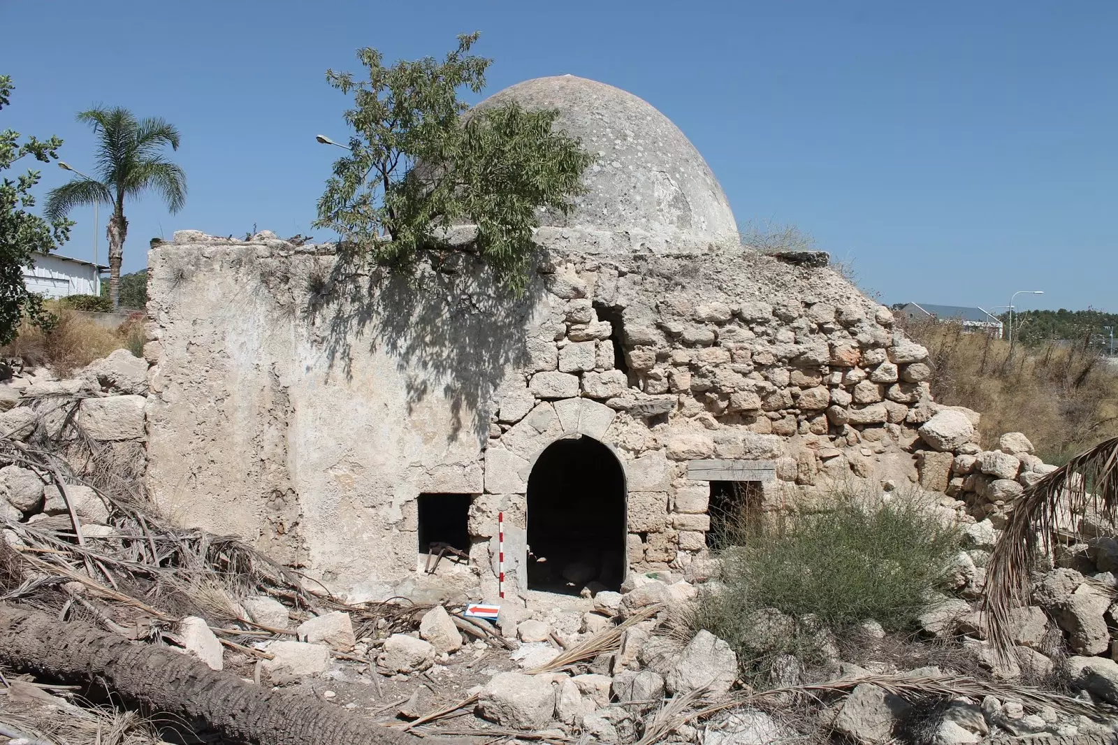
Posted by Ziad Alotleh 1 - مقام الخضر يقرية البصة المهجرة--Ibtisam Sulieman
- The "most civilized" usurped al-Bassa's mosque. How else will the Jews be great again?
- الرياضة والألعاب في القرية -- المزيد عن ذلك في قسم التعليقات
1 - الرياضة والألعاب في القرية -- المزيد عن ذلك في قسم التعليقات #2
- الرياضة والألعاب في القرية -- المزيد عن ذلك في قسم التعليقات #3
- الرياضة والألعاب في القرية -- المزيد عن ذلك في قسم التعليقات #4
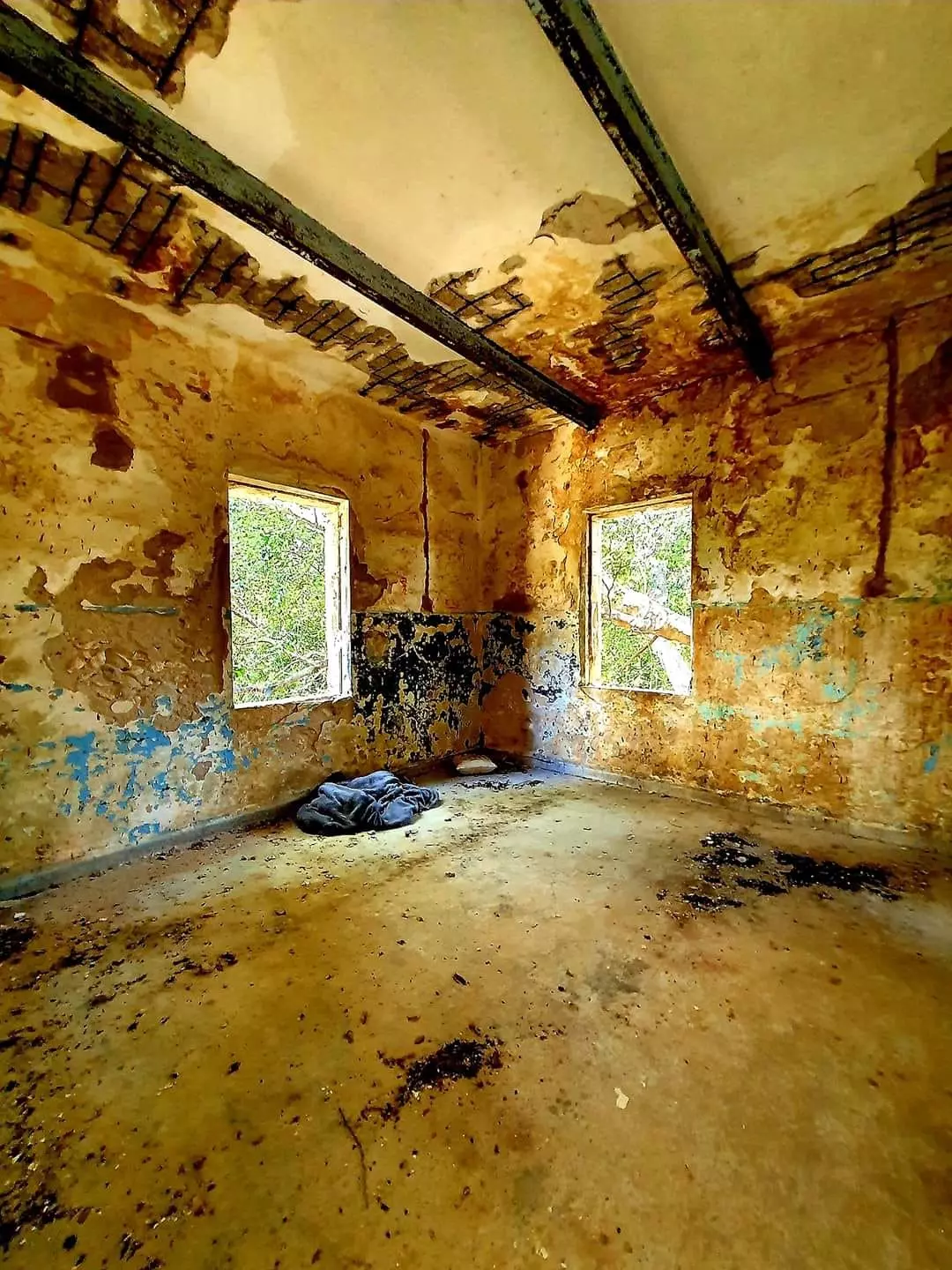
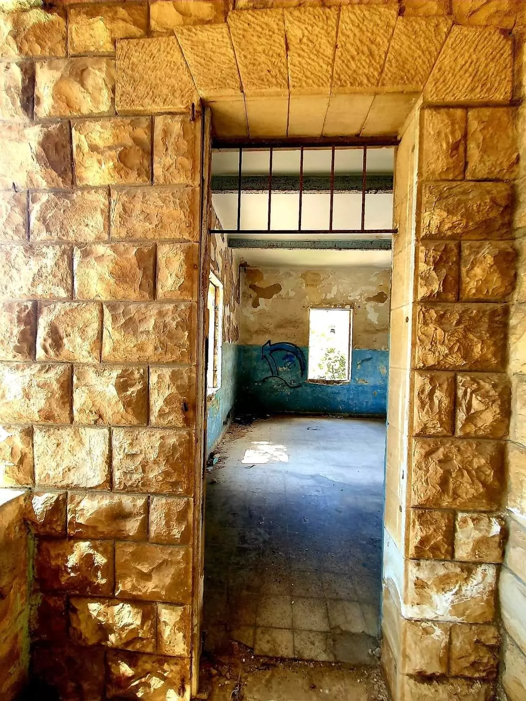
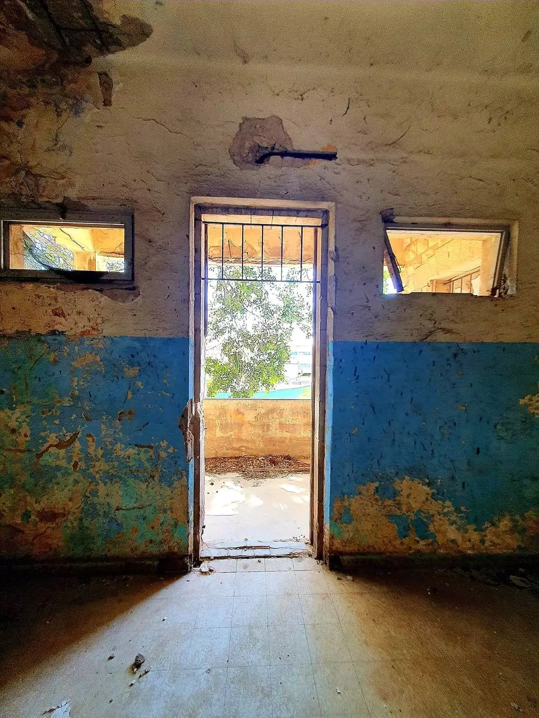
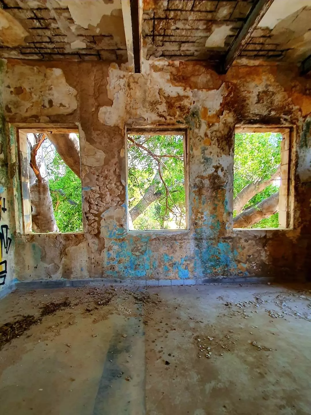
- Let us see how the most "liberal and civilized" of world Jewry has obliterated our village except for the church, the mosque, al-Khadir shrine/maqam, and a few other structures. How else will the Jews be great and safe again? -- القرية دمرت بالكامل بإستثناء بضعة مبناني.. من هنا مر الهمج
- Let us see how the most "liberal and civilized" of world Jewry has obliterated our village except for the church, the mosque, al-Khadir shrine/maqam, and a few other structures. How else will the Jews be great and safe again? -- القرية دمرت بالكامل بإستثناء بضعة مبناني.. من هنا مر الهمج #2
- Let us see how the most "liberal and civilized" of world Jewry has obliterated our village except for the church, the mosque, al-Khadir shrine/maqam, and a few other structures. How else will the Jews be great and safe again? -- القرية دمرت بالكامل بإستثناء بضعة مبناني.. من هنا مر الهمج #3
- Let us see how the most "liberal and civilized" of world Jewry has obliterated our village except for the church, the mosque, al-Khadir shrine/maqam, and a few other structures. How else will the Jews be great and safe again? -- القرية دمرت بالكامل بإستثناء بضعة مبناني.. من هنا مر الهمج #4
- Let us see how the most "liberal and civilized" of world Jewry has obliterated our village except for the church, the mosque, al-Khadir shrine/maqam, and a few other structures. How else will the Jews be great and safe again? -- القرية دمرت بالكامل بإستثناء بضعة مبناني.. من هنا مر الهمج #5
- Let us see how the most "liberal and civilized" of world Jewry has obliterated our village except for the church, the mosque, al-Khadir shrine/maqam, and a few other structures. How else will the Jews be great and safe again? -- القرية دمرت بالكامل بإستثناء بضعة مبناني.. من هنا مر الهمج #6
- Let us see how the most "liberal and civilized" of world Jewry has obliterated our village except for the church, the mosque, al-Khadir shrine/maqam, and a few other structures. How else will the Jews be great and safe again? -- القرية دمرت بالكامل بإستثناء بضعة مبناني.. من هنا مر الهمج #7
- Let us see how the most "liberal and civilized" of world Jewry has obliterated our village except for the church, the mosque, al-Khadir shrine/maqam, and a few other structures. How else will the Jews be great and safe again? -- القرية دمرت بالكامل بإستثناء بضعة مبناني.. من هنا مر الهمج #8
- Let us see how the most "liberal and civilized" of world Jewry has obliterated our village except for the church, the mosque, al-Khadir shrine/maqam, and a few other structures. How else will the Jews be great and safe again? -- القرية دمرت بالكامل بإستثناء بضعة مبناني.. من هنا مر الهمج #9
- Let us see how the most "liberal and civilized" of world Jewry has obliterated our village except for the church, the mosque, al-Khadir shrine/maqam, and a few other structures. How else will the Jews be great and safe again? -- القرية دمرت بالكامل بإستثناء بضعة مبناني.. من هنا مر الهمج #10
- Let us see how the most "liberal and civilized" of world Jewry has obliterated our village except for the church, the mosque, al-Khadir shrine/maqam, and a few other structures. How else will the Jews be great and safe again? -- القرية دمرت بالكامل بإستثناء بضعة مبناني.. من هنا مر الهمج #11
- Let us see how the most "liberal and civilized" of world Jewry has obliterated our village except for the church, the mosque, al-Khadir shrine/maqam, and a few other structures. How else will the Jews be great and safe again? -- القرية دمرت بالكامل بإستثناء بضعة مبناني.. من هنا مر الهمج #12
- Let us see how the most "liberal and civilized" of world Jewry has obliterated our village except for the church, the mosque, al-Khadir shrine/maqam, and a few other structures. How else will the Jews be great and safe again? -- القرية دمرت بالكامل بإستثناء بضعة مبناني.. من هنا مر الهمج #13
- Let us see how the most "liberal and civilized" of world Jewry has obliterated our village except for the church, the mosque, al-Khadir shrine/maqam, and a few other structures. How else will the Jews be great and safe again? -- القرية دمرت بالكامل بإستثناء بضعة مبناني.. من هنا مر الهمج #14
- Let us see how the most "liberal and civilized" of world Jewry has obliterated our village except for the church, the mosque, al-Khadir shrine/maqam, and a few other structures. How else will the Jews be great and safe again? -- القرية دمرت بالكامل بإستثناء بضعة مبناني.. من هنا مر الهمج #15
- Let us see how the most "liberal and civilized" of world Jewry has obliterated our village except for the church, the mosque, al-Khadir shrine/maqam, and a few other structures. How else will the Jews be great and safe again? -- القرية دمرت بالكامل بإستثناء بضعة مبناني.. من هنا مر الهمج #16
- Let us see how the most "liberal and civilized" of world Jewry has obliterated our village except for the church, the mosque, al-Khadir shrine/maqam, and a few other structures. How else will the Jews be great and safe again? -- القرية دمرت بالكامل بإستثناء بضعة مبناني.. من هنا مر الهمج #17
- Let us see how the most "liberal and civilized" of world Jewry has obliterated our village except for the church, the mosque, al-Khadir shrine/maqam, and a few other structures. How else will the Jews be great and safe again? -- القرية دمرت بالكامل بإستثناء بضعة مبناني.. من هنا مر الهمج #18
- Let us see how the most "liberal and civilized" of world Jewry has obliterated our village except for the church, the mosque, al-Khadir shrine/maqam, and a few other structures. How else will the Jews be great and safe again? -- القرية دمرت بالكامل بإستثناء بضعة مبناني.. من هنا مر الهمج #19
- Let us see how the most "liberal and civilized" of world Jewry has obliterated our village except for the church, the mosque, al-Khadir shrine/maqam, and a few other structures. How else will the Jews be great and safe again? -- القرية دمرت بالكامل بإستثناء بضعة مبناني.. من هنا مر الهمج #20
- Let us see how the most "liberal and civilized" of world Jewry has obliterated our village except for the church, the mosque, al-Khadir shrine/maqam, and a few other structures. How else will the Jews be great and safe again? -- القرية دمرت بالكامل بإستثناء بضعة مبناني.. من هنا مر الهمج #21
- Let us see how the most "liberal and civilized" of world Jewry has obliterated our village except for the church, the mosque, al-Khadir shrine/maqam, and a few other structures. How else will the Jews be great and safe again? -- القرية دمرت بالكامل بإستثناء بضعة مبناني.. من هنا مر الهمج #22
- Let us see how the most "liberal and civilized" of world Jewry has obliterated our village except for the church, the mosque, al-Khadir shrine/maqam, and a few other structures. How else will the Jews be great and safe again? -- القرية دمرت بالكامل بإستثناء بضعة مبناني.. من هنا مر الهمج #23
- Let us see how the most "liberal and civilized" of world Jewry has obliterated our village except for the church, the mosque, al-Khadir shrine/maqam, and a few other structures. How else will the Jews be great and safe again? -- القرية دمرت بالكامل بإستثناء بضعة مبناني.. من هنا مر الهمج #24
- Let us see how the most "liberal and civilized" of world Jewry has obliterated our village except for the church, the mosque, al-Khadir shrine/maqam, and a few other structures. How else will the Jews be great and safe again? -- القرية دمرت بالكامل بإستثناء بضعة مبناني.. من هنا مر الهمج #25
- Let us see how the most "liberal and civilized" of world Jewry has obliterated our village except for the church, the mosque, al-Khadir shrine/maqam, and a few other structures. How else will the Jews be great and safe again? -- القرية دمرت بالكامل بإستثناء بضعة مبناني.. من هنا مر الهمج #26
- Let us see how the most "liberal and civilized" of world Jewry has obliterated our village except for the church, the mosque, al-Khadir shrine/maqam, and a few other structures. How else will the Jews be great and safe again? -- القرية دمرت بالكامل بإستثناء بضعة مبناني.. من هنا مر الهمج #27
- Let us see how the most "liberal and civilized" of world Jewry has obliterated our village except for the church, the mosque, al-Khadir shrine/maqam, and a few other structures. How else will the Jews be great and safe again? -- القرية دمرت بالكامل بإستثناء بضعة مبناني.. من هنا مر الهمج #28
- Let us see how the most "liberal and civilized" of world Jewry has obliterated our village except for the church, the mosque, al-Khadir shrine/maqam, and a few other structures. How else will the Jews be great and safe again? -- القرية دمرت بالكامل بإستثناء بضعة مبناني.. من هنا مر الهمج #29
- Let us see how the most "liberal and civilized" of world Jewry has obliterated our village except for the church, the mosque, al-Khadir shrine/maqam, and a few other structures. How else will the Jews be great and safe again? -- القرية دمرت بالكامل بإستثناء بضعة مبناني.. من هنا مر الهمج #30
- Let us see how the most "liberal and civilized" of world Jewry has obliterated our village except for the church, the mosque, al-Khadir shrine/maqam, and a few other structures. How else will the Jews be great and safe again? -- القرية دمرت بالكامل بإستثناء بضعة مبناني.. من هنا مر الهمج #31
- Let us see how the most "liberal and civilized" of world Jewry has obliterated our village except for the church, the mosque, al-Khadir shrine/maqam, and a few other structures. How else will the Jews be great and safe again? -- القرية دمرت بالكامل بإستثناء بضعة مبناني.. من هنا مر الهمج #32
- Let us see how the most "liberal and civilized" of world Jewry has obliterated our village except for the church, the mosque, al-Khadir shrine/maqam, and a few other structures. How else will the Jews be great and safe again? -- القرية دمرت بالكامل بإستثناء بضعة مبناني.. من هنا مر الهمج #33
- Let us see how the most "liberal and civilized" of world Jewry has obliterated our village except for the church, the mosque, al-Khadir shrine/maqam, and a few other structures. How else will the Jews be great and safe again? -- القرية دمرت بالكامل بإستثناء بضعة مبناني.. من هنا مر الهمج #34
- Let us see how the most "liberal and civilized" of world Jewry has obliterated our village except for the church, the mosque, al-Khadir shrine/maqam, and a few other structures. How else will the Jews be great and safe again? -- القرية دمرت بالكامل بإستثناء بضعة مبناني.. من هنا مر الهمج #35
- Let us see how the most "liberal and civilized" of world Jewry has obliterated our village except for the church, the mosque, al-Khadir shrine/maqam, and a few other structures. How else will the Jews be great and safe again? -- القرية دمرت بالكامل بإستثناء بضعة مبناني.. من هنا مر الهمج #36
- Let us see how the most "liberal and civilized" of world Jewry has obliterated our village except for the church, the mosque, al-Khadir shrine/maqam, and a few other structures. How else will the Jews be great and safe again? -- القرية دمرت بالكامل بإستثناء بضعة مبناني.. من هنا مر الهمج #37
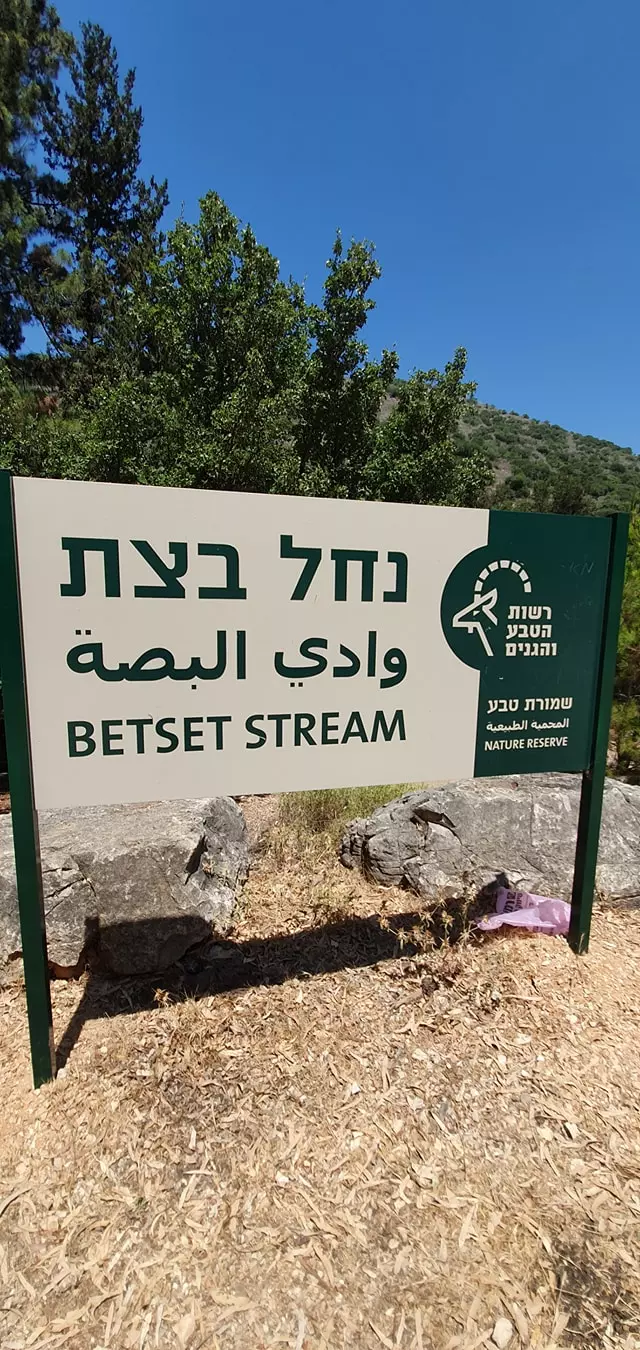
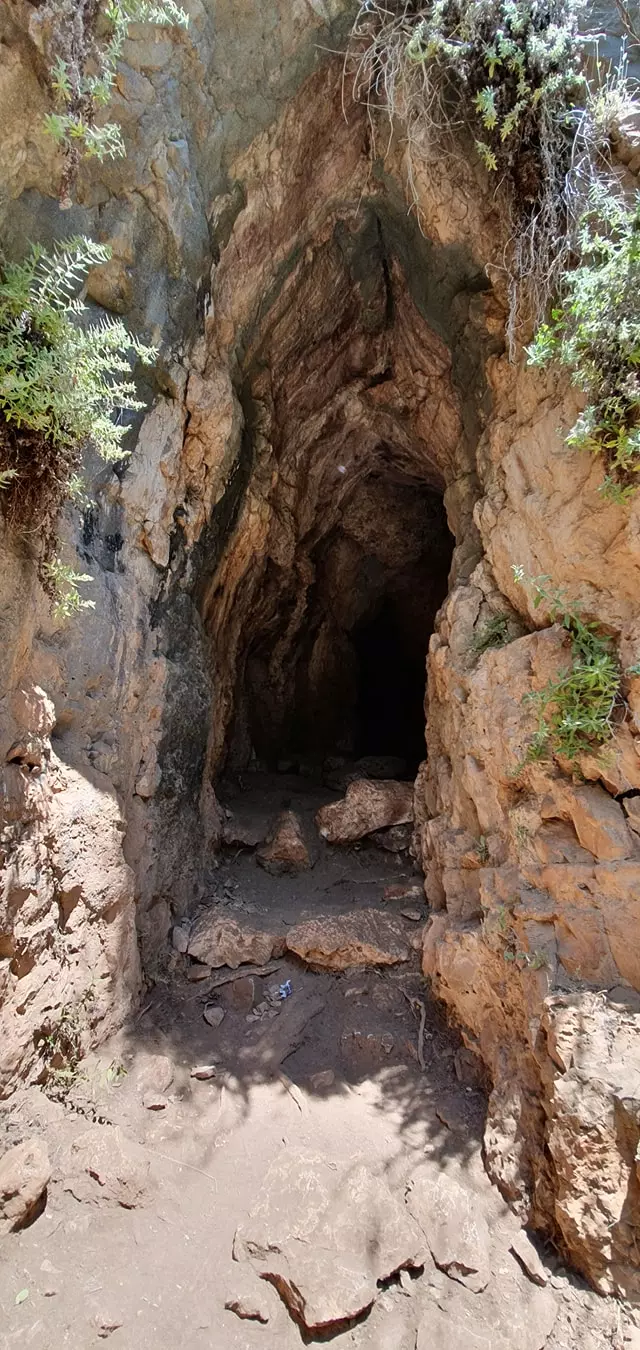
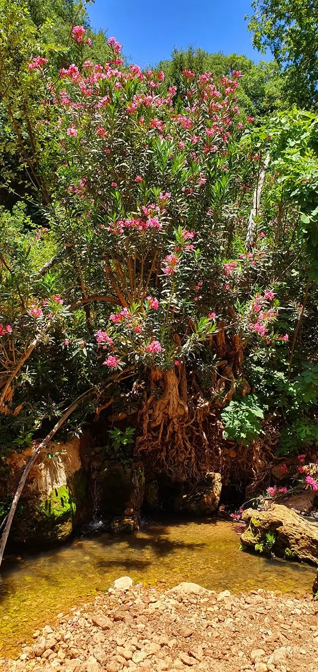
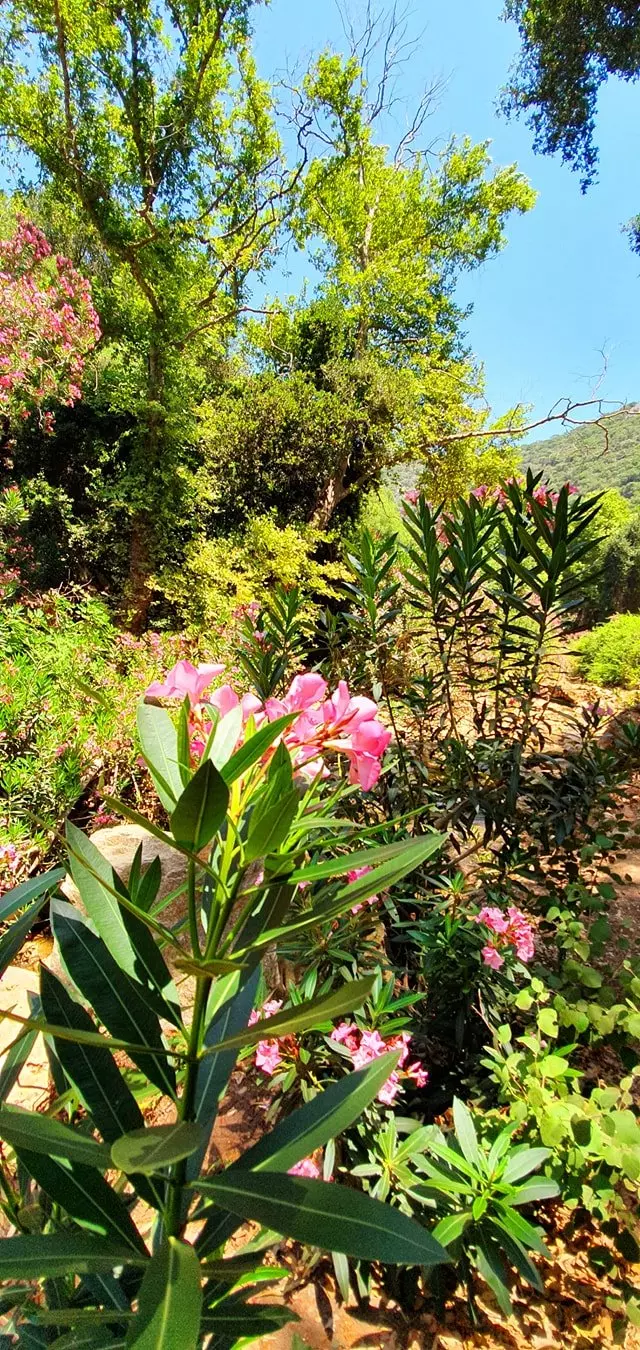
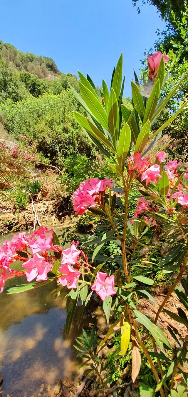
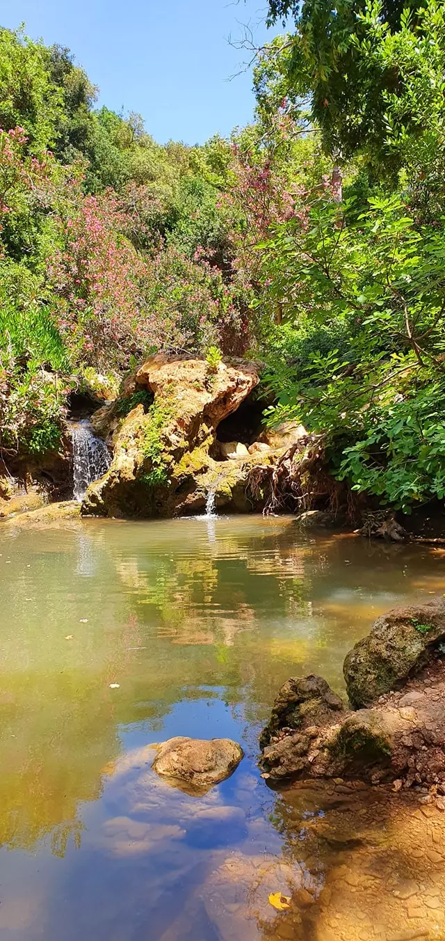
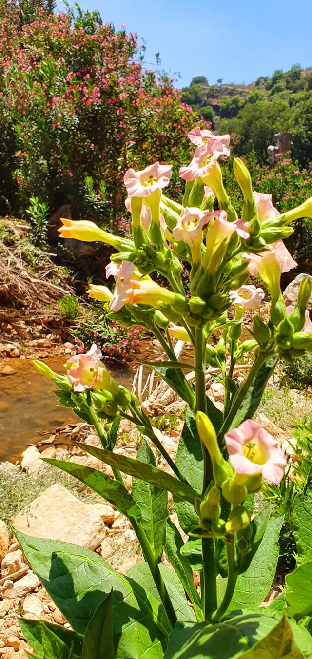
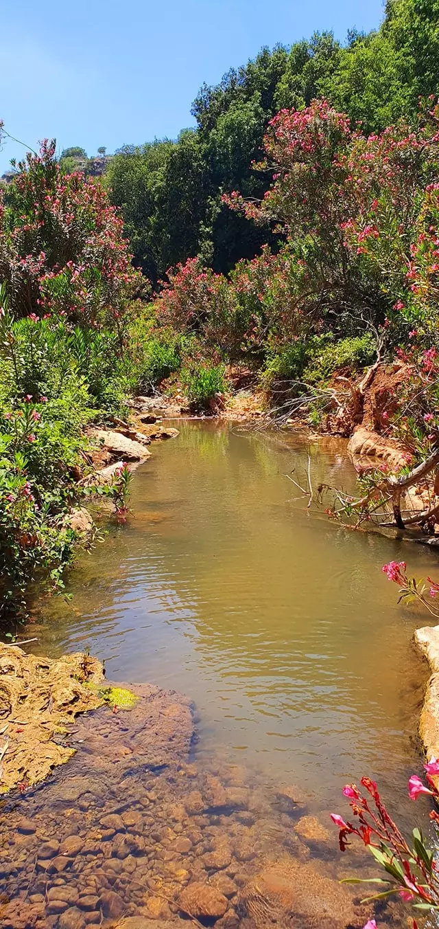
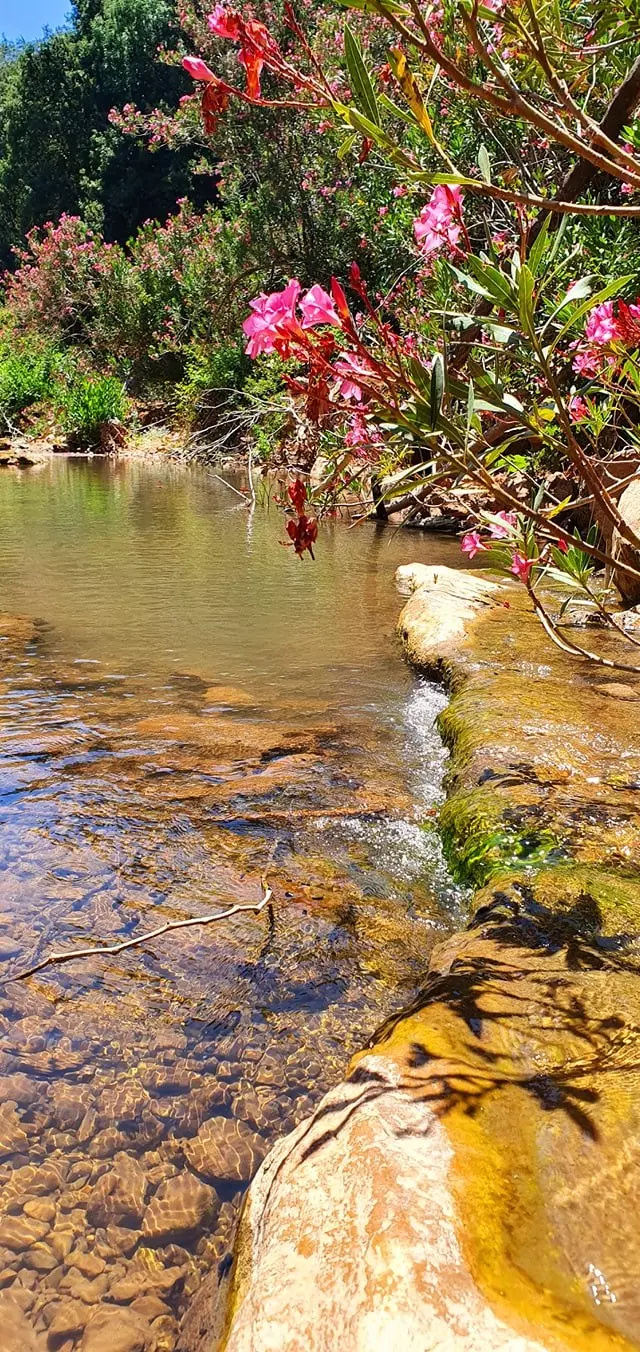
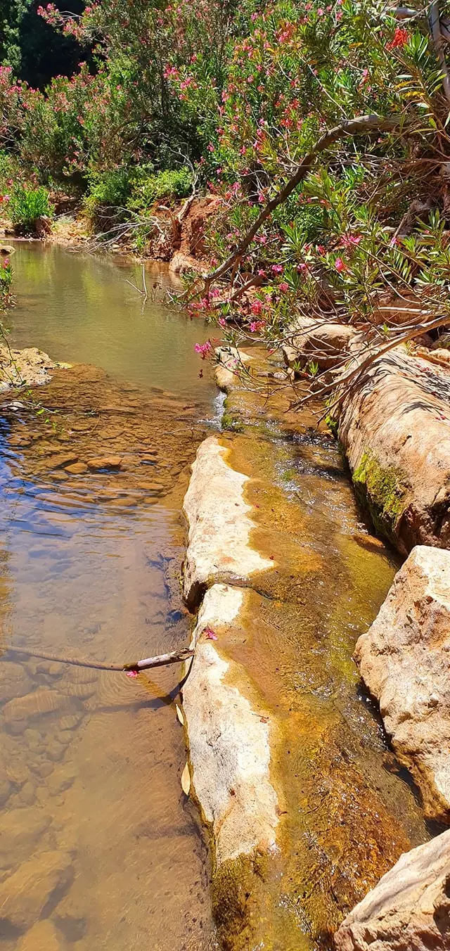
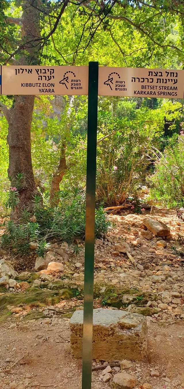
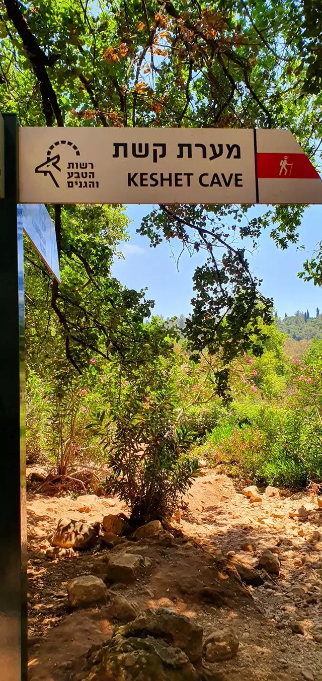
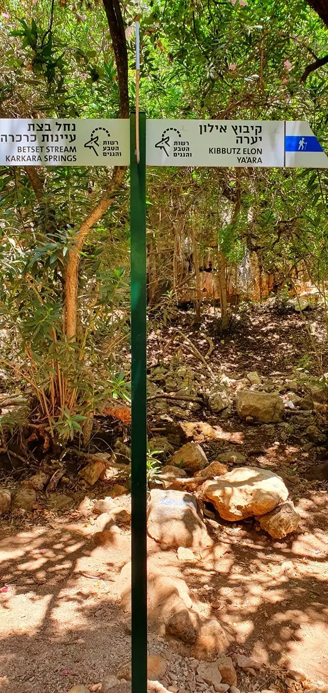
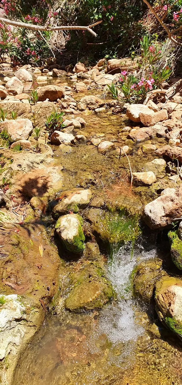
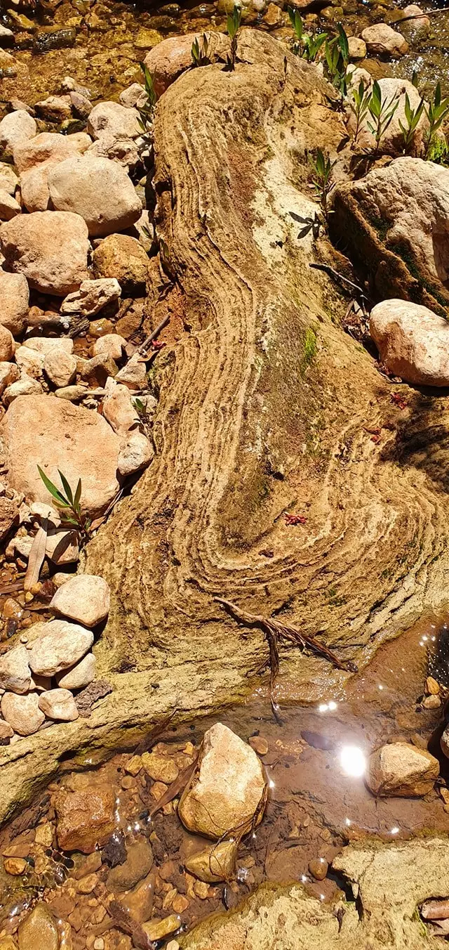
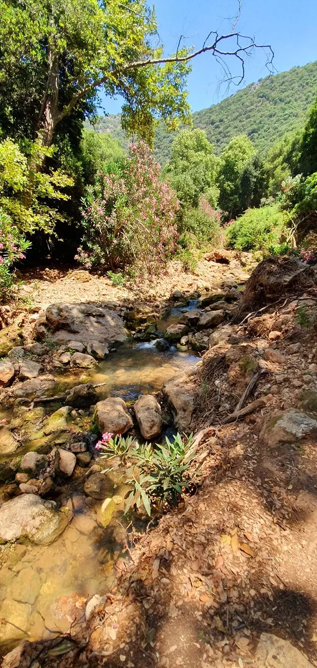
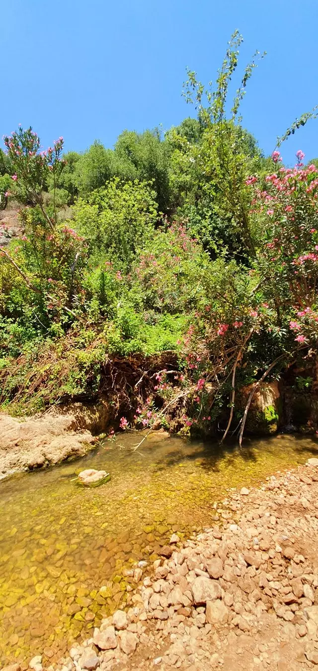
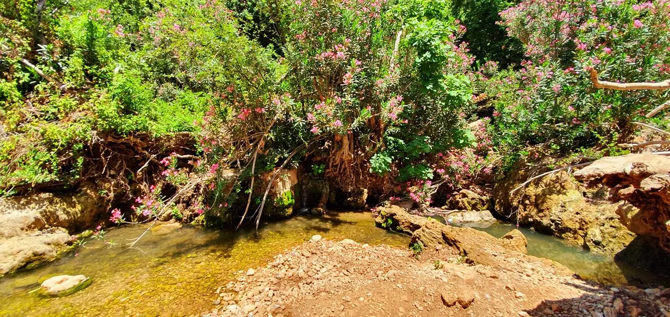
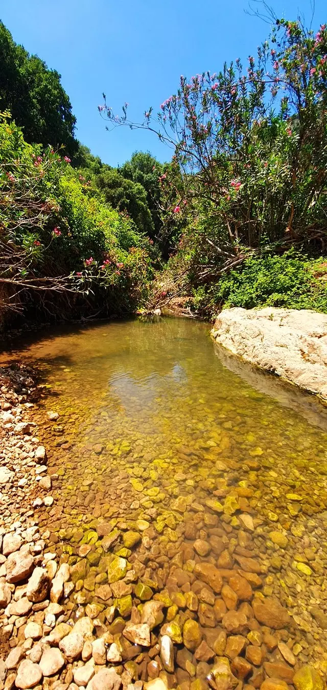
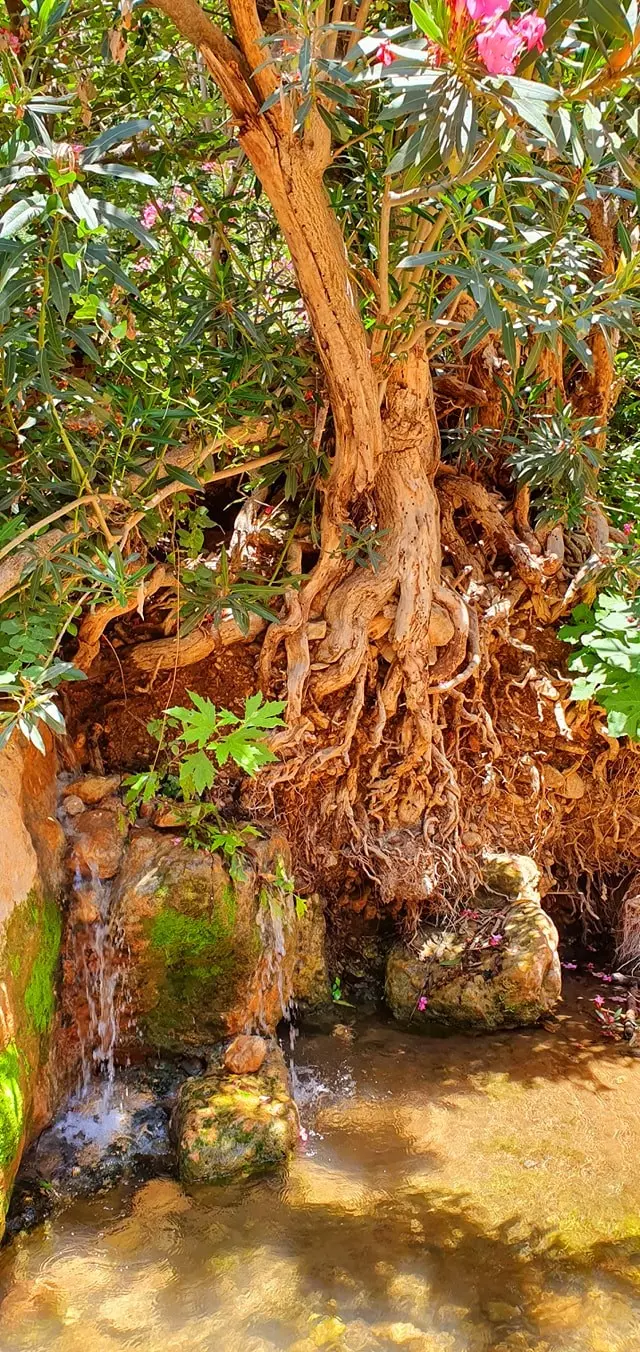
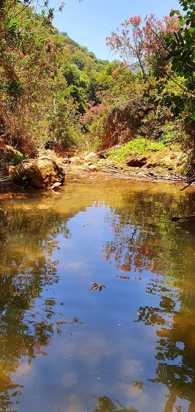
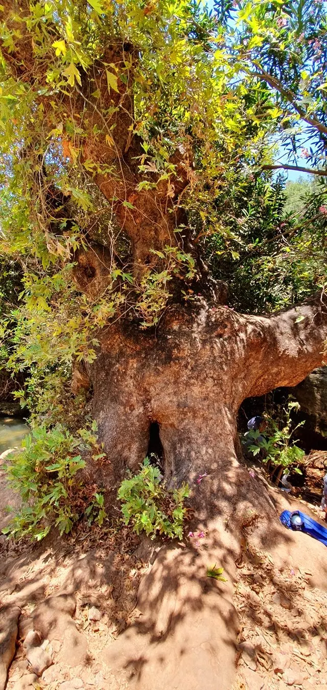
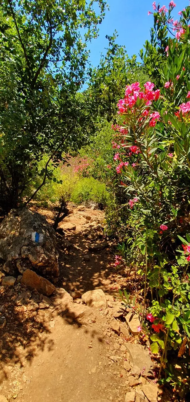
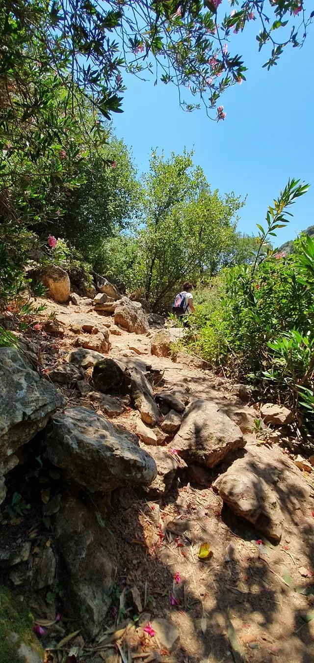
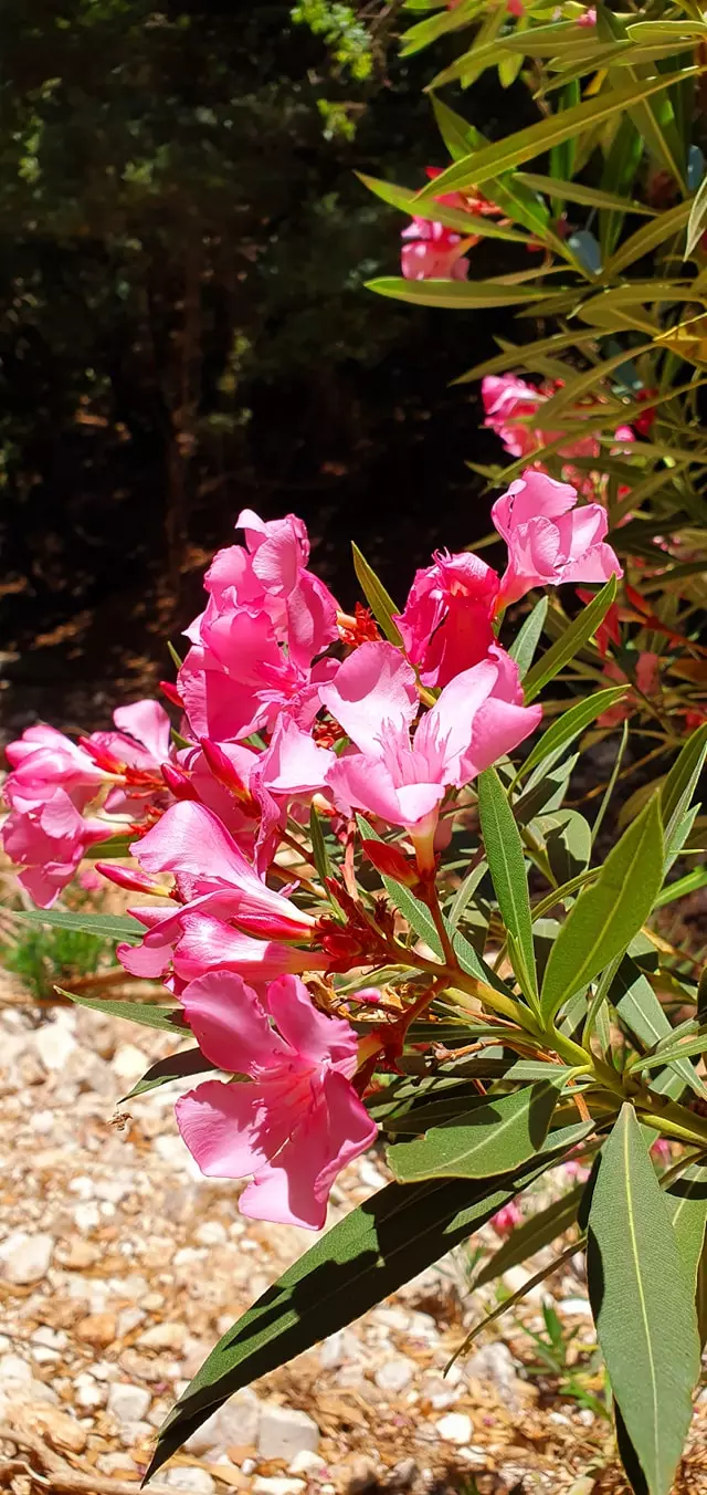
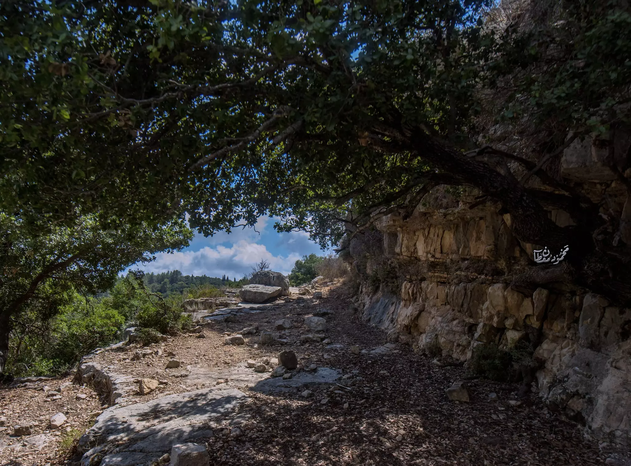
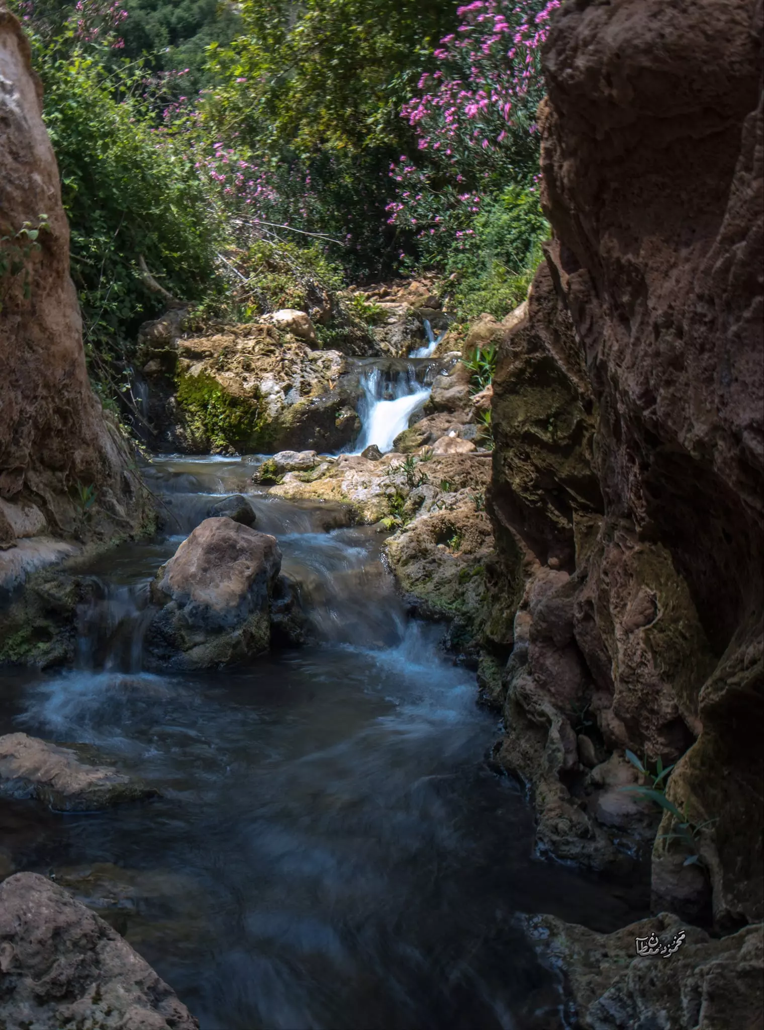
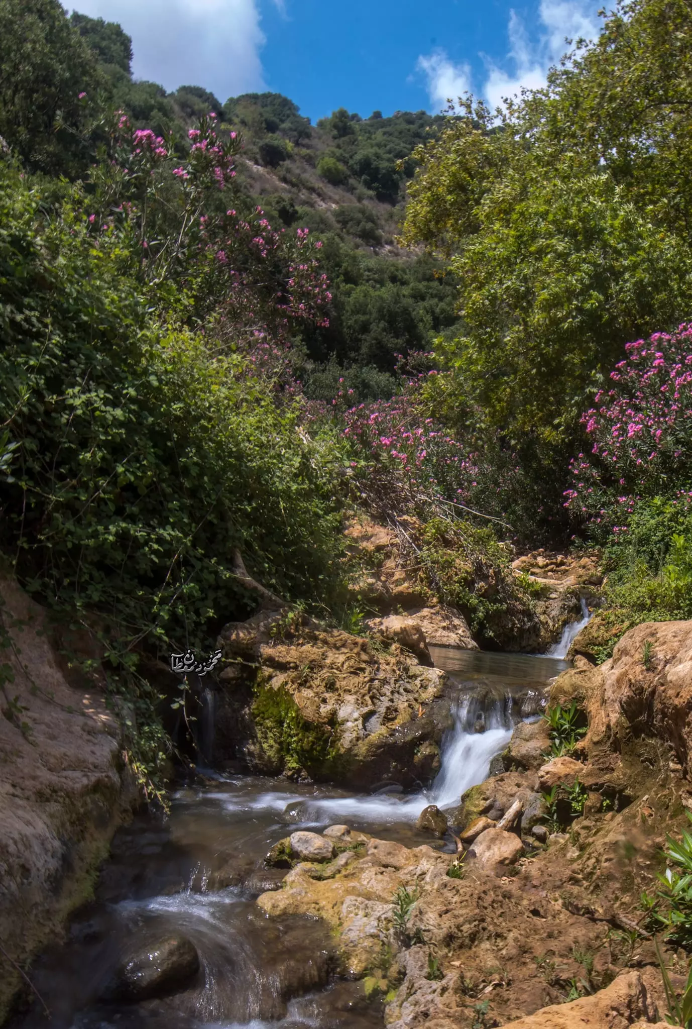
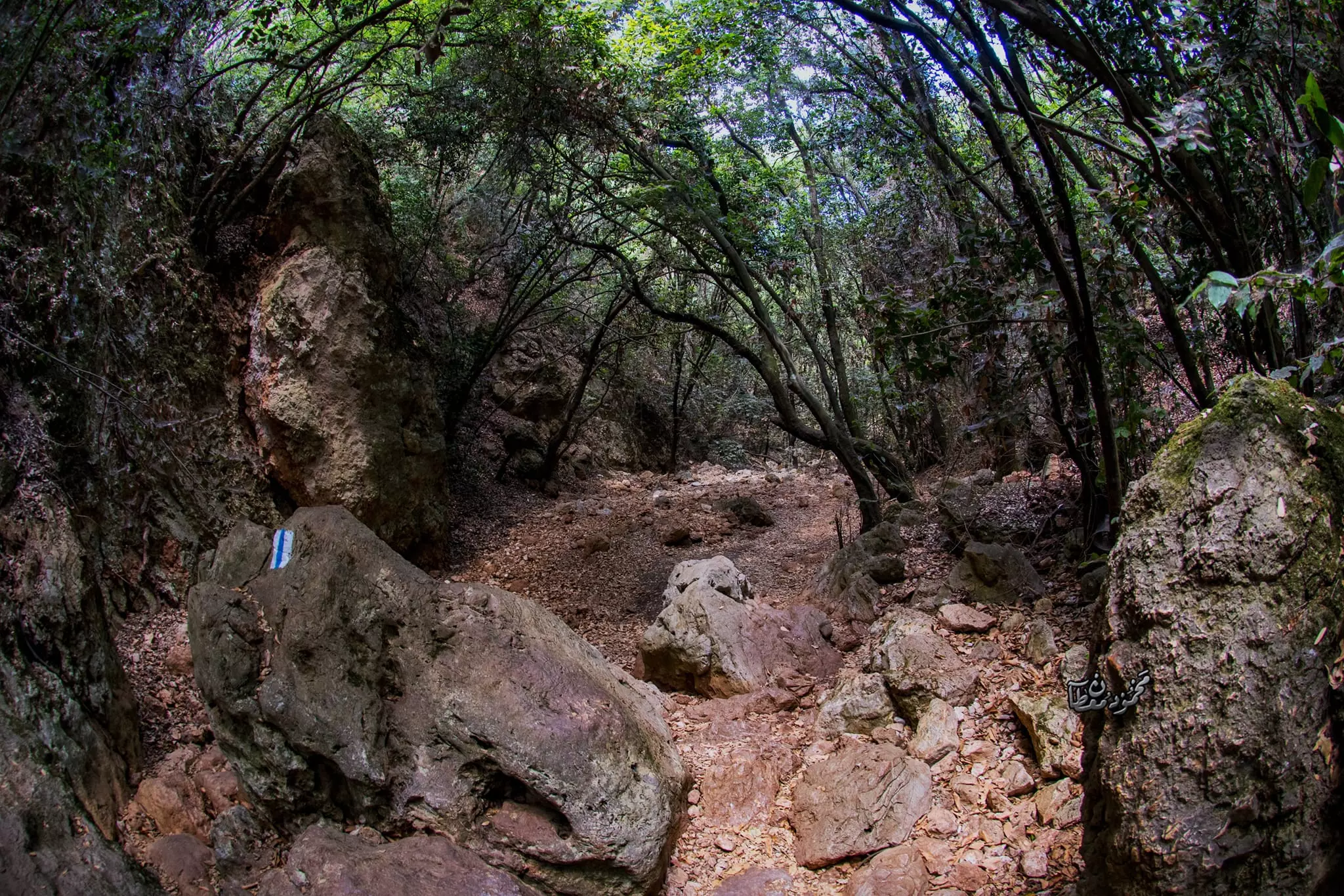
- Let us tour Wadi al-Bassa (aka Betset Streat) -- July 2021 -- Nabela Salem -- جولة رائعة في وادي ألبصة
- Let us tour Wadi al-Bassa (aka Betset Streat) -- July 2021 -- Nabela Salem -- جولة رائعة في وادي ألبصة #2
- Let us tour Wadi al-Bassa (aka Betset Streat) -- July 2021 -- Nabela Salem -- جولة رائعة في وادي ألبصة #3
- Let us tour Wadi al-Bassa (aka Betset Streat) -- July 2021 -- Nabela Salem -- جولة رائعة في وادي ألبصة #4
- Let us tour Wadi al-Bassa (aka Betset Streat) -- July 2021 -- Nabela Salem -- جولة رائعة في وادي ألبصة #5
- Let us tour Wadi al-Bassa (aka Betset Streat) -- July 2021 -- Nabela Salem -- جولة رائعة في وادي ألبصة #6
- Let us tour Wadi al-Bassa (aka Betset Streat) -- July 2021 -- Nabela Salem -- جولة رائعة في وادي ألبصة #7
- Let us tour Wadi al-Bassa (aka Betset Streat) -- July 2021 -- Nabela Salem -- جولة رائعة في وادي ألبصة #8
- Let us tour Wadi al-Bassa (aka Betset Streat) -- July 2021 -- Nabela Salem -- جولة رائعة في وادي ألبصة #9
- Let us tour Wadi al-Bassa (aka Betset Streat) -- July 2021 -- Nabela Salem -- جولة رائعة في وادي ألبصة #10
- Let us tour Wadi al-Bassa (aka Betset Streat) -- July 2021 -- Nabela Salem -- جولة رائعة في وادي ألبصة #11
- Let us tour Wadi al-Bassa (aka Betset Streat) -- July 2021 -- Nabela Salem -- جولة رائعة في وادي ألبصة #12
- Let us tour Wadi al-Bassa (aka Betset Streat) -- July 2021 -- Nabela Salem -- جولة رائعة في وادي ألبصة #13
- Let us tour Wadi al-Bassa (aka Betset Streat) -- July 2021 -- Nabela Salem -- جولة رائعة في وادي ألبصة #14
- Let us tour Wadi al-Bassa (aka Betset Streat) -- July 2021 -- Nabela Salem -- جولة رائعة في وادي ألبصة #15
- Let us tour Wadi al-Bassa (aka Betset Streat) -- July 2021 -- Nabela Salem -- جولة رائعة في وادي ألبصة #16
- Let us tour Wadi al-Bassa (aka Betset Streat) -- July 2021 -- Nabela Salem -- جولة رائعة في وادي ألبصة #17
- Let us tour Wadi al-Bassa (aka Betset Streat) -- July 2021 -- Nabela Salem -- جولة رائعة في وادي ألبصة #18
- Let us tour Wadi al-Bassa (aka Betset Streat) -- July 2021 -- Nabela Salem -- جولة رائعة في وادي ألبصة #19
- Let us tour Wadi al-Bassa (aka Betset Streat) -- July 2021 -- Nabela Salem -- جولة رائعة في وادي ألبصة #20
- Let us tour Wadi al-Bassa (aka Betset Streat) -- July 2021 -- Nabela Salem -- جولة رائعة في وادي ألبصة #21
- Let us tour Wadi al-Bassa (aka Betset Streat) -- July 2021 -- Nabela Salem -- جولة رائعة في وادي ألبصة #22
- Let us tour Wadi al-Bassa (aka Betset Streat) -- July 2021 -- Nabela Salem -- جولة رائعة في وادي ألبصة #23
- Let us tour Wadi al-Bassa (aka Betset Streat) -- July 2021 -- Nabela Salem -- جولة رائعة في وادي ألبصة #24
- Let us tour Wadi al-Bassa (aka Betset Streat) -- July 2021 -- Nabela Salem -- جولة رائعة في وادي ألبصة #25
- Let us tour Wadi al-Bassa (aka Betset Streat) -- July 2021 -- Nabela Salem -- جولة رائعة في وادي ألبصة #26
- Let us tour Wadi al-Bassa (aka Betset Streat) -- July 2021 -- Nabela Salem -- جولة رائعة في وادي ألبصة #27
- Let us tour Wadi al-Bassa (aka Betset Streat) -- July 2021 -- Nabela Salem -- جولة رائعة في وادي ألبصة #28
- Let us tour Wadi al-Bassa (aka Betset Streat) -- July 2021 -- Nabela Salem -- جولة رائعة في وادي ألبصة #29
- انتقل إلى رحمة الله تعالى الحاج خليل العاصي (أبو فهد) عن عمر يناهز الثامنة والثمانين عامًا، ابن بلدة البصة العريقة في قضاء عكا، وأحد أبنائها البررة الذين تجذرت أقدامهم في تراب الوطن وتشبعت قلوبهم بحب الأرض
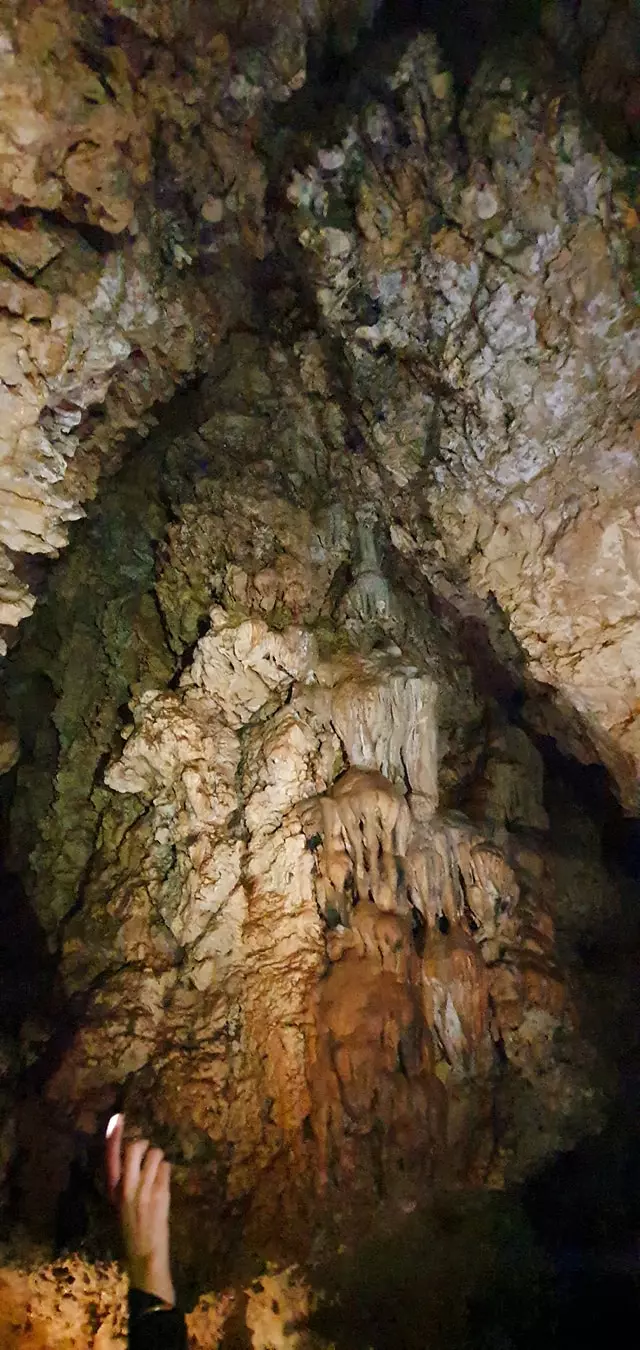
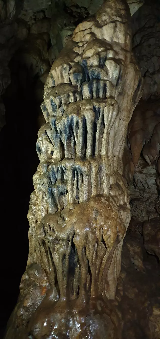
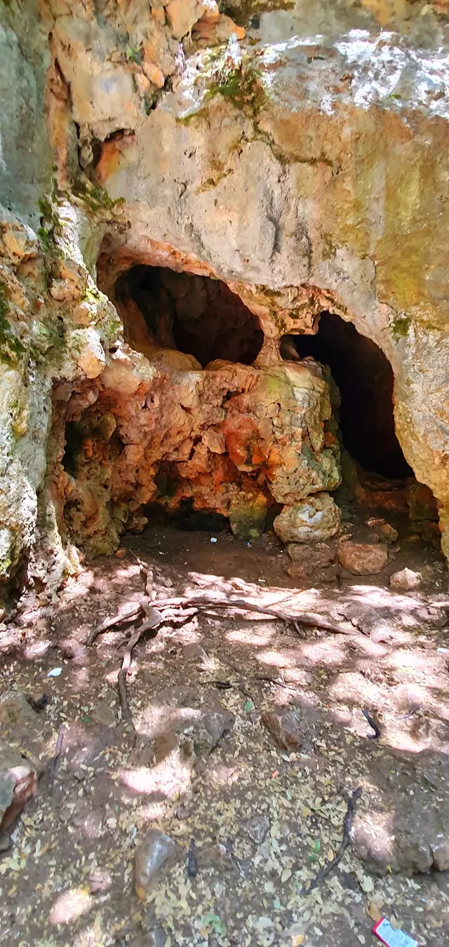
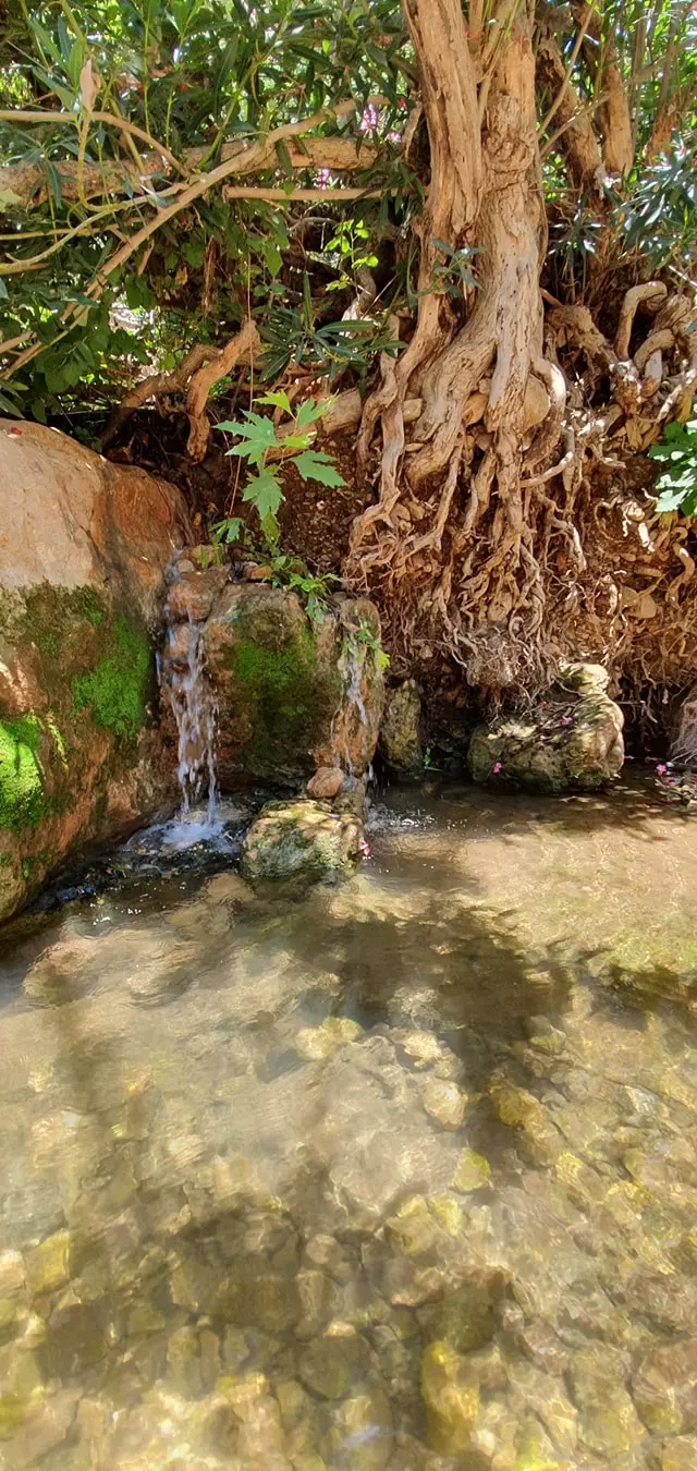
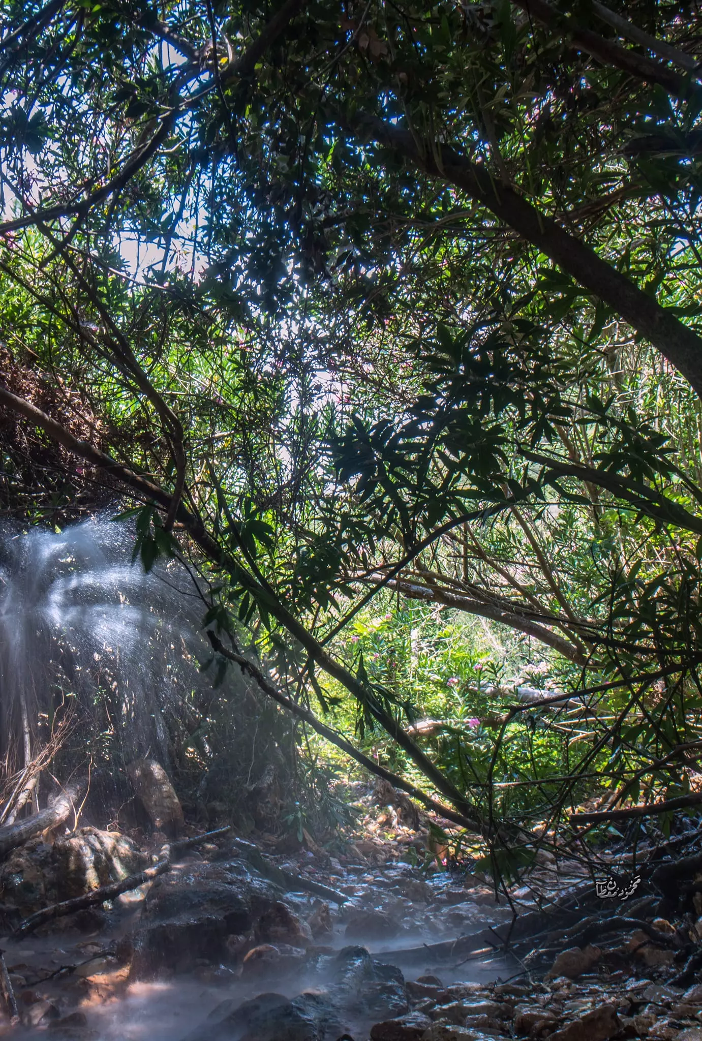
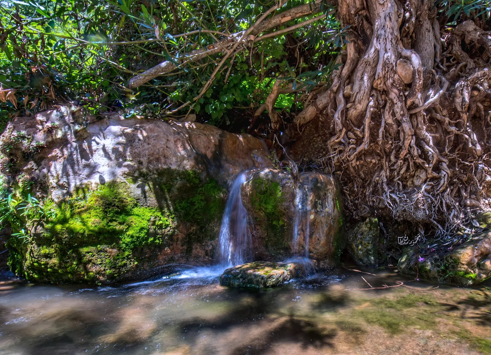
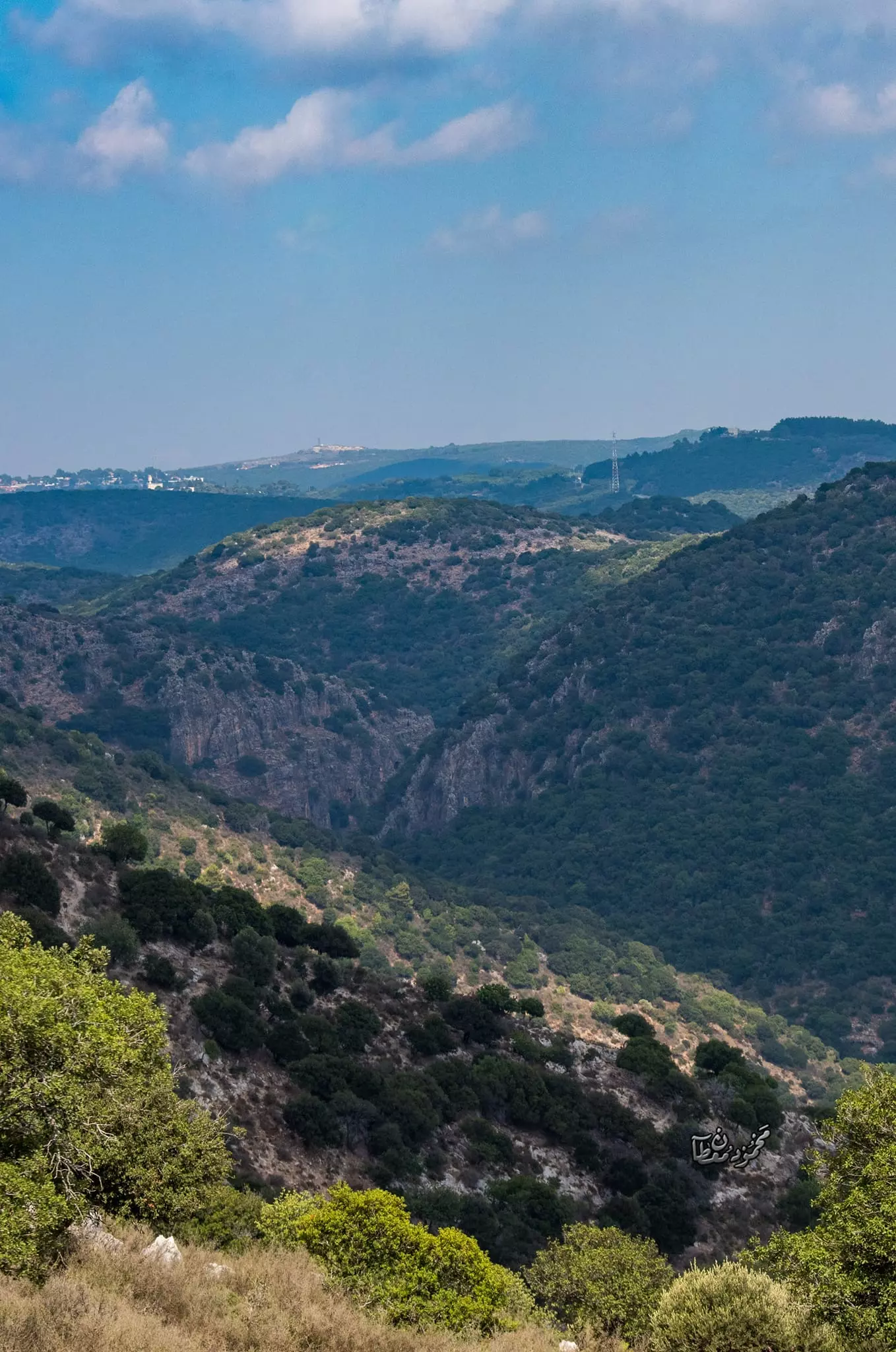
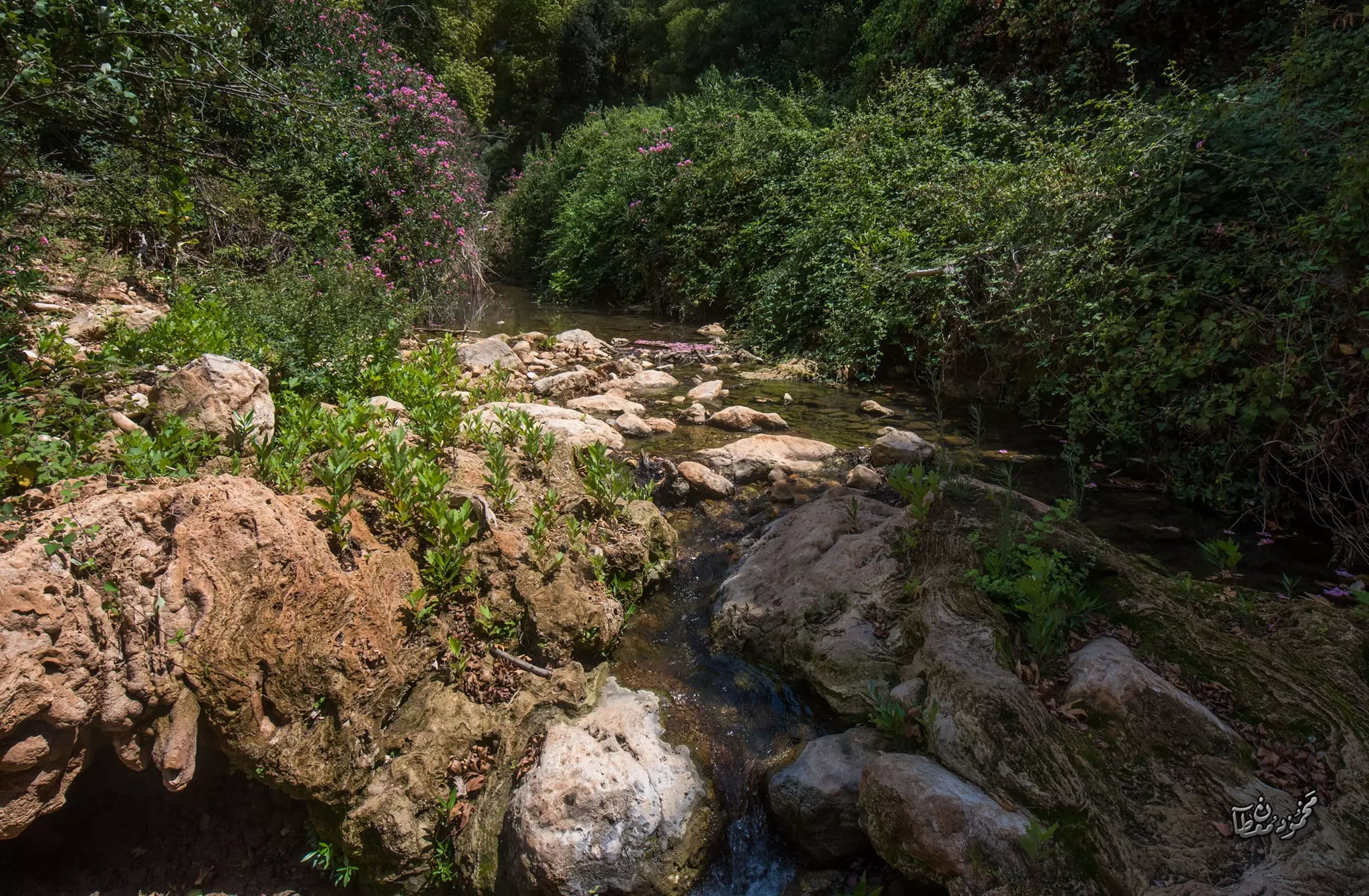
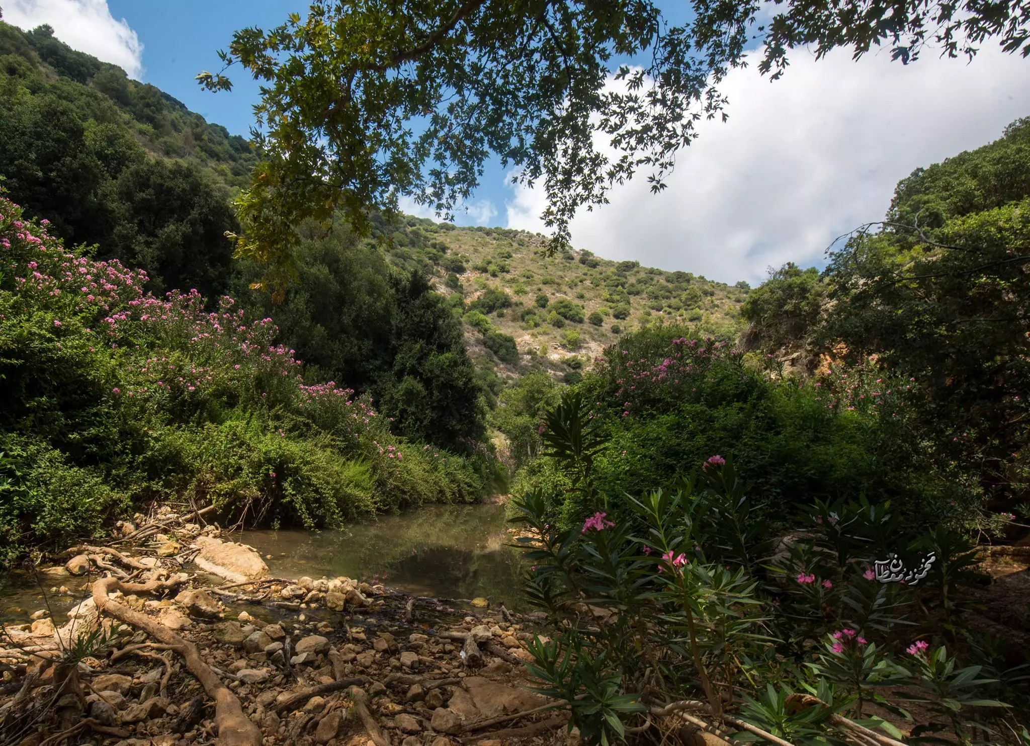
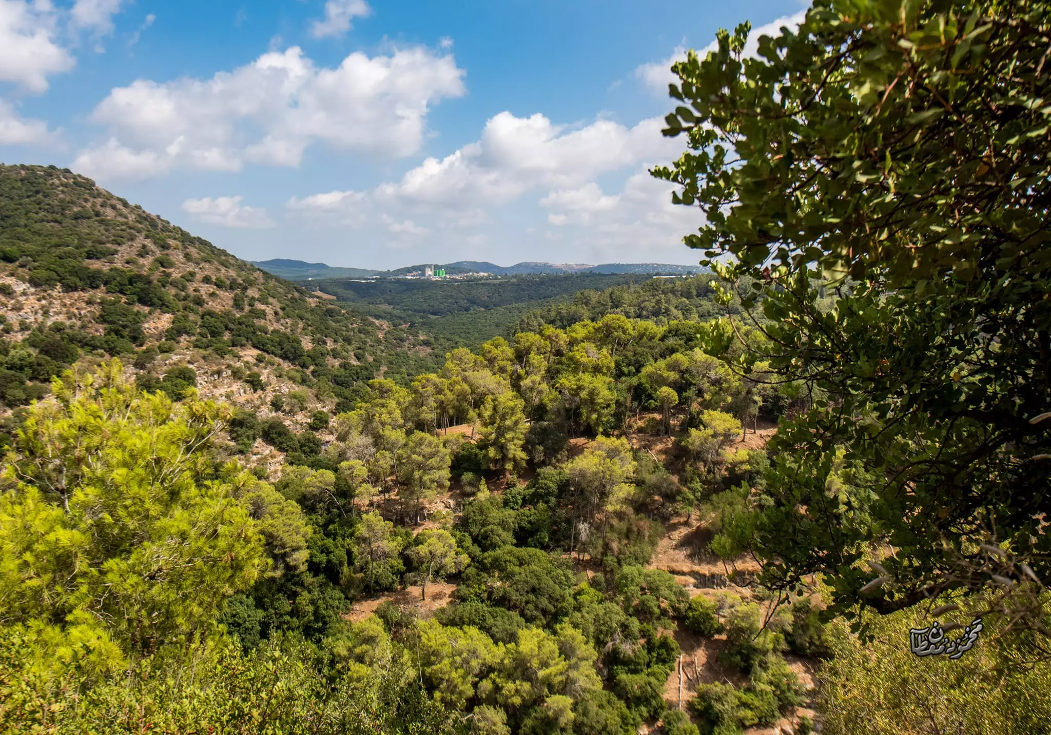
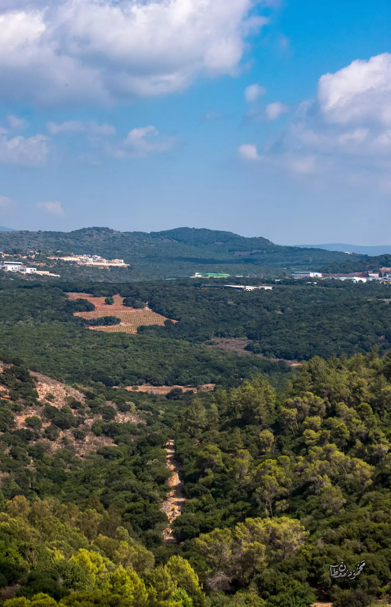
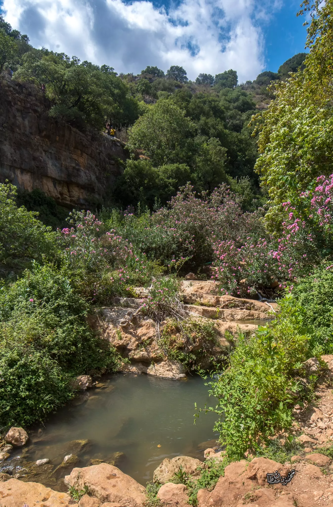
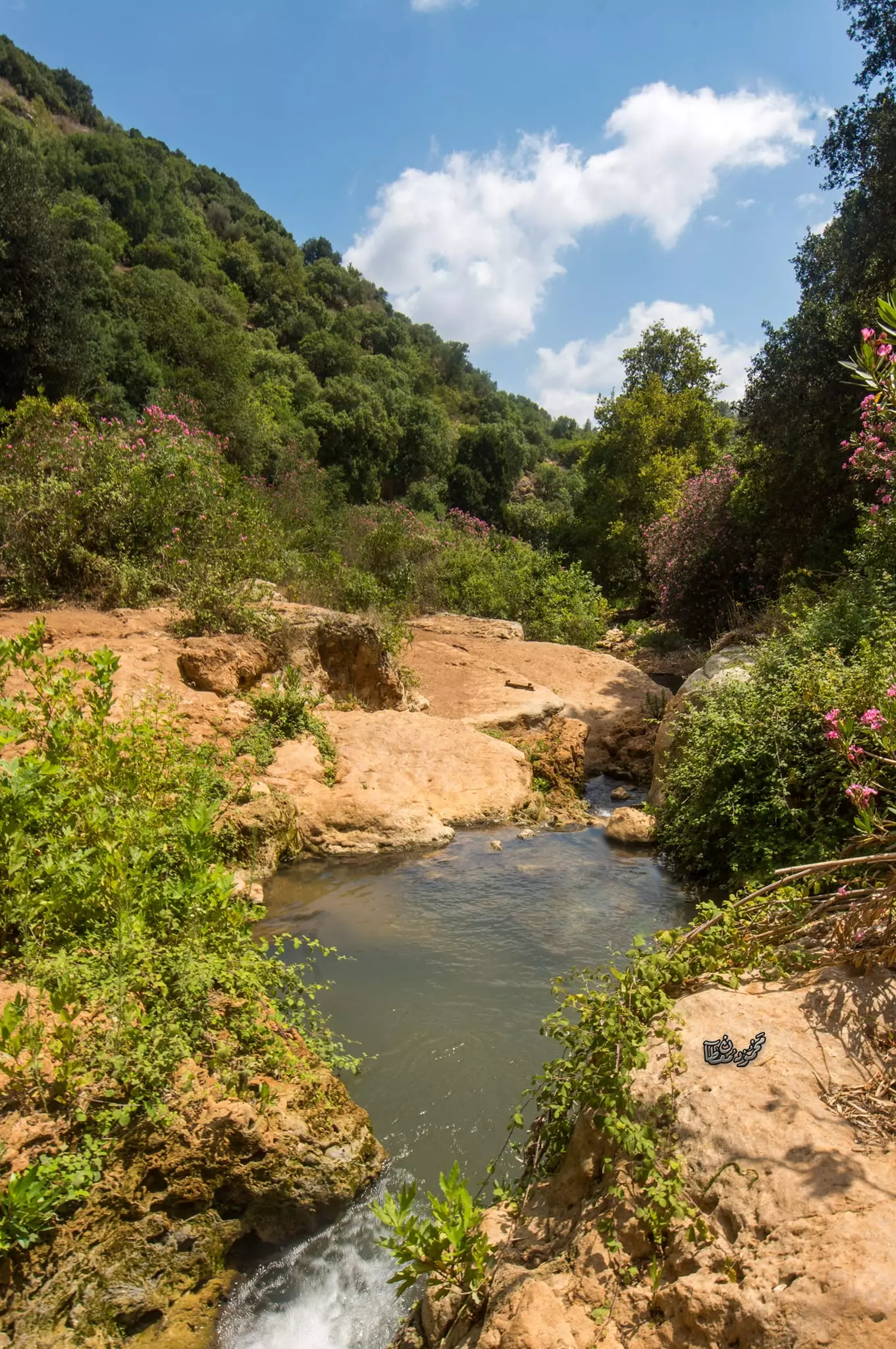
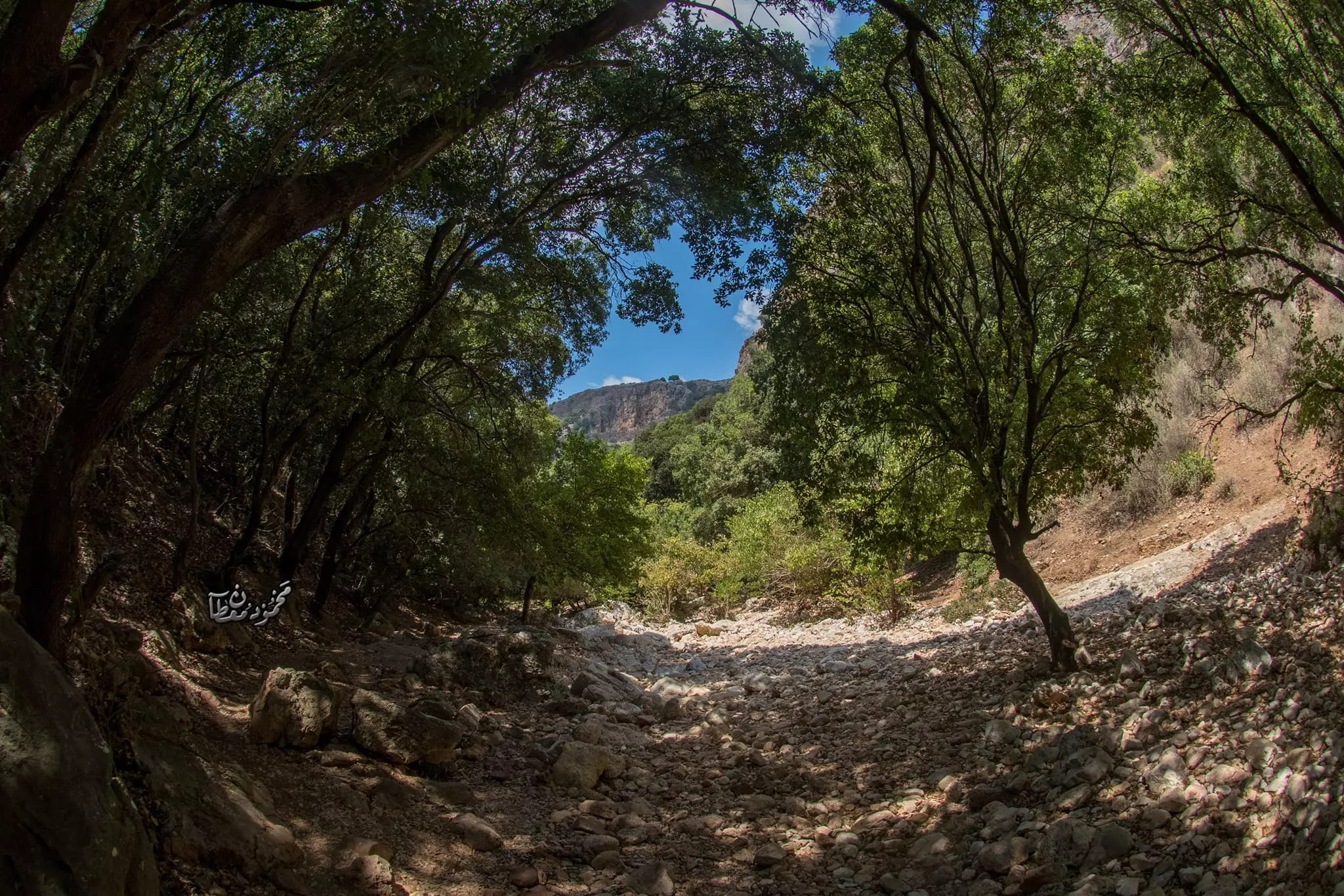
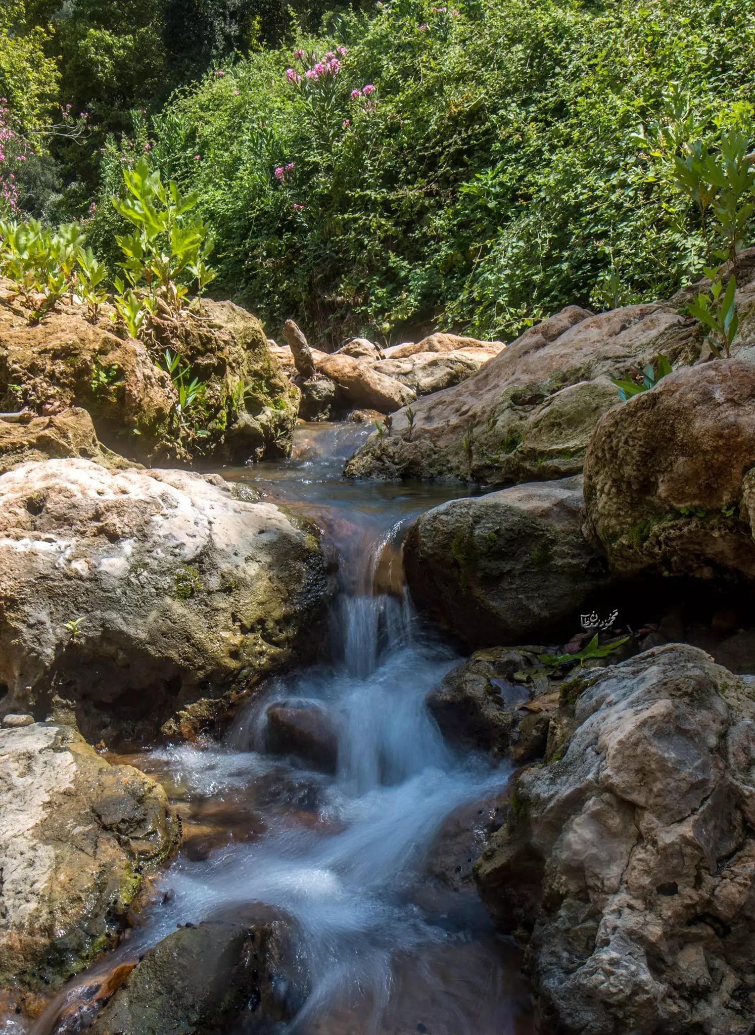
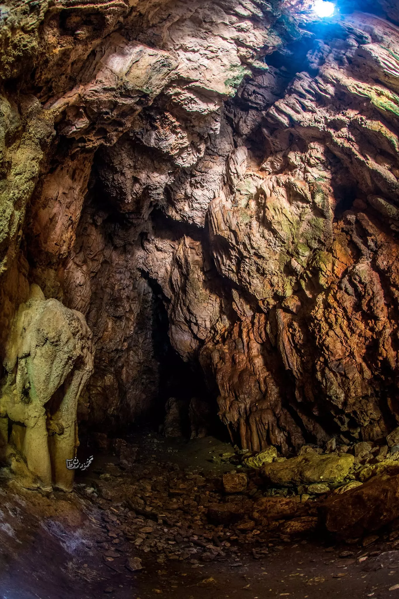
- جولة ساحرة في وادي البصة (وادي كررة) القريب من القرية -- June 2022 -- Mohammad Moutan
- جولة ساحرة في وادي البصة (وادي كررة) القريب من القرية -- June 2022 -- Mohammad Moutan #2
- جولة ساحرة في وادي البصة (وادي كررة) القريب من القرية -- June 2022 -- Mohammad Moutan #3
- جولة ساحرة في وادي البصة (وادي كررة) القريب من القرية -- June 2022 -- Mohammad Moutan #4
- جولة ساحرة في وادي البصة (وادي كررة) القريب من القرية -- June 2022 -- Mohammad Moutan #5
- جولة ساحرة في وادي البصة (وادي كررة) القريب من القرية -- June 2022 -- Mohammad Moutan #6
- جولة ساحرة في وادي البصة (وادي كررة) القريب من القرية -- June 2022 -- Mohammad Moutan #7
- جولة ساحرة في وادي البصة (وادي كررة) القريب من القرية -- June 2022 -- Mohammad Moutan #8
- جولة ساحرة في وادي البصة (وادي كررة) القريب من القرية -- June 2022 -- Mohammad Moutan #9
- جولة ساحرة في وادي البصة (وادي كررة) القريب من القرية -- June 2022 -- Mohammad Moutan #10
- جولة ساحرة في وادي البصة (وادي كررة) القريب من القرية -- June 2022 -- Mohammad Moutan #11
- جولة ساحرة في وادي البصة (وادي كررة) القريب من القرية -- June 2022 -- Mohammad Moutan #12
- جولة ساحرة في وادي البصة (وادي كررة) القريب من القرية -- June 2022 -- Mohammad Moutan #13
- جولة ساحرة في وادي البصة (وادي كررة) القريب من القرية -- June 2022 -- Mohammad Moutan #14
- جولة ساحرة في وادي البصة (وادي كررة) القريب من القرية -- June 2022 -- Mohammad Moutan #15
- جولة ساحرة في وادي البصة (وادي كررة) القريب من القرية -- June 2022 -- Mohammad Moutan #16
- جولة ساحرة في وادي البصة (وادي كررة) القريب من القرية -- June 2022 -- Mohammad Moutan #17
Want to browse more? 80,000 pictures were grouped in these gallaries:
| Display Name | Clan/Hamolah | Country of Residence |
| Samir El-Chaer | El-Chaer | Mississauga, Qatar |
| Gedeon / Jedeon | Gedeon/Jedeon | Michigan, USA |
| عادل السمّور | السمّور | - |
| Sobhi Ammouri | Ammouri | - |
| Abo tareq | Ammouri | - |
| Milad Al Deek | Al Deek | Dbayeh camp / Sweden |
| marwan alafandi | - | sour south lebanon |
| Adel Fraywat | - | - |
| نسر الجليل | الجمل | - |
| Ahmad Moghrabi | - | - |
| Haytham | Elyoussef | Baden Württemberg, Germany |
| Hani El Doukhi | El Doukhi | Al Ain, uae |
| tarek | - | Dammam, Saudi arabia |
| Salah Raya | - | Canada |
| حسين سليمان | - | دبي |
| Ibrahim Safwat Khoury | KHOURY | KENT, UK |
| wassim el jamal | - | moscow, russia |
| Youssef Bayour | Bayour | Dbayeh camp, Lebanon., U.S.A, |
| Belal Ramadan | Ramadan | Doha, Qatar / [email protected] |
| Dina you | اليوسف | - |
| hassn | younis kair | سوريا, سوريا |
| Biss | - | QC, Canada |
| smartman | tokeyeen | tripoli, Libya |
| salhaj52 | alhaj | 2195, saudi arabia |
| Fadi Layous | Layyous | Atlanta, Georgia, USA, Atlanta, Georgia, USA |
| Aymen ElSalim | - | CA, USA |
| saleh khoury | khoury | victoria, australia |
| ali al-doukhi | - | saida |
| Mohamad Haddad | Haddad | AbuDhabi, United Arab Emirates |
| Mira Samara | - | Canada |
| Khaled Elyoussef | ELYOUSSEF | DENMARK |
| Mohamad | El-yousef | Danmark |
| nidal darbasani | darbasani | tripoli, lebanon |
| mahmoud aldoukhi | aldoukhi | swedan, swedan |
| Lilyan | - | USA |
| Maher Boulos | Boulos | CA, USA |
| Ali EL-Doukhi | El-Doukhi | Berlin, Germany |
| moustafa | darwesh | copenhaven, danmark |
| waeil | waheid | malmِ, sweden |
| Samir | Mohsin | U.A.E., U.A.E. |
| Renna 7addad | Haddad/Abu-Hamra | Washington, United States of America |
| Maher El-Abdallah | - | Toronto, Canada |
| Ibraheem Attalla | - | Mazra'a Village |
| Kamile Ginblat | Ginblat | Ontario, Canada |
| Mansour Elhanna | Elhanna | Montreal, Montreal, Canada |
| mohammed el,issa | - | - |
| Wesam Maged Deban Ramadan | - | Al Rashedeah, Lebanon - Qatar 009745418488 |
| Eid Haddad | Haddad | Denmark |
| Boutros Wakim | Wakim | - |
| eaglfree | badwey-samnei | lebanon, lebanon |
| mahmoud | el doukhi | south, lebanon |
| Nasser Al-Einen | Al-Einen | UK |
| Dana Freiwat | - | Abu Dhabi, United Arab Emirates |
| Mohammad Abdullah | - | denmark, denmanrk |
| rami elafandi | rami elafandi | lebanon, lebanon |
| Ghada Fraiwat | - | United Kingdom |
| abo mostafa | kanaan | 00961, 000000000 |
| abusayaf | - | acre |
| oceano | breish | saida, lebanon |
| JASSER | ALTOKEYEEN | sweden, sweden |
| ABDALLAH | ALTOKEYEEN | Germany, Germany |
| hasan | FARHAT | Germany, Germany |
| rami | - | lebanon, lebanon |
| ma xueqing | - | P.R.China, P.R.China |
| N Ramadan | Al TOQIEH | Tyre |
| mohamad al khaled | - | saida, lebanon |
| Ibrahim El-Khatib | - | - |
| ali elali | Al-Ali | Saida, Lebanon |
| Adel Indraos | - | - |
| Haddad | Haddad | - |
| youssef freiwat | - | - |
| Nabil | - | - |
| Nizar El Hanna | - | - |
- برنامج حلوة يا دنيا: زيارة لقرية البصة المهجرة Duration: 14 min 2 sec
- Tracing all that remains of al-Bassa since Nakba Duration: 4 min 5 sec
- مهجري قرية البصة يحيون ذكرى النكبة Duration: 3 min 7 sec
- סיור בכפר אלבסה, (جولة في البصة)، al-Bassa tour Duration: 8 min 52 sec
- قرية البصة المهجرة ،المسجد والكنيسة ومقام الخضر قرى مهجرة الجليل الغربي Duration: 3 min
- بيت الستات الألمان، في قرية البصّة المهجرة- قضاء عكا Duration: 4 min 42 sec
- جولة داخل قرية البصة المهجرة شمال فلسطين Duration: 12 min 22 sec
- زيارة الى شاطئ البصة- قرية البصة المهجرة قضاء عكا Duration: 2 min 54 sec
- الذاكرة مفتاح العودة -- الحلقة 91 -- البصة
- برنامج وثائقي من البي بي سي عن مجزرة البصة سنة ١٩٣٨
- BBC World News...Palestine: Britain´s colonial crimes
- إيابا: زيار لقرية البصة المحجرة مع فهد ابو خليل Duration: 24 min 50 sec
- حبيت تعيشوا تجربة في قرية البصة المهجرة تحسسكم وكأنكم بتمشوا معنا فيها
 Fake Valor: Why Did Zionist Jews Hoist Nazis Flag on Their Ships in the 1930s?
What is new?
-
Facts About Oct. 7th Gaza Raid
-
Remined Us Please:: Who Did Rape Who? Palestinians Raped Israelis? Or, was the other way around?
-
When Prof. Edward Said was invited to debate Bibi Netanyahu in the 1980s, watch what happened!
-
Abusing Blood Libel!
-
Zionist FAQ: Isn't it true that Palestinians don't want peace? Palestinians never accepted the two-state solution
- Facts about Haavara (Transfer) Agreement between Ben-Gurion & Hitler
-
Haavara FAQs: Why Did Zionist Jews Hoist Nazis' Flags on Their Ships in the 1930s?
-
Dear ChatGPT: Why did the Jewish Agency suppress news of the Holocaust during WWII?
-
Video Playlist: Jews share their DNA tests to end the conflict for good.
-
A Tale of Two Conflicts: Examining the Definition of Genocide
-
Prof. Abraham Polak And The Suppressed History of the Khazars and European Jewry
-
How Ronald Reagan would have framed the genocide in Gaza if he were still alive?
-
Haavara FAQs: Let us do the math: how many German Jews did The Haavara Agreement save?
-
Zionist FAQs: The Hebron Massacre of 1929, "clearly proves" that Palestinians are antisemitic, how could you deny it?
-
Zionist FAQs: Why Anti-Zionist Is Not Antisemitism?
-
Zionist FAQs: Isn't it true that the KGB create Palestinian Nationalism in the early 1960s?
- Zionist FAQs: Muslims are killing Muslims all the time; why are Israeli Jews being singled out in the media?
- Zionist FAQs: How is Israel an apartheid state when 20% of its citizens are Arabs who enjoy full rights?
-
Haavara FAQs: Analysis of Herzl's Uganda Scheme and how it could have saved millions of Jews.
-
Haavara FAQs: Why did Hayim Greenberg describe American Jewry as "morally bankrupt" in early 1943?
-
Haavara FAQs: What if the Evian Conference was a resounding success? What would have been the impact of saving European Jewry on Zionism?
- Haavara FAQs: What if the six million were saved, how that would have impacted the Zionist project?
-
Haavara FAQs: How did Zionist leaders react when Europe's Jews lingered in the DP camps after WWII ended?
-
Why does the American Jewish community repeat lies that David Ben-Gurion had debunked before he died?
-
Who has the power to rename the Tatar/Khazar Gene Marker to Jewish IV?
-
Zionist FAQs: Why won't Egypt, Syria, and Jordan take their people back? Jews are indigenous to Palestine, and Arabs immigrated after Jews developed the country. Arabs should leave.
-
Haavara FAQs: Did Hitler and the Nazis conflate between Judaism and Zionist? If that wasn't case, then why?
-
Haavara FAQs: Winston Churchill and antisemitism, a collection of articles written Churchill.
-
Haavara FAQs: Broken by country, how many Jews survived vs. killed during the Holocaust?
-
Haavara FAQs: Why did European Jews vote with their feet and to immigrated to the Americas, not Palestine, after WWII?
-
Watch this American Jewish Girl describing Israeli Jews' cognitive dissonance like no other in under two minutes
-
Haavara FAQs: When the Nazis went out of their way to hide the Holocaust, Israeli Jews did the exact opposite by broadcasting their genocide of Gazans. But why?
-
Haavara FAQs: How Zionist Jews went out of their to show their appreciation to Nazism and Fascism?
- Haavara FAQs: Why Zionist leaders were against bombing the death camps & the Railroads leading to them?
-
Haavara FAQs: Hitler's message to the British and American people: If Jews are such noble citizens and you care about them, how come you're not letting them in? I will gladly ship them to you at my expense, even on luxury liners!
-
A shortlist of Zionist and Israeli false flag operations in the name Jews.
-
The Most Moral Army
- The Land of Kapos (Israel): Where the brave are boycotted and Kapos walk free.
- Why did early Zionists often named their communal enterprises "colonial"?
- Zionist Relations with Nazi Germany by Faris Glubb
-
Two NY Times advertisements by Zionists in the early 1943 that exposes Zionists' treason at the height of the calamity
- Facts Not Lies about the Palestinian-Israeli Conflict.
- Site's pictures have been categorized
- Campgain Against Lice
- A Survey of Palestine, the official source about Palestine before Nakba produced by the British Mandate; over 1200 pages.
- Satellite View & Google Earth: Over 6,000 placemarks identifying all destroyed towns, W. Bank & Gaza Strip Towns, & refugee camps.
- PalestineRemembered.com and its Nakba Oral History Project were featured on al-Jazeera Satellite TV.
- Nakba Oral History Video Podcast:
 Over 700 Oral History interviews (including 3,500+ hours of recording) can be viewed online.
 - Palestine Village Statistics Project
- Gaza Jail Break
- النسخة العربية للموقع الان متوفرة
- Videos: Documenting the destroyed villages in video: Tracing all that remains since Nakba.
- Videos: Responding to Zionist Propaganda
- Interview: The ethnic cleansing of Palestine: George Galloway interviews Israeli Historian Ilan Pappe.
- For Palestinians, memory matters. It provides a blueprint for their future By George Bisharat.
- Zionist FAQ now available in Hebrew שאלות שציונים שואלים, עכשיו בעברית
- Video: The Stephen Walt and John Mearsheimer report on the influence of the Israel Lobby on U.S. Foreign Policy
- The Palestinian-Israeli conflict for beginners
