| PalestineRemembered | About Us | Oral History | العربية | |
| Pictures | Zionist FAQs | Haavara | Maps | |
| Search |
| Camps |
| Districts |
| Acre |
| Baysan |
| Beersheba |
| Bethlehem |
| Gaza |
| Haifa |
| Hebron |
| Jaffa |
| Jericho |
| Jerusalem |
| Jinin |
| Nablus |
| Nazareth |
| Ramallah |
| al-Ramla |
| Safad |
| Tiberias |
| Tulkarm |
| Donate |
| Contact |
| Profile |
| Videos |
Welcome To 'Ibdis - عبدس (עיבדיס)
|
District of Gaza
Ethnically cleansed days ago |
العربية Google Earth |
 |
Gallery (158) |
- Statistics & Facts
-
Before & After

- Satellite View
- Articles 10
- Pictures 158
- Aerial Views 1
- Land Deeds 20
- Oral History 2
- Members 25
- All That Remains
- Town's Map
- Wikipedia
- Videos
- Guest Book 74
- Links 1
| Statistic & Fact | Value | ||||||||||||||
| Occupation Date | July 8, 1948 | ||||||||||||||
| Distance From District | 30 (km) North East of Gaza | ||||||||||||||
| Elevation | 75 (meters) | ||||||||||||||
| Before & After Nakba, Click Map For Details |
|||||||||||||||
|
|||||||||||||||
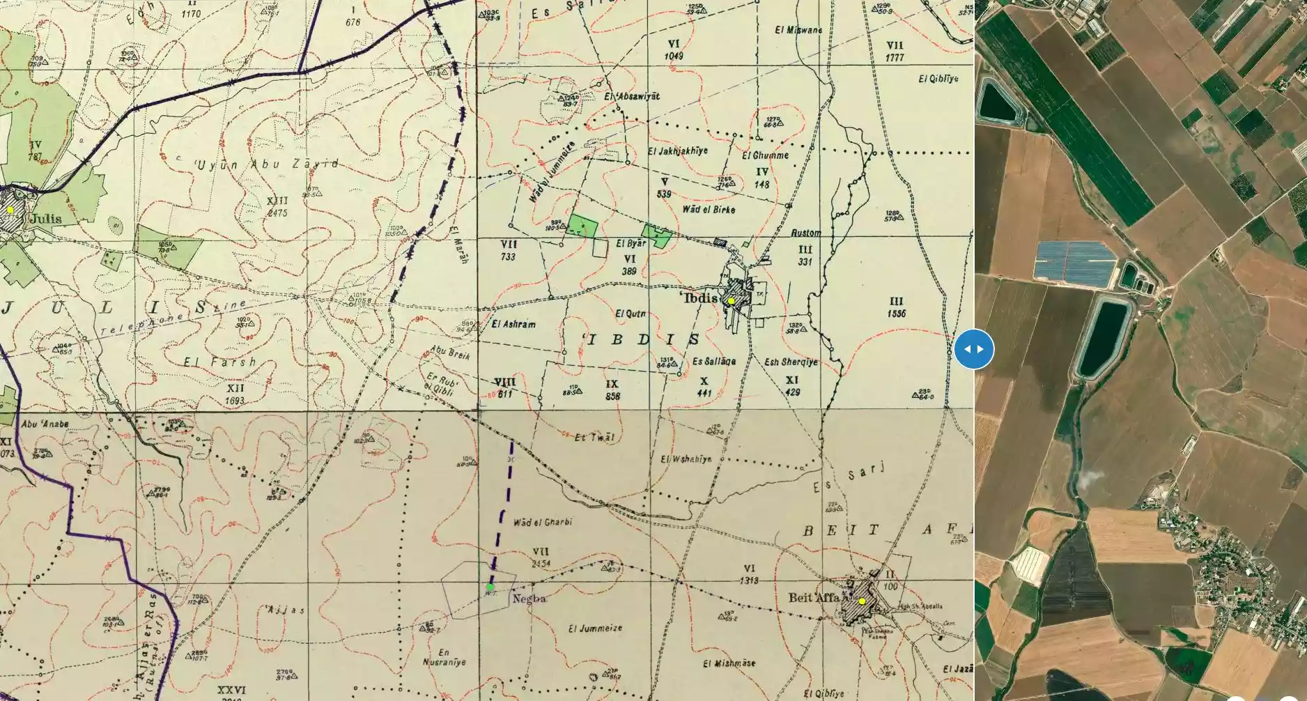
| Map Location | See location #19 on the map View from satellite |
||||||||||||||
| Military Operation | Operation Yo'av | ||||||||||||||
| Attacking Units | Giv'ati Brigade | ||||||||||||||
| Defenders | Egyptian Army | ||||||||||||||
| Exodus Cause | Military assault by Zionist troops | ||||||||||||||
| Village Temains | The village was completely obliterated. | ||||||||||||||
| Ethnically Cleansing | 'Ibdis inhabitants were completely ethnically cleansed. | ||||||||||||||
| Pre-Nakba Land Ownership |
**Town Lands' Demarcation Maps |
||||||||||||||
| Land Usage As of 1945 |
|
||||||||||||||
| Population |
|
||||||||||||||
| Number of Houses |
|
||||||||||||||
| Near By Towns |
|||||||||||||||
|
|||||||||||||||
| Archeological Sites | 'Ibdis contained several khirbats inculding khirbat Abu Juway'id (which had Byzantine artifacts), and Khirbat 'Ajjas. | ||||||||||||||
| Exculsive Jewish Colonies Who Usurped Village Lands |
Merkaz Shappira | ||||||||||||||
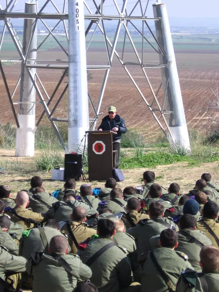
| Featured Video | |||||||||||||||
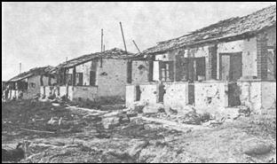
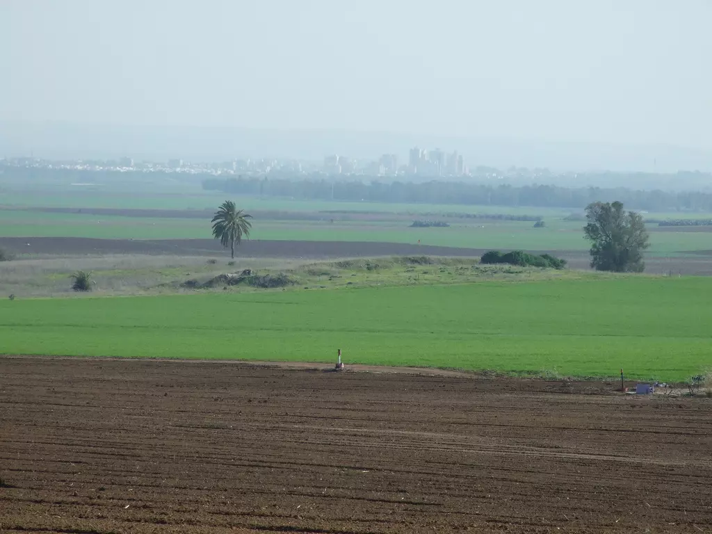
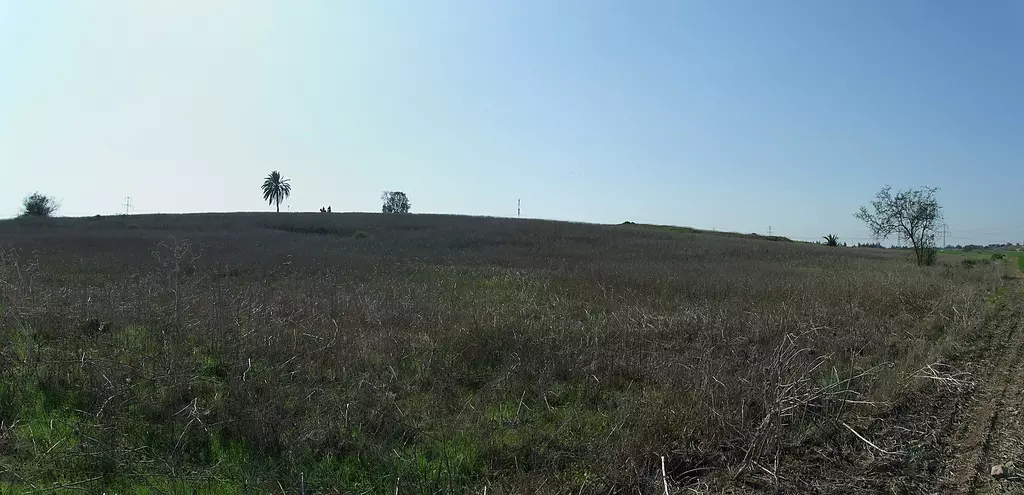
Village Before NakbaThe village stood on flat ground on the coastal plain. It was bordered by Wadi Ibdis, to the east, and was linked by two secondary roads to the highway between al-Majdal and the Jerusalem–Jaffa highway. These two roads also connected it to two neighboring villages. In 1596, Ibdis was a village in the nahiya of Gaza (liwa' of Gaza), with a population of 193. It paid taxes on a number of crops, including wheat, barley, sesame, and fruits, as well as on other types of produce and property, such as goats, beehives, and vineyards.In the late nineteenth century, Ibdis was a moderate-sized village that stood on open ground. Its adobe houses stood close to each other, separated only by narrow alleys. In the final years of the Mandate, new houses were built along the two roads mentioned. The community, which was Muslim, obtained its water for domestic use from a deep (55 m) well. However, because the number of drilled wells was limited, the villagers relied largely on rainfall for their crops. Ibdis was known in the region for its quality grains, such as wheat, barley, and sorghum. In the later period, villagers also grew fruit trees, including grapes, apricots, and oranges. In 1944/45 a total of 4,307 dunums was allotted to cereals; 149 dunums were irrigated or used for orchards. The presence of old and used wells, reservoirs, the foundations of former buildings, and architectural fragments suggested that Ibdis had a long past. A probable Byzantine site, Abu Juway'id lay very near the village. To the southwest of it lay Khirbat Ajjas, which the Arab geographer Yaqut al-Hamawi (d. 1228) mentioned as being a village within the jurisdiction of Ascalon. Village Occupation and Ethnic CleaningThe daily Palestinian newspaper Filastin reported in mid-February 1948 that Zionist forces arrived at Ibdis in three large vehicles on the evening of 17 February. They were engaged by the local militia and a clash ensued which went on for 1½ hours, until the attackers withdrew to the settlement of Negba. According to the newspaper account, none of the village's defenders were injured.On 8 July 1948, as the first truce of the war was about to expire, the Giv'ati Brigade moved on the southern front to link up with Israeli forces in the Negev. Although it did not succeed in this aim, it did manage to expand its area of control southwards, occupying numerous villages in the Gaza sub-disctrict. Ibdis was attacked by the Giv'ati Brigade's Third Battalion during the night of 8 July, resulting in a 'long battle' with two companies from the Egyptian army who were stationed there, according to the account in the History of the War of Independence. The Israeli forces 'only finished cleaning the position by the hours of the morning.' Bayt Affa and Iraq Suwaydan were captured at the same time, according to an Israeli military communiqué quoted in the New York Times. It is unclear whether the inhabitants of Ibdis were expelled at that time, but the Haganah account states that some military equipment was captured from the Egyptians. Egyptian forces tried to recapture it on 10 July, but failed when they suffered 'heavy losses' after confronting Israeli units based there. The History of the War of Independence states: 'This victory at the position of Ibdis was a turning point in Giv'ati's advance. For, from that victory onwards, the Brigade's forces did not withdraw from a Single position until the end of the war. ' Egyptian writer Muhammad Abd al-Mun'im states that Ibdis was recaptured briefly in the 10 July operation, but that the Egyptian units were forced to withdraw under fire from the heights overlooking the village. There was another failed attempt to recapture the village on 12 July. But another Egyptian source states that the village had also been attacked at the beginning of the first truce on 11 June, in violation of the United Nations-brokered agreement. As the late Egyptian president Gamal Abdel Nasser, then a junior Egyptian officer on this front, later recalled: 'On the first day of the truce the enemy moved against the Arab village of Ibdis which interpenetrated our lines.' Abdel Nasser does not mention whether this attack resulted in the occupation of the village, but it presumably remained in Egyptian hands until the 8–9 July attack. Zionists Colonies on Village LandsMerkaz Shappira, established in 1948 on the border between lands belonging to Ibdis and to al-Sawafir al-Gharbiyya, cultivates some of the lands near the site but is not on village lands.Village TodayThe village can only be identified by a cluster of sycamore trees; the houses have been completely obliterated. Part of the surrounding land is cultivated.SourceDr. Walid al-Khalidi, 1992: All That Remains. |
|||||||||||||||
| Related Maps | Town Lands' Demarcation Maps خرائط للقضاء توضح حدود القرى والاودية Town's map on MapQuest View from satellite Help us map this town at WikiMapia |
||||||||||||||
| Related Links | Wikipedia's Page Facebook Page Google Search Google For Images Google For Videos |
||||||||||||||
| More Information | مخطط البلد في كتاب كي لا ننسى المزيد من موقع هوية |
||||||||||||||
- الحاجة حمدة محمد عوض شحادة تتذكر عبدس - جريدة الغد الاردنية الجزء الاول
- الحاجة حمدة محمد عوض شحادة تتذكر عبدس - جريدة الغد الاردنية الجزء الثاني
- عبدس: قرية عربية تبعد 43كم شمال شرق مدينة غزة.
- تفاصيل معركة احتلال عبدس עיבדיס 1948 وسقوط اسرى ومعدات الجيش المصري بيد الصهاينة
- تفاصيل معركة احتلال عبدس עיבדיס 1948 وسقوط اسرى ومعدات الجيش المصري بيد الصهاينة الجزء الاول
- تفاصيل معركة احتلال عبدس עיבדיס 1948 وسقوط اسرى ومعدات الجيش المصري بيد الصهاينة - الجزء الثاني
- تفاصيل معركة احتلال عبدس עיבדיס 1948 وسقوط اسرى ومعدات الجيش المصري بيد الصهاينة - الجزء الثالث
- تفاصيل معركة احتلال عبدس עיבדיס 1948 وسقوط اسرى ومعدات الجيش المصري بيد الصهاينة - الجزء الرابع
- رواية اخرى لمعارك عبدس:
- نبذة تاريخية عن قرية عبدس (قضاء غزة) من كتاب (كي لا ننسى)
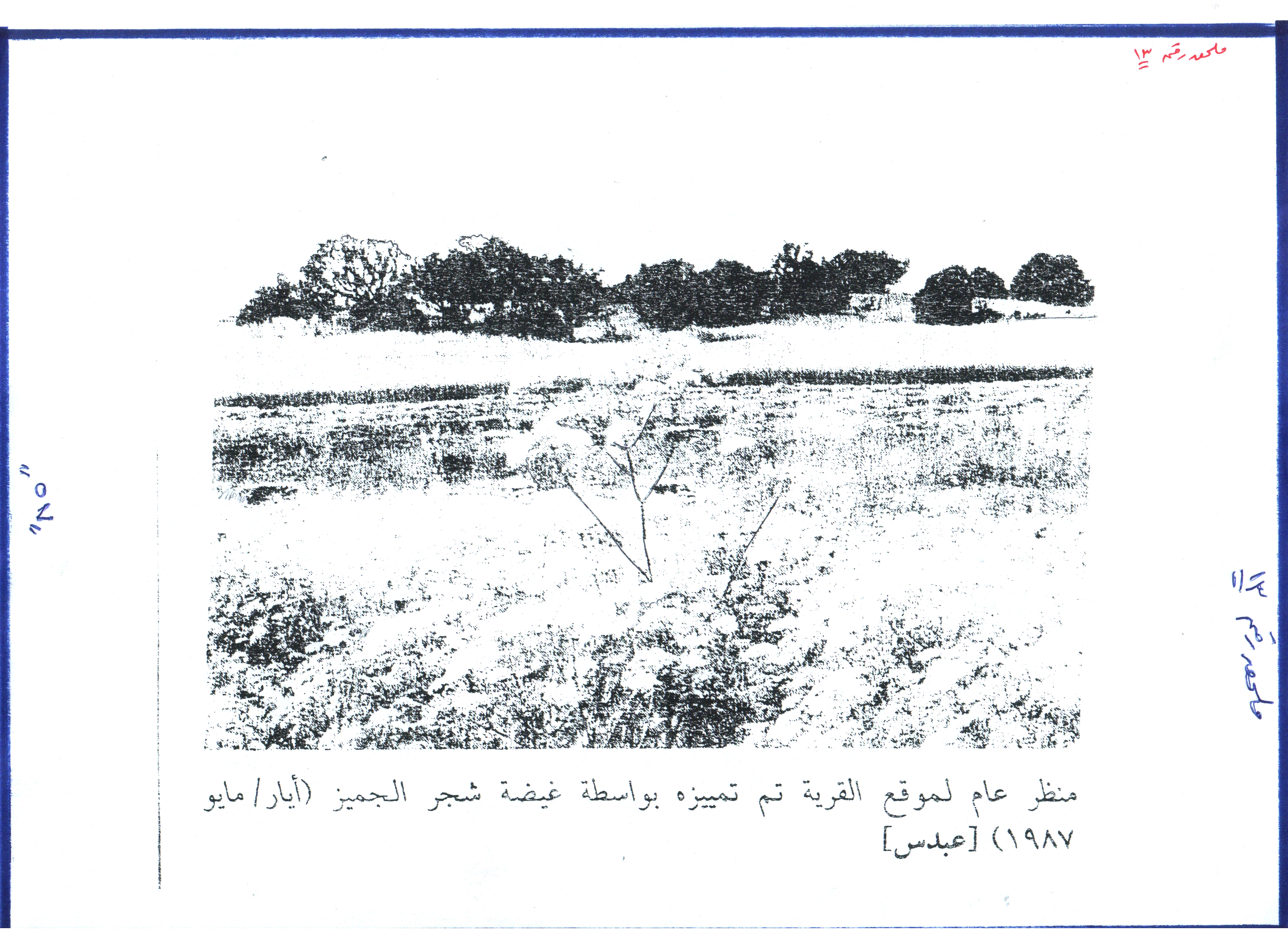
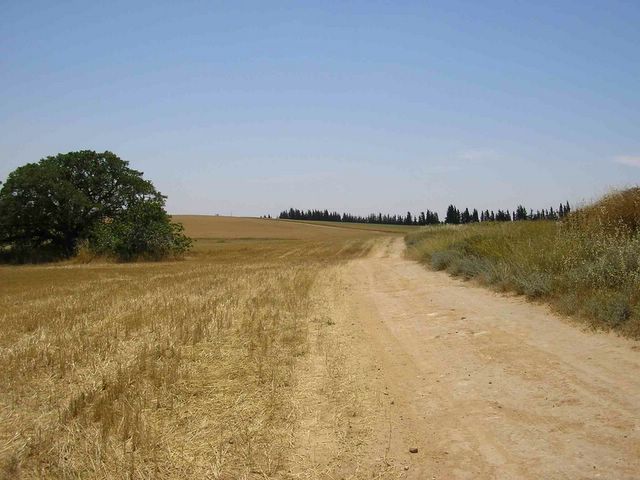
- General View Of The Village Site In 1987
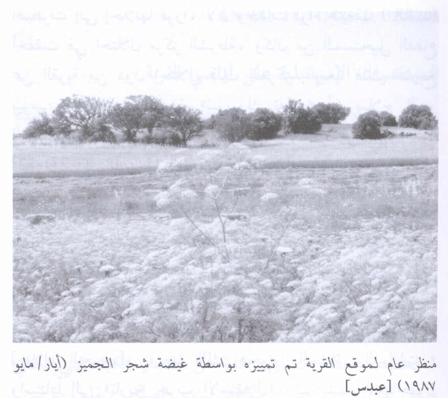
Scanned from "All That Remains" by Dr. Walid Khalidi 3 - حمدة عوض: وضعت على قبر أبي الشهيد نخلة.
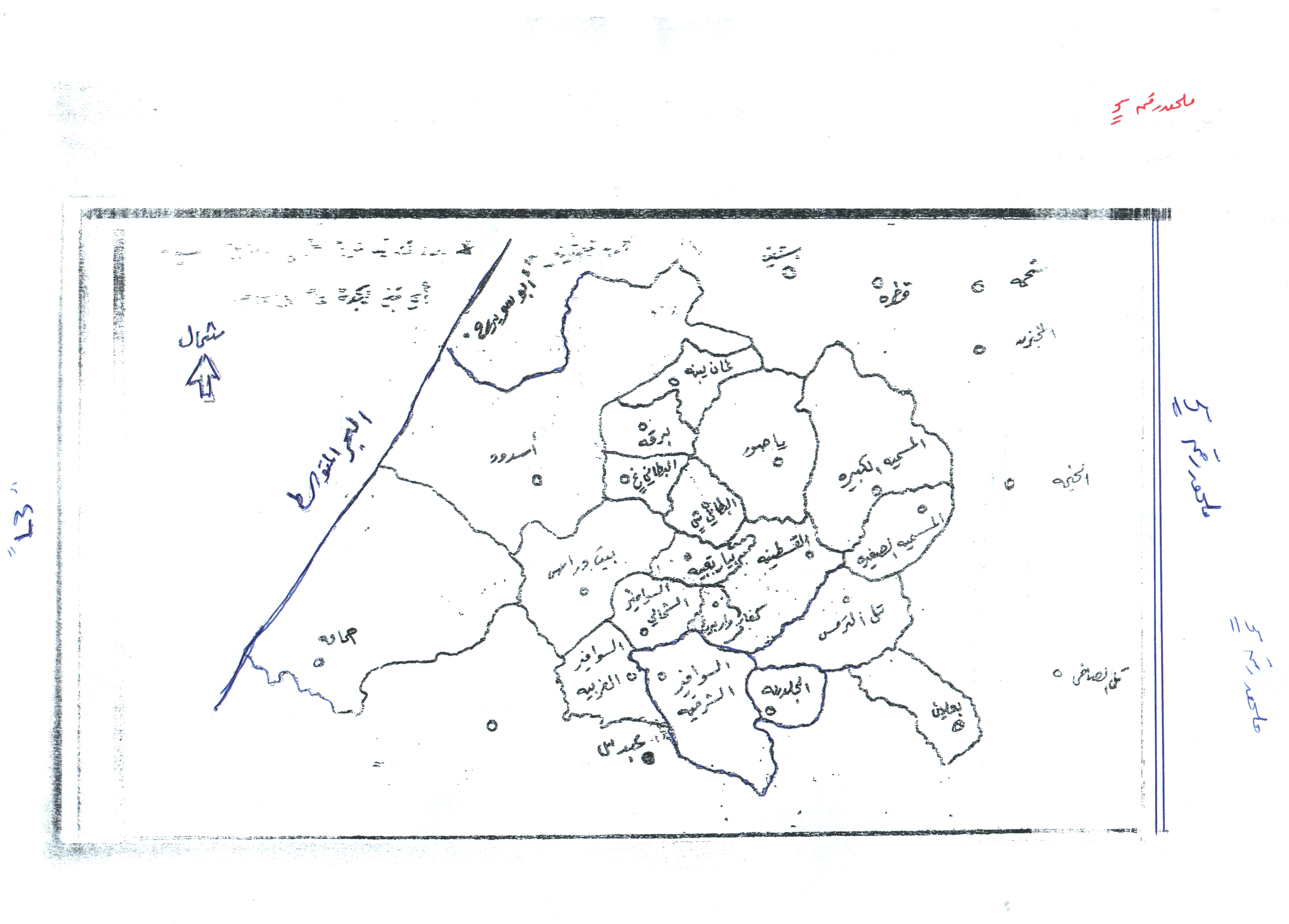
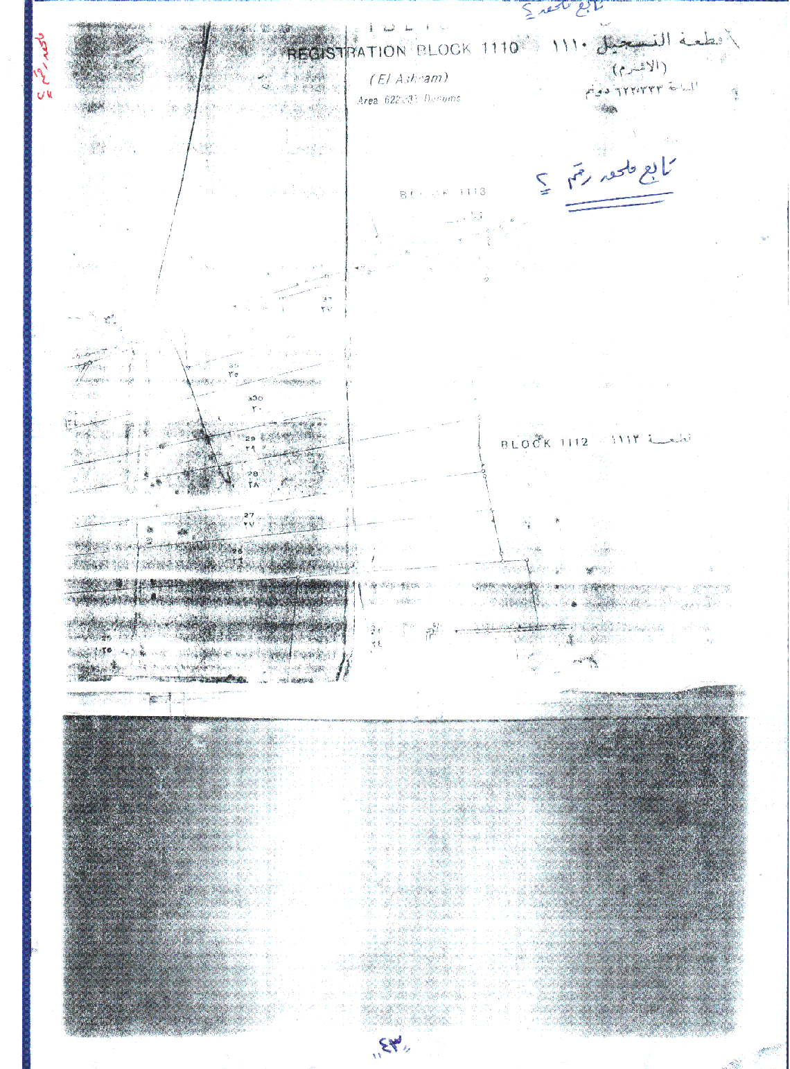
Posted by M. S. 3 - خارطة تبين حدود أراضي القرى الموجودة قي القسم الجنوبي لمحافظة غزة. اُنقر الصورة لتكبيرها. ملحق رقم 1
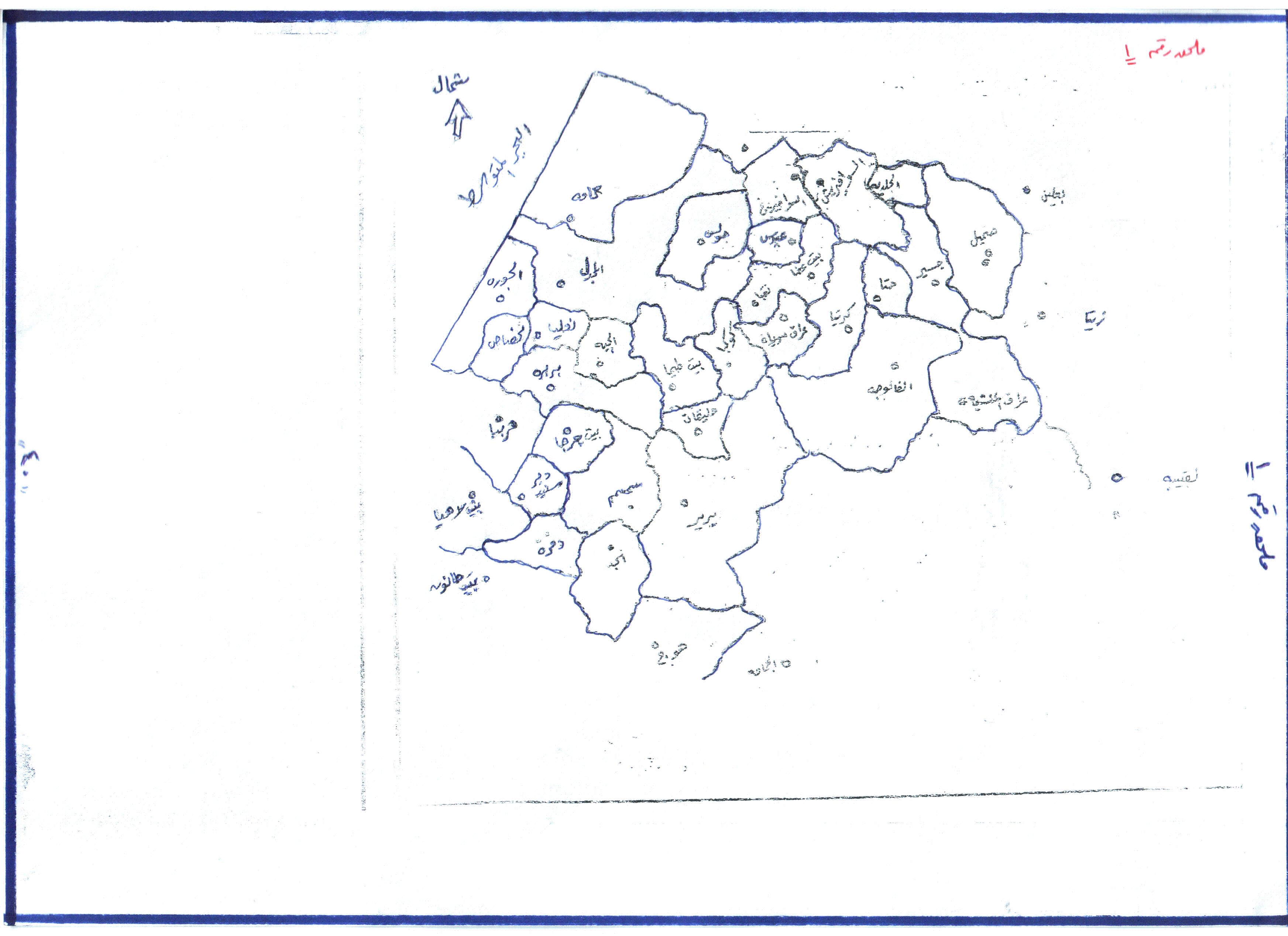
Posted by M. S. - خارطة تبين حدود أراضي القرى الموجودة قي القسم الشمالي لمحافظة غزة. اُنقر الصورة لتكبيرها. ملحق رقم5
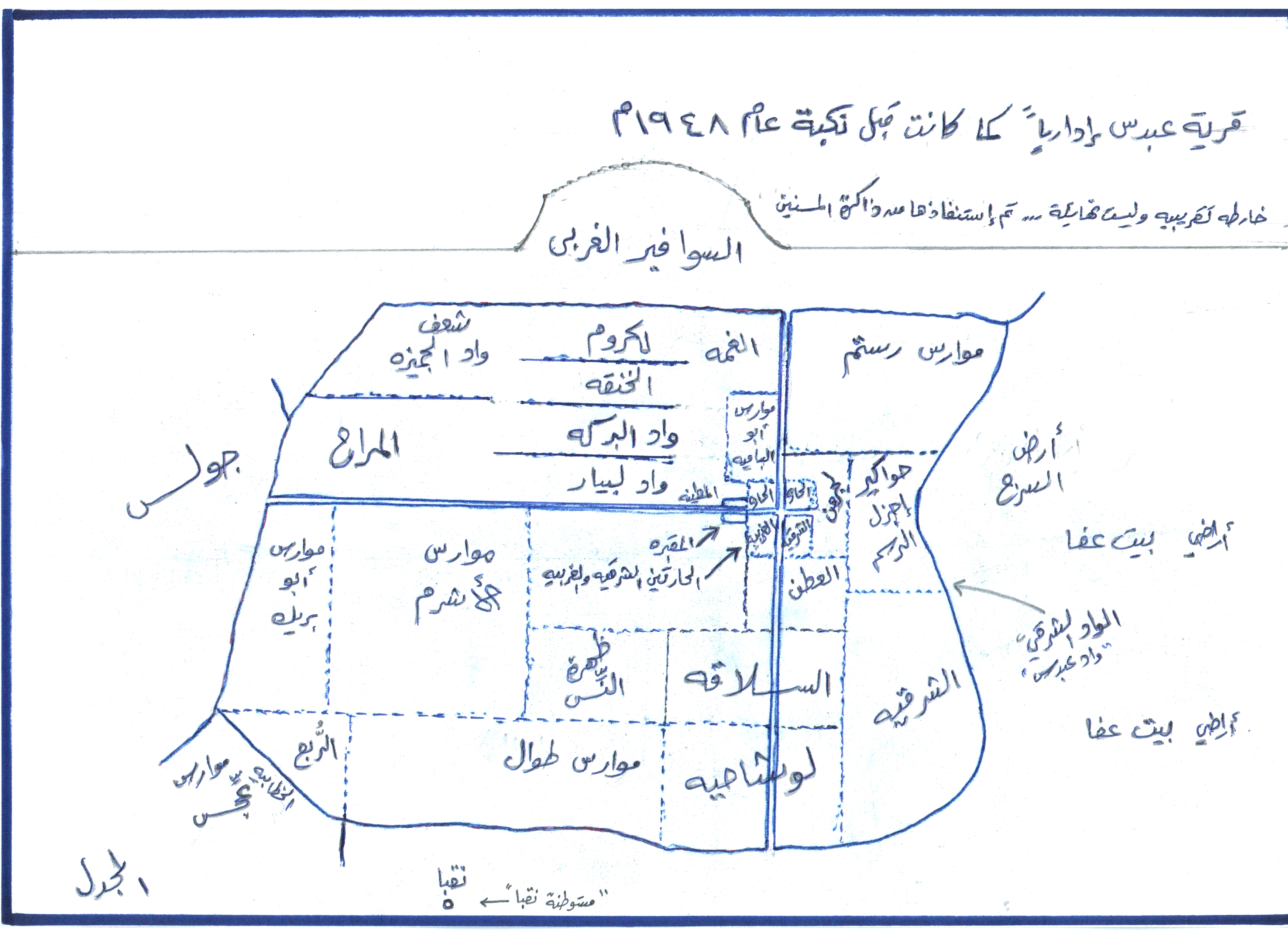
Posted by M. S. - خارطة تبين أسماء الأراضي وبعض معالم القرية. ملحق رقم 3
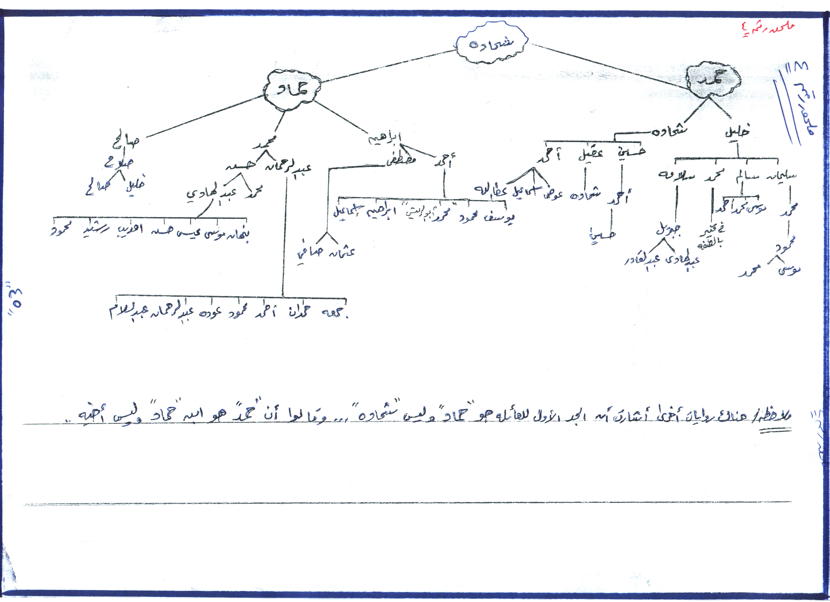
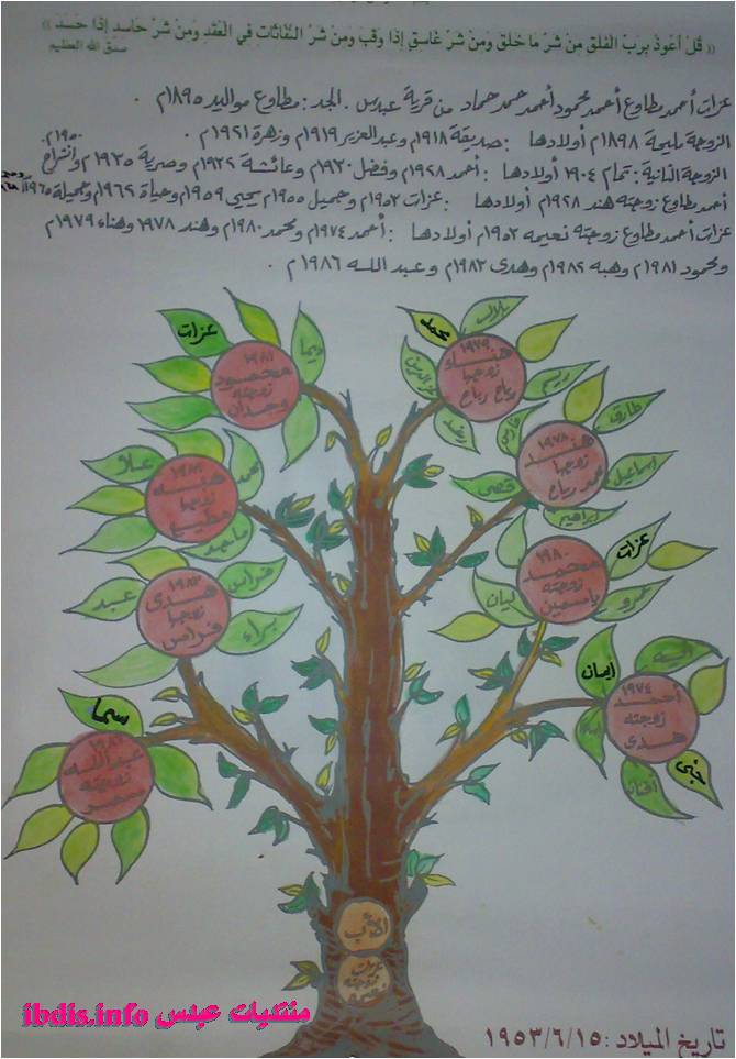
Posted by M. S. - شجرة عائلة حمولة شحادة وأفخاذها: حمد وحماد. اُنقر الصورة لتكبيرها. ملحق رقم 4
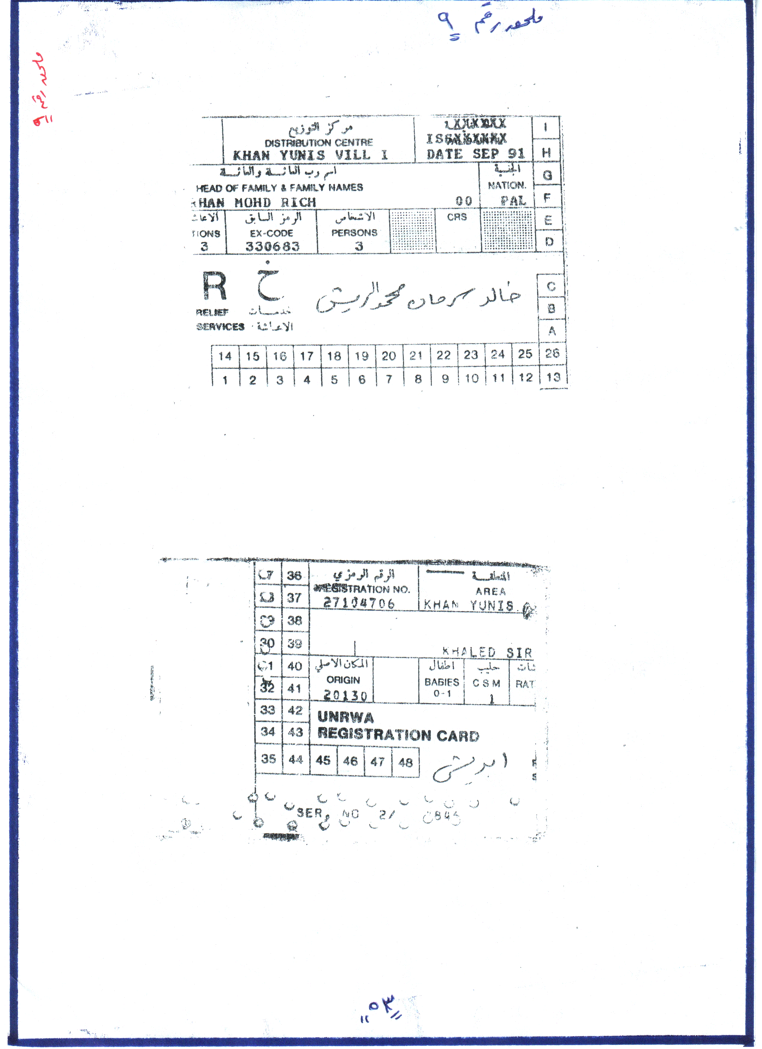
Posted by M. S. 2 - بطاقة تموين صادرة من الوكالة. ملحق رقم 9
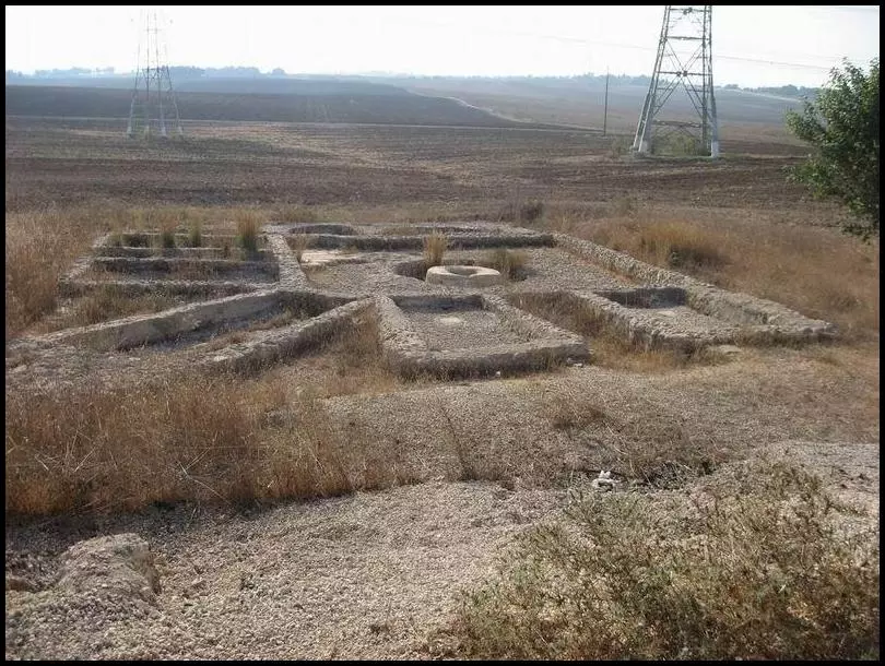
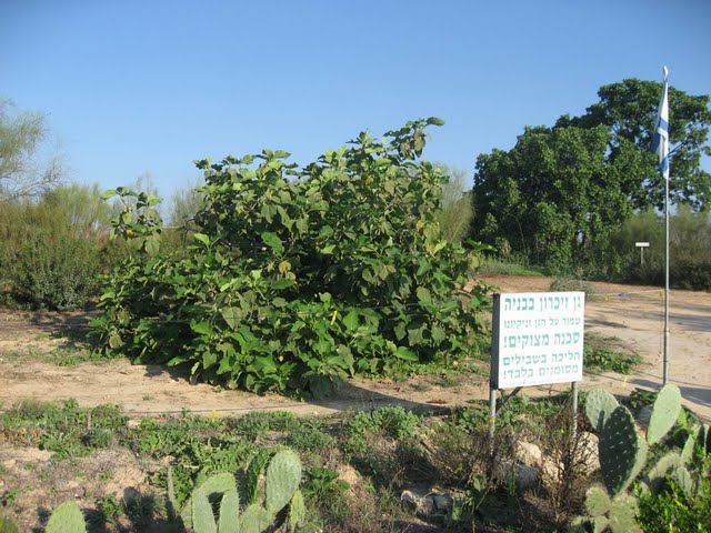
Posted by M. S. - منظر عام للقرية المدمرة تم تمييزه بواسطة غيطة شجرة الجميز. 1987
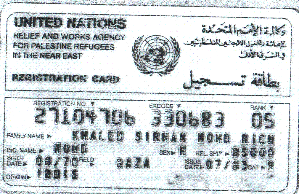
Posted by M. S. - بطاقة تسجيل في الوكالة. ملحق رقم 11
Posted by M. S. 1 - ورقة طابو تثبت ملكية الأراضي. تابع 6
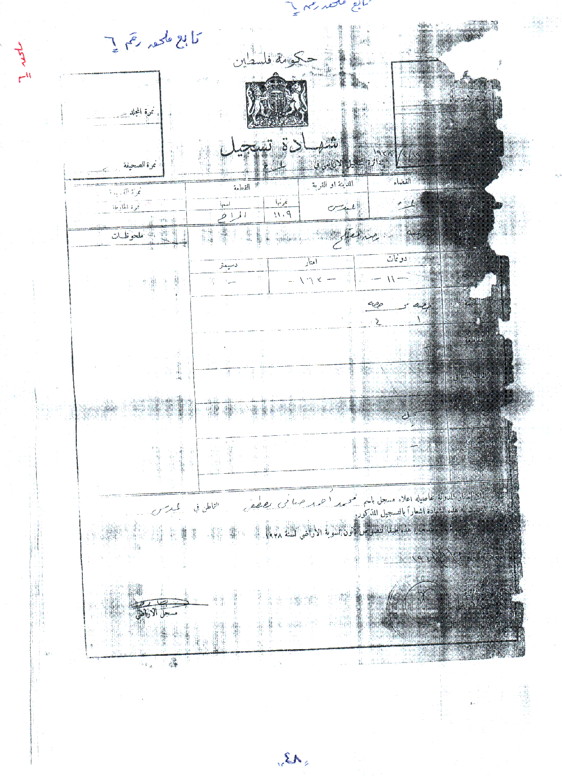
Posted by M. S. - ورقة طابو تثبت ملكية الأراضي. تابع ملحق 6
Posted by M. S. - ورقة طابو تثبت ملكية الأراضي. تابع ملحق 2
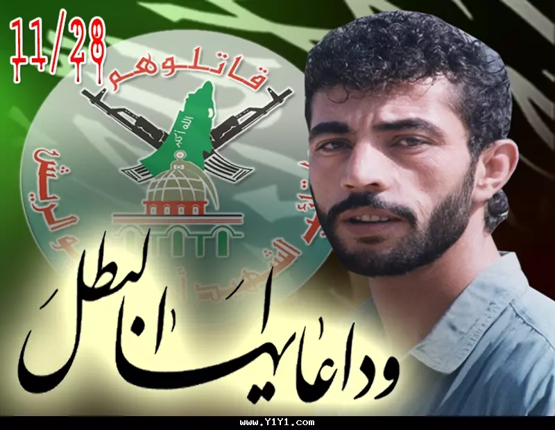
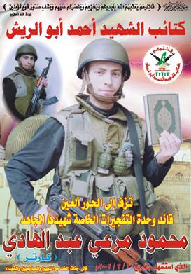
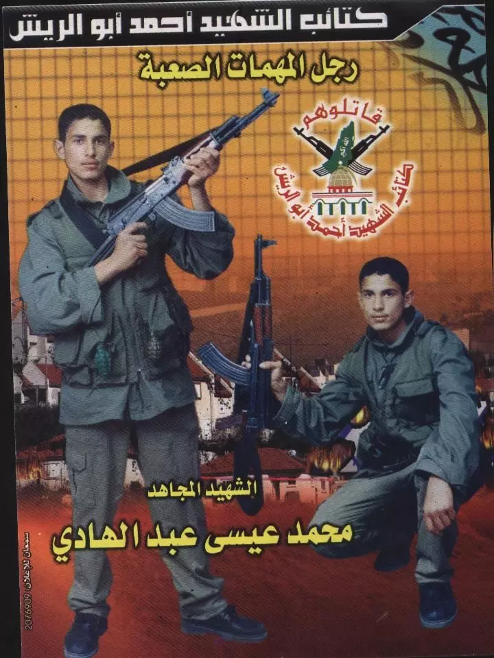
Posted by M. S. - من عبدس الشهيد القائد البطل أحمد خالد سرحان أبو الريش
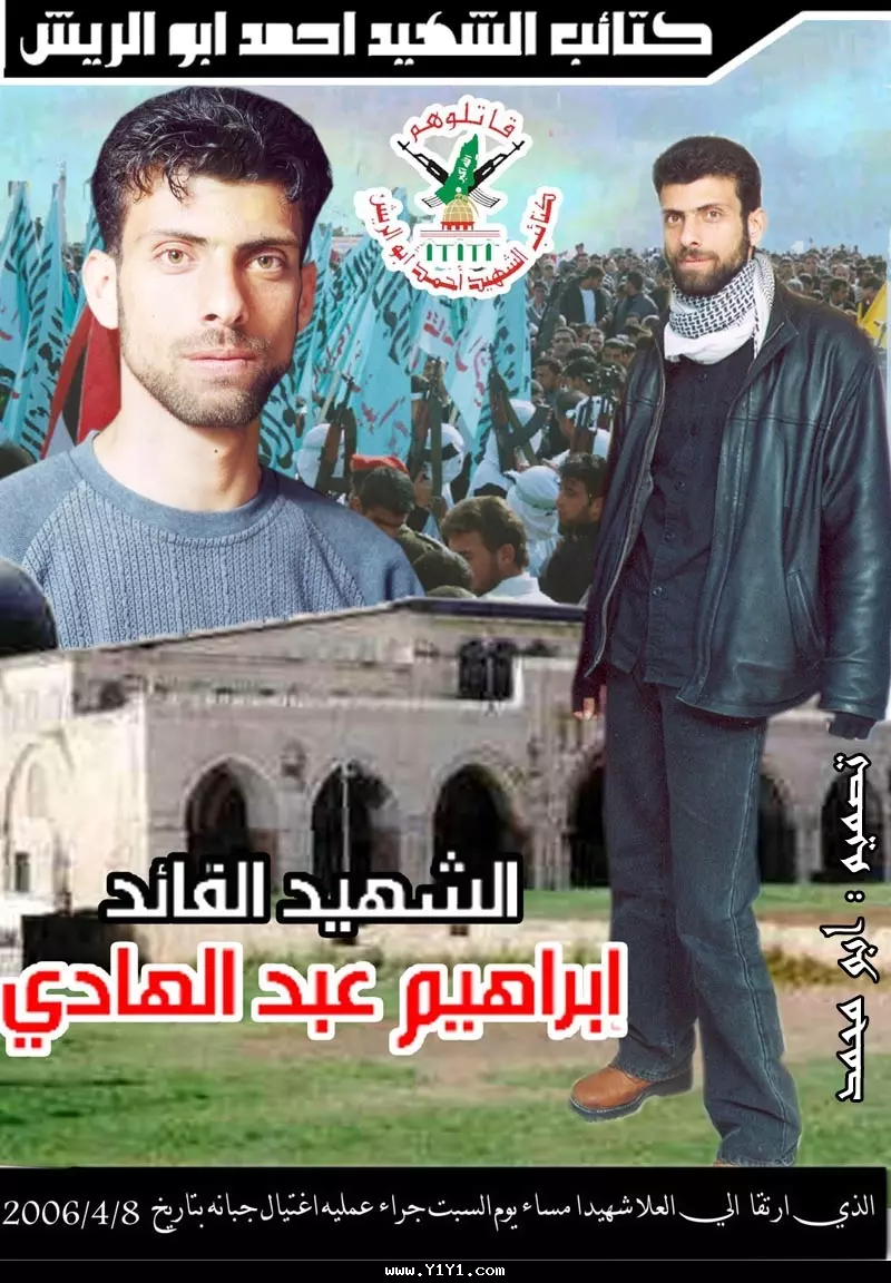
Posted by M. S. 1 - من عبدس الشهيد القائد البطل ابراهيم عبدالهادي
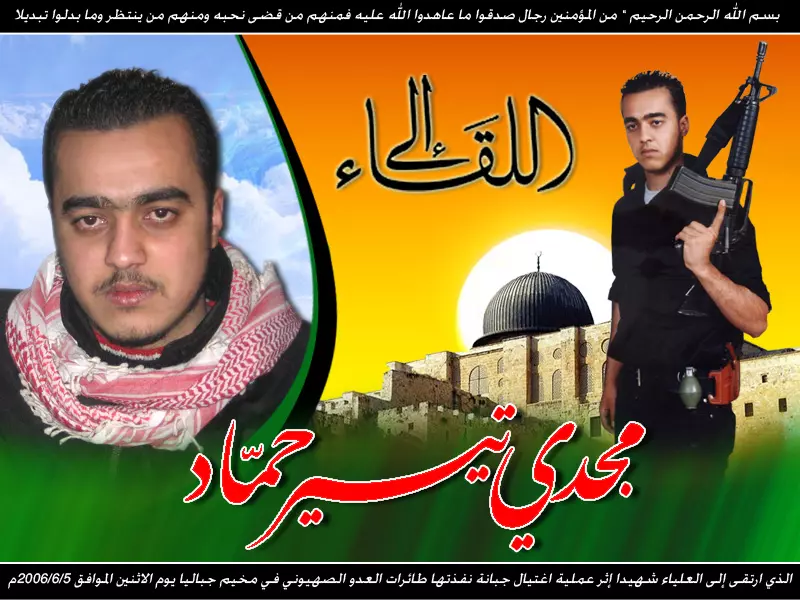
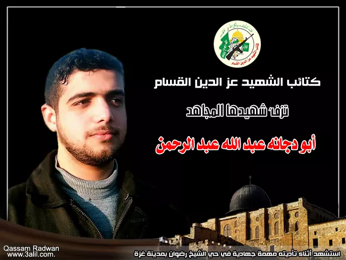
Posted by M. S. 5 - الشهيد المجاهد / مجدي تيسير حماد ........... قائد سلاح الصواريخ في ألوية الناصر صلاح الدين
Posted by محمد حماد 2 - صور حديثة لقرية عبدس تم الحصول عليها بواسطة غوغل من مواقع عبرية
Posted by M. S. - صور حديثة لقرية عبدس تم الحصول عليها بواسطة غوغل من مواقع عبرية
Posted by M. S. - صور حديثة لقرية عبدس تم الحصول عليها بواسطة غوغل من مواقع عبرية

Posted by M. S. - صور حديثة لقرية عبدس تم الحصول عليها بواسطة غوغل من مواقع عبرية

Posted by M. S. - صور حديثة لقرية عبدس تم الحصول عليها بواسطة غوغل من مواقع عبرية

Posted by M. S. - صور حديثة لقرية عبدس تم الحصول عليها بواسطة غوغل من مواقع عبرية
Posted by M. S. - صور حديثة لقرية عبدس تم الحصول عليها بواسطة غوغل من مواقع عبرية

Posted by M. S. - صور حديثة لقرية عبدس تم الحصول عليها بواسطة غوغل من مواقع عبرية
Posted by M. S. - صور حديثة لقرية عبدس تم الحصول عليها بواسطة غوغل من مواقع عبرية

Posted by M. S. - صور حديثة لقرية عبدس تم الحصول عليها بواسطة غوغل من مواقع عبرية

Posted by M. S. - شجرةعائلة من عبدس
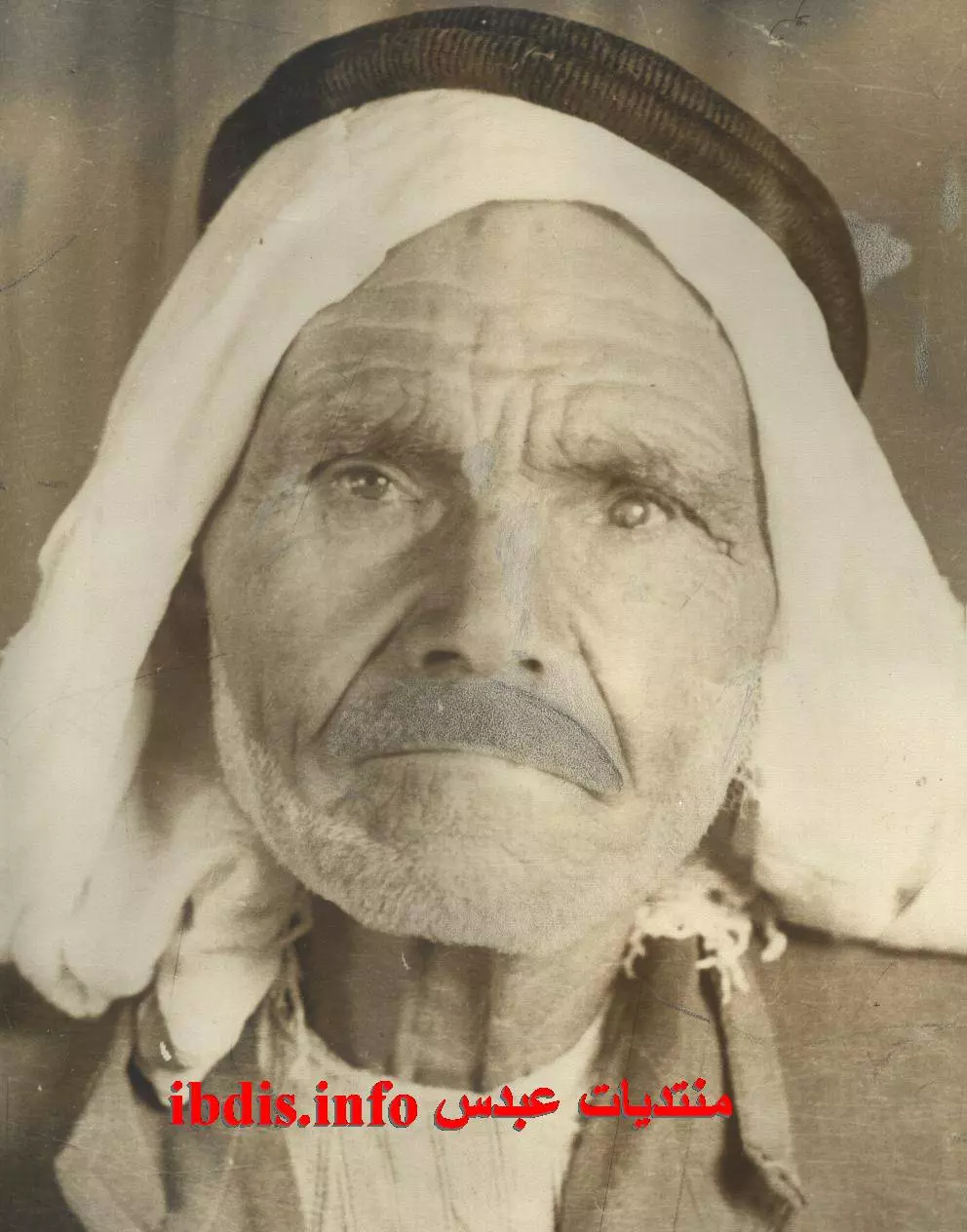
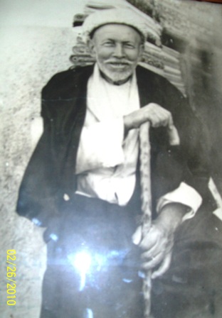
Posted by M. S. 1 - صورة الحاج/مطاوع أحمد محمود/المولد عام 1871 فيي عبدس وعاش حوالي 106 سنوات وتزوج في حياته من مليحة وصديقة
Posted by M. S. - صور حديثة لقرية عبدس تم الحصول عليها بواسطة غوغل من مواقع عبرية
Posted by M. S. - صور حديثة لقرية عبدس تم الحصول عليها بواسطة غوغل من مواقع عبرية
Posted by M. S. - صور حديثة لقرية عبدس تم الحصول عليها بواسطة غوغل من مواقع عبرية
Posted by M. S. - صور حديثة لقرية عبدس تم الحصول عليها بواسطة غوغل من مواقع عبرية
Posted by M. S. - صور حديثة لقرية عبدس تم الحصول عليها بواسطة غوغل من مواقع عبرية
Posted by M. S. - صور حديثة لقرية عبدس تم الحصول عليها بواسطة غوغل من مواقع عبرية
Posted by M. S. - صور حديثة لقرية عبدس تم الحصول عليها بواسطة غوغل من مواقع عبرية
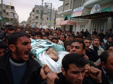
Posted by M. S. - الشهيد محمود مرعي عبد الهادي من عبدس
Posted by M. S. - الشهيد محمود مرعي عبد الهادي من عبدس
Posted by M. S. - صورة الحاجة صديقة مطاوع- أم محمد وهي زوجة الحاج المرحوم عوض الله ولدت سنة 1918 توفيت سنة 1999
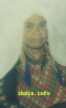
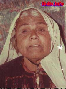
Posted by M. S. - صورة الحاجة( هند أم عزات) ربنا يعطيها الصحة والعافية وهي من مواليد1928
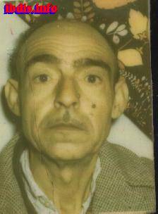
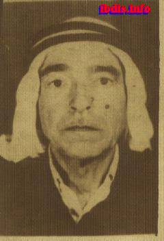
Posted by M. S. - صورة عوض الله احمد- أبو محمد من مواليد 1921 توفي عن عمر يقارب 65 عاما سنة 1986
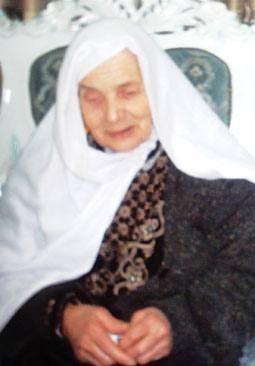
Posted by M. S. - صورة الحاجة تمام فارس صافي- أم أحمد وهي من مواليد سنة 1904توفيت الى رحمه الله سنة 2007 وللعلم فالحاجة رحمها الله شاهدت ابن ابن ابن ابنها
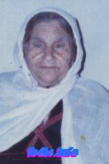
Posted by M. S. - صورة الحاجة تمام فارس صافي- أم أحمد وهي من مواليد سنة 1904توفيت الى رحمه الله سنة 2007 وللعلم فالحاجة رحمها الله شاهدت ابن ابن ابن ابنها
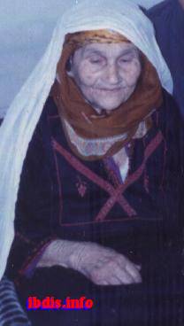
Posted by M. S. - صورة الحاجة تمام فارس صافي- أم أحمد وهي من مواليد سنة 1904توفيت الى رحمه الله سنة 2007 وللعلم فالحاجة رحمها الله شاهدت ابن ابن ابن ابنها

Posted by M. S. - صورة الحاجة صديقة مطاوع- أم محمد وهي زوجة الحاج المرحوم عوض الله ولدت سنة 1918 توفيت سنة 1999
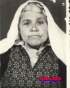
Posted by M. S. - صورة الحاجة صديقة مطاوع- أم محمد وهي زوجة الحاج المرحوم عوض الله ولدت سنة 1918 توفيت سنة 1999
Posted by M. S. - صورة عوض الله احمد- أبو محمد من مواليد 1921 توفي عن عمر يقارب 65 عاما سنة 1986
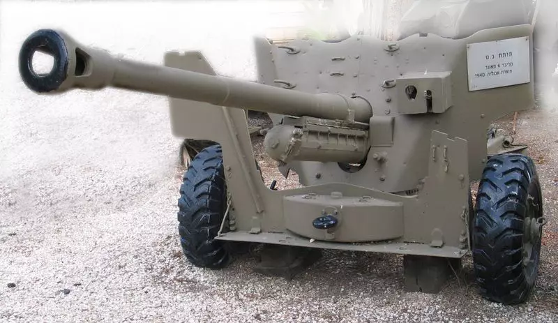
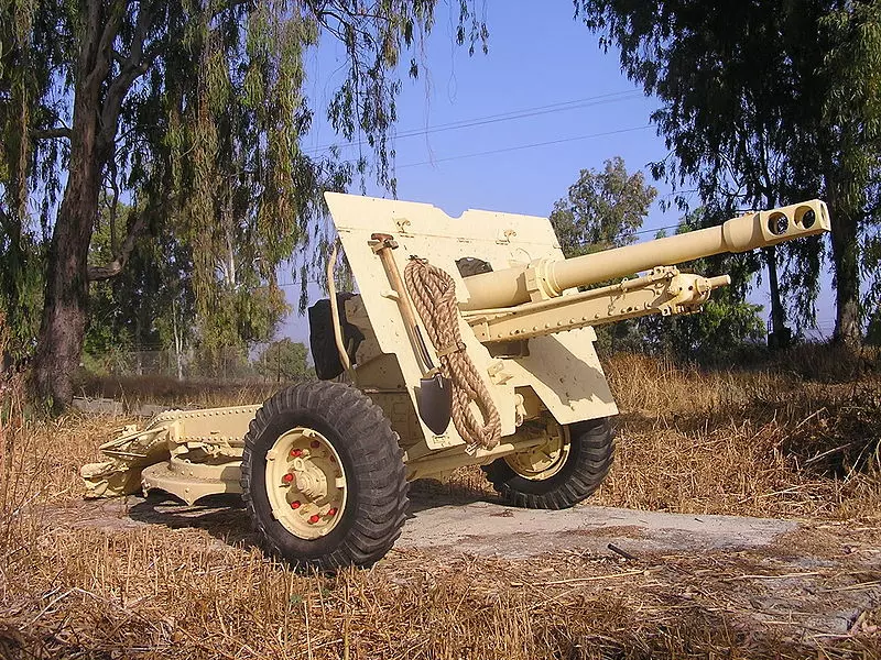
Posted by M. S. - مدرعة الجيش المصري في معارك عبدس 1948
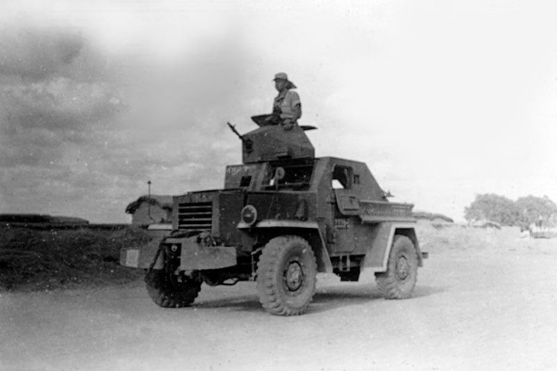
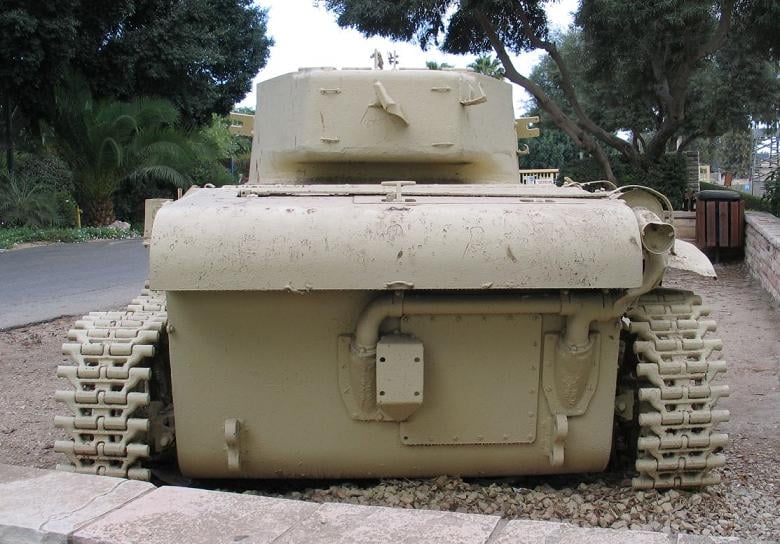
Posted by M. S. - هذه الدبابة للجيش المصري حاربت في 1948 بمنطقة عبدس-عراق سويدان-بيت عفا ثم وقعت بالاسر اثتاء محاولة اقتحام مغتصبة نقبا وبقيت شاهد للتاريخ
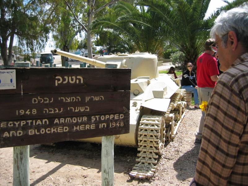
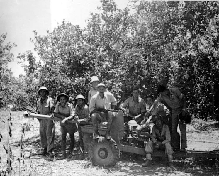
Posted by M. S. 9 - هذه الدبابة للجيش المصري حاربت في 1948 بمنطقة عبدس-عراق سويدان-بيت عفا ثم وقعت بالاسر اثتاء محاولة اقتحام مغتصبة نقبا وبقيت شاهد للتاريخ
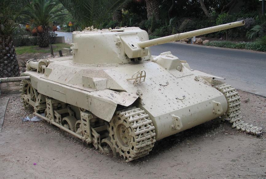
Posted by M. S. - هذه الدبابة للجيش المصري حاربت في 1948 بمنطقة عبدس-عراق سويدان-بيت عفا ثم وقعت بالاسر اثتاء محاولة اقتحام مغتصبة نقبا وبقيت شاهد للتاريخ
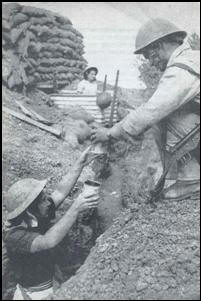
Posted by M. S. - اليهود يحفرون الخنادق بنمطقة عبدس
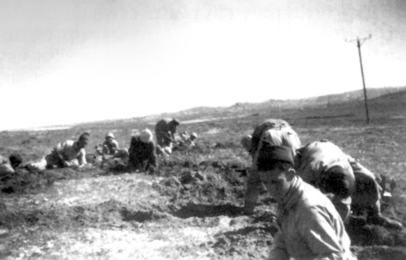
Posted by M. S. - اليهود يحفرون الخنادق بنمطقة عبدس
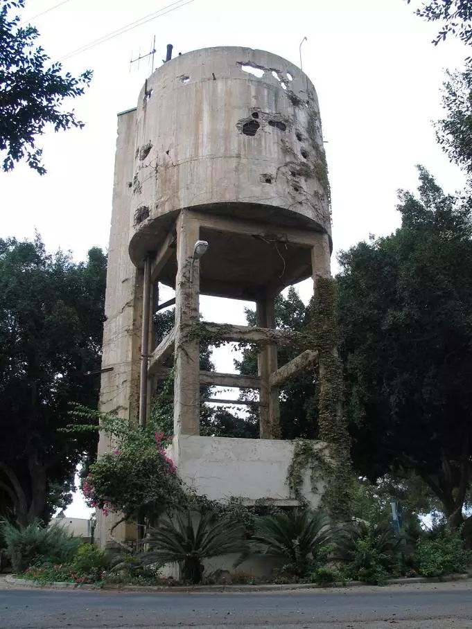
Posted by M. S. - هذه اثار القصف على برج المياه والمنشأت اثتاء محاولة اقتحام مغتصبة نقبا بالقرب من عبدس 1948
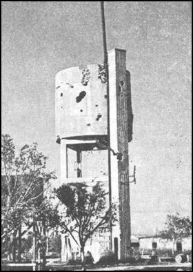
Posted by M. S. - هذه اثار القصف على برج المياه والمنشأت اثتاء محاولة اقتحام مغتصبة نقبا بالقرب من عبدس 1948
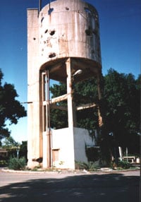
Posted by M. S. - هذه اثار القصف على برج المياه والمنشأت اثتاء محاولة اقتحام مغتصبة نقبا بالقرب من عبدس 1948
Posted by M. S. - هذه اثار القصف اثتاء محاولة اقتحام مغتصبة نقبا بالقرب من عبدس 1948
Posted by M. S. - هذه اثار القصف اثتاء محاولة اقتحام مغتصبة نقبا بالقرب من عبدس 1948
Posted by M. S. - قادة يهود بمنطقة عبدس 1948
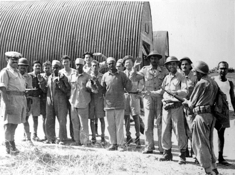
Posted by M. S. - انكسار الجيش المصري واسر عدد منهم بمنطقة عبدس بشهر 7 / 1948
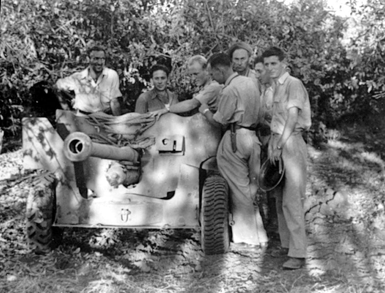
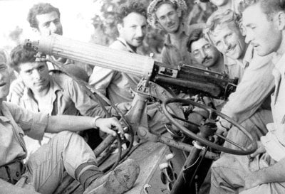
Posted by M. S. - غنائم اليهود بعد انكسار الجيش المصري واسر عدد منهم بمنطقة عبدس بشهر 7 / 1948
Posted by M. S. - غنائم اليهود بعد انكسار الجيش المصري واسر عدد منهم بمنطقة عبدس بشهر 7 / 1948
Posted by M. S. - غنائم اليهود بعد انكسار الجيش المصري واسر عدد منهم بمنطقة عبدس بشهر 7 / 1948
Posted by M. S. - غنائم اليهود بعد انكسار الجيش المصري واسر عدد منهم بمنطقة عبدس بشهر 7 / 1948
Posted by M. S. - غنائم اليهود بعد انكسار الجيش المصري واسر عدد منهم بمنطقة عبدس بشهر 7 / 1948

Posted by M. S. - غنائم اليهود بعد انكسار الجيش المصري واسر عدد منهم بمنطقة عبدس بشهر 7 / 1948
Posted by M. S. - اليهود يضربون بالمدافع المضادة للطائرات على طائرات الجيش المصري التي حاولت استعادة عبدس بعد انكسار الجيش المصري واسر عدد منهم بمنطقة عبدس بشهر 7 / 1948
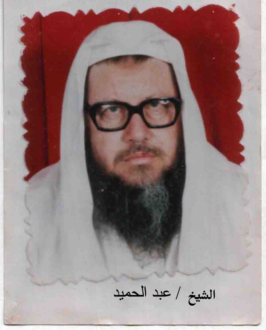
Posted by M. S. - صورة الشيخ الأستاذ الدكتور الداعية عبد الحميد خالد ابو الريش ابو محمد مواليد عام 1940 م في قرية عبدس وتوفي عام 2004م في دولة الكويت
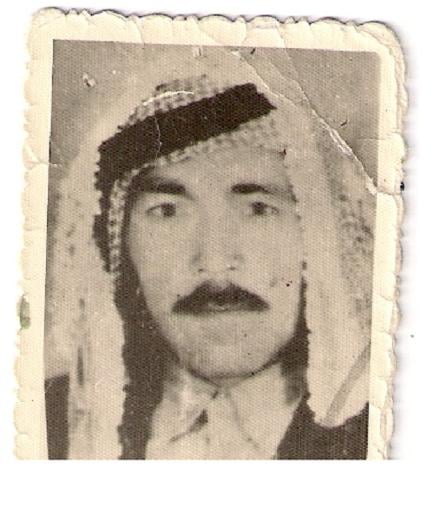
Posted by M. S. 2 - صورة خالد سرحان محمد ( ابو الريش ) احمد مواليد العام 1913م ( عبدس ) والد الشيخ الأستاذ الدكتور الداعية( عبد الحميد ابو الريش ) ووالد الشهيد القائد ( احمد ابو الريش ) رحمه الله ، استشهد عام 1993م
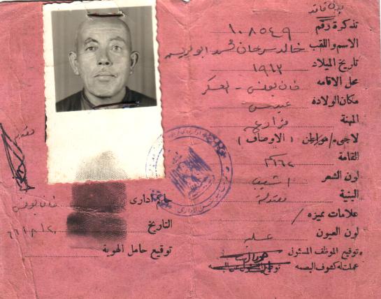
Posted by M. S. 2 - صورة الهوية الخاصة لخالد سرحان محمد ( ابو الريش ) احمد مواليد العام 1913م ( عبدس )( إبان حكم الإدارة المصرية ) للقطاع عام 1966م
Posted by M. S. - صورة الحاج/عبد القادر حسين سلمان ابو الريش - مواليد 1935م في قرية عبدس وتوفي في خانيونس عام 96م رحمه الله واسكنه فسيح جنانه
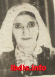
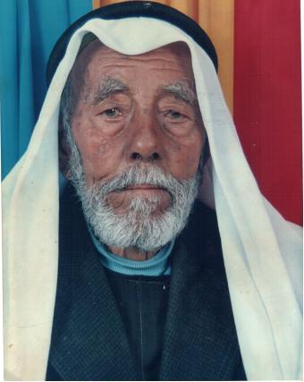
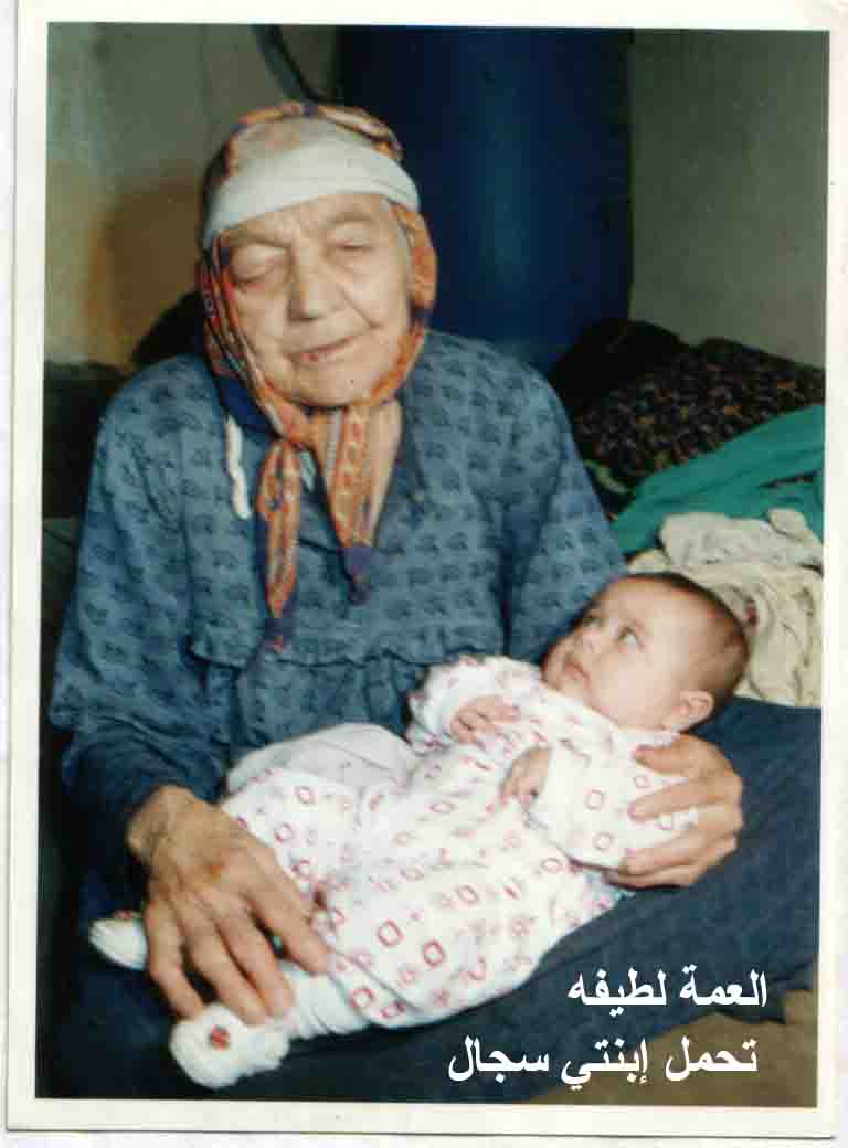
Posted by M. S. - صورة الحاجة لطيفة سرحان ابو الريش( ام سليمان) - مواليد 1920 م في قرية عبدس وتوفيت عام 2005م
Posted by M. S. - احتفالات الصهاينة بذكرى معركة عبدس بمنطقة المعركة ومكان قتلاهم
Posted by M. S. - من قتلى الصهاينة في عبدس 1948
Posted by M. S. - الغنائم التي تحدث عنها لواء غفعاتي والتي تركها المصريين عندما انكسروا في عبدس 1948
Posted by M. S. - الغنائم التي تحدث عنها لواء غفعاتي والتي تركها المصريين عندما انكسروا في عبدس 1948
Posted by M. S. - الغنائم التي تحدث عنها لواء غفعاتي والتي تركها المصريين عندما انكسروا في عبدس 1948
Posted by M. S. - الغنائم التي تحدث عنها لواء غفعاتي والتي تركها المصريين عندما انكسروا في عبدس 1948
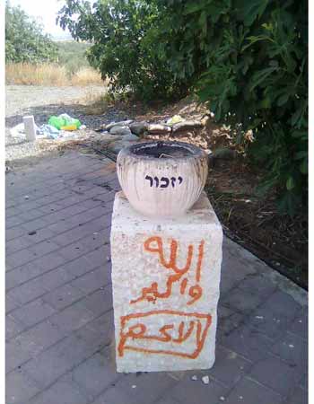
Posted by M. S. - صور لنصب قتلى الصهاينة في عبدس واحتفالاتهم بذكرى قتلاهم بشهر 7
Posted by M. S. - صور لنصب قتلى الصهاينة في عبدس واحتفالاتهم بذكرى قتلاهم بشهر 7
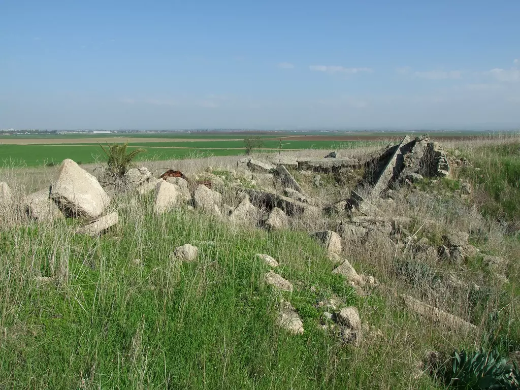
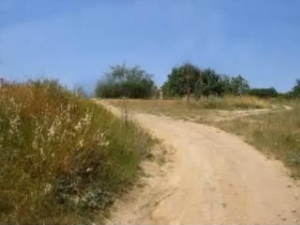
Posted by M. S. - بقايا اعلى تلال قرية عبدس
Posted by M. S. - بقايا اعلى تلال قرية عبدس
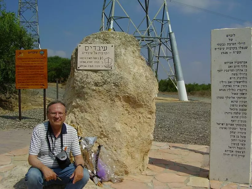
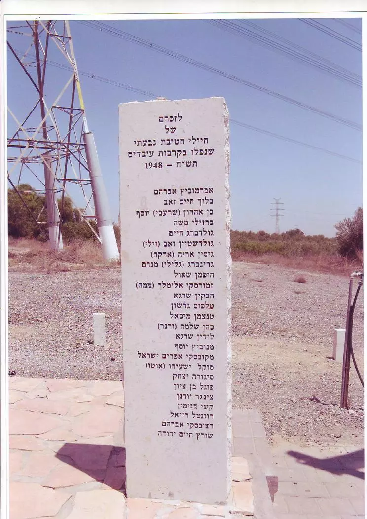
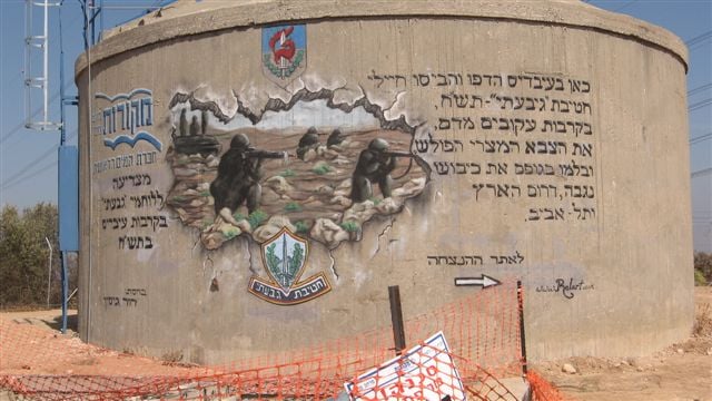
Posted by M. S. - نصب ذكرى معركة عبدس بمنطقة المعركة ومكان قتلى الصهاينة بعبدس 1948
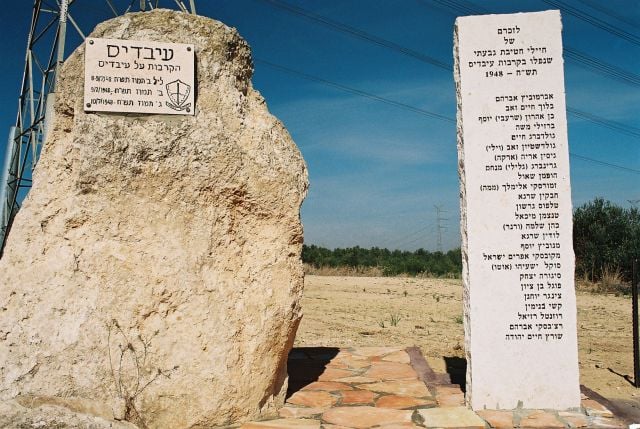
Posted by M. S. - نصب ذكرى معركة عبدس بمنطقة المعركة ومكان قتلى الصهاينة بعبدس 1948
Posted by M. S. - نصب ذكرى معركة عبدس بمنطقة المعركة ومكان قتلى الصهاينة بعبدس 1948
Posted by M. S. - رسم لذكرى معركة عبدس بمنطقة المعركة ومكان قتلى الصهاينة بعبدس 1948
Posted by M. S. - ذكرى معركة عبدس بمنطقة المعركة ومكان قتلى الصهاينة بعبدس 1948
Posted by M. S. - ذكرى معركة عبدس بمنطقة المعركة ومكان قتلى الصهاينة بعبدس 1948
Posted by M. S. - عملية ان فار وذكرى معركة عبدس بمنطقة المعركة ومكان قتلى الصهاينة بعبدس 1948
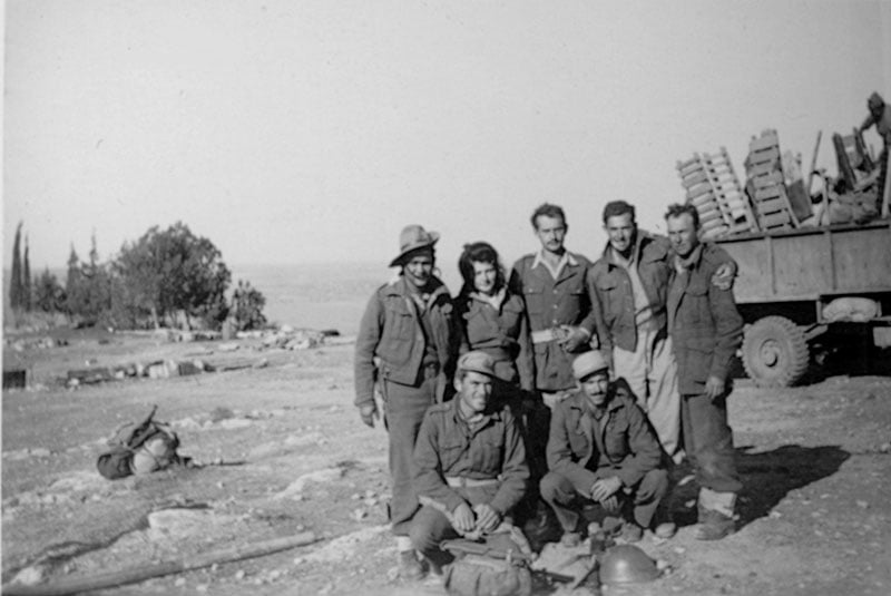
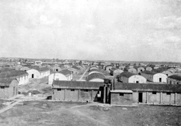
Posted by M. S. - صورة كامب الجيش الانجليزي بالقرب من عبدس 1948
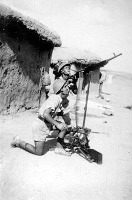
Posted by M. S. - المجاهد العبدساوي
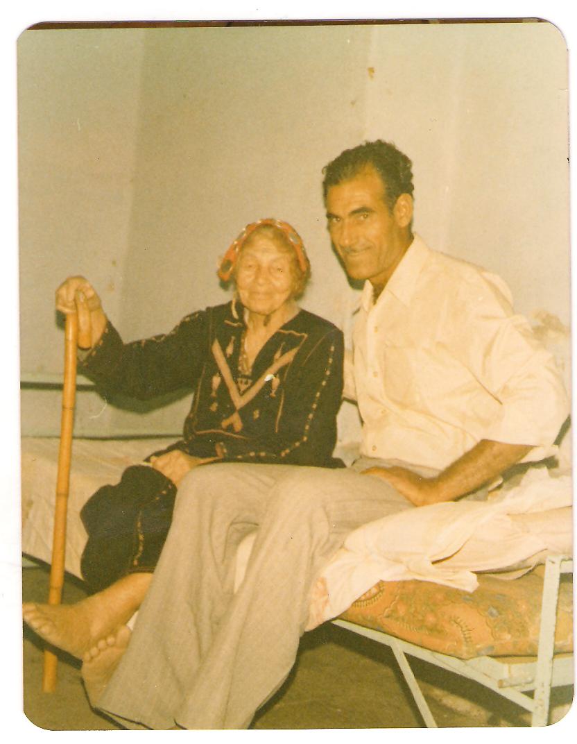
Posted by M. S. - الحاج اسماعيل صافي اطال الله في عمره مع العمه مدللة فارس صافي يرحمها الله - التقطت هذه الصورة في عام 1982 - تاريخ ميلاد الحاجة 1890 - تاريخ الوفاة 1990 - عن عمر يناهز 100 عام
Posted by M. S. - المختار الحاج/عبد العزيز محمد صافي وهو من مواليد عبدس سنة 1890 - توفي سنة 1970
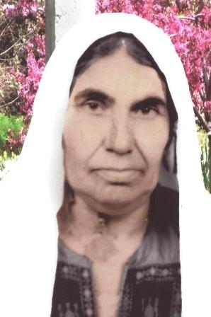
Posted by M. S. - الحاجة: حليمة محمود علي العصار - مواليد عبدس 1923 توفيت سنة 2006 عن عمر يناهز 83 عام
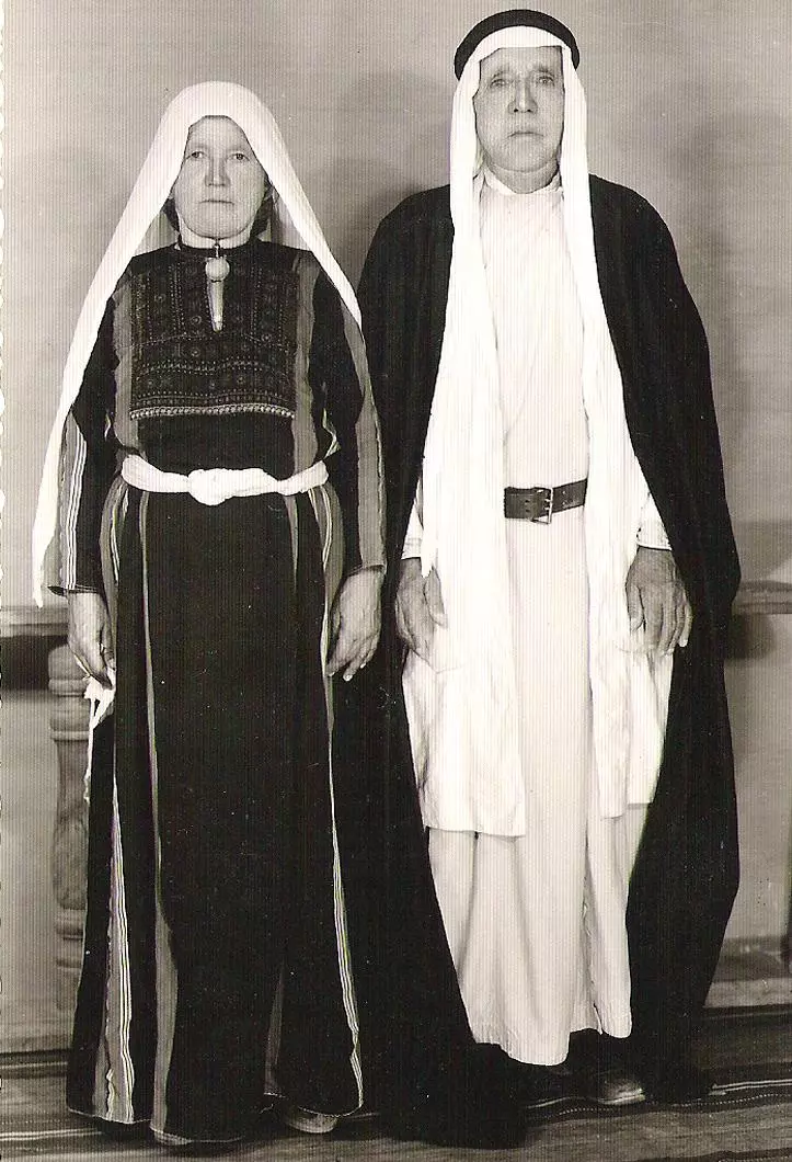
Posted by M. S. - المرحوم عبدالله جمعة عبدالرحمن والمرحومة زوجته تمام شحاده - من مواليد عبدس وهجرو الى غزة
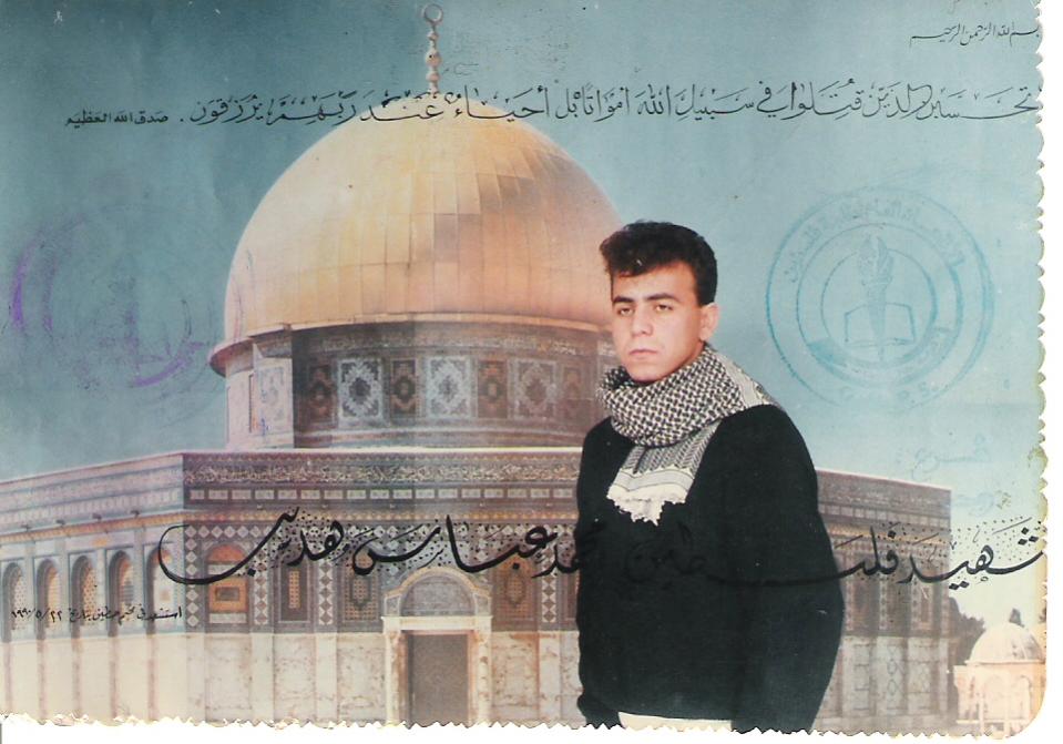
Posted by M. S. - الشهيد محمد عباس عبدالهادي -سقط الشهيد في 22/5/1990 برصاصات غادرة أثناء قيادته مسيرة غضب في مخيم حطين احتجاجا على الصمت العربي على مجزرة عيون قارة
Posted by M. S. - من عبدس : الشهيد البطل(محمد عيسى عبد الرحيم عبد الهادي ) ارتقى شهيدنا الغالي محمد يوم الأحد الموافق 16\3\2003 أثناء قيامه بإنقاذ ثلاثة شبان كانوا قد أصيبوا برصاص الاحتلال الاسرائيلى فأصابه الرصاص الغادر مما أدى إلى استشهاده على الفور
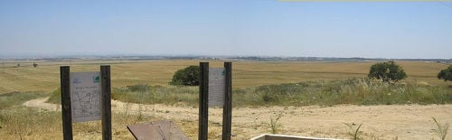
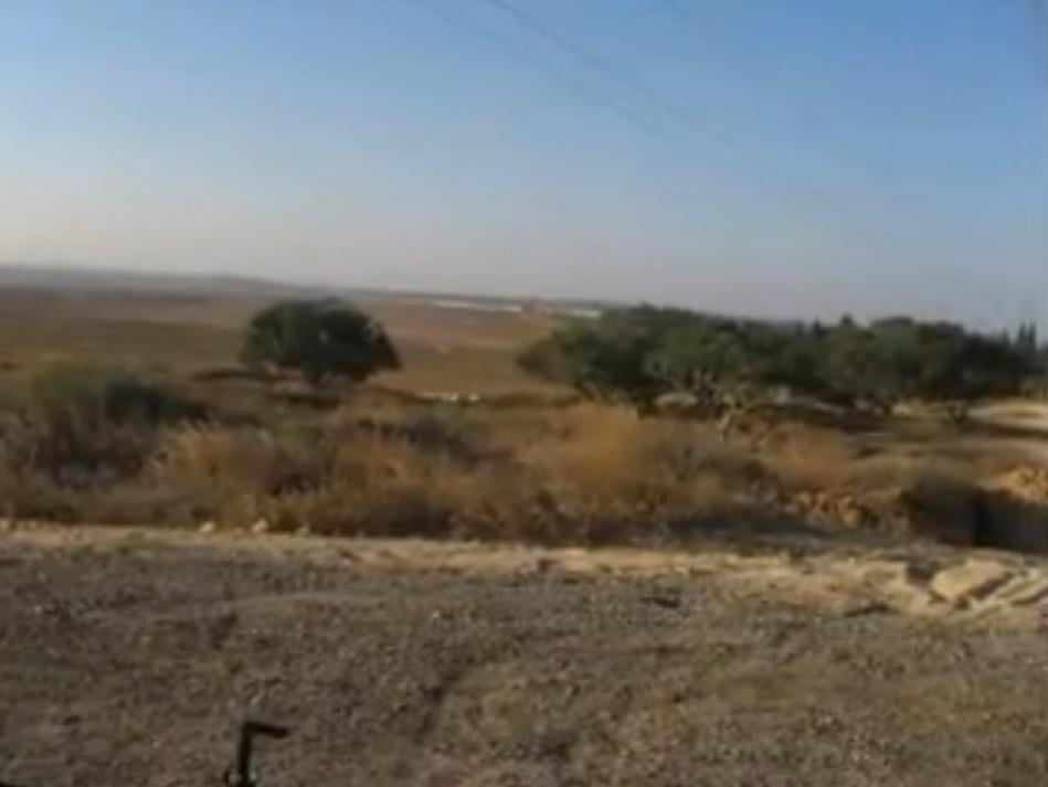
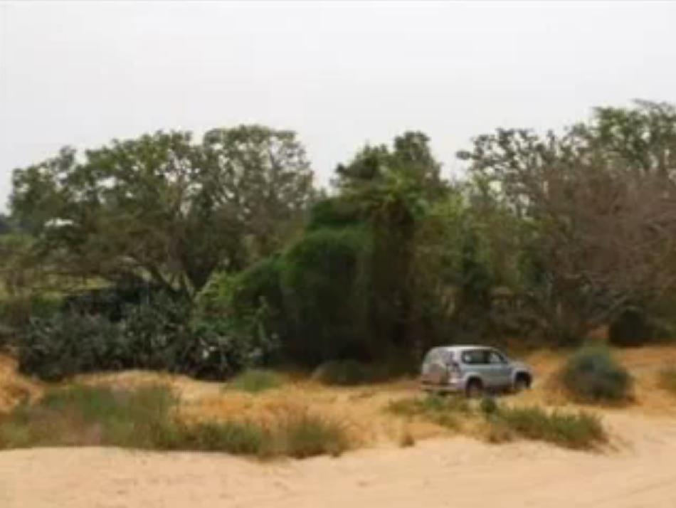
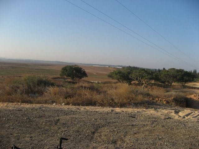
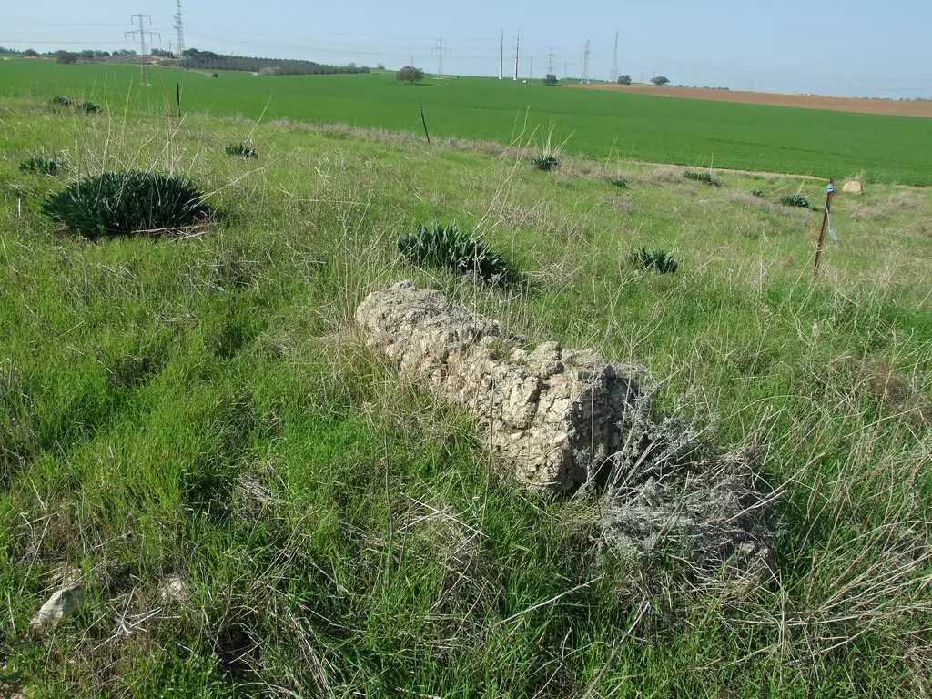
Posted by M. S. - A view of the hill on which the village stood
Posted by Uri Zackhem - Looking SW at the village hill
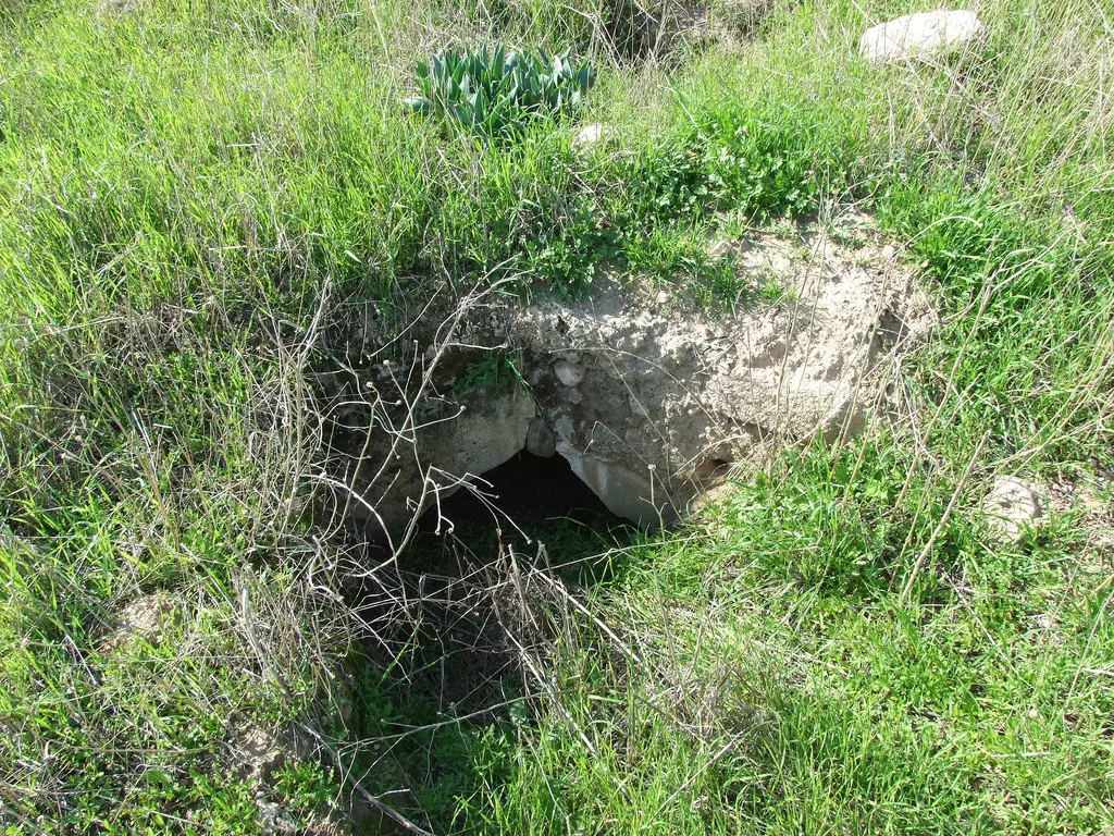
Posted by Uri Zackhem - Rubble
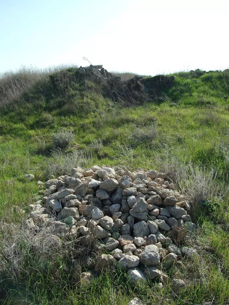
Posted by Uri Zackhem - Rubble
Posted by Uri Zackhem - A grave, northern end of the hill.
Posted by Uri Zackhem - Remains.
Posted by Uri Zackhem - A well? Irrigation pool?
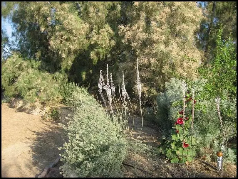
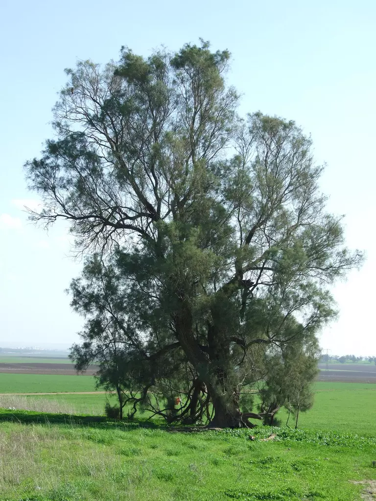
Posted by Uri Zackhem - A large tamarisk
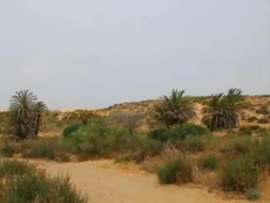
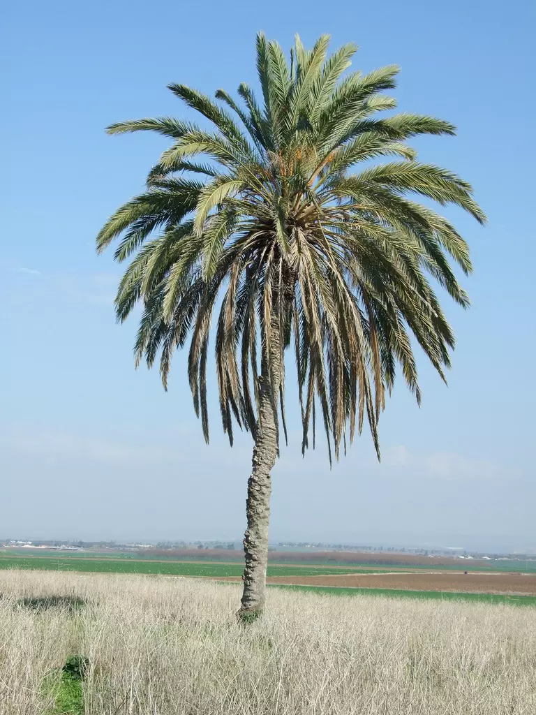
Posted by Uri Zackhem - A large palm
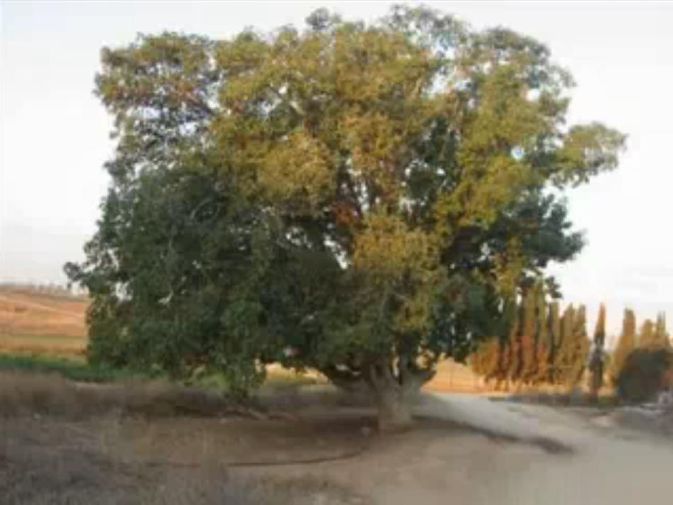
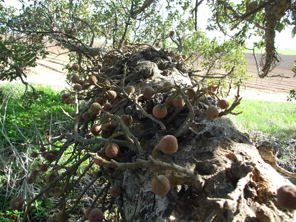
Posted by Uri Zackhem - A nice fruit bearing sycamore, near the village
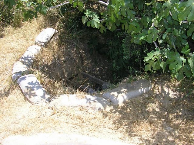
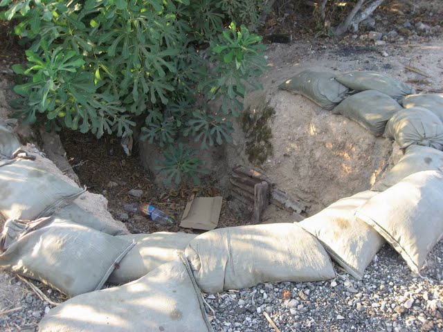
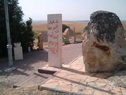
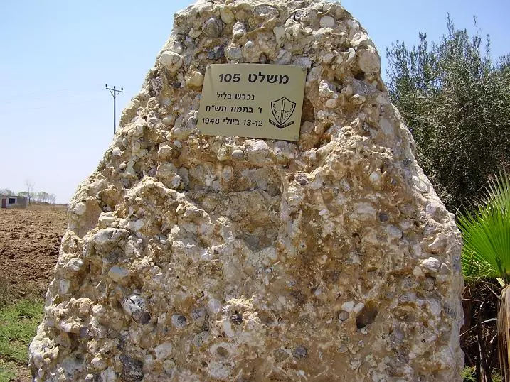
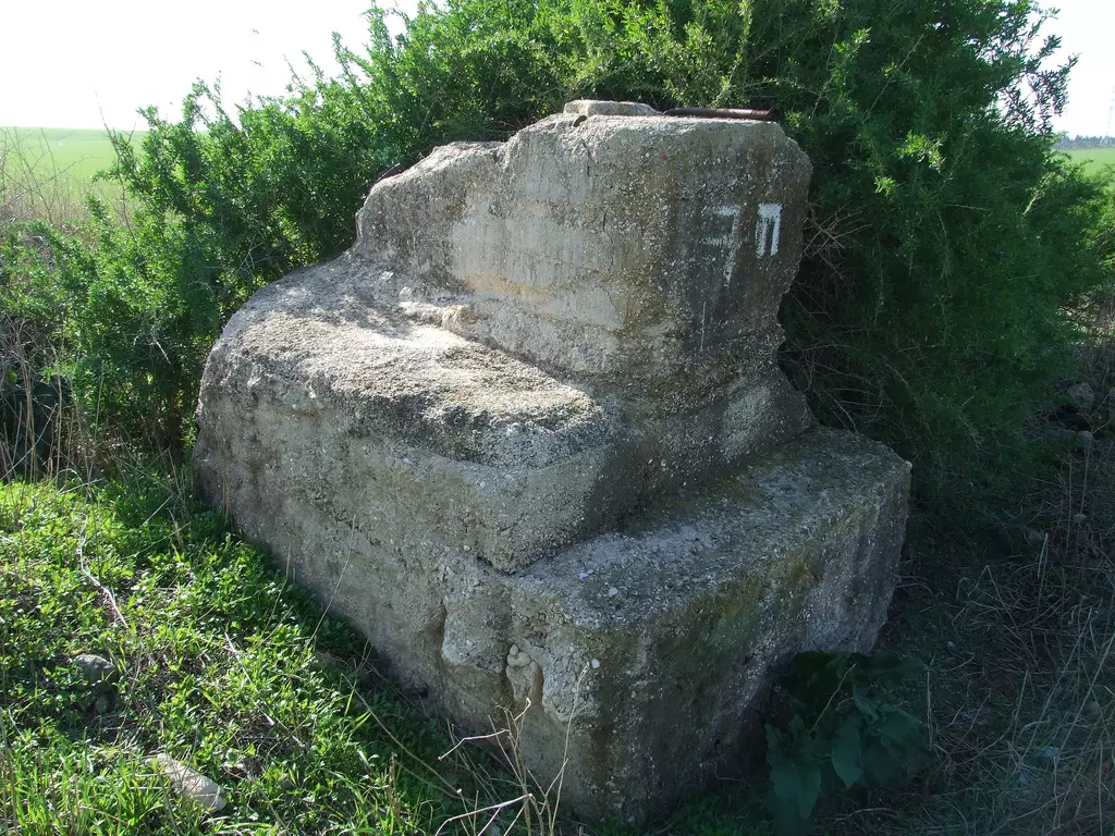
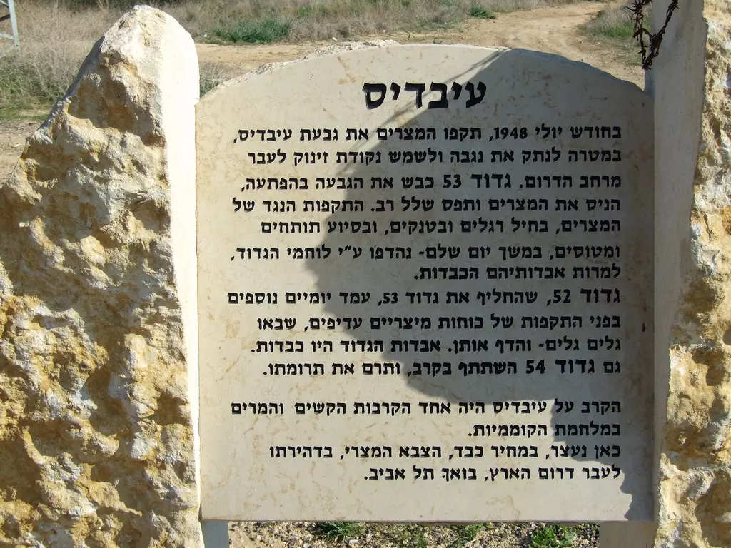
Posted by Uri Zackhem - Old Zionist fort & commemoration, west of the village
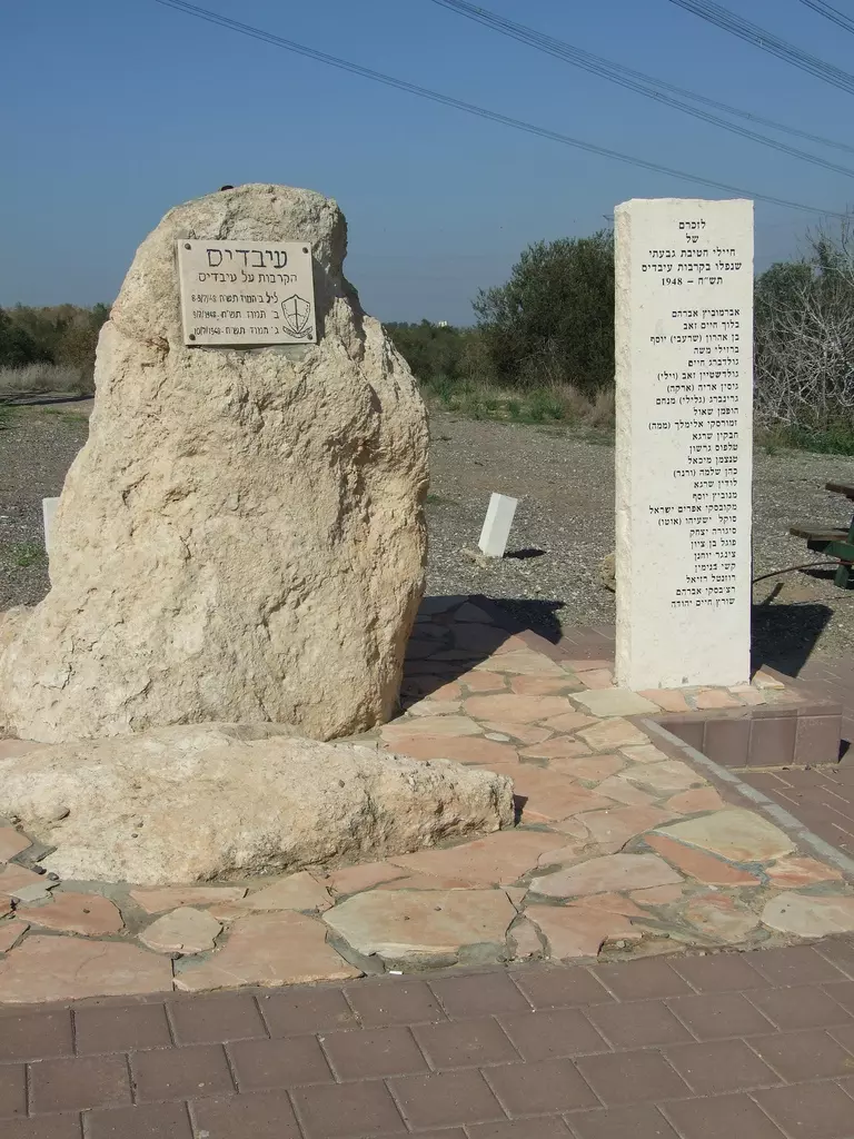
Posted by Uri Zackhem - Old Zionist fort & commemoration, west of the village
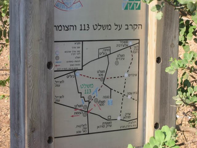
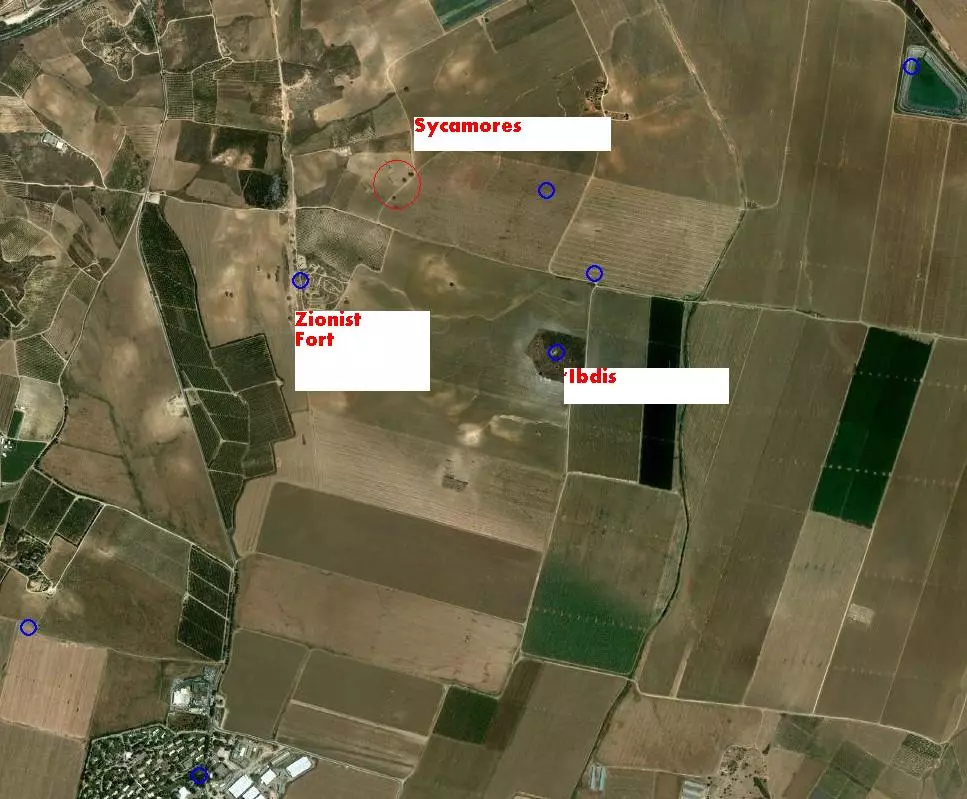
Posted by Uri Zackhem - Locations
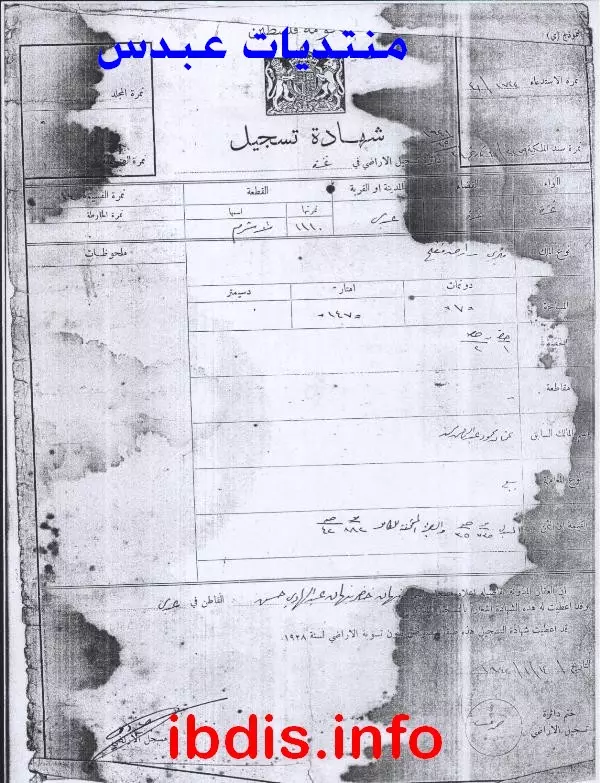
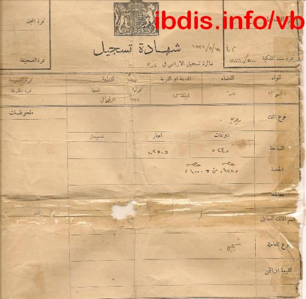
Posted by Uri Zackhem - مستندات طابو هامة/ من العم الحاج: أبو عاطف نبهان عبد الهادي
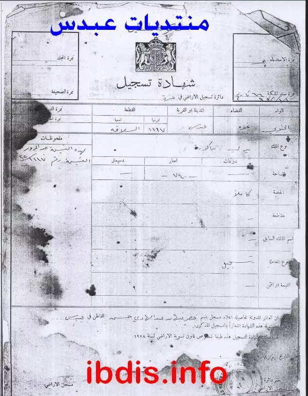
Posted by M. S. - مستندات طابو هامة/ من العم الحاج: أبو عاطف نبهان عبد الهادي
Posted by M. S. - مستندات طابو هامة/ من العم الحاج: أبو عاطف نبهان عبد الهادي
Posted by M. S. - مستندات طابو هامة/ من العم الحاج: أبو عاطف نبهان عبد الهادي
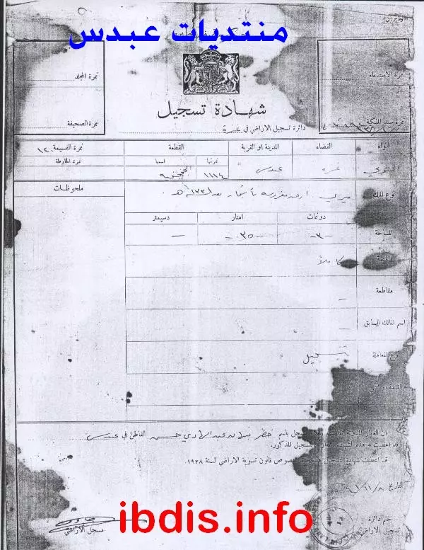
Posted by M. S. - مستندات طابو هامة/ من العم الحاج: أبو عاطف نبهان عبد الهادي
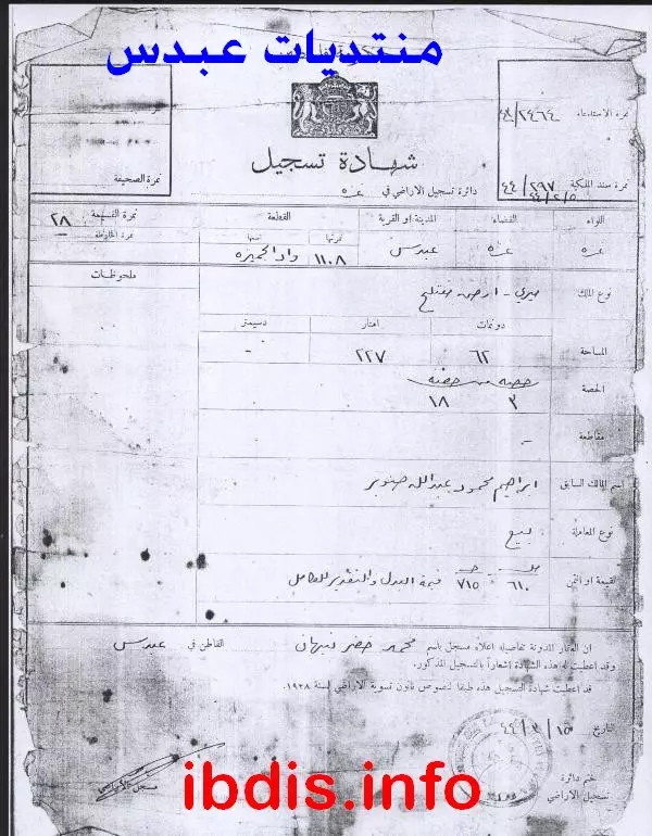
Posted by M. S. - مستندات طابو هامة/ من العم الحاج: أبو عاطف نبهان عبد الهادي
Posted by M. S. - مستندات طابو هامة/ من العم الحاج: أبو عاطف نبهان عبد الهادي
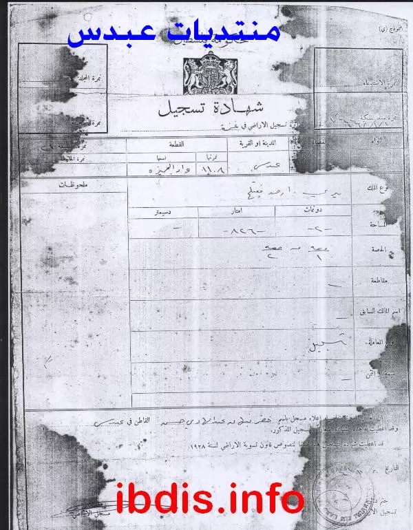
Posted by M. S. - مستندات طابو هامة/ من العم الحاج: أبو عاطف نبهان عبد الهادي
Posted by M. S. - مستندات طابو هامة/ من العم الحاج: أبو عاطف نبهان عبد الهادي
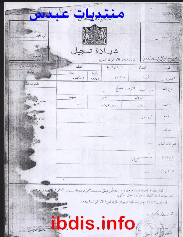
Posted by M. S. - مستندات طابو هامة/ من العم الحاج: أبو عاطف نبهان عبد الهادي
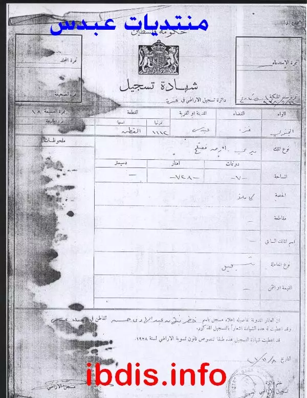
Posted by M. S. - مستندات طابو هامة/ من العم الحاج: أبو عاطف نبهان عبد الهادي
Posted by M. S. - مستندات طابو هامة/ من العم الحاج: أبو عاطف نبهان عبد الهادي
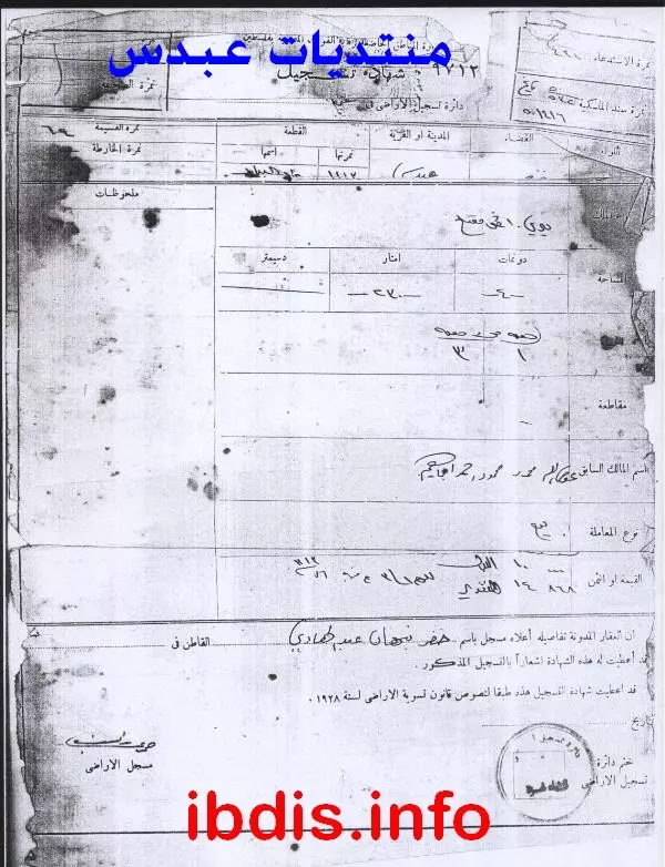
Posted by M. S. - مستندات طابو هامة/ من العم الحاج: أبو عاطف نبهان عبد الهادي
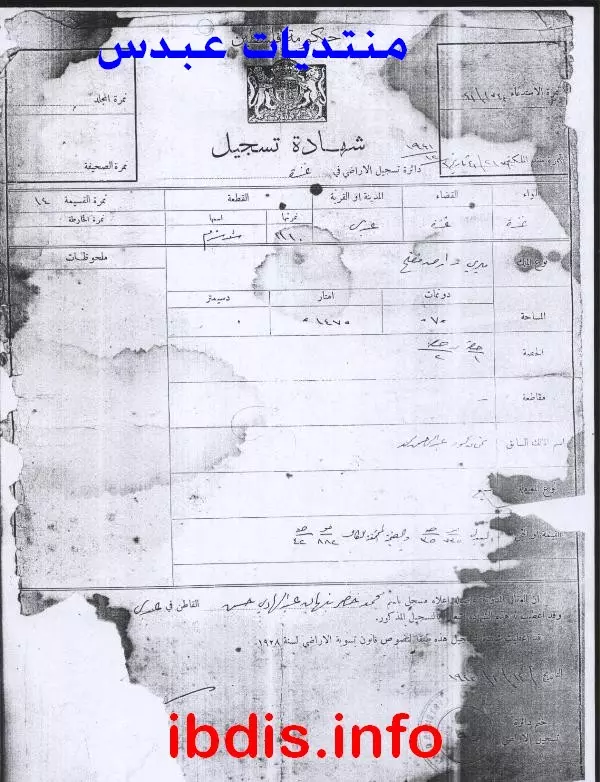
Posted by M. S. - مستندات طابو هامة/ من العم الحاج: أبو عاطف نبهان عبد الهادي
Posted by M. S. - مستندات طابو هامة/ من العم الحاج: أبو عاطف نبهان عبد الهادي
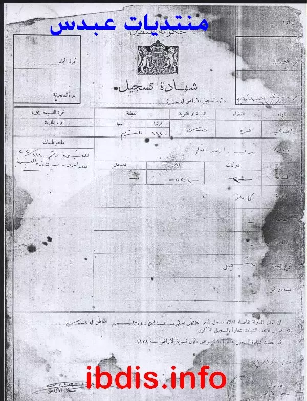
Posted by M. S. - مستندات طابو هامة/ من العم الحاج: أبو عاطف نبهان عبد الهادي
Posted by M. S. - مستندات طابو هامة/ من العم الحاج: أبو عاطف نبهان عبد الهادي
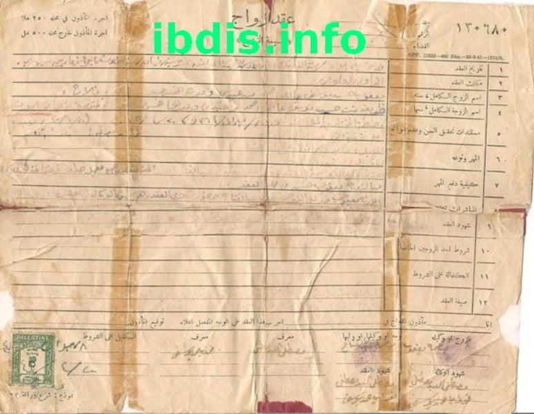
Posted by M. S. - عقد زواج تم في عبدس في 8 جمادى الاولى 1364 هجريه الموافق 20-4-1945 ميلاديه
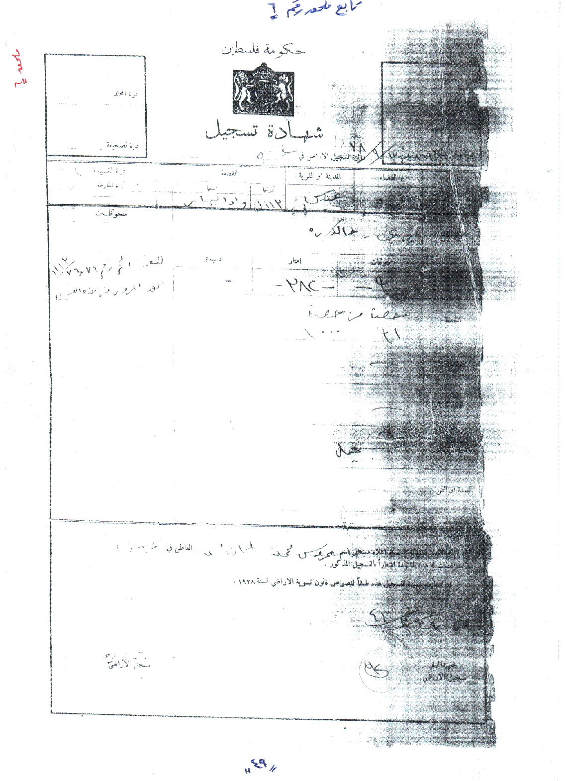
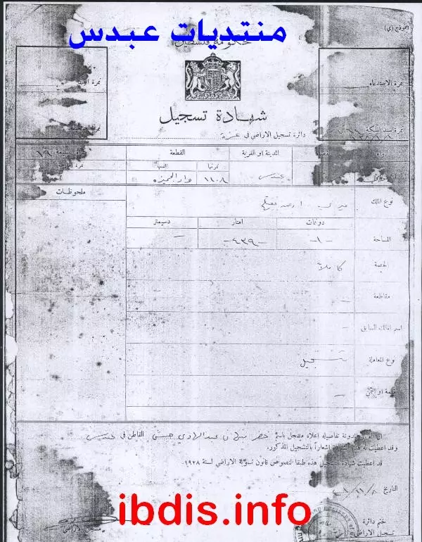
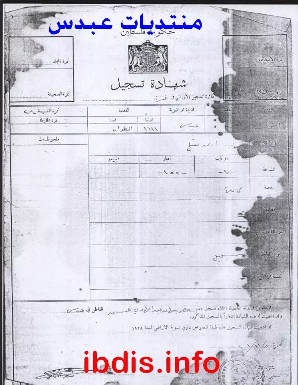
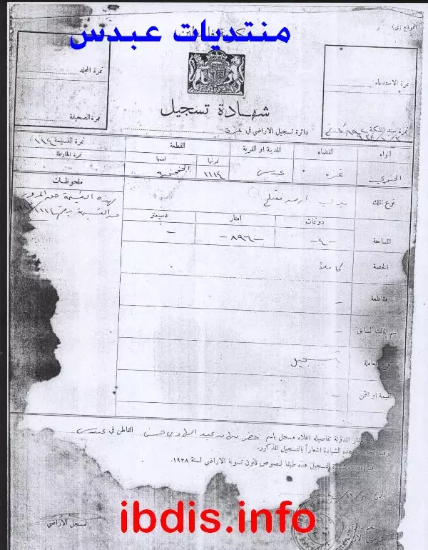
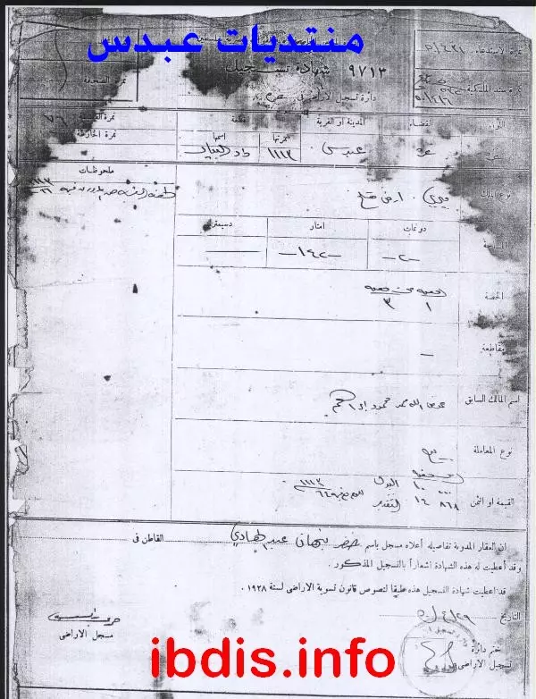
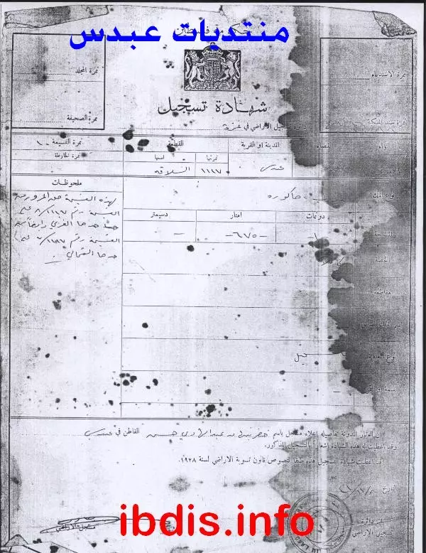
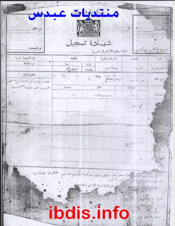
Posted by M. S. - شهادة تسجيل -الجزء السفلي منها تالف ومفقود - لقطعه من مارس الطوال ورقمه 1111 ومساحتها كما هو ظاهر 24 دونما وثلاثمايه وخمسون مترا وهي من النوع الميري .والشهاده ب 438 حصه من اصل 1000 حصه.
Posted by M. S. - الشهيد/ محمد جمال صبحي نبهان عبد الهادي -خان يونس ــــ الذي استشهد عندما أصابته رصاصات الغدر الصهيونية -نفية دكاليم غرب -خانيونس أثناء قيامة بقراءة الفاتحة على قبر صديقة الشهيد عبد الله صباح يوم 7/6/2004م

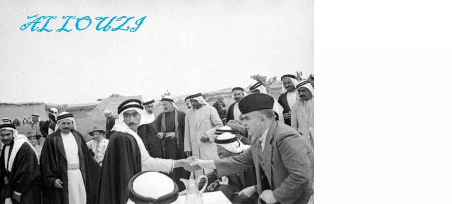
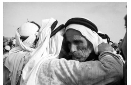
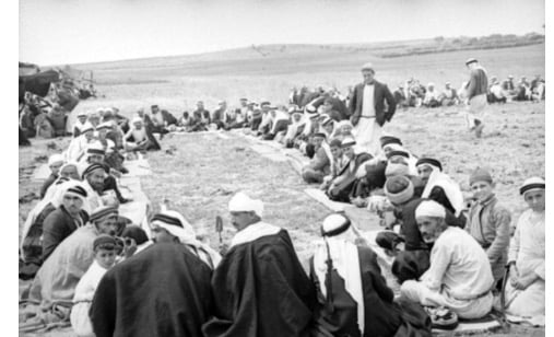
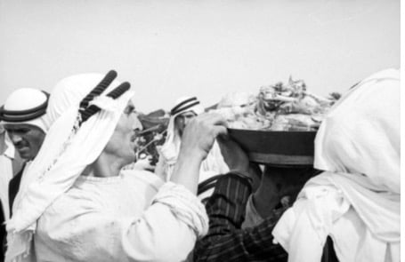
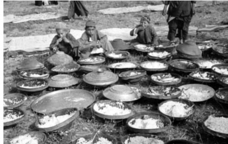
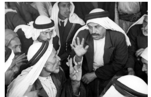
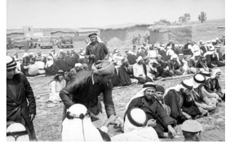
Posted by M. S. 1 - احتفال صلح في شهر ٥ من عام ١٩٤٠ في ابدس
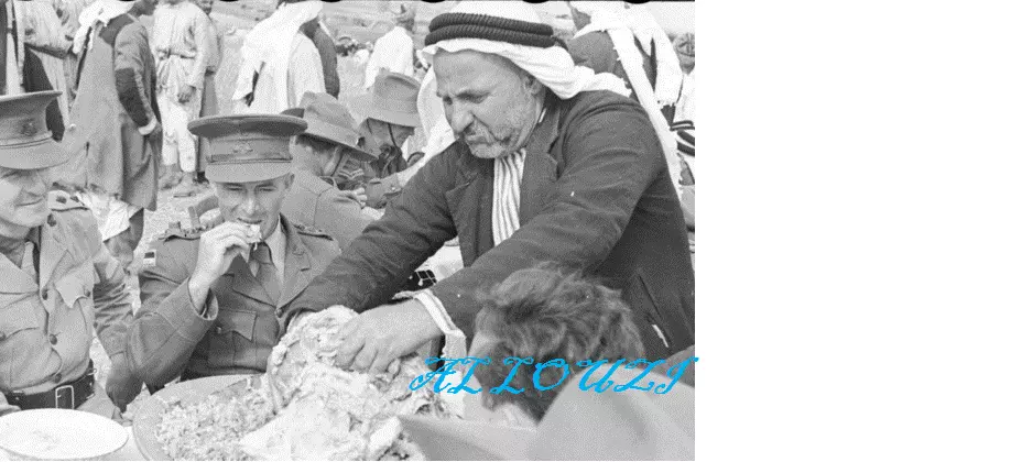
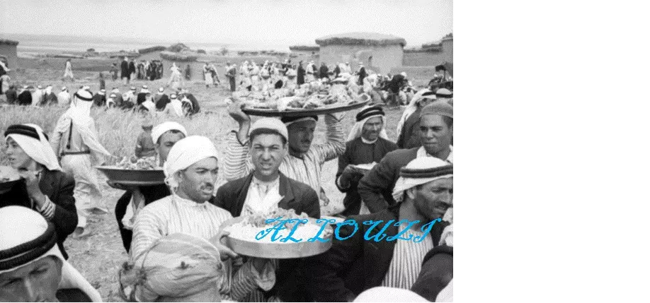
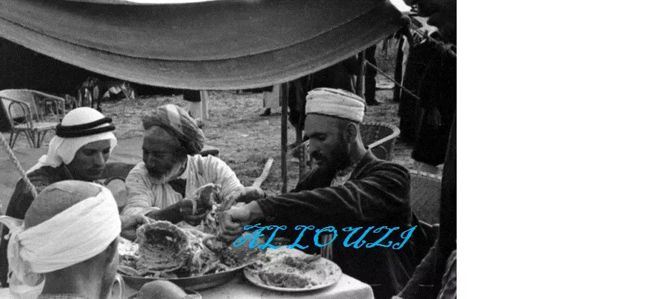
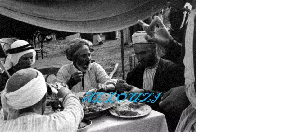
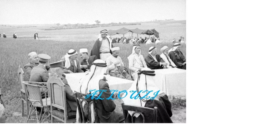
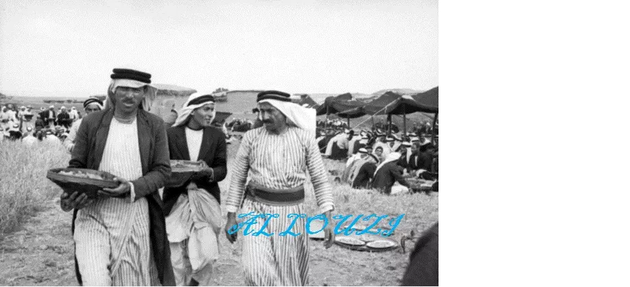
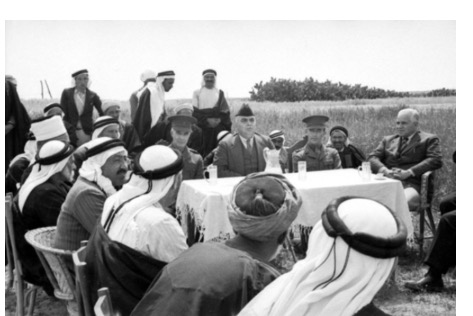
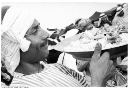
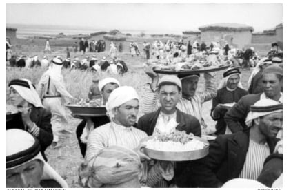
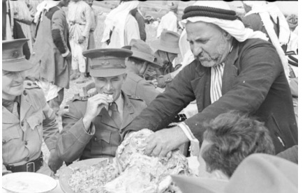
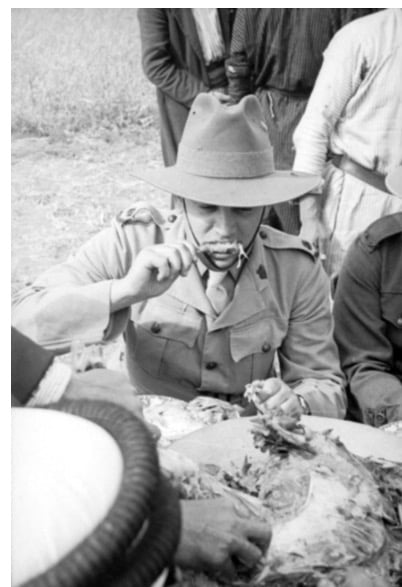
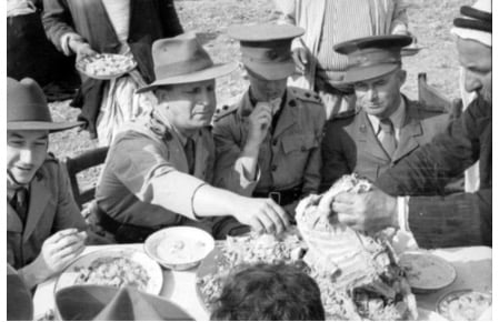
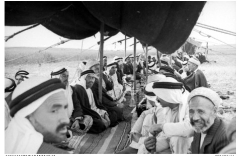
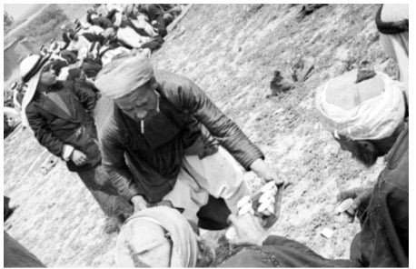
Posted by hussein abdo - اجتماع صلح لعشيرتين من عبدس عام 1940 بحضور عسكري استرالي تخلله احتفال غداء2
Posted by hussein abdo - اجتماع صلح لعشيرتين من عبدس عام 1940 بحضور عسكري استرالي تخلله احتفال غداء3
Posted by hussein abdo - اجتماع صلح لعشيرتين من عبدس عام 1940 بحضور عسكري استرالي تخلله احتفال غداء4
Posted by hussein abdo - اجتماع صلح لعشيرتين من عبدس عام 1940 بحضور عسكري استرالي تخلله احتفال غداء5
Posted by hussein abdo - اجتماع صلح لعشيرتين من عبدس عام 1940 بحضور عسكري استرالي تخلله احتفال غداء6
Posted by hussein abdo - اجتماع صلح لعشيرتين من عبدس عام 1940 بحضور عسكري استرالي تخلله احتفال غداء7
Posted by hussein abdo - اجتماع صلح لعشيرتين من عبدس عام 1940 بحضور عسكري استرالي تخلله احتفال غداء8
Posted by hussein abdo - اجتماع صلح لعشيرتين من عبدس عام 1940 بحضور عسكري استرالي تخلله احتفال غداء9
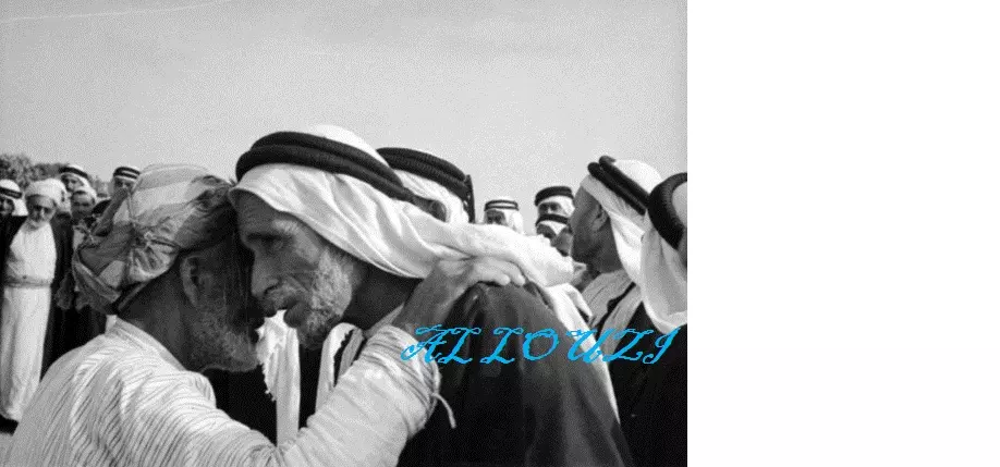
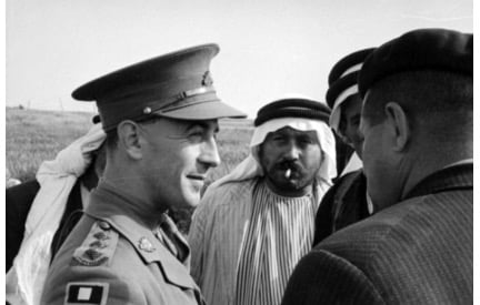
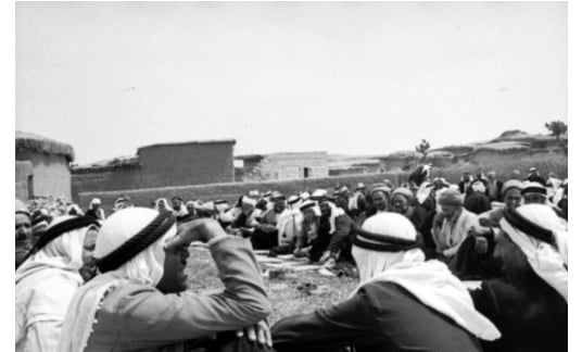
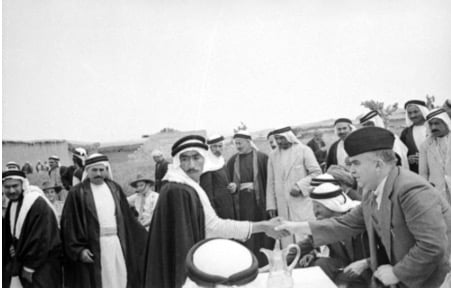
Posted by hussein abdo - عقد صلح في عبدس بحضور الضابط البريطاني سنه 1940
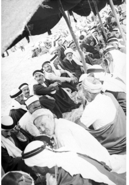
Posted by abu raya - صلح في عبدس سنه 1940
Posted by abu raya - صلح في عبدس سنه 1940
Posted by abu raya - صلح بين عشيرتين في عبدس سنه 1940
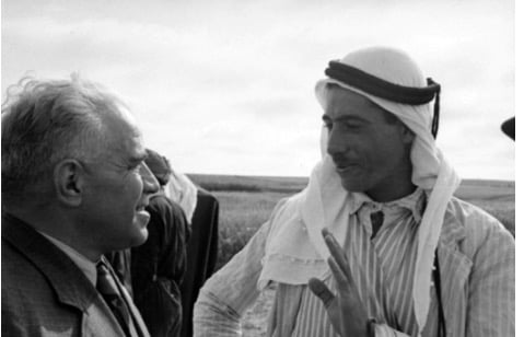
Posted by abu raya - صلح في عبدس بوجود الضابط البريطاني سنه 1940
Posted by abu raya - صلح في عبدس بحضور الضابط البريطاني سنه 1940
Posted by abu raya - صلح في عبدس سنه 1940
Posted by abu raya - صلح في عبدس سنه 1940
Posted by abu raya - صلح في قريه عبدس سنه 1940
Posted by abu raya - صلح في عبدس سنه 1940
Posted by abu raya - صلح في عبدس سنه 1940
Posted by abu raya - صلح في عبدس سنه 1940
Posted by abu raya - صلح في عبدس سنه 1940
Posted by abu raya - صلح في عبدس سنه 1940
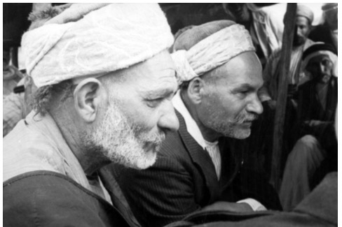
Posted by abu raya - صلح في عبدس سنه 1940
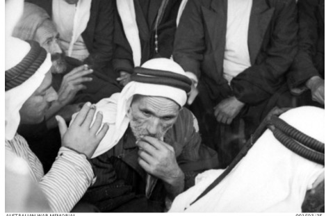
Posted by abu raya - صلح في عبدس سنه 1940
Posted by abu raya - صلح في عبدس سنه 1940
Posted by abu raya - صلح في عبدس سنه 1940
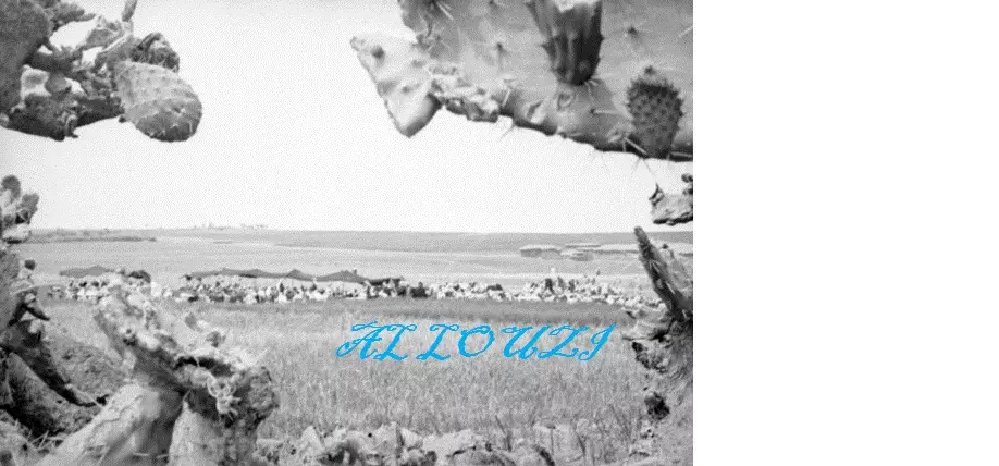
Posted by abu raya - قريه عبدس سنه 1940
Posted by abu raya - قريه عبدس ايارسنه 1940
Posted by abu raya - صلح في عبدس سنه 1940
Posted by abu raya
Want to browse more? 80,000 pictures were grouped in these gallaries:
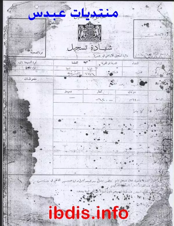
- ورقة طابو تثبت ملكية الأراضي. تابع 6
Posted by M. S. - ورقة طابو تثبت ملكية الأراضي. تابع ملحق 6
Posted by M. S. - مستندات طابو هامة/ من العم الحاج: أبو عاطف نبهان عبد الهادي
Posted by M. S. - مستندات طابو هامة/ من العم الحاج: أبو عاطف نبهان عبد الهادي
Posted by M. S. - مستندات طابو هامة/ من العم الحاج: أبو عاطف نبهان عبد الهادي
Posted by M. S. - مستندات طابو هامة/ من العم الحاج: أبو عاطف نبهان عبد الهادي
Posted by M. S. - مستندات طابو هامة/ من العم الحاج: أبو عاطف نبهان عبد الهادي
Posted by M. S. - مستندات طابو هامة/ من العم الحاج: أبو عاطف نبهان عبد الهادي
Posted by M. S. - مستندات طابو هامة/ من العم الحاج: أبو عاطف نبهان عبد الهادي
Posted by M. S. - مستندات طابو هامة/ من العم الحاج: أبو عاطف نبهان عبد الهادي
Posted by M. S. - مستندات طابو هامة/ من العم الحاج: أبو عاطف نبهان عبد الهادي
Posted by M. S. - مستندات طابو هامة/ من العم الحاج: أبو عاطف نبهان عبد الهادي
Posted by M. S. - مستندات طابو هامة/ من العم الحاج: أبو عاطف نبهان عبد الهادي
Posted by M. S. - مستندات طابو هامة/ من العم الحاج: أبو عاطف نبهان عبد الهادي
Posted by M. S. - مستندات طابو هامة/ من العم الحاج: أبو عاطف نبهان عبد الهادي
Posted by M. S. - مستندات طابو هامة/ من العم الحاج: أبو عاطف نبهان عبد الهادي
Posted by M. S. - مستندات طابو هامة/ من العم الحاج: أبو عاطف نبهان عبد الهادي
Posted by M. S. - مستندات طابو هامة/ من العم الحاج: أبو عاطف نبهان عبد الهادي
Posted by M. S. - مستندات طابو هامة/ من العم الحاج: أبو عاطف نبهان عبد الهادي
Posted by M. S. - شهادة تسجيل -الجزء السفلي منها تالف ومفقود - لقطعه من مارس الطوال ورقمه 1111 ومساحتها كما هو ظاهر 24 دونما وثلاثمايه وخمسون مترا وهي من النوع الميري .والشهاده ب 438 حصه من اصل 1000 حصه.
Posted by M. S.
| Display Name | Clan/Hamolah | Country of Residence |
| ماهر فتحي محمد عطالله احمد شحادة | شحادة | الرياض, السعودية |
| محمود صبري | - | الاردن, عمان |
| issam abu alreesh | Abu Alreesh | - |
| jehadahmad | أحمد | قطاع غزة, خانيونس-حي الامل |
| Abu Dana | Yousef | Dammam, السعوديه |
| احمد عبد الرحمن | عبد الرحمن | - |
| ابو زياد | عبد الهادى | خانيونس, عبدس |
| thaer hudep | - | - |
| amer yousef | yousef | amman |
| RANDA YOUSEF | yousef | - |
| eng.hazem ali aycob | - | amman -jordan |
| Hasan | Yousef | Palestine, Palestine |
| محمد سالم احمد | احمد | - |
| ماهر اسماعيل صافي | - | جده, السعوديه |
| M. S. | Shehadeh شحاده | - |
| عمرو شحادة | شحادة | - |
| العبادسة | أحمد | غزة, فلسطين |
| nidhal | ahmad | - |
| Mazen Shehadeh | - | - |
| رانية عبدالرحمن | عبدالرحمن | GAZA, PALESTINE |
| جمال حمدان | عبدالرحمن | المنطقة الشرقية, المملكة العربية السعودية |
| Dr-Abu El Reish | - | - |
| Yasser Shehada | shehada | Shubra El Khima, Cairo, Egypt |
| issam Abu Al Rish | - | - |
| M.R | - | Amman, Jordan |
 Fake Valor: Why Did Zionist Jews Hoist Nazis Flag on Their Ships in the 1930s?
What is new?
-
Facts About Oct. 7th Gaza Raid
-
Remined Us Please:: Who Did Rape Who? Palestinians Raped Israelis? Or, was the other way around?
-
When Prof. Edward Said was invited to debate Bibi Netanyahu in the 1980s, watch what happened!
-
Ezra Klein of the NY Times on the "Jewish Race".
-
Abusing Blood Libel!
-
Did Israeli Soldiers Activate The Hanniba Direective On Oct. 7th? You Be The Judge
-
Zionist FAQ: Isn't it true that Palestinians don't want peace? Palestinians never accepted the two-state solution
- Facts about Haavara (Transfer) Agreement between Ben-Gurion & Hitler
-
Haavara FAQs: Why Did Zionist Jews Hoist Nazis' Flags on Their Ships in the 1930s?
- Haavara FAQs: When Chaim Weizmann met FDR in mid-1943, why was he silent about rescuing European Jewry?
-
Dear ChatGPT: How did Palestinians resist Napoleon's invasion of their country in 1799?
-
Dear ChatGPT: Gaza had a vibrant Jewish community in the mid-17th century. What happened to them?
-
Dear ChatGPT: Why did the Jewish Agency suppress news of the Holocaust during WWII?
-
Video Playlist: Jews share their DNA tests to end the conflict for good.
-
A Tale of Two Conflicts: Examining the Definition of Genocide
-
Prof. Abraham Polak And The Suppressed History of the Khazars and European Jewry
-
How Ronald Reagan would have framed the genocide in Gaza if he were still alive?
-
Haavara FAQs: Let us do the math: how many German Jews did The Haavara Agreement save?
-
Zionist FAQs: The Hebron Massacre of 1929, "clearly proves" that Palestinians are antisemitic, how could you deny it?
-
Zionist FAQs: Why Anti-Zionist Is Not Antisemitism?
-
Zionist FAQs: Isn't it true that the KGB created Palestinian Nationalism in the early 1960s?
- Zionist FAQs: Muslims are killing Muslims all the time; why are Israeli Jews being singled out in the media?
- Zionist FAQs: How is Israel an apartheid state when 20% of its citizens are Arabs who enjoy full rights?
-
Haavara FAQs: Why Did Dorothy Thompson Flip From A Zionist Advocate to A Silenced Dissenter?
-
Haavara FAQs: Analysis of Herzl's Uganda Scheme and how it could have saved millions of Jews.
-
Haavara FAQs: Why did Hayim Greenberg describe American Jewry as "morally bankrupt" in early 1943?
-
Haavara FAQs: What if the Evian Conference was a resounding success? What would have been the impact of saving European Jewry on Zionism?
- Haavara FAQs: What if the six million were saved, how that would have impacted the Zionist project?
-
Haavara FAQs: How did Zionist leaders react when Europe's Jews lingered in the DP camps after WWII ended?
-
Why does the American Jewish community repeat lies that David Ben-Gurion had debunked before he died?
-
Who has the power to rename the Tatar/Khazar Gene Marker to Jewish IV?
-
Zionist FAQs: Why won't Egypt, Syria, and Jordan take their people back? Jews are indigenous to Palestine, and Arabs immigrated after Jews developed the country. Arabs should leave.
-
Haavara FAQs: Did Hitler and the Nazis conflate between Judaism and Zionist? If that wasn't case, then why?
-
Haavara FAQs: Winston Churchill and antisemitism, a collection of articles written Churchill.
-
Haavara FAQs: Broken by country, how many Jews survived vs. killed during the Holocaust?
-
Haavara FAQs: Why did European Jews vote with their feet and to immigrated to the Americas, not Palestine, after WWII?
-
Watch this American Jewish Girl describing Israeli Jews' cognitive dissonance like no other in under two minutes
-
Haavara FAQs: When the Nazis went out of their way to hide the Holocaust, Israeli Jews did the exact opposite by broadcasting their genocide of Gazans. But why?
-
Haavara FAQs: How Zionist Jews went out of their to show their appreciation to Nazism and Fascism?
- Haavara FAQs: Why Zionist leaders were against bombing the death camps & the Railroads leading to them?
-
Haavara FAQs: Hitler's message to the British and American people: If Jews are such noble citizens and you care about them, how come you're not letting them in? I will gladly ship them to you at my expense, even on luxury liners!
-
A shortlist of Zionist and Israeli false flag operations in the name Jews.
-
The Most Moral Army
- The Land of Kapos (Israel): Where the brave are boycotted and Kapos walk free.
- Why did early Zionists often named their communal enterprises "colonial"?
- Zionist Relations with Nazi Germany by Faris Glubb
-
Two NY Times advertisements by Zionists in the early 1943 that exposes Zionists' treason at the height of the calamity
- Facts Not Lies about the Palestinian-Israeli Conflict.
- Site's pictures have been categorized
- Campgain Against Lice
- A Survey of Palestine, the official source about Palestine before Nakba produced by the British Mandate; over 1200 pages.
- Satellite View & Google Earth: Over 6,000 placemarks identifying all destroyed towns, W. Bank & Gaza Strip Towns, & refugee camps.
- PalestineRemembered.com and its Nakba Oral History Project were featured on al-Jazeera Satellite TV.
- Nakba Oral History Video Podcast:
 Over 700 Oral History interviews (including 3,500+ hours of recording) can be viewed online.
 - Palestine Village Statistics Project
- Gaza Jail Break
- النسخة العربية للموقع الان متوفرة
- Videos: Documenting the destroyed villages in video: Tracing all that remains since Nakba.
- Videos: Responding to Zionist Propaganda
- Interview: The ethnic cleansing of Palestine: George Galloway interviews Israeli Historian Ilan Pappe.
- For Palestinians, memory matters. It provides a blueprint for their future By George Bisharat.
- Zionist FAQ now available in Hebrew שאלות שציונים שואלים, עכשיו בעברית
- Video: The Stephen Walt and John Mearsheimer report on the influence of the Israel Lobby on U.S. Foreign Policy
- The Palestinian-Israeli conflict for beginners
