| PalestineRemembered | About Us | Oral History | العربية | |
| Pictures | Zionist FAQs | Haavara | Maps | |
| Search |
| Camps |
| Districts |
| Acre |
| Baysan |
| Beersheba |
| Bethlehem |
| Gaza |
| Haifa |
| Hebron |
| Jaffa |
| Jericho |
| Jerusalem |
| Jinin |
| Nablus |
| Nazareth |
| Ramallah |
| al-Ramla |
| Safad |
| Tiberias |
| Tulkarm |
| Donate |
| Contact |
| Profile |
| Videos |
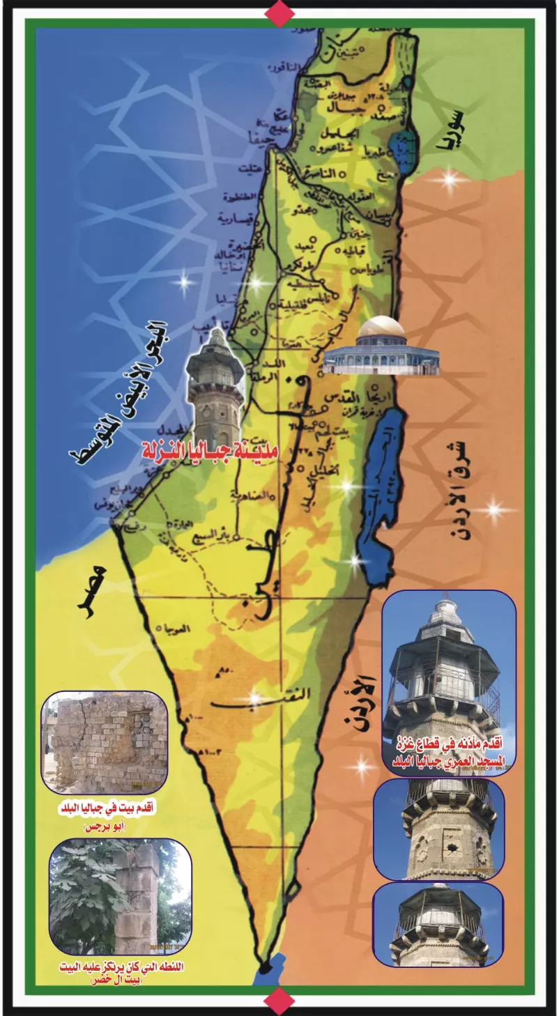
Welcome To Jabaliya - جباليا (ג'באליה)
|
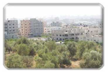
District of Gaza
|
العربية Google Earth |
 |
Gallery (118) |
- Statistics & Facts
-
Before & After

- Satellite View
- Articles 21
- Pictures 118
- Members 5
- Wikipedia
- Videos 8
- Guest Book 7
- Links 7
| Statistic & Fact | Value | ||||||||||||||
| Distance From District | 6 km north of Gaza | ||||||||||||||
| Before & After Nakba, Click Map For Details |
|||||||||||||||
|
|||||||||||||||
| Land Ownership |
**Town Lands' Demarcation Maps |
||||||||||||||
| Land Usage As of 1945 |
|
||||||||||||||
| Population |
|
||||||||||||||
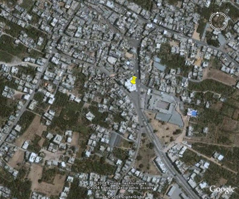
| Related Maps | Town Lands' Demarcation Maps خرائط للقضاء توضح حدود القرى والاودية View from satellite Town's map on MapQuest Help us map this town at WikiMapia |
||||||||||||||
| Related Links | Wikipedia's Page Facebook Page Google Search Google For Images Google For Videos في كتاب بلادنا فلسطين المزيد من موقع هوية |
||||||||||||||
- جباليا ارض البرتقال وشرارة الانتفاضة الاولى المباركة
- معلومات تاريخة قديمة حديثة لجباليا
- مدينة جباليا الموقع والتسمية
- التفاصيل الدقيقة لانطلاق شرارة الانتفاضة الفلسطينية الاولى 1987م
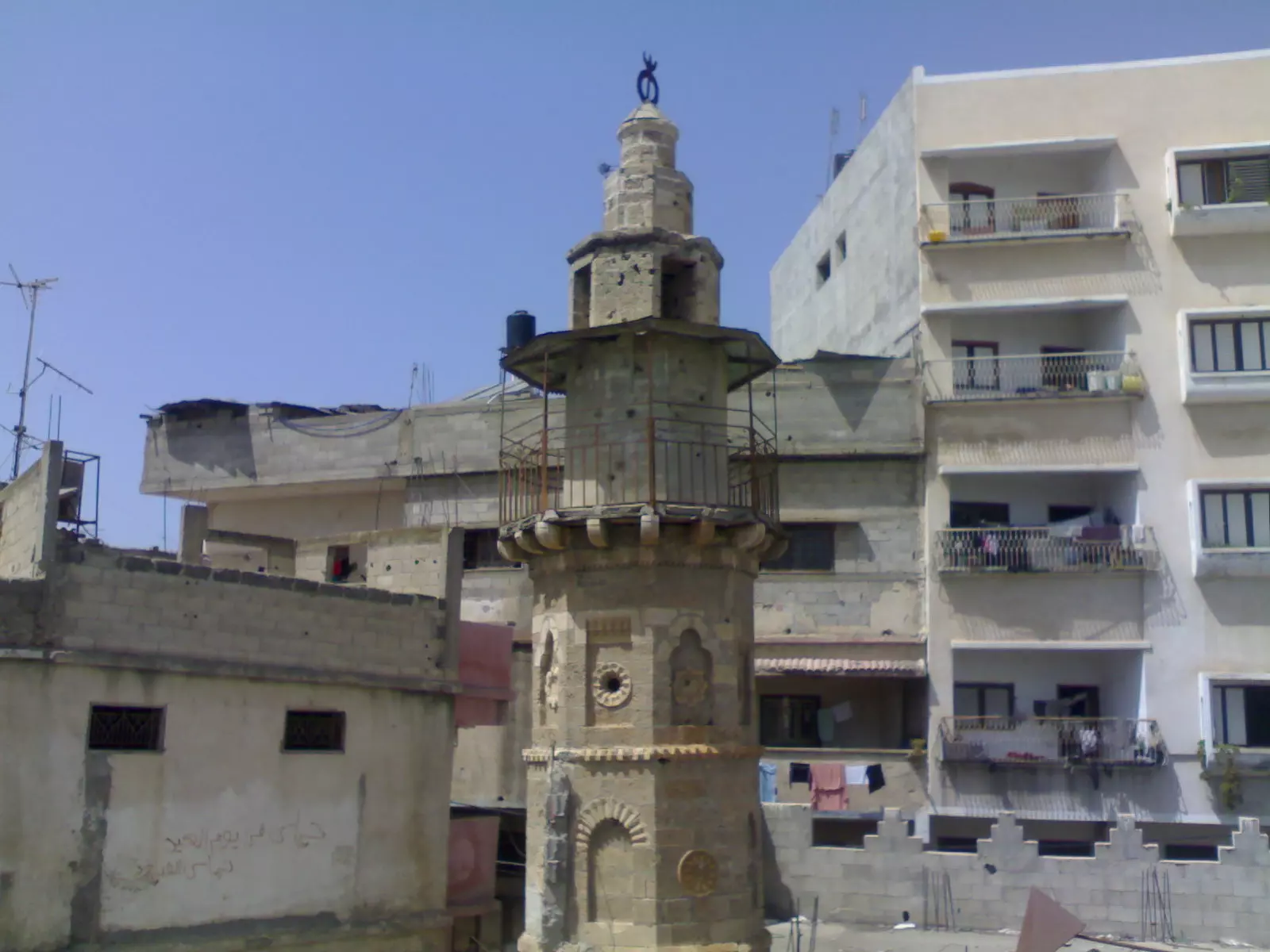
- معلومات عن المسجد العمري الكبير بمدينة جباليا البلد
- قصيدة في وصف جباليا
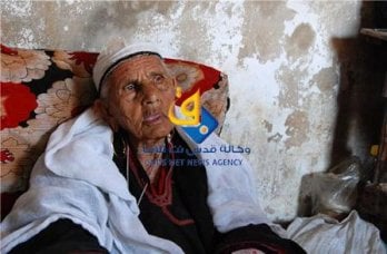
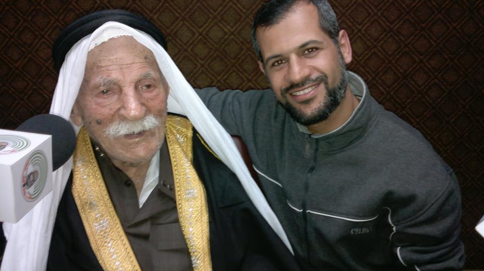
- أكبر معمر بفلسطين: كان ثائرا.. وأكل الزيت والزعتر.. وتزوج مرة واحدة
- جباليا مفجرة الانتفاضة في سطور
- قصيدة(حكاية ياسمينا ) بقلم أمل أحمد الرشايدة
- المسجد العمري أقدم مسجد بالشمال .. تاريخ عريق أزعج "إسرائيل"
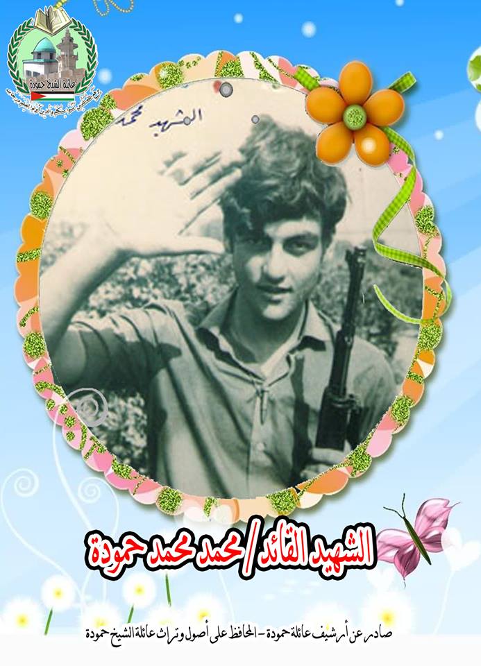
- في الذاكرة الشهيد القائد / محمد محمد حمودة
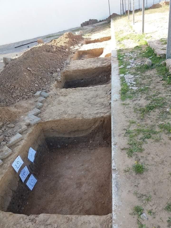
- المقبرة الرومانية شرق مدينة جباليا
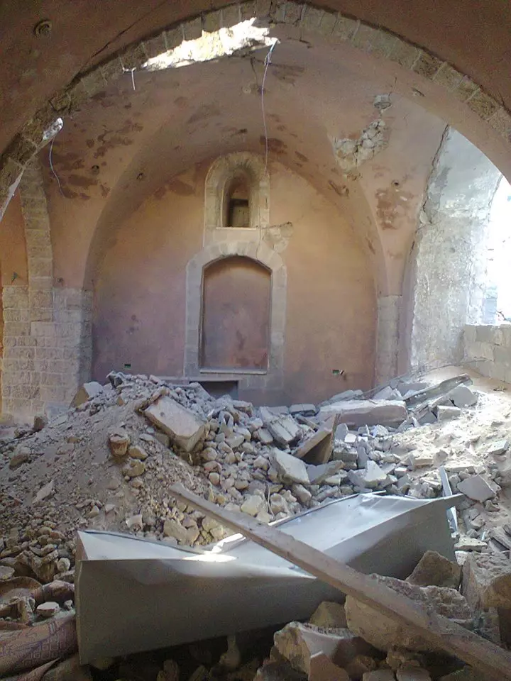
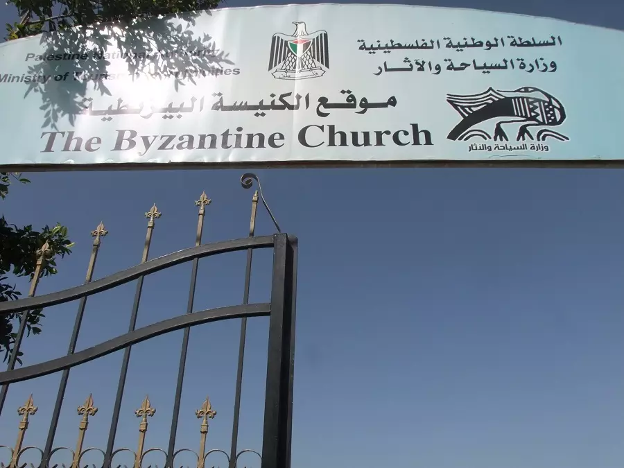
- الكنيسة البيزنطية شرق مدينة جباليا
- الشهيدة فاطمة جمعة النجار أول جدة استشهادية تفجر نفسها وسط جنود صهاينة#جباليا
- أسماء عائلات مدينة جباليا _البلد- شمال غزة
- وفاة أكبر معمر في فلسطين الحاج رجب التوم ... عمره 127 عام وله 300 حفيد وعاصر خمس حكومات على فلسطين
- ***صولة الأيام*** كلمات الشاعر الأستاذ/ خالد ابو الحسنى المشهور فنياً-خالد جودة-
- رثاء الطالب الشهيد علي أحمد شاهين كلمات الدكتور/ عاطف القانوع
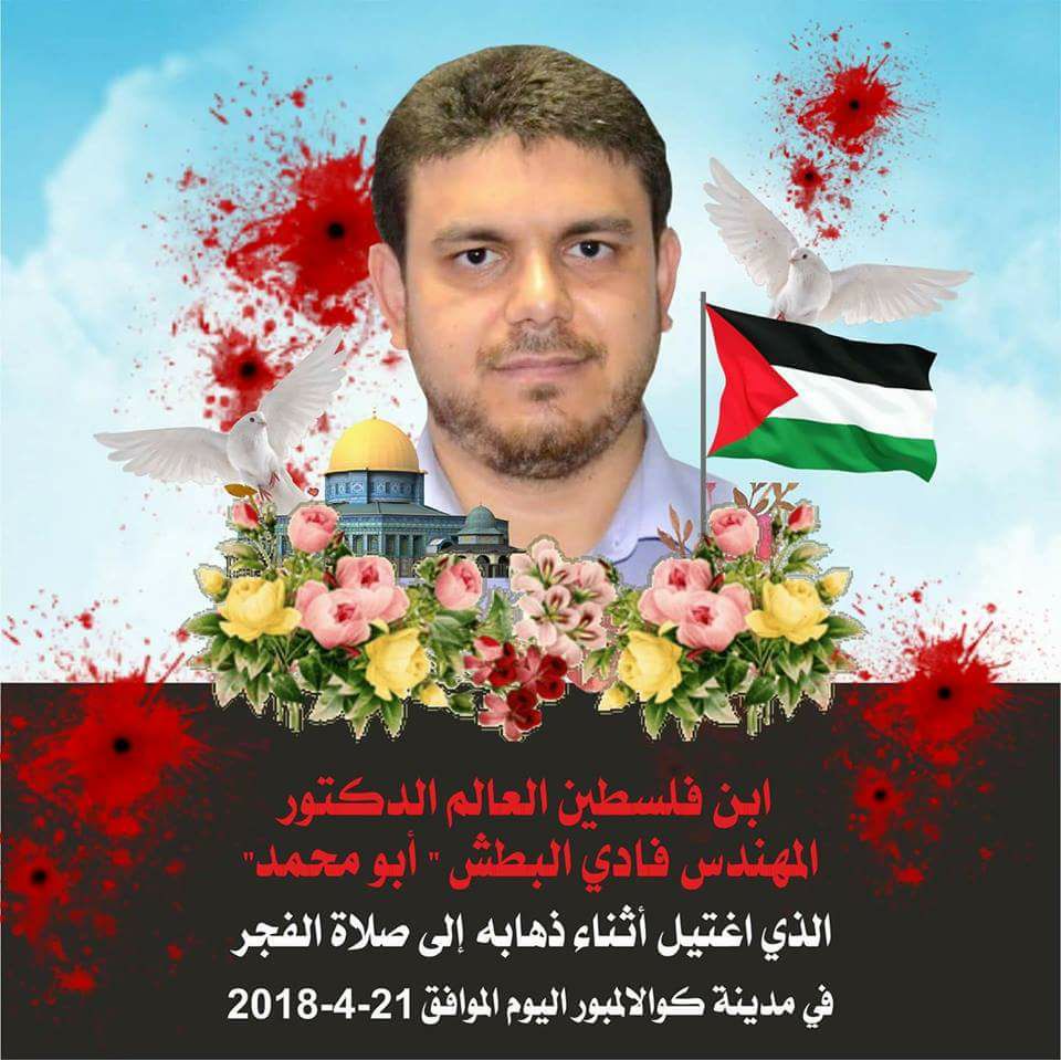
- سيرة وأسباب إغتيال الموساد الصهيوني للدكتور المهندس فادي البطش من سكان مدينة جباليا
- بقلم زوجة الشهيد العالم فادي محمد البطش إبن مدينة جباليا شمال غزة
- مدينة جبا ليا شعلة الانتفاضة الأولى ومهد وحاضنة رجال المقاومة 8/12/1987م
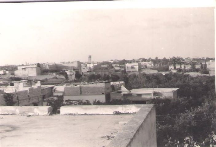
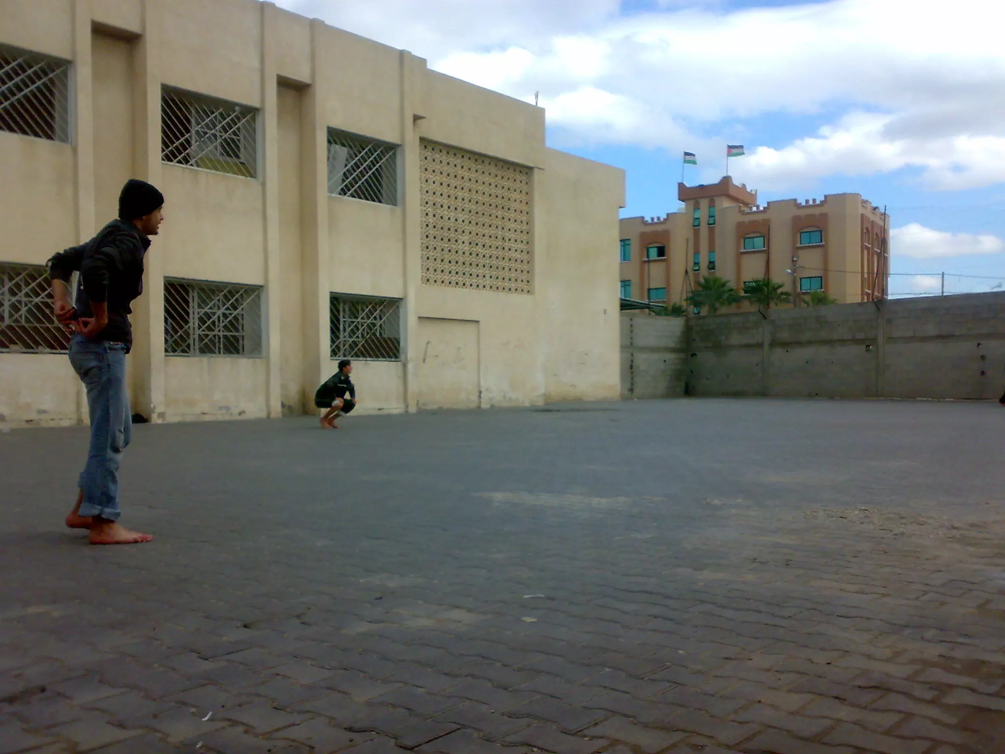
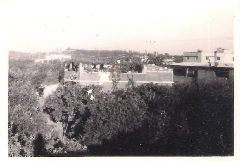
- هذه الصورة الى مدينة جباليا من على سطح مدرسة جباليا الأعدادية ويظهر فيها خزان المياه ( الحاووز)بالقرب من مستوصف الرعاية منطقة سرارى
Posted by ابو احمد - صور لمسجد مدينة جباليا(العمري)
Posted by ابو احمد - صورة لبساتين مدينة جباليا
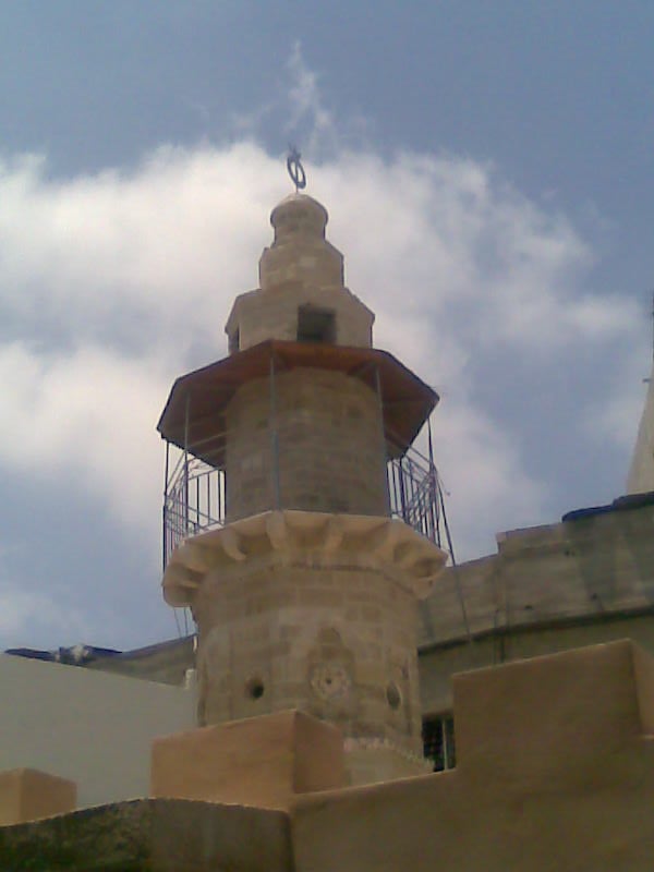
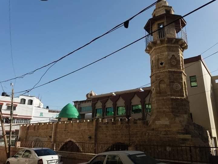
Posted by ابو احمد - مأذنة المسجد العمري بجباليا الاثرية
Posted by ابو احمد 1 - صورة لبساتين مدينة جباليا
Posted by ابو احمد - صورة اثرية لاول مدرسة للاميين قبل عام 1919 في مدينة جباليا
Posted by ابو احمد - خريطة فلسطين عليها أثار من جباليا البلد
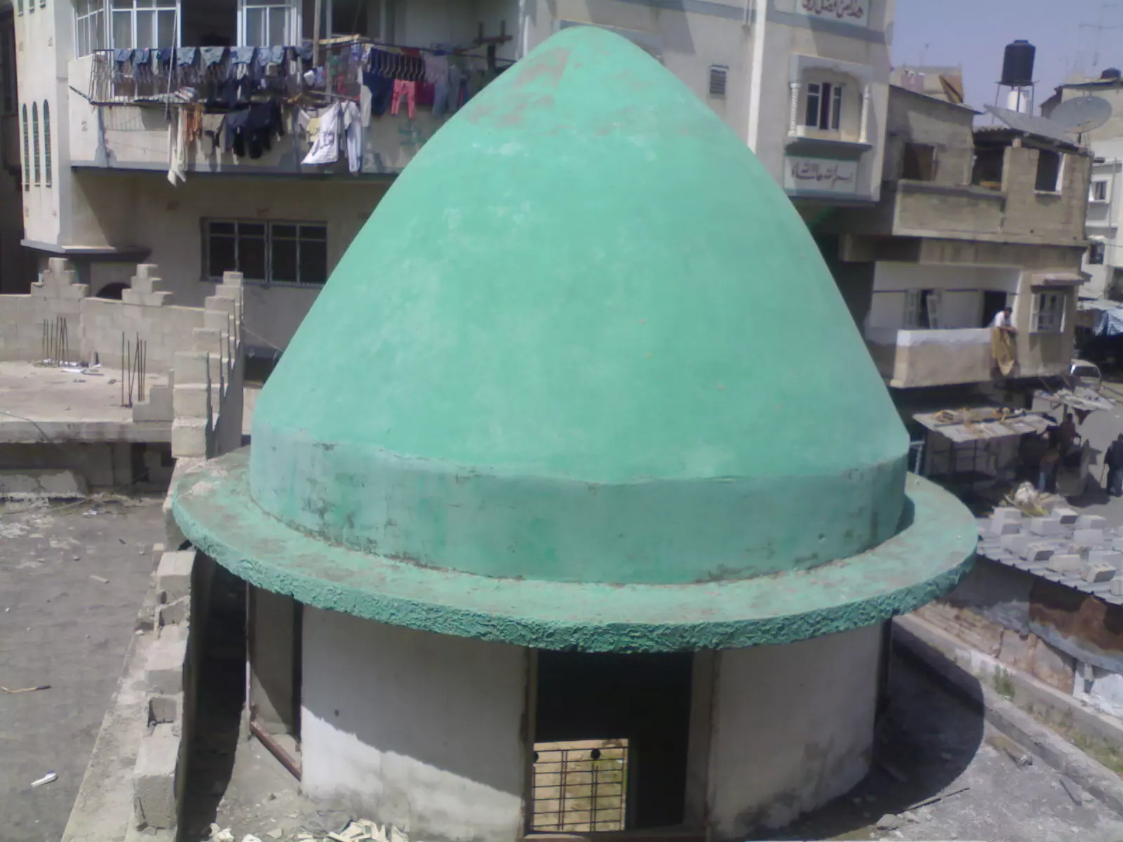
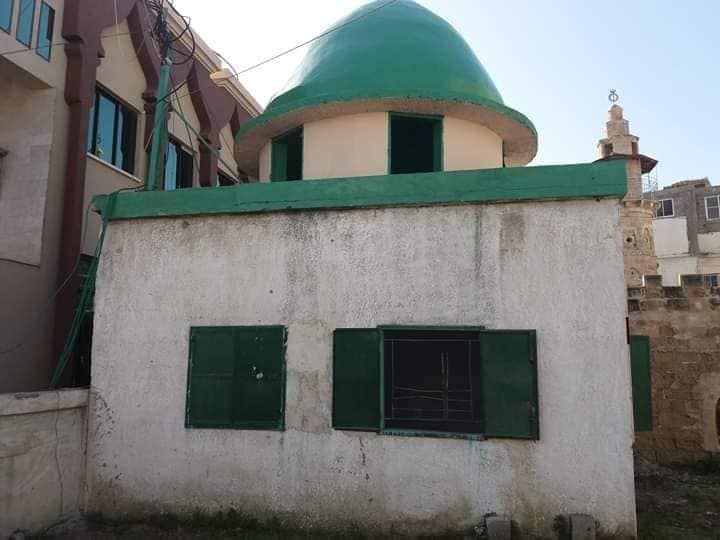
Posted by ابو احمد 3 - القبة الخضراء للمسجد العمري بجباليا الاثرية
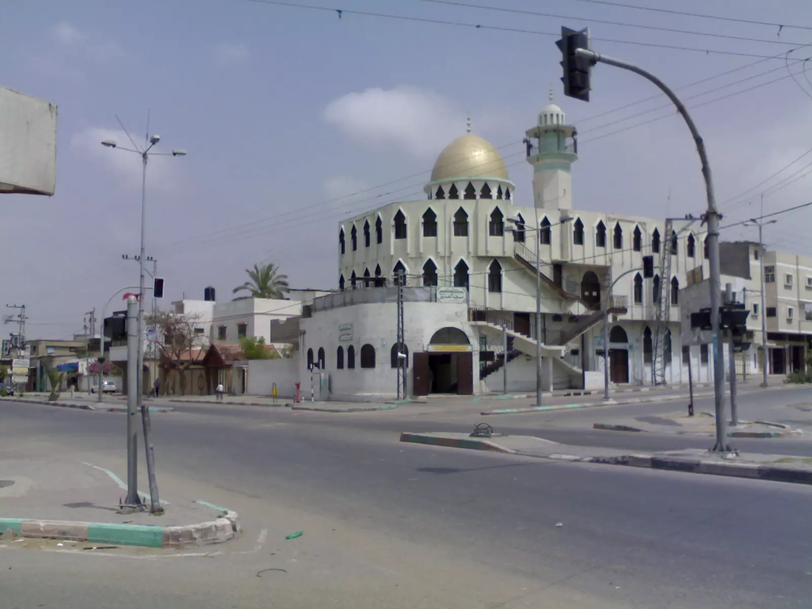
Posted by ابو احمد - المسجد العمري وسط مدينة جباليا صورة عبر القمر الصناعي
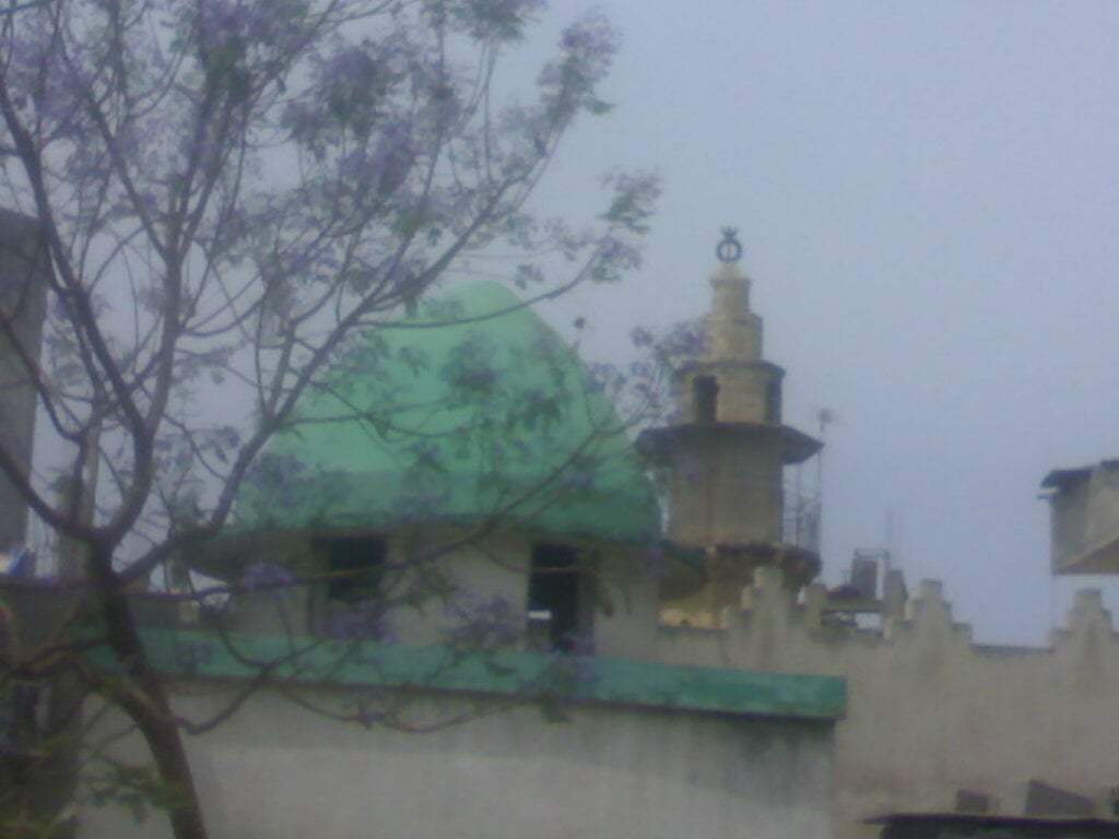
Posted by ابو احمد 1 - صورة للقبة الخضراء والمأذنة الاثرية في جباليا
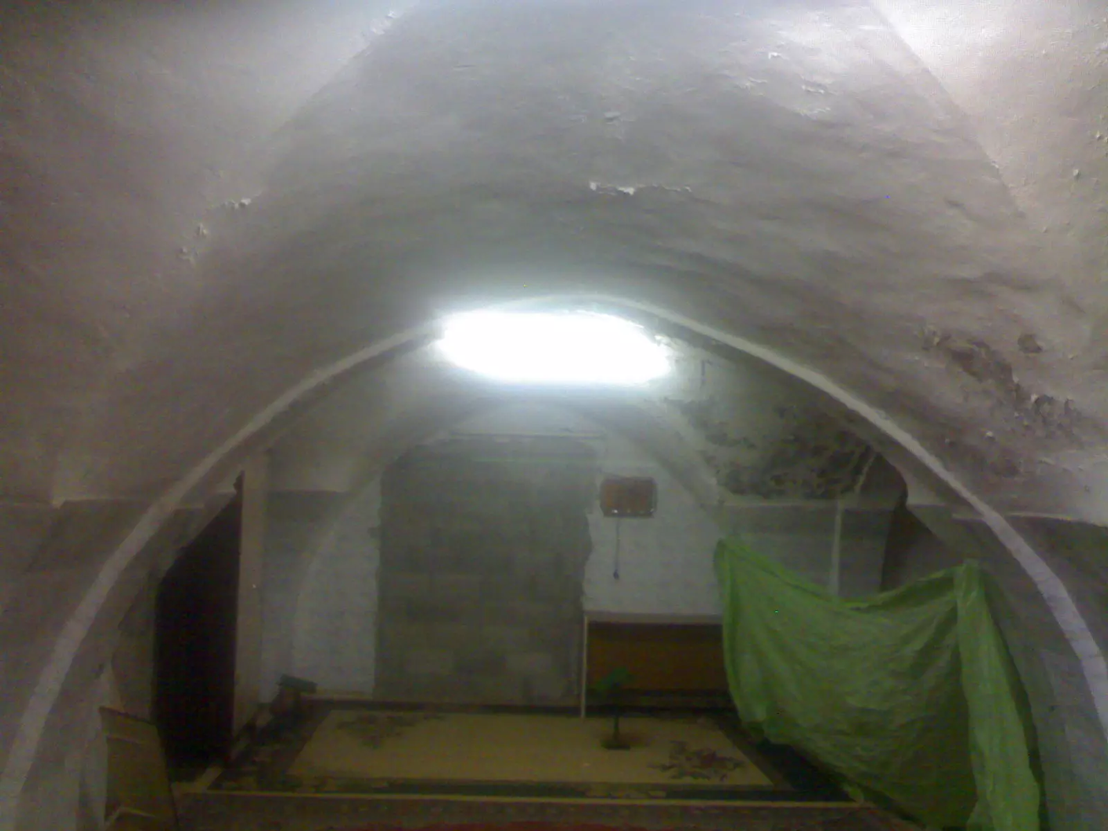
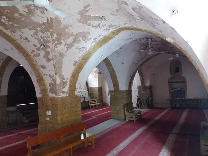
Posted by ابو احمد - صورة للمسجد العمري من الداخل
Posted by ابو احمد - صورة لمركز تحفيظ القران الكريم داخل المسجد العمري
Posted by ابو احمد - صورة لمدرسة الاميين الاثرية من الخارج في جباليا
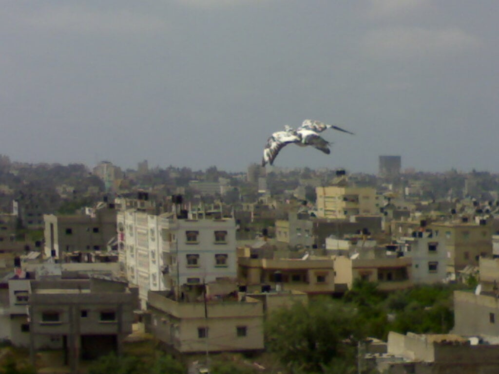
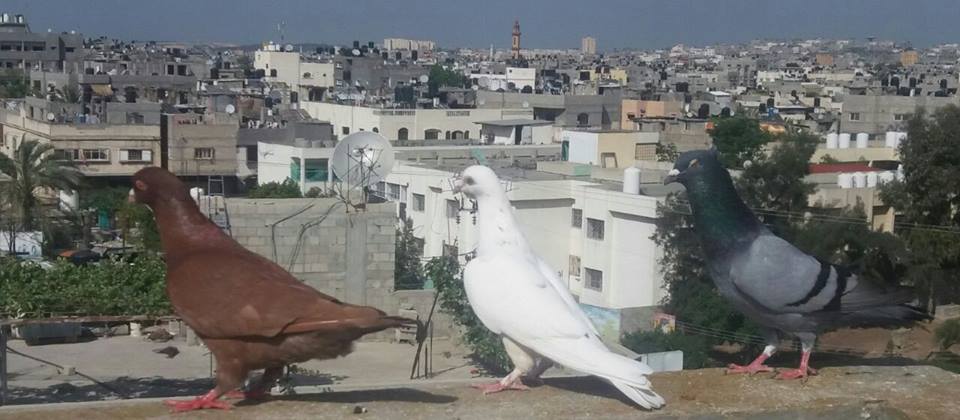
Posted by ابو احمد - صورة لحمامة تحلق في سماء جباليا
Posted by ابو احمد 1 - صورة لمفترق الصديق (القرم) شرق جباليا
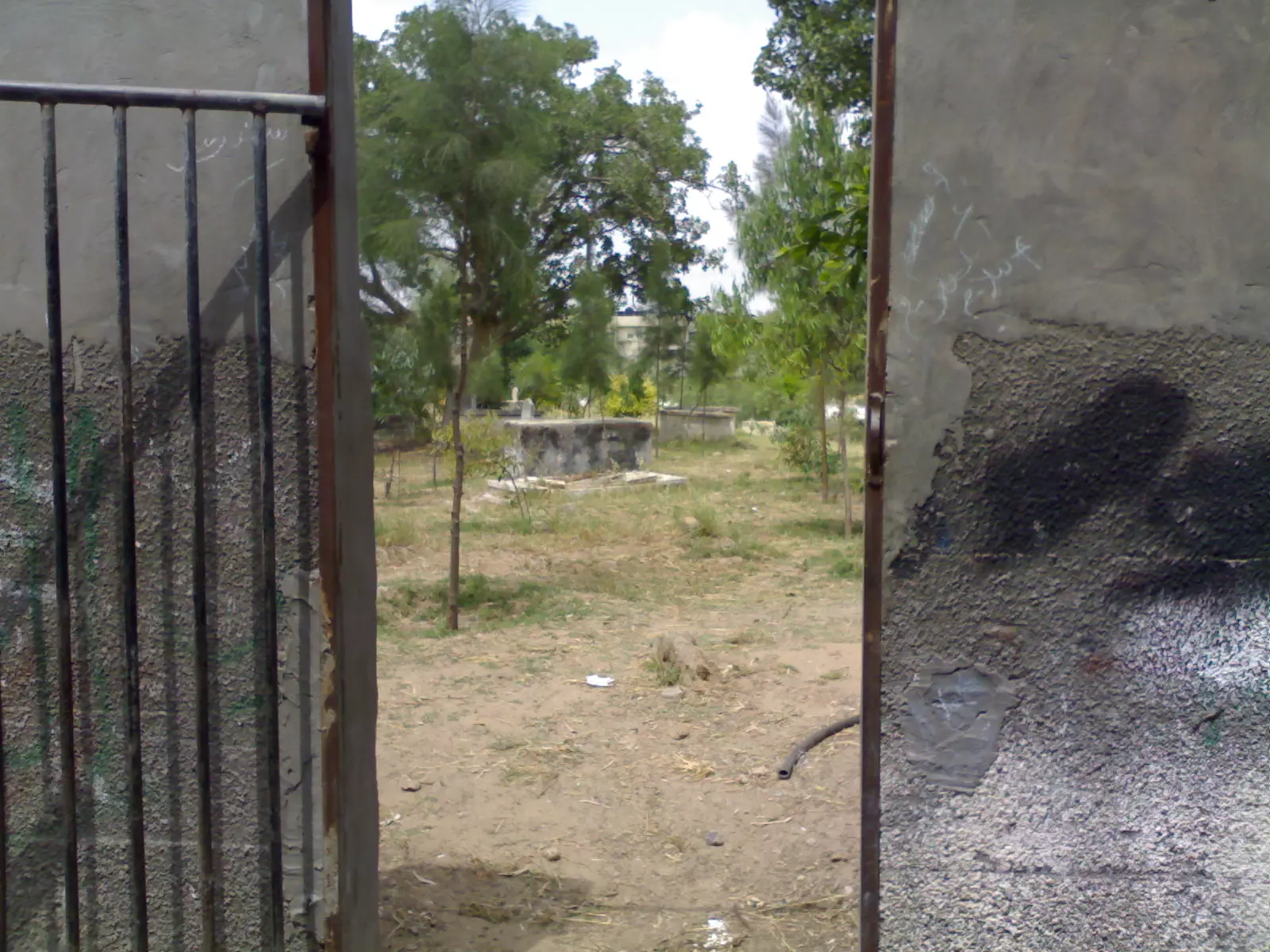
Posted by ابو احمد 1 - صورة لمقبرة جباليا القديمة وسط جباليا لبلد
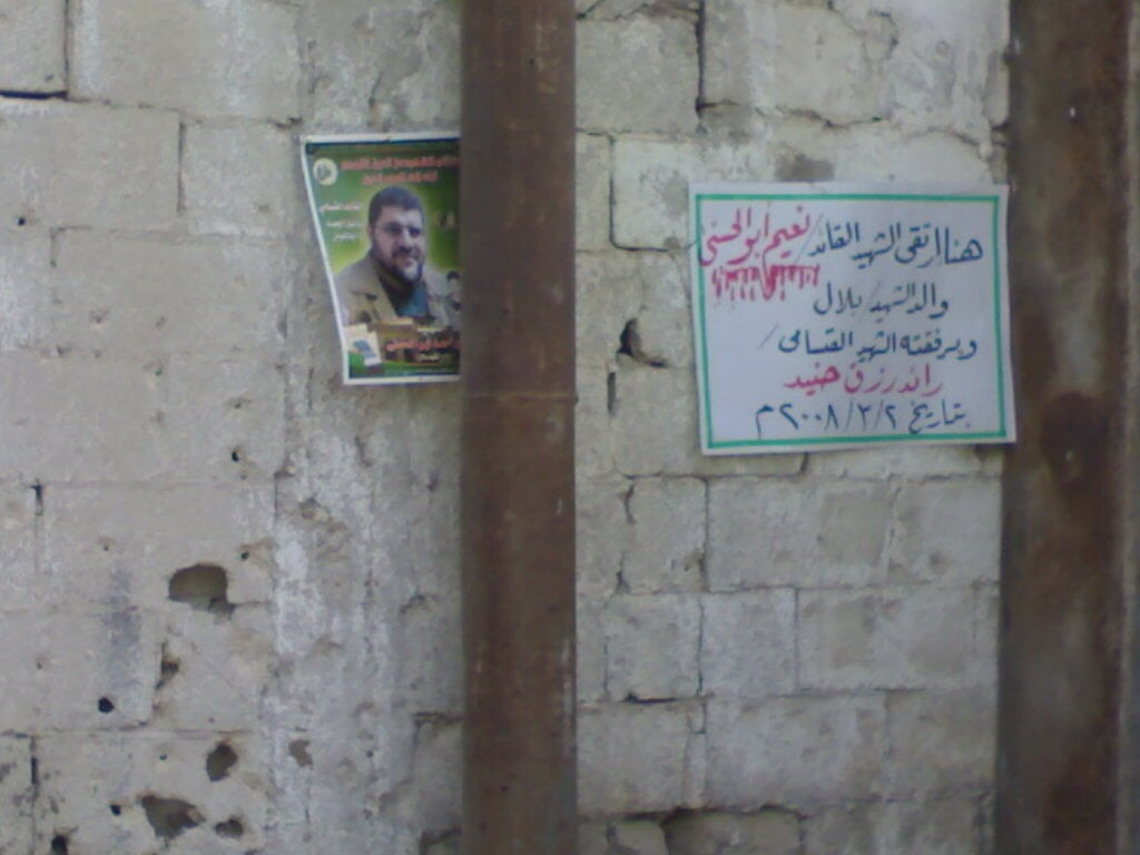
Posted by ابو احمد - صورة مؤثرة لمكان استشهاد االقائد نعيم ابو الحسنى والشهيد رائد جنيد شرق بلدة جباليا اثناء المحرقة !!!؟؟؟
Posted by ابو احمد - صورة منزل عائلة ابو الجديان المهدم اثناء اجتياح منطقة زمو
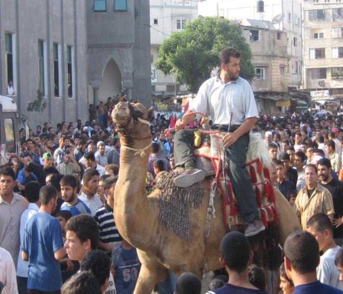
Posted by محمد خضر 1 - زفة العرسان من امام المسجد العمري بمدينة بجاليا
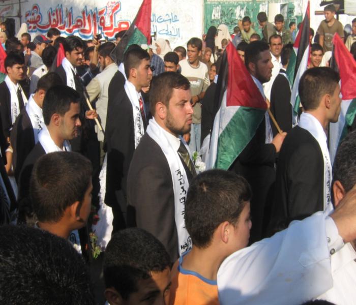
Posted by ابو احمد - زفة العرسان من امام المسجد العمري بمدينة بجاليا 1
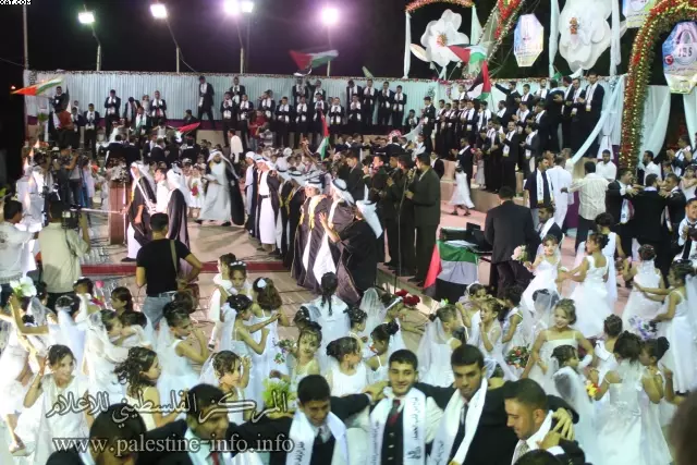
Posted by ابو احمد - جانب من مهرجان العرس الجماعي والذي اقيم بمدينة جباليا
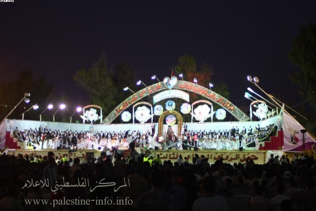
Posted by ابو احمد 2 - جانب من مهرجان العرس الجماعي والذي اقيم بمدينة جباليا
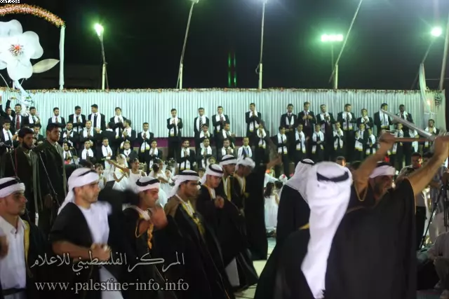
Posted by ابو احمد - جانب من مهرجان العرس الجماعي والذي اقيم بمدينة جباليا
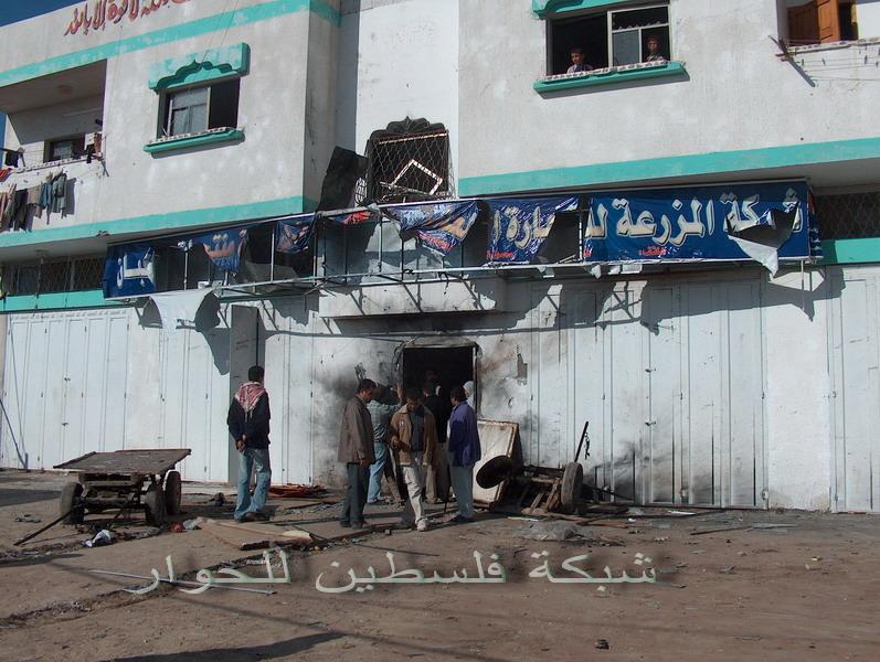
Posted by ابو احمد - صورة لمعلب الرافعي خلال حرب الفرقان
Posted by amar assalya - شارع موجود في جباليا البلد
Posted by amar assalya 1 - صورة مأذنة المسجد العمرى بعد الترميم
Posted by ابو احمد - صورة لمأذنة المسجد العمرى اثناءالترميم
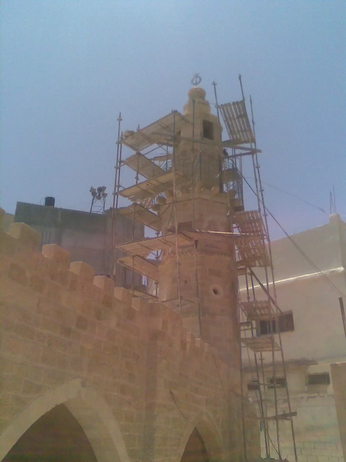
Posted by ابو احمد - صورة لمأذنة المسجد العمرى اثناءالترميم1
Posted by ابو احمد - صورة لجانب من المسجد العمرى بعد الترميم
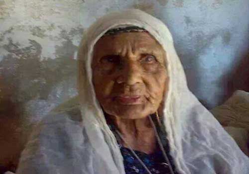
Posted by ابو احمد - أكبر معمر فلسطينية لازالت على قيد الحياة تسكن مدينة جباليا إسمها الحاجة علمية حمودة أو الاسم المشهورة به الحاجة عالمية حمودة وتسكن في جزء من مدرسة الاميين الاثرية بمدينة جباليا
Posted by ابو احمد - صورة مبين عليها سبب تسمية الانتفاضة الاولى بهذا الاسم
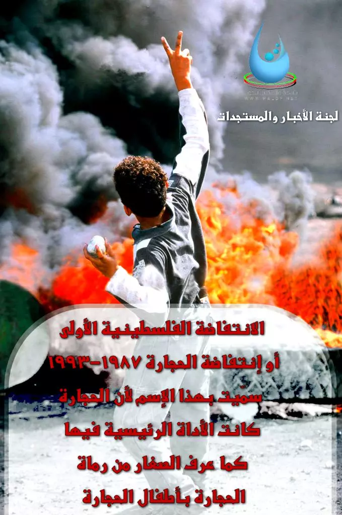
Posted by ابو احمد - صورة تجسد وتبين سبب اندلاع الانتفاضة الفلسطينية الاولى

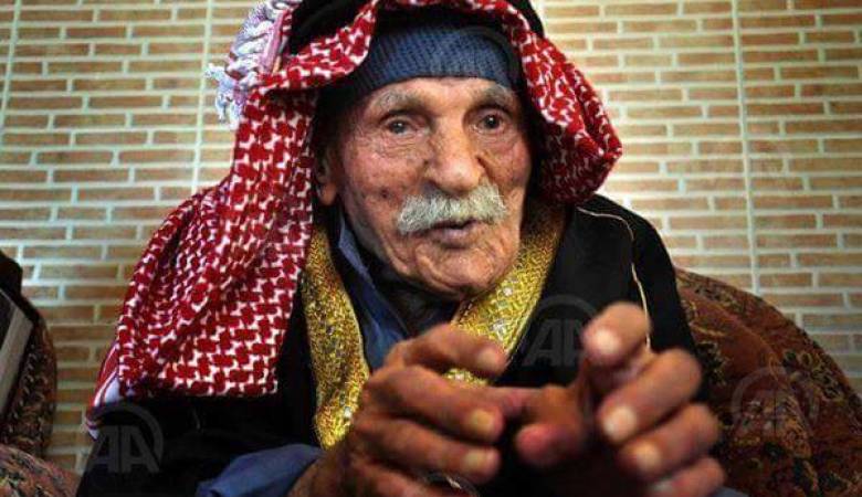
Posted by ابو احمد - المعمر رجب التوم
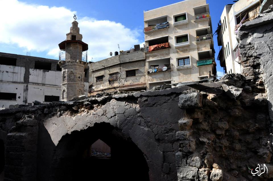
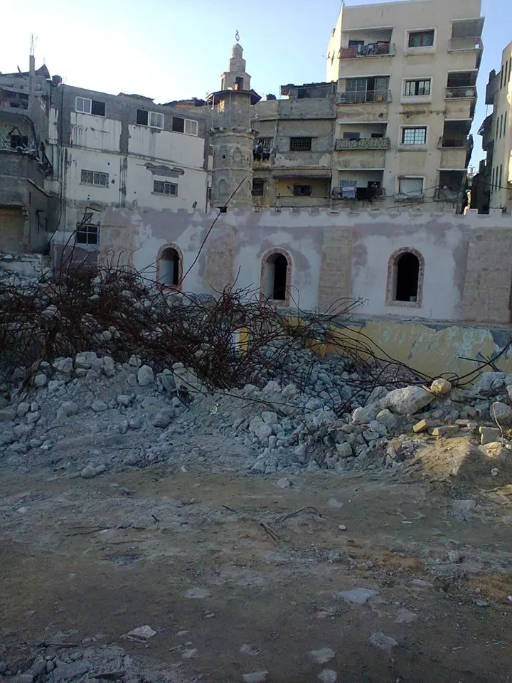
Posted by ابو احمد - صورة للمسجد العمري الاثري والمسجد الجديد وسط جبالياا الذي دمر في عدوان 2014 الصهيوني الاخير
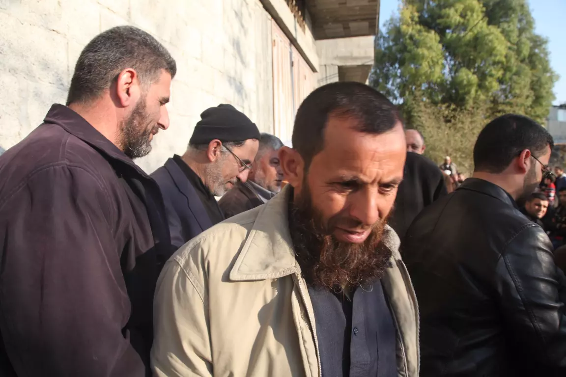
Posted by ابو احمد - صورة أحد جرحى الانتفاضة الاولى الشيخ /كمال قدورةحمودة وهو والد احد الشهداء
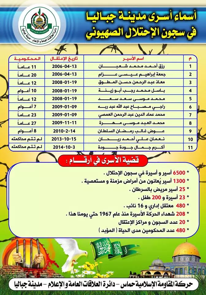
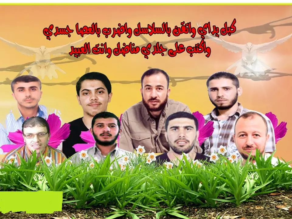
Posted by ابو احمد - أسماء أسرى مدينة جباليا في السجون الصهونية
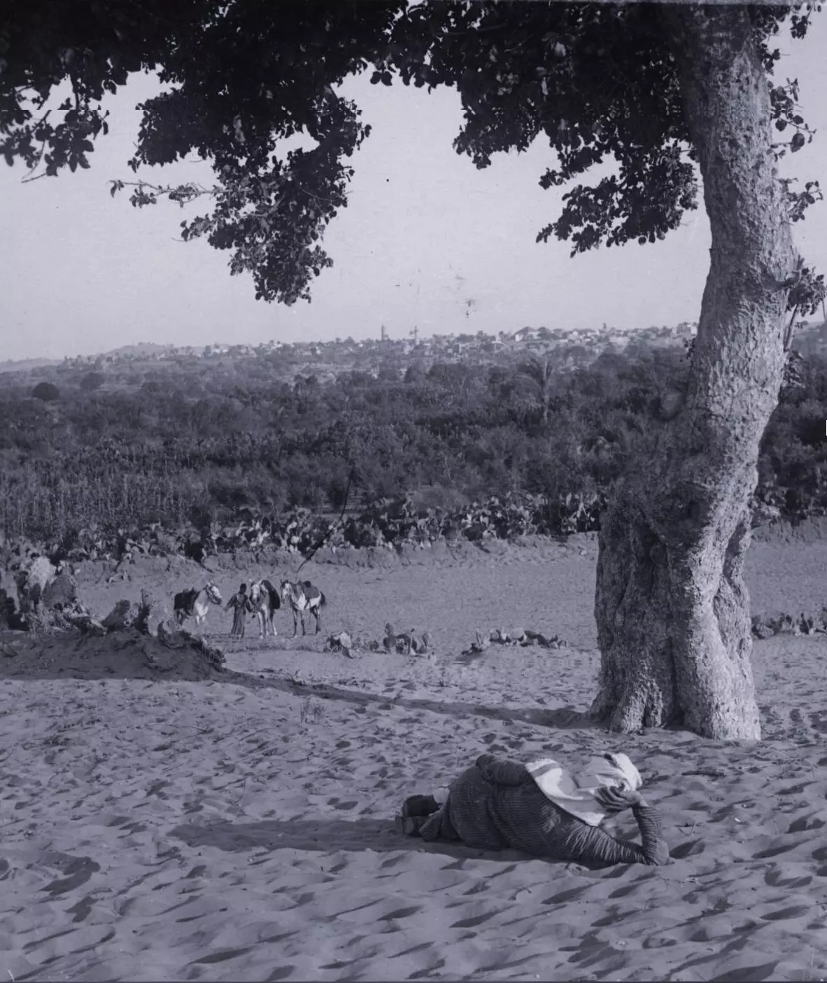
Posted by ابو احمد - صورة قديمة غير متأكد لشرق جباليا ام لغزة
Posted by ابو احمد - الفدائي القائد الشهيد / محمد حمودة
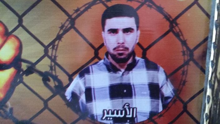
Posted by ابو احمد - الاسير البطل باسل محمد ابو زينة
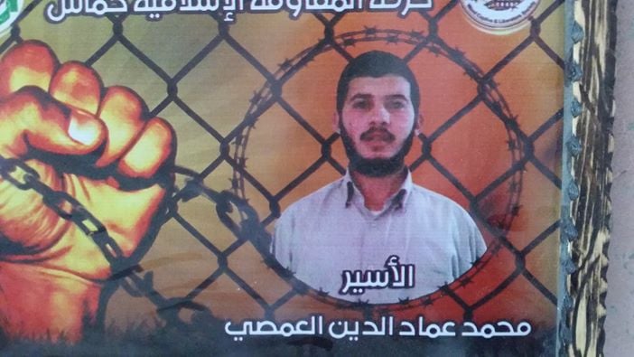
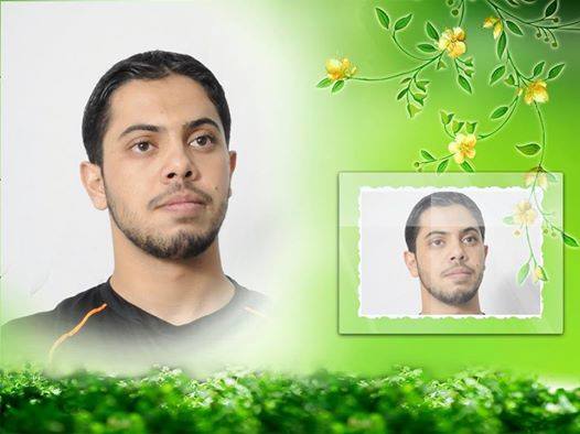
Posted by ابو احمد - الاسير البطل محمد عماد الدين العمصي
Posted by ابو احمد - الاسير البطل محمد موسى سعد
Posted by ابو احمد - الاسير البطل معاذ عبدالرحمن المطوق
Posted by ابو احمد - الاسير البطل أكرم جمال جودة
Posted by ابو احمد - الاسير البطل رزق أحمد شعبان
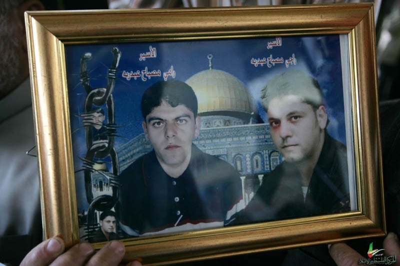
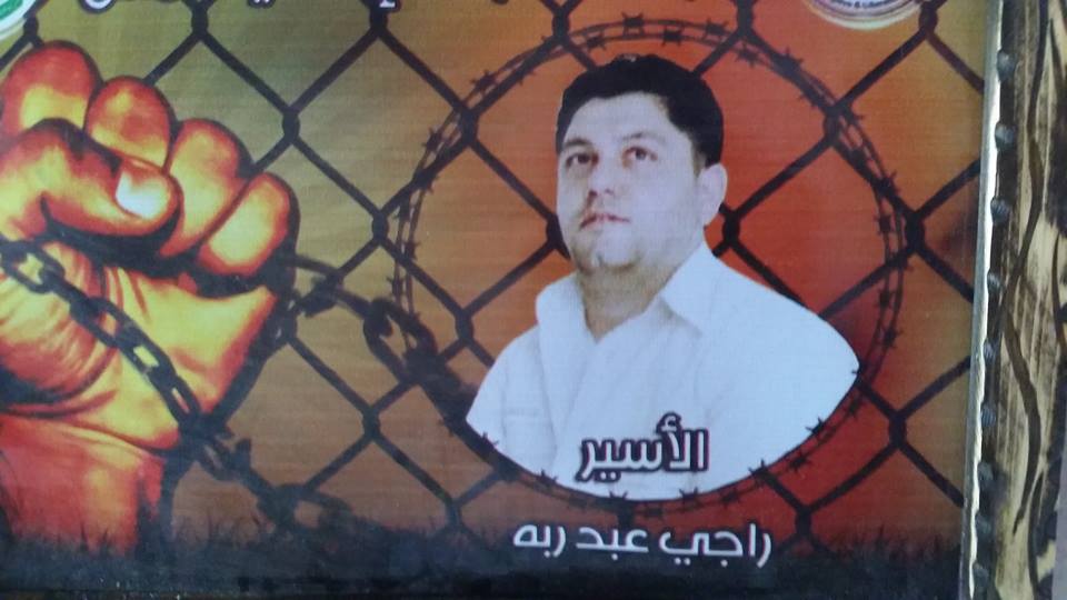
Posted by ابو احمد - الاسيرين البطلين راجي ورامي مصباح عبدربة
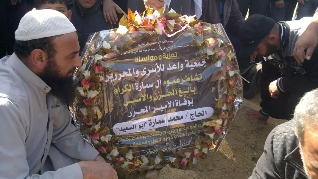
Posted by ابو احمد - صورة على قبر الاسير محمد سمارة ابو السعيد
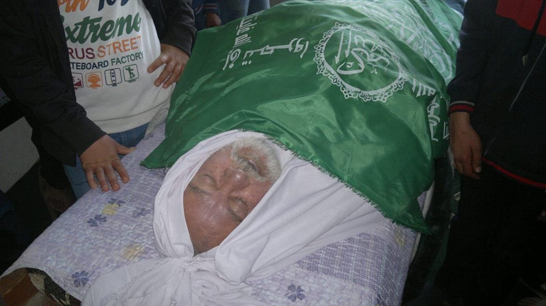
Posted by ابو احمد - صورة الاسير محمد سمارة والذي قضى بعد صراع مع المرض
Posted by ابو احمد - صورة الاسير البطل نعمان علي ريحان
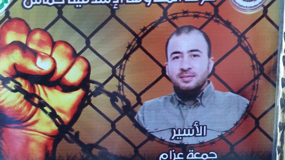
Posted by ابو احمد - الاسير البطل جمعة ابراهيم عزام

Posted by ابو احمد - الاسير البطل راجي مصباح عبدربة

Posted by ابو احمد - صورة الاسير البطل نعمان علي ريحان

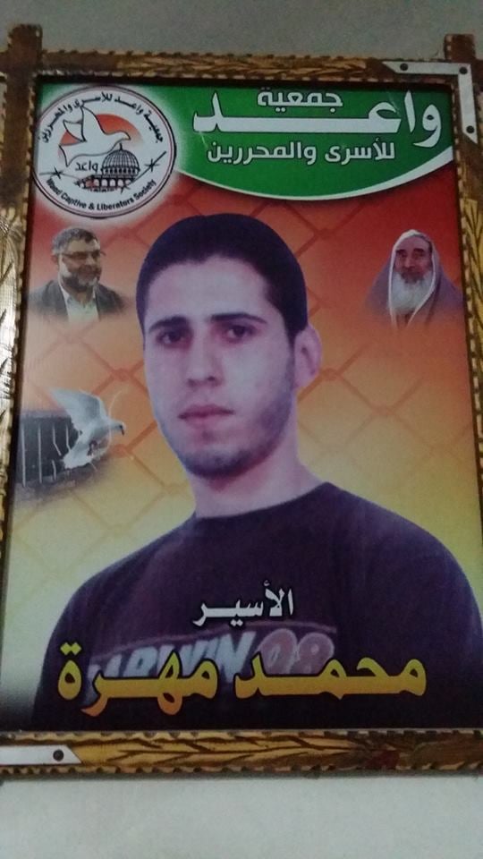
Posted by ابو احمد - الاسير البطل محمد العبد مهرة
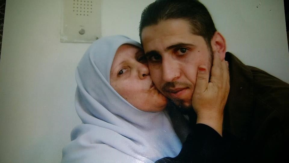
Posted by ابو احمد - الاسير البطل محمد العبد مهرة مع أمه
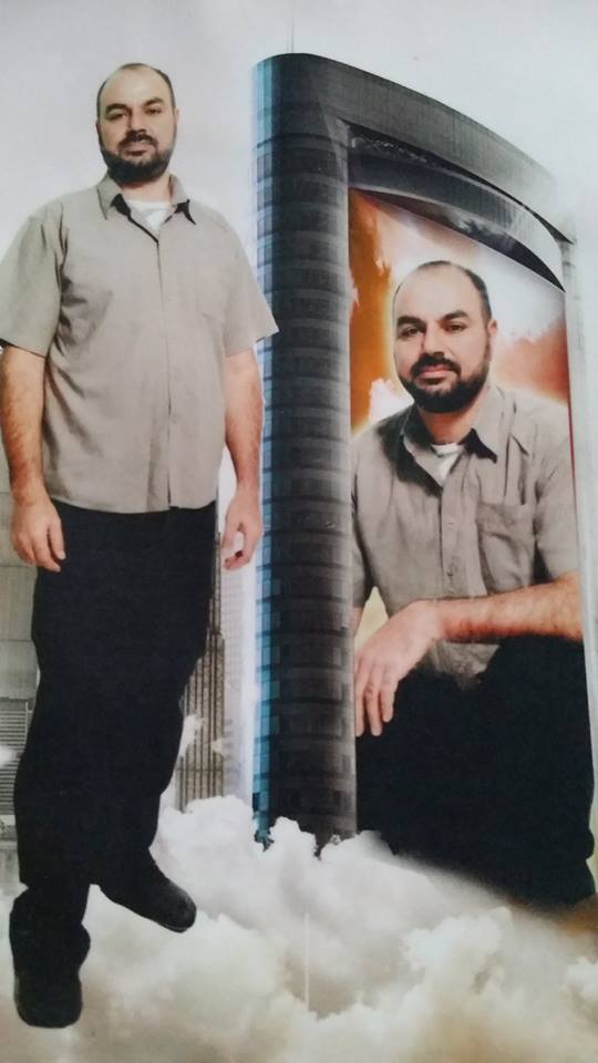
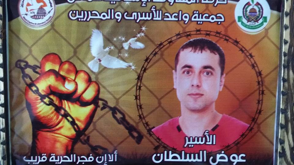
Posted by ابو احمد - الاسير البطل عوض غالب السلطان

Posted by ابو احمد - الاسير البطل جمعة ابراهيم عزام
Posted by ابو احمد - الاسير البطل راجي مصباح عبدربة
Posted by ابو احمد - صورة الاسير البطل نعمان علي ريحان
Posted by ابو احمد - الاسير البطل عوض غالب السلطان
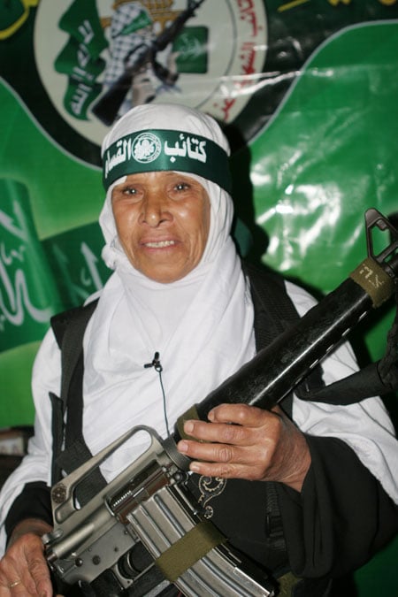
Posted by ابو احمد - #جباليا صورة للفدائية من جباليا البلد مجموعة الشهيد محمد حمودة
Posted by ابو احمد - جباليا ابو رامي يحمل صورة ابنه الاسير البطل راجي مصباح عبدربة
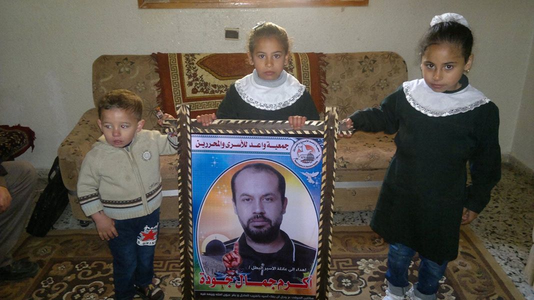
Posted by ابو احمد - جباليا أطفال الاسير البطل أكرم جمال جودة يحملون صورة أبيهم
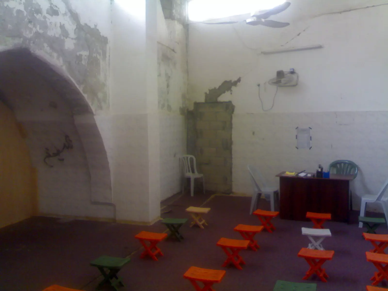
Posted by ابو احمد - #جباليا صورة للمسجد العمري الاثري من الداخل وأثار الدمار في الحرب الاخيرة
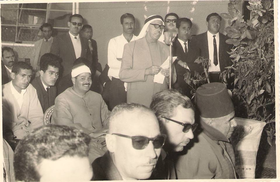
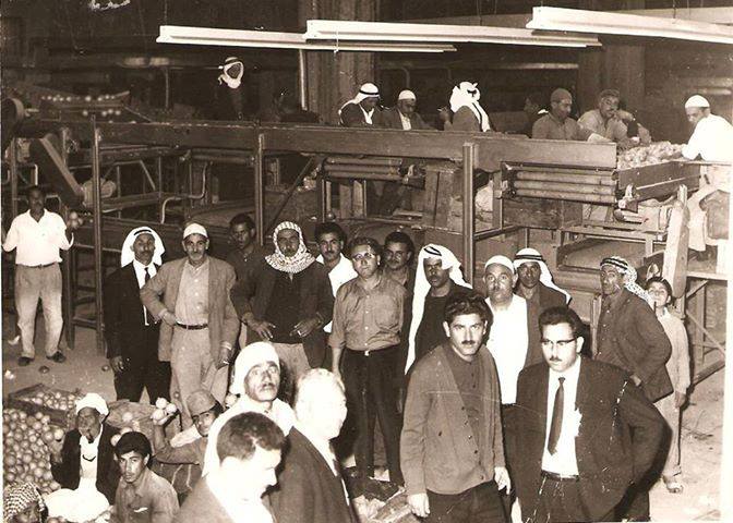
Posted by ابو احمد - صورة السيد محمد مسعود رئيس مجلس قروى سنة 1962 أثناء أفتتاح أول محطة كهرباء فى جباليا وكانت فى سوق جباليا الحالى
Posted by ابو احمد - صورة المسجد العمري الجديد أثر بعد عين وفي الخلفية المسجد العمري الاثري بعد الترميم من الحرب الاخيرة
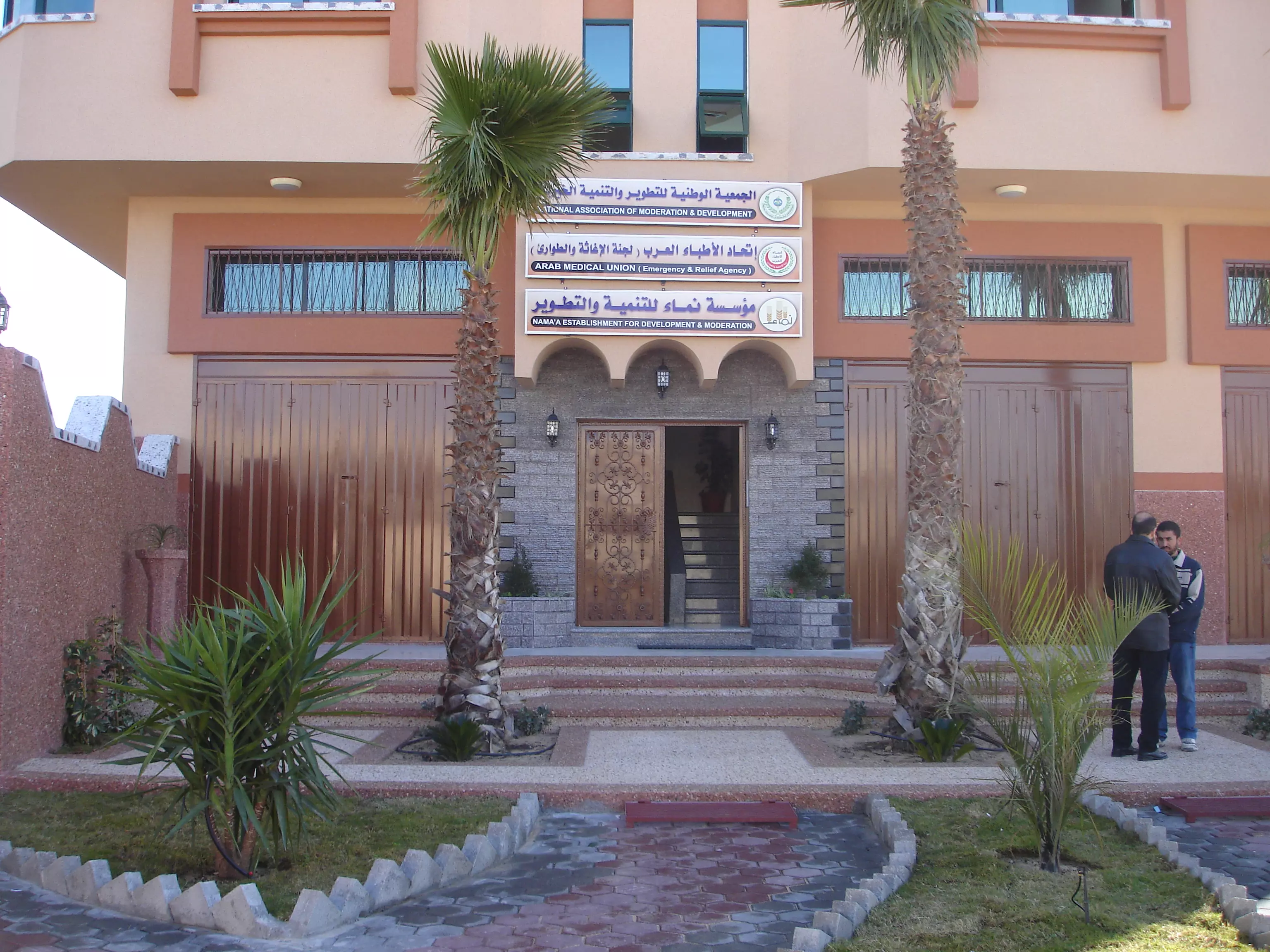
Posted by ابو احمد - مؤسسة نماء جباليا
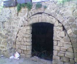
Posted by ابو احمد - بوابة الكنيسة البيزنطية شرق مدينة جباليا
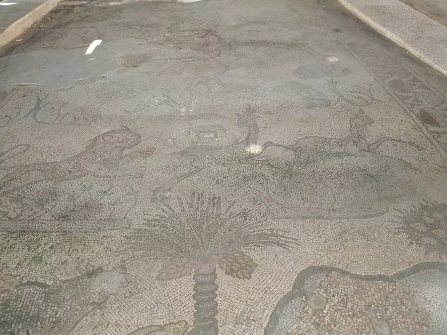
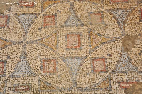
Posted by ابو احمد - أرضية الفسيفساء بالكنيسة البيزنطية شرق مدينة جباليا
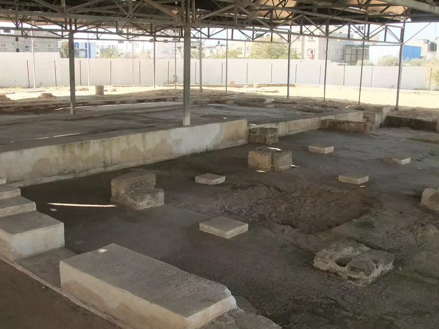
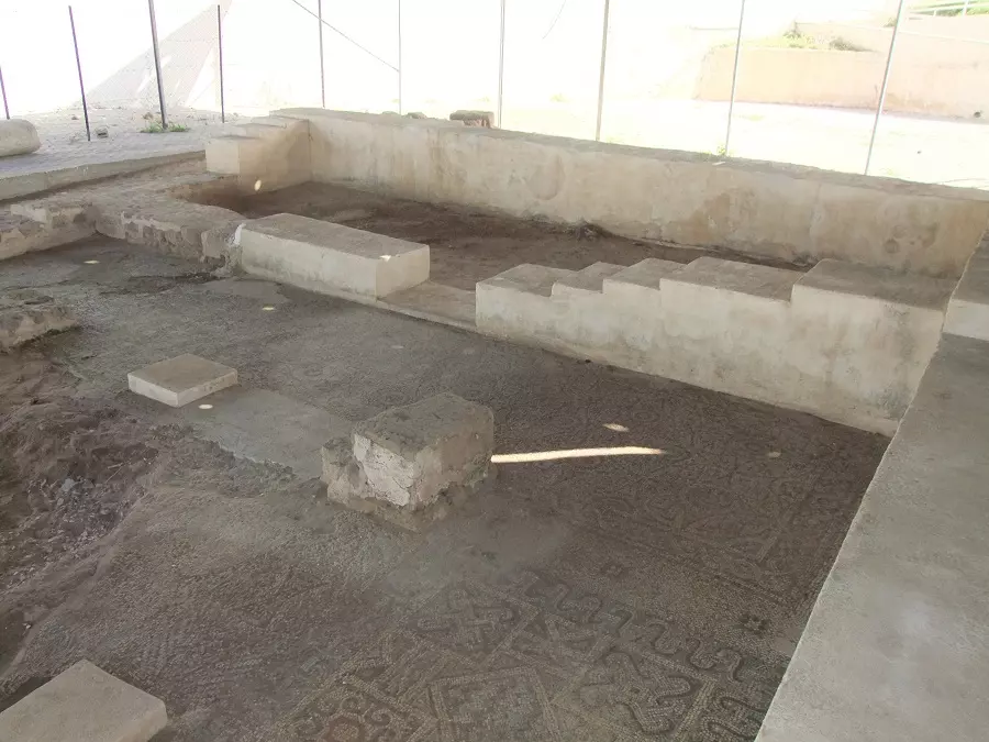
Posted by ابو احمد - منظر عام للكنيسة من الداخل
Posted by ابو احمد - أرضية الفسيفساء بالكنيسة البيزنطية شرق مدينة جباليا1
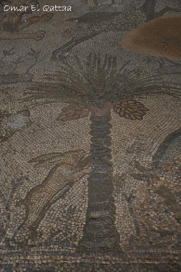
Posted by ابو احمد - رسمة بالفسيفساء بالكنيسة البيزنطية شرق مدينة جباليا
Posted by ابو احمد - جانب من الكنيسة البيزنطية شرق مدينة جباليا
Posted by ابو احمد - المقبرة الرومانية شرق مدينة جباليا
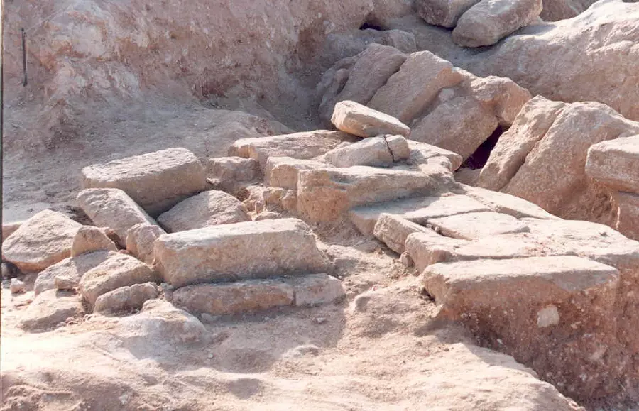
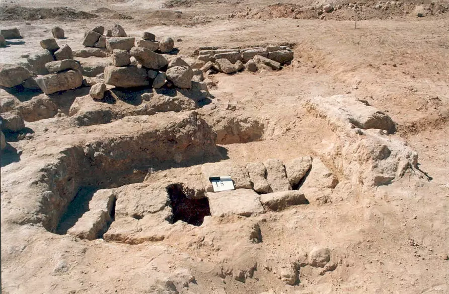
Posted by ابو احمد - منظر عام للمقبرة الرومانية شرق مدينة جباليا
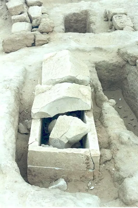
Posted by ابو احمد - أحد القبور في المقبرة الرومانية
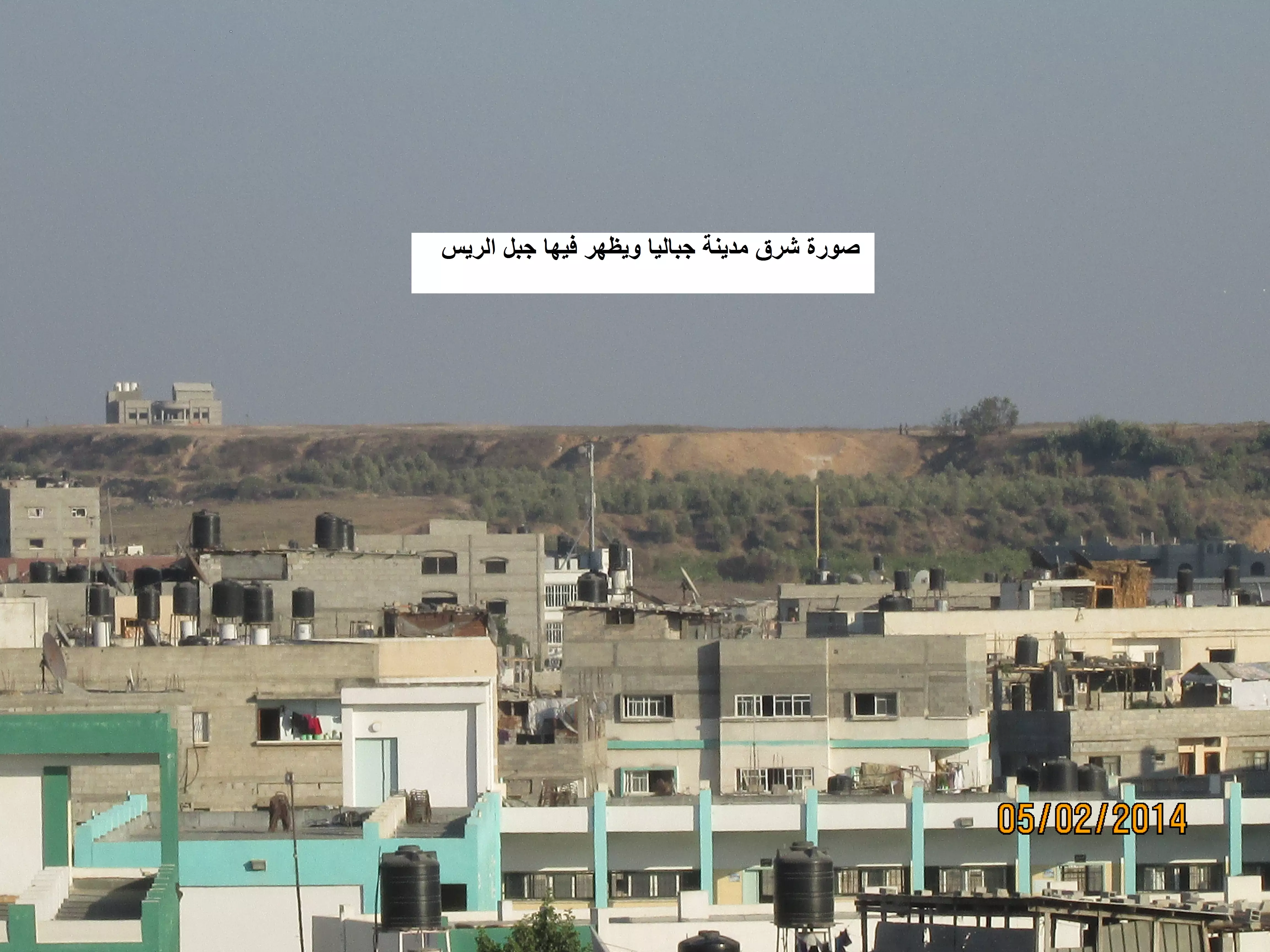
Posted by ابو احمد - مدينة جباليا جبل الريس
Posted by ابو احمد - الشهيد المجاهد/ أم صالح البطش #جباليا
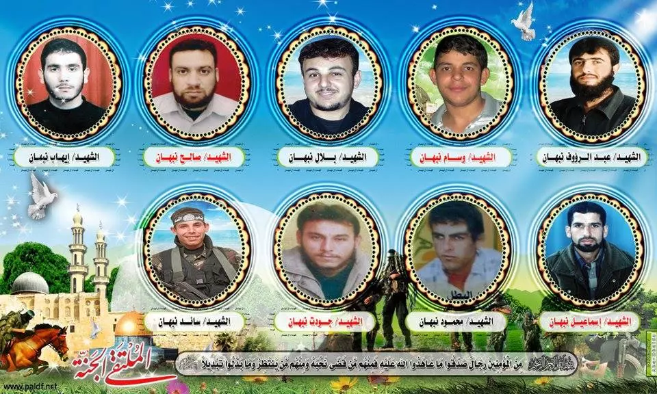
Posted by ابو احمد - كوكبة من شهداء آل نبهان بمدينة جباليا
Posted by ابو احمد - الشيخ الراحل ربيع الشناط أبو نزار مقرئ المسجد العمري
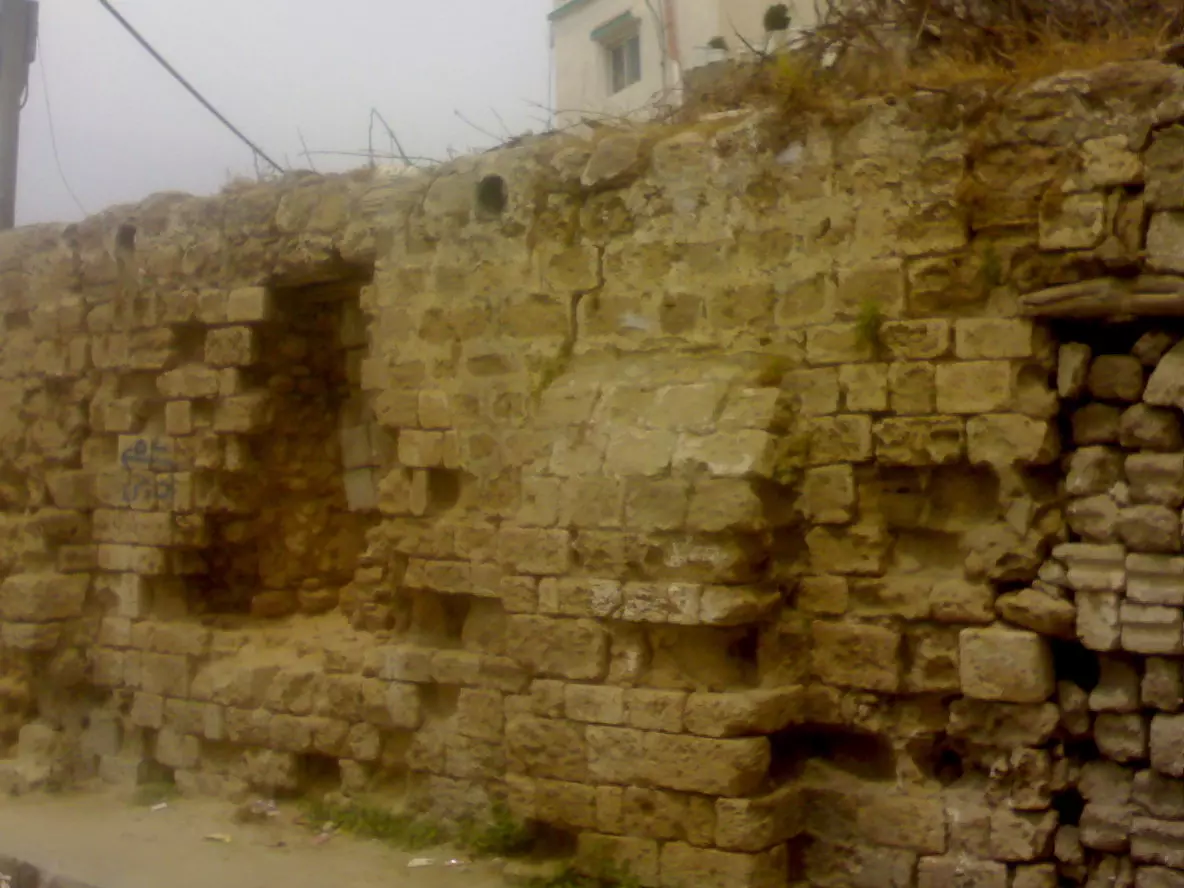
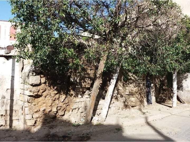
Posted by ابو احمد - صور لشرق ميدنة جباليا :قديمة:
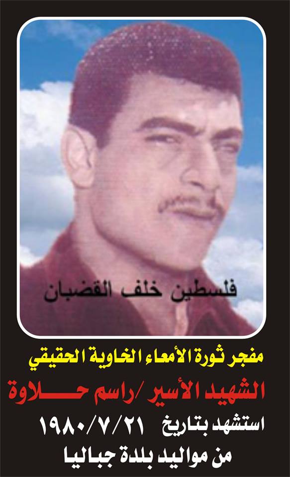
Posted by ابو احمد - الشهيد الاسير : راسم حلاوة#جباليا
Posted by ابو احمد - #جباليا الاستشهادية الجده / فاطمة عمر جمعة النجار ام محمد فجرت جسدها بجنود الاحتلال شرق مدينة جباليا .
Posted by ابو احمد - #جباليا بيت ابو سهيل النجار الذي كان به جنود الاحتلال أثناء إجتياح شرق مدينة جباليا والتي فجرت الحاجة فاطمة النجار نفسها به
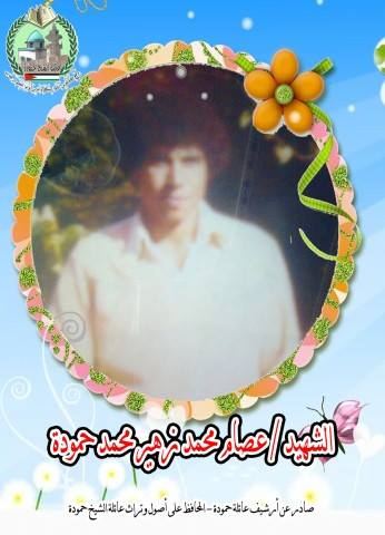
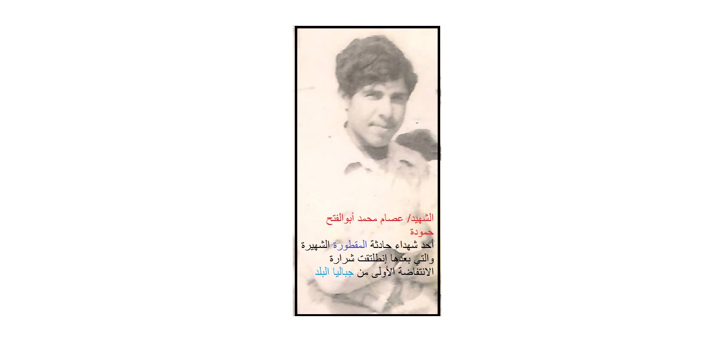
Posted by ابو احمد - #جباليا الشهيد/ عصام محمدأبوالفتح حمودة أحد شهداء المقطورة الشهيرة والتي بعدها تفجرت الانتفاضة من قرية جباليا البلد
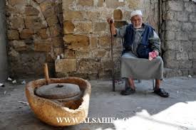
Posted by ابو احمد - الطاحونة الاثرية والابن الذكر الوحيد للحاجة عالمية حمودة بمدينة جباليا
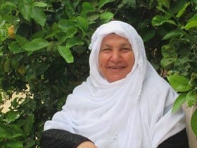
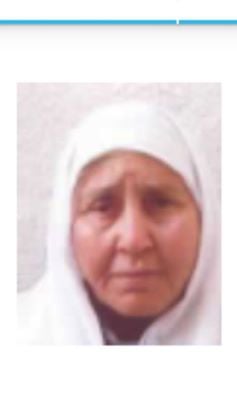
Posted by ابو احمد - صورة المهمرة الفلسطينية عالمية حمودة من مدينة جباليا شمال غزة رحمها الله
Posted by ابو احمد - صورة نادرة للشهيد / عصام محمد ابو الفتح حمودة
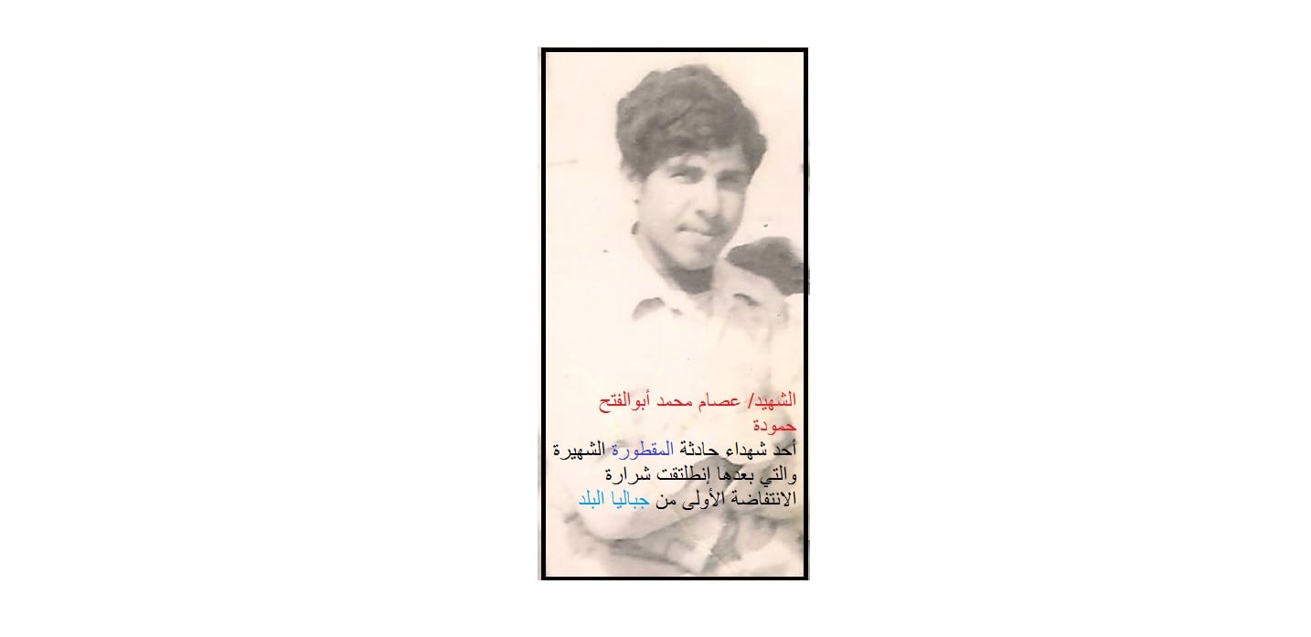
Posted by ابو احمد - صورة نادرة للشهيد / عصام محمد ابو الفتح حمودة
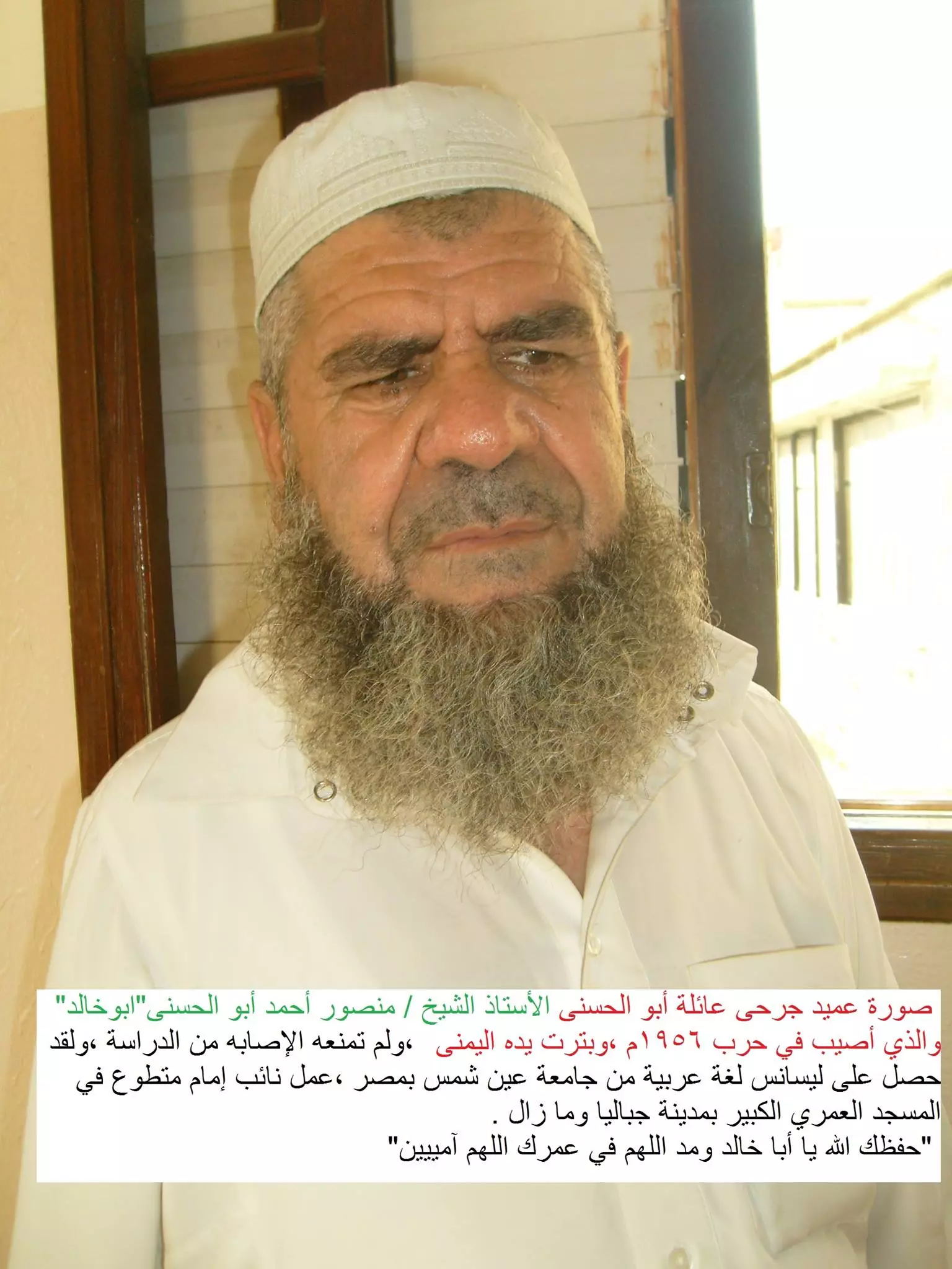
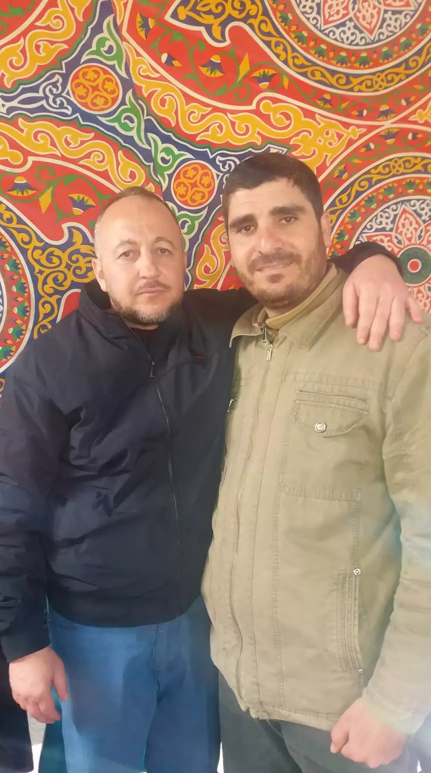
Posted by ابو احمد - صورة الشيخ الأستاذ منصور أحمد أبو الحسنى "أبو خالد" عميد جرحى عائلة أبو الحسنى
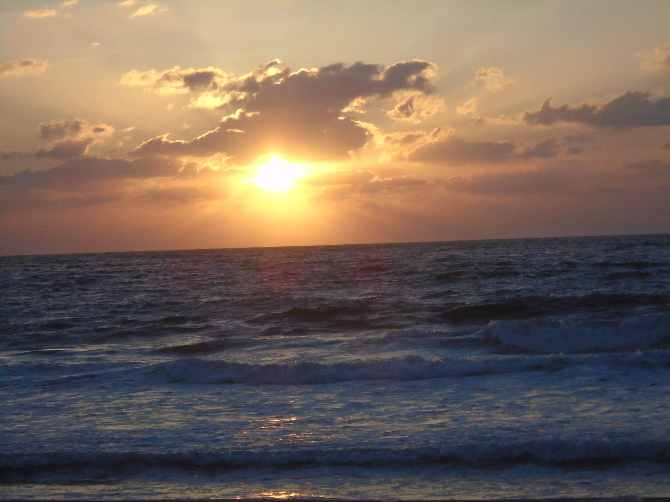
Posted by ابو احمد - صورة الغروب شاطئ بحر مدينة جباليا
Posted by ابو احمد - صورة مصنع أبوالخير للحمضيات شرق مدينة جباليا
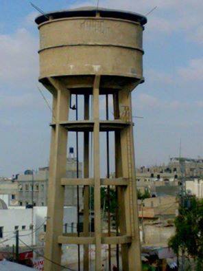
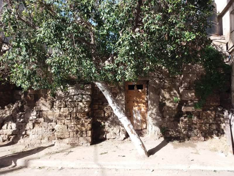
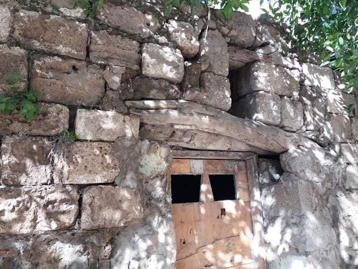
Posted by ابو احمد - صورة حاووز جباليا الخاص بالمياه معلم قديم
Posted by ابو احمد - الأسيرالمحرر راجي مصباح عبدربة برفقة والدة أبو رامي
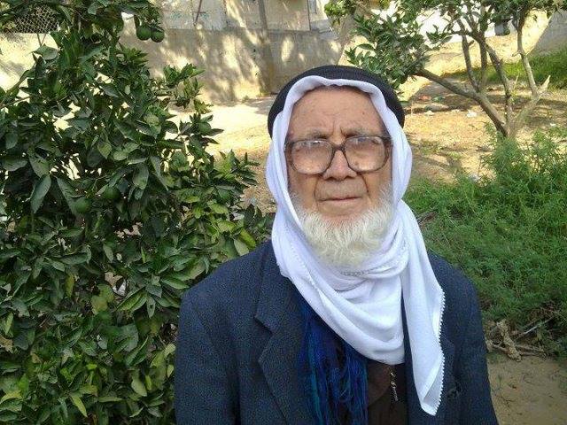
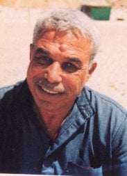
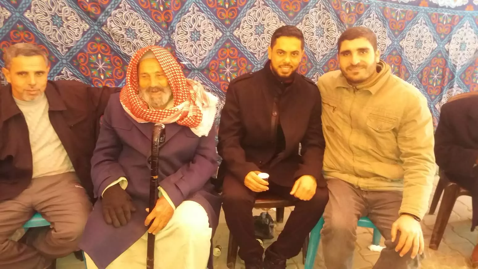
Posted by ابو احمد - صورة أكبر معمر في فلسطين الحاج رجب التوم رحمه الله
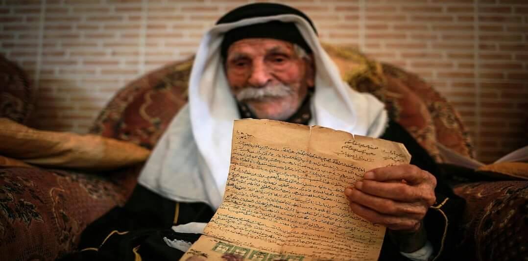
Posted by ابو احمد - صورة أكبر معمر في فلسطين الحاج رجب التوم رحمه الله #
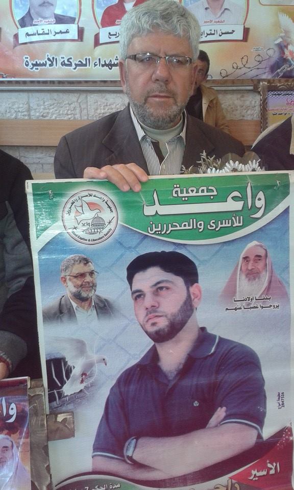
Posted by ابو احمد - صورة حصرية للأسير/ أكرم جمال جودة ووالده من داخل سجن ريمون الصهيوني
Posted by ابو احمد - صورة حصرية للأسير/ أكرم جمال جودة ووالده من داخل سجن ريمون الصهيوني
Posted by ابو احمد - صورة 3 حمامات أعلى سطح منزل بوسط مدينة جباليا
Posted by ابو احمد 1 - لوحة فنية بها المسجد العمري ومكتوب عليه جباليا بريشة شربجي
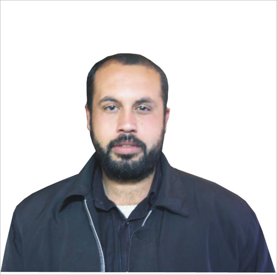
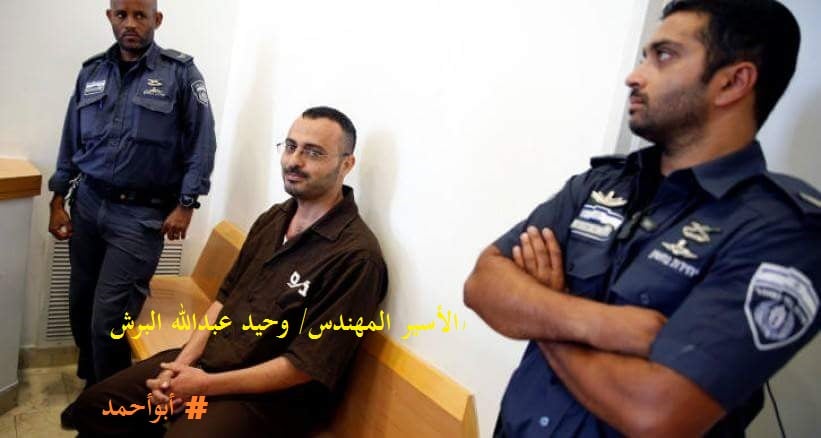
Posted by ابو احمد - صورة الاسير المهندس/ وحيد عبدالله البرش من داخل المحكمة
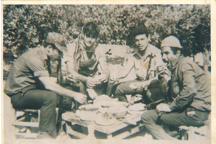
Posted by ابو احمد - الرفيق القائد/صالح دردونه أبوناصر أحد أبرز قادة الجبهة الشعبية في فلسطين
Posted by ابو احمد - الاسير المحرر أحمد ربيع عبدربه برفقة الناشط ابورامي عبدربه وتامر عبدربه
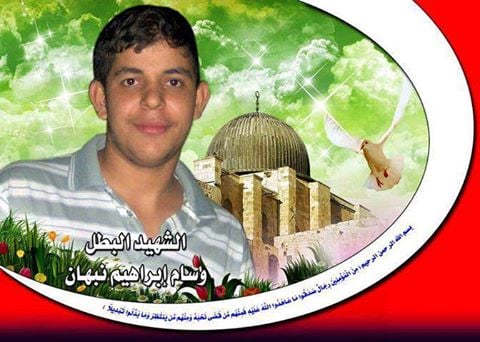
Posted by ابو احمد - صورة الشهيد / وسام إبراهيم نبهان من مدينة جباليا
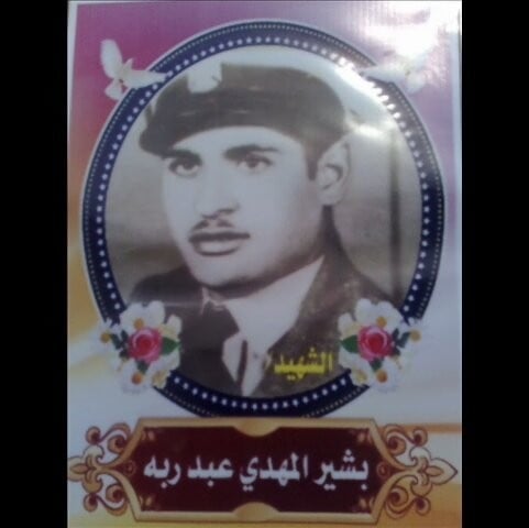
Posted by ابو احمد - الشهيد الفدائي/ بشير المهدي عبدربه
Posted by ابو احمد - الشهيدة وزوجة الشهيد / مريم أحمد عبدربه" حمودة" أم أيمن
Posted by ابو احمد - صورة لمجموعة من أسرى مدينة جباليا فك الله قيدهم قريباً
Posted by ابو احمد - صورة الشهيد الحي الجريح/ كمال قدورة حمودة وهو أحد الناجين من حادثة المقطورة الشهيرة
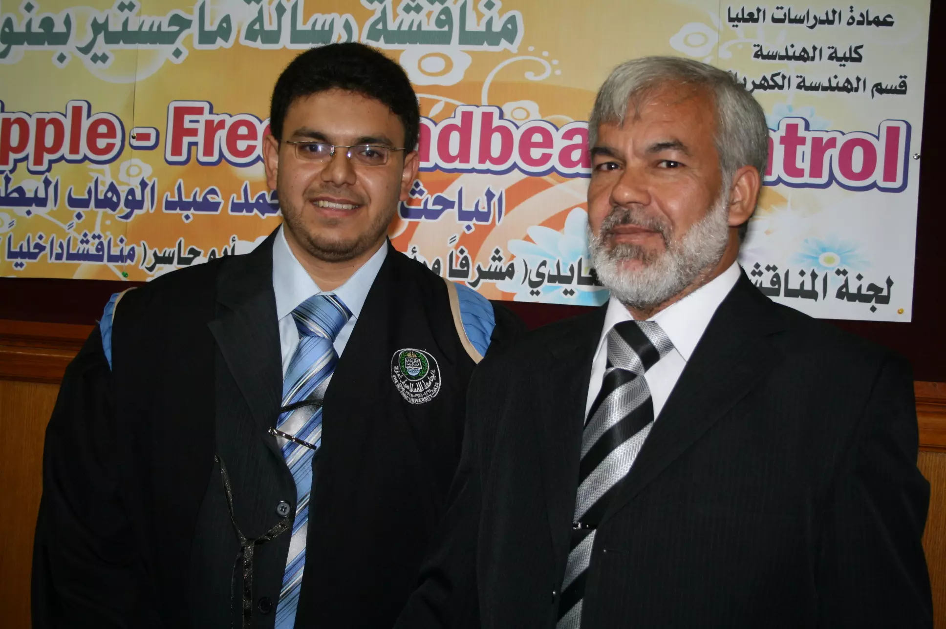
Posted by ابو احمد - صورة حصرية للشهيد المهندس العالم / فادي محمد البطش من سكان مدينة جباليا برفقة والده الاستاذ محمد ربيع البطش
Posted by ابو احمد - صورة حصرية للشهيد المهندس العالم / فادي محمد البطش من سكان مدينة جباليا إغتاله الموساد بماليزيا
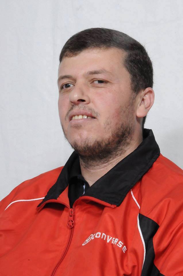
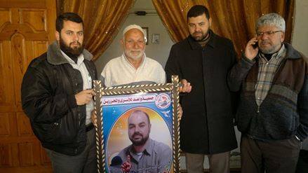
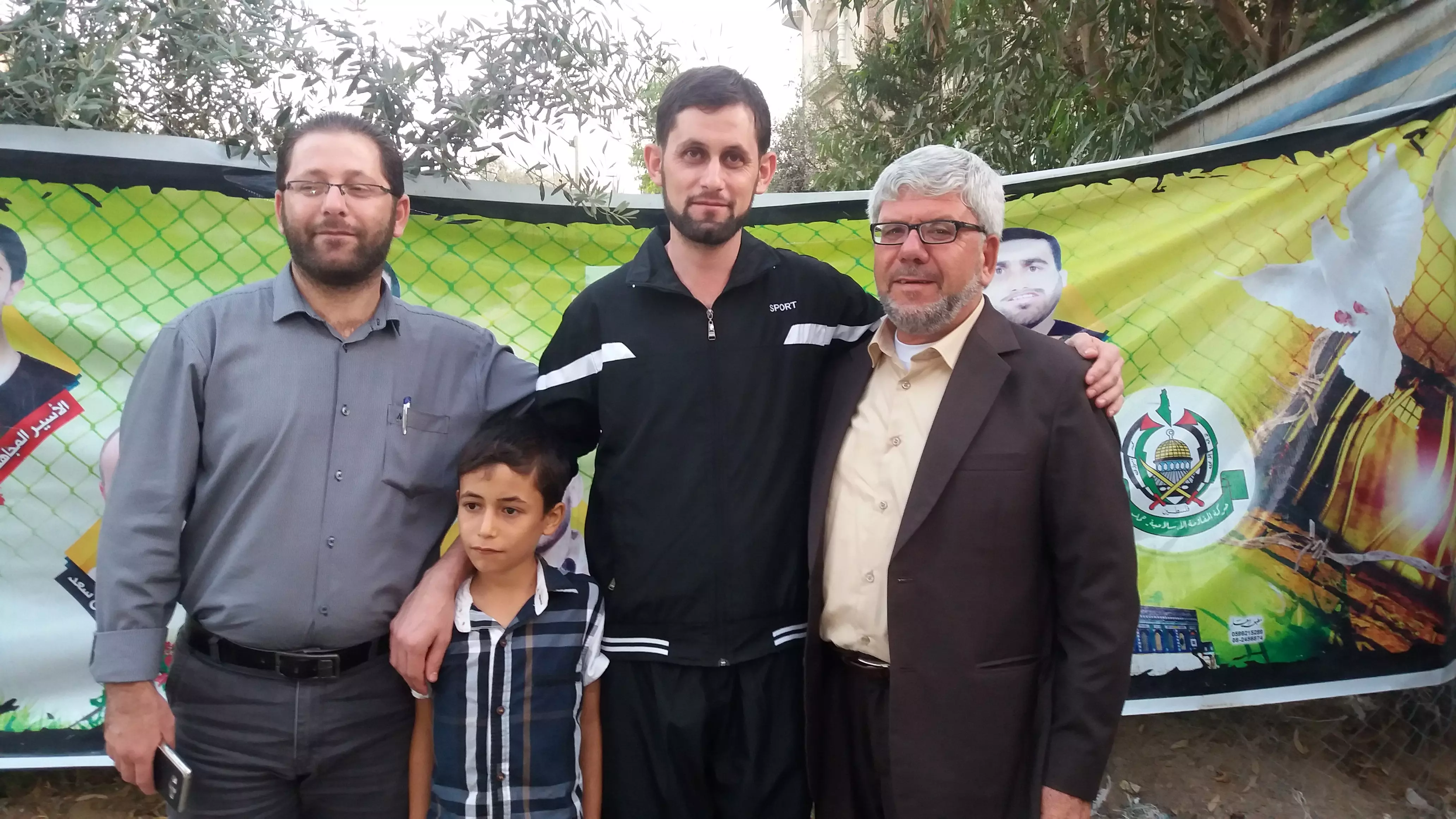
Posted by ابو احمد - صورة الأسيرين المحرريين من سجون الإحتلال الصهيوني محمد سعد ومعاذ المطوق من مدينة جباليا شمال غزة بعد قضاء 12 عام في الاسر
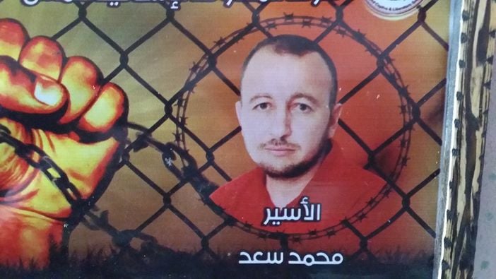
Posted by ابو احمد - صورة الأسير المحرر من سجون الإحتلال الصهيوني محمد سعد من مدينة جباليا شمال غزة بعد قضاء 12 عام في الأسر
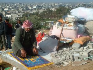
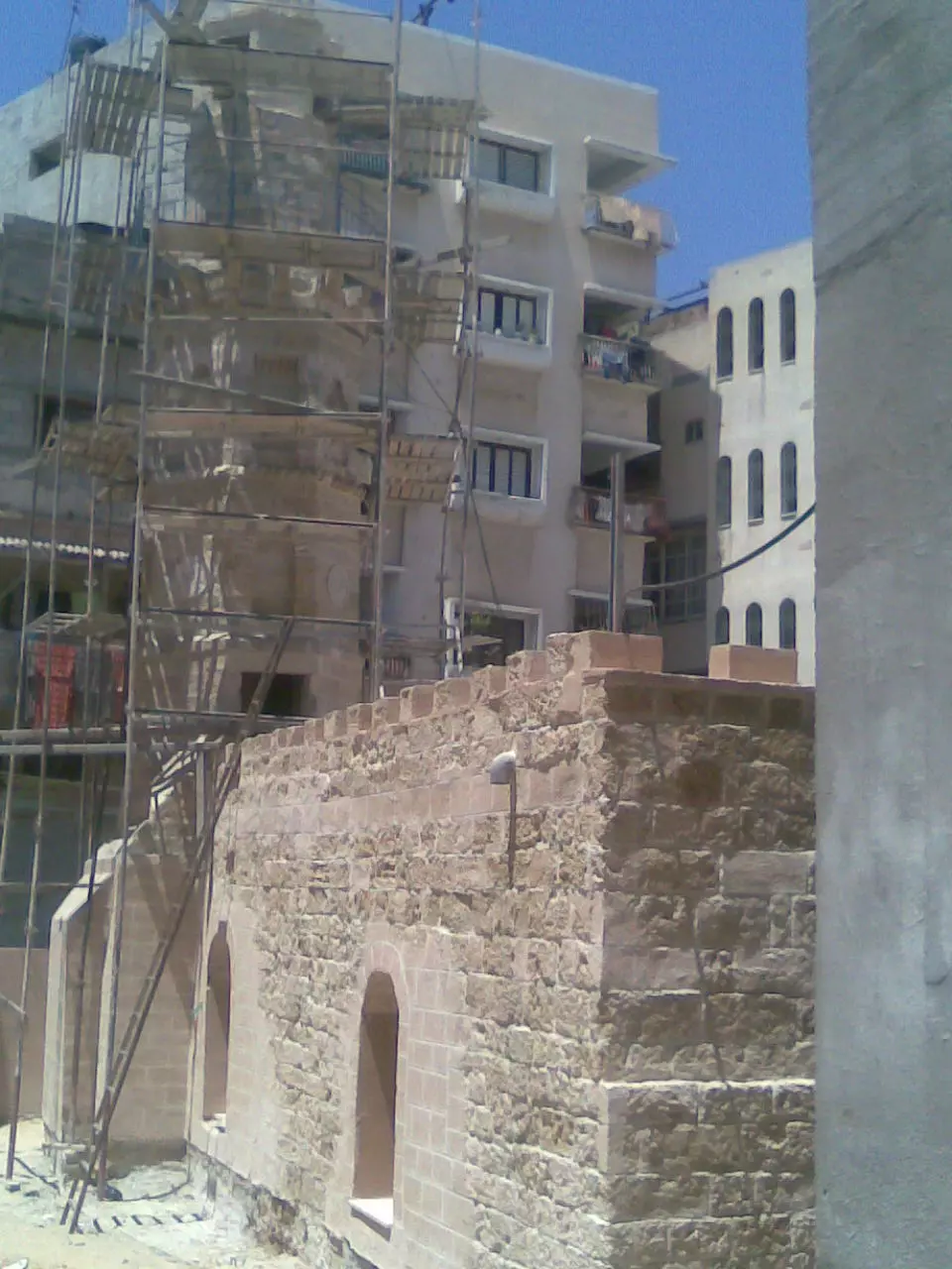
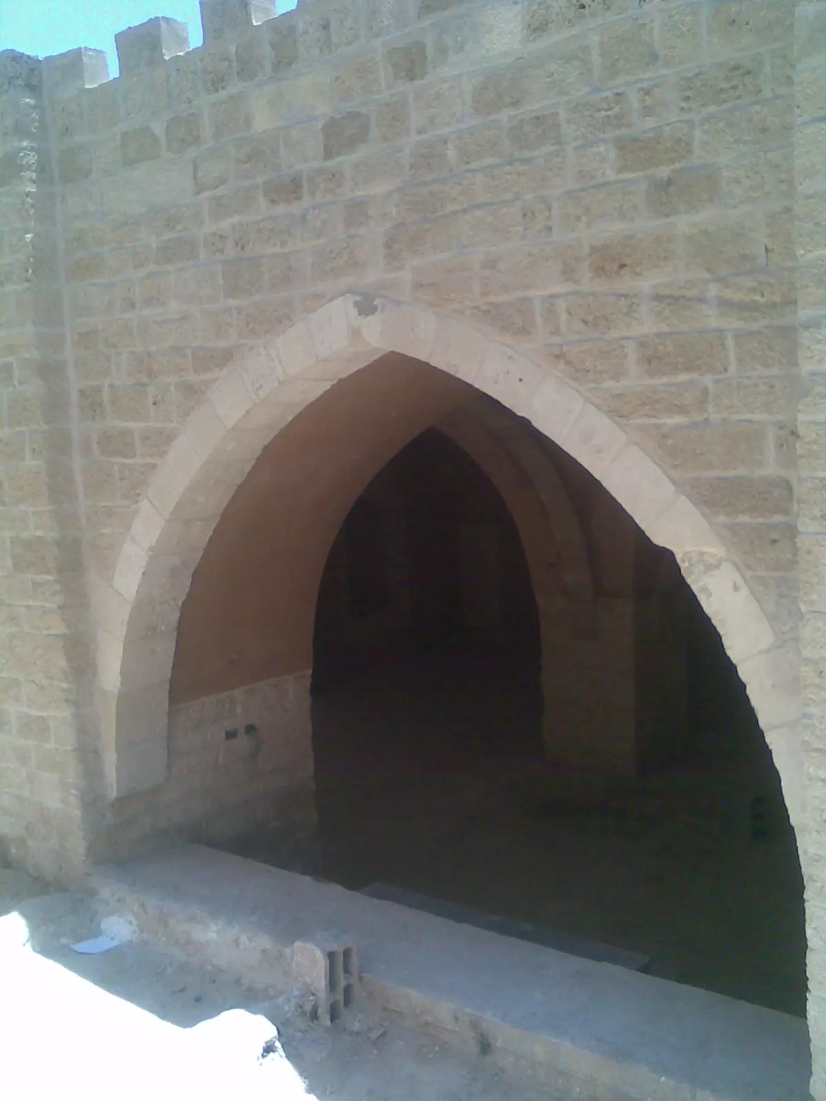
Posted by ابو احمد - جباليا ونزلتها...آثارها وعمرانها ...المزيد عنها في قسم التعليقات اسفل الصورة
1 - جباليا ونزلتها...آثارها وعمرانها ...المزيد عنها في قسم التعليقات اسفل الصورة #2
- جباليا ونزلتها...آثارها وعمرانها ...المزيد عنها في قسم التعليقات اسفل الصورة #3
- جباليا ونزلتها...آثارها وعمرانها ...المزيد عنها في قسم التعليقات اسفل الصورة #4
- جباليا ونزلتها...آثارها وعمرانها ...المزيد عنها في قسم التعليقات اسفل الصورة #5
- جباليا ونزلتها...آثارها وعمرانها ...المزيد عنها في قسم التعليقات اسفل الصورة #6
- جباليا ونزلتها...آثارها وعمرانها ...المزيد عنها في قسم التعليقات اسفل الصورة #7
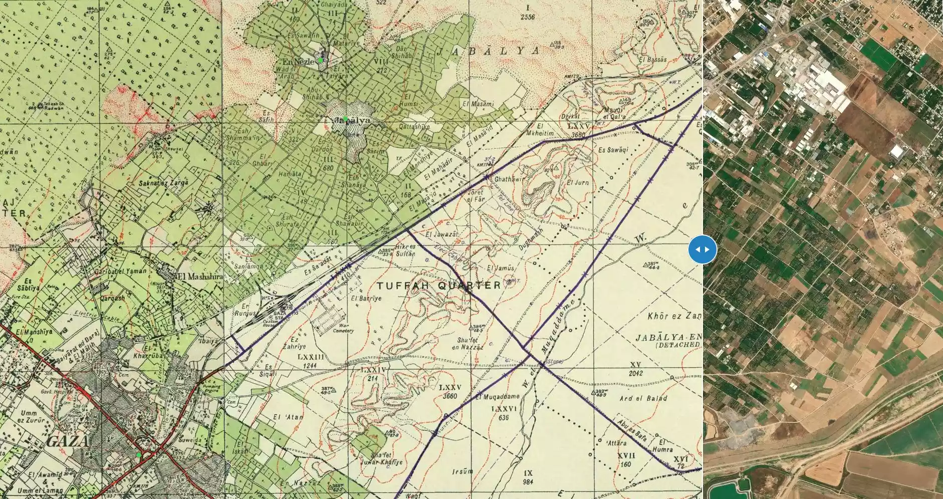
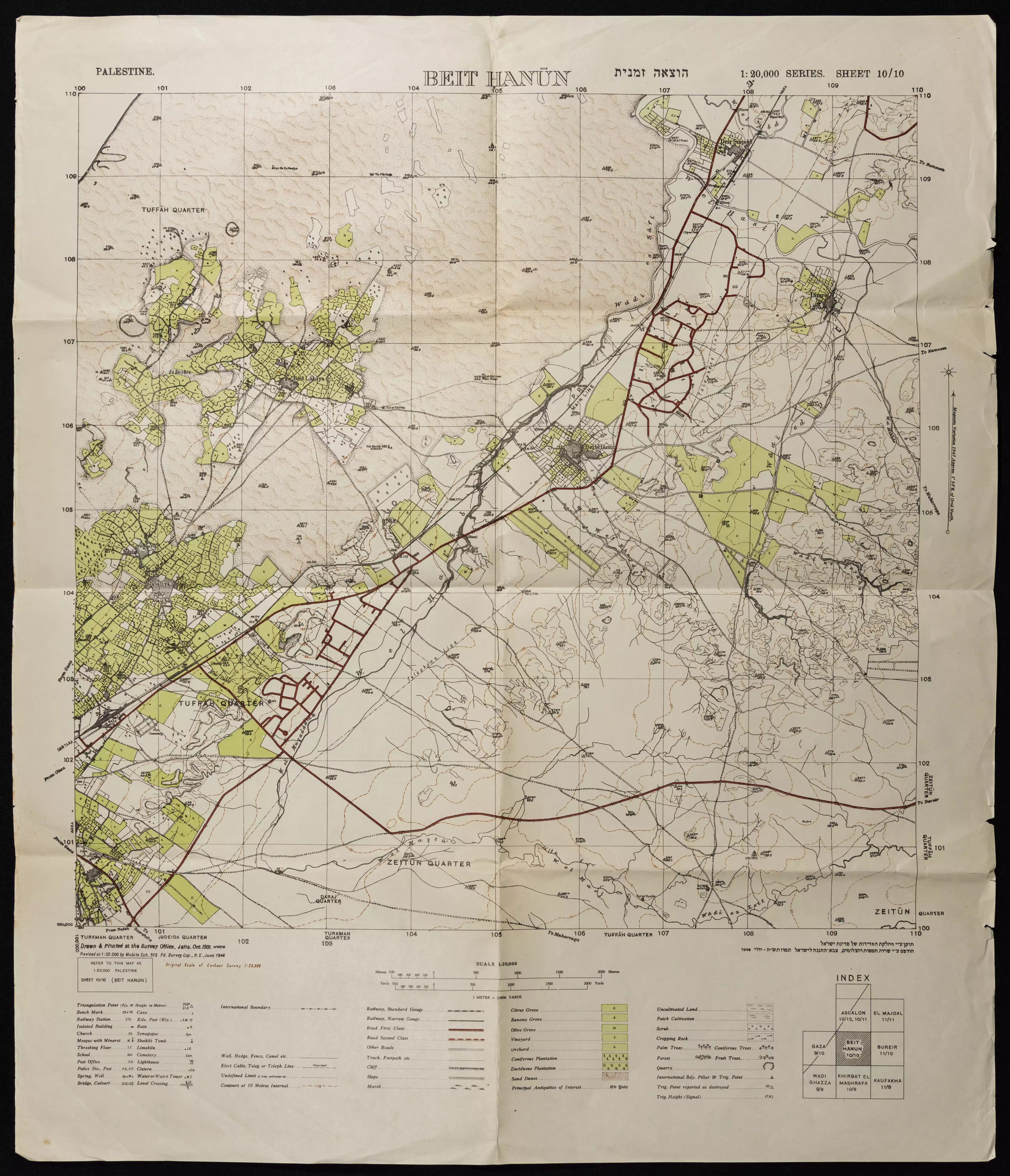
- خارطة تُظهِر الحدود والطرق بأنواعها والأماكن المقدسة والطبيعة الطوبغرافية من تلال وسهول ومنحدرات والتشكيلة الطبيعية للأرض وأنواع المزروعات. نُشرت الخريطة فترة الانتداب البريطاني، تم إضافة تعديلات عليها من قِبَل خدمة الخرائط والصور التابعة للقوات العسكرية الاسرائيلية فترة الأربعينيات.
Want to browse more? 80,000 pictures were grouped in these gallaries:
| Display Name | Clan/Hamolah | Country of Residence |
| ابو احمد ابو الحسنى | ابو الحسنى | جباليا , فلسطين |
| ابو غانم | - | اماتين, اماتين |
| مجد أبو شمالة | أبو شمالة | غزة |
| adriano | - | - |
| ابو احمد | أبو الحسنى | جباليا |
- مشاهد من قصف على جباليا في انتفاضة الاقصى
- مشاهد من مجزرة في بلدة جباليا في انتفاضة الاقصى
- فيديو للمبدعة إسراء عطاالله أبو الحسنى مسابقة الزجل قصيدة حكاية ياسمينا من كلمات المعلمة أمل أحمد الرشايدة
- فيديو خاص بالمقبرة القديمة وسط مدينة جباليا شمال غزة
- مقبرة جباليا القديمة من اقدم مقابر غزة
- الشيخ الشهيد/أحمد ياسين يروي حقيقة إنطلاق شرارة الإنتفاضة الأولى1987م من جبالياالبلد
- من هو العالم الفلسطيني فادي محمد البطش إبن مدينة جباليا
- https://f.top4top.net/m_851ldqwy1.mp4
 Fake Valor: Why Did Zionist Jews Hoist Nazis Flag on Their Ships in the 1930s?
What is new?
-
Facts About Oct. 7th Gaza Raid
-
Remined Us Please:: Who Did Rape Who? Palestinians Raped Israelis? Or, was the other way around?
-
When Prof. Edward Said was invited to debate Bibi Netanyahu in the 1980s, watch what happened!
-
Ezra Klein of the NY Times on the "Jewish Race".
-
Abusing Blood Libel!
-
Did Israeli Soldiers Activate The Hanniba Direective On Oct. 7th? You Be The Judge
-
Zionist FAQ: Isn't it true that Palestinians don't want peace? Palestinians never accepted the two-state solution
- Facts about Haavara (Transfer) Agreement between Ben-Gurion & Hitler
-
Haavara FAQs: Why Did Zionist Jews Hoist Nazis' Flags on Their Ships in the 1930s?
- Haavara FAQs: When Chaim Weizmann met FDR in mid-1943, why was he silent about rescuing European Jewry?
-
Dear ChatGPT: How did Palestinians resist Napoleon's invasion of their country in 1799?
-
Dear ChatGPT: Gaza had a vibrant Jewish community in the mid-17th century. What happened to them?
-
Dear ChatGPT: Why did the Jewish Agency suppress news of the Holocaust during WWII?
-
Video Playlist: Jews share their DNA tests to end the conflict for good.
-
A Tale of Two Conflicts: Examining the Definition of Genocide
-
Prof. Abraham Polak And The Suppressed History of the Khazars and European Jewry
-
How Ronald Reagan would have framed the genocide in Gaza if he were still alive?
-
Haavara FAQs: Let us do the math: how many German Jews did The Haavara Agreement save?
-
Zionist FAQs: The Hebron Massacre of 1929, "clearly proves" that Palestinians are antisemitic, how could you deny it?
-
Zionist FAQs: Why Anti-Zionist Is Not Antisemitism?
-
Zionist FAQs: Isn't it true that the KGB created Palestinian Nationalism in the early 1960s?
- Zionist FAQs: Muslims are killing Muslims all the time; why are Israeli Jews being singled out in the media?
- Zionist FAQs: How is Israel an apartheid state when 20% of its citizens are Arabs who enjoy full rights?
-
Haavara FAQs: Why Did Dorothy Thompson Flip From A Zionist Advocate to A Silenced Dissenter?
-
Haavara FAQs: Analysis of Herzl's Uganda Scheme and how it could have saved millions of Jews.
-
Haavara FAQs: Why did Hayim Greenberg describe American Jewry as "morally bankrupt" in early 1943?
-
Haavara FAQs: What if the Evian Conference was a resounding success? What would have been the impact of saving European Jewry on Zionism?
- Haavara FAQs: What if the six million were saved, how that would have impacted the Zionist project?
-
Haavara FAQs: How did Zionist leaders react when Europe's Jews lingered in the DP camps after WWII ended?
-
Why does the American Jewish community repeat lies that David Ben-Gurion had debunked before he died?
-
Who has the power to rename the Tatar/Khazar Gene Marker to Jewish IV?
-
Zionist FAQs: Why won't Egypt, Syria, and Jordan take their people back? Jews are indigenous to Palestine, and Arabs immigrated after Jews developed the country. Arabs should leave.
-
Haavara FAQs: Did Hitler and the Nazis conflate between Judaism and Zionist? If that wasn't case, then why?
-
Haavara FAQs: Winston Churchill and antisemitism, a collection of articles written Churchill.
-
Haavara FAQs: Broken by country, how many Jews survived vs. killed during the Holocaust?
-
Haavara FAQs: Why did European Jews vote with their feet and to immigrated to the Americas, not Palestine, after WWII?
-
Watch this American Jewish Girl describing Israeli Jews' cognitive dissonance like no other in under two minutes
-
Haavara FAQs: When the Nazis went out of their way to hide the Holocaust, Israeli Jews did the exact opposite by broadcasting their genocide of Gazans. But why?
-
Haavara FAQs: How Zionist Jews went out of their to show their appreciation to Nazism and Fascism?
- Haavara FAQs: Why Zionist leaders were against bombing the death camps & the Railroads leading to them?
-
Haavara FAQs: Hitler's message to the British and American people: If Jews are such noble citizens and you care about them, how come you're not letting them in? I will gladly ship them to you at my expense, even on luxury liners!
-
A shortlist of Zionist and Israeli false flag operations in the name Jews.
-
The Most Moral Army
- The Land of Kapos (Israel): Where the brave are boycotted and Kapos walk free.
- Why did early Zionists often named their communal enterprises "colonial"?
- Zionist Relations with Nazi Germany by Faris Glubb
-
Two NY Times advertisements by Zionists in the early 1943 that exposes Zionists' treason at the height of the calamity
- Facts Not Lies about the Palestinian-Israeli Conflict.
- Site's pictures have been categorized
- Campgain Against Lice
- A Survey of Palestine, the official source about Palestine before Nakba produced by the British Mandate; over 1200 pages.
- Satellite View & Google Earth: Over 6,000 placemarks identifying all destroyed towns, W. Bank & Gaza Strip Towns, & refugee camps.
- PalestineRemembered.com and its Nakba Oral History Project were featured on al-Jazeera Satellite TV.
- Nakba Oral History Video Podcast:
 Over 700 Oral History interviews (including 3,500+ hours of recording) can be viewed online.
 - Palestine Village Statistics Project
- Gaza Jail Break
- النسخة العربية للموقع الان متوفرة
- Videos: Documenting the destroyed villages in video: Tracing all that remains since Nakba.
- Videos: Responding to Zionist Propaganda
- Interview: The ethnic cleansing of Palestine: George Galloway interviews Israeli Historian Ilan Pappe.
- For Palestinians, memory matters. It provides a blueprint for their future By George Bisharat.
- Zionist FAQ now available in Hebrew שאלות שציונים שואלים, עכשיו בעברית
- Video: The Stephen Walt and John Mearsheimer report on the influence of the Israel Lobby on U.S. Foreign Policy
- The Palestinian-Israeli conflict for beginners
