| PalestineRemembered | About Us | Oral History | العربية | |
| Pictures | Zionist FAQs | Haavara | Maps | |
| Search |
| Camps |
| Districts |
| Acre |
| Baysan |
| Beersheba |
| Bethlehem |
| Gaza |
| Haifa |
| Hebron |
| Jaffa |
| Jericho |
| Jerusalem |
| Jinin |
| Nablus |
| Nazareth |
| Ramallah |
| al-Ramla |
| Safad |
| Tiberias |
| Tulkarm |
| Donate |
| Contact |
| Profile |
| Videos |
Welcome To al-Maliha - المالحة (אל-מאלחה)
|
District of Jerusalem
Ethnically cleansed days ago |
العربية Google Earth |
 |
Gallery (182) |
- Statistics & Facts
-
Before & After

- Satellite View
- Articles 14
- Pictures 182
- Aerial Views 1
- Land Deeds 5
- Oral History 3
- Members 63
- Families
- All That Remains
- Town's Map
- Wikipedia
- Videos 11
- Guest Book 74
- Links 1
| Statistic & Fact | Value | |||||||||||||||||||||
| Occupation Date | July 15, 1948 | |||||||||||||||||||||
| Distance From District | 5.5 (km) West of Jerusalem | |||||||||||||||||||||
| Elevation | 750 (meters) | |||||||||||||||||||||
| Before & After Nakba, Click Map For Details |
||||||||||||||||||||||
|
||||||||||||||||||||||
| Pre-Nakba Aerial View |
||||||||||||||||||||||
|
||||||||||||||||||||||
| Map Location | See location #26 on the map View from satellite |
|||||||||||||||||||||
| Attacking Units | Irgun Zvai Leumi (IZL or ETZEL) and Yonathan Company of the Gadna (Palmach Youth Battalions). | |||||||||||||||||||||
| Defenders | Egyptian Muslim Brotherhoods operating south of Jerusalem alongside Palestinian guerrillas. | |||||||||||||||||||||
| Exodus Cause | Military assault by Zionist troops | |||||||||||||||||||||
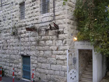
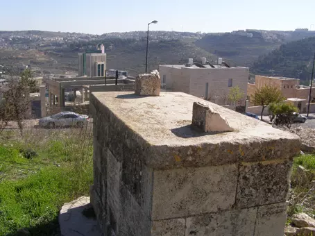
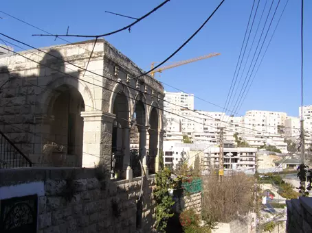
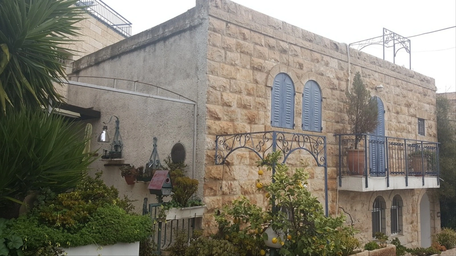
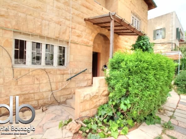
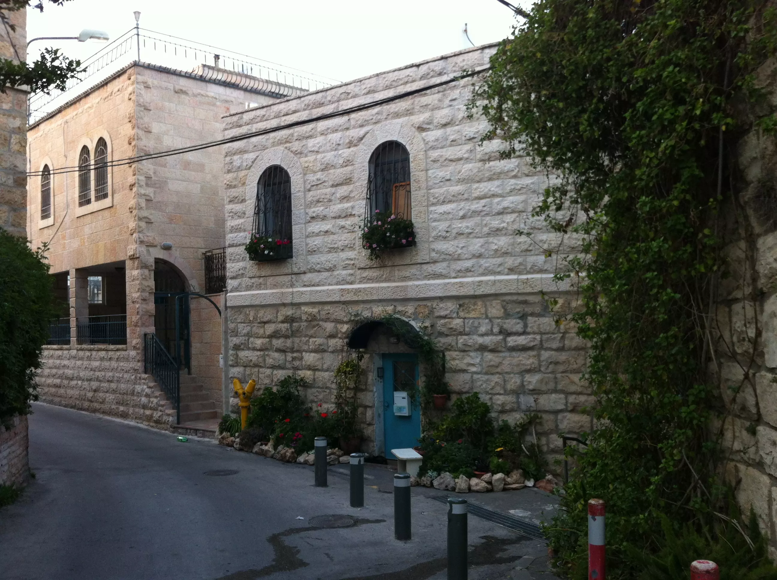
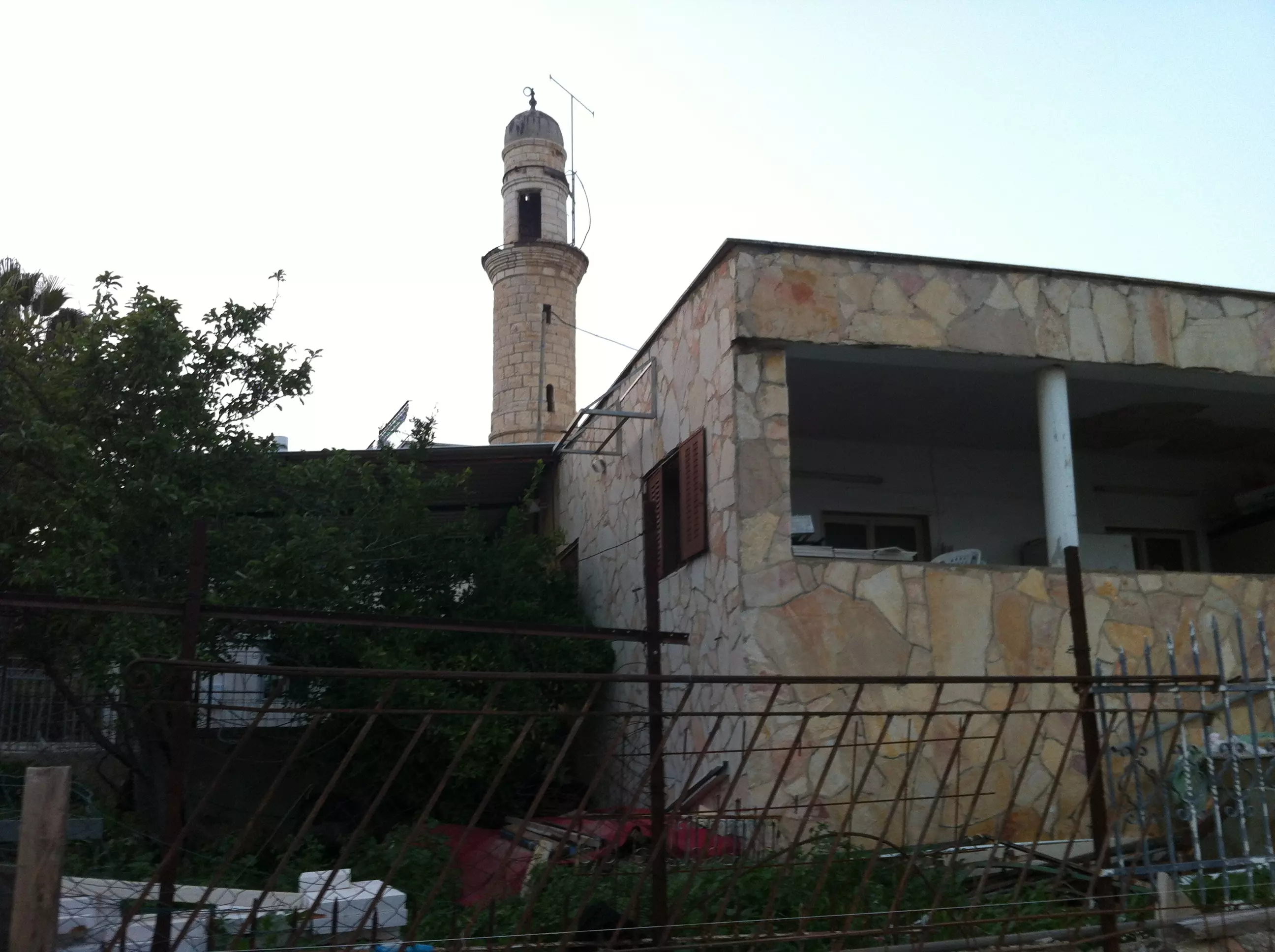
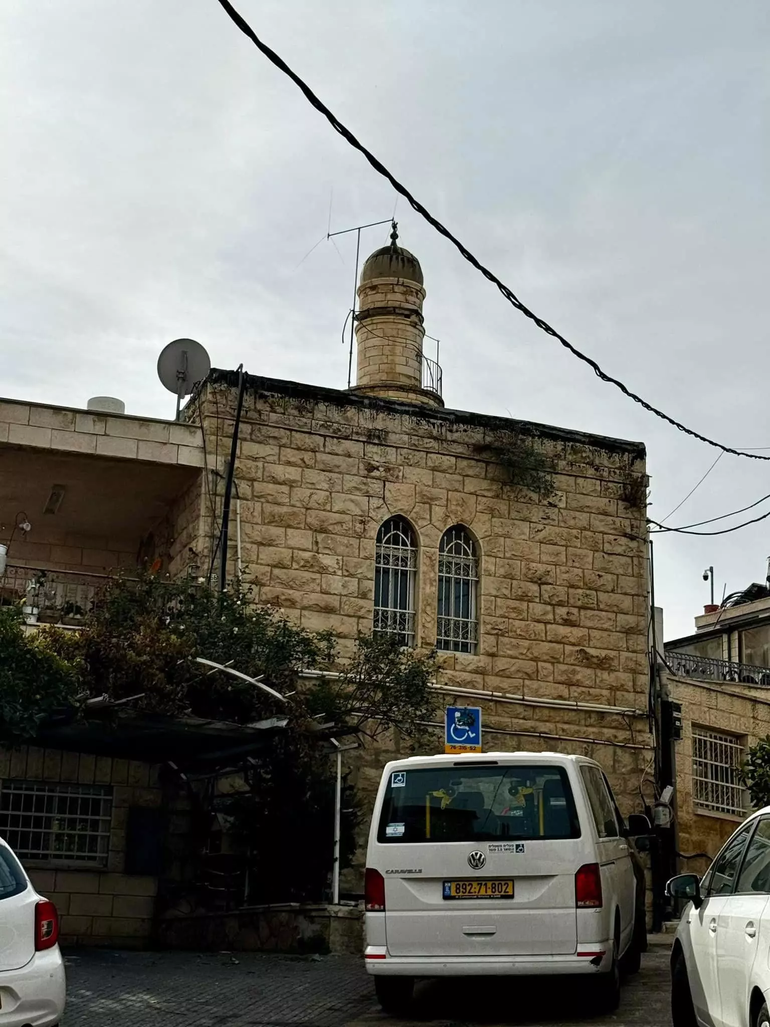
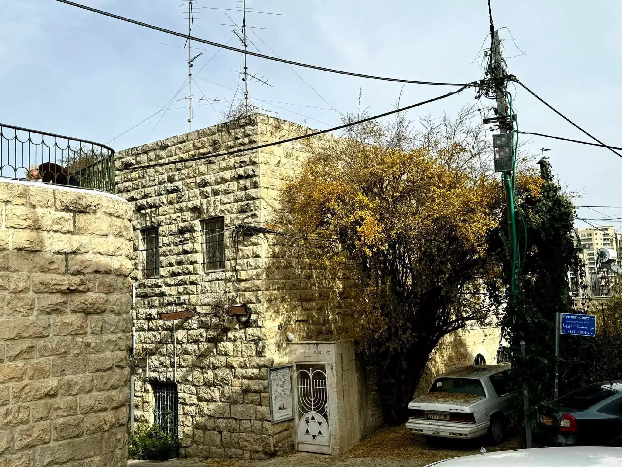
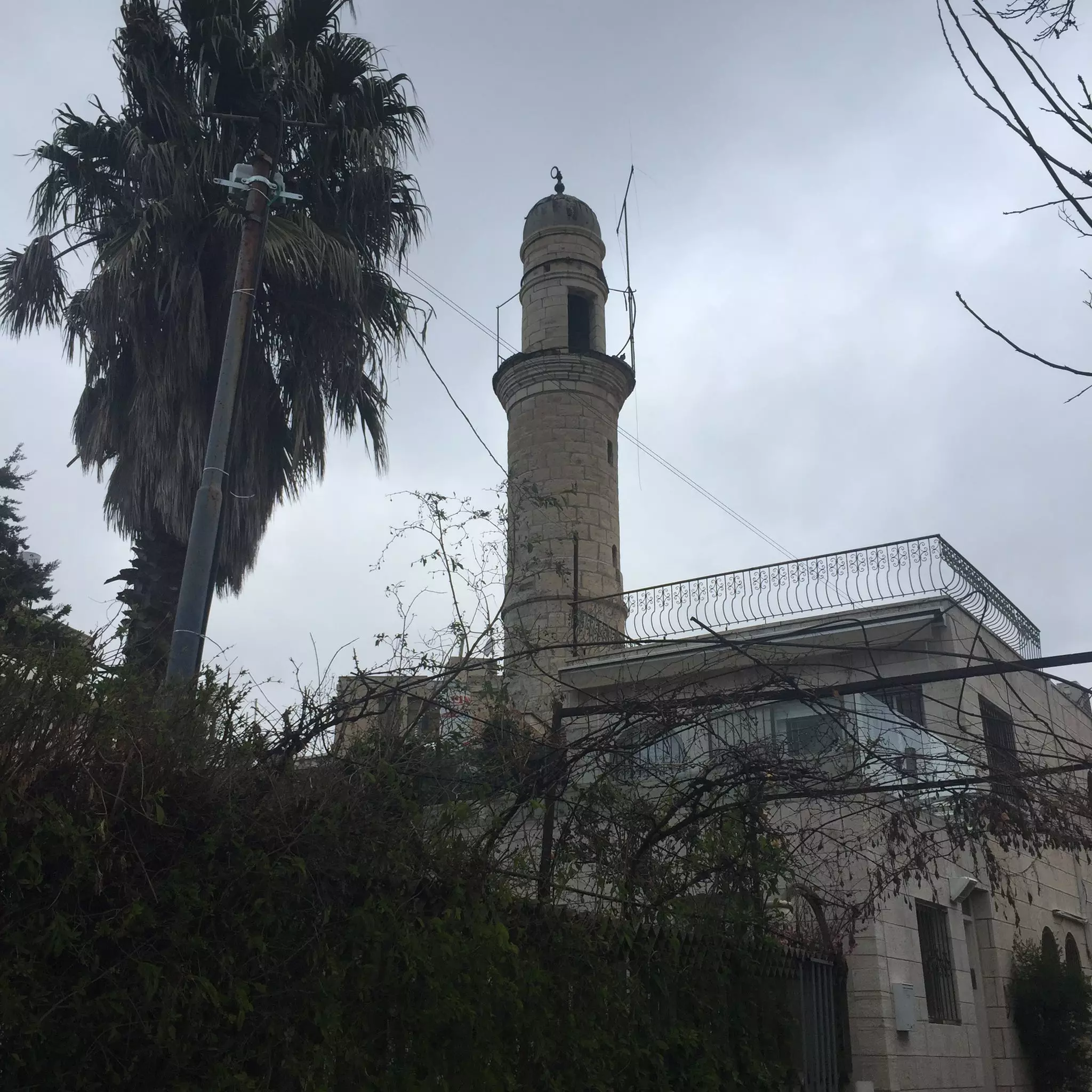
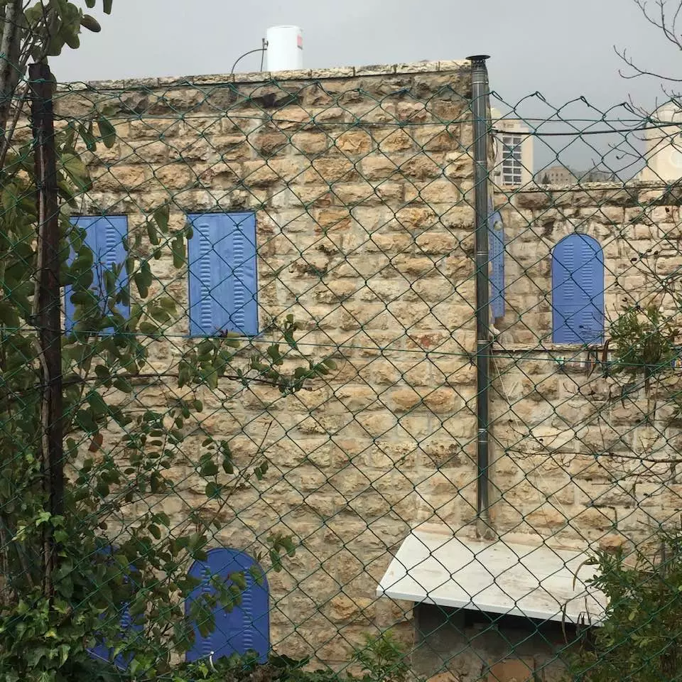
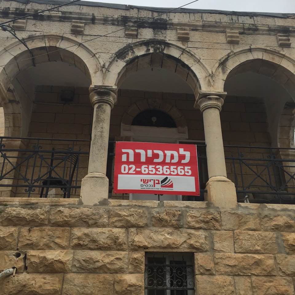
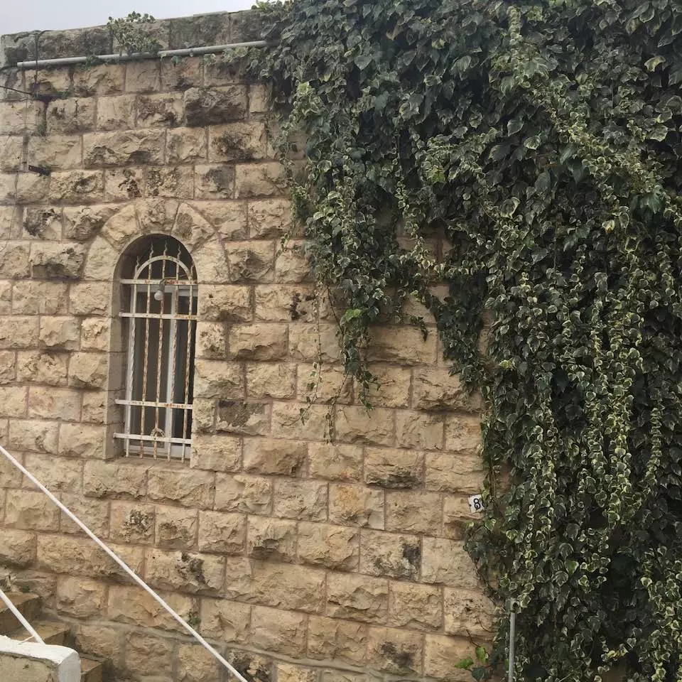
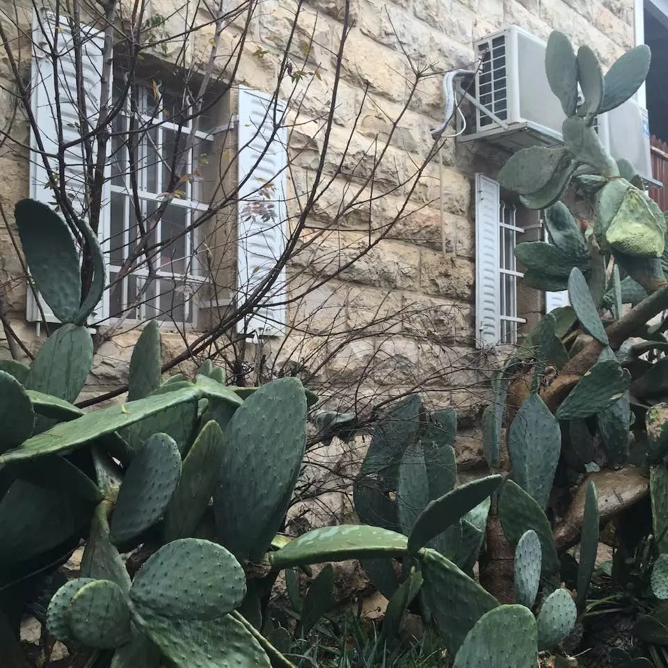
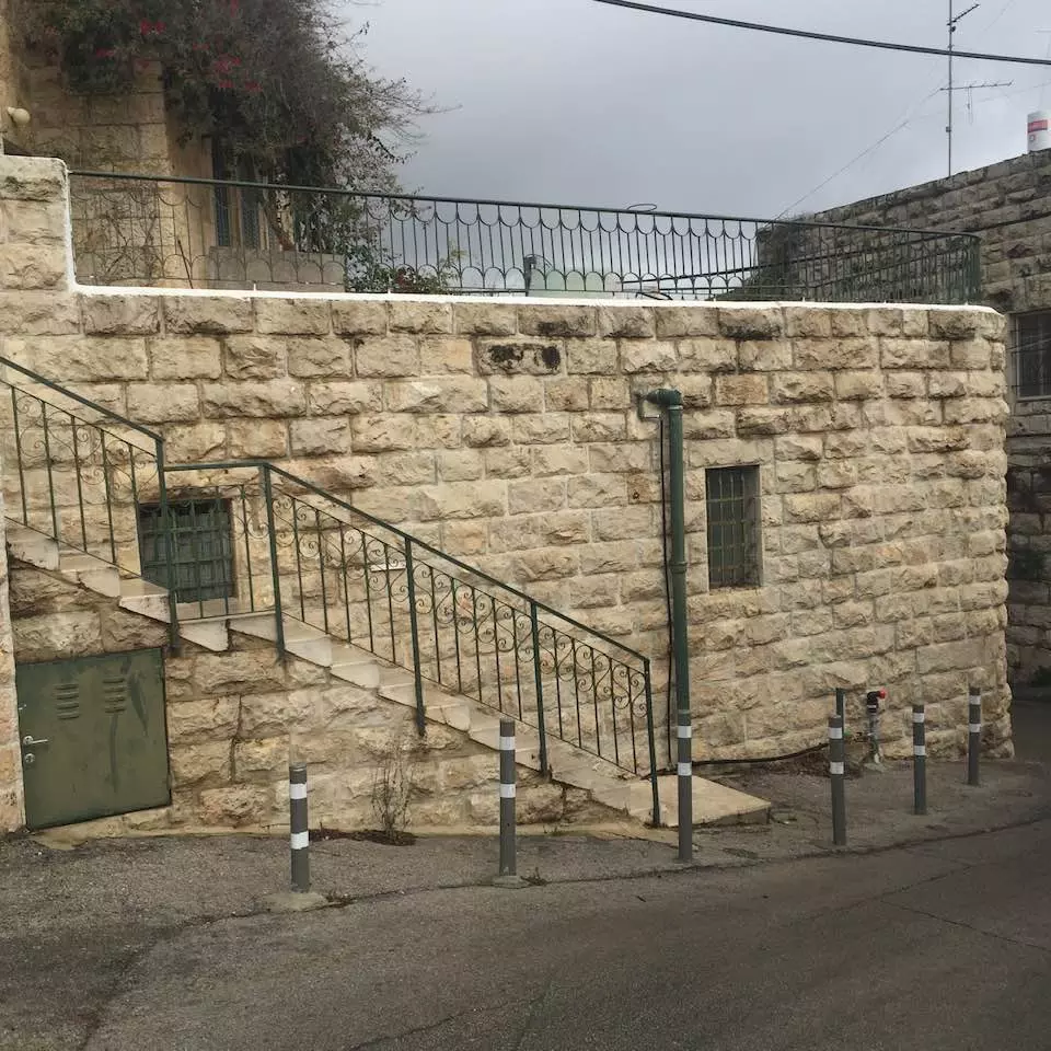
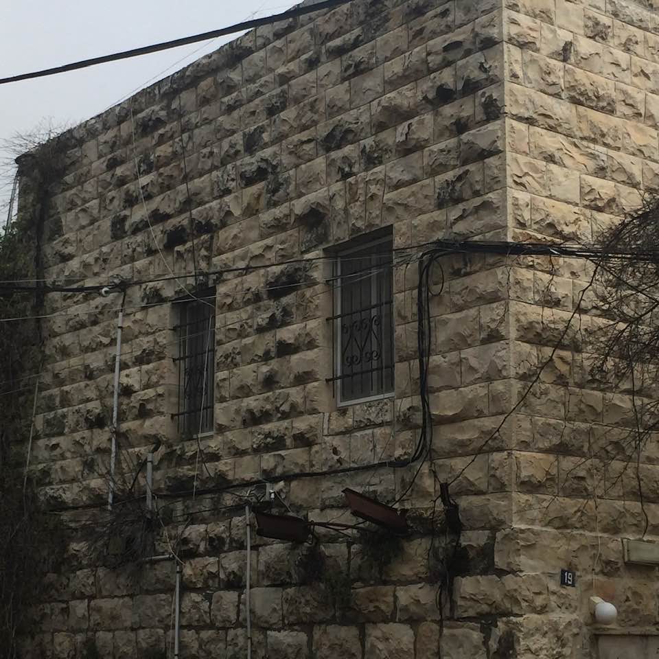
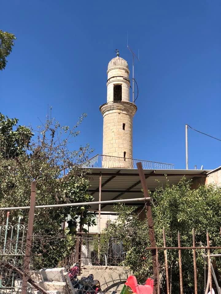
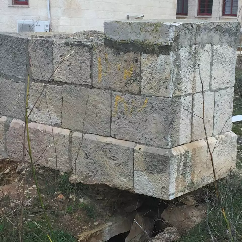
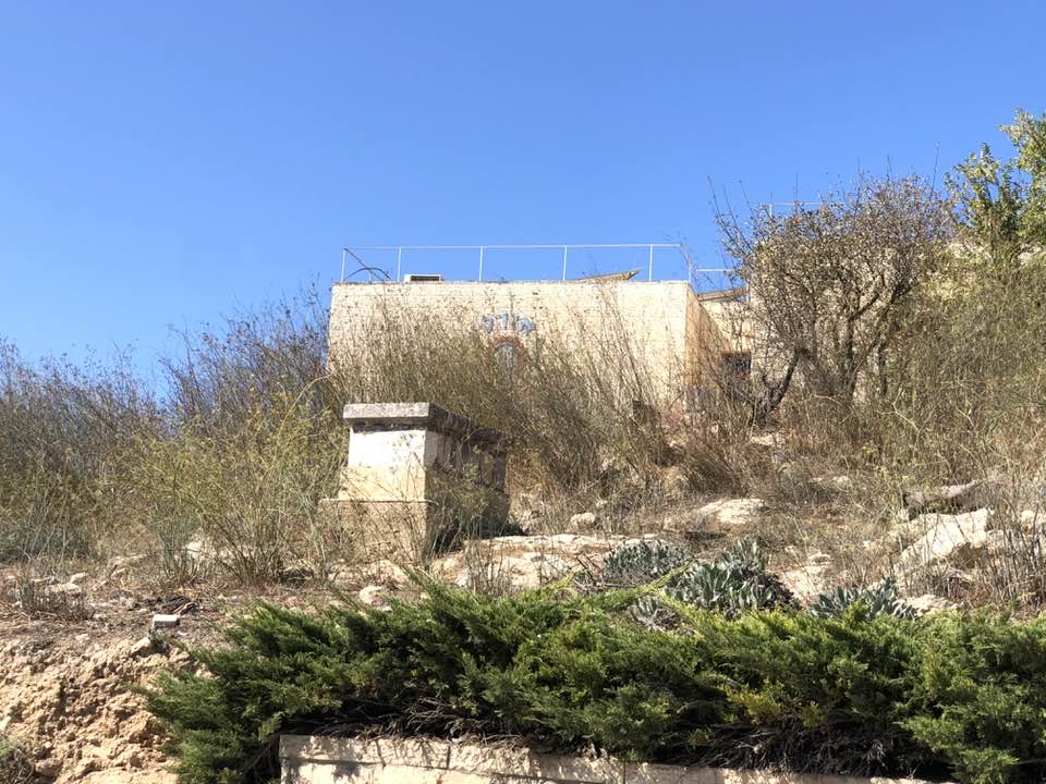
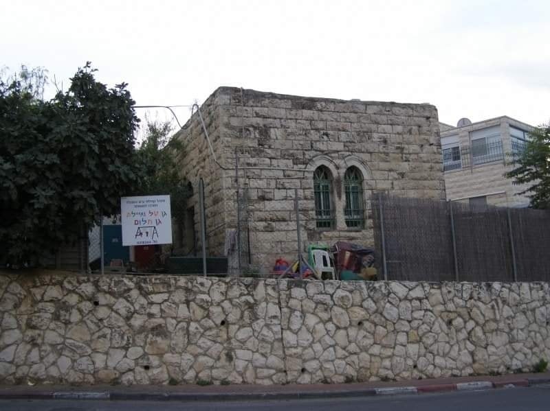
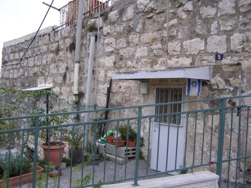
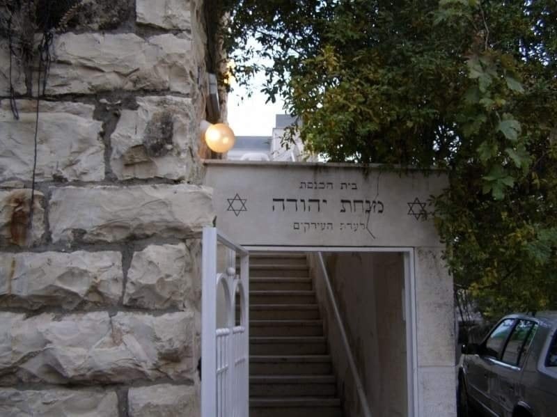
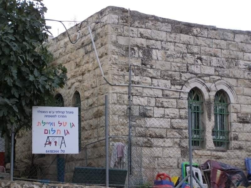
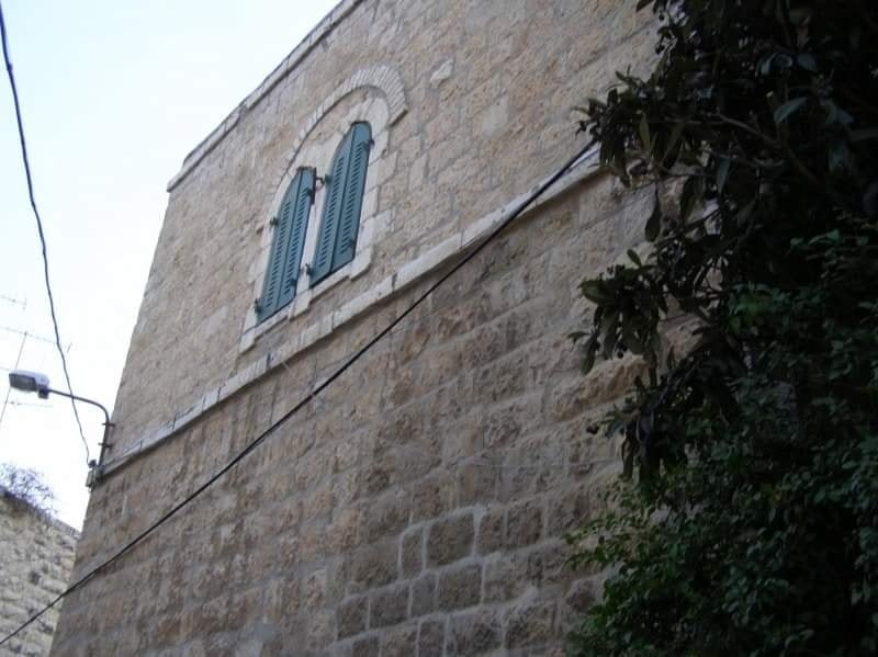
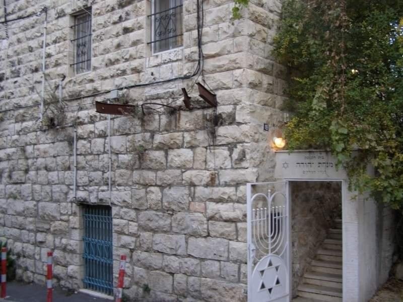
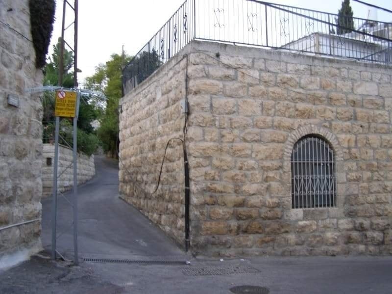
| Village Temains | Many houses remain standing and occupied by Israeli Jewish settlers, although few houses, on the south side, were demolished. al-Maliha's mosque remain standing, but it is CLOSED for worshipers, unless you have an idea on how to open it! | |||||||||||||||||||||
| Ethnically Cleansing | al-Maliha inhabitants were completely ethnically cleansed. | |||||||||||||||||||||
| Clans | In 1850, the village was the home of one of the most influential families in the Jerusalem Mountains, the al-Shaykha family. | |||||||||||||||||||||
| Pre-Nakba Land Ownership |
**Town Lands' Demarcation Maps |
|||||||||||||||||||||
| Land Usage As of 1945 |
|
|||||||||||||||||||||
| Population |
|
|||||||||||||||||||||
| Number of Houses | In (1931): 299 (includes 'Ayn Yalu) | |||||||||||||||||||||
| Near By Towns |
||||||||||||||||||||||
|
||||||||||||||||||||||
| Town's Name Through History | At one point al-Maliha was known also by Maliha al-Sughra. | |||||||||||||||||||||
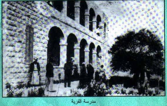
| Schools | One public elementary school for boys which remains standing. | |||||||||||||||||||||
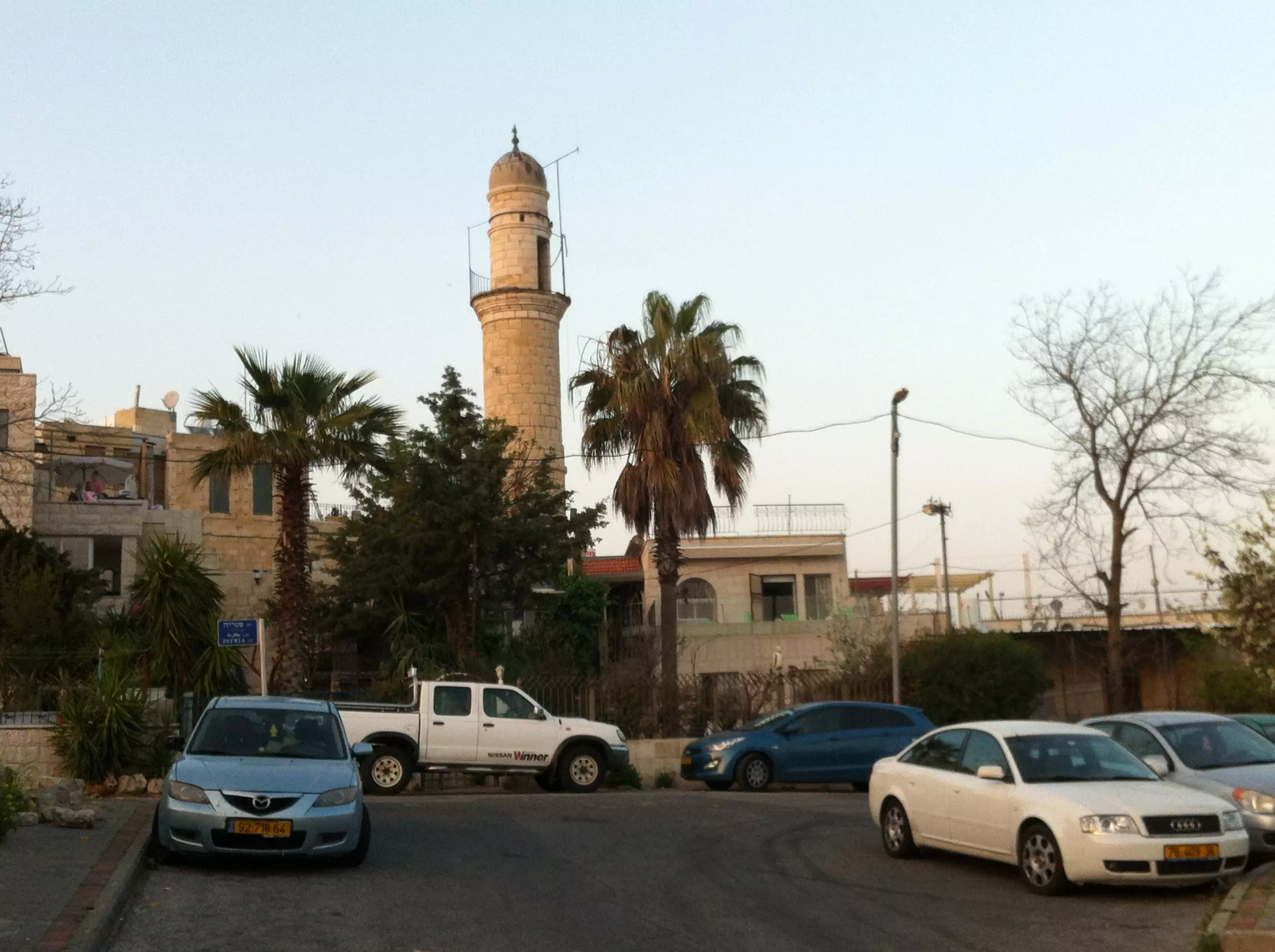
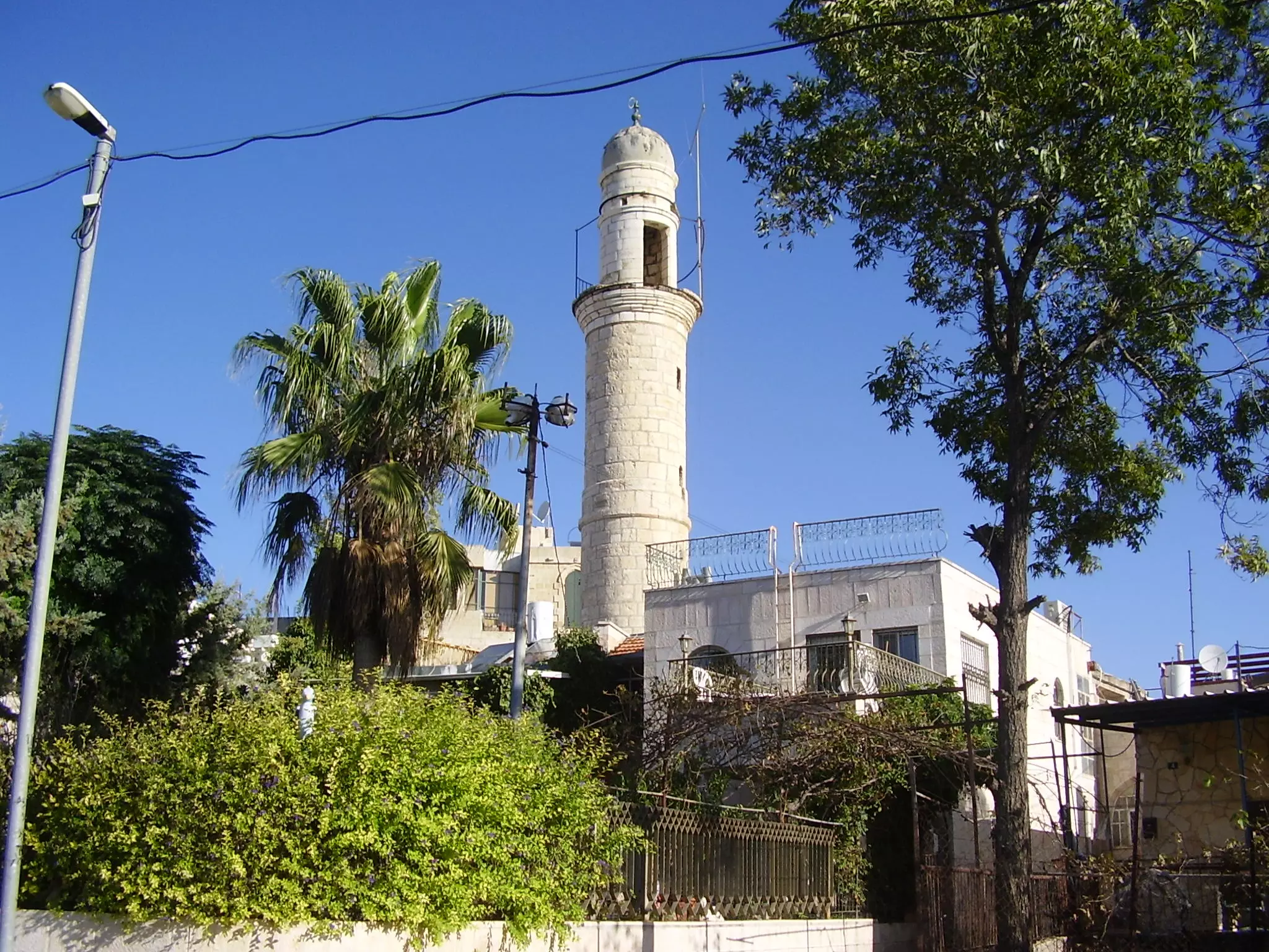
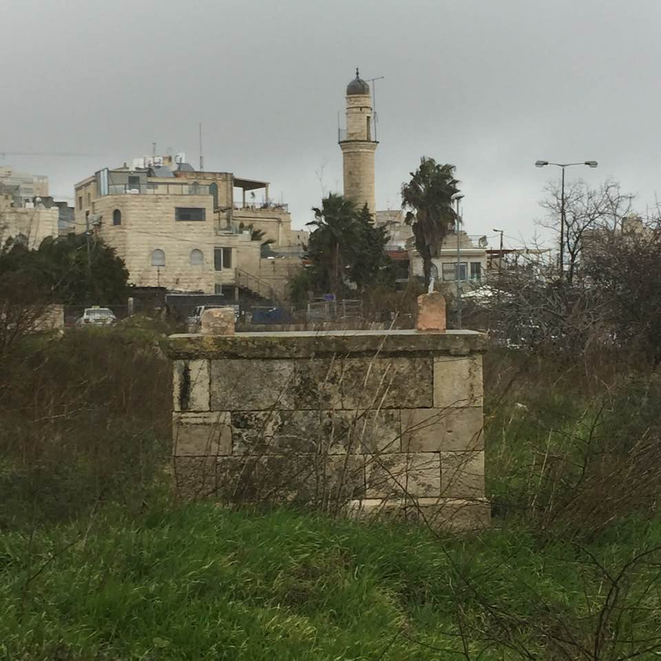
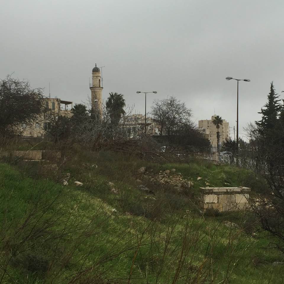
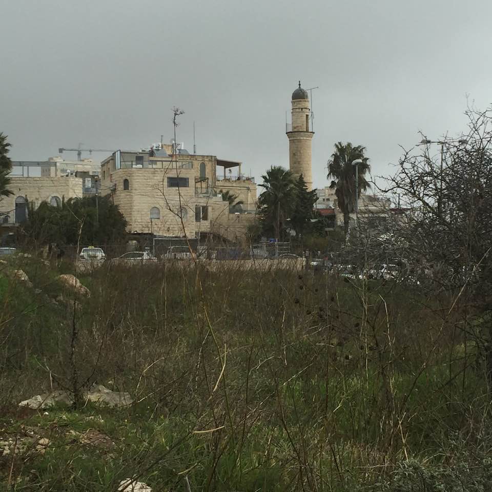
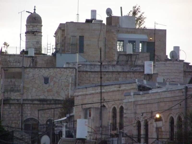
| Places of Warship | One large mosque known by 'Umar ibn al-Khattab and until this date it's still standing. | |||||||||||||||||||||
| Exculsive Jewish Colonies Who Usurped Village Lands |
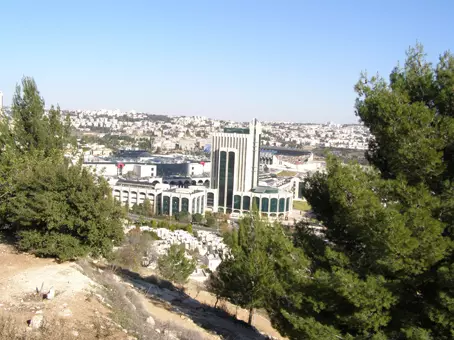
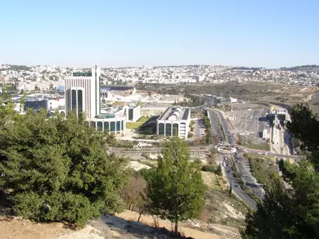
Manachat and Israeli Jerusalem neighborhood of Ramat Daniya | |||||||||||||||||||||
| Featured Video | ||||||||||||||||||||||
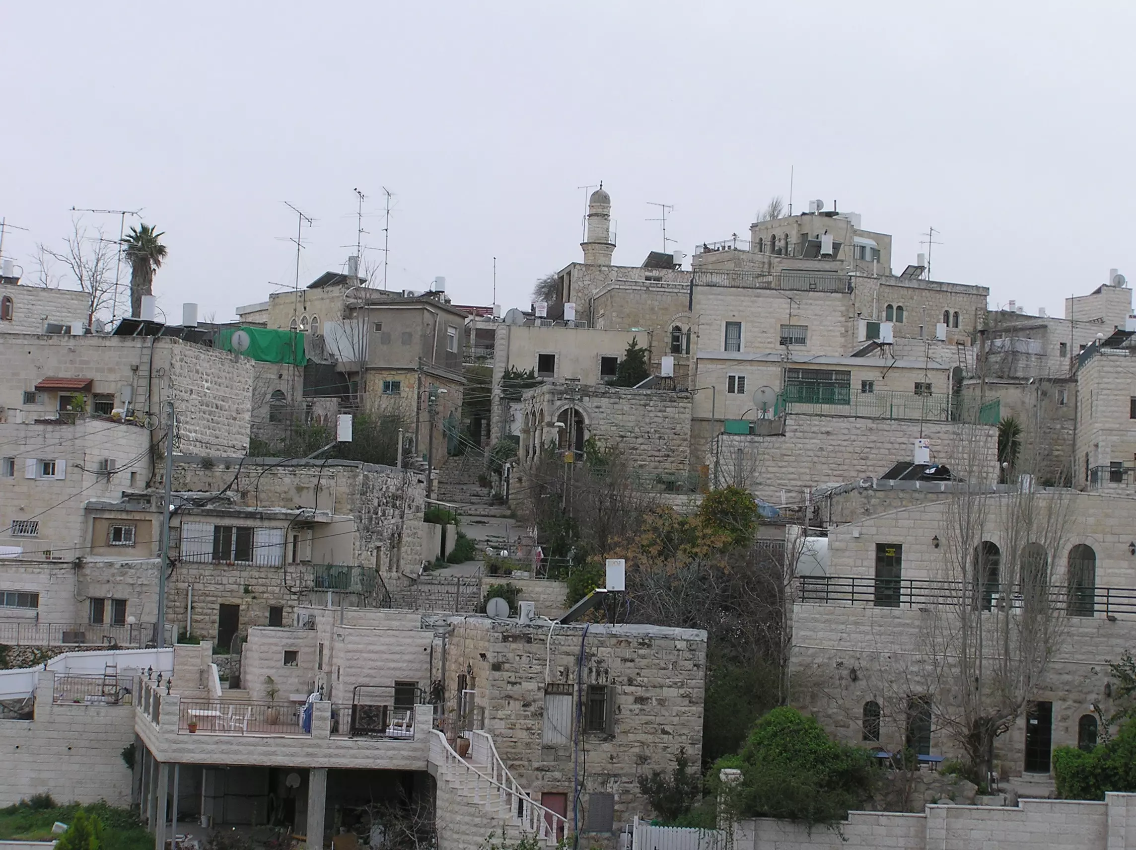
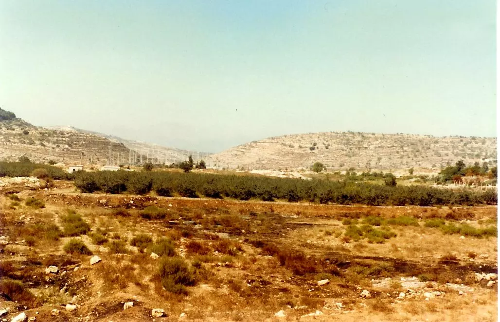
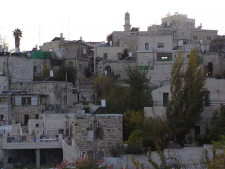
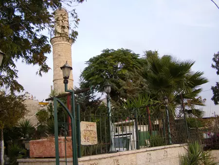
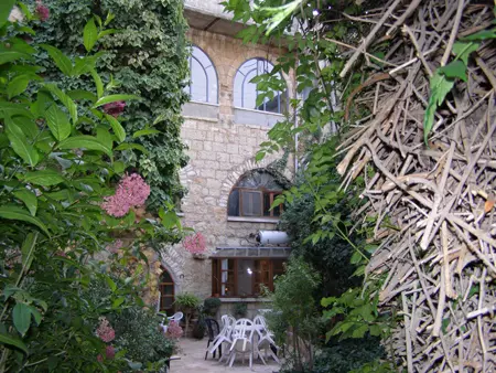
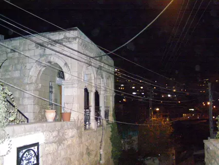
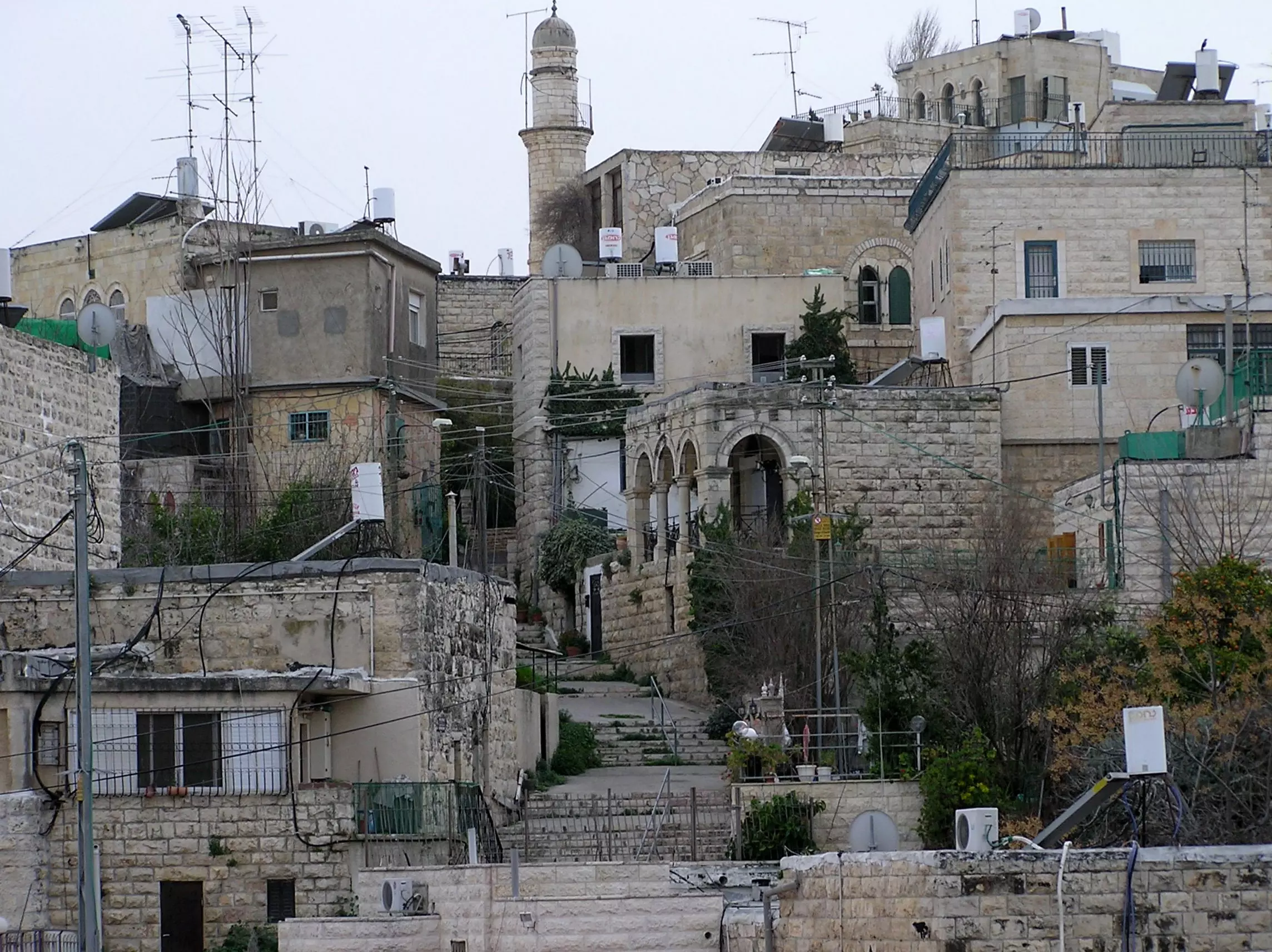
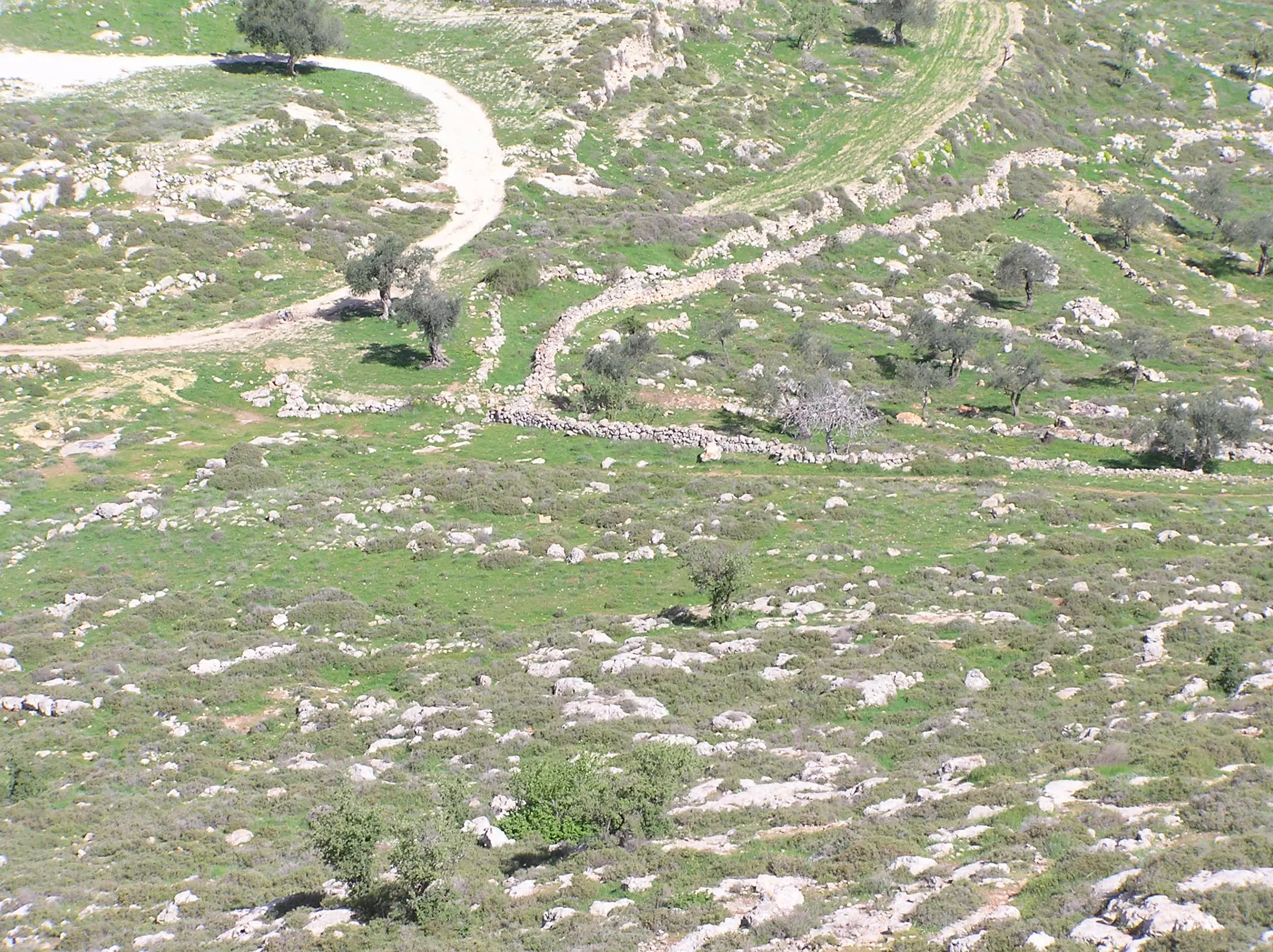
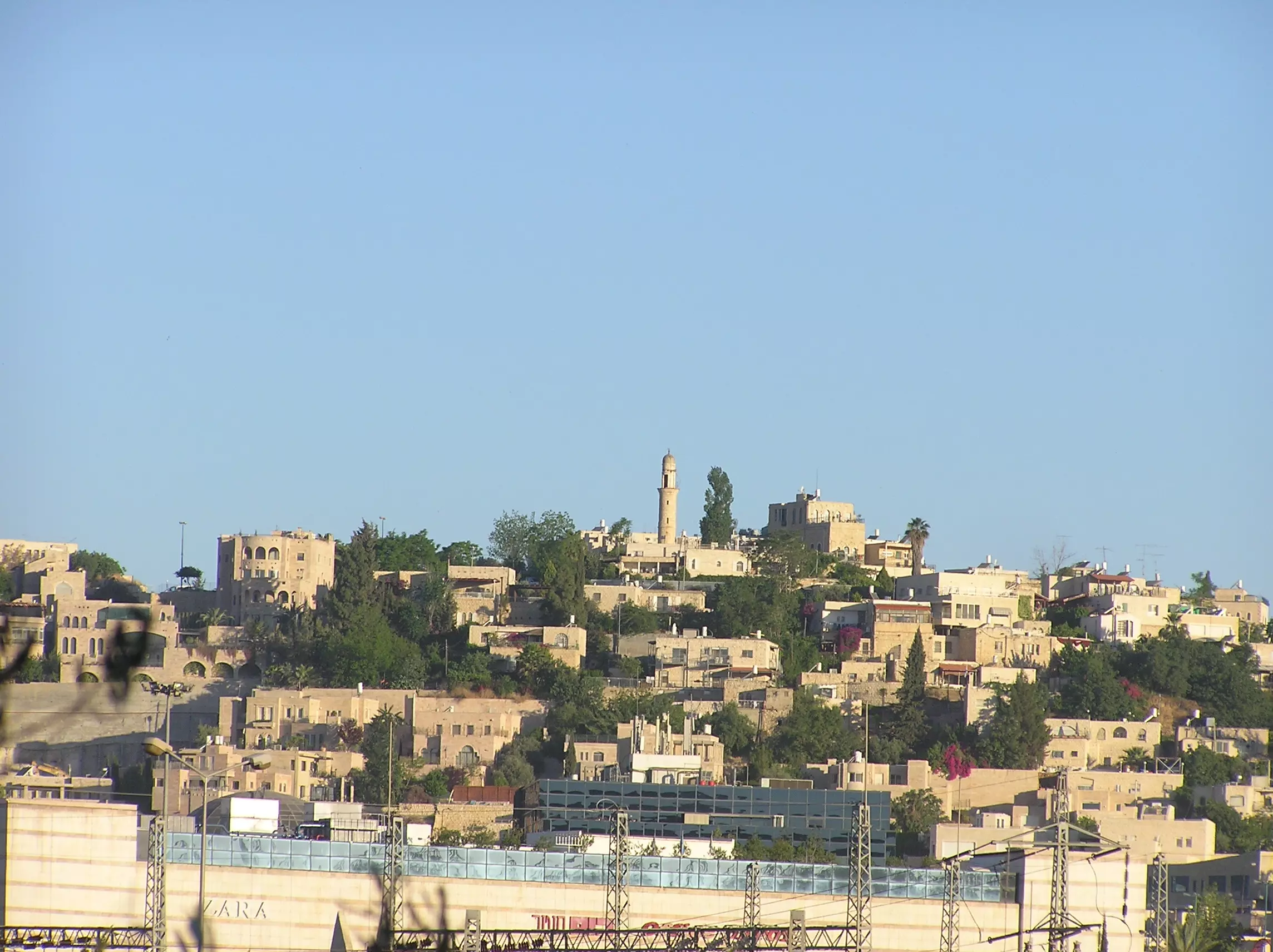
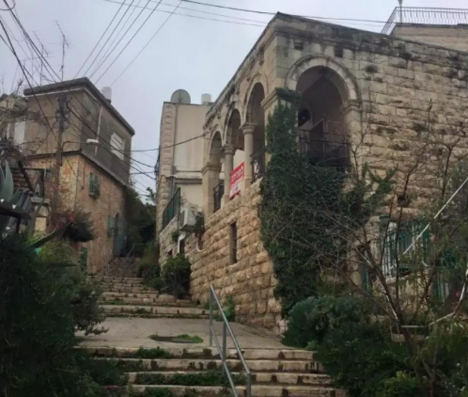
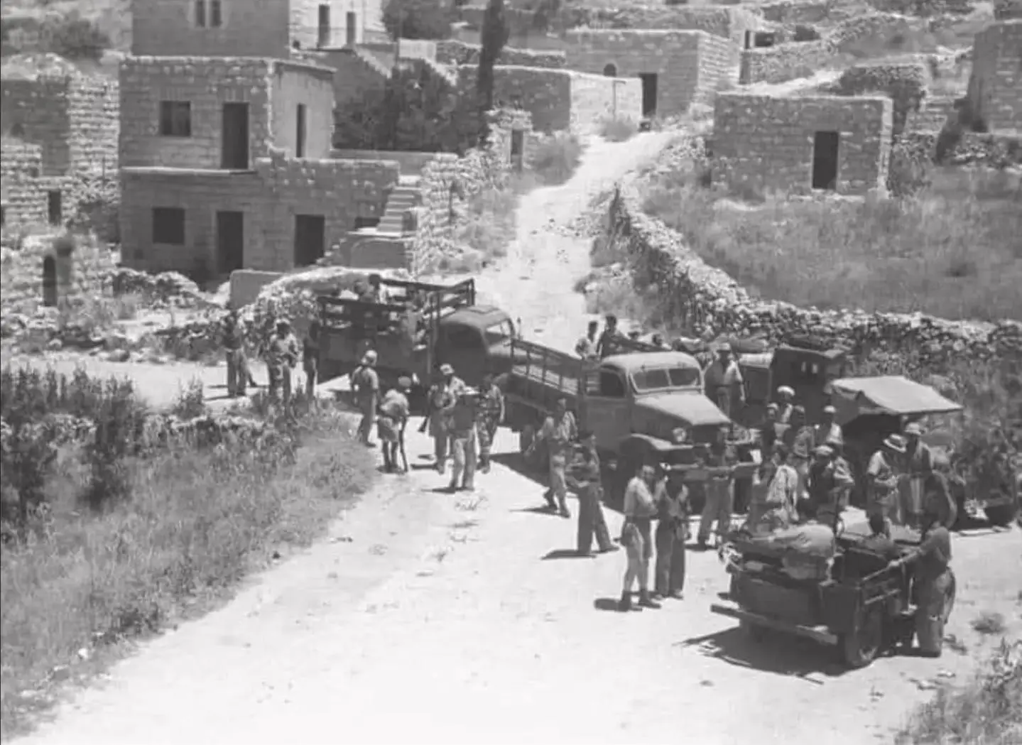
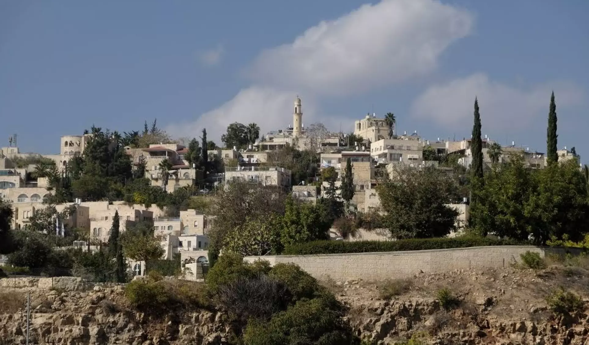
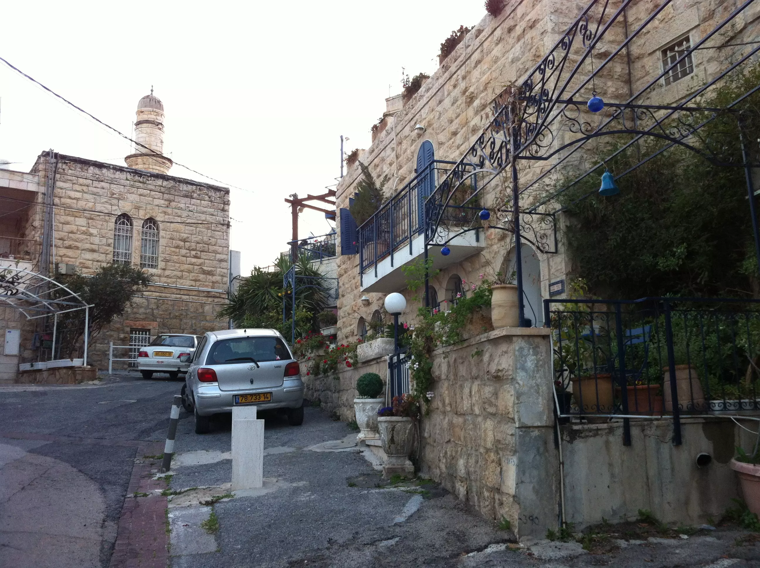
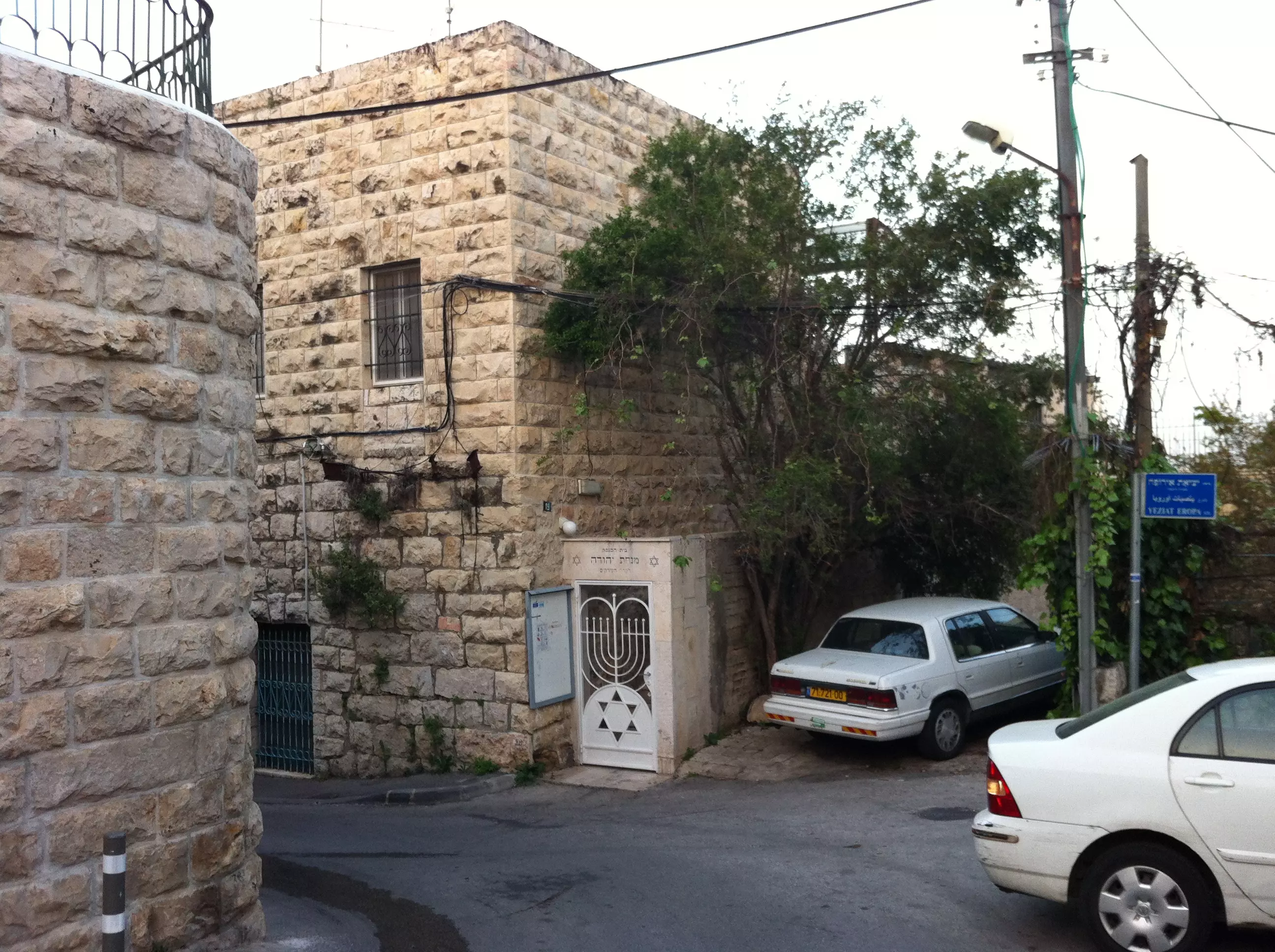
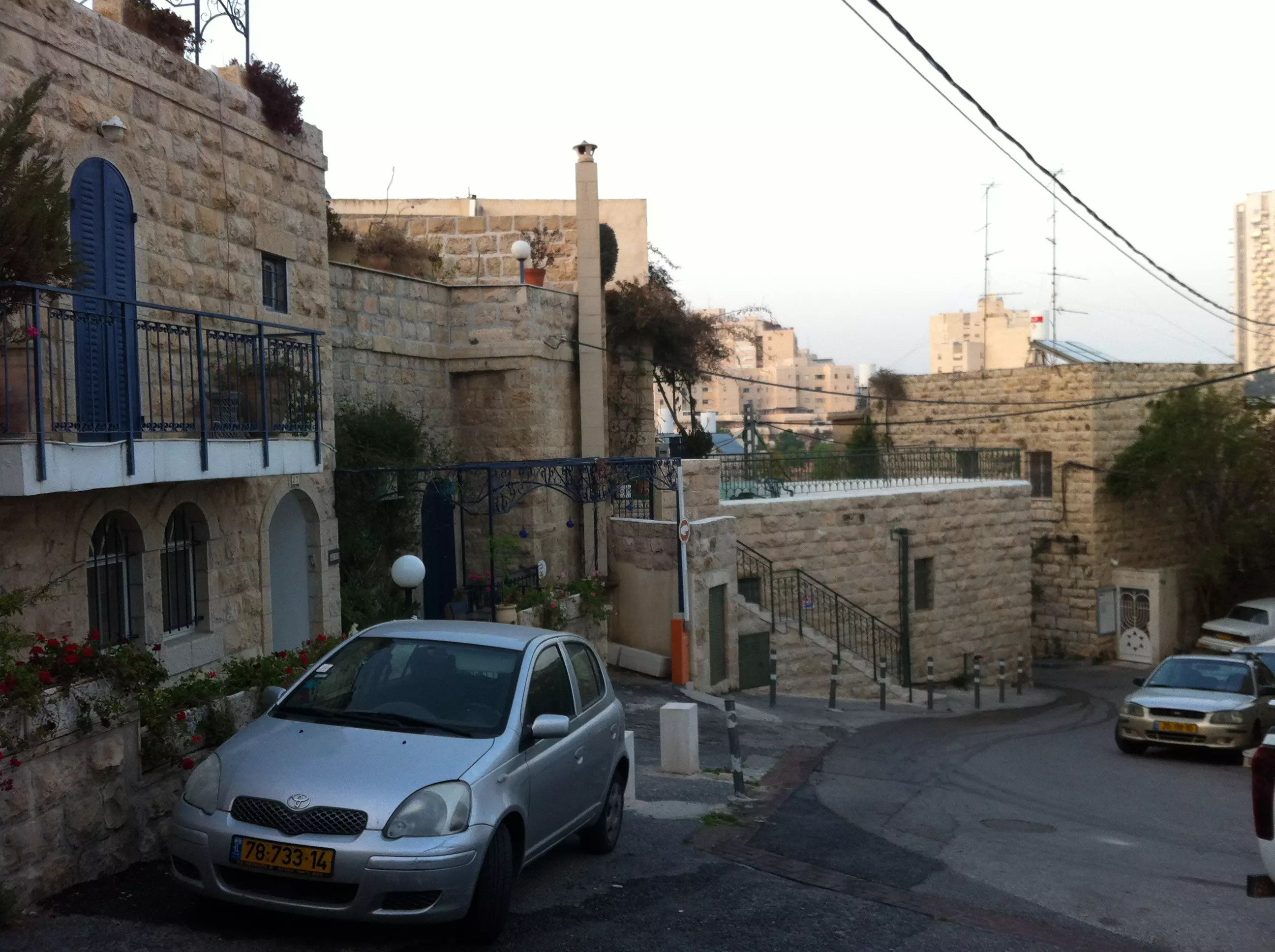
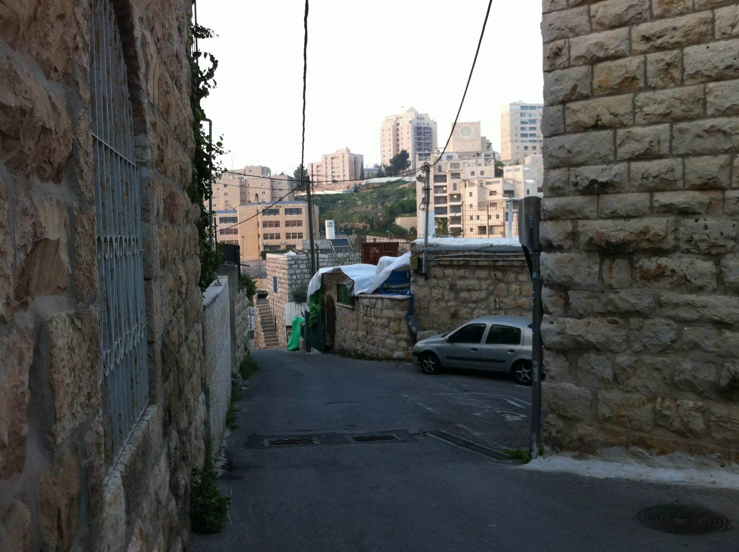
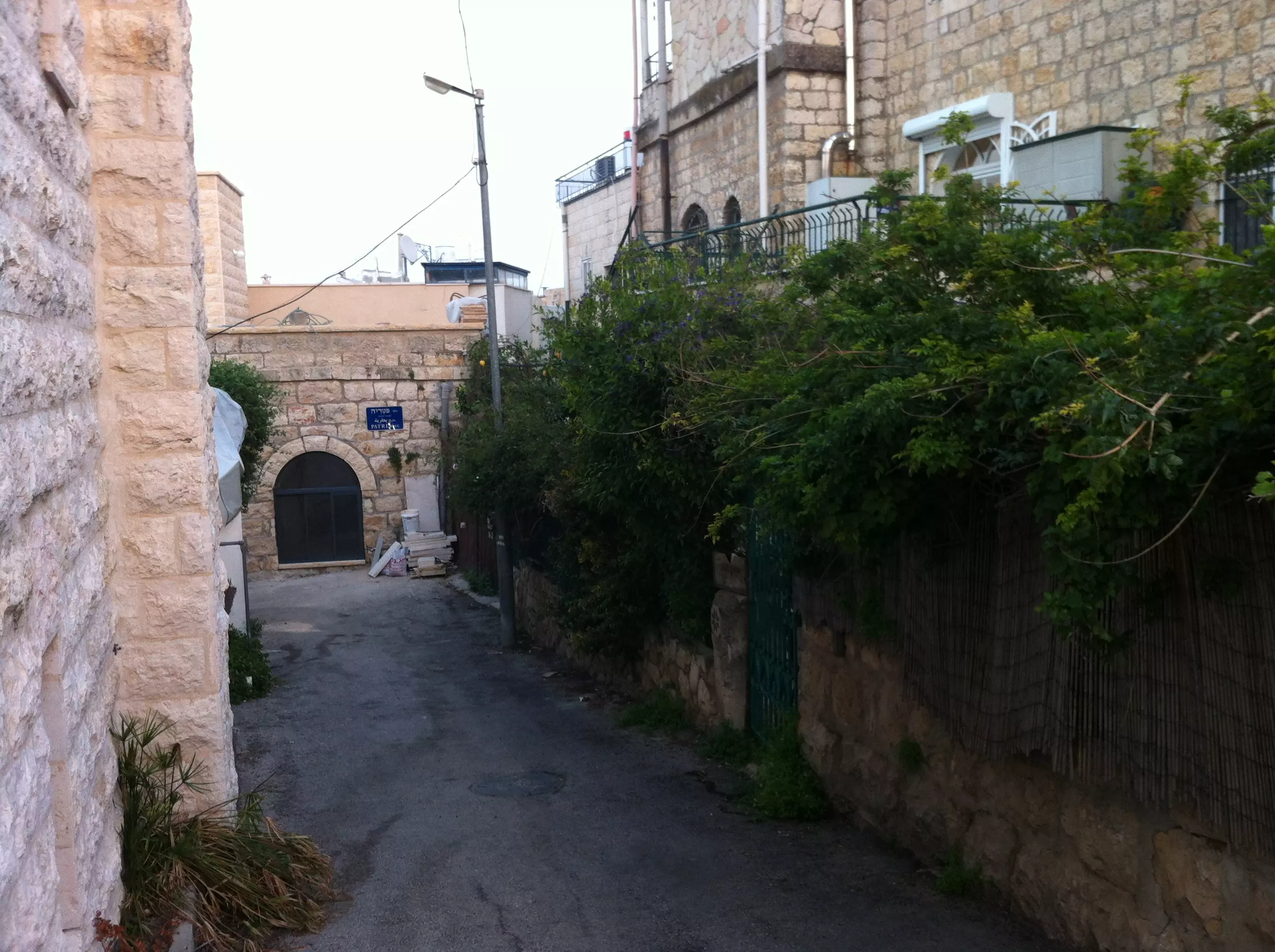
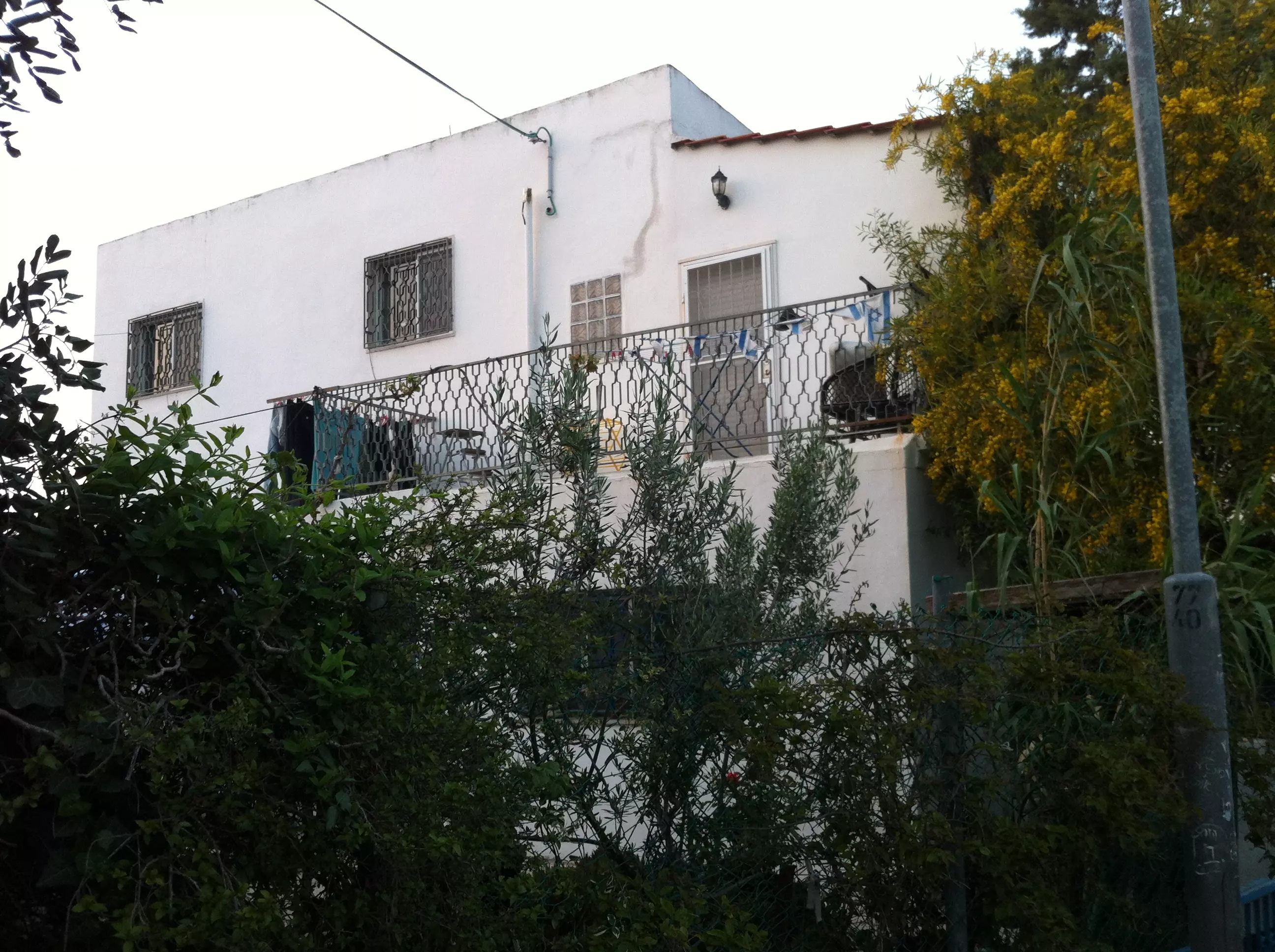
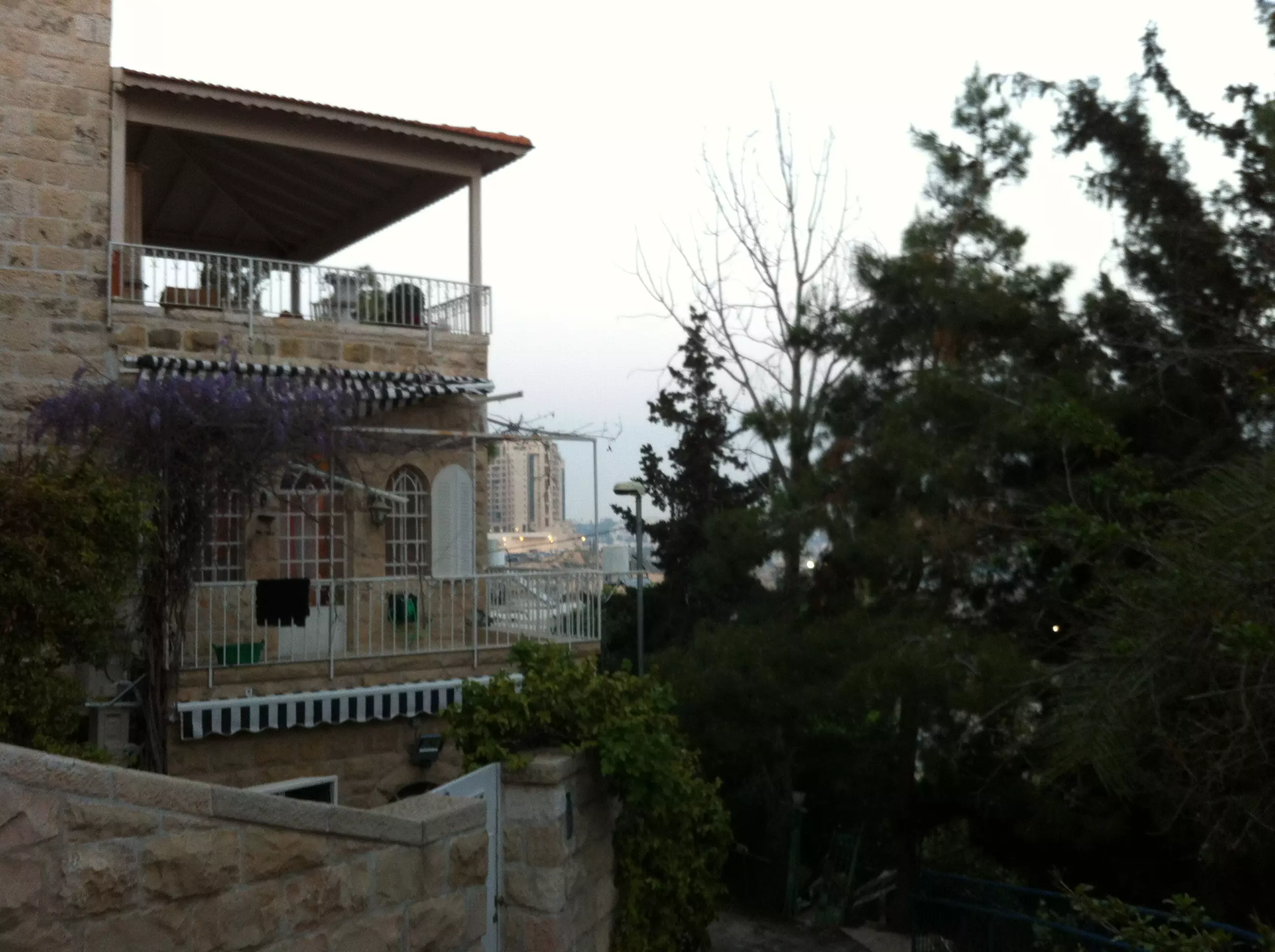
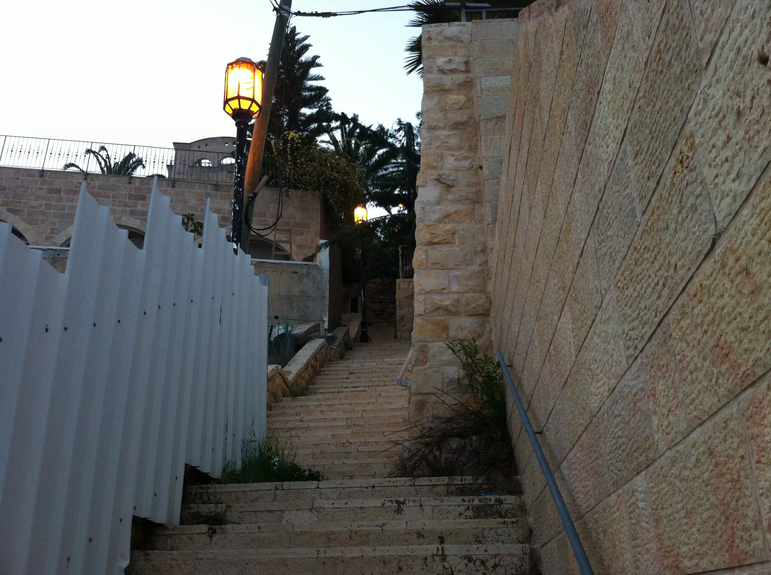
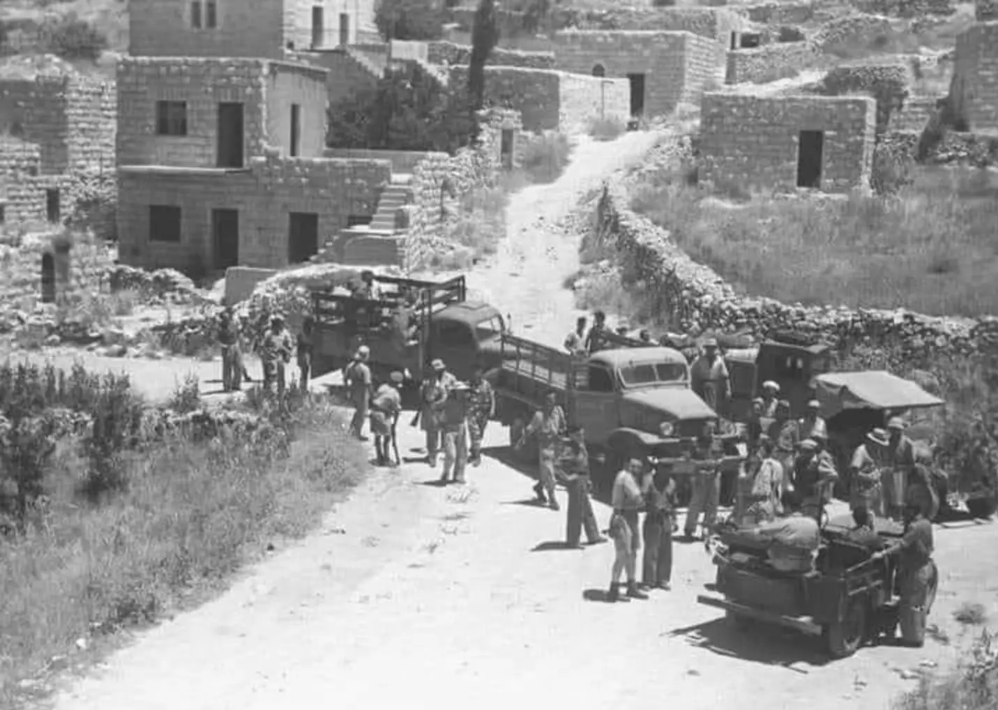
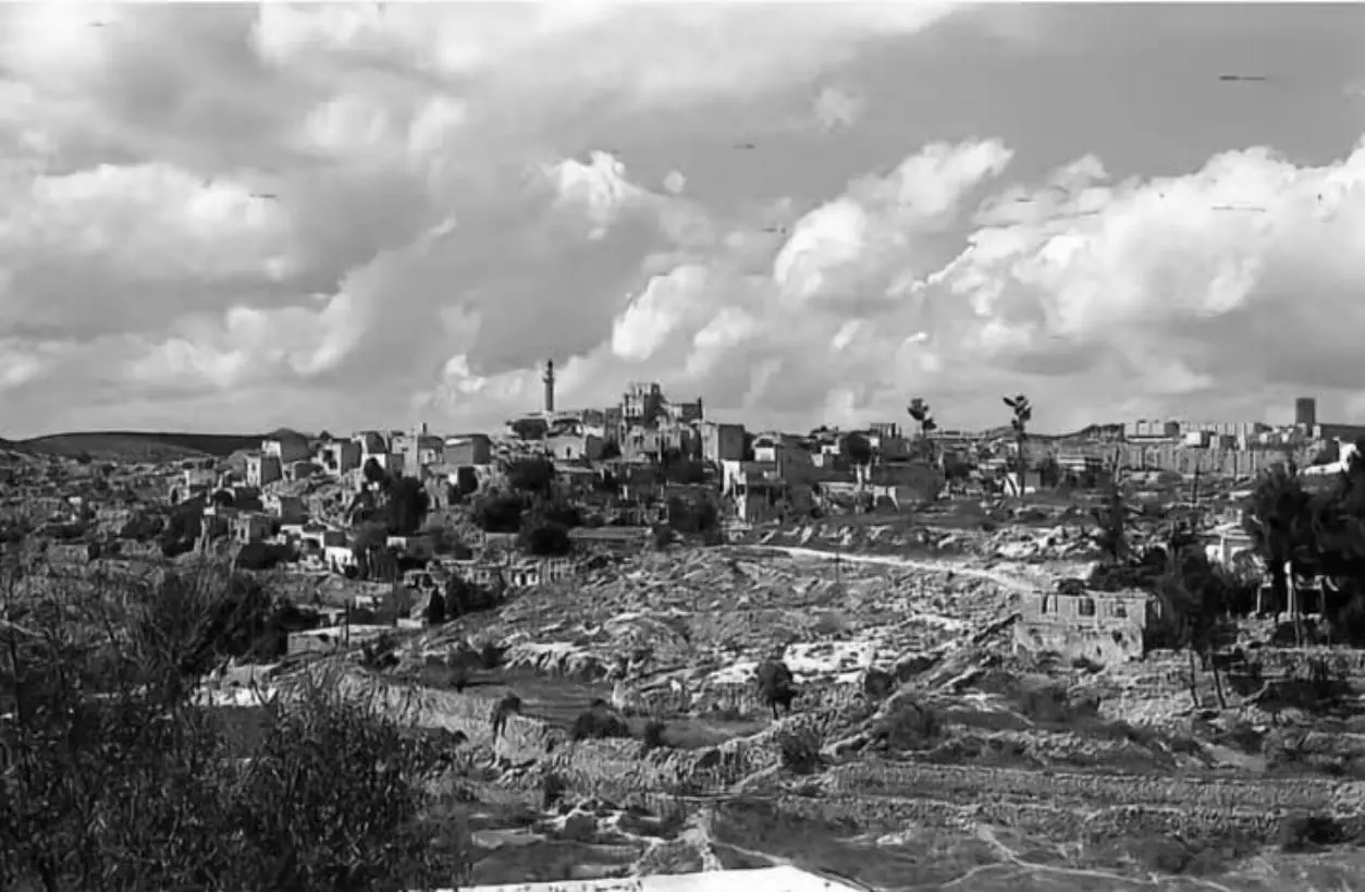
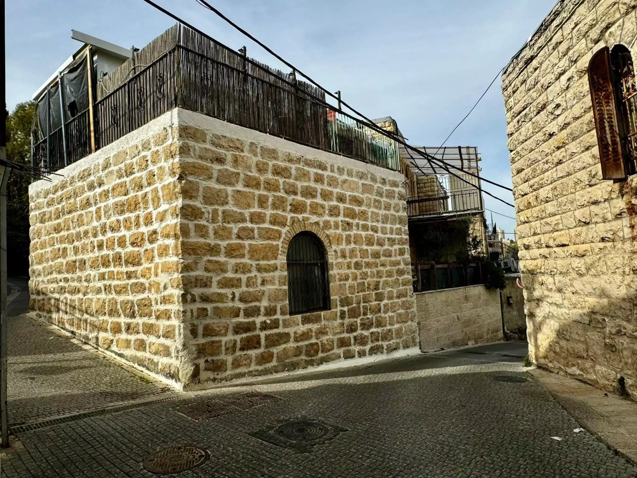
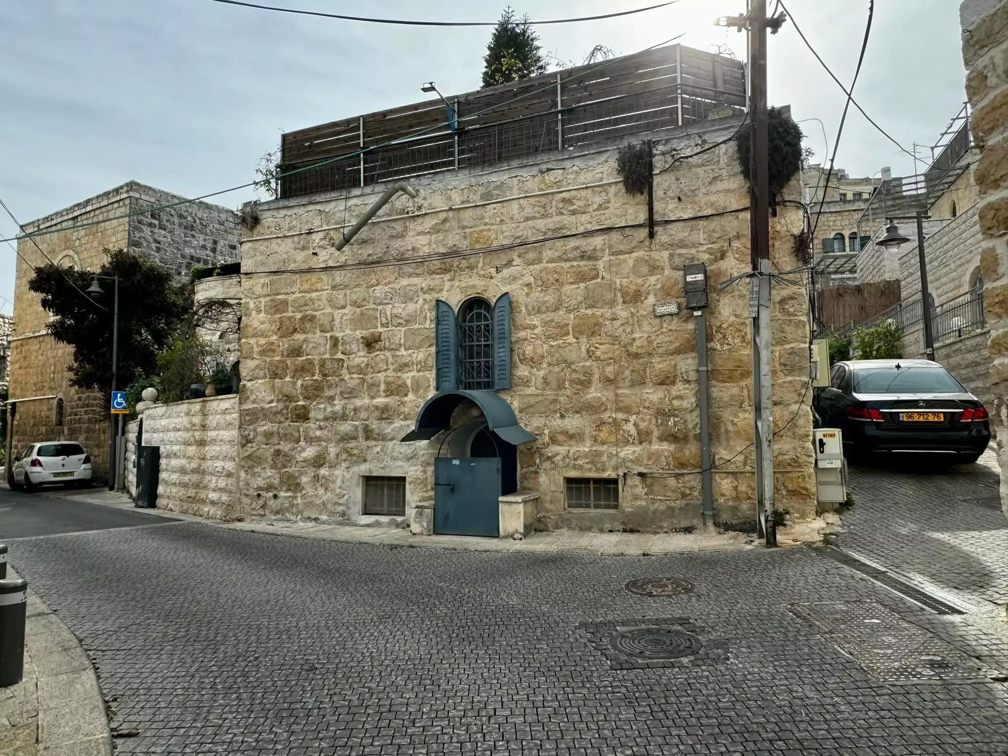
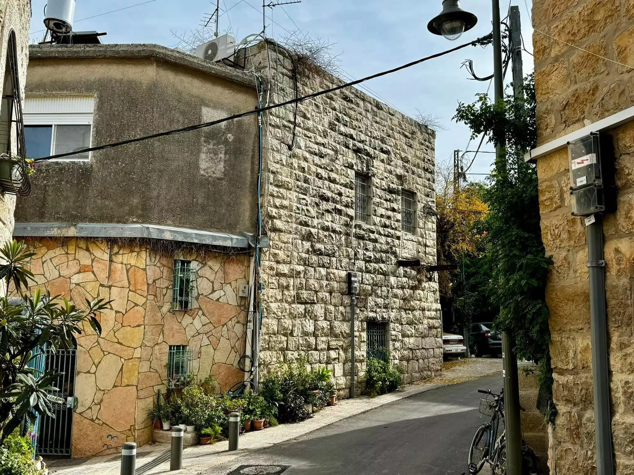
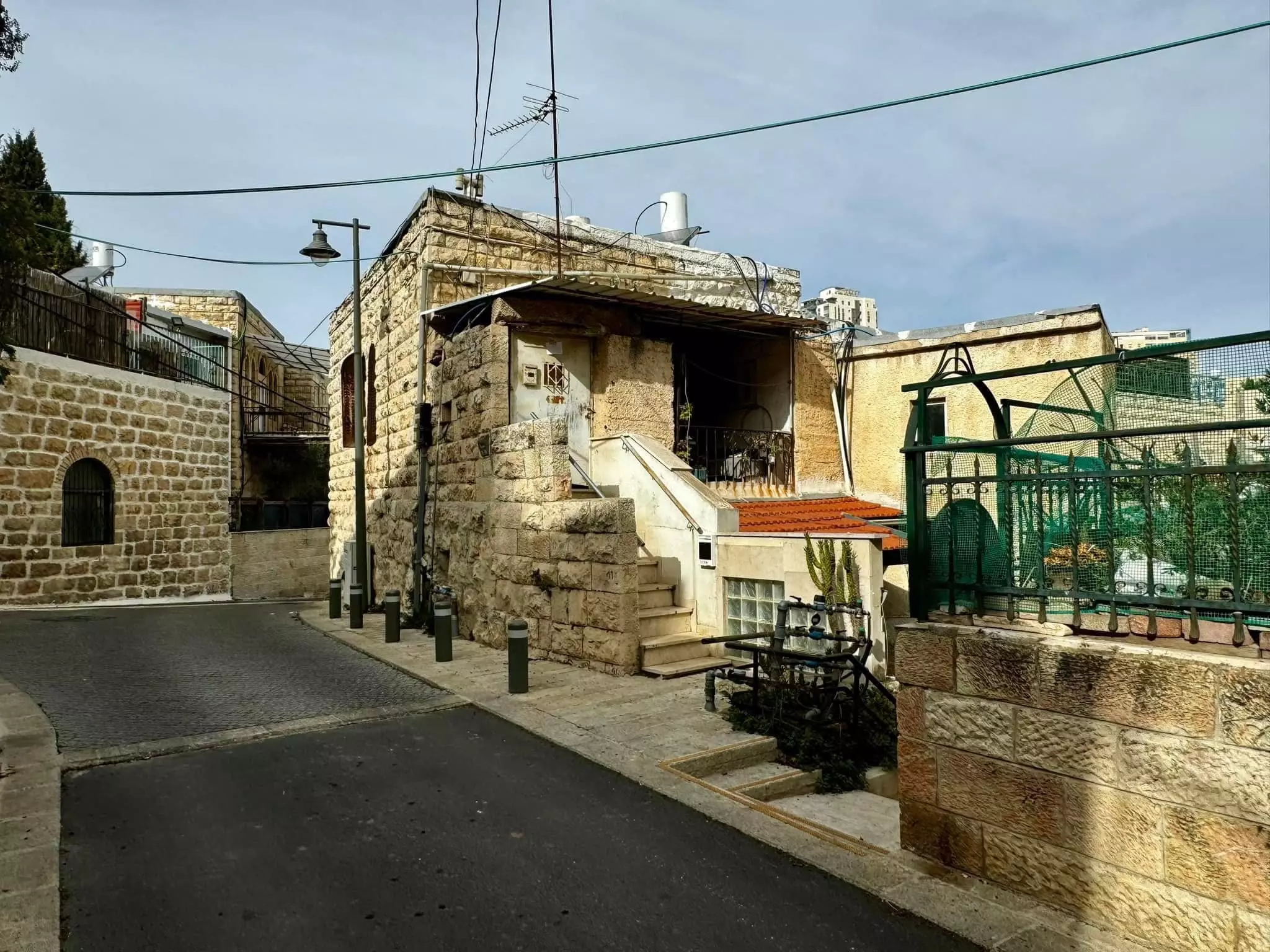
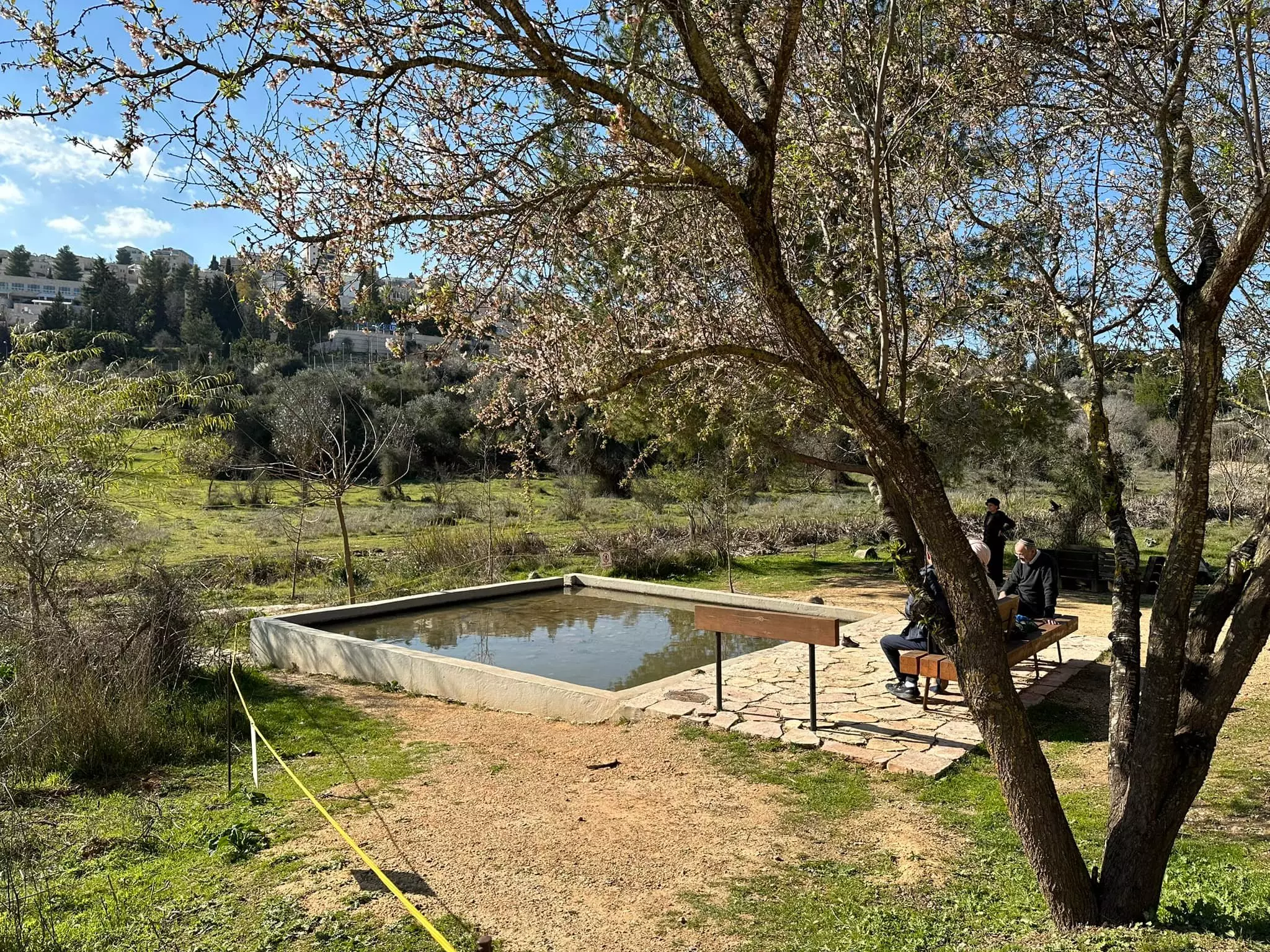
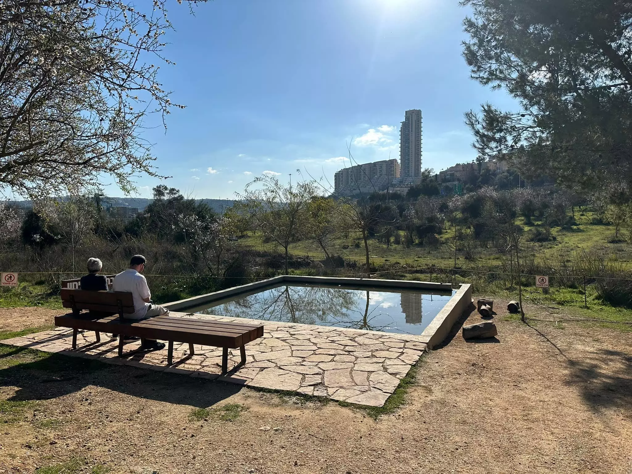
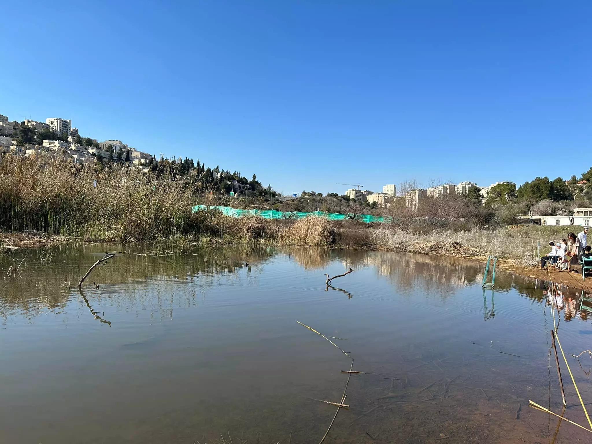
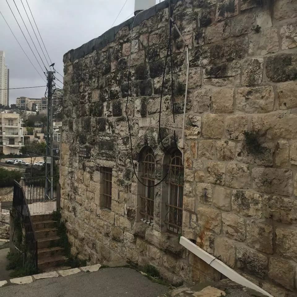
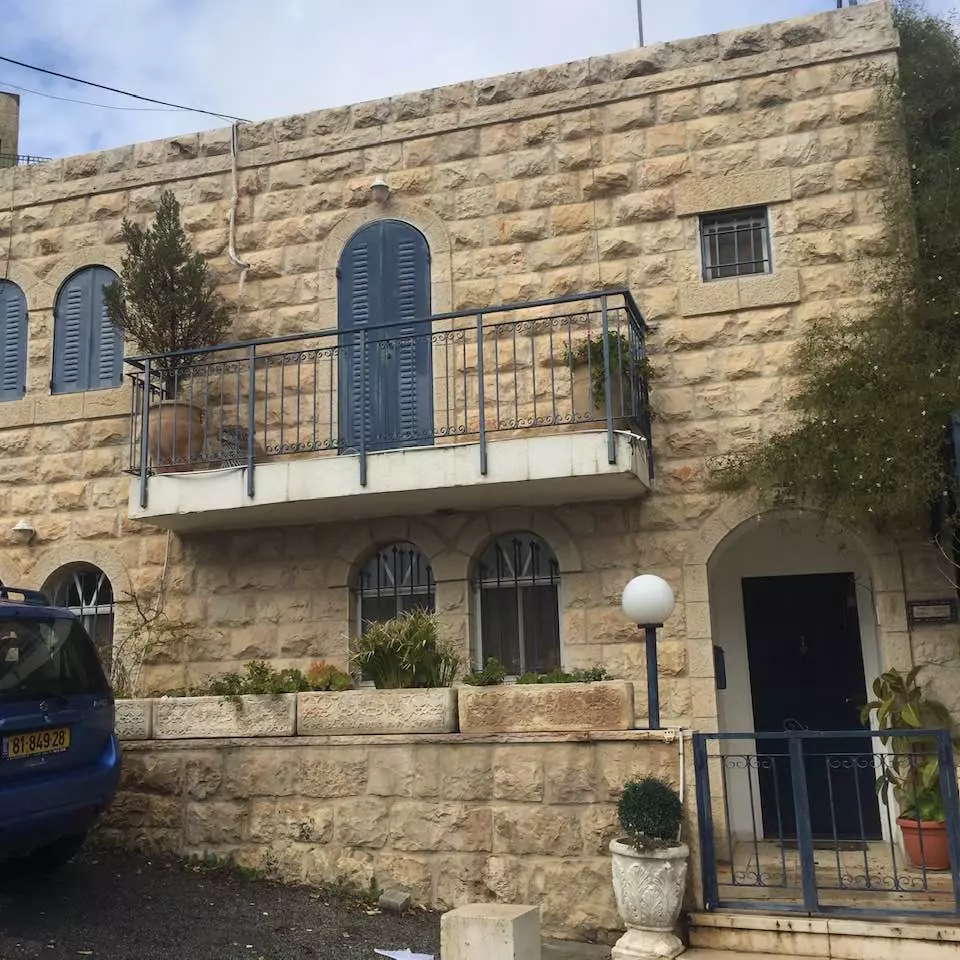
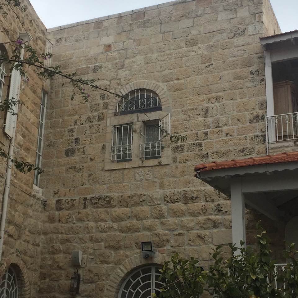
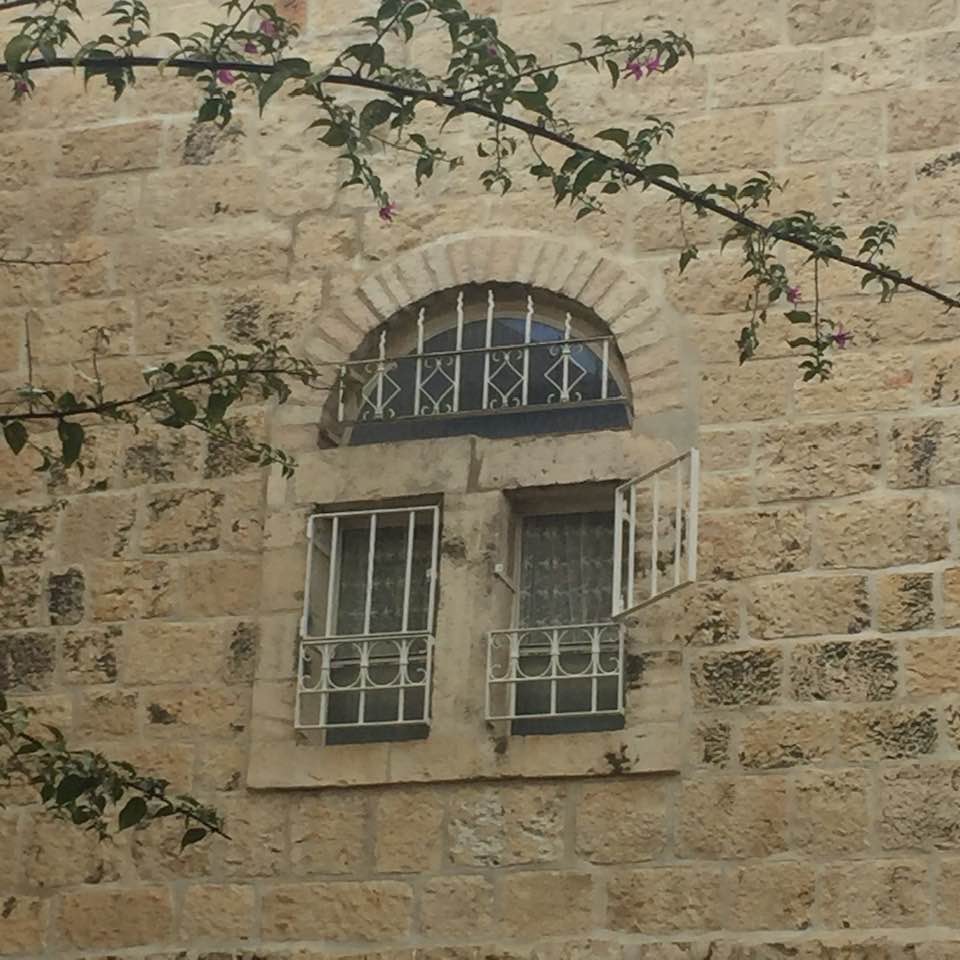
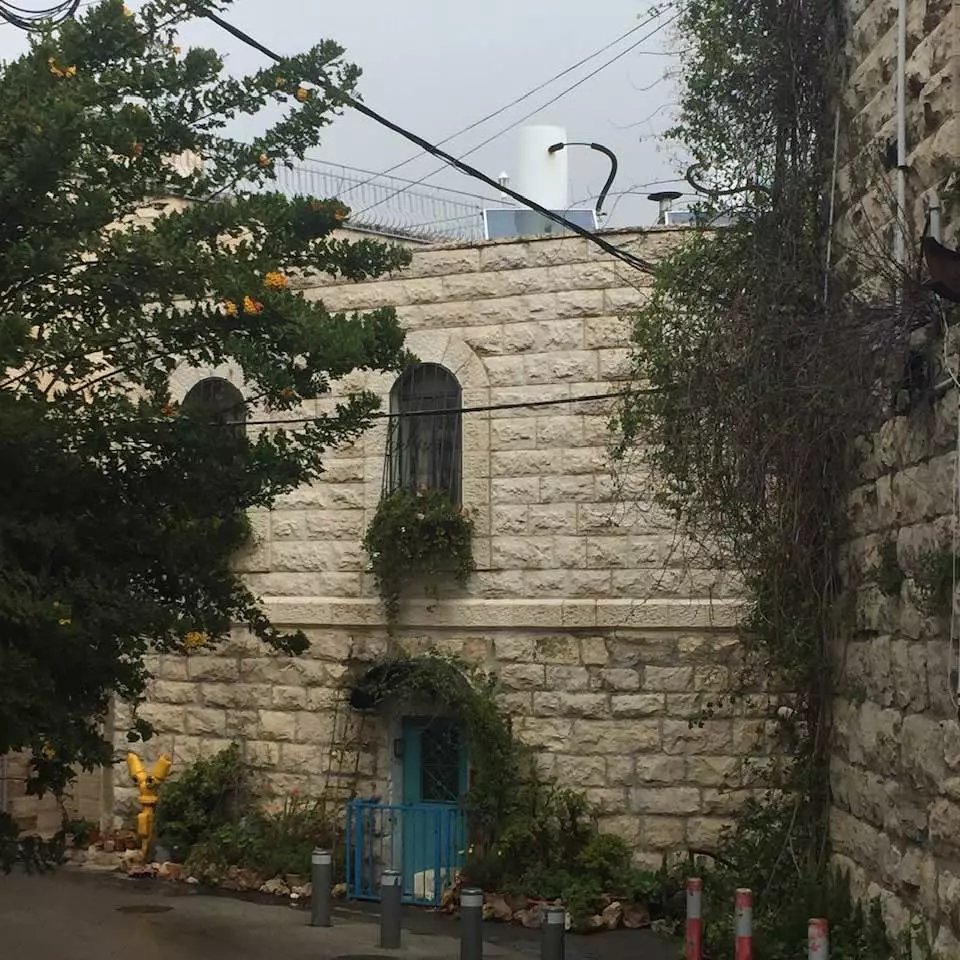
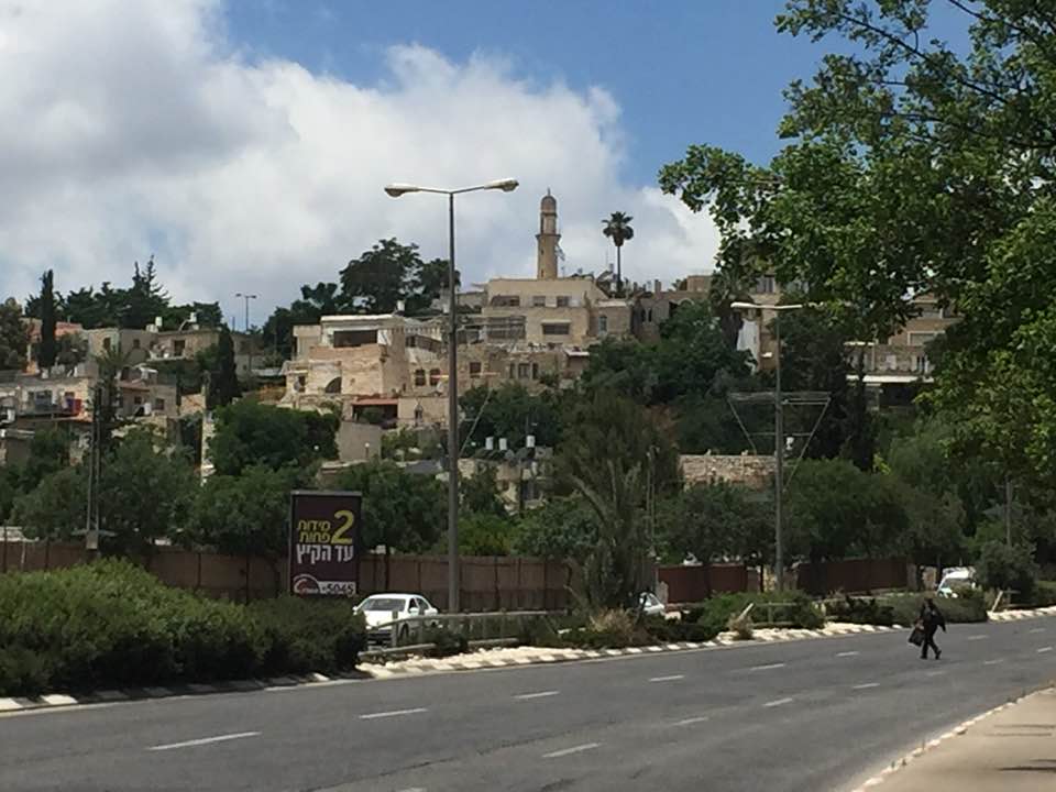
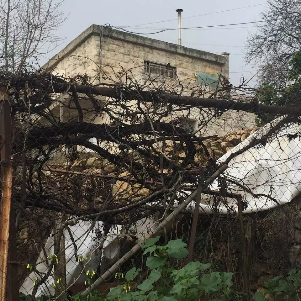
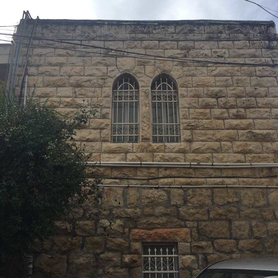
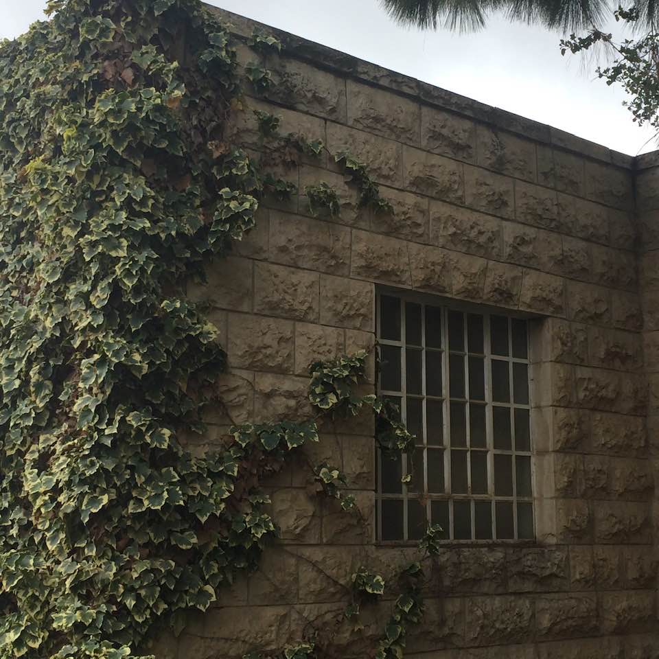
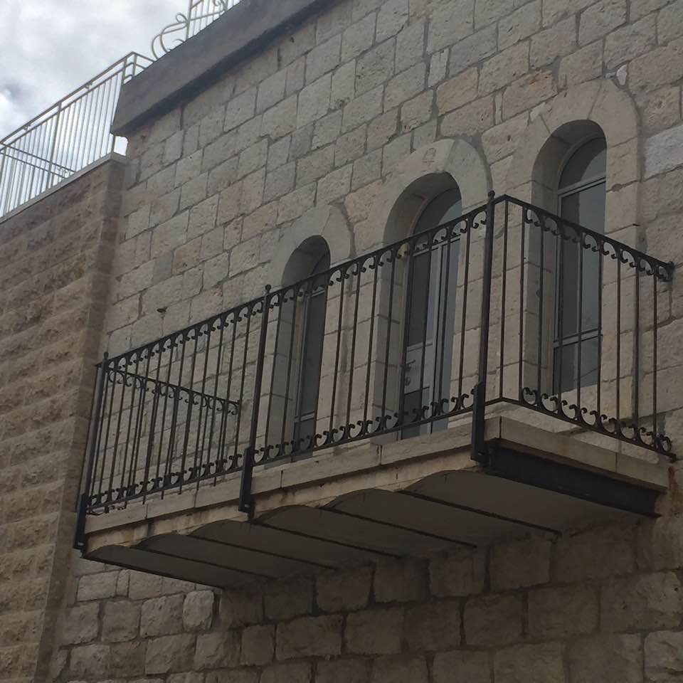
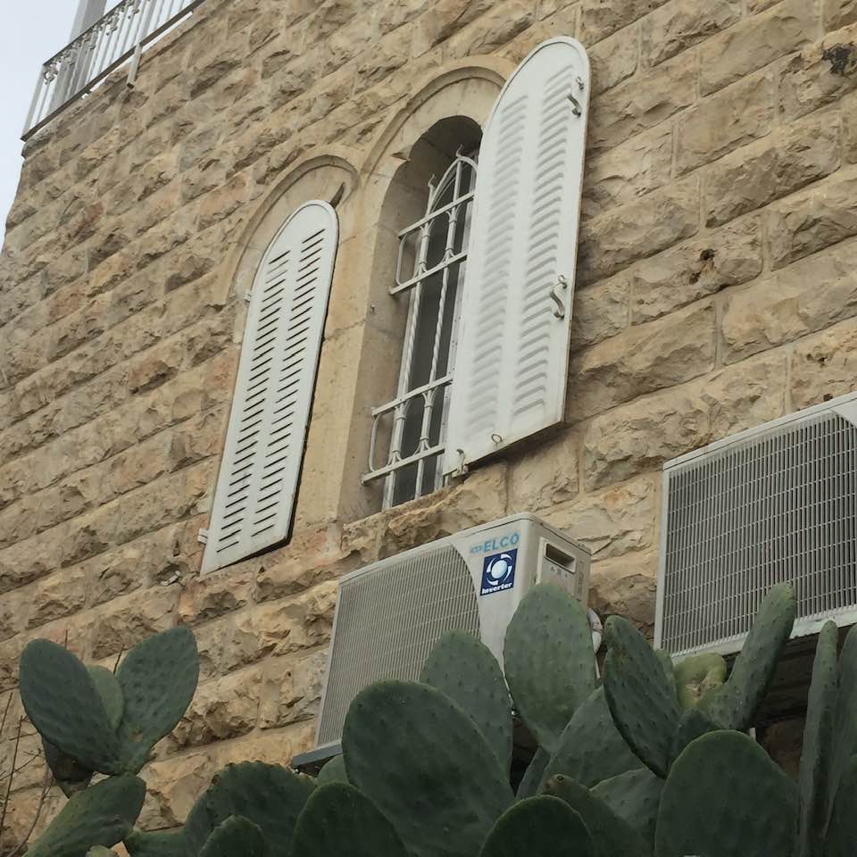
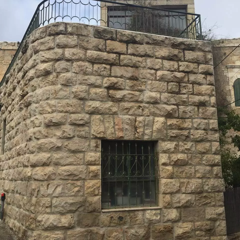
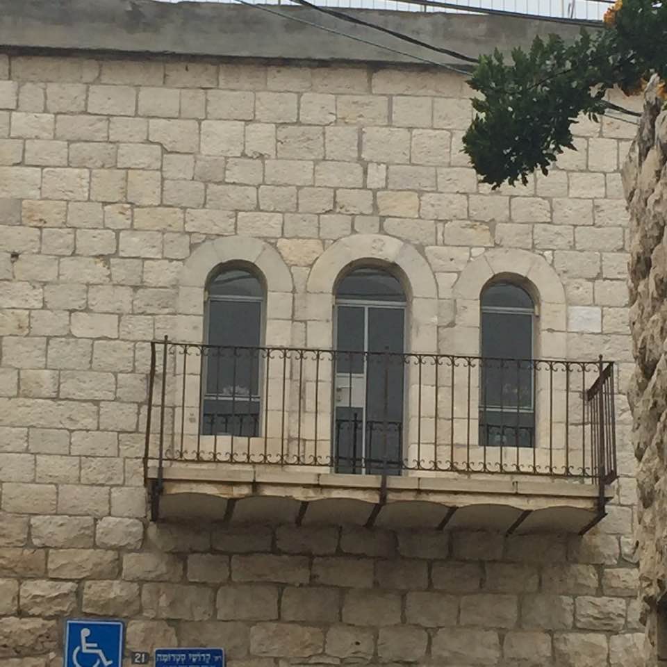
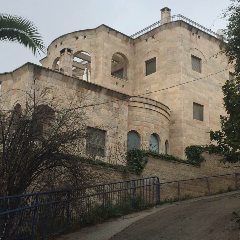
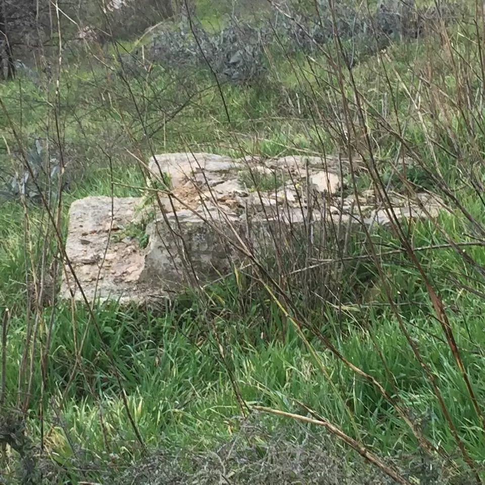
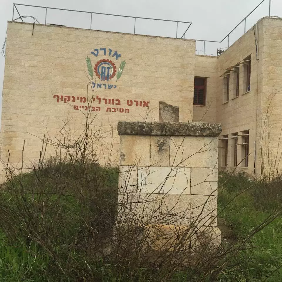
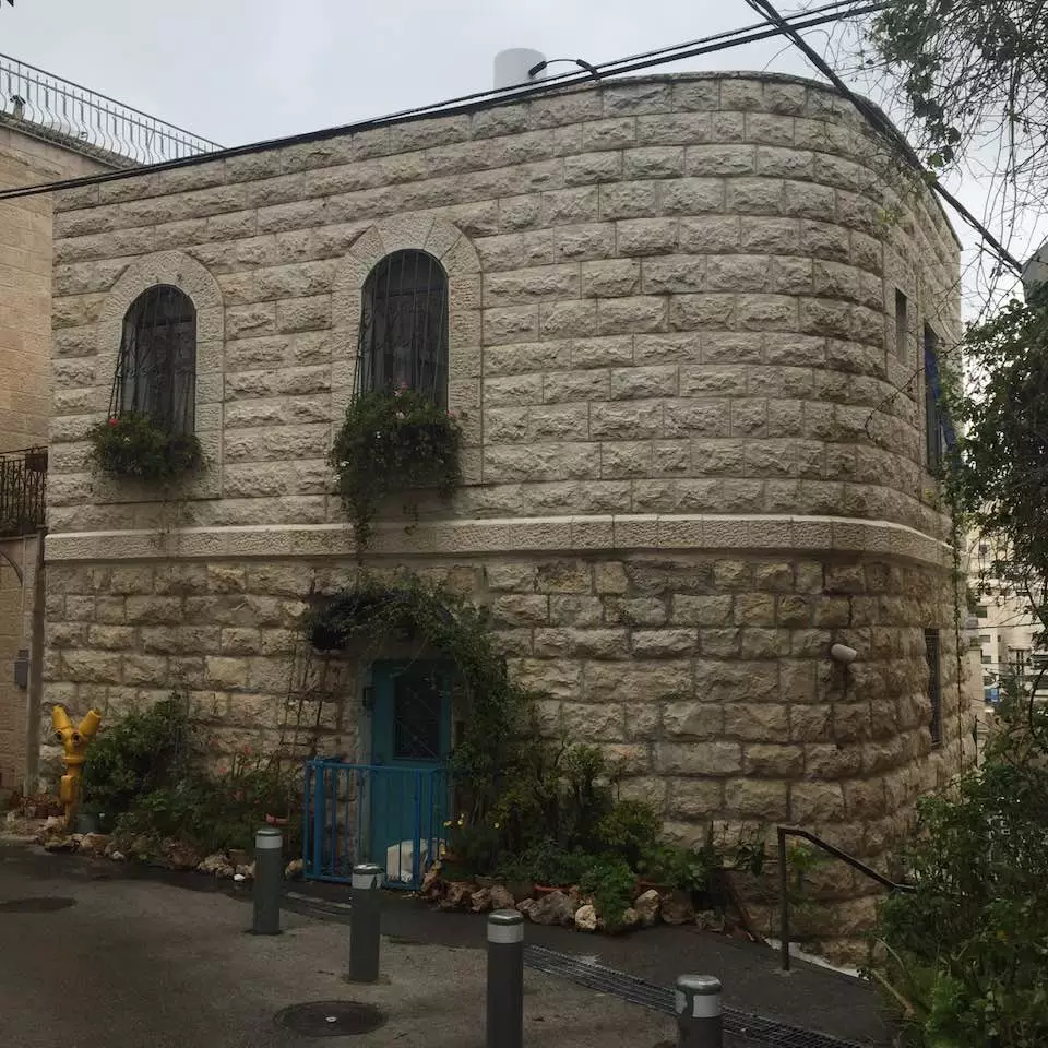
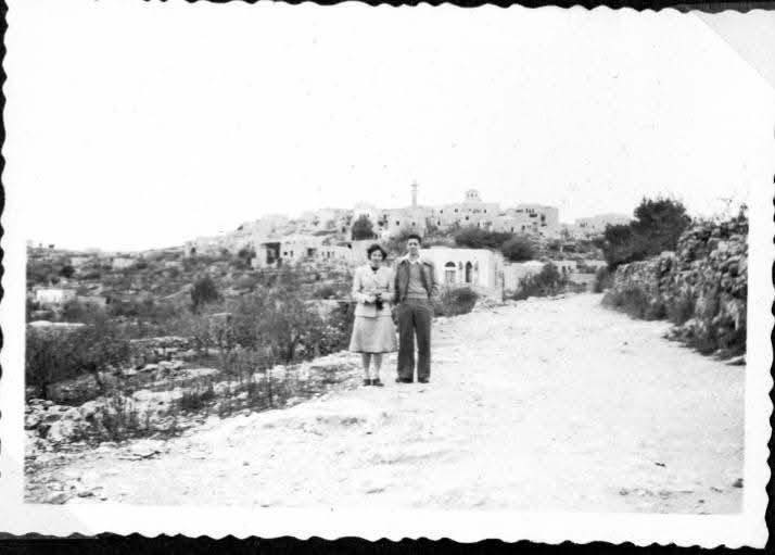
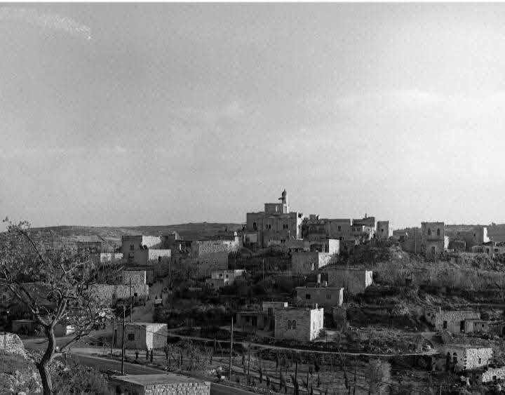
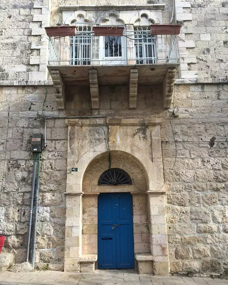
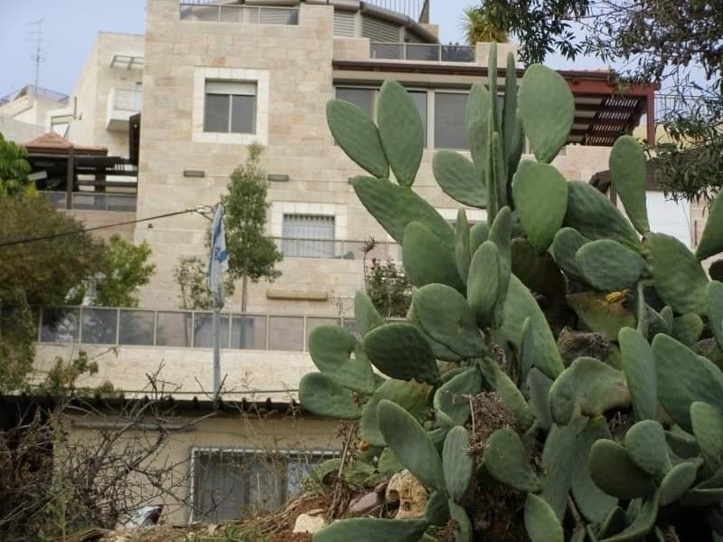
Village Before NakbaThe village stood on a plateau, overlooking a wide area on all sides but the north. A newer part of the village was built on the southeastern slope of a neighboring hill. A short secondary road linked al-Maliha to a highway leading to Jerusalem, and other secondary roads and dirt paths connected it to neighboring villages. Biblical scholars have identified this village with Manahath (Joshua 15:59). In 1596 al-Maliha was a village in the nahiya of Jerusalem (liwa' of Jerusalem). It was known as Maliha al-Sughra and had a population of 286. It paid taxes on wheat, barley, and olive and fruit trees. Taxes were also paid on goats and beehives. Mary Rogers (the sister of Edward Thomas Rogers, British vice-consul in Haifa in the 1850s), passed by the village in 1855 and reported that it was on the summit of a steep hill, with large kilns for preparing charcoal on the terraces below it. At that time it was the home of one of the most influential families in the Jerusalem Mountains, the al-Shaykha. As Jerusalem expanded, al-Maliha became one of its suburbs. The British surveyors who authored the Survey of Western Palestine saw al-Maliha in the 1870s and described it as a village of moderate size, standing high on a flat ridge. To the south of it, in a valley, was 'Ayn Yalu. The village plan was rectangular, and most of its houses were built of stone. Its population was predominantly Muslim, with only about 10 Christians out of an estimated total of 1,940 in 1945. It had a public elementary school, a medical clinic, a few shops, and a village council. It also had a large mosque named after 'Umar ibn al-Khattab, the second Muslim caliph.Most of the villagers worked in rainfed agriculture and livestock breeding, but some worked in crafts, commerce, and services. Their lands were planted in grain, vegetables, and fruit. In 1944/45 a total of 1,013 dunums was allocated to cereals; 2,613 dunums were irrigated or used for orchards, of which 1,370 dunums for olives. Wild vegetation covered the slopes of the neighboring mountains, which were used for grazing. There were many rock-cut tombs in and around the village, and a ruined tower stood near the mosque. This and the artifactual evidence on the site all suggested the great antiquity of the village. Village Occupation and Ethnic CleaningThe earliest attack against al-Maliha occurred on 6 March 1948, according to a report in the Jaffa-based Palestinian daily Filastin. The report said merely that a Jewish unit infiltrated into the outskirts of al-Maliha and clashed with the village's defenders; it made no mention of casualties. Israeli historian Benny Morris implies that the village was evacuated in two waves; the first occurred in April, as a result of the massacre in nearby Deir Yasin on 9 April.But the village was not completely emptied until mid-July, when it was directly attacked after the first truce of the war. The New York Times indicates that the Haganah began to encroach on al-Maliha on the night of 1−2 May when it extended its positions southwards from the Qatamon sub-disctrict of Jerusalem. But the History of the War of Independence relates that the village was occupied about ten weeks later, during operations conducted around Jerusalem in conjunction with Operation Dani (see Abu al-Fadl, Ramla sub-disctrict). After a fierce battle that lasted for several days, the village fell firmly into Israeli hands. On the night of 13−14 July, a company from the Irgun Zvai Leumi (IZL) and two platoons from the Yonathan Company of the Gadna (Palmach Youth Battalions) entered al-Maliha, taking up positions in the village. Arab forces launched a counterattack on 15 July, forcing the IZL unit to withdraw from the furthest position in the village. That same day, the Egyptian irregulars operating south of Jerusalem alongside Palestinian guerrillas announced taking al-Maliha in a communiqué quoted by the New York Times, but it was soon reoccupied after the arrival of IZL reinforcements. The Times reported that the Israelis were using medium artillery and mortar fire to mount diversionary attacks on the Jerusalem front on 14 July. The objective was to take the 'important supply base and assembly center' of al-Maliha, according to the paper's correspondent. By 16 July, the Times reported that the village was in Israeli hands and that an Arab counterattack on that day, which resulted in the deaths of fifteen Irgun men and left twenty others wounded, did not succeed in recapturing it. (The IZL said it had been 'let down' by the Haganah, which withdrew from a flanking height and failed to give covering fire during the Arab assault, but the Haganah denied the charges.) A few days later, on 22 July, the Israeli commander of the Jerusalem area, David Shaltiel, told the Times correspondent that the 'strategic' villages of al-Maliha and 'Ayn Karim had been occupied between the truces, thus ending a 'threatened Egyptian invasion' of Jerusalem. Zionists Colonies on Village LandsZionists established the suburb of Manachat (167129) on the village site in 1949.Village TodayMany houses are still standing and are occupied by Jewish families, although a few houses on the southern side of the village have been demolished. The inhabited houses are generally two-storey structures built of limestone, with arched windows and doors. Some houses have balconies with roofs that are supported by columns and circular arches. The school building is abandoned and its classrooms are filled with refuse. Some of the village streets are wide and paved while others are narrow alleys that are interrupted at points by limestone steps. The village mosque, with its tall, round minaret, still stands in the center of the village (see photos). It is closed and in a state of neglect. The village cemetery is on the southern edge of the site. Five large tombs stand out among the smaller ones. One of the graves is open, and human bones are visible. Orchards grow on the southern and southeastern slopes and in the valleys. Parts of the Israeli Jerusalem neighborhood of Ramat Daniya surround the village site on the west and north.SourceDr. Walid al-Khalidi, 1992: All That Remains. |
||||||||||||||||||||||
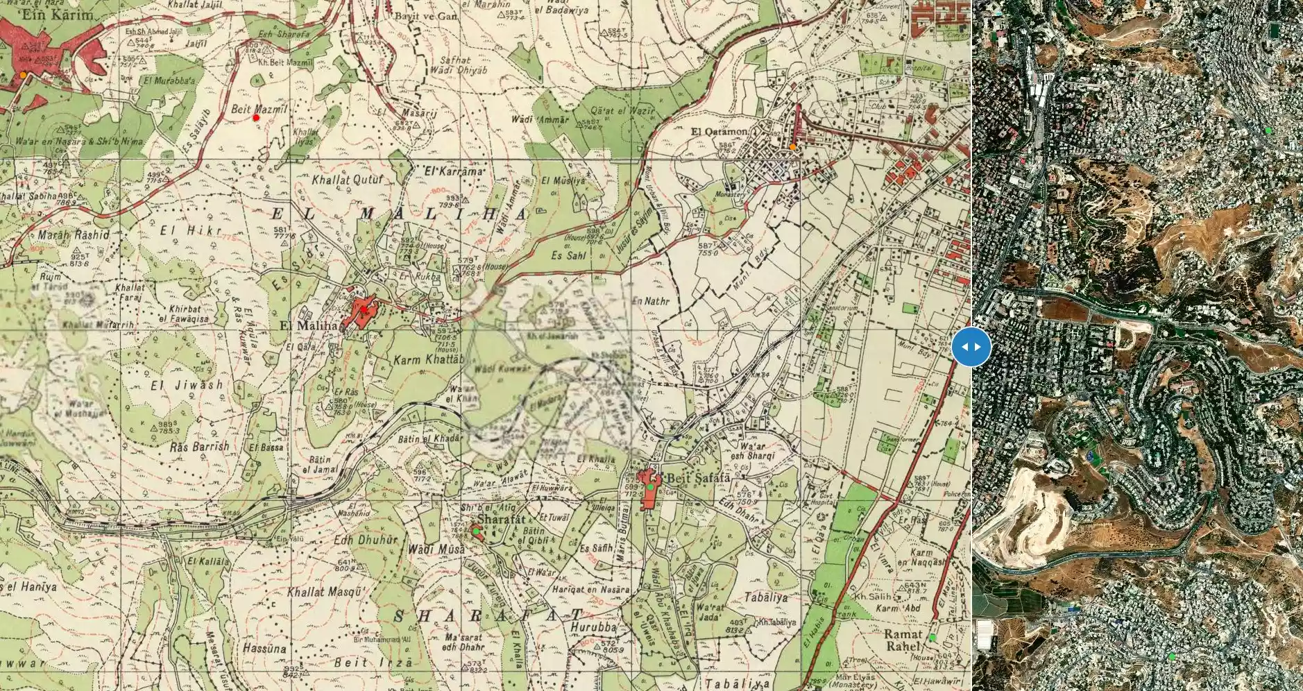
| Related Maps | Town Lands' Demarcation Maps خرائط للقضاء توضح حدود القرى والاودية Town's map on MapQuest View from satellite Help us map this town at WikiMapia |
|||||||||||||||||||||
| Related Links | Wikipedia's Page Facebook Page Google Search Google For Images Google For Videos |
|||||||||||||||||||||
| More Information | مخطط البلد في كتاب كي لا ننسى في كتاب بلادنا فلسطين المزيد من موقع هوية |
|||||||||||||||||||||
- خارطة مفصلة ودقيقة للمالحة قبل النكبة دونها السيد صالح الحلو قبل وفاته رسمها على جدار احد صالته
- وثائق وصور عديدة دوناها من السيد صالح الحلو قبل وفاته
- The Olive trees groves, terraces,the mosque remembered.
- العشرات من أطفال مركز لاجئ يزورون قراهم الأصلية
- الحياة الاجتماعية / الحياة الاقتصادية قرية المالحة ( مؤيد رزق الجواريش )
- الاندية والمراكز / جمعية المالحة الخيرية / ( مؤيد رزق الجواريش )
- المخاتير - قرية المالحة ( مؤيد رزق الجواريش )
- الاغاني الشعبية / المعتقدات الشعبية/ الامثال الشعبية ( مؤيد رزق الجواريش )
- العادات / التقاليد / الازياء الشعبية ( مؤيد رزق الجواريش )
- الشهداء - نحتسبهم - / التراث الاجتماعي / اللهجة ( مؤيد رزق الجواريش )
- عائلات المالحة (القدس) قبل النكبة - مؤيد رزق الجواريش
- المساجد / القبور الاثرية / عيون الماء ( مؤيد رزق الجواريش )
- نبذة تاريخية عن قرية المالحة (قضاء القدس) من كتاب (كي لا ننسى)
- المالحة… مشاهد حلوة وذكريات مرّة
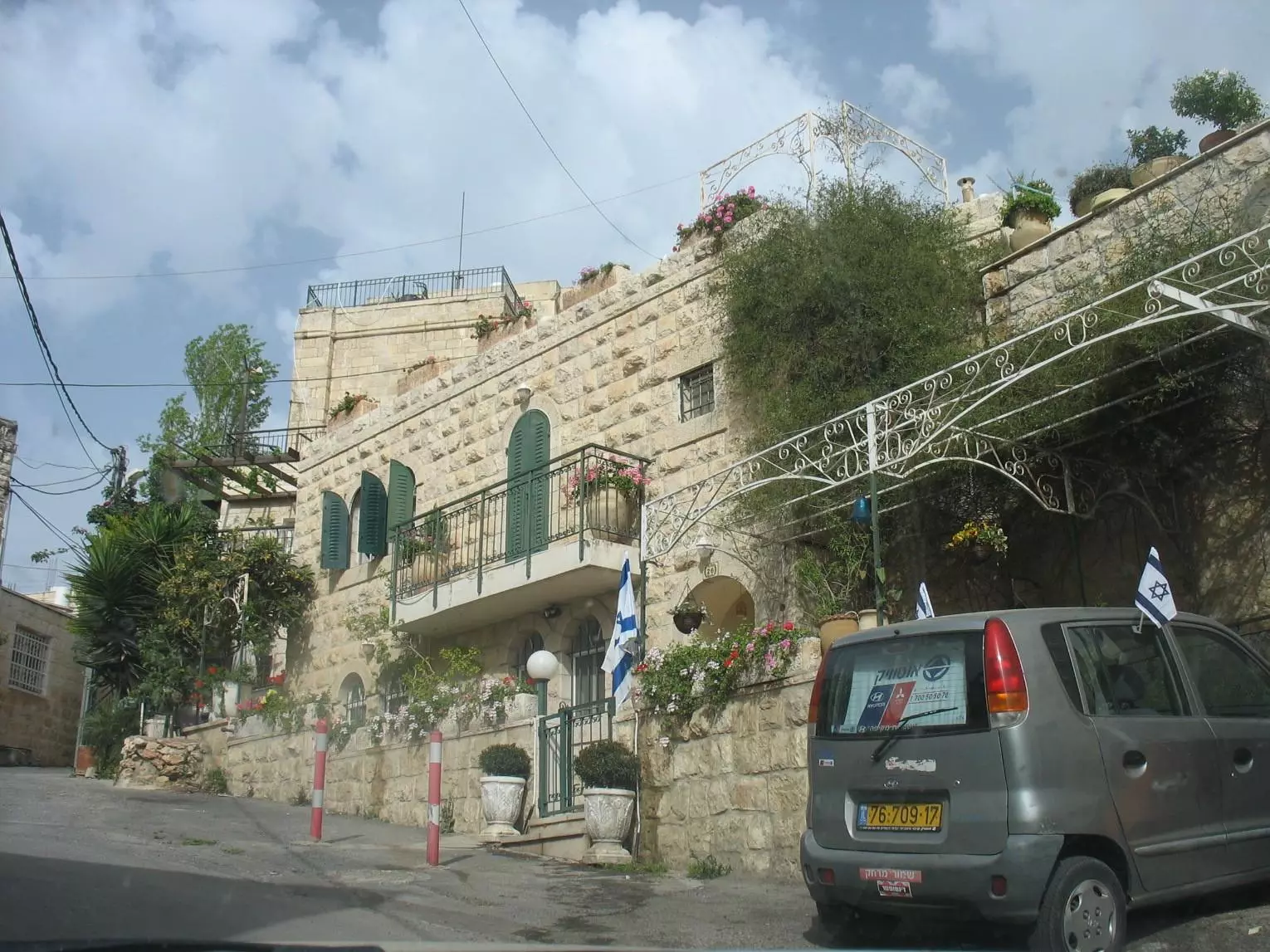
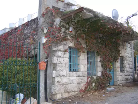
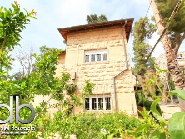
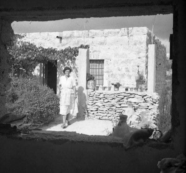
- Village House In 1986
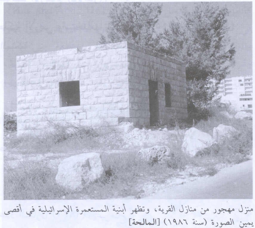
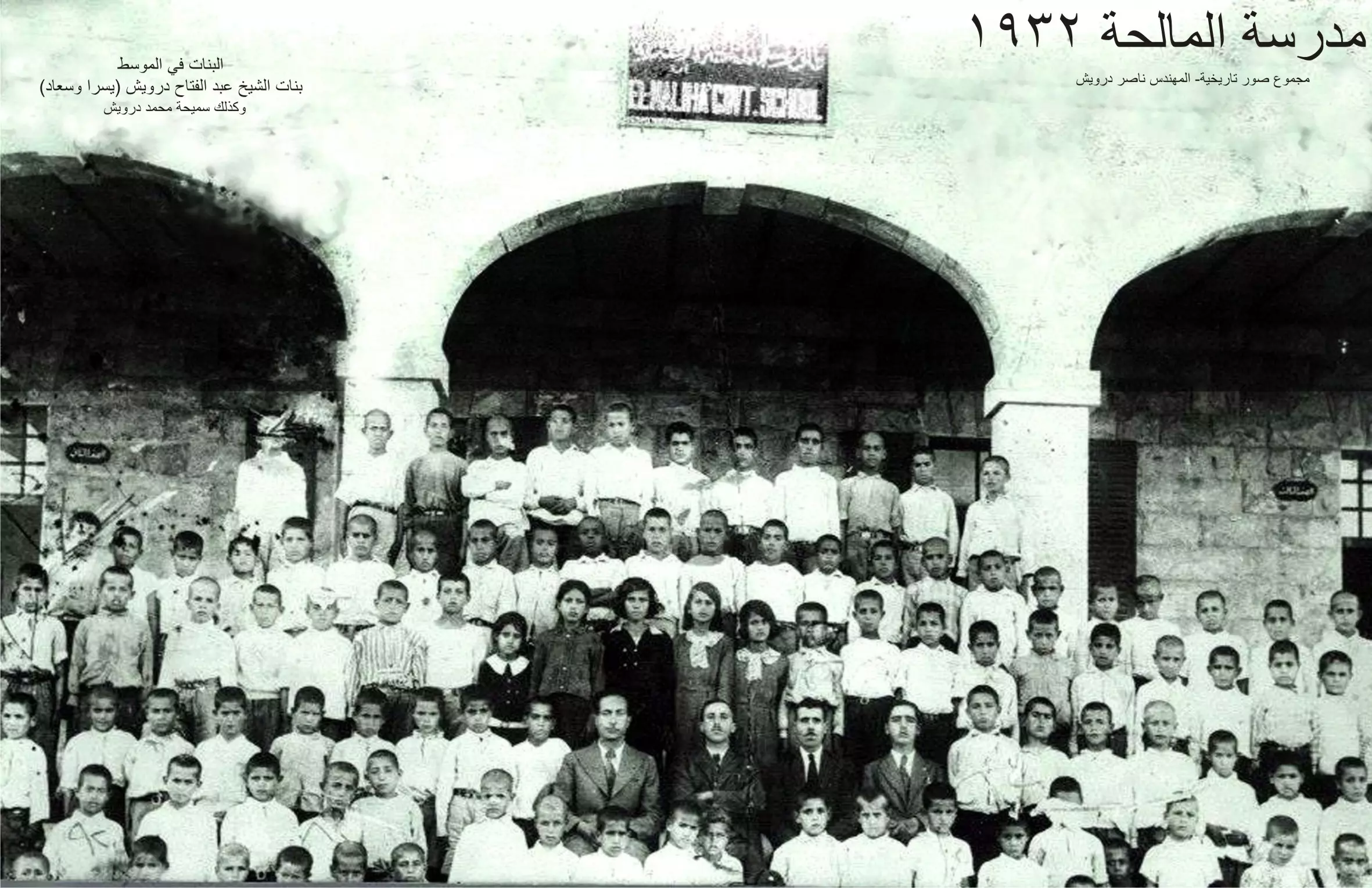
Scanned from "All That Remains" by Dr. Walid Khalidi 4 - Memorable picture for Malha's students in 1932
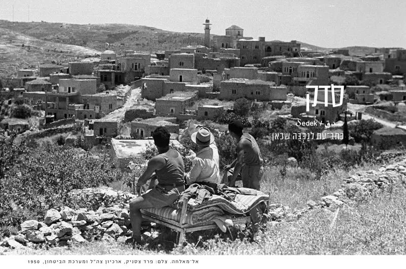
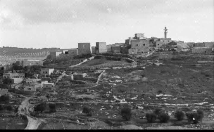
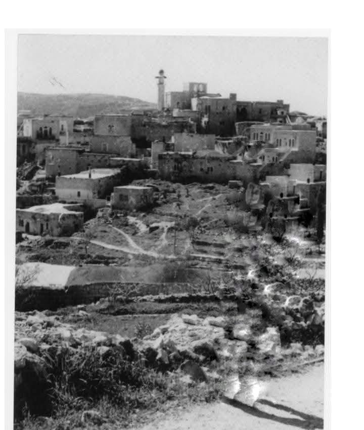
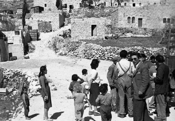
Posted by nasser 1 - منظر عام لقرية المالحة يمكن رؤية معظم بيوت ومسجد القريه , حيث تم تصويرها بتاريخ 1-1-1949

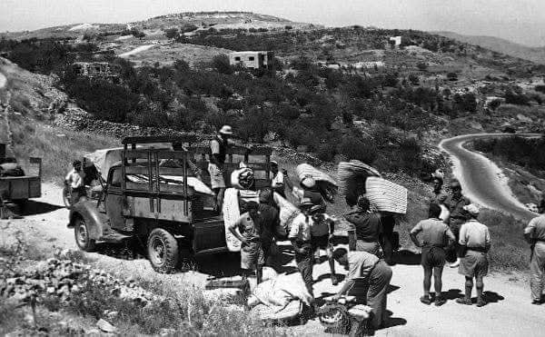
Posted by صفافي أصيل 3 - RARE picture for al-Maliha taken soon after Nakba (1-6-1949) and in the forground Israeli Jews looting Palestinian properties.
Posted by صفافي أصيل 7 - Geneal view for the usupred house, the Omari mosque can be seen in the background
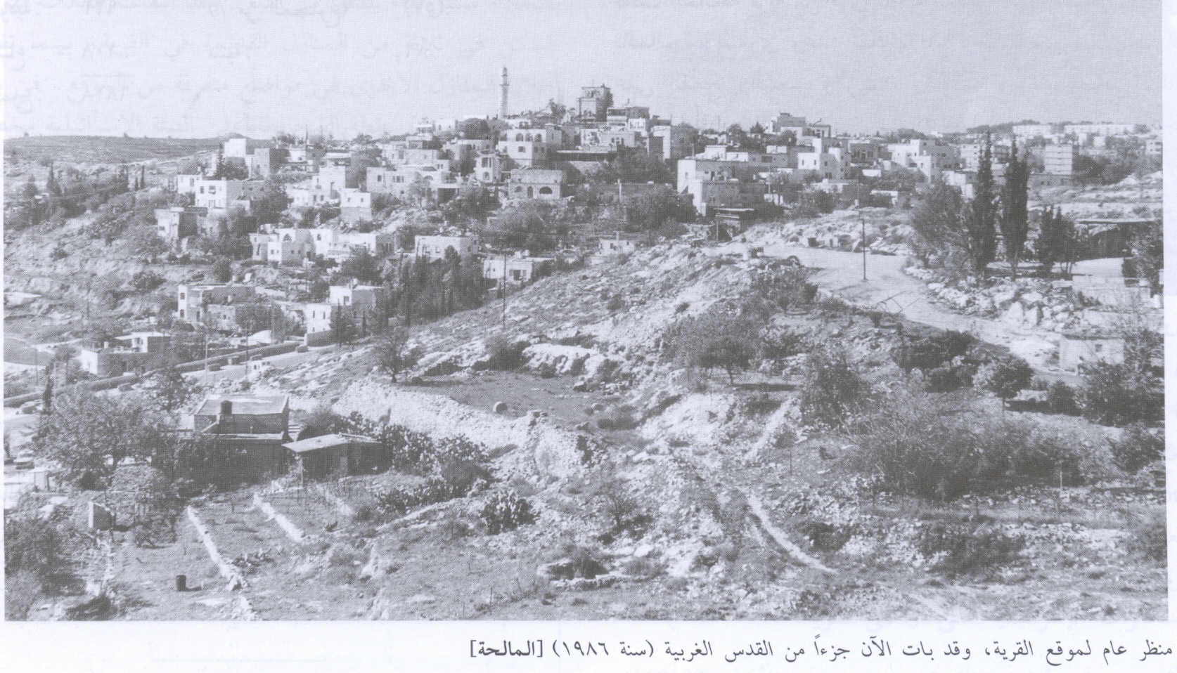
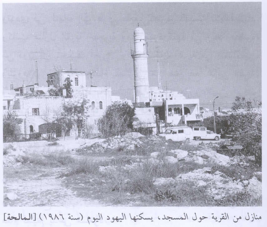
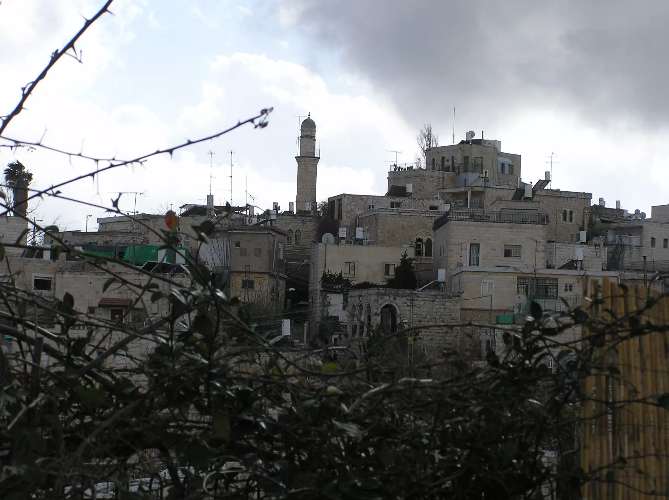
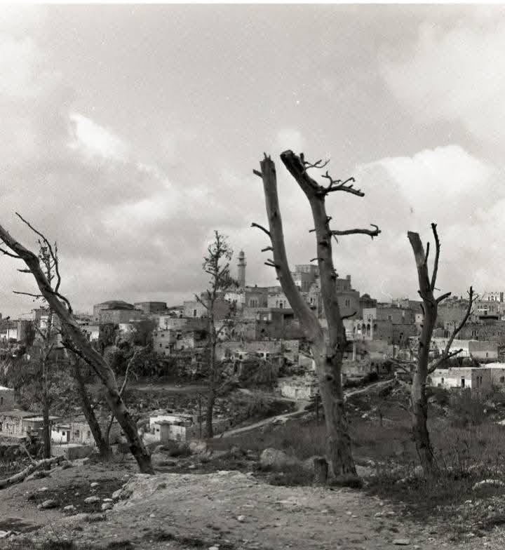
Posted by Noga Kadman 7 - General view of the village, 1986
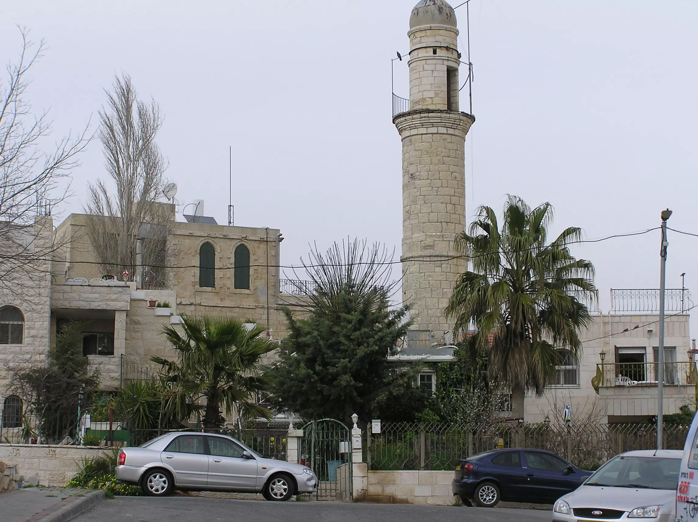
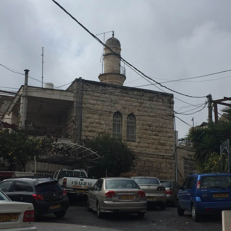
Scanned from "All That Remains" by Dr. Walid Khalidi - Al Maliha And Its Beautiful Minaret
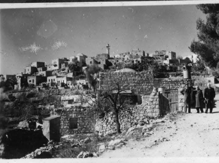
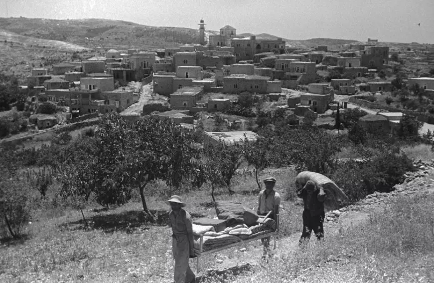
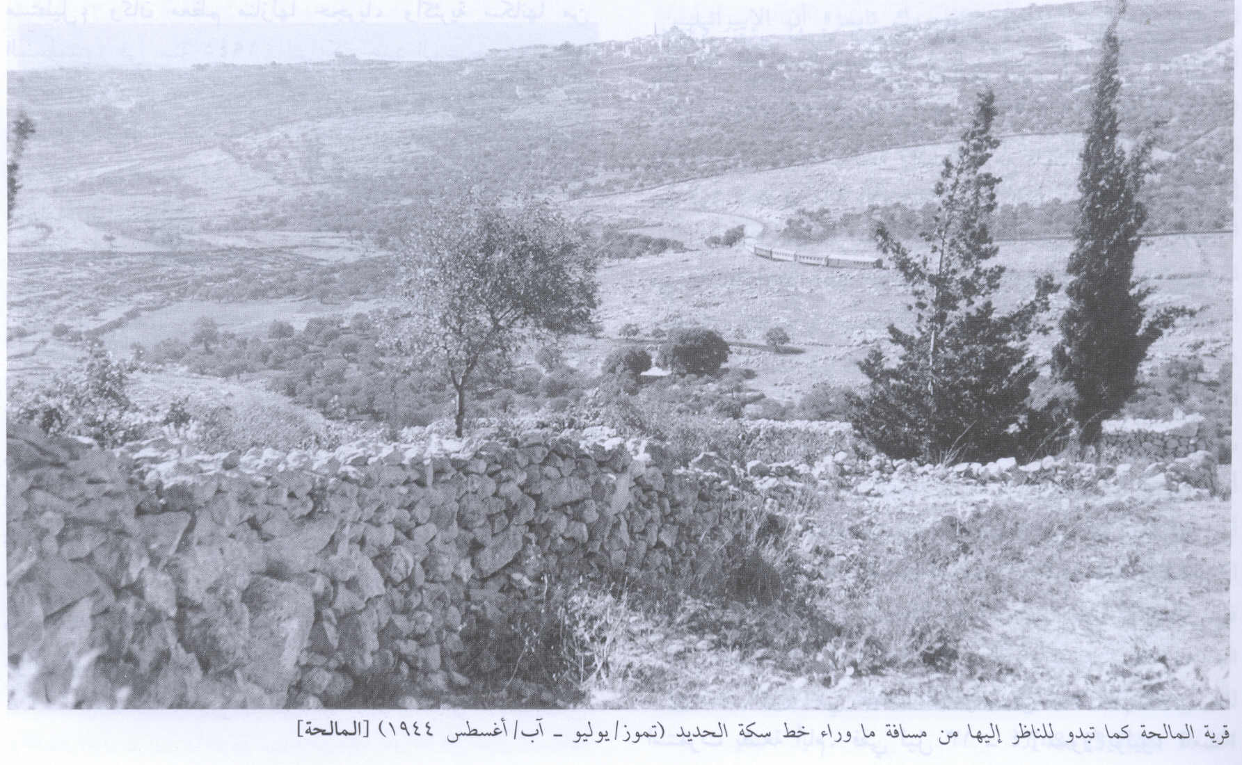
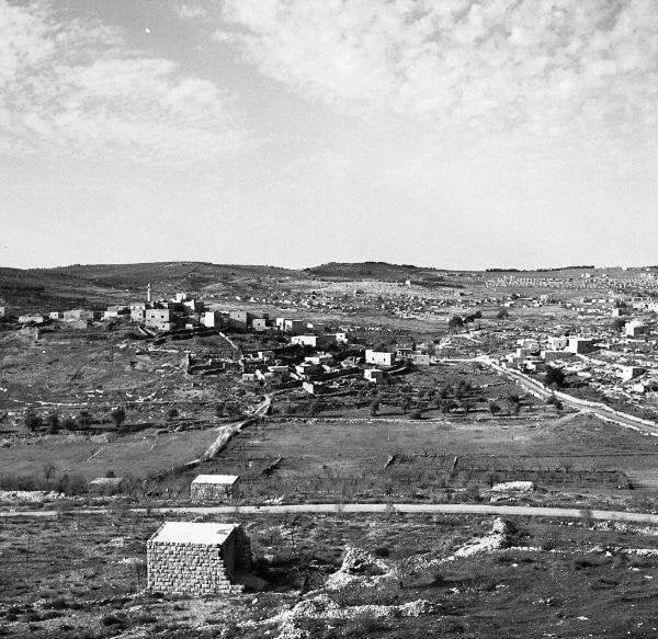
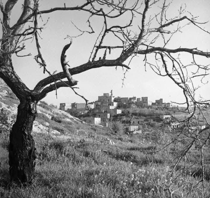
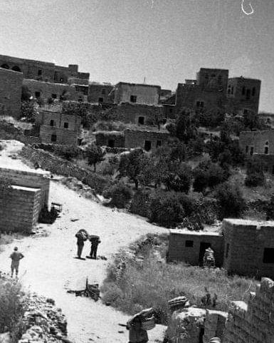
Posted by Umar Abu El-Bararri 4 - General view of the village looking northwest, 1944
Scanned from "All That Remains" by Dr. Walid Khalidi - Omar Ibn al-Khatab Village Mosque In 1986
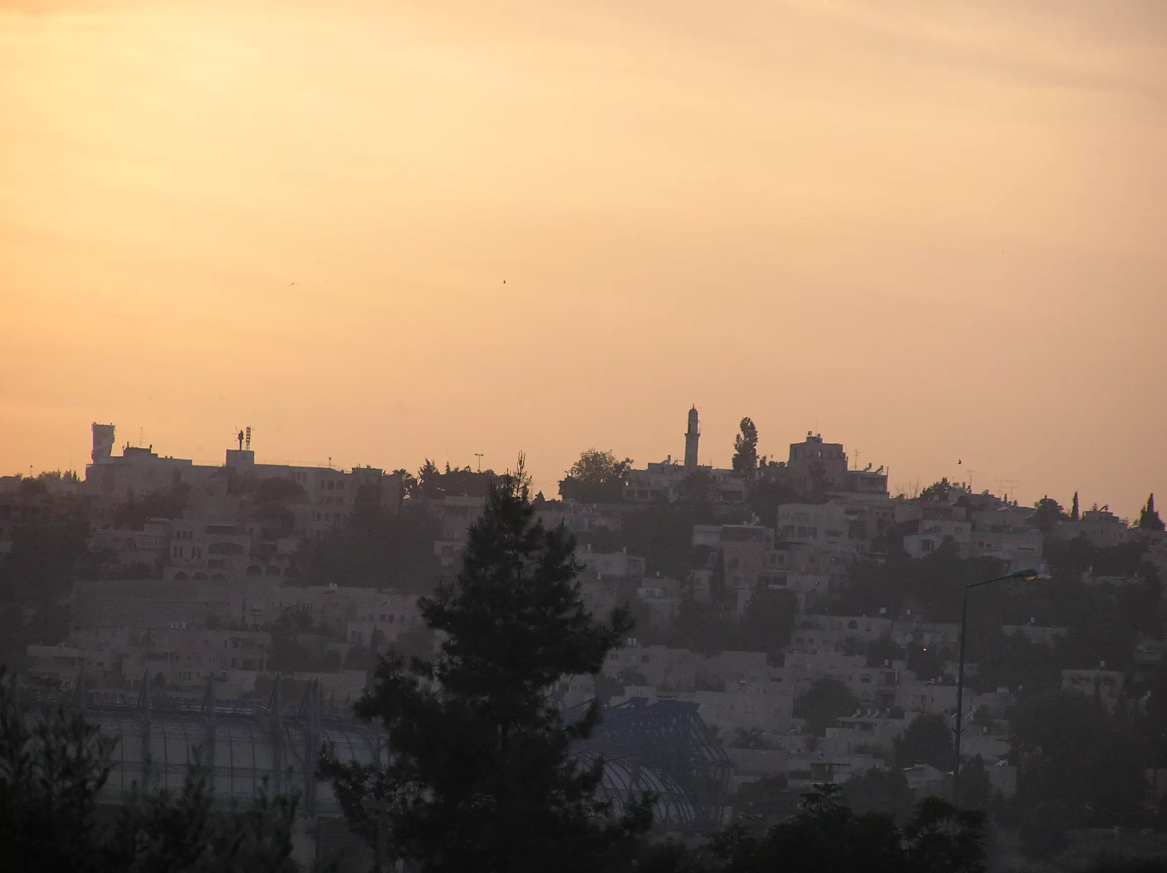
Scanned from "All That Remains" by Dr. Walid Khalidi - Sunset over Al_Maliha Photo taken from Sharafat (1973). The Minaret to the Mosque can be seen on the left side of photo

Posted by Umar Ilayann - the school of the village
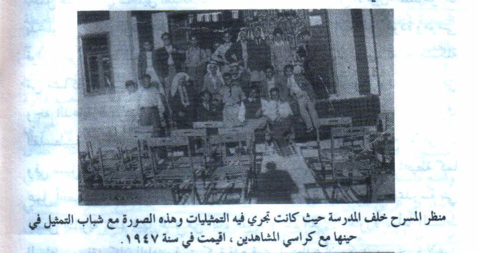
Posted by shahaberko 1 - al-Malhia's school theater
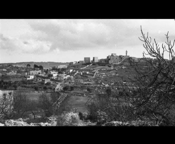
Posted by shahaberko 1 - View of Al Maliha from Al Walaja (2006)
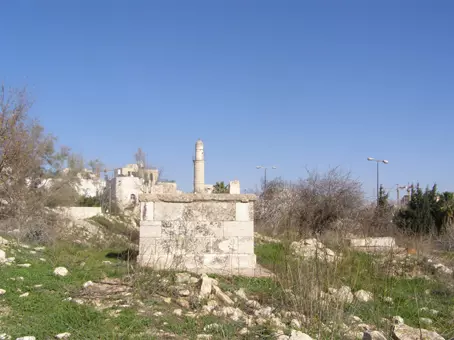
Posted by Ghada El-Sadek 1 - al-Omari Mosque
Posted by Noga Kadman 9 - A street scene in the usupred village
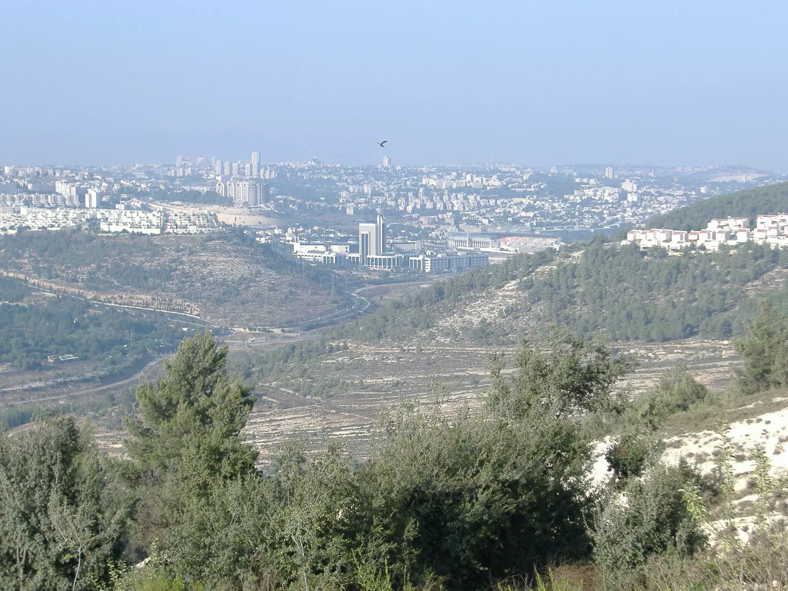
Posted by Noga Kadman 3 - Jabal Al-Malha (center right) & Its Natural Beauty 1973
Posted by Umar Abu El-Bararri - منظر عام للمالحة في نوفمبر 2007 . تصوير عمر اغبارية
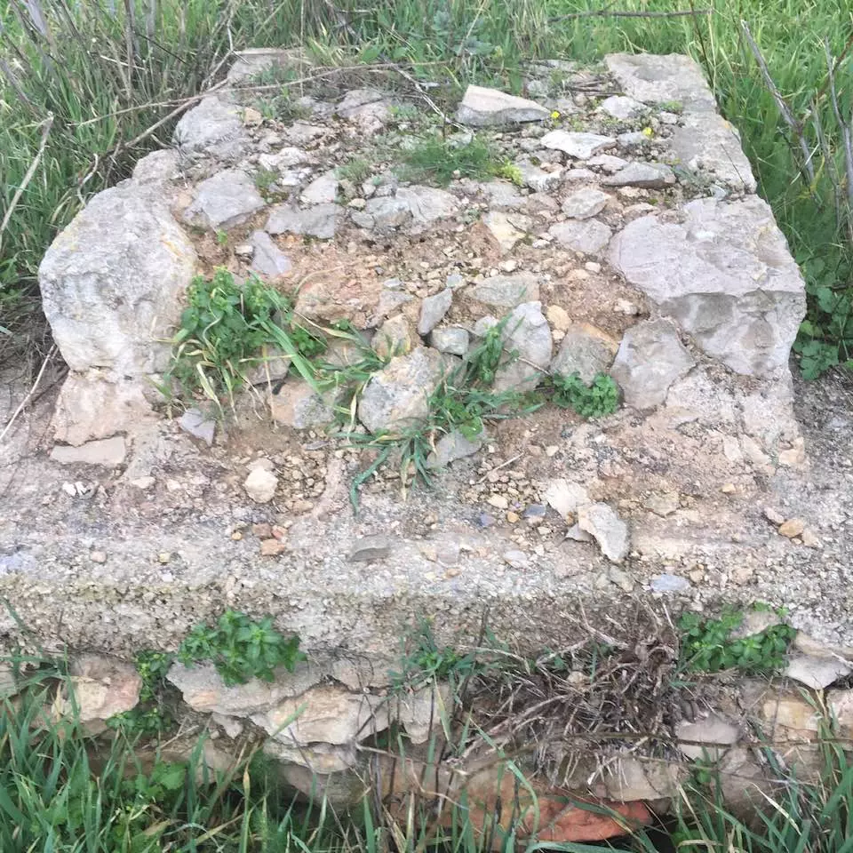
Posted by Umar Ighbariyyeh - المالحة نوفمبر 2007 . آثار المقبرة المهملة والآيلة للاندثار. تصوير عمر اغبارية
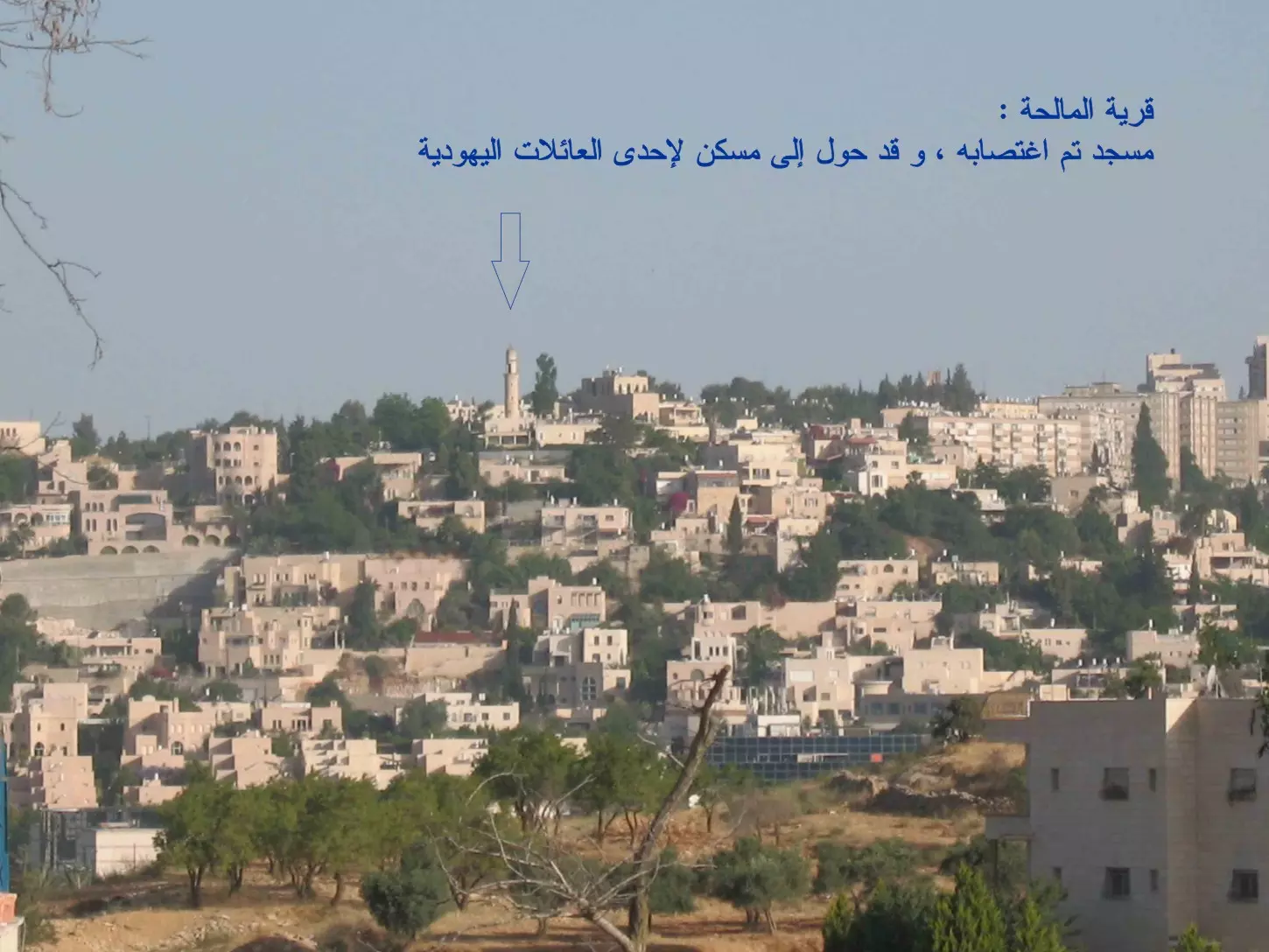
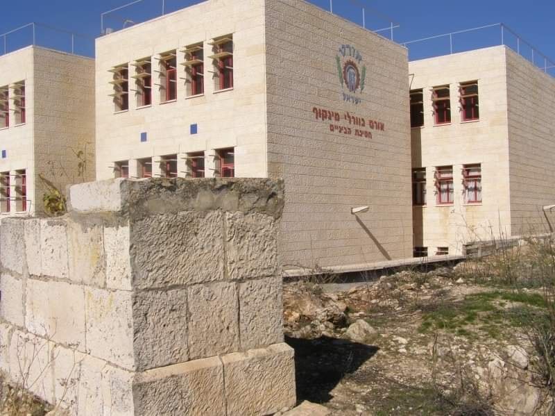
Posted by Umar Ighbariyyeh 2 - المالحة نوفمبر 2007 . مسجد عمر بن الخطاب يسكنه المغتصبين . تصوير عمر اغبارية
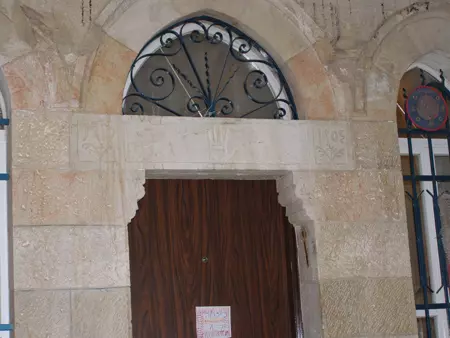
Posted by Umar Ighbariyyeh - المالحة نوفمبر 2007 . مدخل بيت مغتصب مع نقش فوق الباب. تصوير عمر اغبارية
Posted by Umar Ighbariyyeh - المالحة نوفمبر 2007 . بيت مغتصب . تصوير عمر اغبارية
Posted by Umar Ighbariyyeh - المالحة نوفمبر 2007 . بيت مغتصب حوّله الغزاة كنيساً يهودياً. تصوير عمر اغبارية
Posted by Umar Ighbariyyeh - المالحة نوفمبر 2007 . بيت مغتصب حوّله الغزاة كنيساً. كتب على مدخله ( كنيس
Posted by Umar Ighbariyyeh - المالحة نوفمبر 2007 . بيت مغتصب . تصوير عمر اغبارية
Posted by Umar Ighbariyyeh - الشارع المؤدي إلى المالحة. نوفمبر 2007 . تصوير عمر اغبارية
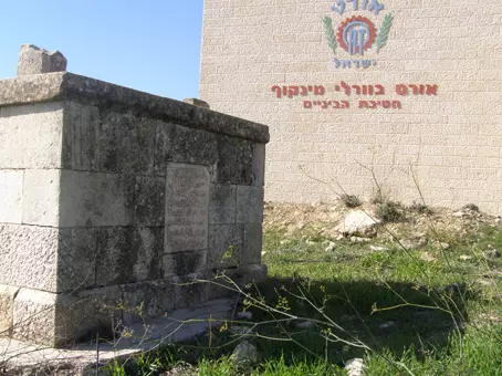
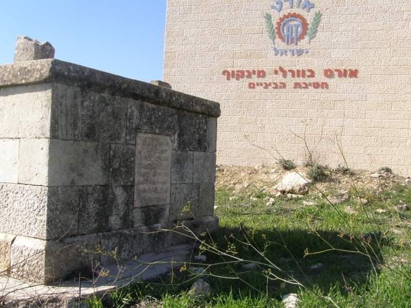
Posted by Umar Ighbariyyeh - مقبرة المالحة، ما تبقى منها، كانون أول 2007 تصوير عمر اغبارية
Posted by Umar Ighbariyyeh 1 - مقبرة المالحة، ما تبقى منها، كانون أول 2007 تصوير عمر اغبارية
Posted by Umar Ighbariyyeh - مقبرة المالحة، ما تبقى منها، كانون أول 2007 تصوير عمر اغبارية
Posted by Umar Ighbariyyeh - مقبرة المالحة، قبر له اسم، كانون أول 2007 تصوير عمر اغبارية
Posted by Umar Ighbariyyeh - مقبرة المالحة، قبر له اسم، كانون أول 2007 تصوير عمر اغبارية
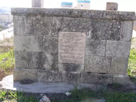
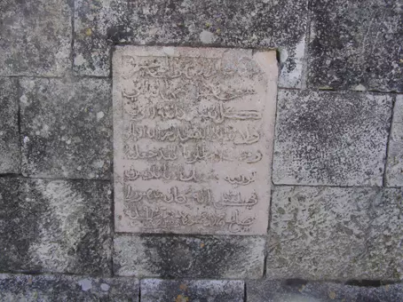
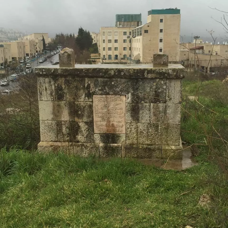
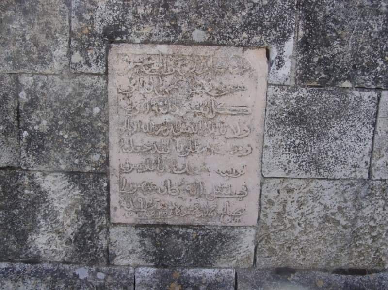
Posted by Umar Ighbariyyeh 3 - مقبرة المالحة، كتابة على قبر، كانون أول 2007 تصوير عمر اغبارية
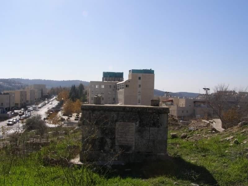
Posted by Umar Ighbariyyeh - مقبرة المالحة، قبر يطل على البنايات الصهيونية على الأرض الفلسطينية،كانون أول 2007 تصوير عمر اغبارية
Posted by Umar Ighbariyyeh - المالحة،بيت فلسطيني وفي الخلفية استيطان صهيوني على أرض المالحة،كانون أول 2007 تصوير عمر اغبارية
Posted by Umar Ighbariyyeh - المالحة،منظر من منطقة الراس على
Posted by Umar Ighbariyyeh - المالحة،منظر من منطقة الراس على
Posted by Umar Ighbariyyeh - المالحة، حفر صهيوني لبناء كنيس جديد على أرض المالحة، كانون أول 2007 تصوير عمر اغبارية
Posted by Umar Ighbariyyeh - المالحة، حفر صهيوني لبناء كنيس جديد على أرض المالحة، كانون أول 2007 تصوير عمر اغبارية
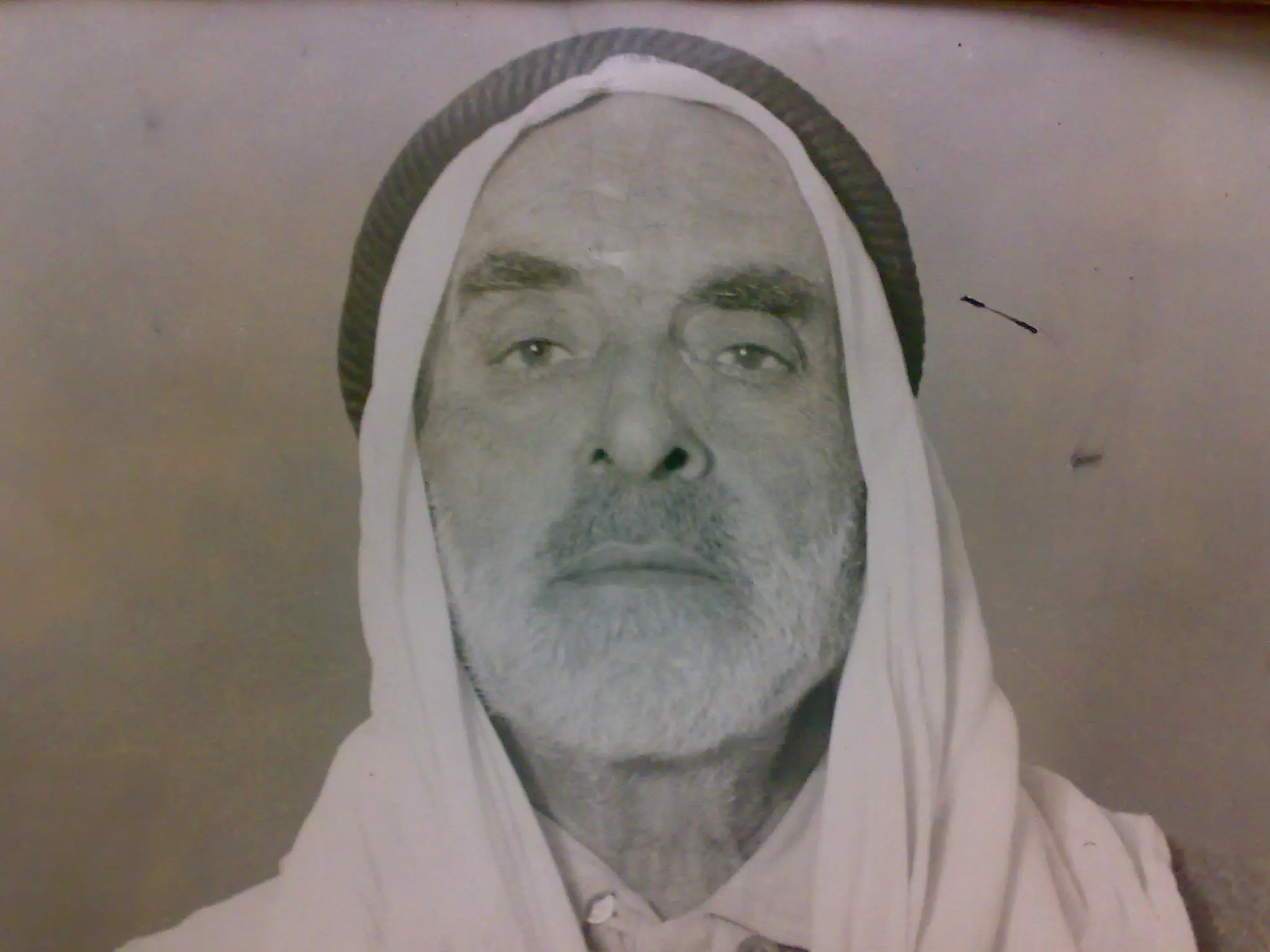
Posted by Umar Ighbariyyeh - Al-Haj Ibrahim Mohamed hussein ismaeel Al-Hanash
Posted by shahaberko 3 - picture of al-kinion mole in al--maliha village
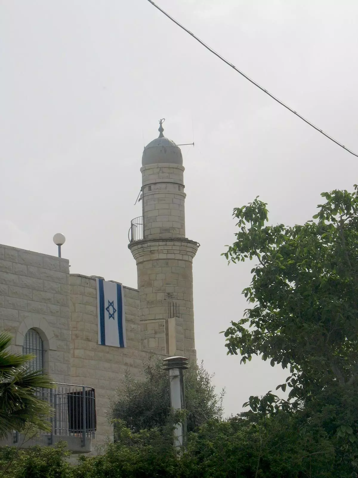
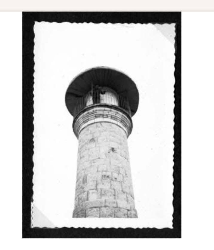
Posted by shahaberko - Al Maliha Mosque Minaret
Posted by Umar Abu El-Bararri - Al-Maliha With Its Minaret & Original Houses.
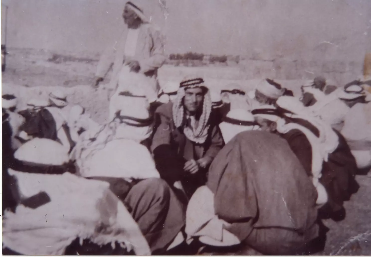
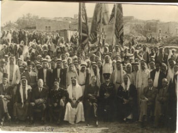
Posted by Umar Abu El-Bararri - عام 1942يوم العيد في المالحه شيخ المالحه يخدم ضيوفه
Posted by adel khatib 2 - Al Maliha's Minaret Stands As A Witness In The Sunset.
Posted by Umar Abu El-Bararri - الصلحه بحضور ورعاية الوجهاء اثر مقتل محمود حسين عام 1934
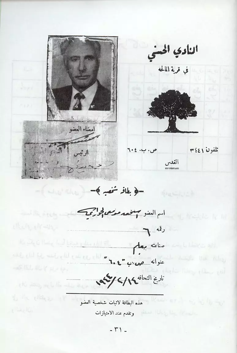
Posted by adel khatib - بطاقة عضويه نادي في المالحه للعضو اسحق الحواري
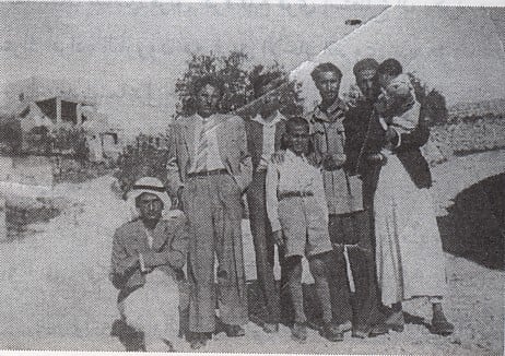
Posted by adel khatib 5 - مجموعه من اهل المالحه في احد ازقتها في الاربعينات
Posted by adel khatib 3 - A General View Of Al-Maliha With Its Center Steps Leading To Its Mosque/Minaret.
Posted by Umar Abu El-Bararri - The Old Trail Alley 'Ziquaq El-Maliha' From Sharafat To El-Maliha
Posted by Umar Abu El-Bararri - The Old Trail Alley 'Ziquaq El-Maliha' From Sharafat To El-Maliha
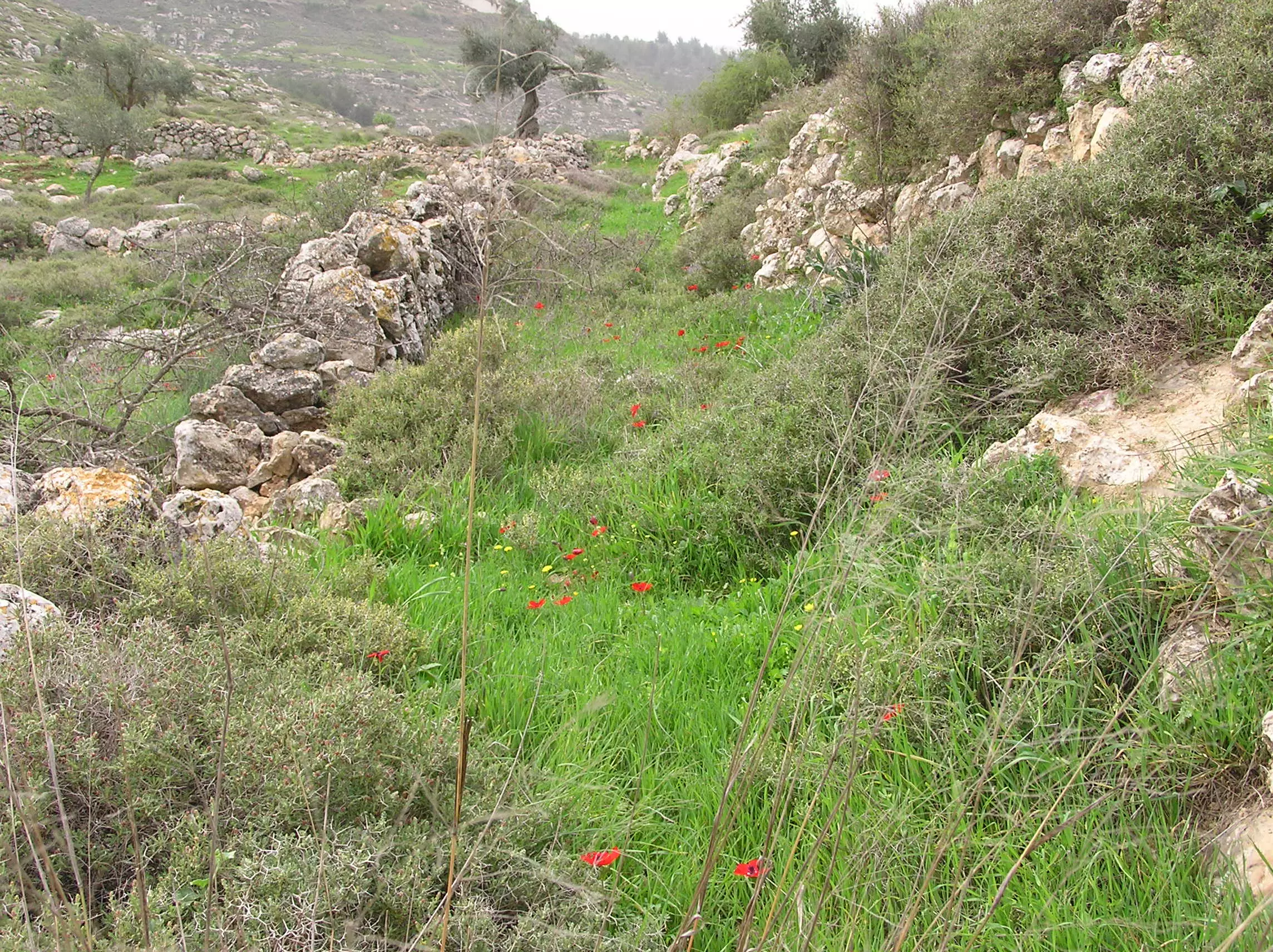
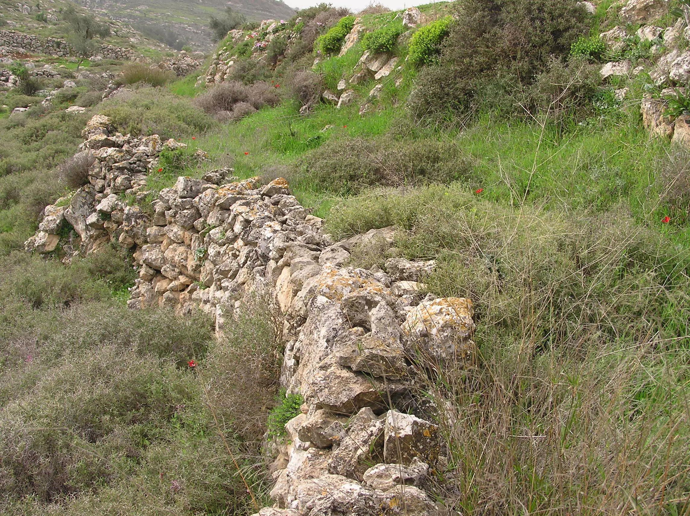
Posted by Umar Abu El-Bararri - The Trail Alley 'Ziqaq El-Maliha' From Sharafat To Al-Maliha. The 'Ziqaq' can be seen between the two stone walls going towards Al-Maliha (NW).
Posted by Umar Abu El-Bararri - A View Of Al-Maliha From The East.
Posted by Umar Abu El-Bararri 1 - مسجد عمر بن الخطاب يسكنه المغتصبين . تصوير مراد أبو الروس2008
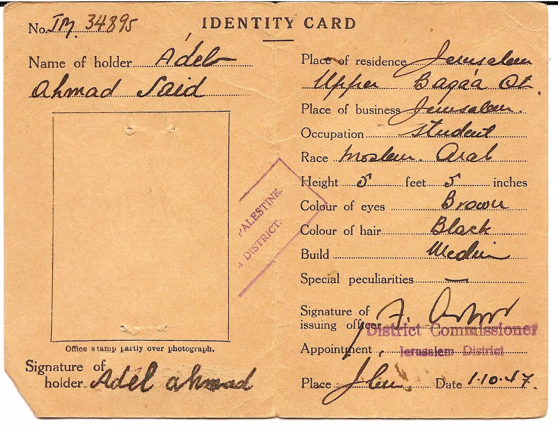
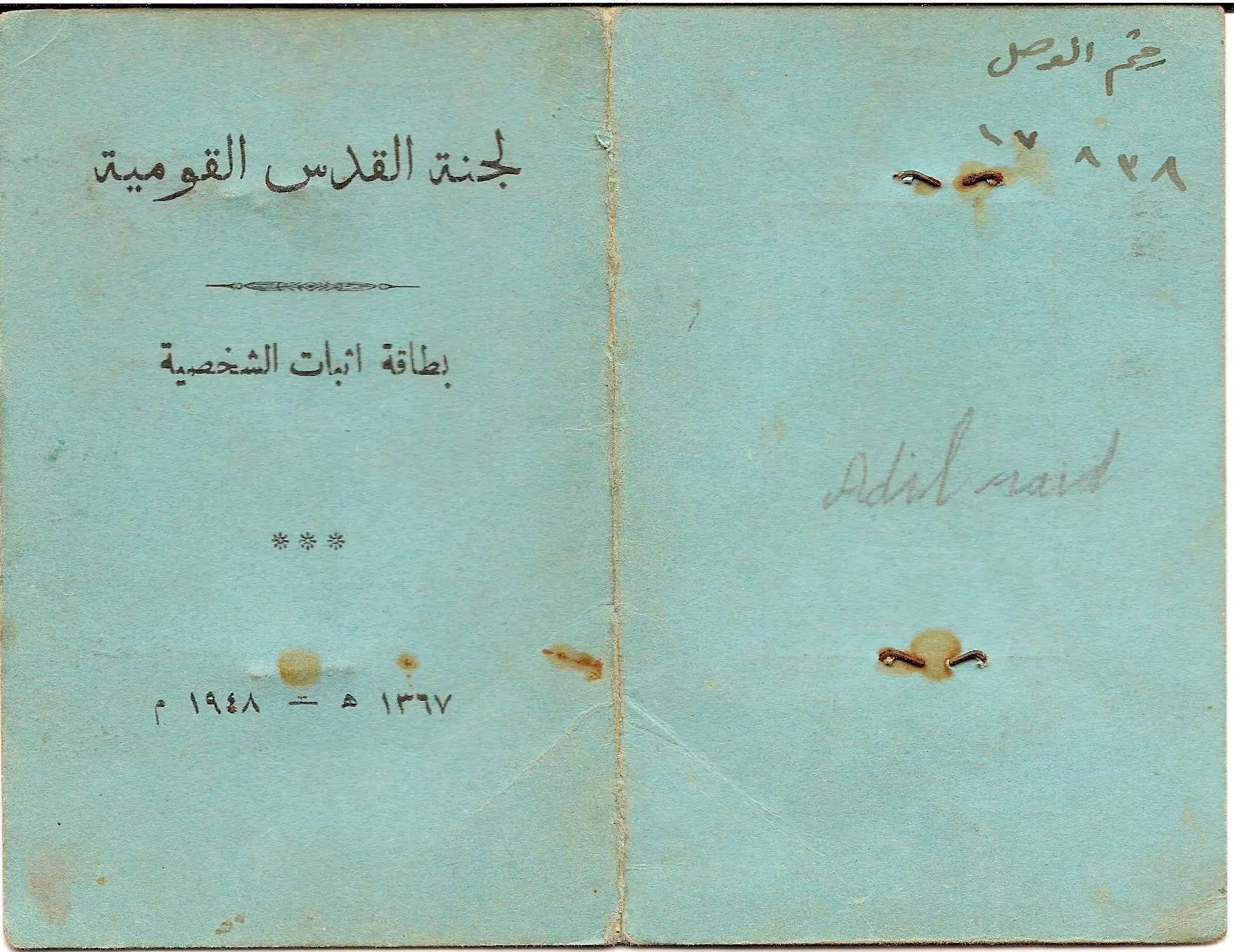
Posted by مراد أبو الروس - Identity Card Dated 1/10/1947-A

Posted by Ayah Bseisy - Identity Card Dated 1/10/1947-B
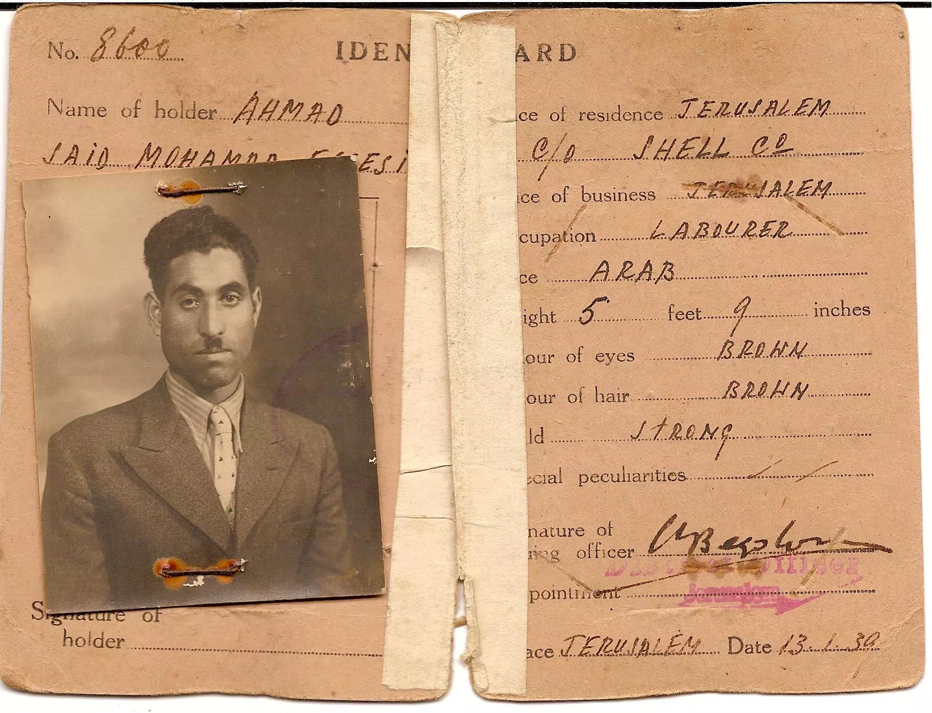
Posted by Ayah Bseisy - Identity Card Dated 13/1/1930-A
Posted by Ayah Bseisy - Identity Card Dated 13/1/1930-B
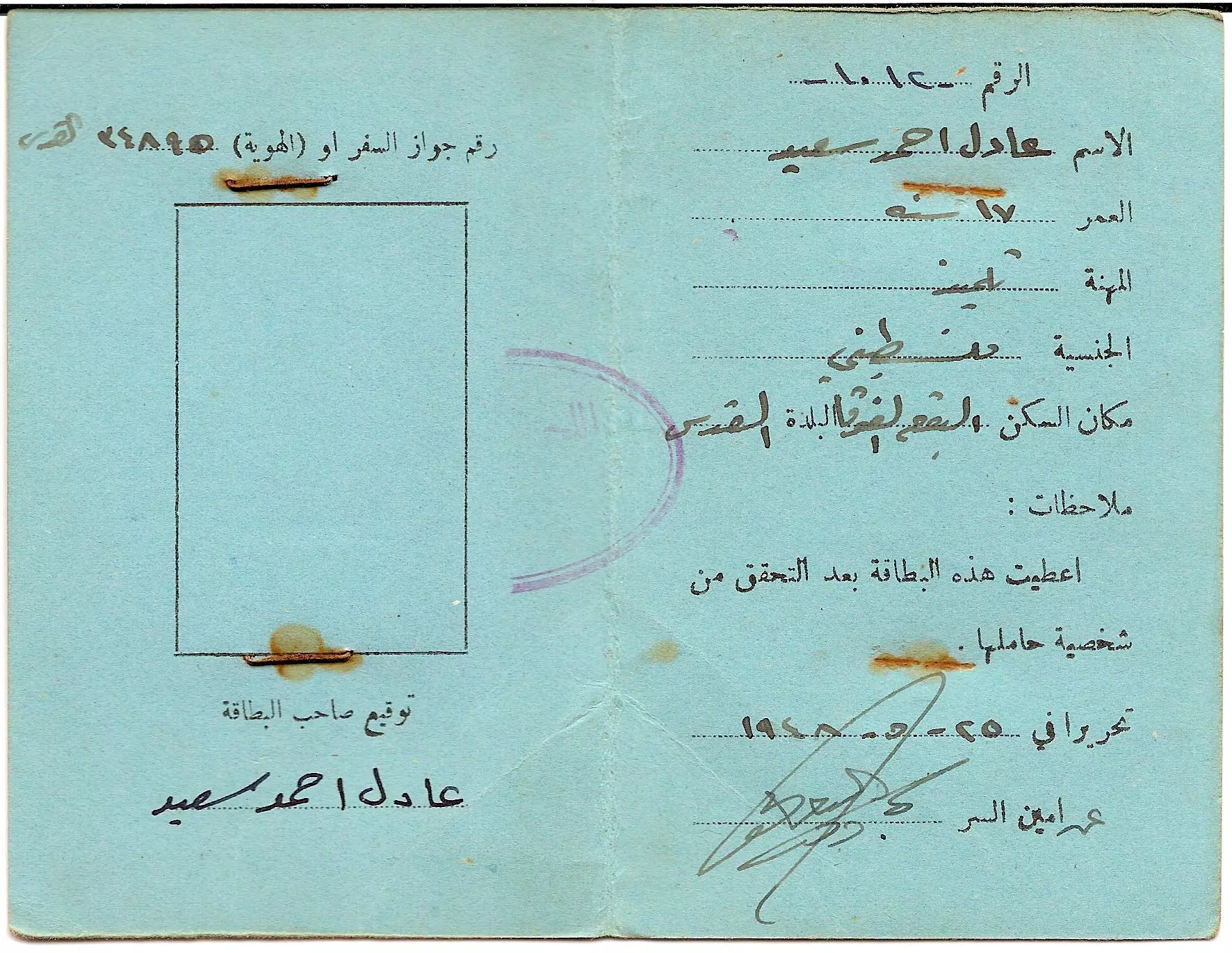
Posted by Ayah Bseisy - ID dated 25/5/1948-A
Posted by Ayah Bseisy - ID dated 25/5/1948-B
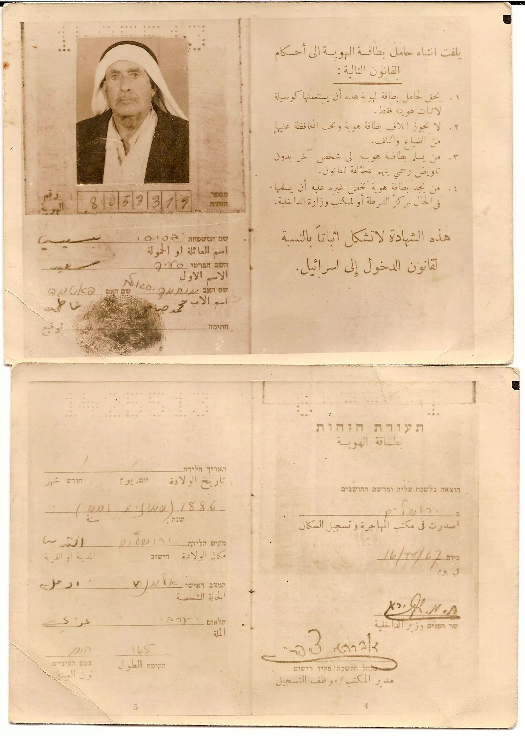
Posted by Ayah Bseisy - ID dated 16/11/1967
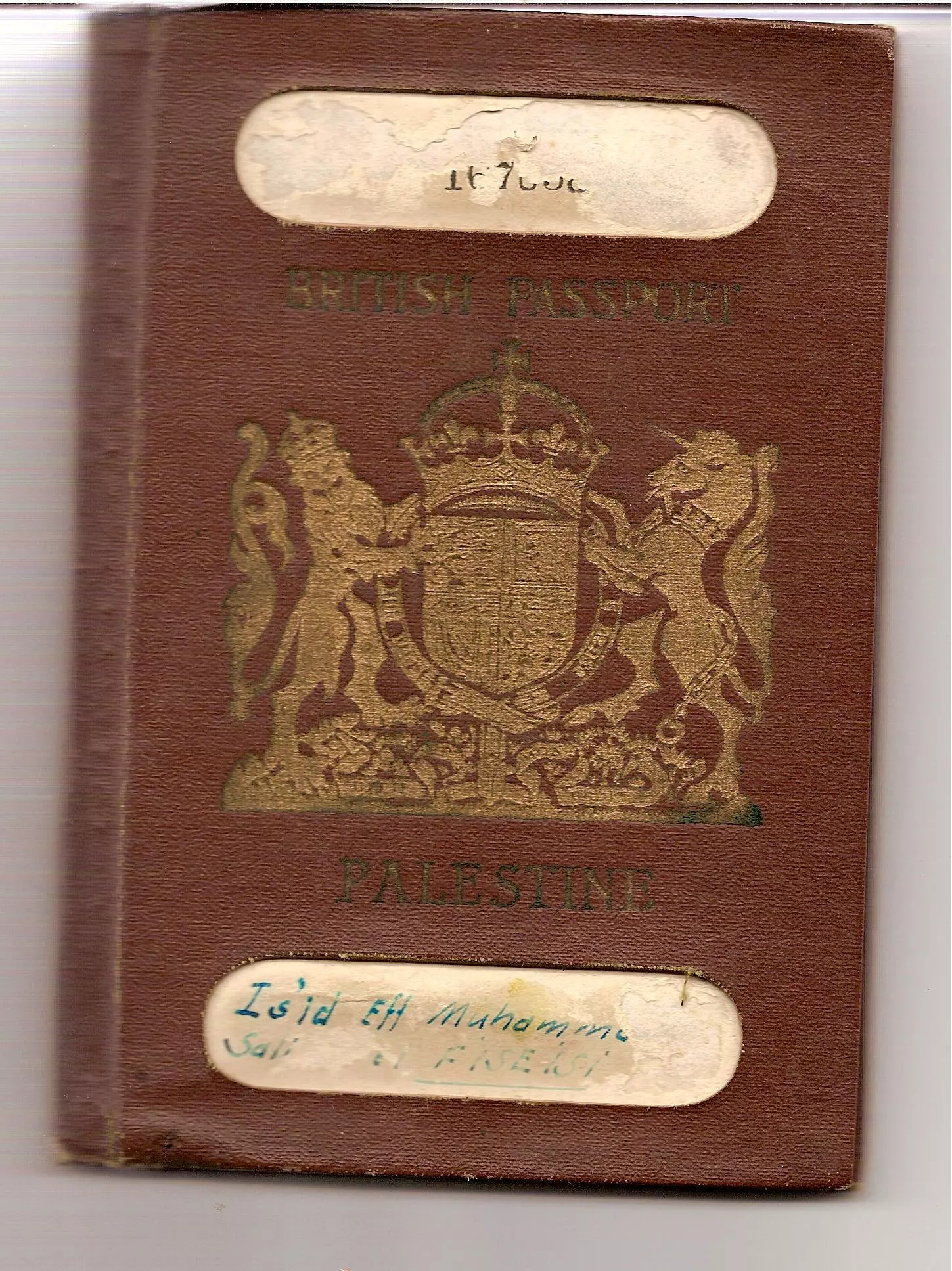
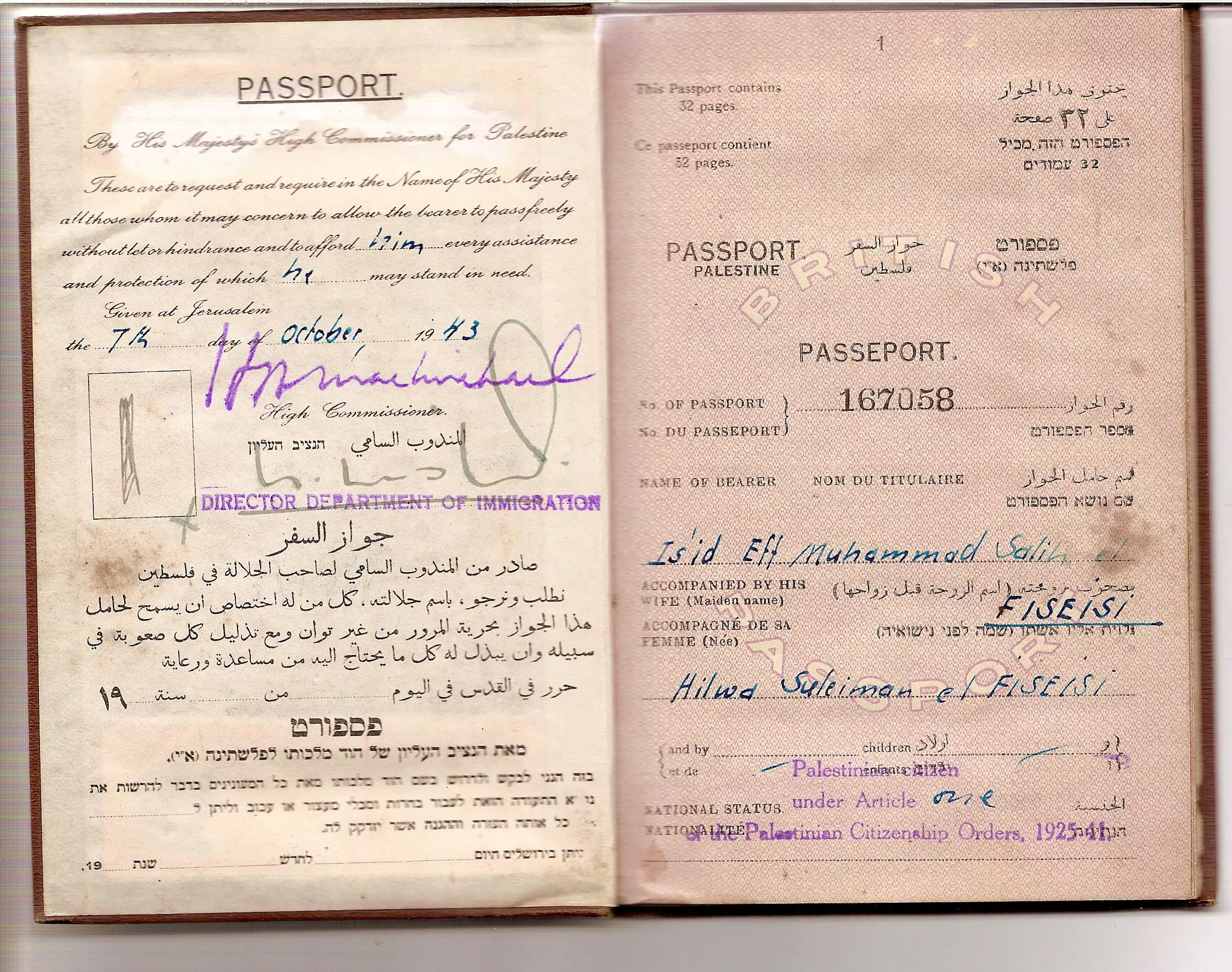
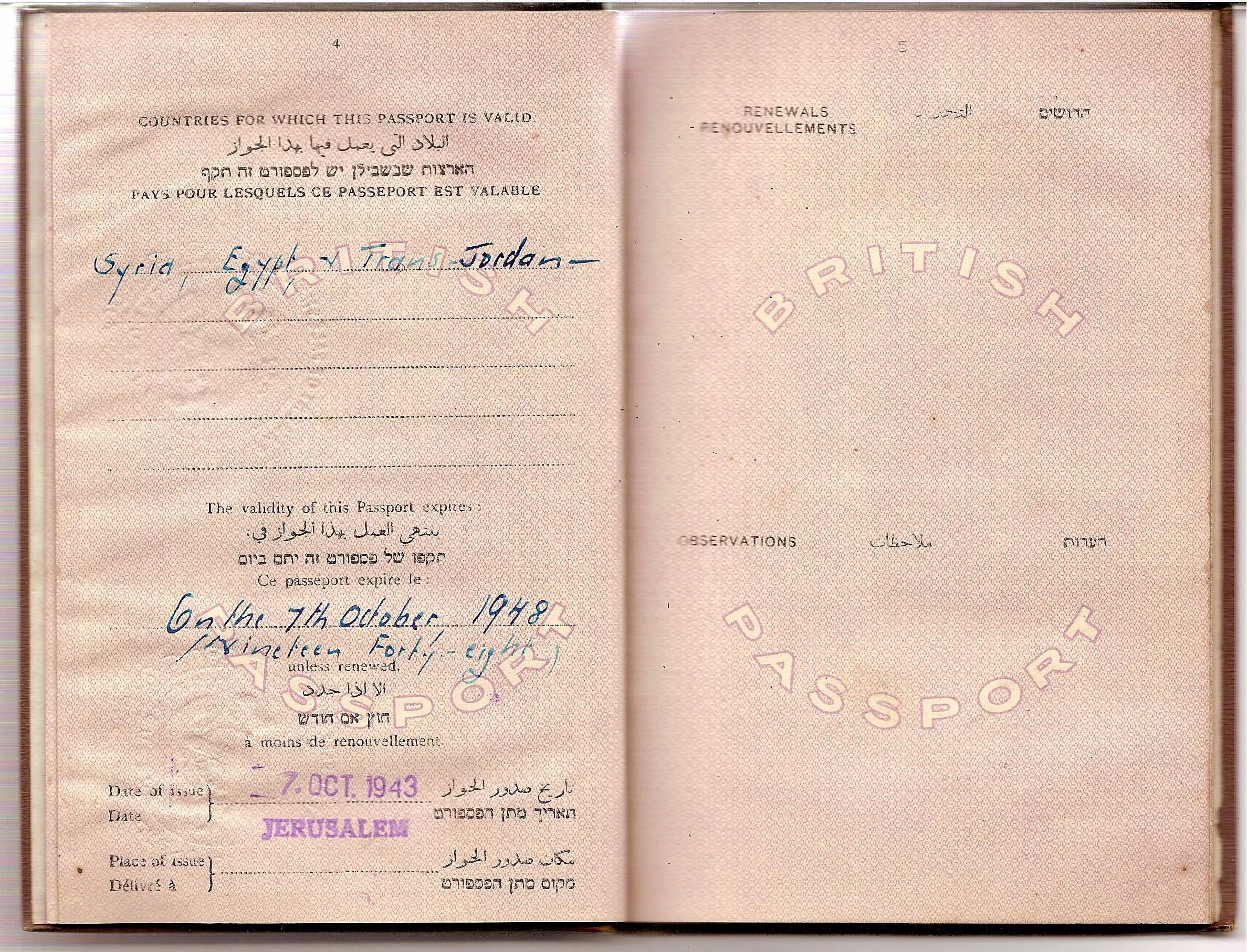
Posted by Ayah Bseisy - Passport Dated 1/10/1943-A
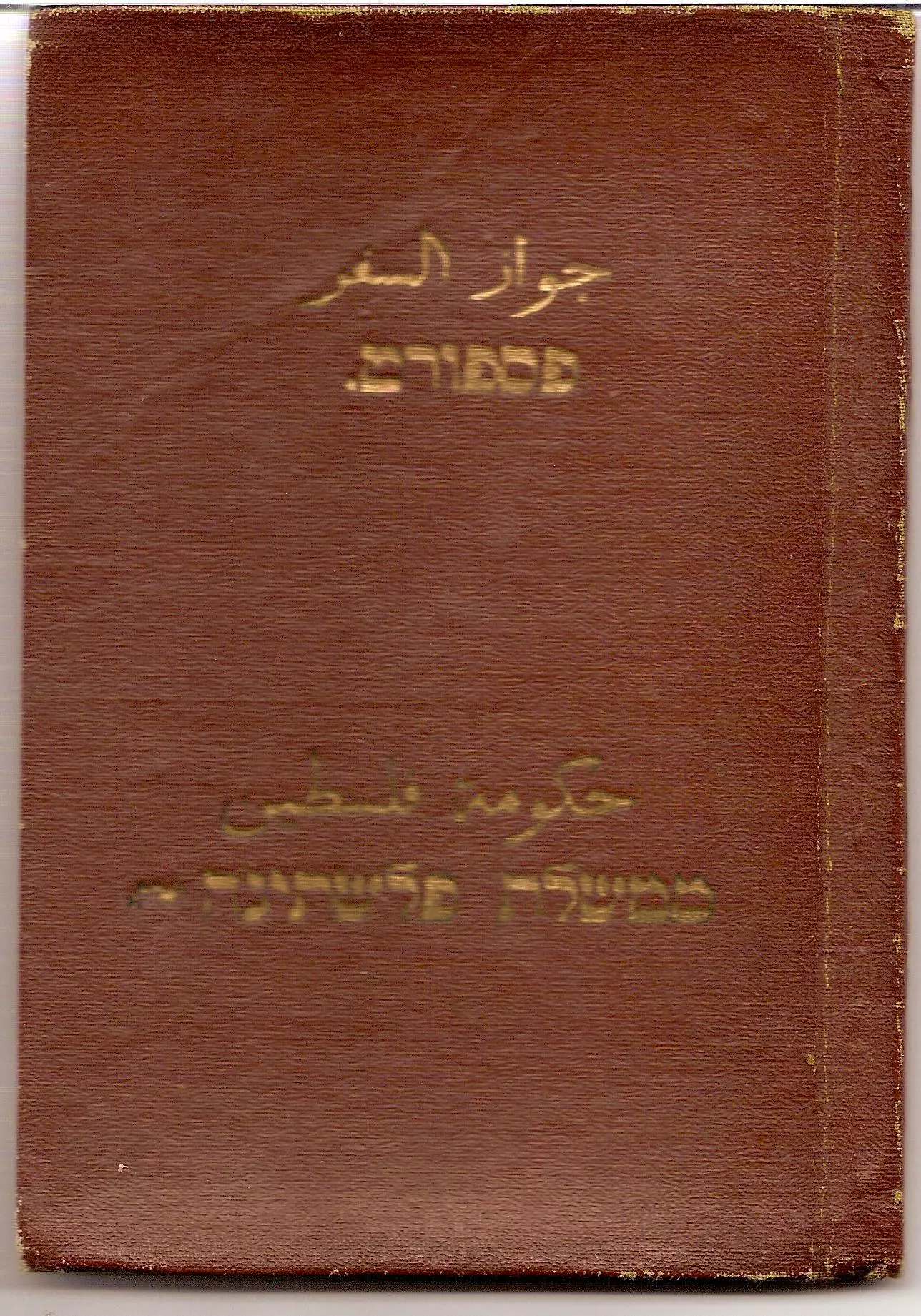
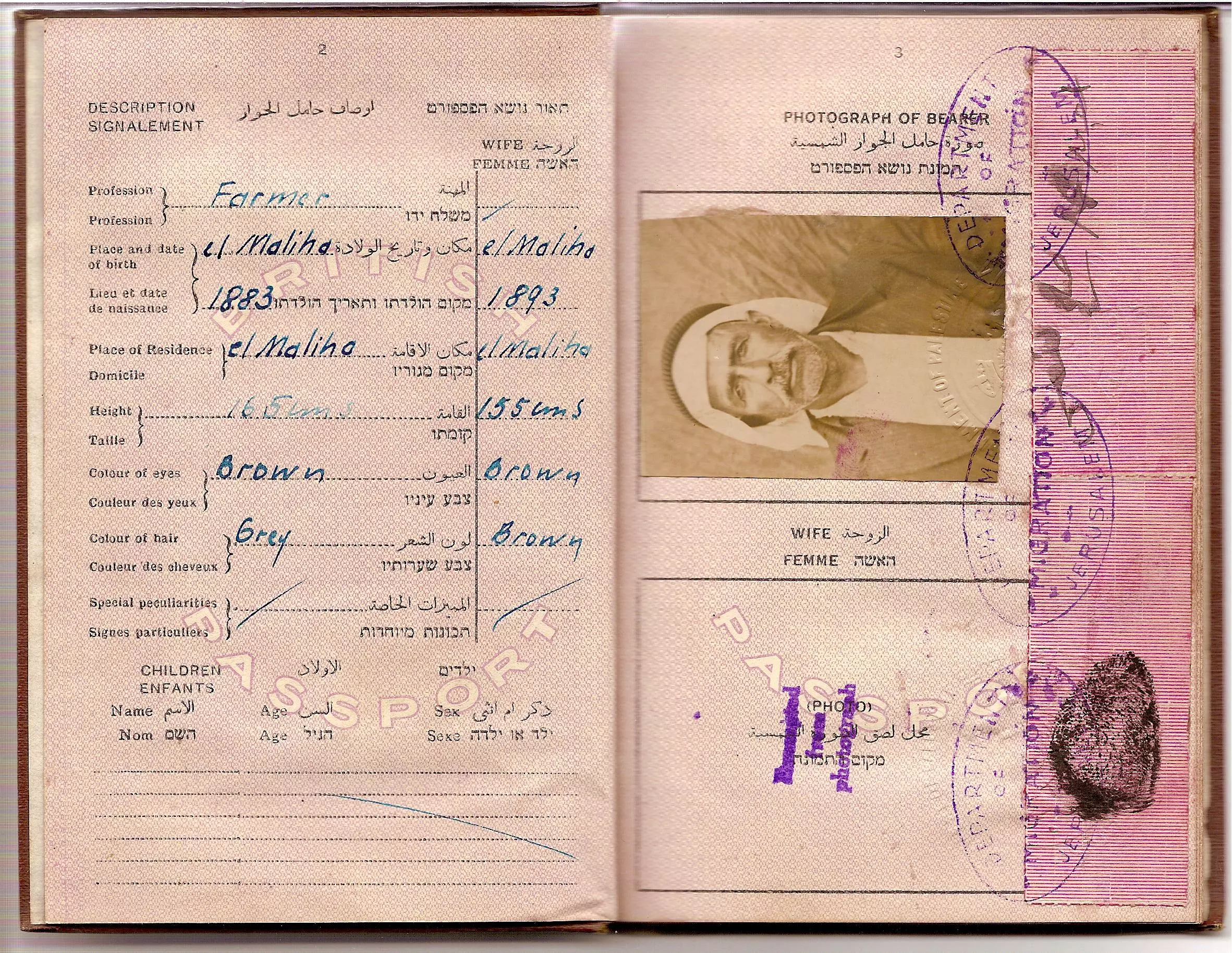
Posted by Ayah Bseisy - Passport Dated 1/10/1943-B
Posted by Ayah Bseisy - Passport Dated 1/10/1943-C
Posted by Ayah Bseisy - Passport Dated 1/10/1943-D
Posted by Ayah Bseisy - Passport Dated 1/10/1943-F
Posted by Ayah Bseisy - Passport Dated 1/10/1943-G
Posted by Ayah Bseisy - خط سكة الحديد من القدس الى يافا -المنطقة ما قبل الولجة- هدية من صفافي
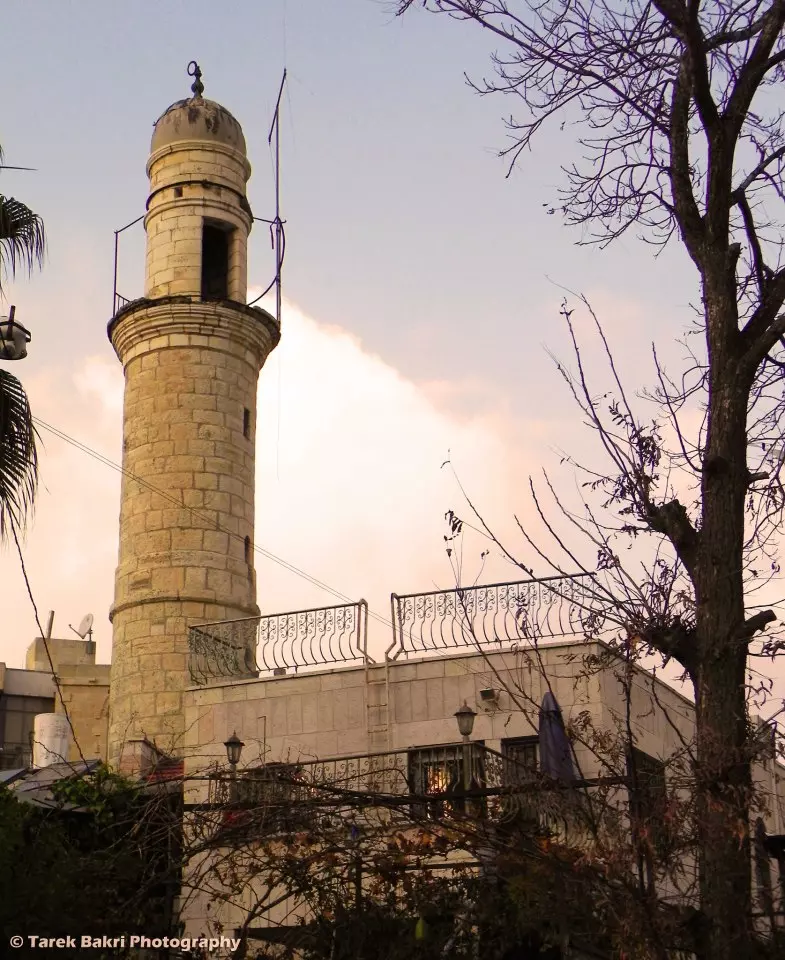
Posted by ابو عمر - The mosque of the village is now the residence of an israeli family
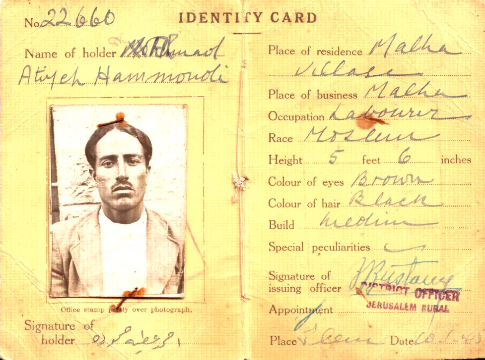
Posted by Tarek Bakri - Identity Card Malha Jerusalem for Ahmad Atiyya Hamoudeh
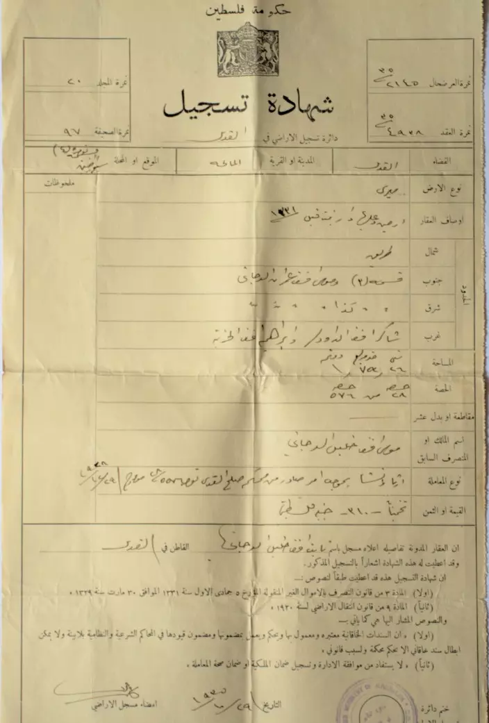
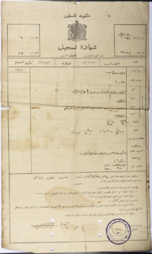
Posted by Ahmad Hammoudeh - شهادة تسجيل أرض باسم ثابت خليل الدجاني في المالحة عام 1935
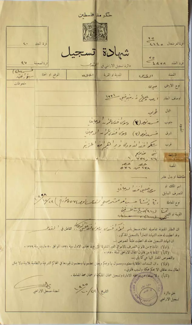
- شهادة تسجيل أرض فؤاد موسى الدجاني في المالحة عام 1935
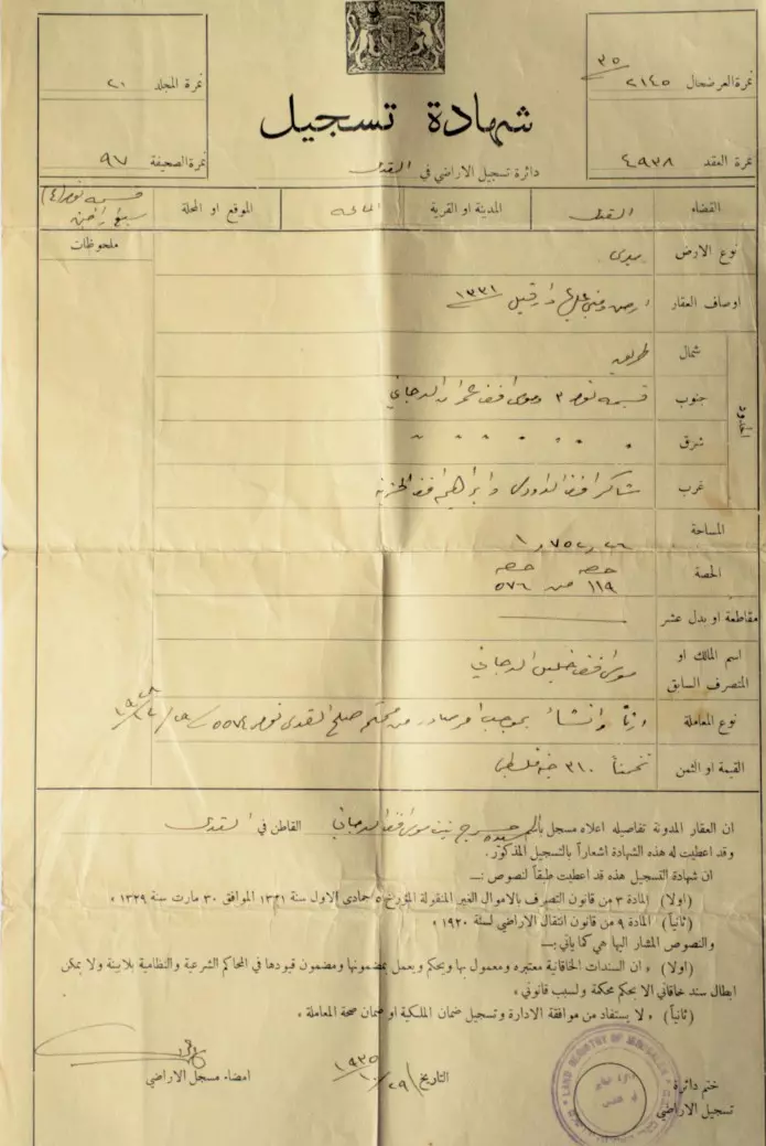
- شهادة تسجيل أرض في المالحة باسم خسرج موسى الدجاني من القدس عام 1935
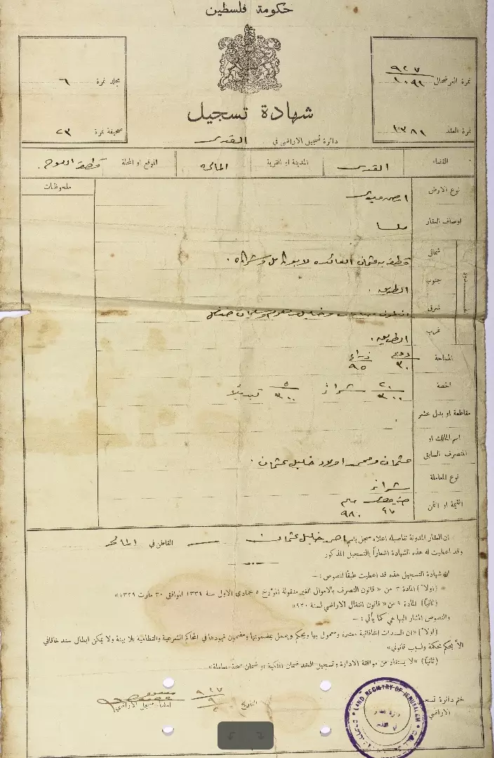
- وثيقة ملكية قطعة أرض في قرية المالحة في القدس باسم أحمد عثمان
- Zionist Jews looting al-Maliha, 1950 - صهاينة وهم ينهبون المالحة في خمسينيات القرن الماضي
- Maliha in 1956 - صورة لقرية المالحة عام 1956
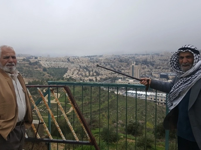
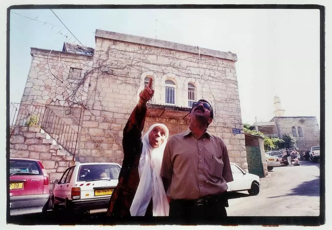
- الشيخ محمد فرج (يمين) والحاج جابر فرج يطلان على المالحة (الجزيرة نت)
- سيارات لمستوطنين من أقطار العالم استوطنوا منازل الفلسطينيين بالمالحة (الجزيرة)
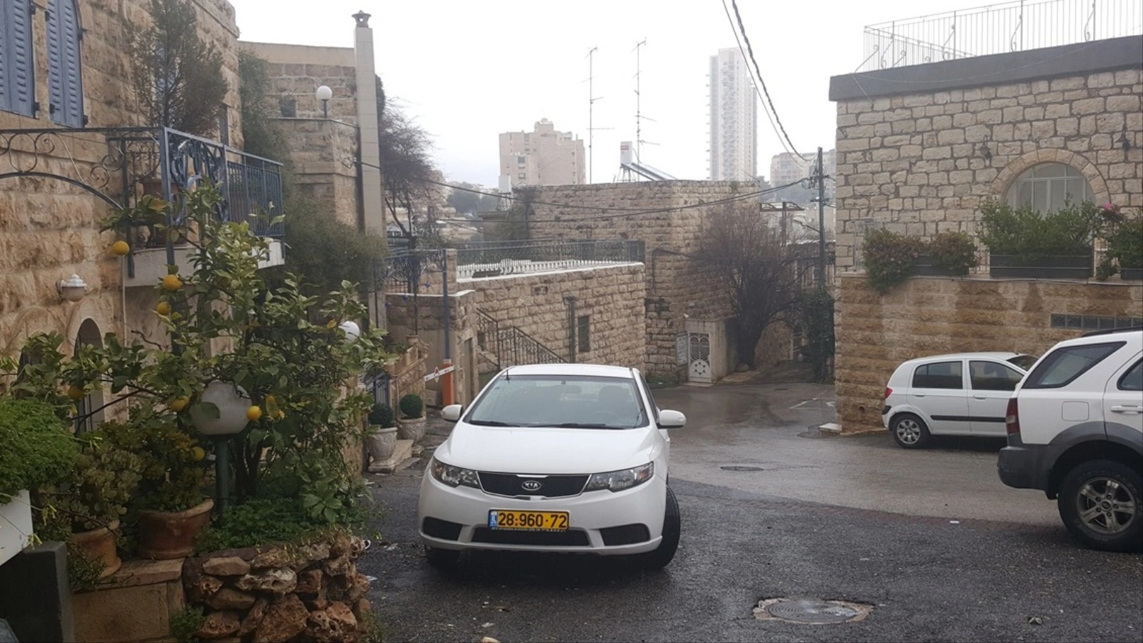
- منازل فلسطينية ما زالت موجودة في قرية المالحة المهجرة غرب القدس (الجزيرة نت)
- قرية المالحة تتعرض لمخطط استيطاني يهدد منازلها القديمة ومسجدها
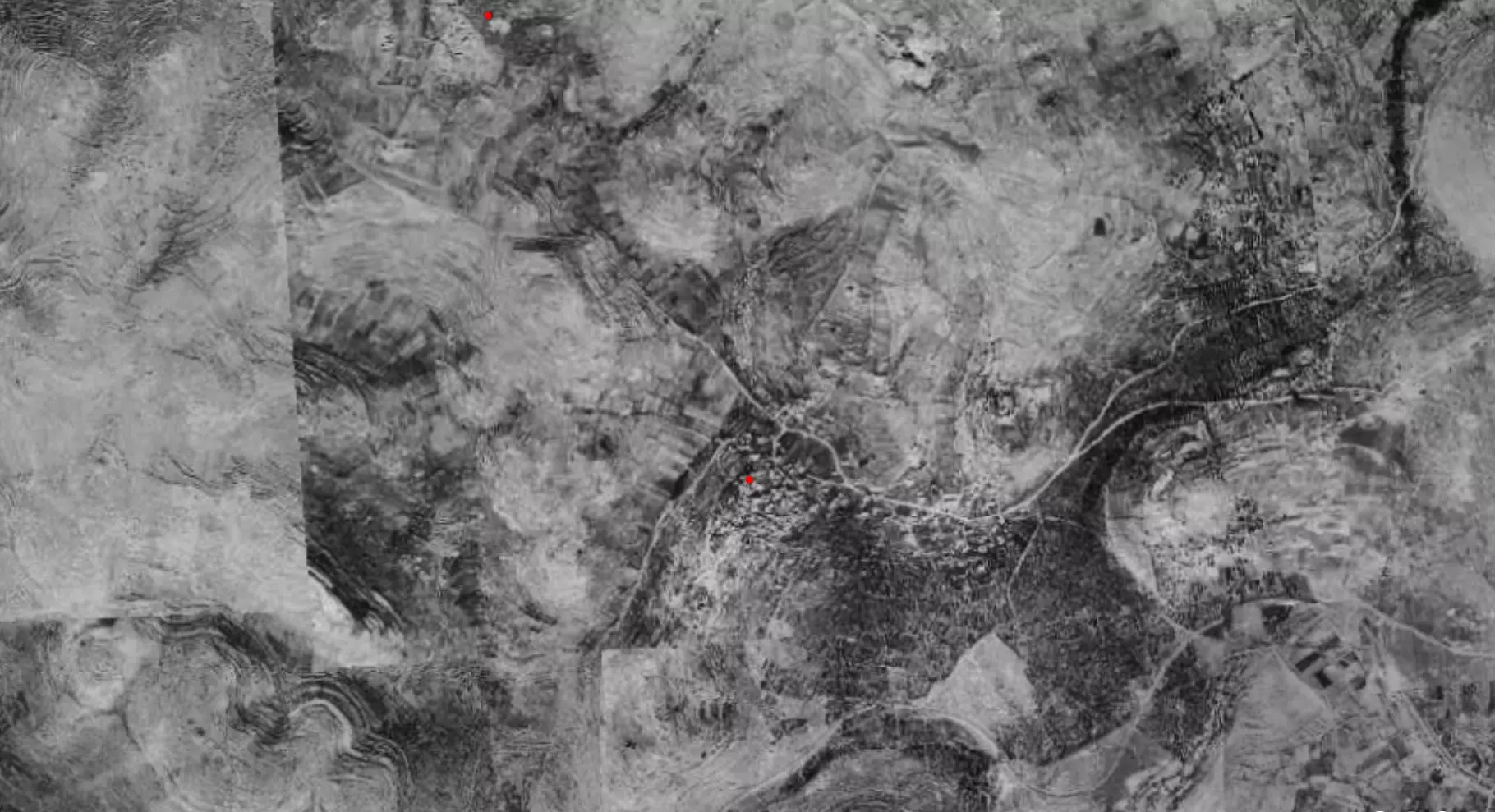
- Pre-Nakba Aerial view of the village / صورة من الجو للقرية اخذت قبل النكبة
- وثيقة ملكية قطعة أرض في قرية المالحة في القدس مسجلة باسم أحمد عثمان
- قرية المالحة عام 1950 بعد احتلالها
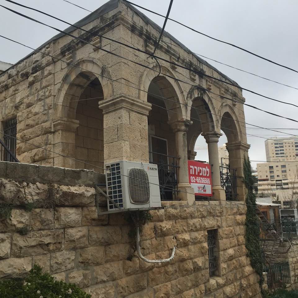
- Several looted Palestinian homes are for sale in al-Maliha #2
- Several looted Palestinian homes are for sale in al-Maliha #3
- Our beautiful usurped Maliha. A Promise: we shall cleanse you soon. We are coming back home; stay tuned my beloved Maliha
- Retracing the Nakba in West Jerusalem’s al-Malha by Alex Shams
- Retracing the Nakba in West Jerusalem’s al-Malha by Alex Shams #2
- Retracing the Nakba in West Jerusalem’s al-Malha by Alex Shams #3
- Retracing the Nakba in West Jerusalem’s al-Malha by Alex Shams #4
- Retracing the Nakba in West Jerusalem’s al-Malha by Alex Shams #5
- Retracing the Nakba in West Jerusalem’s al-Malha by Alex Shams #6
- Retracing the Nakba in West Jerusalem’s al-Malha by Alex Shams #7
- Retracing the Nakba in West Jerusalem’s al-Malha by Alex Shams #8
- Retracing the Nakba in West Jerusalem’s al-Malha by Alex Shams #9
- Retracing the Nakba in West Jerusalem’s al-Malha by Alex Shams #10
- Retracing the Nakba in West Jerusalem’s al-Malha by Alex Shams #11
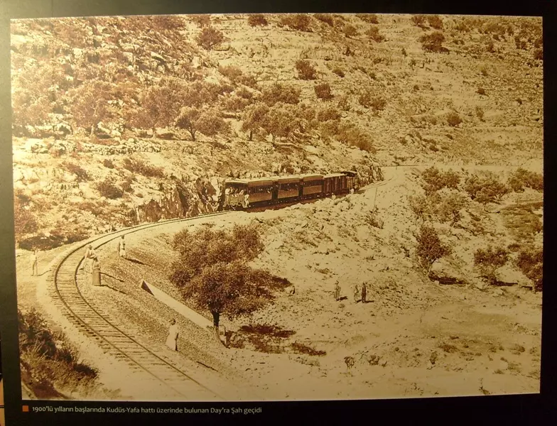
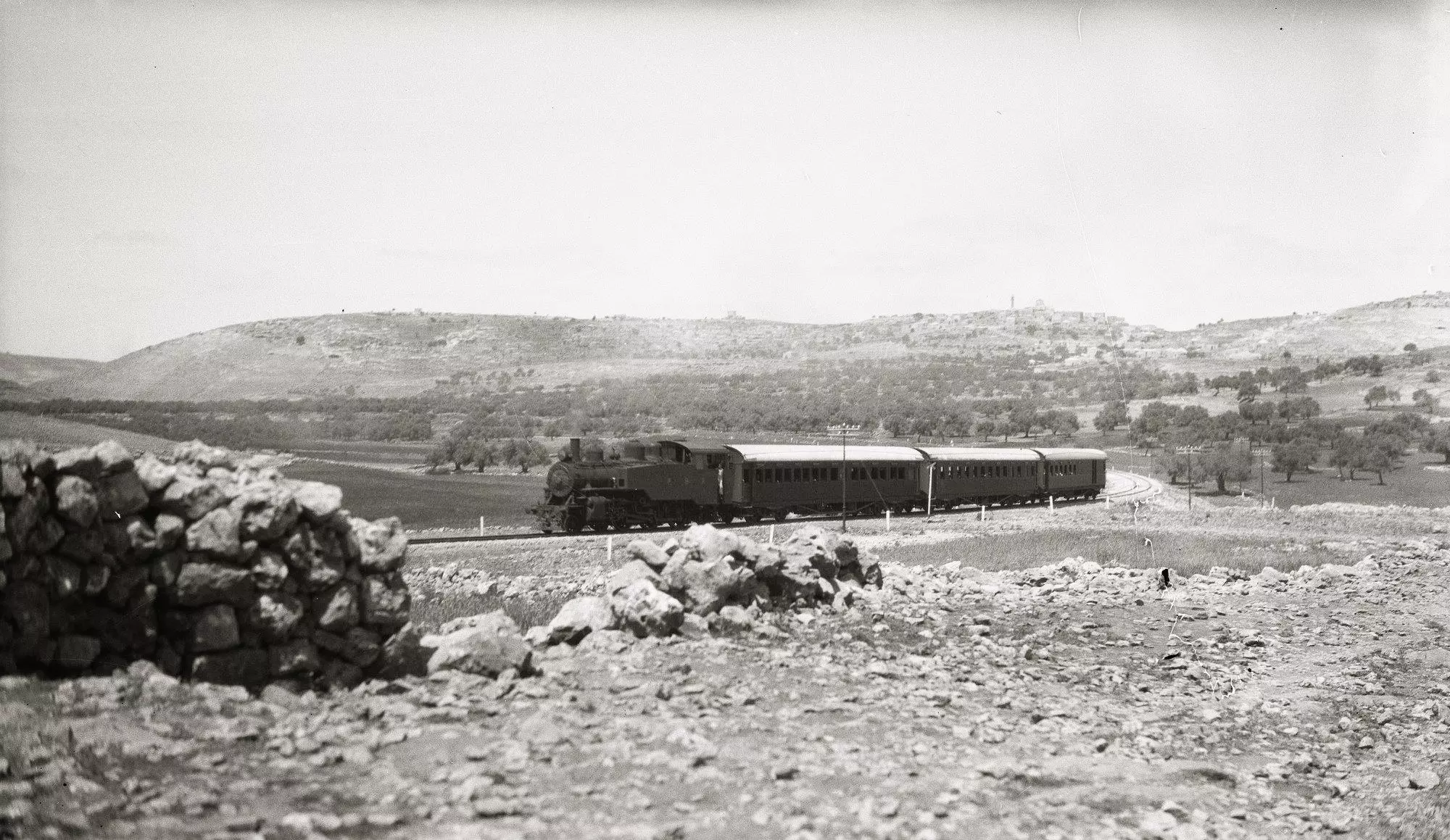
- صورة نادة لقطار يافا القدس وقرية المالحة المغتصبة تظهر في اعلى الصورة--- A rare picture during the pre-Nakba era of Jaffa - Jerusalem train and at the top al-Maliha can be clearly seen
- قرية المالحة بالقدس عام 1950
- Our village, 17 years after the "civilized" replaced us, we shall return
- A tour of Palestinian homes that were looted by the "most civilized". How else will the Jews be great again? Mazletov
- A tour of Palestinian homes that were looted by the "most civilized". How else will the Jews be great again? Mazletov #2
- A tour of Palestinian homes that were looted by the "most civilized". How else will the Jews be great again? Mazletov #3
- A tour of Palestinian homes that were looted by the "most civilized". How else will the Jews be great again? Mazletov #4
- A tour of Palestinian homes that were looted by the "most civilized". How else will the Jews be great again? Mazletov #5
- A tour of Palestinian homes that were looted by the "most civilized". How else will the Jews be great again? Mazletov #6
- Malha's mosque minaret; we are coming back. Stay tuned
- The "civilized" usurped our mosque, and they wonder why they are hated!
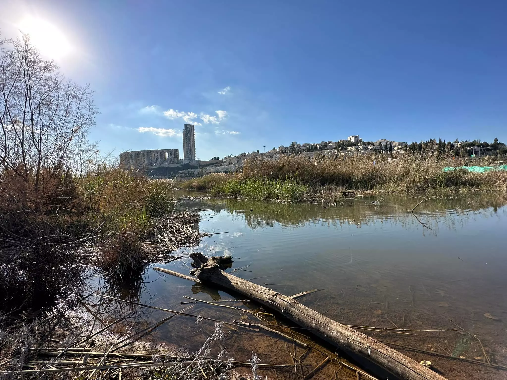
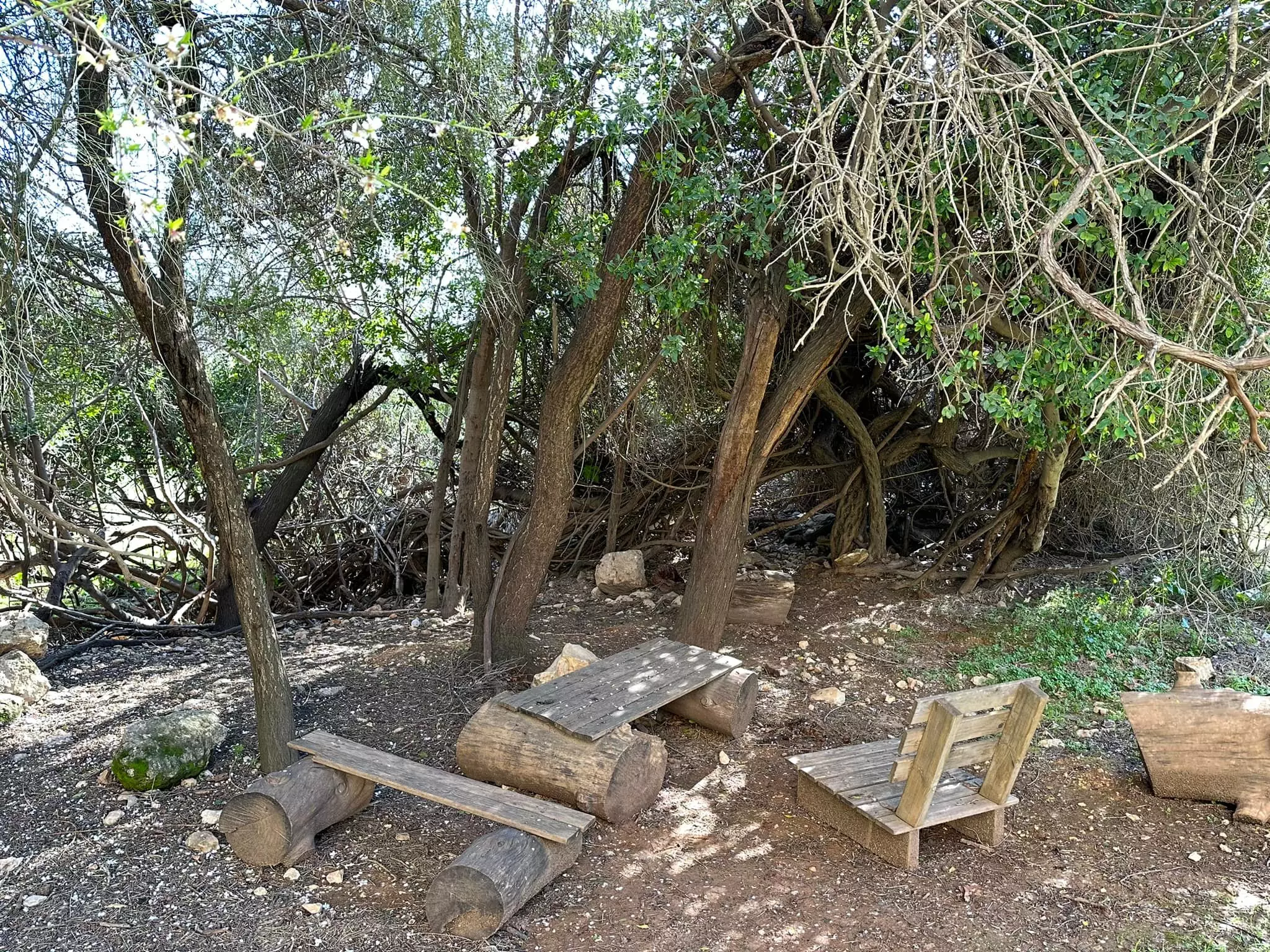
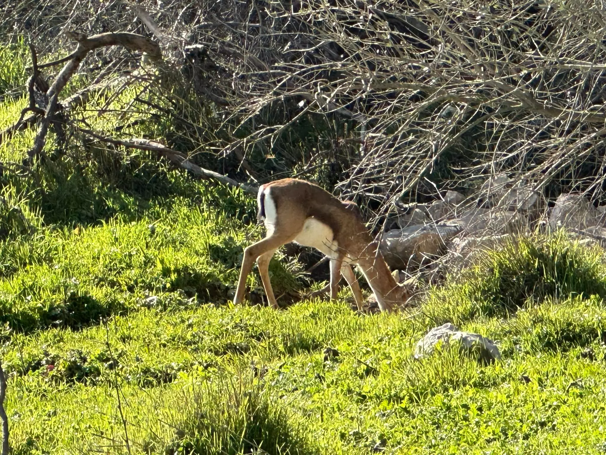
- وادي الغزلان -- كان اسمه واد ام وادين كان يمتد من دير المصلبه الي المالحه -- 2023 -- Iyad Jaber
- وادي الغزلان -- كان اسمه واد ام وادين كان يمتد من دير المصلبه الي المالحه -- 2023 -- Iyad Jaber #2
- وادي الغزلان -- كان اسمه واد ام وادين كان يمتد من دير المصلبه الي المالحه -- 2023 -- Iyad Jaber #3
- وادي الغزلان -- كان اسمه واد ام وادين كان يمتد من دير المصلبه الي المالحه -- 2023 -- Iyad Jaber #4
- وادي الغزلان -- كان اسمه واد ام وادين كان يمتد من دير المصلبه الي المالحه -- 2023 -- Iyad Jaber #5
- وادي الغزلان -- كان اسمه واد ام وادين كان يمتد من دير المصلبه الي المالحه -- 2023 -- Iyad Jaber #6
- Let us see what the "MOST CIVILIZED" have looted from the Palestinian people. No, we are not talking about the Germans; we are referring to the "chosen" ones! See for yourself how the most "liberal & progressive" of World Jewry have done to Palestinians' homes. WOW. Soon, Gaza might have a similar fate. Mazeltov. How else will Jews be great again?
- Let us see what the "MOST CIVILIZED" have looted from the Palestinian people. No, we are not talking about the Germans; we are referring to the "chosen" ones! See for yourself how the most "liberal & progressive" of World Jewry have done to Palestinians' homes. WOW. Soon, Gaza might have a similar fate. Mazeltov. How else will Jews be great again? #2
- Let us see what the "MOST CIVILIZED" have looted from the Palestinian people. No, we are not talking about the Germans; we are referring to the "chosen" ones! See for yourself how the most "liberal & progressive" of World Jewry have done to Palestinians' homes. WOW. Soon, Gaza might have a similar fate. Mazeltov. How else will Jews be great again? #3
- Let us see what the "MOST CIVILIZED" have looted from the Palestinian people. No, we are not talking about the Germans; we are referring to the "chosen" ones! See for yourself how the most "liberal & progressive" of World Jewry have done to Palestinians' homes. WOW. Soon, Gaza might have a similar fate. Mazeltov. How else will Jews be great again? #4
- Let us see what the "MOST CIVILIZED" have looted from the Palestinian people. No, we are not talking about the Germans; we are referring to the "chosen" ones! See for yourself how the most "liberal & progressive" of World Jewry have done to Palestinians' homes. WOW. Soon, Gaza might have a similar fate. Mazeltov. How else will Jews be great again? #5
- Let us see what the "MOST CIVILIZED" have looted from the Palestinian people. No, we are not talking about the Germans; we are referring to the "chosen" ones! See for yourself how the most "liberal & progressive" of World Jewry have done to Palestinians' homes. WOW. Soon, Gaza might have a similar fate. Mazeltov. How else will Jews be great again? #6
- Let us see what the "MOST CIVILIZED" have looted from the Palestinian people. No, we are not talking about the Germans; we are referring to the "chosen" ones! See for yourself how the most "liberal & progressive" of World Jewry have done to Palestinians' homes. WOW. Soon, Gaza might have a similar fate. Mazeltov. How else will Jews be great again? #7
- Let us see what the "MOST CIVILIZED" have looted from the Palestinian people. No, we are not talking about the Germans; we are referring to the "chosen" ones! See for yourself how the most "liberal & progressive" of World Jewry have done to Palestinians' homes. WOW. Soon, Gaza might have a similar fate. Mazeltov. How else will Jews be great again? #8
- Let us see what the "MOST CIVILIZED" have looted from the Palestinian people. No, we are not talking about the Germans; we are referring to the "chosen" ones! See for yourself how the most "liberal & progressive" of World Jewry have done to Palestinians' homes. WOW. Soon, Gaza might have a similar fate. Mazeltov. How else will Jews be great again? #9
- Let us see what the "MOST CIVILIZED" have looted from the Palestinian people. No, we are not talking about the Germans; we are referring to the "chosen" ones! See for yourself how the most "liberal & progressive" of World Jewry have done to Palestinians' homes. WOW. Soon, Gaza might have a similar fate. Mazeltov. How else will Jews be great again? #10
- Let us see what the "MOST CIVILIZED" have looted from the Palestinian people. No, we are not talking about the Germans; we are referring to the "chosen" ones! See for yourself how the most "liberal & progressive" of World Jewry have done to Palestinians' homes. WOW. Soon, Gaza might have a similar fate. Mazeltov. How else will Jews be great again? #11
- Let us see what the "MOST CIVILIZED" have looted from the Palestinian people. No, we are not talking about the Germans; we are referring to the "chosen" ones! See for yourself how the most "liberal & progressive" of World Jewry have done to Palestinians' homes. WOW. Soon, Gaza might have a similar fate. Mazeltov. How else will Jews be great again? #12
- Let us see what the "MOST CIVILIZED" have looted from the Palestinian people. No, we are not talking about the Germans; we are referring to the "chosen" ones! See for yourself how the most "liberal & progressive" of World Jewry have done to Palestinians' homes. WOW. Soon, Gaza might have a similar fate. Mazeltov. How else will Jews be great again? #13
- Let us see what the "MOST CIVILIZED" have looted from the Palestinian people. No, we are not talking about the Germans; we are referring to the "chosen" ones! See for yourself how the most "liberal & progressive" of World Jewry have done to Palestinians' homes. WOW. Soon, Gaza might have a similar fate. Mazeltov. How else will Jews be great again? #14
- Let us see what the "MOST CIVILIZED" have looted from the Palestinian people. No, we are not talking about the Germans; we are referring to the "chosen" ones! See for yourself how the most "liberal & progressive" of World Jewry have done to Palestinians' homes. WOW. Soon, Gaza might have a similar fate. Mazeltov. How else will Jews be great again? #15
- Let us see what the "MOST CIVILIZED" have looted from the Palestinian people. No, we are not talking about the Germans; we are referring to the "chosen" ones! See for yourself how the most "liberal & progressive" of World Jewry have done to Palestinians' homes. WOW. Soon, Gaza might have a similar fate. Mazeltov. How else will Jews be great again? #16
- Let us see what the "MOST CIVILIZED" have looted from the Palestinian people. No, we are not talking about the Germans; we are referring to the "chosen" ones! See for yourself how the most "liberal & progressive" of World Jewry have done to Palestinians' homes. WOW. Soon, Gaza might have a similar fate. Mazeltov. How else will Jews be great again? #17
- Let us see what the "MOST CIVILIZED" have looted from the Palestinian people. No, we are not talking about the Germans; we are referring to the "chosen" ones! See for yourself how the most "liberal & progressive" of World Jewry have done to Palestinians' homes. WOW. Soon, Gaza might have a similar fate. Mazeltov. How else will Jews be great again? #18
- Let us see what the "MOST CIVILIZED" have looted from the Palestinian people. No, we are not talking about the Germans; we are referring to the "chosen" ones! See for yourself how the most "liberal & progressive" of World Jewry have done to Palestinians' homes. WOW. Soon, Gaza might have a similar fate. Mazeltov. How else will Jews be great again? #19
- Let us see what the "MOST CIVILIZED" have looted from the Palestinian people. No, we are not talking about the Germans; we are referring to the "chosen" ones! See for yourself how the most "liberal & progressive" of World Jewry have done to Palestinians' homes. WOW. Soon, Gaza might have a similar fate. Mazeltov. How else will Jews be great again? #20
- Let us see what the "MOST CIVILIZED" have looted from the Palestinian people. No, we are not talking about the Germans; we are referring to the "chosen" ones! See for yourself how the most "liberal & progressive" of World Jewry have done to Palestinians' homes. WOW. Soon, Gaza might have a similar fate. Mazeltov. How else will Jews be great again? #21
- Let us see what the "MOST CIVILIZED" have looted from the Palestinian people. No, we are not talking about the Germans; we are referring to the "chosen" ones! See for yourself how the most "liberal & progressive" of World Jewry have done to Palestinians' homes. WOW. Soon, Gaza might have a similar fate. Mazeltov. How else will Jews be great again? #22
- Let us see what the "MOST CIVILIZED" have looted from the Palestinian people. No, we are not talking about the Germans; we are referring to the "chosen" ones! See for yourself how the most "liberal & progressive" of World Jewry have done to Palestinians' homes. WOW. Soon, Gaza might have a similar fate. Mazeltov. How else will Jews be great again? #23
- Let us see what the "MOST CIVILIZED" have looted from the Palestinian people. No, we are not talking about the Germans; we are referring to the "chosen" ones! See for yourself how the most "liberal & progressive" of World Jewry have done to Palestinians' homes. WOW. Soon, Gaza might have a similar fate. Mazeltov. How else will Jews be great again? #24
- Let us see what the "MOST CIVILIZED" have looted from the Palestinian people. No, we are not talking about the Germans; we are referring to the "chosen" ones! See for yourself how the most "liberal & progressive" of World Jewry have done to Palestinians' homes. WOW. Soon, Gaza might have a similar fate. Mazeltov. How else will Jews be great again? #25
- Let us see what the "MOST CIVILIZED" have looted from the Palestinian people. No, we are not talking about the Germans; we are referring to the "chosen" ones! See for yourself how the most "liberal & progressive" of World Jewry have done to Palestinians' homes. WOW. Soon, Gaza might have a similar fate. Mazeltov. How else will Jews be great again? #26
- Let us see what the "MOST CIVILIZED" have looted from the Palestinian people. No, we are not talking about the Germans; we are referring to the "chosen" ones! See for yourself how the most "liberal & progressive" of World Jewry have done to Palestinians' homes. WOW. Soon, Gaza might have a similar fate. Mazeltov. How else will Jews be great again? #27
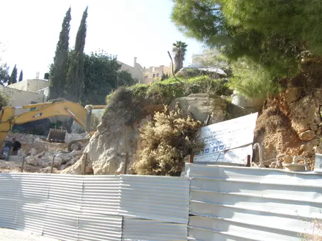
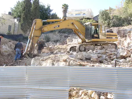
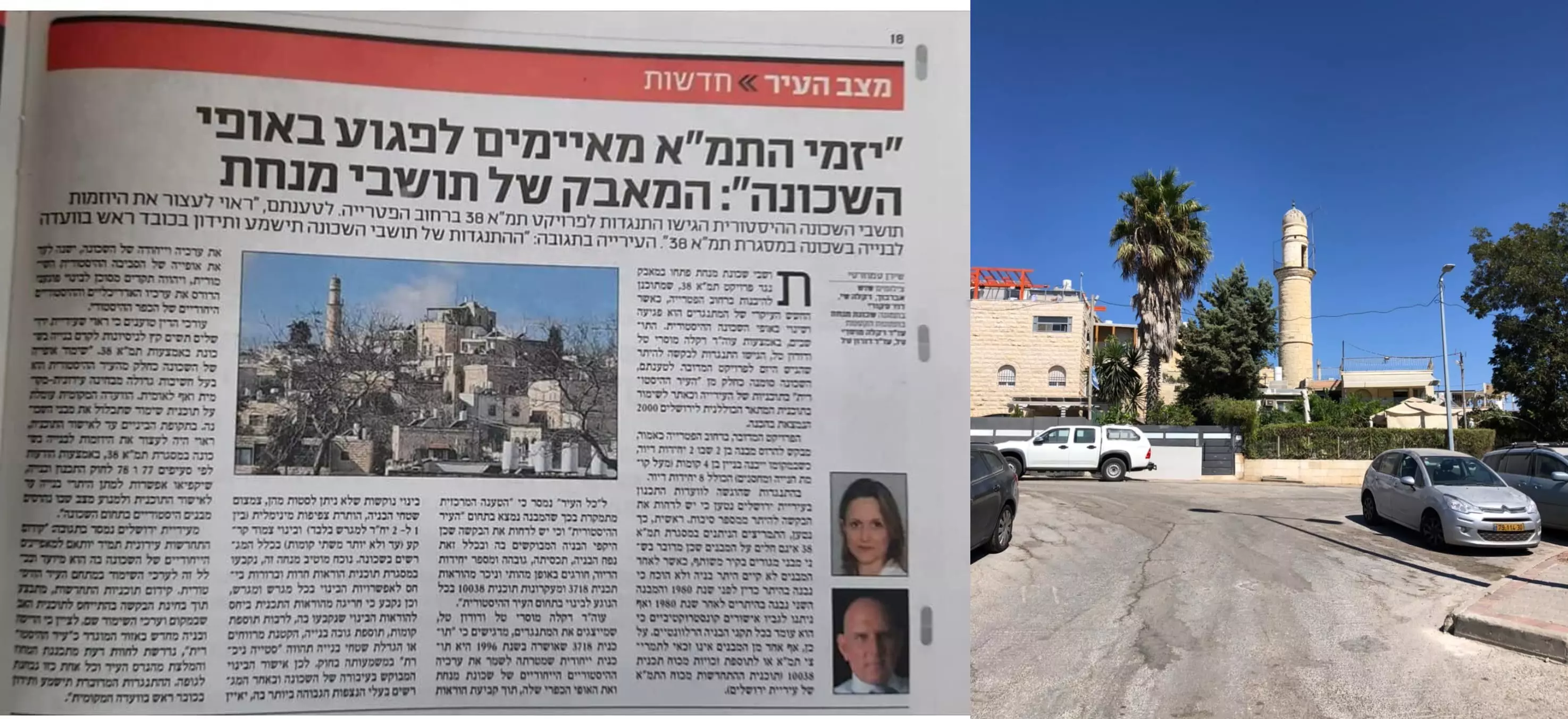
- مشروع استيطاني ضخم في القدس يهدف لهدم قرية المالحة والمسجد التاريخي والمقبرة الاسلامية -- March, 2022 -- Iyad Jaber
- مسجد عمر بن الخطاب في قرية المالحة المهجرة قضاء القدس تم اقتطاع حزء كبير من مساحته لصالح العائلة اليهودية ، اما سطحه يستعمل من جيران الحي للسهرات الليلية -- Jan. 19th, 2022, Iyad Jaber
- جولة في مقبرة قرية المالحة المهجرة -- Iyad Jaber
- جولة في مقبرة قرية المالحة المهجرة -- Iyad Jaber #2
- جولة في مقبرة قرية المالحة المهجرة -- Iyad Jaber #3
- جولة في مقبرة قرية المالحة المهجرة -- Iyad Jaber #4

- جولة في مقبرة قرية المالحة المهجرة -- Iyad Jaber #5
- جولة في مقبرة قرية المالحة المهجرة -- Iyad Jaber #6
- جولة في مقبرة قرية المالحة المهجرة -- Iyad Jaber #7
- Rare pictures of our village al-Maliha taken two years after the Jews replaced and dispossessed, 1950 -- مجموعة صور نادرة للمالحة..اخذت سنتين بعد إغتصابها
- Rare pictures of our village al-Maliha taken two years after the Jews replaced and dispossessed, 1950 -- مجموعة صور نادرة للمالحة..اخذت سنتين بعد إغتصابها #2
- Rare pictures of our village al-Maliha taken two years after the Jews replaced and dispossessed, 1950 -- مجموعة صور نادرة للمالحة..اخذت سنتين بعد إغتصابها #3
- Rare pictures of our village al-Maliha taken two years after the Jews replaced and dispossessed, 1950 -- مجموعة صور نادرة للمالحة..اخذت سنتين بعد إغتصابها #4
- Rare pictures of our village al-Maliha taken two years after the Jews replaced and dispossessed, 1950 -- مجموعة صور نادرة للمالحة..اخذت سنتين بعد إغتصابها #5
- Rare pictures of our village al-Maliha taken two years after the Jews replaced and dispossessed, 1950 -- مجموعة صور نادرة للمالحة..اخذت سنتين بعد إغتصابها #6
- Rare pictures of our village al-Maliha taken two years after the Jews replaced and dispossessed, 1950 -- مجموعة صور نادرة للمالحة..اخذت سنتين بعد إغتصابها #7
- Rare pictures of our village al-Maliha taken two years after the Jews replaced and dispossessed, 1950 -- مجموعة صور نادرة للمالحة..اخذت سنتين بعد إغتصابها #8
- Rare pictures of our village al-Maliha taken two years after the Jews replaced and dispossessed, 1950 -- مجموعة صور نادرة للمالحة..اخذت سنتين بعد إغتصابها #9
- Rare pictures shot while the most "civilized & liberal" of world Jewry were looting Palestinians' homes. How else will the Jews be great again?
- Rare pictures shot while the most "civilized & liberal" of world Jewry were looting Palestinians' homes. How else will the Jews be great again? #2

- Rare pictures shot while the most "civilized & liberal" of world Jewry were looting Palestinians' homes. How else will the Jews be great again? #3
- Rare pictures shot while the most "civilized & liberal" of world Jewry were looting Palestinians' homes. How else will the Jews be great again? #4
- Rare pictures shot while the most "civilized & liberal" of world Jewry were looting Palestinians' homes. How else will the Jews be great again? #5
- Rare pictures shot while the most "civilized & liberal" of world Jewry were looting Palestinians' homes. How else will the Jews be great again? #6
- Another looted Palestinian house
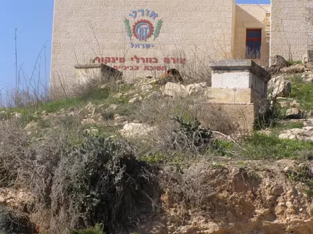
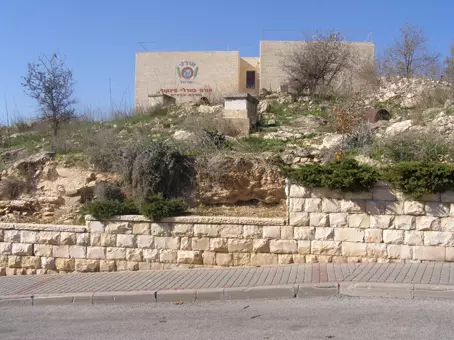
- مدرسة إسرائيلية على أنقاض مقبرة المالحة في القدس
- مدرسة إسرائيلية على أنقاض مقبرة المالحة في القدس #2
- مدرسة إسرائيلية على أنقاض مقبرة المالحة في القدس #3
- مدرسة إسرائيلية على أنقاض مقبرة المالحة في القدس #4
- Just imagine yourself a progressive & liberal Jew (like those in the picture) who looted Palestinian homes, farms, lands, and businesses; who still wonders why he or she is hated? Some people are a magnet for hate!
- Just imagine yourself a progressive & liberal Jew (like those in the picture) who looted Palestinian homes, farms, lands, and businesses; who still wonders why he or she is hated? Some people are a magnet for hate! #2
- The most "liberal" of world Jewry looted our homes, farms, and businesses. Now imagine what their fascists would have done? Genocide(s).
- The most "liberal" of world Jewry looted our homes, farms, and businesses. Now imagine what their fascists would have done? Genocide(s). #2
- The most "liberal" of world Jewry looted our homes, farms, and businesses. Now imagine what their fascists would have done? Genocide(s). #3
- The most "liberal" of world Jewry looted our homes, farms, and businesses. Now imagine what their fascists would have done? Genocide(s). #4
- The most "liberal" of world Jewry looted our homes, farms, and businesses. Now imagine what their fascists would have done? Genocide(s). #5
- The most "liberal" of world Jewry looted our homes, farms, and businesses. Now imagine what their fascists would have done? Genocide(s). #6
- The most "liberal" of world Jewry looted our homes, farms, and businesses. Now imagine what their fascists would have done? Genocide(s). #7
- The most "liberal" of world Jewry looted our homes, farms, and businesses. Now imagine what their fascists would have done? Genocide(s). #8
- The most "liberal" of world Jewry looted our homes, farms, and businesses. Now imagine what their fascists would have done? Genocide(s). #9
- The most "liberal" of world Jewry looted our homes, farms, and businesses. Now imagine what their fascists would have done? Genocide(s). #10
- The most "liberal" of world Jewry looted our homes, farms, and businesses. Now imagine what their fascists would have done? Genocide(s). #11
- The most "liberal" of world Jewry looted our homes, farms, and businesses. Now imagine what their fascists would have done? Genocide(s). #12
Want to browse more? 80,000 pictures were grouped in these gallaries:
- شهادة تسجيل أرض باسم ثابت خليل الدجاني في المالحة عام 1935
- شهادة تسجيل أرض فؤاد موسى الدجاني في المالحة عام 1935
- شهادة تسجيل أرض في المالحة باسم خسرج موسى الدجاني من القدس عام 1935
- وثيقة ملكية قطعة أرض في قرية المالحة في القدس باسم أحمد عثمان
- وثيقة ملكية قطعة أرض في قرية المالحة في القدس مسجلة باسم أحمد عثمان
| Display Name | Clan/Hamolah | Country of Residence |
| R. J. | - | Germantown, United States of America |
| Maryam Shahin | Alkalla | CA, CA |
| abo daniel | hasan abo kamel | athense, greece |
| عندليب | ابو قمل | Jordan, Jordan |
| ghada abu-kamel | - | amman, jordan |
| حسن عودة | عودة | القدس |
| مؤيد الجواريش | الجواريش | بيت لحم , بيت لحم |
| moussa | - | Amman |
| Alaa Marouf | - | saudi arabia, el riyadh |
| علاءكو | داوود | - |
| عبدالرحمن قطامش | - | - |
| AMAL | abu qamel | JORDAN, JORDAN |
| ayman ammar | ammar | ca, ca |
| الحج | - | مخيم شعفاط, القدس |
| علاء | Jawareesh/ Mawaleh | Palestine, Palestine |
| Ghadeer Abu Kamel | Abu Kamel | Amman, Jordan |
| maisa'a alkhars | عمار | amman, jordan |
| حقنا للعوده | - | القدس, المالحه |
| SAMEER MOUALLA | MOUALLA | UAE, UAE |
| omar moulla | moulla | jordan, jordan |
| Sameeh Moualla | Moualla | , UAE |
| Emad Abu Qamel | Abu Qamel | Amman - Jordan |
| Ghadeer Abu Ali | Ammar | Amman, Jordan |
| محمد درويش أبوزهيرة | أبو ززهيرة | - |
| Abu Ahmed | الحنش | القدس |
| asem | jawaresh | amman |
| أبو خالد | - | - |
| Isra Odeh | - | Ramallah, Palestine |
| أبوثائر | الفسيسي | AMMAN |
| قريه المالحه | - | - |
| Najwan Odeh | Odeh | Ramallah, Palestine |
| محمد | عودة | رامالله |
| EMAD AYUOB JADO | AYUOB | AMMAN, JORDAN |
| abu mohammed | abu qamel | Amman ju |
| ahmad moh'ed alsheekh ahmad abu kamel | abu qamel | - |
| abu murad | darwish | - |
| Rasim Ramadan | Jawareesh | Capital, Jordan |
| gigi | - | boston, united states |
| AL-BASHA | Jawareesh | WestBank, Palestain |
| shahaberko | al-hanash | student, palestine |
| Rafat Odeh | Odeh | Kansas, USA |
| romantic-devil | Hanash | amman, jordan |
| nobler | - | |
| Ribhi Faraj | Darweesh | - |
| sarhan | sarhan | -------------, jordan |
| sarhan | - | -------------, jordan |
| Haifa Faraj | Faraj | Washington State |
| adel khatib | - | AMSTERDAM, HOLLAND |
| mai odeh | odeh | UAE, Abu Dhabi |
| raed awwad | Fawaksa | JORDAN |
| mona odeh | fawaksa | - |
| maiss odeh | fawaksa | - |
| Islam Saleh Alkam | Alkam (Jawareesh) | Amman, jordan |
| Raed | Fessesi | Amman, Jordan |
| Amjad Saleh Alkam | Alkam (Jawareesh) | Amman, Jordan |
| yasin | al_shouk (dawoad) | France, France |
| Ayman | ayman | tripoly, باريس |
| Medhat | Odeh | MO, USA |
| david داوود | - | - |
| mohamud odah | odah | dubai, U.A.E |
| mahmoud abu kamal | abu alkamil | bethlehem, palestine |
| nasser tachta | Jawareesh | california, usa |
| lana saleh | abu-alkamil | Amman, jordan |
- برنامج حلوة يا دنيا يعمل زيارة لقرية المالحة المهجرة Duration: 15 min 14 sec
- فلم بسيط عن المالحة ومسجد عمر المغتصب Duration: 47 sec
- حكاية لاجئ من قرية المالحة المهجرة -- Duration: 24 min 17 sec
- شهادة الحاج موسى محمد داوود سلامة - www.zochrot.org Duration: 82 min 12 sec
- وثائقي قرية المالحة ... اخراج فراس المالحي -- المخرج فراس المالحي Duration: 16 min 13 sec
- حديقة الحيوانات في اراضي قرية المالحة قضاء القدس waze גן החיות Duration: 20 sec
- قرية المالحة المهجرة قضاء القدس ويتوسطها مأذنة جامع عمر بن الخطاب Duration: 16 sec
- مقبرة القرية المالحة المهجرة Duration: 45 sec
- جولة رائعة في القرية المهجرة -- 2025 Duration: min 11 sec
- جولة رائعة في القرية المهجرة #2-- 2025 Duration: min 7 sec
- حكاية لاجئ من قرية المالحة المهجرة Duration: 24 min 17 sec
 Fake Valor: Why Did Zionist Jews Hoist Nazis Flag on Their Ships in the 1930s?
What is new?
-
Facts About Oct. 7th Gaza Raid
-
Remined Us Please:: Who Did Rape Who? Palestinians Raped Israelis? Or, was the other way around?
-
When Prof. Edward Said was invited to debate Bibi Netanyahu in the 1980s, watch what happened!
-
Abusing Blood Libel!
-
Zionist FAQ: Isn't it true that Palestinians don't want peace? Palestinians never accepted the two-state solution
- Facts about Haavara (Transfer) Agreement between Ben-Gurion & Hitler
-
Haavara FAQs: Why Did Zionist Jews Hoist Nazis' Flags on Their Ships in the 1930s?
-
Dear ChatGPT: Why did the Jewish Agency suppress news of the Holocaust during WWII?
-
Video Playlist: Jews share their DNA tests to end the conflict for good.
-
A Tale of Two Conflicts: Examining the Definition of Genocide
-
Prof. Abraham Polak And The Suppressed History of the Khazars and European Jewry
-
How Ronald Reagan would have framed the genocide in Gaza if he were still alive?
-
Haavara FAQs: Let us do the math: how many German Jews did The Haavara Agreement save?
-
Zionist FAQs: The Hebron Massacre of 1929, "clearly proves" that Palestinians are antisemitic, how could you deny it?
-
Zionist FAQs: Why Anti-Zionist Is Not Antisemitism?
-
Zionist FAQs: Isn't it true that the KGB create Palestinian Nationalism in the early 1960s?
- Zionist FAQs: Muslims are killing Muslims all the time; why are Israeli Jews being singled out in the media?
- Zionist FAQs: How is Israel an apartheid state when 20% of its citizens are Arabs who enjoy full rights?
-
Haavara FAQs: Analysis of Herzl's Uganda Scheme and how it could have saved millions of Jews.
-
Haavara FAQs: Why did Hayim Greenberg describe American Jewry as "morally bankrupt" in early 1943?
-
Haavara FAQs: What if the Evian Conference was a resounding success? What would have been the impact of saving European Jewry on Zionism?
- Haavara FAQs: What if the six million were saved, how that would have impacted the Zionist project?
-
Haavara FAQs: How did Zionist leaders react when Europe's Jews lingered in the DP camps after WWII ended?
-
Why does the American Jewish community repeat lies that David Ben-Gurion had debunked before he died?
-
Who has the power to rename the Tatar/Khazar Gene Marker to Jewish IV?
-
Zionist FAQs: Why won't Egypt, Syria, and Jordan take their people back? Jews are indigenous to Palestine, and Arabs immigrated after Jews developed the country. Arabs should leave.
-
Haavara FAQs: Did Hitler and the Nazis conflate between Judaism and Zionist? If that wasn't case, then why?
-
Haavara FAQs: Winston Churchill and antisemitism, a collection of articles written Churchill.
-
Haavara FAQs: Broken by country, how many Jews survived vs. killed during the Holocaust?
-
Haavara FAQs: Why did European Jews vote with their feet and to immigrated to the Americas, not Palestine, after WWII?
-
Watch this American Jewish Girl describing Israeli Jews' cognitive dissonance like no other in under two minutes
-
Haavara FAQs: When the Nazis went out of their way to hide the Holocaust, Israeli Jews did the exact opposite by broadcasting their genocide of Gazans. But why?
-
Haavara FAQs: How Zionist Jews went out of their to show their appreciation to Nazism and Fascism?
- Haavara FAQs: Why Zionist leaders were against bombing the death camps & the Railroads leading to them?
-
Haavara FAQs: Hitler's message to the British and American people: If Jews are such noble citizens and you care about them, how come you're not letting them in? I will gladly ship them to you at my expense, even on luxury liners!
-
A shortlist of Zionist and Israeli false flag operations in the name Jews.
-
The Most Moral Army
- The Land of Kapos (Israel): Where the brave are boycotted and Kapos walk free.
- Why did early Zionists often named their communal enterprises "colonial"?
- Zionist Relations with Nazi Germany by Faris Glubb
-
Two NY Times advertisements by Zionists in the early 1943 that exposes Zionists' treason at the height of the calamity
- Facts Not Lies about the Palestinian-Israeli Conflict.
- Site's pictures have been categorized
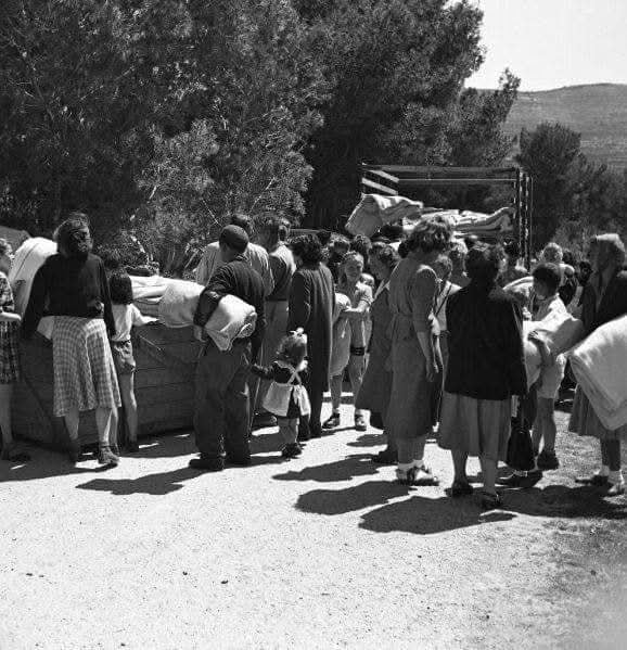
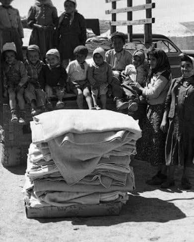
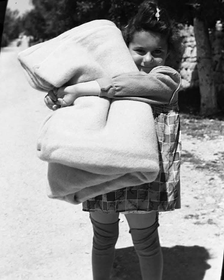
- Campgain Against Lice
- A Survey of Palestine, the official source about Palestine before Nakba produced by the British Mandate; over 1200 pages.
- Satellite View & Google Earth: Over 6,000 placemarks identifying all destroyed towns, W. Bank & Gaza Strip Towns, & refugee camps.
- PalestineRemembered.com and its Nakba Oral History Project were featured on al-Jazeera Satellite TV.
- Nakba Oral History Video Podcast:
 Over 700 Oral History interviews (including 3,500+ hours of recording) can be viewed online.
 - Palestine Village Statistics Project
- Gaza Jail Break
- النسخة العربية للموقع الان متوفرة
- Videos: Documenting the destroyed villages in video: Tracing all that remains since Nakba.
- Videos: Responding to Zionist Propaganda
- Interview: The ethnic cleansing of Palestine: George Galloway interviews Israeli Historian Ilan Pappe.
- For Palestinians, memory matters. It provides a blueprint for their future By George Bisharat.
- Zionist FAQ now available in Hebrew שאלות שציונים שואלים, עכשיו בעברית
- Video: The Stephen Walt and John Mearsheimer report on the influence of the Israel Lobby on U.S. Foreign Policy
- The Palestinian-Israeli conflict for beginners
