| PalestineRemembered | About Us | Oral History | العربية | |
| Pictures | Zionist FAQs | Haavara | Maps | |
| Search |
| Camps |
| Districts |
| Acre |
| Baysan |
| Beersheba |
| Bethlehem |
| Gaza |
| Haifa |
| Hebron |
| Jaffa |
| Jericho |
| Jerusalem |
| Jinin |
| Nablus |
| Nazareth |
| Ramallah |
| al-Ramla |
| Safad |
| Tiberias |
| Tulkarm |
| Donate |
| Contact |
| Profile |
| Videos |
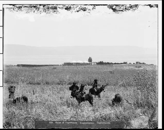
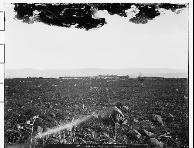
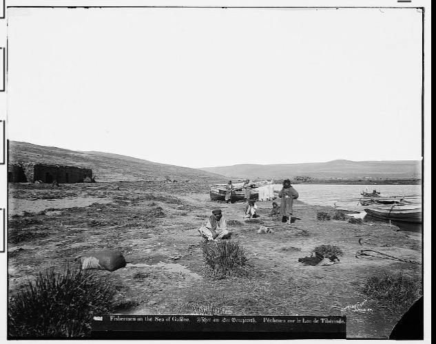
Welcome To al-Samakiyya - السمكية (ערב א-סמכיה)
|
District of Tiberias
Ethnically cleansed days ago |
العربية Google Earth |
 |
Gallery (49) |
- Statistics & Facts
-
Before & After

- Satellite View
- Articles 14
- Pictures 49
- Mayrters & Prisoners 1
- Land Deeds 1
- Members 11
- All That Remains
- Wikipedia
- Videos 1
- Guest Book 3
- Links
| Statistic & Fact | Value | ||||||||||||||
| Occupation Date | May 4, 1948 | ||||||||||||||
| Distance From District | 11 (km) Northeast of Tiberias | ||||||||||||||
| Elevation | about -200 (meters) | ||||||||||||||
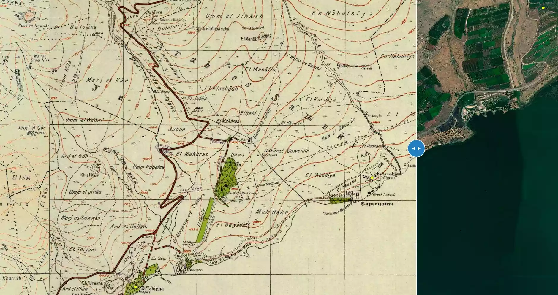
| Before & After Nakba, Click Map For Details |
|||||||||||||||
|
|||||||||||||||
| Map Location | See location #3 on the map View from satellite |
||||||||||||||
| Military Operation | Operation Matat (Broom). A sub-operation within Operation Yiftach | ||||||||||||||
| Exodus Cause | Expulsion by Zionist troops | ||||||||||||||
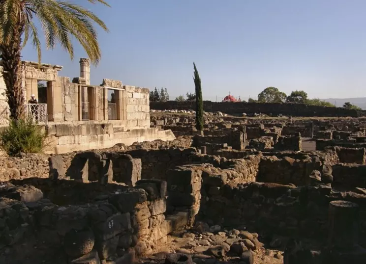
| Village Temains | al-Samakiyyan was completely obliterated and defaced. | ||||||||||||||
| Ethnically Cleansing | al-Samakiyya inhabitants were completely ethnically cleansed. | ||||||||||||||
| Pre-Nakba Land Ownership |
**Town Lands' Demarcation Maps |
||||||||||||||
| Land Usage As of 1945 |
|
||||||||||||||
| Population |
|
||||||||||||||
| Number of Houses | In (1931): 60 (includes Talhum) | ||||||||||||||
| Near By Towns |
|||||||||||||||
|
|||||||||||||||
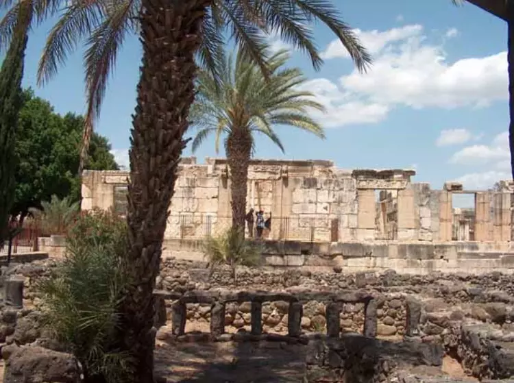
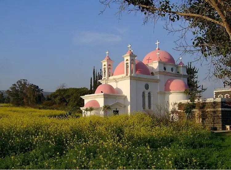
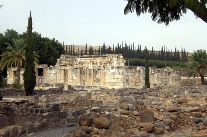
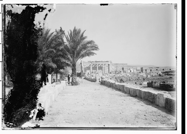
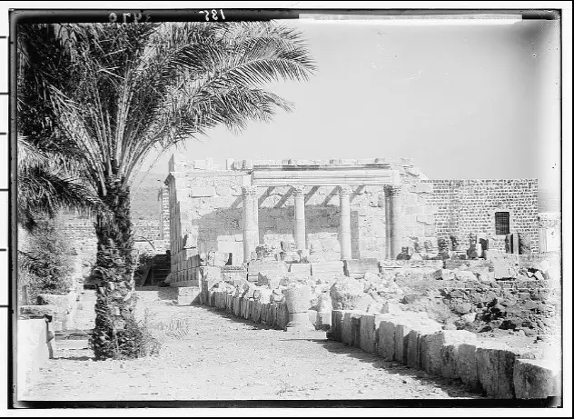
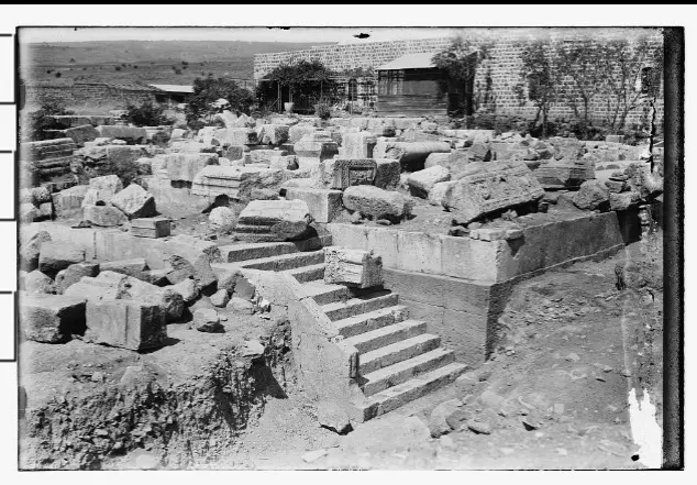
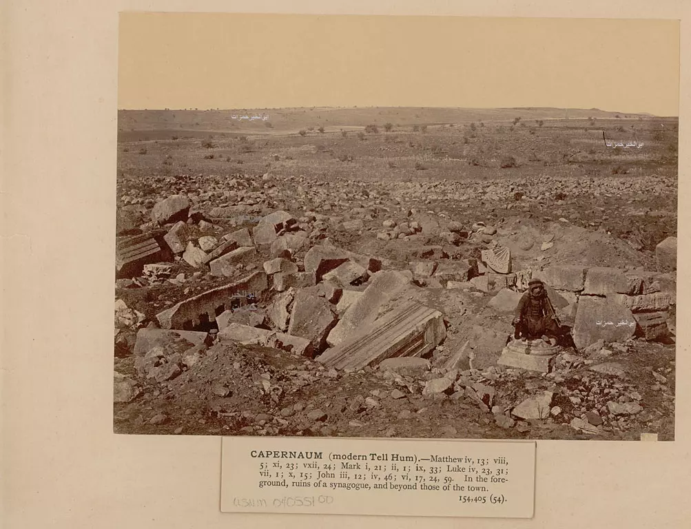
| Places of Warship | al-Samakiyya had an Italian monastery, a Franciscan church, and a Greek Orthodox church . It's very possible that all of these churches or monasteries remains standing! | ||||||||||||||
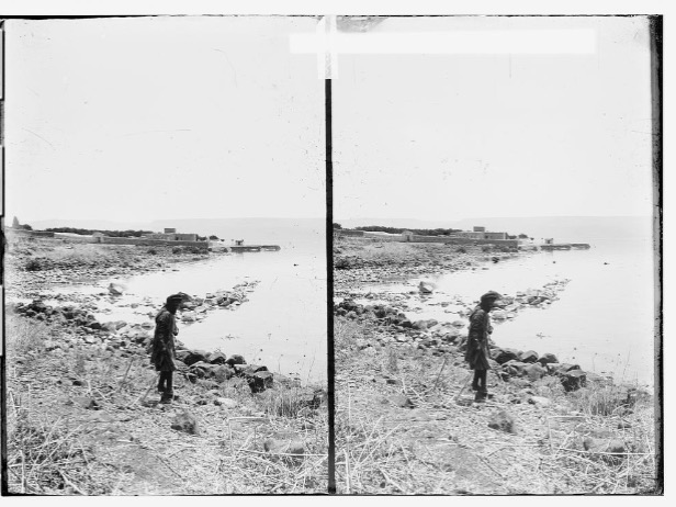
| Nearby Wadies & Rivers | Wadi al-Wadabani borders village lands | ||||||||||||||
| Exculsive Jewish Colonies Who Usurped Village Lands |
Amnon and Korazin | ||||||||||||||
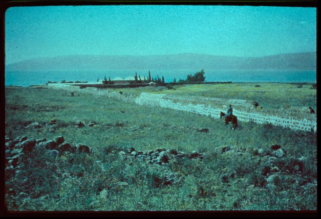
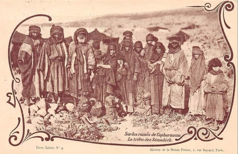
Village TodayAccording to the Palestinian historian Walid Khalidi, the village remaining structures on the village land are:The village site is covered with wild vegetation, piles of basalt stones, and date palm trees. Part of the surrounding land is used as pasture, and the other part is planted with fruit and walnut trees |
|||||||||||||||
| Related Maps | Town Lands' Demarcation Maps خرائط للقضاء توضح حدود القرى والاودية Town's map on MapQuest View from satellite Help us map this town at WikiMapia |
||||||||||||||
| Related Links | Wikipedia's Page Google Search Google For Images Google For Videos |
||||||||||||||
| More Information | في كتاب كي لا ننسى في كتاب بلادنا فلسطين المزيد من موقع هوية |
||||||||||||||
- mohammadaa11@yahoo. com
- mohammadaa11@yahoo. com
- ثوار من قريتي ( تلحوم )
- كلمات ( تلحومية سمكية ) كانت متداولة
- المثل الشعبي
- (( عادات وتقاليد تلحومية // القهوة المرة ))
- كيفية حل النزاعات والخلافات
- ((( بالنّاوي )))
- شاعر تلحوم
- تلحوم من رحم فلسطين
- ثلاثة بابوات ورئيس امريكي في تلحوم
- نبذة تاريخية عن قرية السمكية (قضاء طبريا) من كتاب (كي لا ننسى)
- وطني الجريح
- أشلاءُ وطن
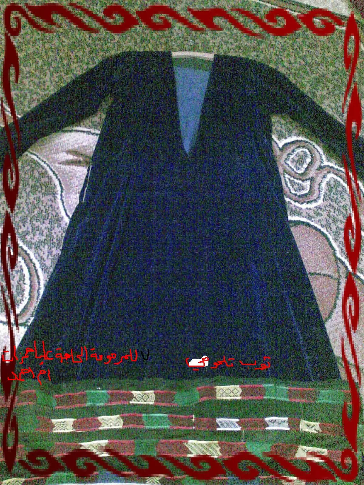
- ثوب تلحومي
Posted by محمد خير حمزات - تلحوم عند الضحى
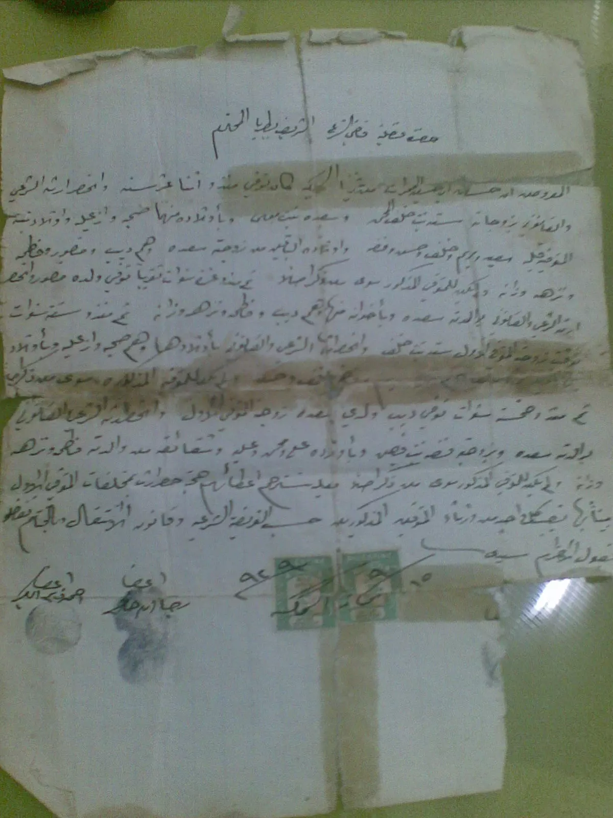
Posted by محمد خير حمزات - وثيقة حصر ارث
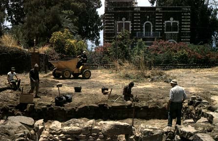
Posted by محمد خير حمزات 1 - الاثار في (((تلحوم ))) تسرق
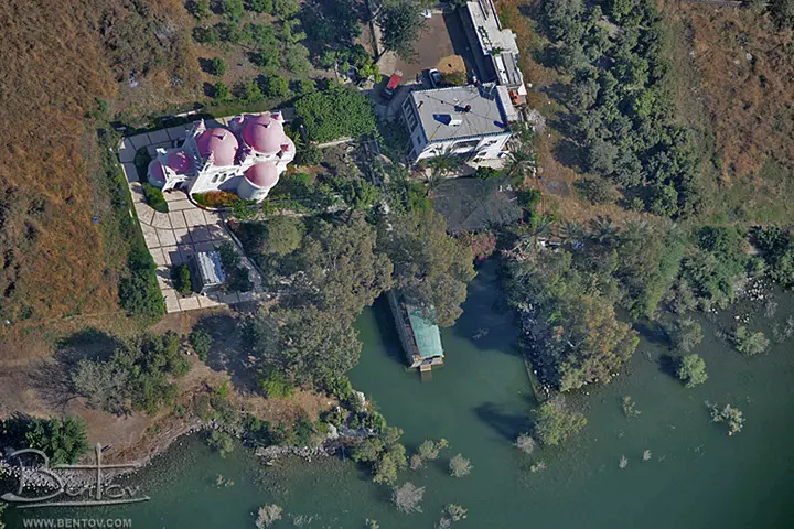
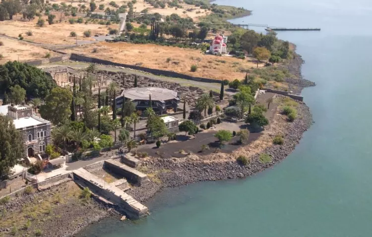
Posted by محمد خير حمزات - منظر جوي للمواقع الموجودة الان في تلحوم
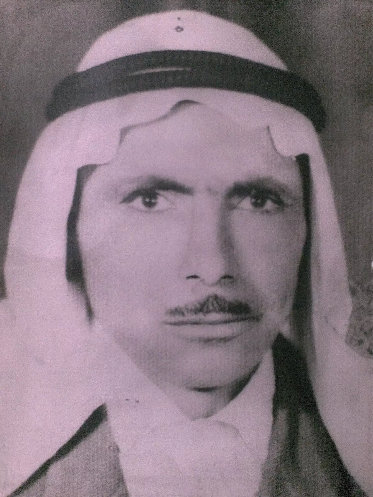
Posted by محمد خير حمزات 1 - المجاهد المرحوم علي ديب حمزات من ثوار/ 1936/
Posted by محمد خير حمزات 1 - الشهيد محمد ابراهيم شتيوي
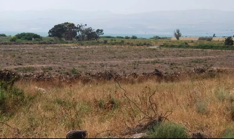
Posted by محمد خير حمزات - موقع القريه واراضيها
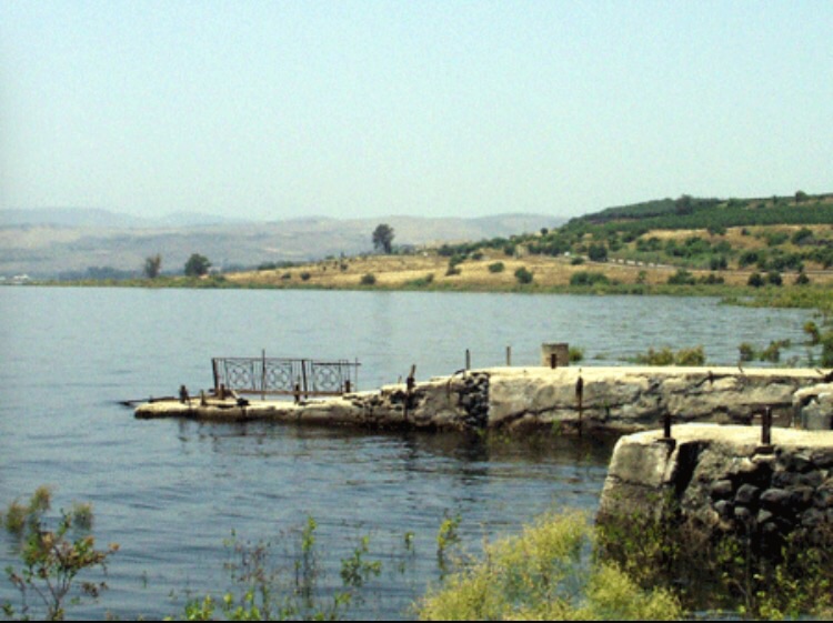
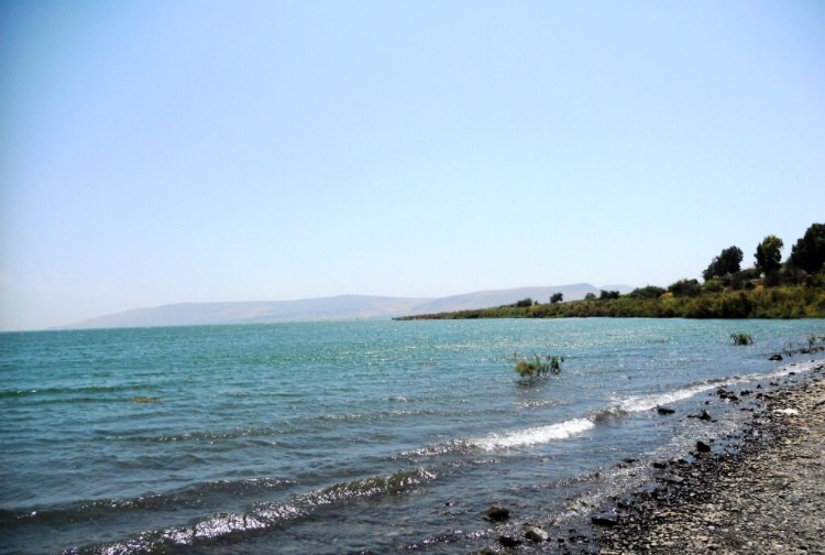
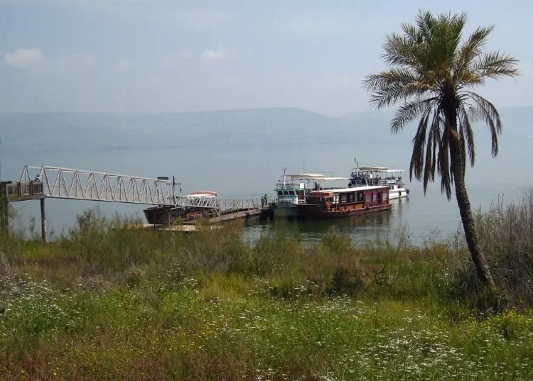
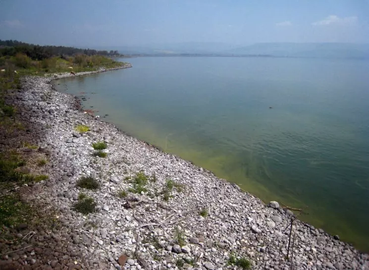
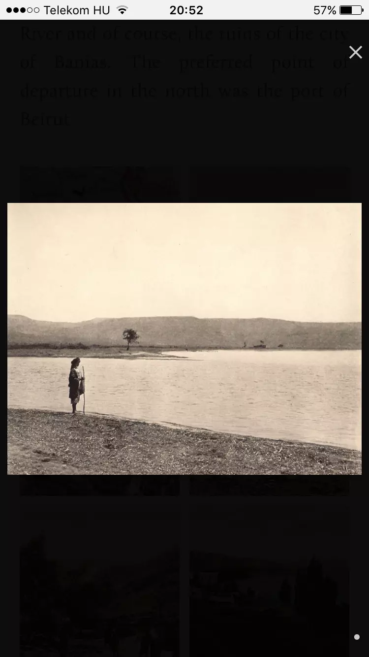
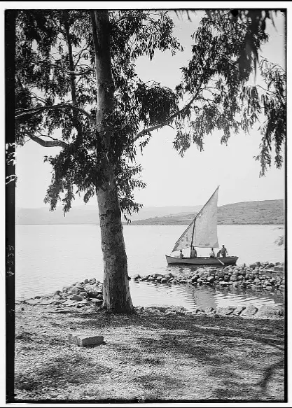
Posted by abu raya - من شاطى القريه
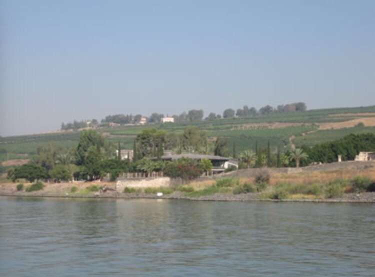
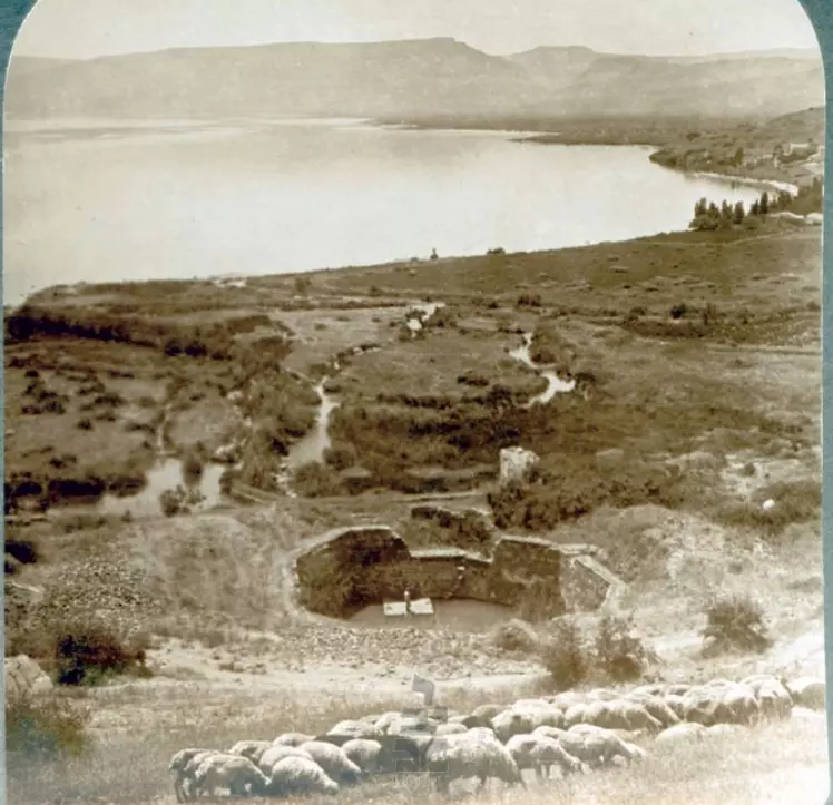
Posted by abu raya - منظر لموقع القريه وراضيها من بحيره طبريا
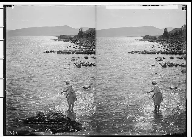
Posted by abu raya 1 - شاطى بحيره طبريا من جانب القريه
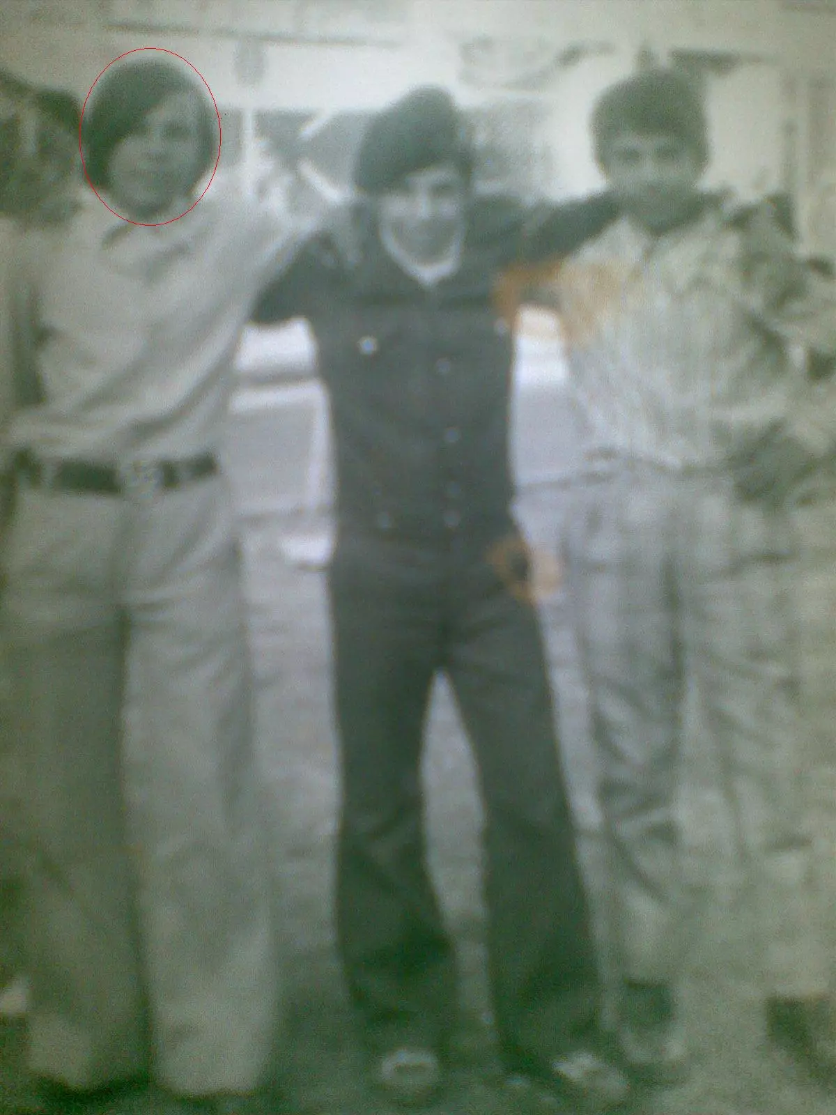
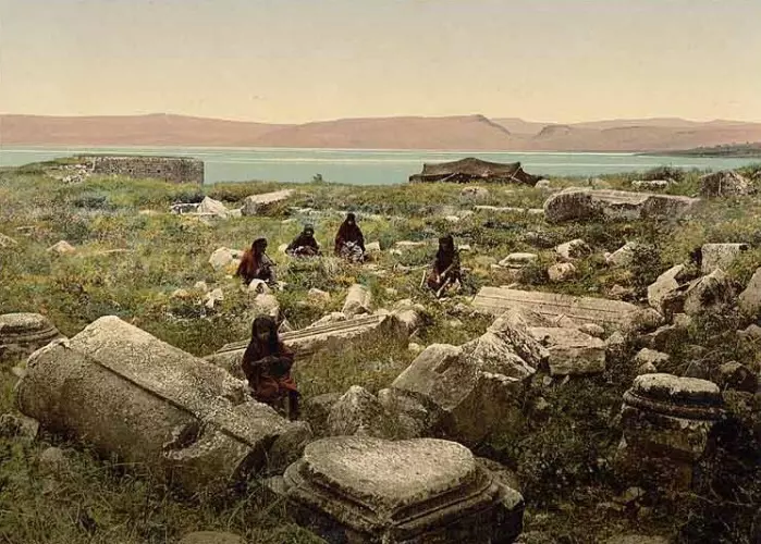
Posted by abu raya - صوره قديمه من القريه
Posted by abu raya 1 - اراضي القريه من شمالها
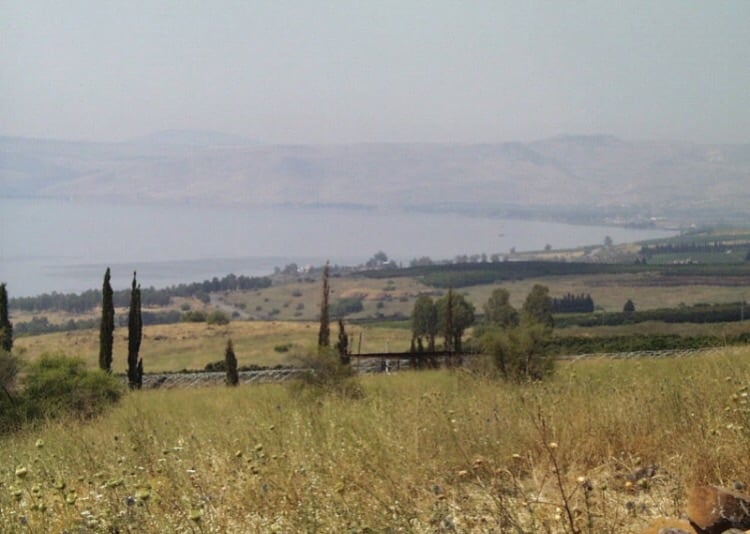
Posted by abu raya 1 - منظر لتلحوم وبحيره طبريا
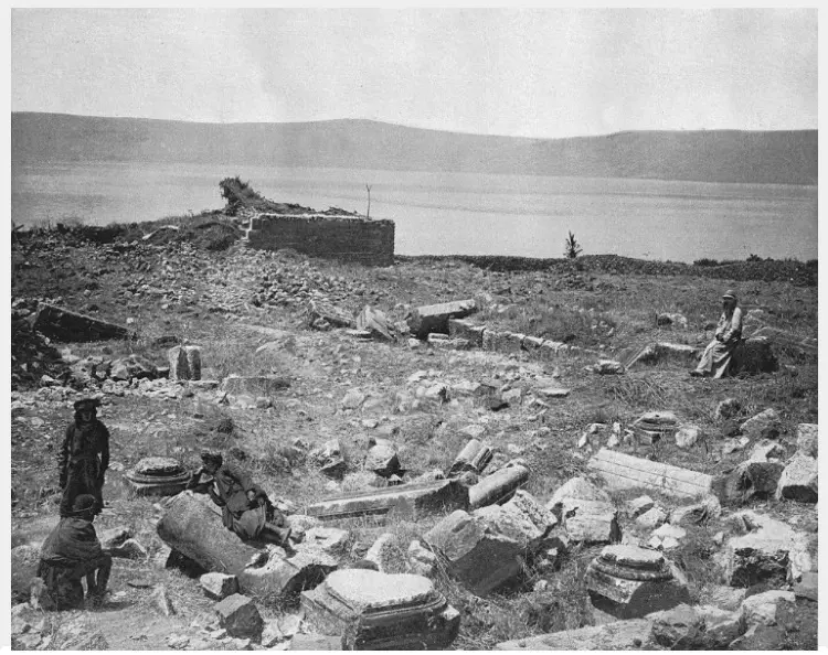
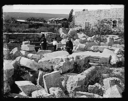
Posted by abu raya - من اثار تلحوم
Posted by abu raya 1 - صوره قديمه من القريه
Posted by abu raya 1 - الكنيسه في السماكيه
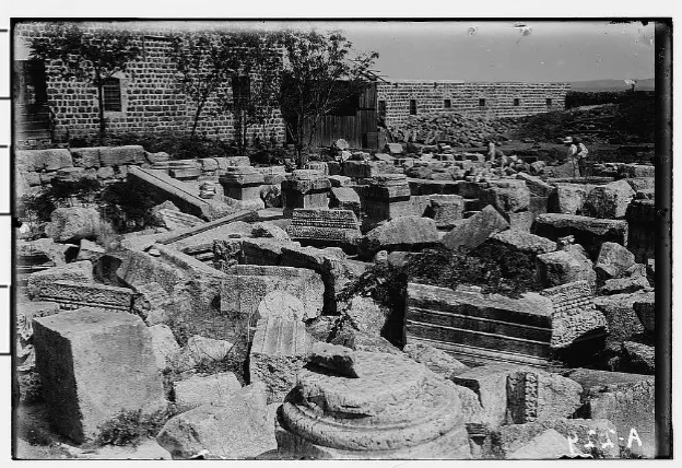
Posted by abu raya 1 - اثار السماكيه
Posted by abu raya 1 - اثار السماكيه القديمه
Posted by abu raya 1 - بالقرب من موقع القريه وبحيره طبريا
Posted by abu raya - اثار السماكيه

Posted by abu raya - السماكيه
Posted by abu raya - االاثار القديمه في القريه
Posted by abu raya - صوره نادره من قريه السماكيه
Posted by abu raya 1 - صوره نادره لقريه السمكيه
Posted by abu raya - قريه السماكيه قبل النكبه
Posted by abu raya 1 - السماكيه قبل النكبه

Posted by abu raya 1 - السماكيه قبل النكبه
Posted by abu raya - قريه السماكيه قبل النكبه
Posted by abu raya - صوره قديمه من قريه السمكيه قبل النكبه
Posted by abu raya 1 - من قريه السمكيه قبل النكبه
Posted by abu raya - السمكيه قبل النكبه
Posted by abu raya 1 - السمكيه قبل النكبه
Posted by abu raya 1 - السمكيه قبل النكبه
Posted by abu raya - السمكيه قبل النكبه
Posted by abu raya 1 - السمكيه قبل النكبه
Posted by abu raya - السمكيه قبل النكبه
Posted by abu raya - السمكيه قبل النكبه
Posted by abu raya - السمكيه قبل النكبه
Posted by abu raya - السمكيه قبل النكبه
Posted by abu raya - السمكيه قبل النكبه
Posted by abu raya - السمكيه قبل النكبه
Posted by abu raya - السمكيه قبل النكبه
Posted by abu raya - السمكيه قبل النكبه
Posted by abu raya - السمكيه قبل النكبه

Posted by abu raya - السمكيه قبل النكبه
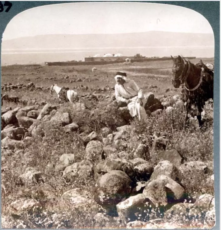
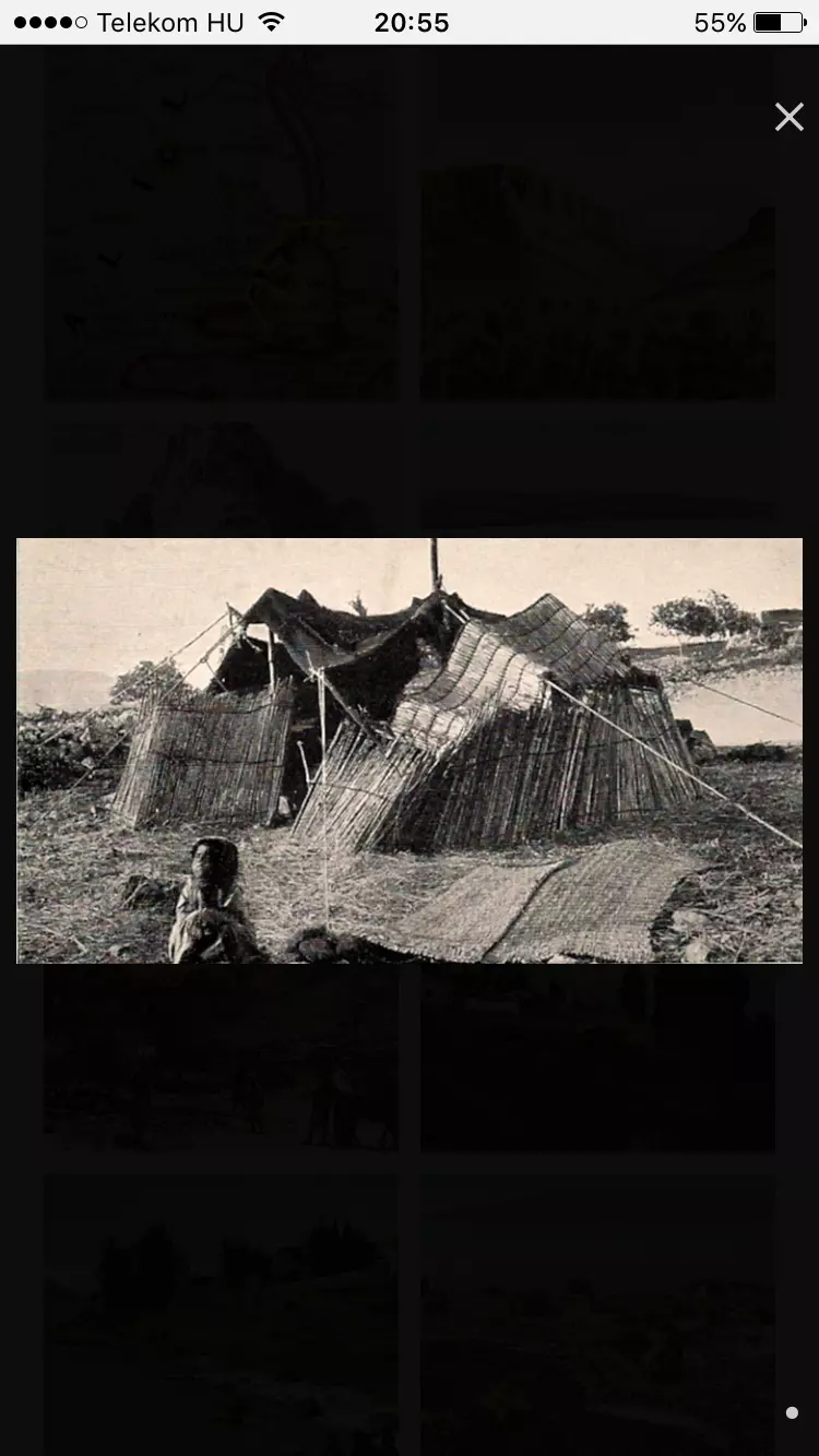
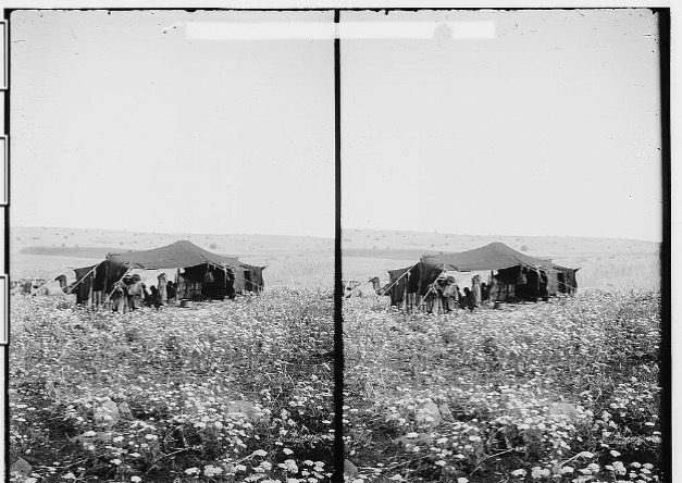
Posted by abu raya - تلحوم / السمكية قبل عام 1900
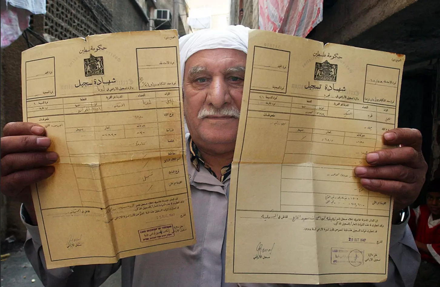
Posted by أبو الخير حمزات - Abu Ahmad al-Sukari, 70, a Palestinian refugee who lives in the al-Yarmouk camp on the outskirts of Damascus, Syria, holds up property deeds for lands in Israel
- صورة لاهالي قرية السمكيه من عام 1902
Want to browse more? 80,000 pictures were grouped in these gallaries:
| Display Name | Clan/Hamolah | Country of Residence |
| محمود محمد حسين حسين | الطويلين | فنش بوري, فنش بوري |
| فراس عيلان | السمكية | - |
| رضوان قاسم | البكر | مخيم اليرموك |
| mohammedzqu | قباجة | الخليل |
| ابو عاصم | السمكية | دمشق |
| علاء الدين حمزات | السمكية | يرموك |
| ابو طه | السمكية | سوريا, مخيم اليرموك |
| ضياء السمكي | بدوي سمكي | سوريا, مخيم اليرموك |
| محمد خير حمزات | السمكية | - |
| Issam Issa al-ali | - | Labenon, Labenon |
| محمد السمكي | السمكي | الاردن |
- الذاكرة مفتاح العودة -الحلقة 8 - قرية تلحوم السمكية Duration: 23 min 22 sec
No links have been shared yet, be free to the first to share the first link.
 Fake Valor: Why Did Zionist Jews Hoist Nazis Flag on Their Ships in the 1930s?
What is new?
-
Facts About Oct. 7th Gaza Raid
-
Remined Us Please:: Who Did Rape Who? Palestinians Raped Israelis? Or, was the other way around?
-
When Prof. Edward Said was invited to debate Bibi Netanyahu in the 1980s, watch what happened!
-
Abusing Blood Libel!
-
Zionist FAQ: Isn't it true that Palestinians don't want peace? Palestinians never accepted the two-state solution
- Facts about Haavara (Transfer) Agreement between Ben-Gurion & Hitler
-
Haavara FAQs: Why Did Zionist Jews Hoist Nazis' Flags on Their Ships in the 1930s?
-
Dear ChatGPT: Why did the Jewish Agency suppress news of the Holocaust during WWII?
-
Video Playlist: Jews share their DNA tests to end the conflict for good.
-
How Ronald Reagan would have framed the genocide in Gaza if he was still alive?
-
Haavara FAQs: Let us do the math: how many German Jews did The Haavara Agreement save?
-
Zionist FAQs: The Hebron Massacre of 1929, "clearly proves" that Palestinians are antisemitic, how could you deny it?
-
Zionist FAQs: Why Anti-Zionist Is Not Antisemitism?
-
Zionist FAQs: Isn't it true that the KGB create Palestinian Nationalism in the early 1960s?
- Zionist FAQs: Muslims are killing Muslims all the time; why are Israeli Jews being singled out in the media?
- Zionist FAQs: How is Israel an apartheid state when 20% of its citizens are Arabs who enjoy full rights?
-
Haavara FAQs: Analysis of Herzl's Uganda Scheme and how it could have saved millions of Jews.
-
Haavara FAQs: Why did Hayim Greenberg describe American Jewry as "morally bankrupt" in early 1943?
-
Haavara FAQs: What if the Evian Conference was a resounding success? What would have been the impact of saving European Jewry on Zionism?
- Haavara FAQs: What if the six million were saved, how that would have impacted the Zionist project?
-
Haavara FAQs: How did Zionist leaders react when Europe's Jews lingered in the DP camps after WWII ended?
-
Why does the American Jewish community repeat lies that David Ben-Gurion had debunked before he died?
-
Who has the power to rename the Tatar/Khazar Gene Marker to Jewish IV?
-
Zionist FAQs: Why won't Egypt, Syria, and Jordan take their people back? Jews are indigenous to Palestine, and Arabs immigrated after Jews developed the country. Arabs should leave.
-
Haavara FAQs: Did Hitler and the Nazis conflate between Judaism and Zionist? If that wasn't case, then why?
-
Haavara FAQs: Winston Churchill and antisemitism, a collection of articles written Churchill.
-
Haavara FAQs: Broken by country, how many Jews survived vs. killed during the Holocaust?
-
Haavara FAQs: Why did European Jews vote with their feet and to immigrated to the Americas, not Palestine, after WWII?
-
Watch this American Jewish Girl describing Israeli Jews' cognitive dissonance like no other in under two minutes
-
Haavara FAQs: When the Nazis went out of their way to hide the Holocaust, Israeli Jews did the exact opposite by broadcasting their genocide of Gazans. But why?
-
Haavara FAQs: How Zionist Jews went out of their to show their appreciation to Nazism and Fascism?
- Haavara FAQs: Why Zionist leaders were against bombing the death camps & the Railroads leading to them?
-
Haavara FAQs: Hitler's message to the British and American people: If Jews are such noble citizens and you care about them, how come you're not letting them in? I will gladly ship them to you at my expense, even on luxury liners!
-
A shortlist of Zionist and Israeli false flag operations in the name Jews.
-
The Most Moral Army
- The Land of Kapos (Israel): Where the brave are boycotted and Kapos walk free.
- Why did early Zionists often named their communal enterprises "colonial"?
- Zionist Relations with Nazi Germany by Faris Glubb
-
Two NY Times advertisements by Zionists in the early 1943 that exposes Zionists' treason at the height of the calamity
- Facts Not Lies about the Palestinian-Israeli Conflict.
- Site's pictures have been categorized
- Campgain Against Lice
- A Survey of Palestine, the official source about Palestine before Nakba produced by the British Mandate; over 1200 pages.
- Satellite View & Google Earth: Over 6,000 placemarks identifying all destroyed towns, W. Bank & Gaza Strip Towns, & refugee camps.
- PalestineRemembered.com and its Nakba Oral History Project were featured on al-Jazeera Satellite TV.
- Nakba Oral History Video Podcast:
 Over 700 Oral History interviews (including 3,500+ hours of recording) can be viewed online.
 - Palestine Village Statistics Project
- Gaza Jail Break
- النسخة العربية للموقع الان متوفرة
- Videos: Documenting the destroyed villages in video: Tracing all that remains since Nakba.
- Videos: Responding to Zionist Propaganda
- Interview: The ethnic cleansing of Palestine: George Galloway interviews Israeli Historian Ilan Pappe.
- For Palestinians, memory matters. It provides a blueprint for their future By George Bisharat.
- Zionist FAQ now available in Hebrew שאלות שציונים שואלים, עכשיו בעברית
- Video: The Stephen Walt and John Mearsheimer report on the influence of the Israel Lobby on U.S. Foreign Policy
- The Palestinian-Israeli conflict for beginners
