| PalestineRemembered | About Us | Oral History | العربية | |
| Pictures | Zionist FAQs | Haavara | Maps | |
| Search |
| Camps |
| Districts |
| Acre |
| Baysan |
| Beersheba |
| Bethlehem |
| Gaza |
| Haifa |
| Hebron |
| Jaffa |
| Jericho |
| Jerusalem |
| Jinin |
| Nablus |
| Nazareth |
| Ramallah |
| al-Ramla |
| Safad |
| Tiberias |
| Tulkarm |
| Donate |
| Contact |
| Profile |
| Videos |
Welcome To Khulda - خلدة (ח'ולדה)
|
District of al-Ramla
Ethnically cleansed days ago |
العربية Google Earth |
 |
Gallery (45) |
- Statistics & Facts
-
Before & After

- Satellite View
- Articles 5
- Pictures 45
- Members 8
- All That Remains
- Wikipedia
- Videos 1
- Guest Book 4
- Links
| Statistic & Fact | Value | ||||||||||||||
| Occupation Date | April 6, 1948 | ||||||||||||||
| Distance From District | 12 (km) South of al-Ramla | ||||||||||||||
| Elevation | 150 (meters) | ||||||||||||||
| Before & After Nakba, Click Map For Details |
|||||||||||||||
|
|||||||||||||||
| Map Location | See location #46 on the map View from satellite |
||||||||||||||
| Military Operation | Operation Nachshon | ||||||||||||||
| Exodus Cause | Military assault by Zionist troops | ||||||||||||||
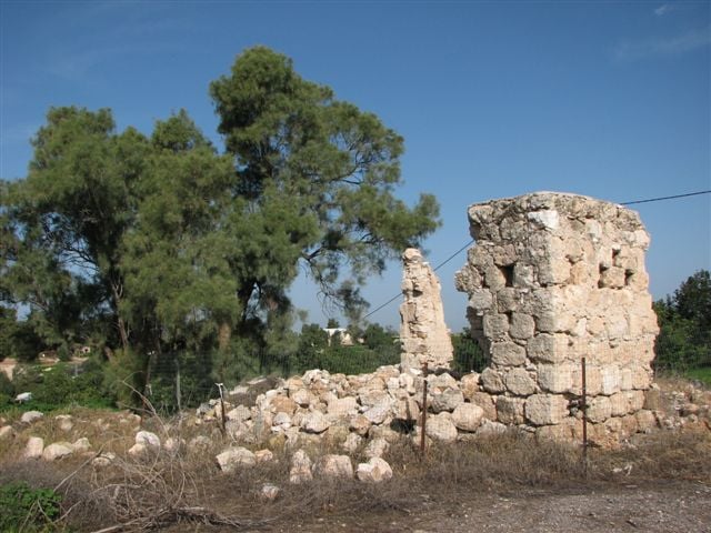
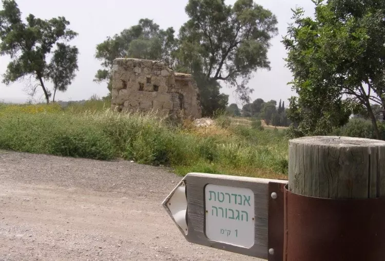
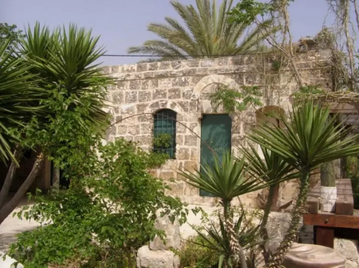
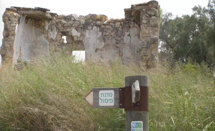
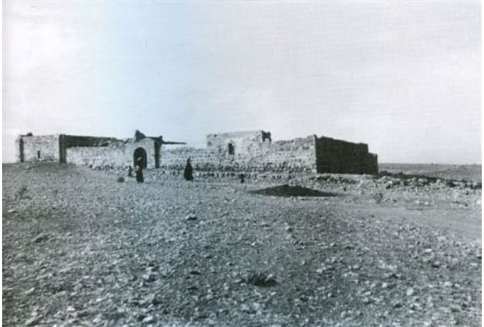
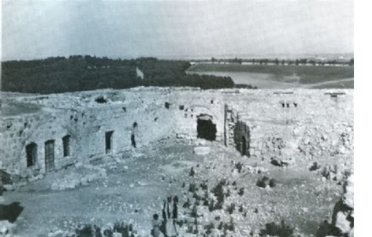
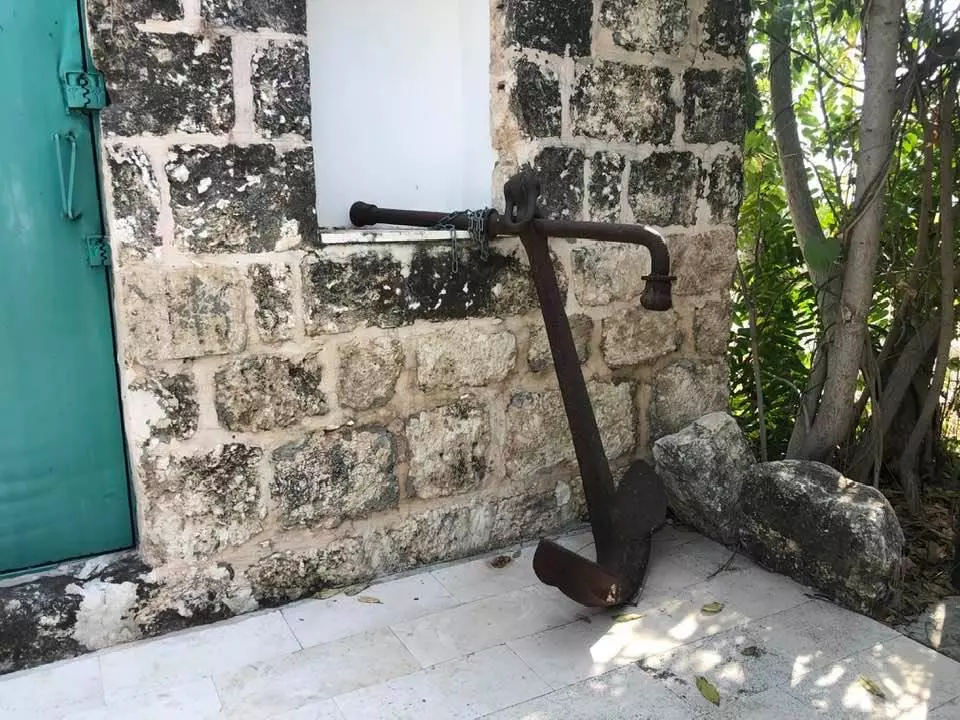
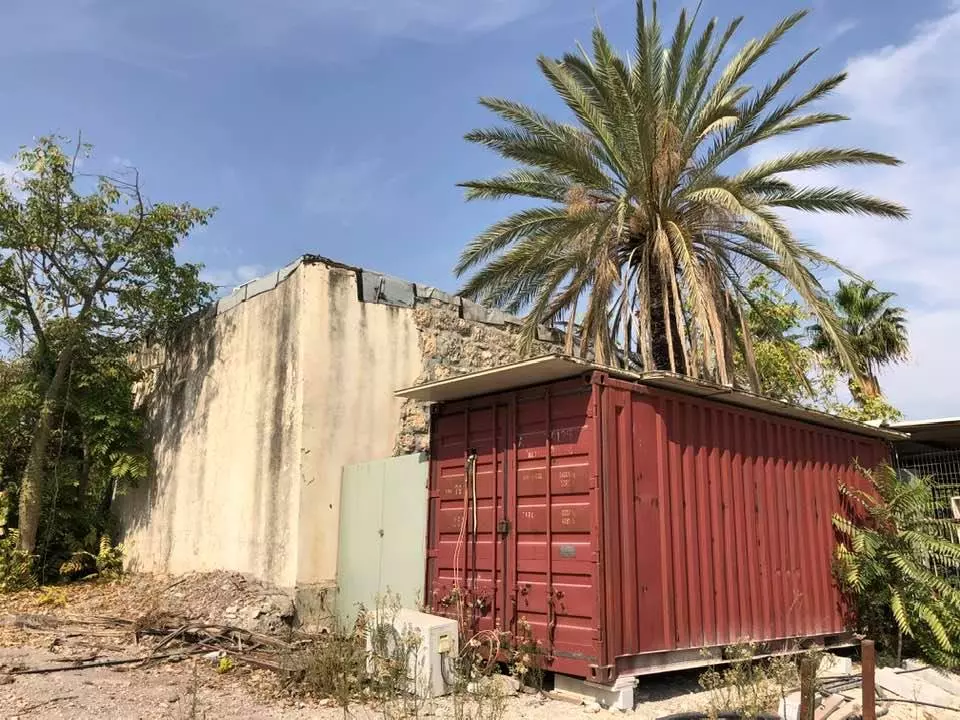
| Village Temains | On April 20th, 1948, Khulda was mostly bulldozed with the exception of two houses remain standing. | ||||||||||||||
| Ethnically Cleansing | Early April 1948, Khulda inhabitants were completely ethnically cleansed. | ||||||||||||||
| Pre-Nakba Land Ownership |
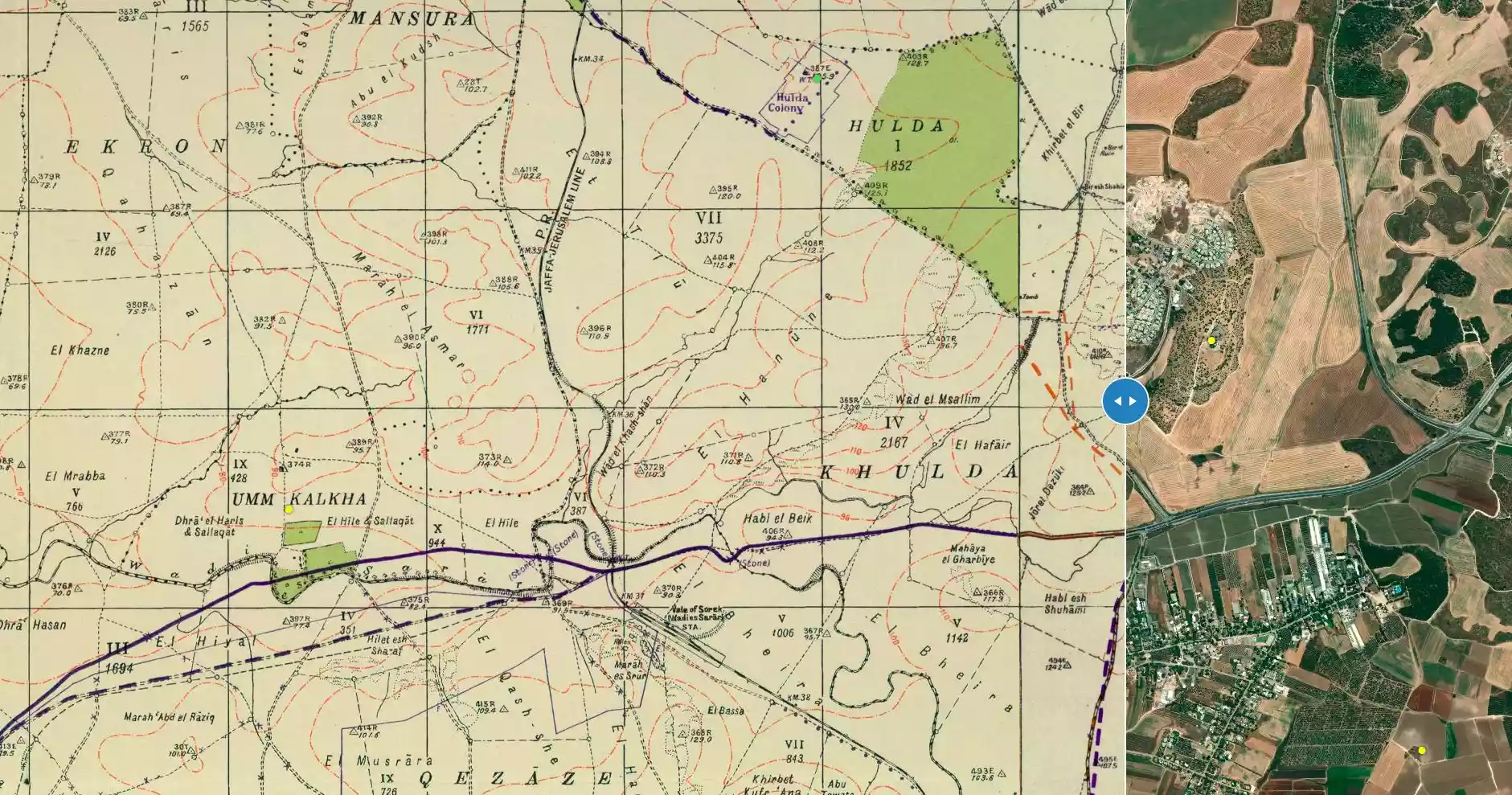
**Town Lands' Demarcation Maps |
||||||||||||||
| Land Usage As of 1945 |
|
||||||||||||||
| Population |
|
||||||||||||||
| Number of Houses |
|
||||||||||||||
| Near By Towns |
|||||||||||||||
|
|
|||||||||||||||
| Town's Name Through History | The Crusades referred to Khulda by Huldre. | ||||||||||||||
| Places of Warship | One mosque | ||||||||||||||
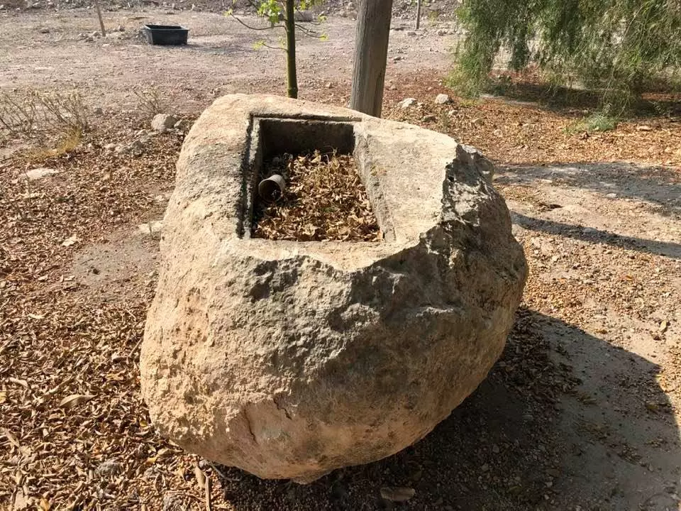
| Water Supply | Villagers drew water for domestic use from two wells located northeast of the village center. | ||||||||||||||
| Exculsive Jewish Colonies Who Usurped Village Lands |
Kibbutz Mishmar David and Tal shachar. | ||||||||||||||
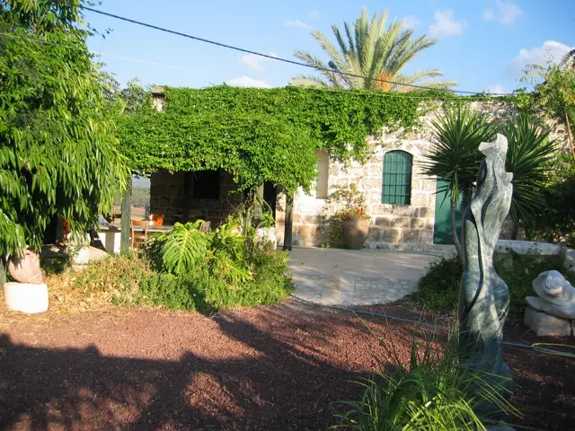
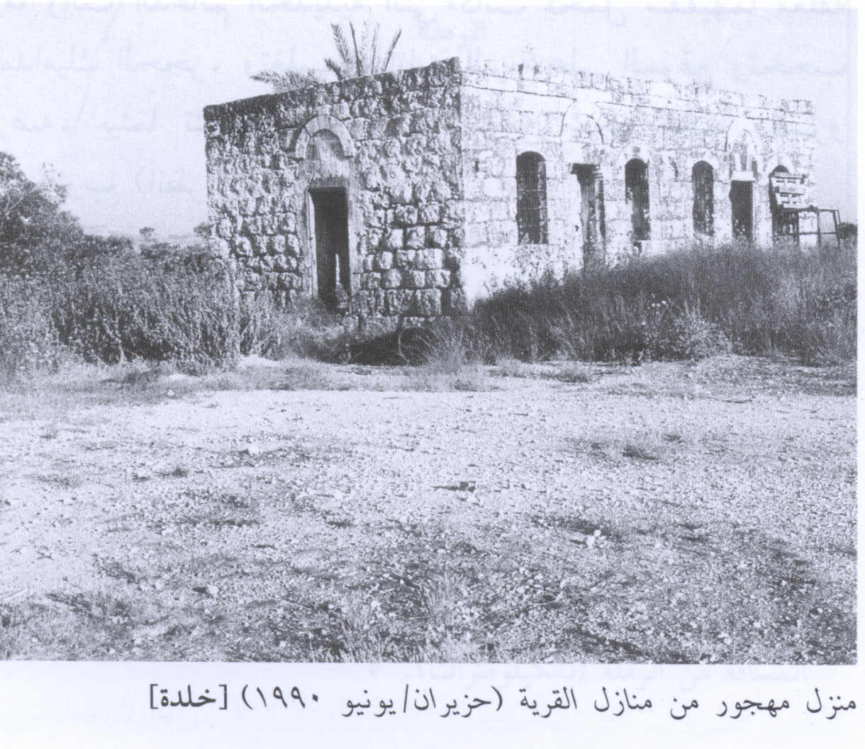
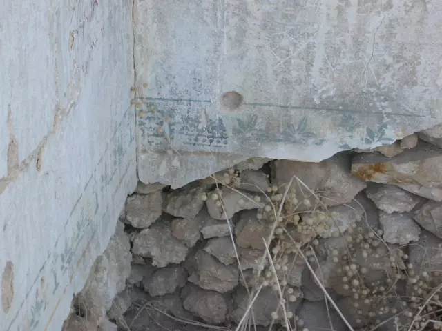
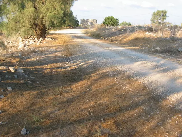
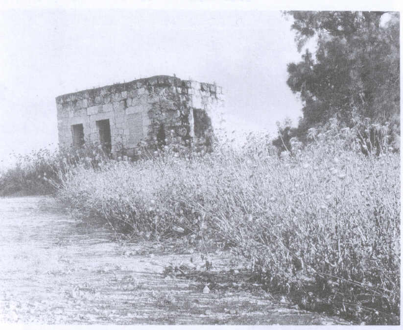
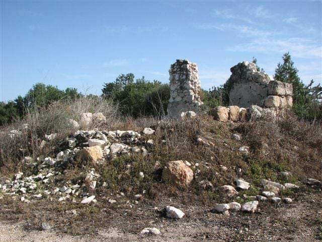
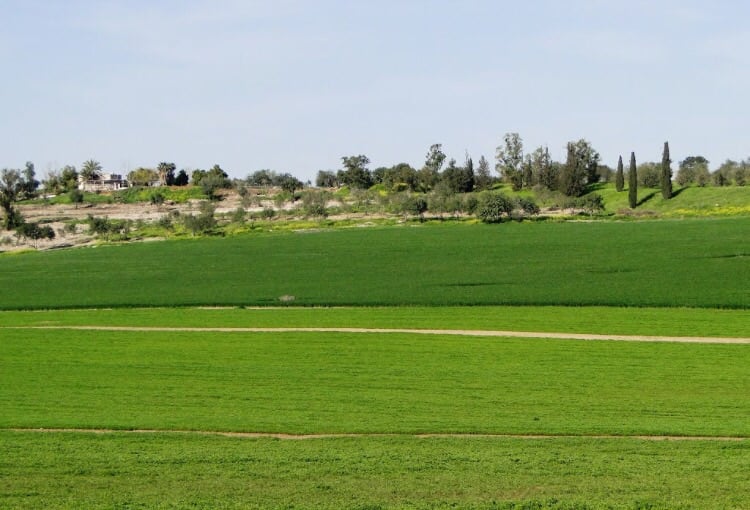
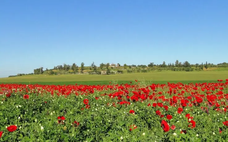
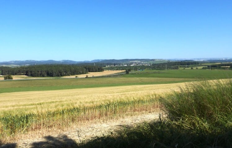
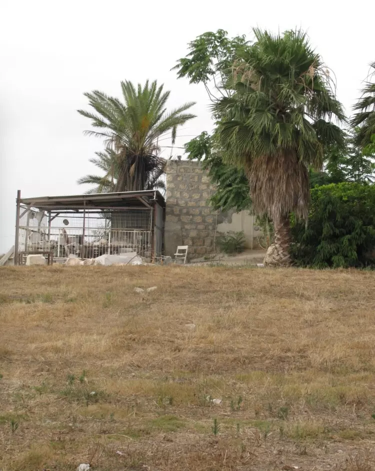
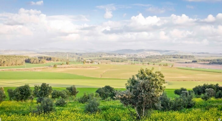
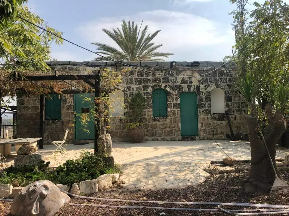
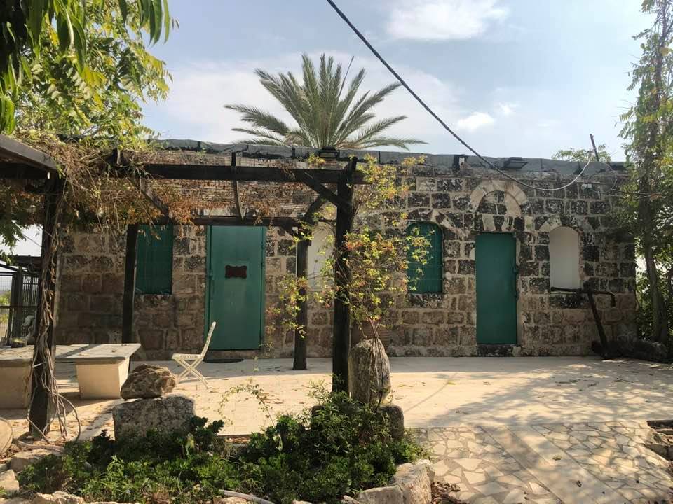
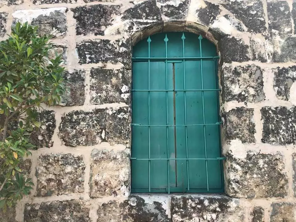
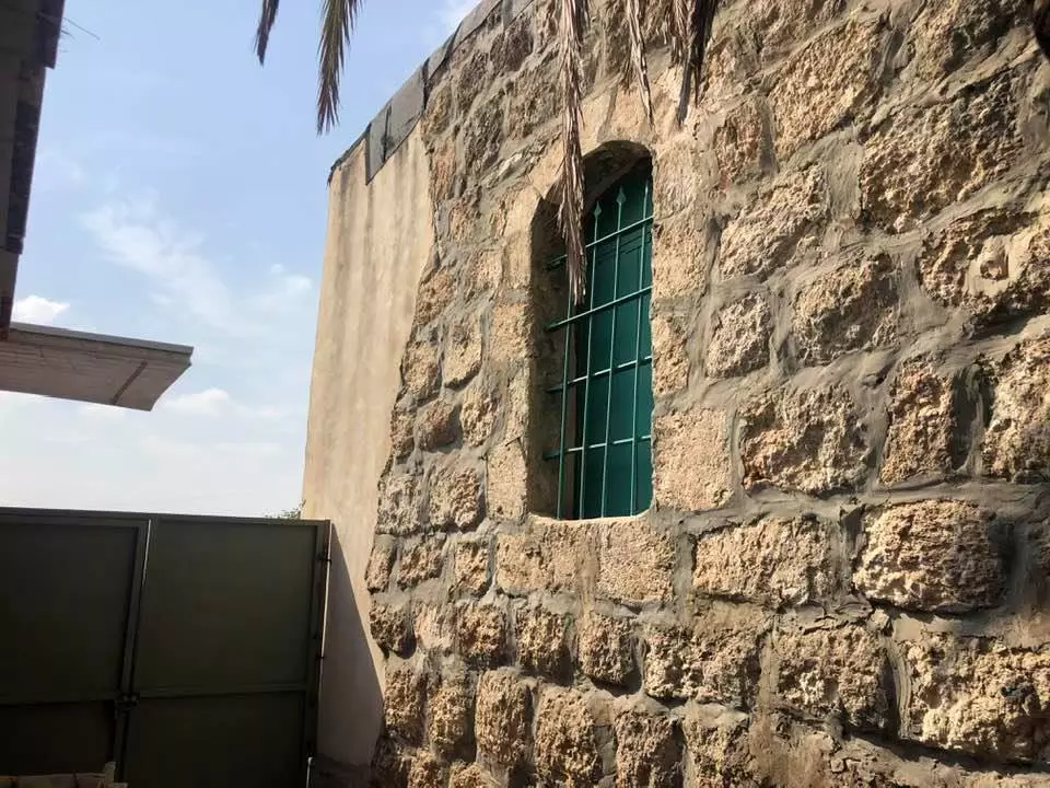
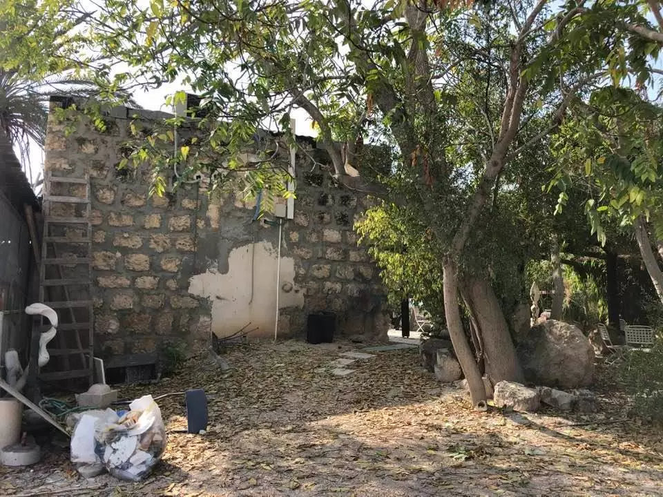
Village Before NakbaThe village was situated on a flat hilltop and overlooked wide areas on all four sides. Khulda lay close to a highway that connected Gaza with the Ramla-Jerusalem highway, and was linked by a network of secondary roads to Ramla and a number of major highways. It is identified with a locality that the Crusaders called Huldre. In 1596, Khulda was a village in the nahiya of Ramla (liwa' of Gaza) with a population of sixty-six. It paid taxes on a number of crops, including wheat and barley, as well as on other types of produce, such as goats and beehives. Robinson passed by the village in 1838; he described it as 'large.' In the late nineteenth century, Khulda was described as a large village built of stone and mud and situated on the side of a hill. The village had a masonry well to the west. All of the people of Khulda were Muslims and maintained their own mosque. They drew water for domestic use from two wells, northeast of the village. They worked primarily in animal husbandry and rainfed agriculture, growing grain and small amounts of vegetables. In 1944/45 a total of 8,994 dunums was allotted to cereals; 9 dunums were irrigated or used for orchards.Village Occupation and Ethnic CleaningOn 3 April 1948, at the start of Operation Nachshon (see Bayt Naqquba, Jerusalem sub-district), a Haganah battalion occupied Khulda along with neighboring Dayr Muhaysin. Khulda was systematically levelled with bulldozers on 20 April, two weeks after its capture. The History of the Haganah says only that the village was taken 'without fighting.' Battles continued to rage around the village in later weeks, however, especially in the last week of May when an engagement around al-Latrun spread to the Khulda area, becoming what the press called 'the biggest Single clash of the war to date.'Zionists Colonies on Village LandsKibbutz Mishmar David (140136) was established in 1948 about 0.5 km west of the site, on village lands. Tal Shachar (140134) is nearby, 2 km south of the site; it is not on village lands.Village TodayOnly two houses are left. Between them the walls of two destroyed houses still stand; the iron braces that formerly supported the roofs are still attached to the brickwork. Otherwise, the site is covered with wild vegetation. Eucalyptus forests and carob and cypress trees grow around the site (see photos).SourceDr. Walid al-Khalidi, 1992: All That Remains. |
|||||||||||||||
| Related Maps | Town Lands' Demarcation Maps خرائط للقضاء توضح حدود القرى والاودية Town's map on MapQuest View from satellite Help us map this town at WikiMapia |
||||||||||||||
| Related Links | Wikipedia's Page Google Search Google For Images Google For Videos |
||||||||||||||
| More Information | في كتاب كي لا ننسى في كتاب بلادنا فلسطين المزيد من موقع هوية |
||||||||||||||
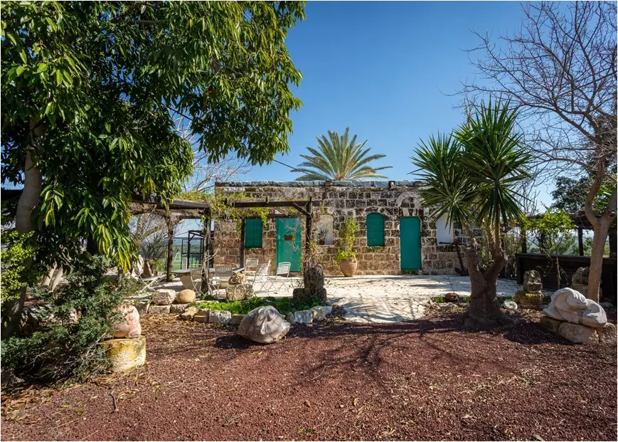
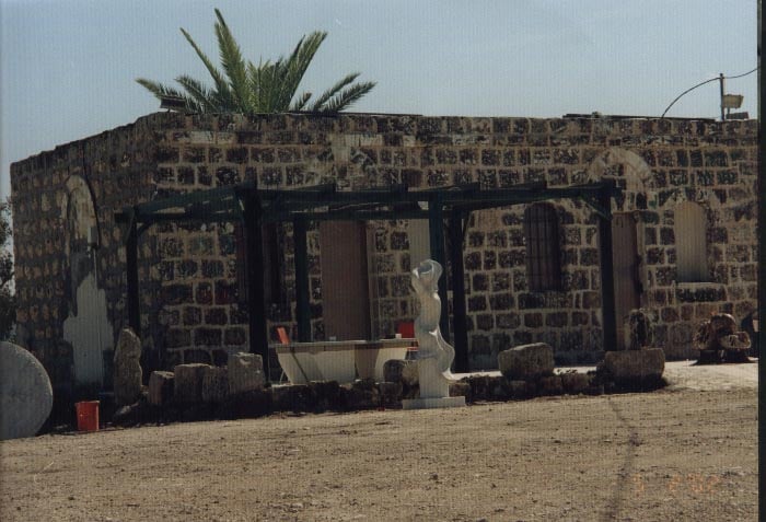
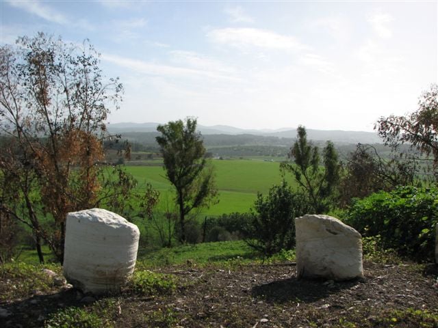
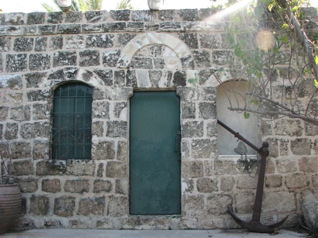
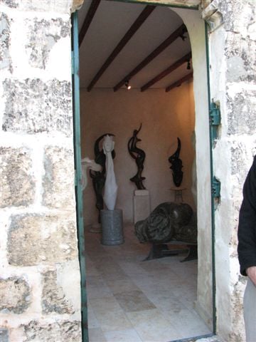
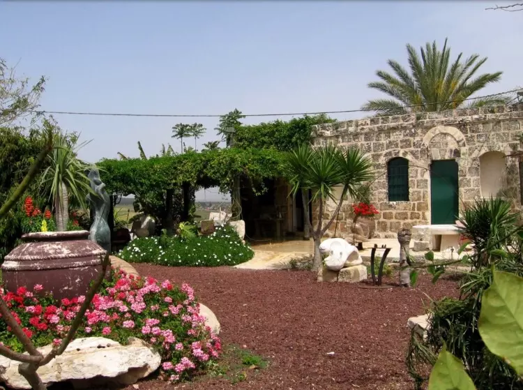
- House now occupied by Israeli sculptor. Photo: Annemarie Jacir
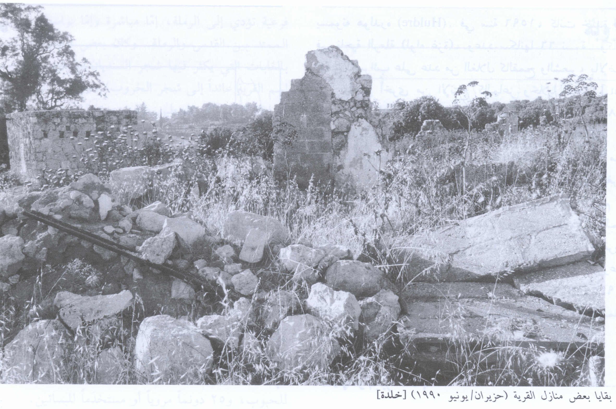
Posted by Annemarie Jacir 1 - Village House Still Standing In 1990
Scanned from "All That Remains" by Dr. Walid Khalidi 1 - Khulda's mosque which has been converted to a museum-February-2002
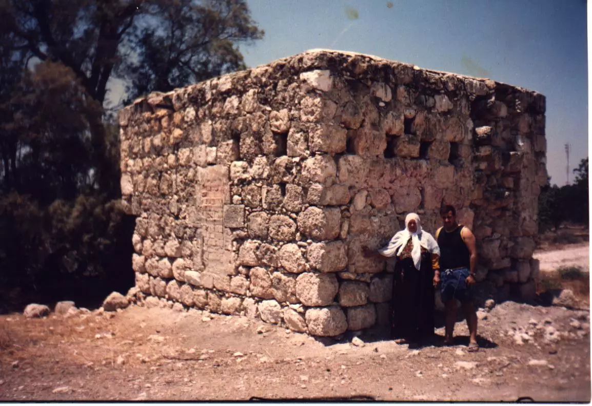
Posted by Aqsa Association-Palestine-1948 1 - Remains Of Village House In 1990
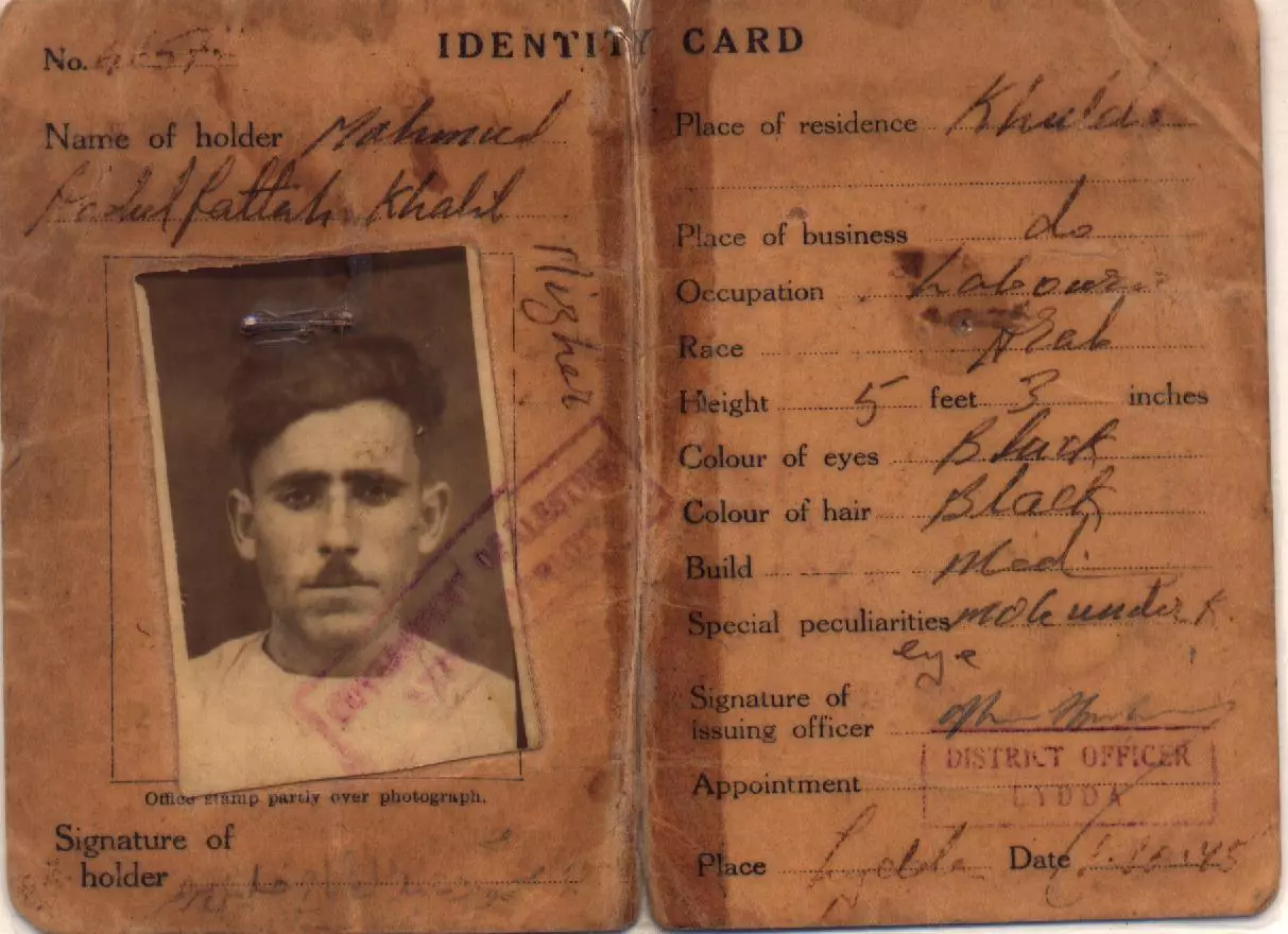
Scanned from "All That Remains" by Dr. Walid Khalidi 1 - بطاقة هوية محمود عبد الفتاح مزهر من خلدة صادرة عام 1945 من اللد
Posted by ibraheem mizher - بيت عبد الفتاح مزهر وقد شيد في عقد الثلاثينات من القرن العشرين
Posted by ibraheem mizher 1 - Remaining Paint decor on demolished house wall. Photo: Annemarie Jacir
Posted by Annemarie Jacir - Khulda. Fall 2006. Photo: Annemarie Jacir
Posted by Annemarie Jacir - One of two remaining structures
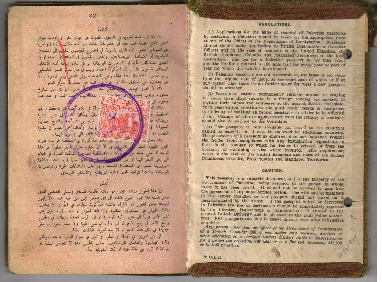
Scanned from "All That Remains" by Dr. Walid Khalidi 1 - جواز سفر خليل عبد الرسول مزهر صادر عن حكومة الانتداب البريطاني في فلسطين عام 1947 صوره رقم (1)
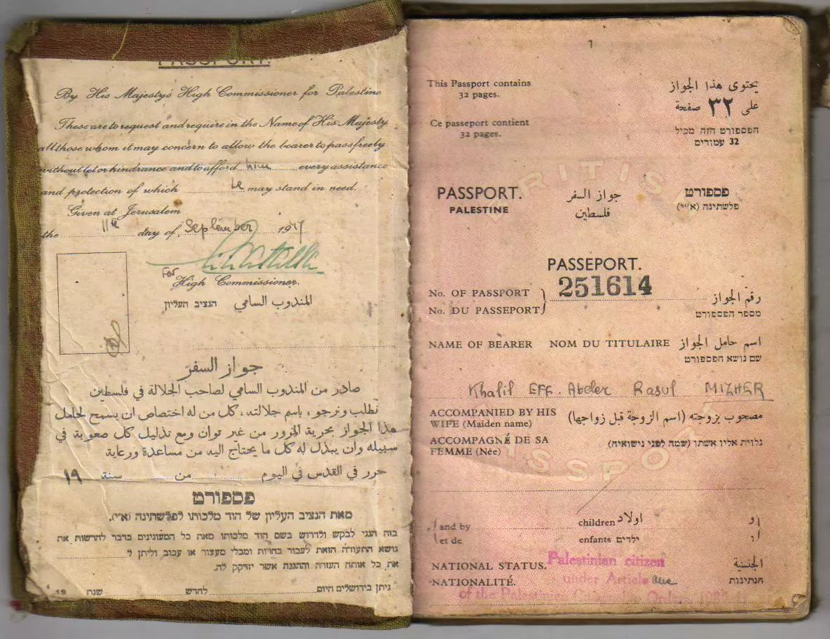
Posted by ibraheem mizher - جواز سفر خليل عبد الرسول مزهر صادر عن حكومة الانتداب البريطاني في فلسطين عام 1947 صوره رقم (2)
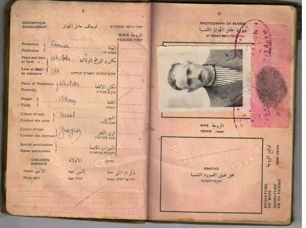
Posted by ibraheem mizher 1 - جواز سفر خليل عبد الرسول مزهر صادر عن حكومة الانتداب البريطاني في فلسطين عام 1947 صوره رقم (3)
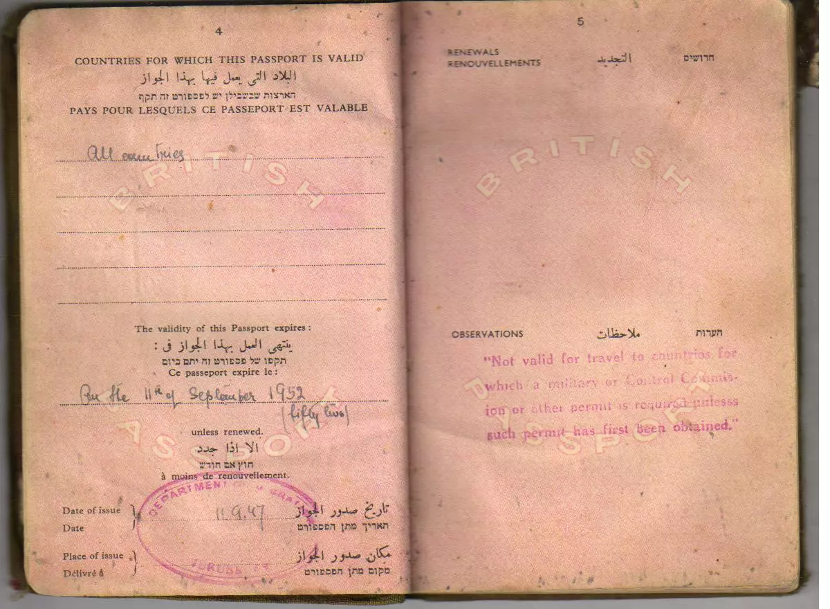
Posted by ibraheem mizher - جواز سفر خليل عبد الرسول مزهر صادر عن حكومة الانتداب البريطاني في فلسطين عام 1947 صوره رقم (4)
Posted by ibraheem mizher - chulda
Posted by said - khulda - view from the mosq 29-01-2010
Posted by said - khulda - elevation mosq 29-01-2010
Posted by said - khulda - elevation mosq 29-01-2010
Posted by said - khulda
Posted by said - khulda
Posted by said - khulda
Posted by said 1 - اراضي القريه
Posted by abu raya - جامع القريه تم تحويله الى متحف
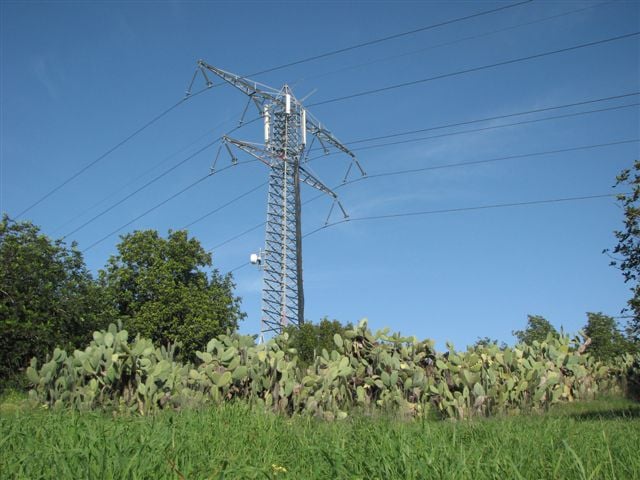
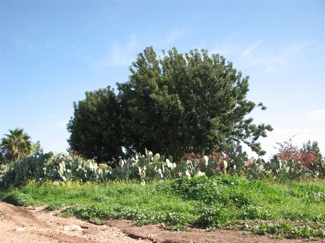
Posted by abu raya - اراضي القريه وموقعها بين الشجر
Posted by abu raya - اراضي القريه
Posted by abu raya - اراضي القريه
Posted by abu raya - جامع القريه
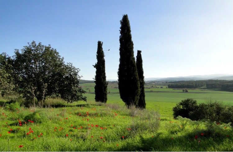
Posted by abu raya - من موقع القريه
Posted by abu raya - المتبقي من بيوت القريه
Posted by abu raya 1 - جامع القريه
Posted by abu raya - اثار بيوت القريه
Posted by abu raya - منظر عام لقريه خلده قبل النكبه
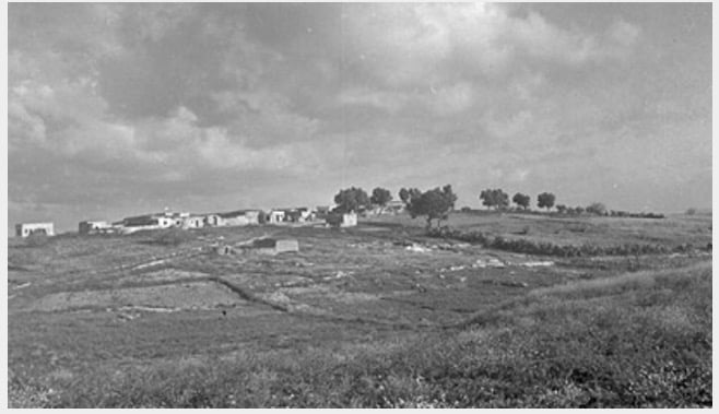
Posted by abu raya - قريه خلده قبل النكبه
Posted by abu raya - قريه خلده قبل النكبه
Posted by abu raya - قريه خلده قبل النكبه
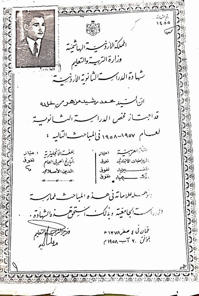
Posted by abu raya - شهادة الدراسه الثانويه لابن البلد محمد رشيد مزهر عام 1958
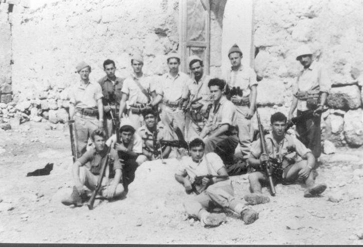
Posted by ibraheem mizher - The "civilized" destroyed our village way after the battle was over to hinder our return. The village was occupied while it was intactt
- Let us see what the "MOST CIVILIZED" have looted from the Palestinian people. No, we are not talking about the Germans; we are referring to the "chosen" ones! See for yourself how the most "liberal & progressive" of World Jewry have done to Palestinians' homes: They turned our village into an artists' gallery (Gadi Fraiman); WOW. Soon, Gaza might have a similar fate. Mazeltov. How else will Jews be great & safe again?
- The "civilized" obliterated our village except for the mosque. How else will the Jews be great and safe again?
- Let us see how the most "liberal and civilized" of world Jewry has obliterated our village except for a handful of structures. How else will the Jews be great and safe again? -- القرية دمرت بالكامل.. من هنا مر الهمج
- Let us see how the most "liberal and civilized" of world Jewry has obliterated our village except for a handful of structures. How else will the Jews be great and safe again? -- القرية دمرت بالكامل.. من هنا مر الهمج #2
- Let us see how the most "liberal and civilized" of world Jewry has obliterated our village except for a handful of structures. How else will the Jews be great and safe again? -- القرية دمرت بالكامل.. من هنا مر الهمج #3
- Let us see how the most "liberal and civilized" of world Jewry has obliterated our village except for a handful of structures. How else will the Jews be great and safe again? -- القرية دمرت بالكامل.. من هنا مر الهمج #4
- Let us see how the most "liberal and civilized" of world Jewry has obliterated our village except for a handful of structures. How else will the Jews be great and safe again? -- القرية دمرت بالكامل.. من هنا مر الهمج #5
- Let us see how the most "liberal and civilized" of world Jewry has obliterated our village except for a handful of structures. How else will the Jews be great and safe again? -- القرية دمرت بالكامل.. من هنا مر الهمج #6
- Let us see how the most "liberal and civilized" of world Jewry has obliterated our village except for a handful of structures. How else will the Jews be great and safe again? -- القرية دمرت بالكامل.. من هنا مر الهمج #7
Want to browse more? 80,000 pictures were grouped in these gallaries:
| Display Name | Clan/Hamolah | Country of Residence |
| Tariq Mizher | - | بيت لحم |
| Samir Elian | - | MI, USA |
| حازم عليان | - | عمان |
| سامر محمد جميل حسن أحمد مزهر | مزهر | - |
| shadi mezhir | mezhir | jeddah, ksa |
| BASEM AHMAD ELAYAN | ELAYAN | AMMAN, JORDAN |
| ibraheem mizher | mizher | palestine |
| محمد خليل | mizher | *****, ****** |
- قرية خلدة المهجرة قضاء الرملة Duration: 15 sec
No links have been shared yet, be free to the first to share the first link.
 Fake Valor: Why Did Zionist Jews Hoist Nazis Flag on Their Ships in the 1930s?
What is new?
-
Facts About Oct. 7th Gaza Raid
-
Remined Us Please:: Who Did Rape Who? Palestinians Raped Israelis? Or, was the other way around?
-
When Prof. Edward Said was invited to debate Bibi Netanyahu in the 1980s, watch what happened!
-
Abusing Blood Libel!
-
Zionist FAQ: Isn't it true that Palestinians don't want peace? Palestinians never accepted the two-state solution
- Facts about Haavara (Transfer) Agreement between Ben-Gurion & Hitler
-
Haavara FAQs: Why Did Zionist Jews Hoist Nazis' Flags on Their Ships in the 1930s?
-
Dear ChatGPT: Why did the Jewish Agency suppress news of the Holocaust during WWII?
-
Video Playlist: Jews share their DNA tests to end the conflict for good.
-
How Ronald Reagan would have framed the genocide in Gaza if he was still alive?
-
Haavara FAQs: Let us do the math: how many German Jews did The Haavara Agreement save?
-
Zionist FAQs: The Hebron Massacre of 1929, "clearly proves" that Palestinians are antisemitic, how could you deny it?
-
Zionist FAQs: Why Anti-Zionist Is Not Antisemitism?
-
Zionist FAQs: Isn't it true that the KGB create Palestinian Nationalism in the early 1960s?
- Zionist FAQs: Muslims are killing Muslims all the time; why are Israeli Jews being singled out in the media?
- Zionist FAQs: How is Israel an apartheid state when 20% of its citizens are Arabs who enjoy full rights?
-
Haavara FAQs: Analysis of Herzl's Uganda Scheme and how it could have saved millions of Jews.
-
Haavara FAQs: Why did Hayim Greenberg describe American Jewry as "morally bankrupt" in early 1943?
-
Haavara FAQs: What if the Evian Conference was a resounding success? What would have been the impact of saving European Jewry on Zionism?
- Haavara FAQs: What if the six million were saved, how that would have impacted the Zionist project?
-
Haavara FAQs: How did Zionist leaders react when Europe's Jews lingered in the DP camps after WWII ended?
-
Why does the American Jewish community repeat lies that David Ben-Gurion had debunked before he died?
-
Who has the power to rename the Tatar/Khazar Gene Marker to Jewish IV?
-
Zionist FAQs: Why won't Egypt, Syria, and Jordan take their people back? Jews are indigenous to Palestine, and Arabs immigrated after Jews developed the country. Arabs should leave.
-
Haavara FAQs: Did Hitler and the Nazis conflate between Judaism and Zionist? If that wasn't case, then why?
-
Haavara FAQs: Winston Churchill and antisemitism, a collection of articles written Churchill.
-
Haavara FAQs: Broken by country, how many Jews survived vs. killed during the Holocaust?
-
Haavara FAQs: Why did European Jews vote with their feet and to immigrated to the Americas, not Palestine, after WWII?
-
Watch this American Jewish Girl describing Israeli Jews' cognitive dissonance like no other in under two minutes
-
Haavara FAQs: When the Nazis went out of their way to hide the Holocaust, Israeli Jews did the exact opposite by broadcasting their genocide of Gazans. But why?
-
Haavara FAQs: How Zionist Jews went out of their to show their appreciation to Nazism and Fascism?
- Haavara FAQs: Why Zionist leaders were against bombing the death camps & the Railroads leading to them?
-
Haavara FAQs: Hitler's message to the British and American people: If Jews are such noble citizens and you care about them, how come you're not letting them in? I will gladly ship them to you at my expense, even on luxury liners!
-
A shortlist of Zionist and Israeli false flag operations in the name Jews.
-
The Most Moral Army
- The Land of Kapos (Israel): Where the brave are boycotted and Kapos walk free.
- Why did early Zionists often named their communal enterprises "colonial"?
- Zionist Relations with Nazi Germany by Faris Glubb
-
Two NY Times advertisements by Zionists in the early 1943 that exposes Zionists' treason at the height of the calamity
- Facts Not Lies about the Palestinian-Israeli Conflict.
- Site's pictures have been categorized
- Campgain Against Lice
- A Survey of Palestine, the official source about Palestine before Nakba produced by the British Mandate; over 1200 pages.
- Satellite View & Google Earth: Over 6,000 placemarks identifying all destroyed towns, W. Bank & Gaza Strip Towns, & refugee camps.
- PalestineRemembered.com and its Nakba Oral History Project were featured on al-Jazeera Satellite TV.
- Nakba Oral History Video Podcast:
 Over 700 Oral History interviews (including 3,500+ hours of recording) can be viewed online.
 - Palestine Village Statistics Project
- Gaza Jail Break
- النسخة العربية للموقع الان متوفرة
- Videos: Documenting the destroyed villages in video: Tracing all that remains since Nakba.
- Videos: Responding to Zionist Propaganda
- Interview: The ethnic cleansing of Palestine: George Galloway interviews Israeli Historian Ilan Pappe.
- For Palestinians, memory matters. It provides a blueprint for their future By George Bisharat.
- Zionist FAQ now available in Hebrew שאלות שציונים שואלים, עכשיו בעברית
- Video: The Stephen Walt and John Mearsheimer report on the influence of the Israel Lobby on U.S. Foreign Policy
- The Palestinian-Israeli conflict for beginners
