| PalestineRemembered | About Us | Oral History | العربية | |
| Pictures | Zionist FAQs | Haavara | Maps | |
| Search |
| Camps |
| Districts |
| Acre |
| Baysan |
| Beersheba |
| Bethlehem |
| Gaza |
| Haifa |
| Hebron |
| Jaffa |
| Jericho |
| Jerusalem |
| Jinin |
| Nablus |
| Nazareth |
| Ramallah |
| al-Ramla |
| Safad |
| Tiberias |
| Tulkarm |
| Donate |
| Contact |
| Profile |
| Videos |
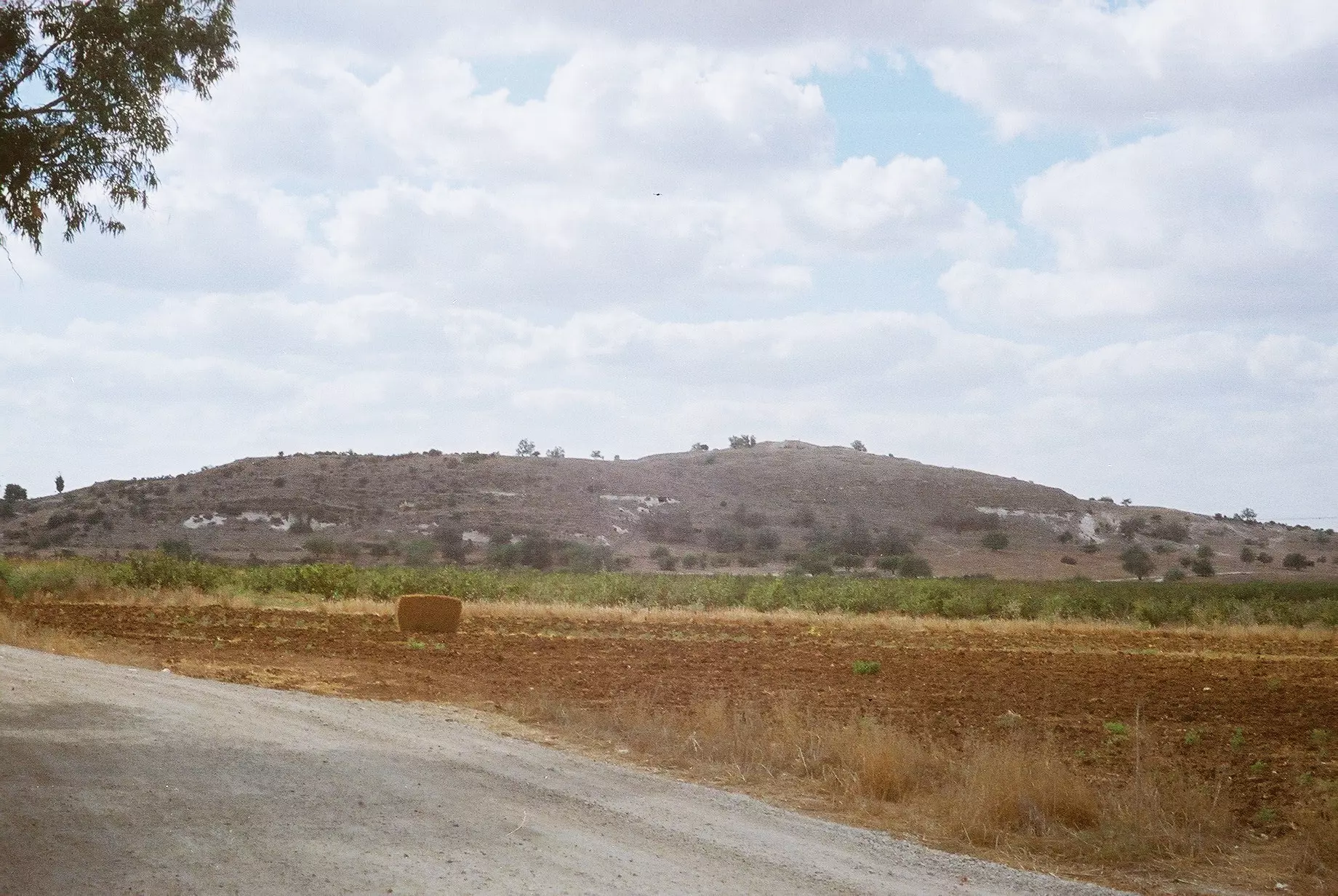
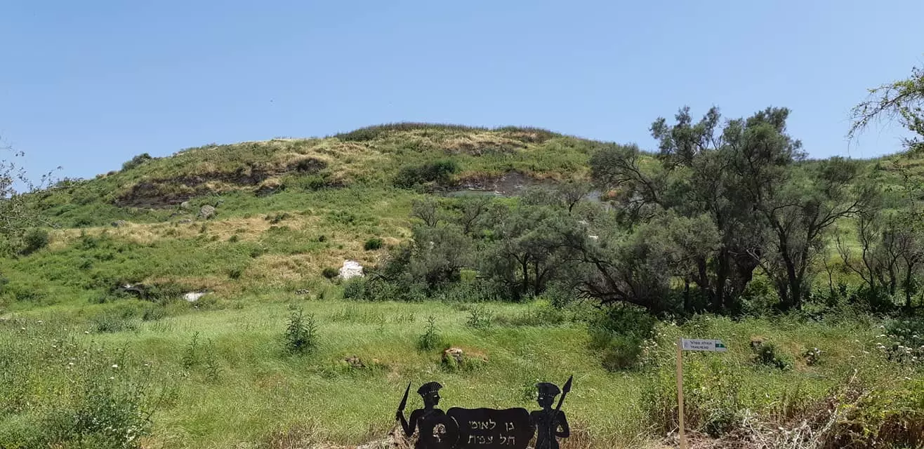
Welcome To Tall al-Safi - تل الصافي (תל א-צאפי)
|
District of Hebron
Ethnically cleansed days ago |
العربية Google Earth |
 |
Gallery (127) |
- Statistics & Facts
-
Before & After

- Satellite View
- Articles 27
- Pictures 127
- Aerial Views 1
- Oral History 2
- Members 92
- Families
- All That Remains
- Wikipedia
- Videos 4
- Guest Book
- Links
| Statistic & Fact | Value | |||||||||||||||||||||
| Occupation Date | July 9, 1948 | |||||||||||||||||||||
| Distance From District | 35 (km) Northwest of Hebron | |||||||||||||||||||||
| Elevation | 175 (meters) | |||||||||||||||||||||
| Before & After Nakba, Click Map For Details |
||||||||||||||||||||||
|
||||||||||||||||||||||
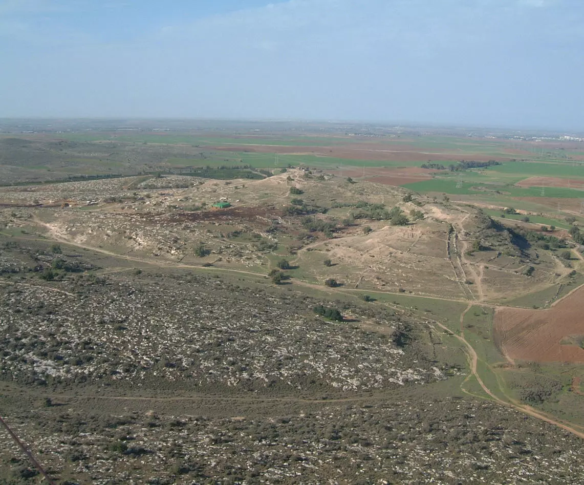
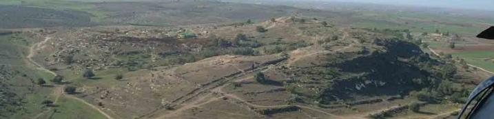
| Pre-Nakba Aerial View |
||||||||||||||||||||||

|
||||||||||||||||||||||
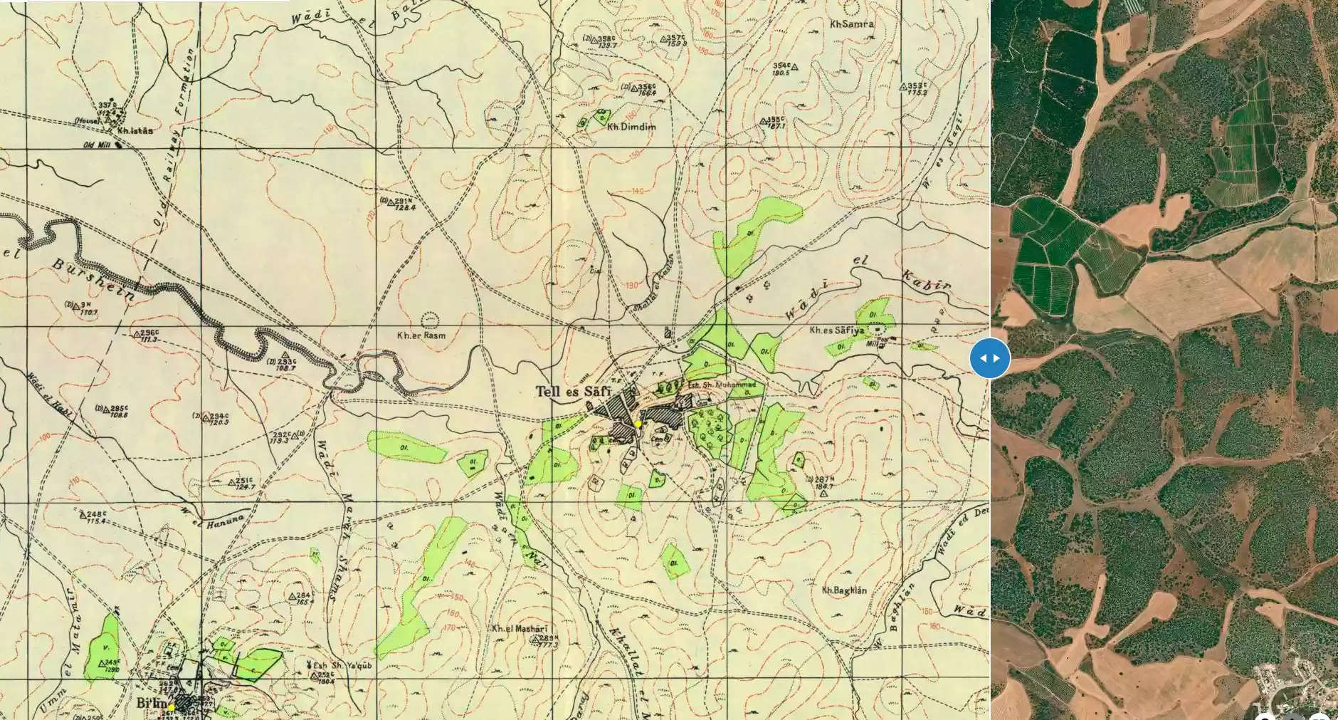
| Map Location | See location #3 on the map View from satellite |
|||||||||||||||||||||
| Military Operation | Operation An-Far | |||||||||||||||||||||
| Attacking Units | The First Battalion of the Giva'ti Brigade | |||||||||||||||||||||
| Defenders | Egyptian Muslim Brotherhoods, local Palestinian militias and some Arab Liberation Army volunteers. | |||||||||||||||||||||
| Refugees' Migration Routes | Refugess headed to the Hebron hills. | |||||||||||||||||||||
| Exodus Cause | Military assault by Zionist troops | |||||||||||||||||||||
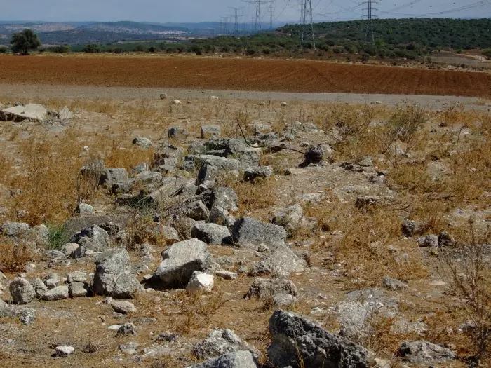
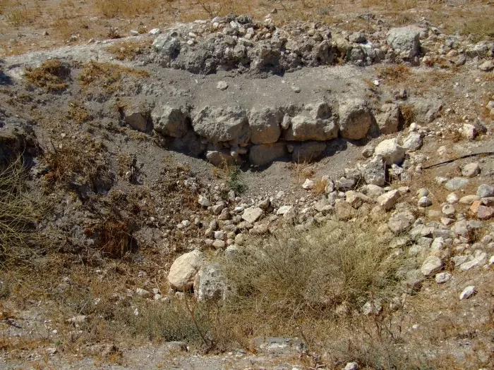
| Village Temains | The village was completely obliterated and defaced. | |||||||||||||||||||||
| Ethnically Cleansing | Tall al-Safi inhabitants were completely ethnically cleansed. | |||||||||||||||||||||
| Pre-Nakba Land Ownership |
**Town Lands' Demarcation Maps |
|||||||||||||||||||||
| Land Usage As of 1945 |
|
|||||||||||||||||||||
| Population |
|
|||||||||||||||||||||
| Number of Houses | In (1931): 208 (includes three adjacent khirbas) | |||||||||||||||||||||
| Near By Towns |
||||||||||||||||||||||
|
||||||||||||||||||||||
| Town's Name Through History | The Philistine referred to Tall al-Safi by the city of Gath. | |||||||||||||||||||||
| Shrines / Maqams | The villagers maintained a shrine for a local sage known by al-Shaykh Muhammad. | |||||||||||||||||||||
| Nearby Wadies & Rivers | Tall al-Safi is situated on the southern banks of Wadi 'Ajjur. | |||||||||||||||||||||
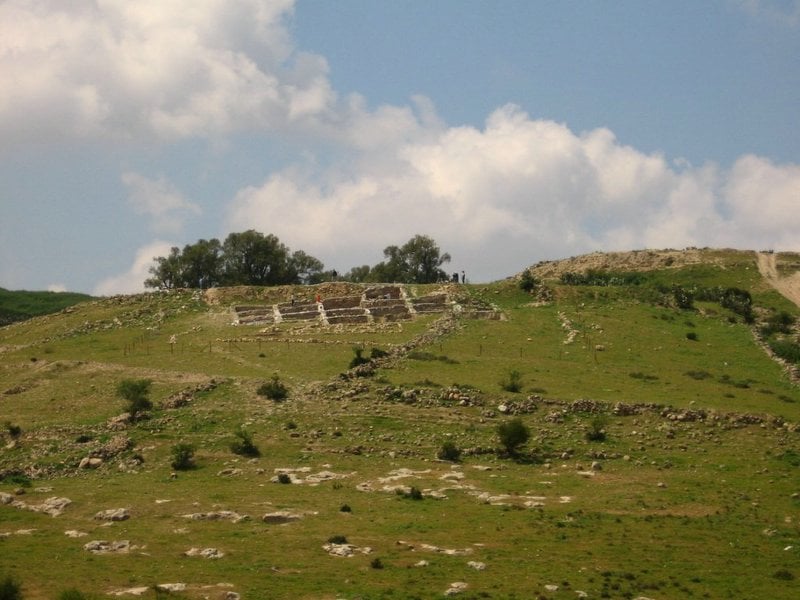
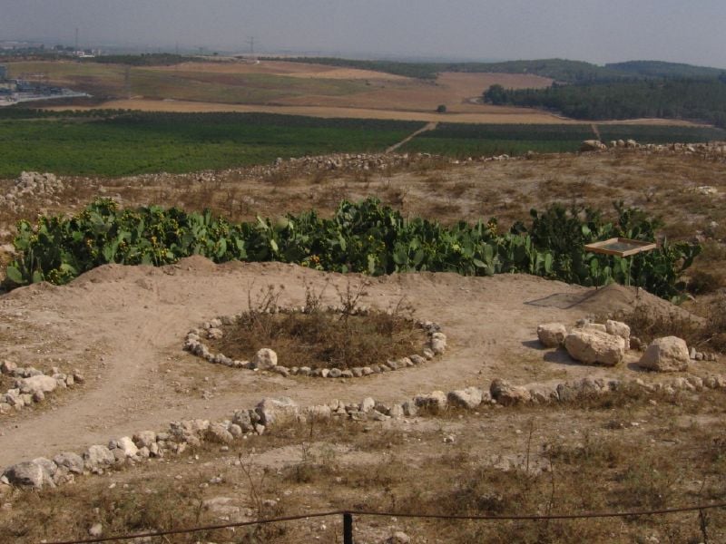
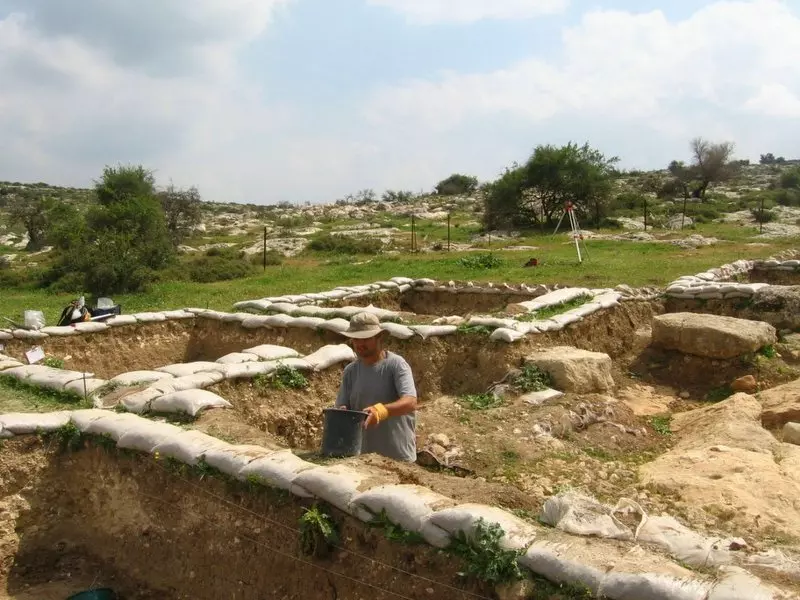
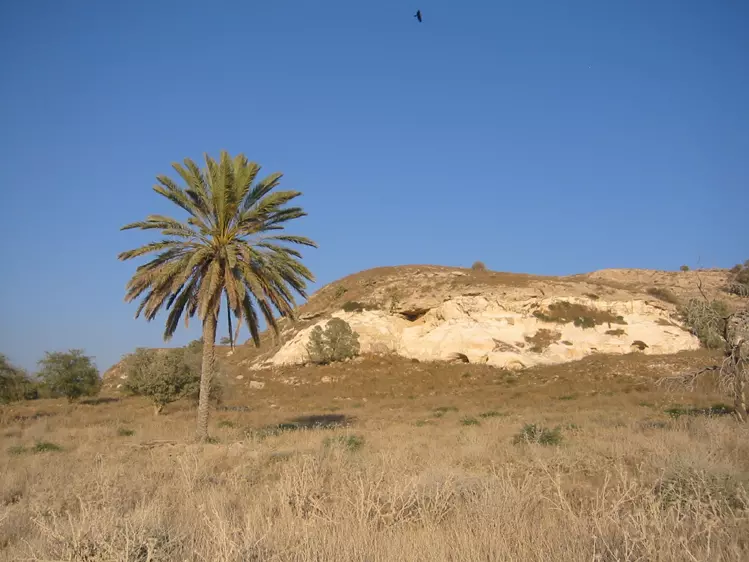
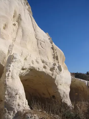
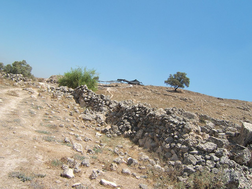
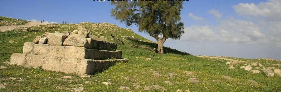
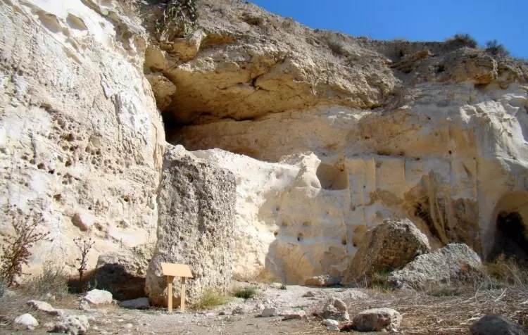
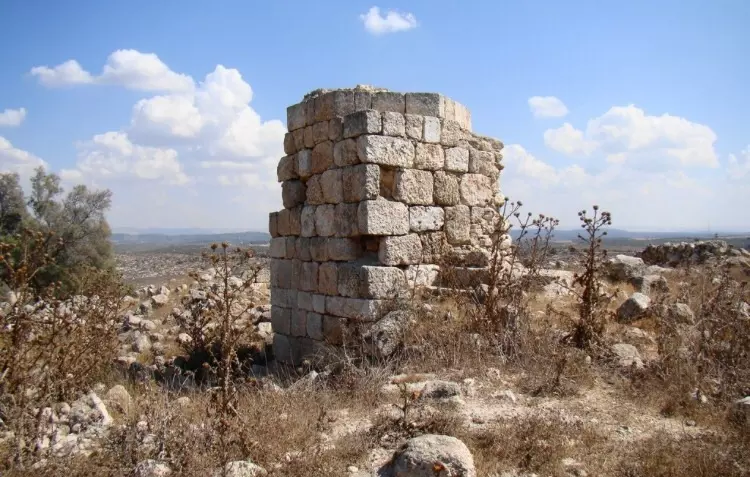
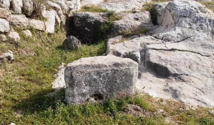
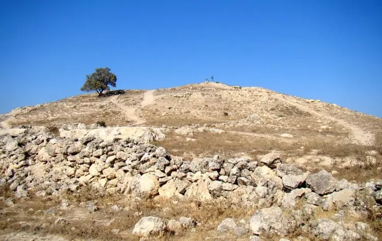
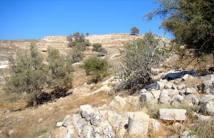
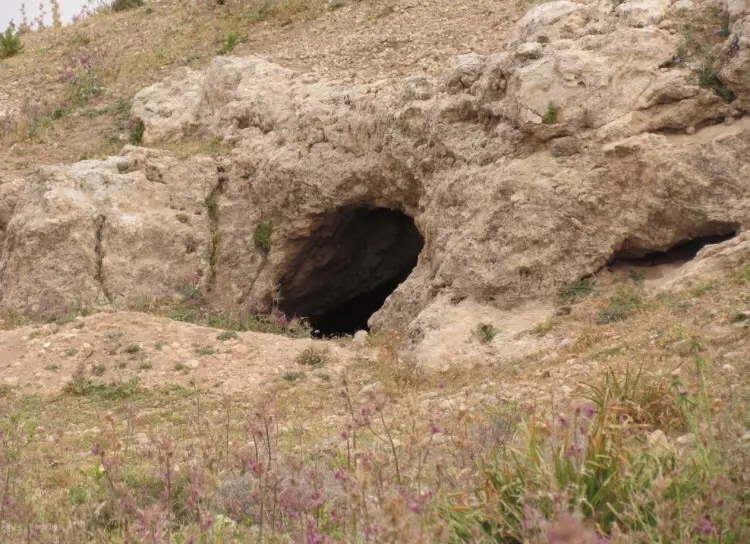
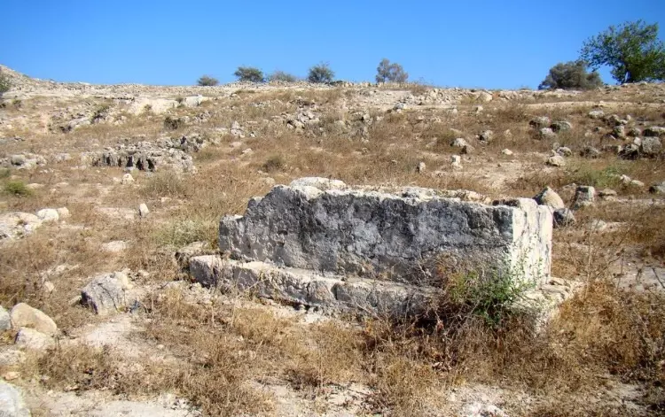
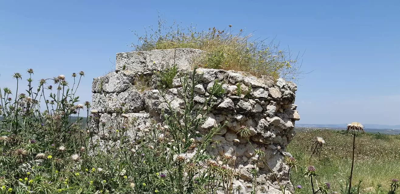
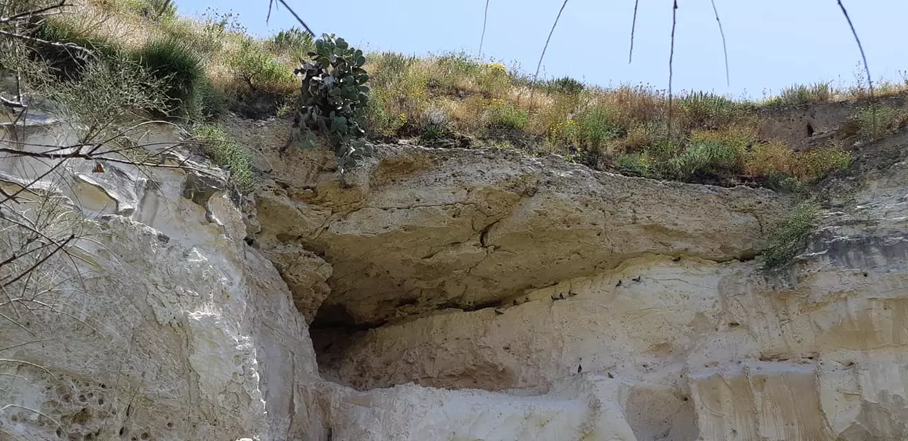
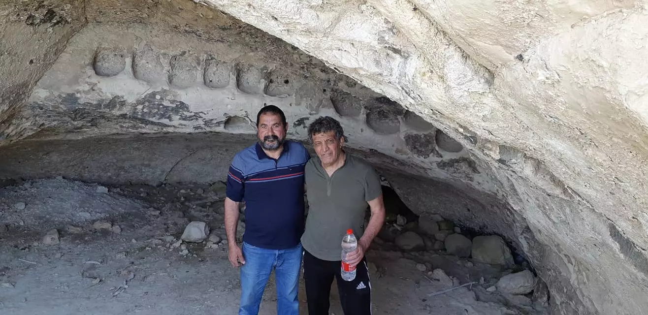
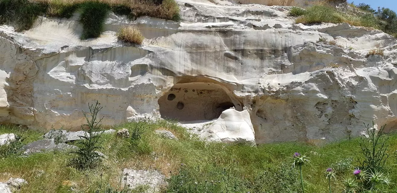
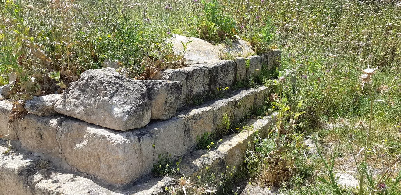
| Archeological Sites | Tall al-Safi contains a Crusades castle and it also contains walls, burial places, a cave, and carved stones. | |||||||||||||||||||||
| Exculsive Jewish Colonies Who Usurped Village Lands |
No Israeli settlements on village lands. | |||||||||||||||||||||
| Featured Video | ||||||||||||||||||||||
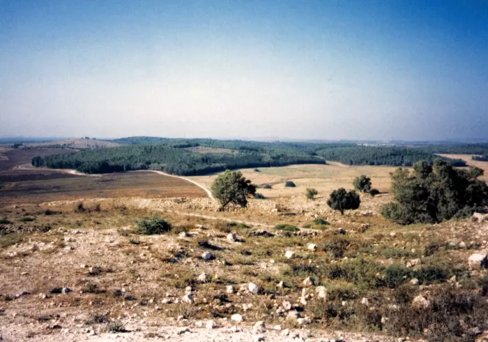
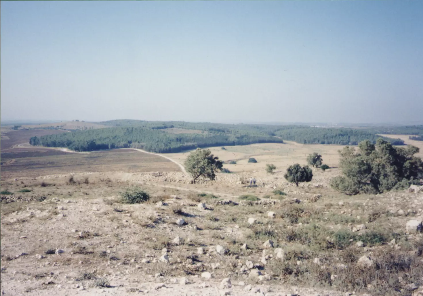
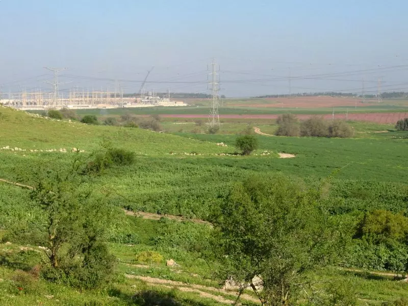
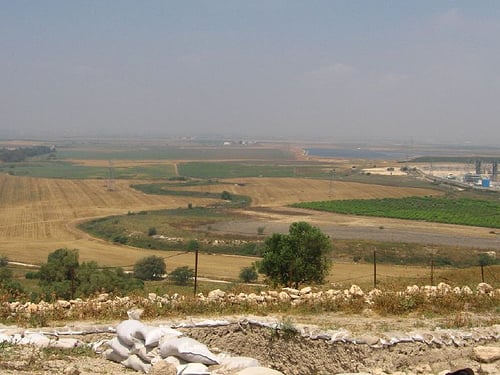
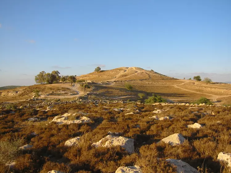
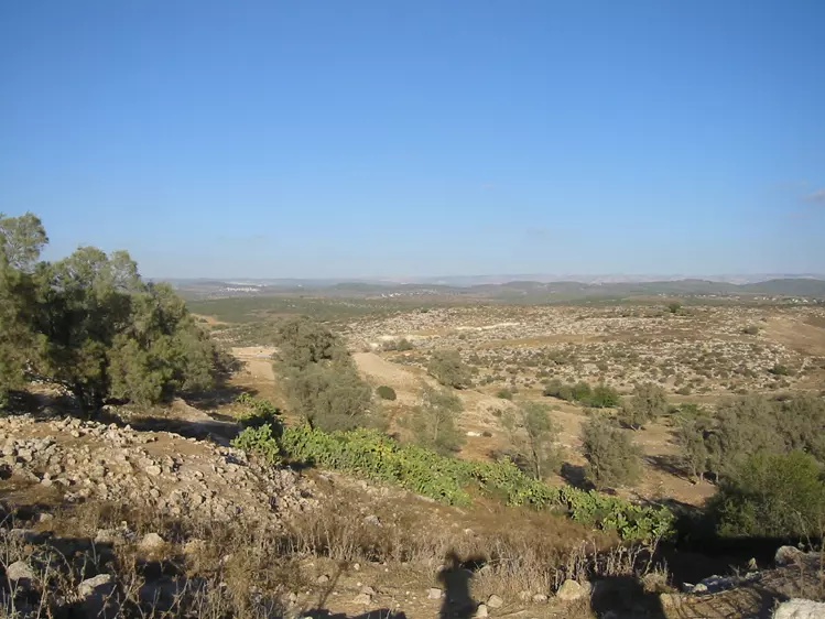
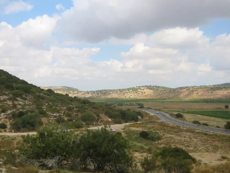
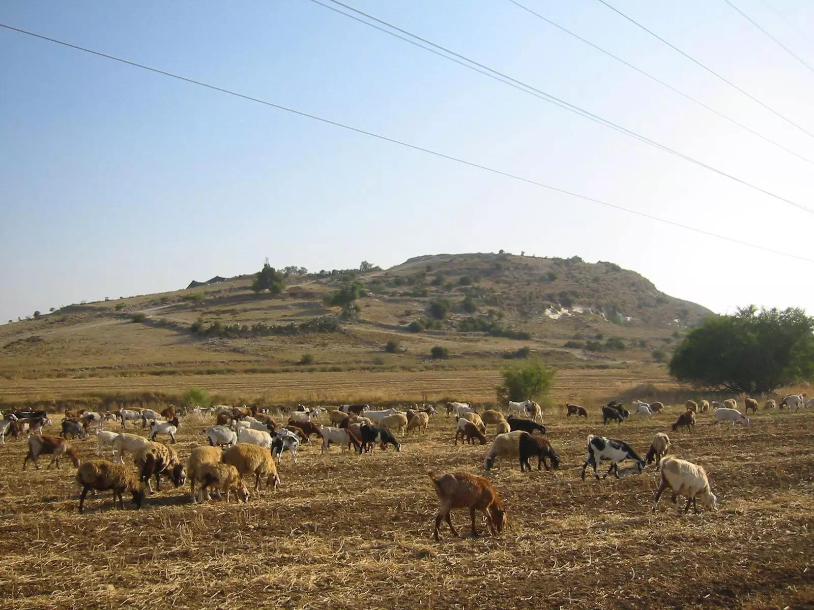
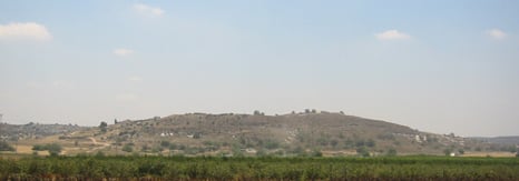
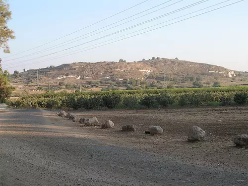
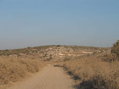
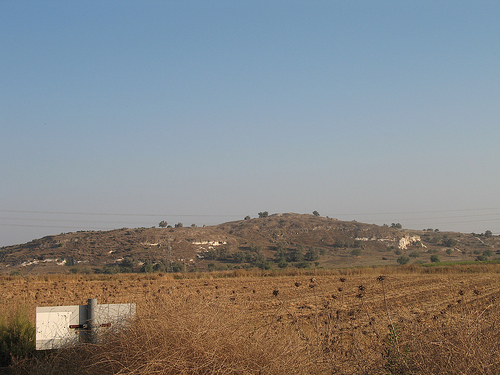
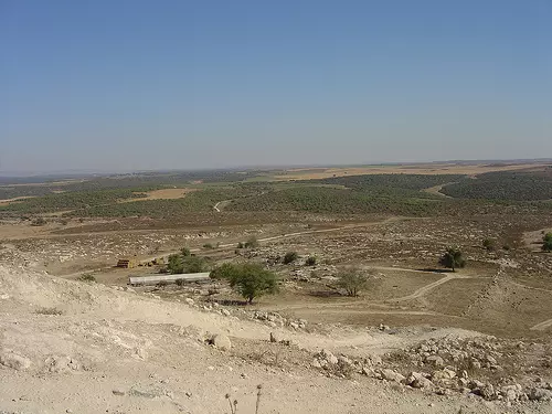
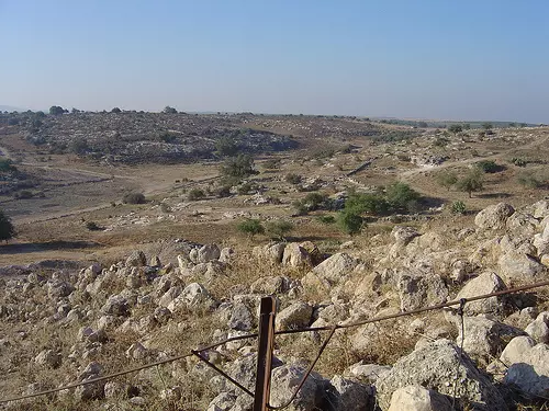
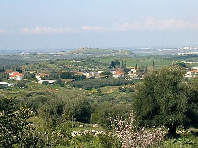
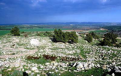
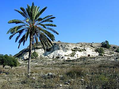
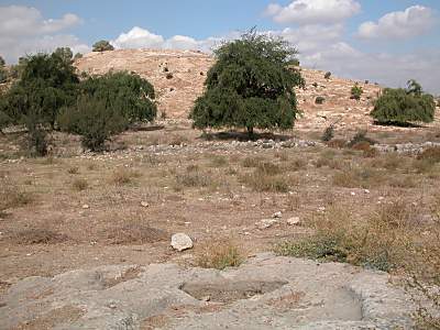
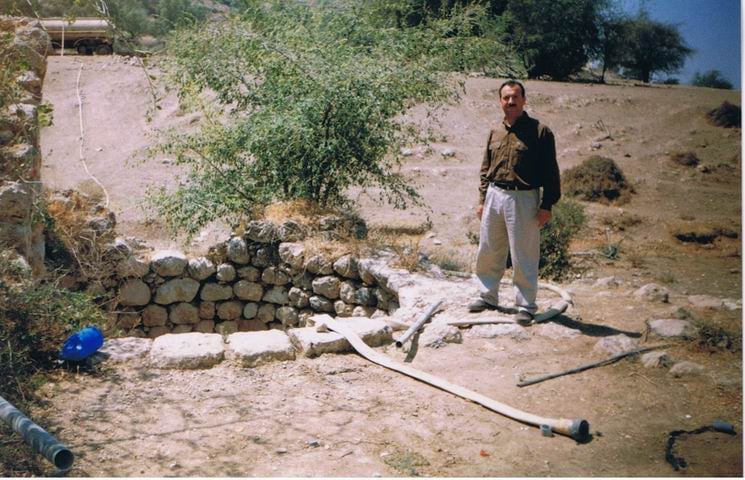
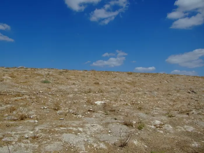
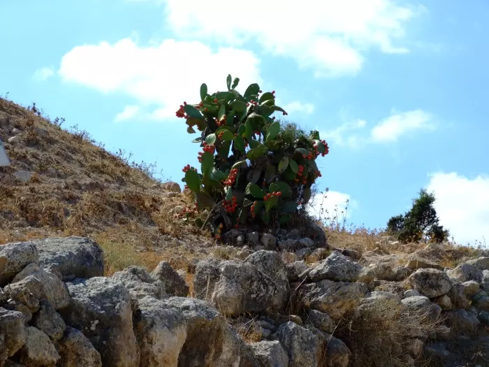
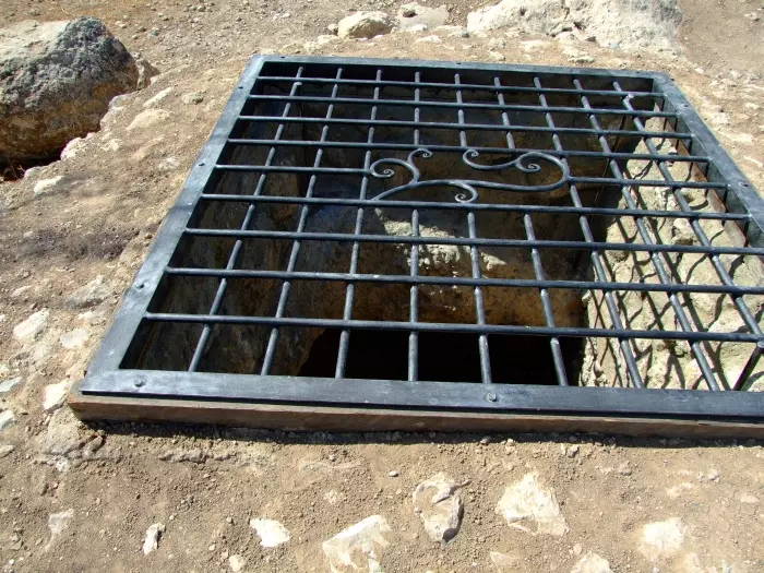
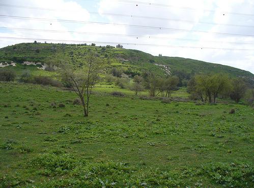
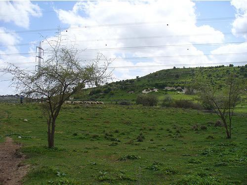
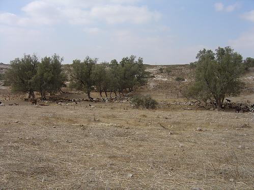
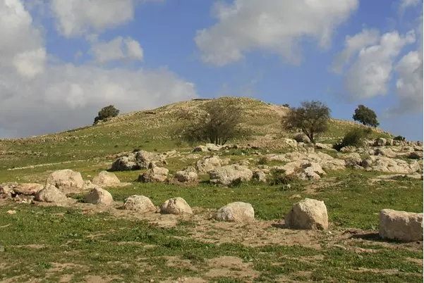
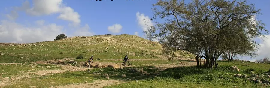
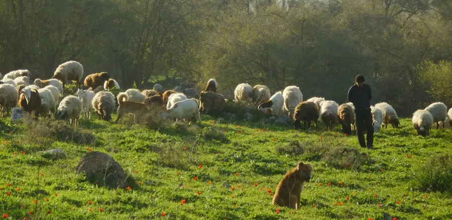
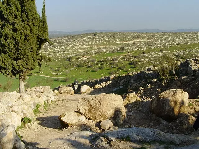
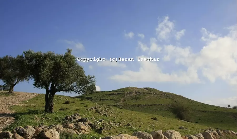
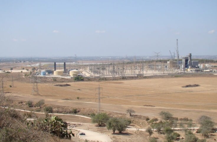
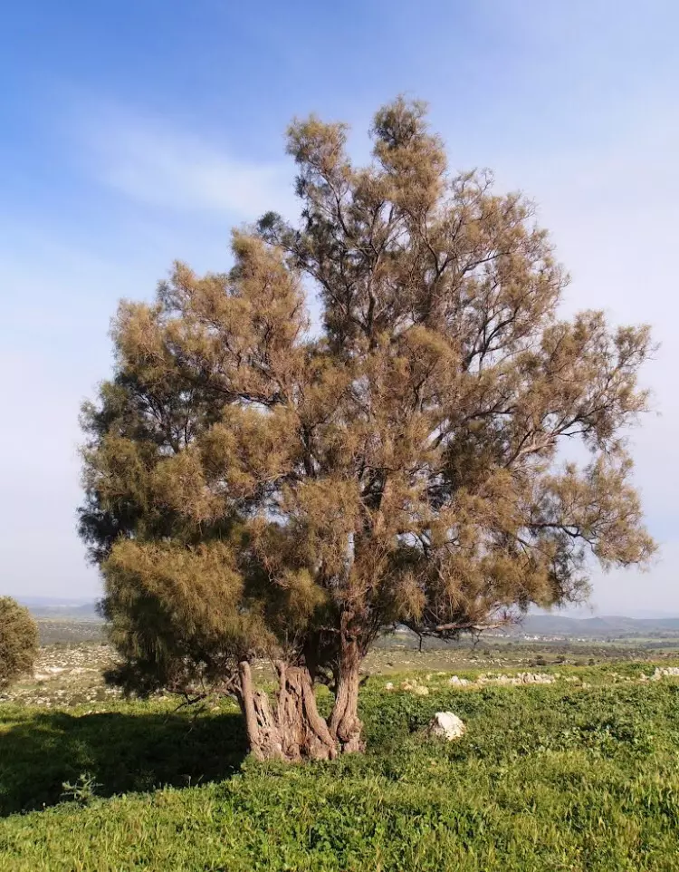
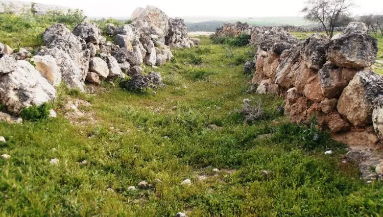
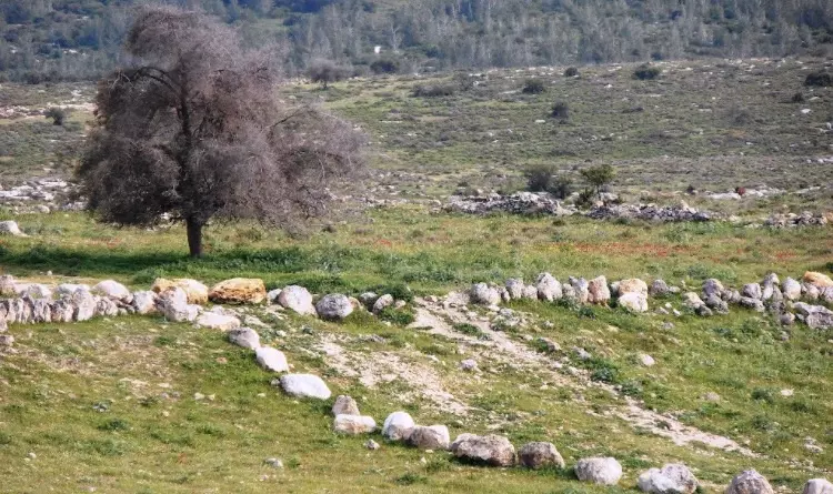
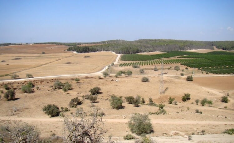
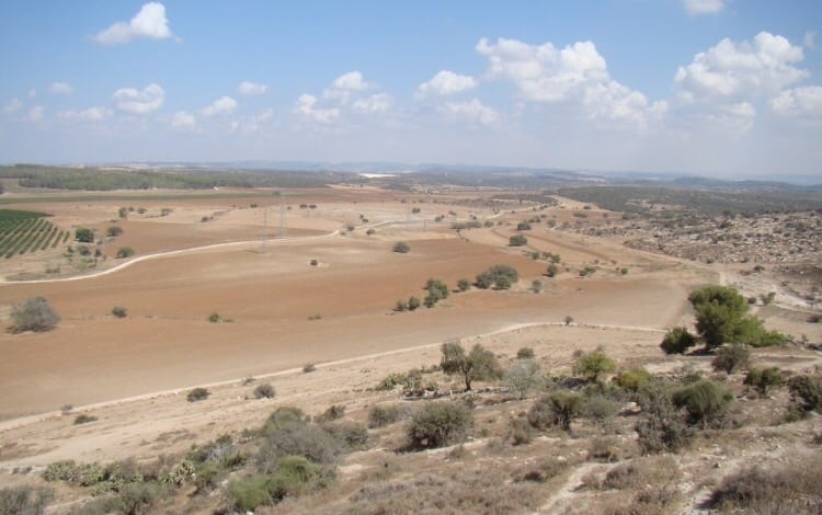
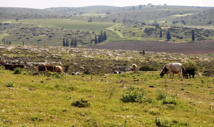
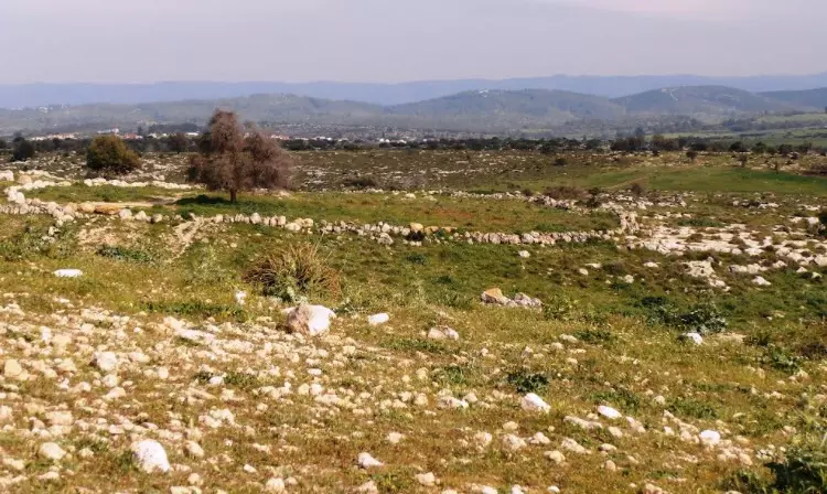
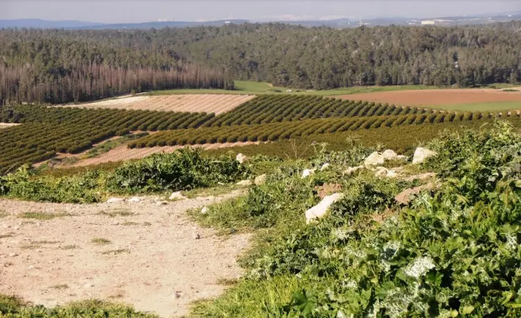
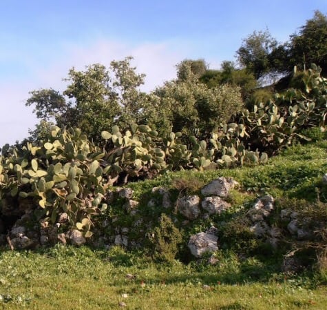
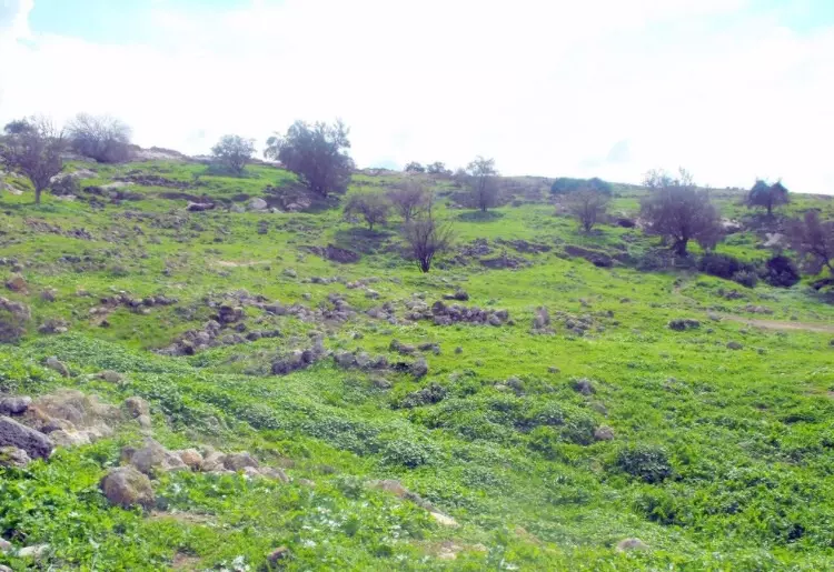
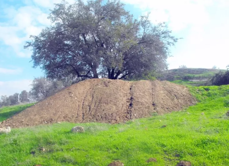
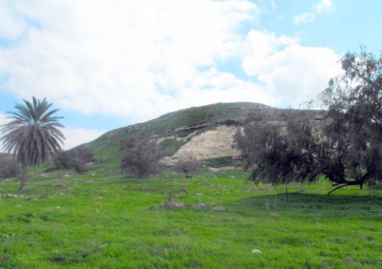
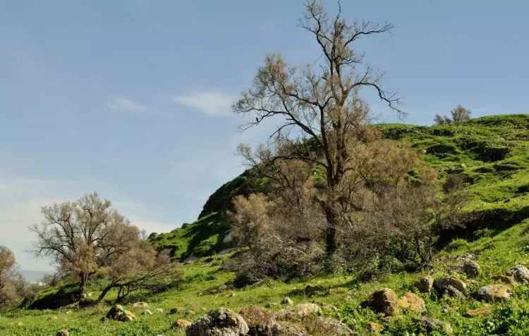
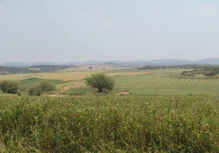
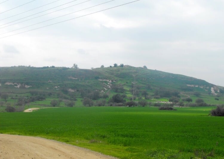
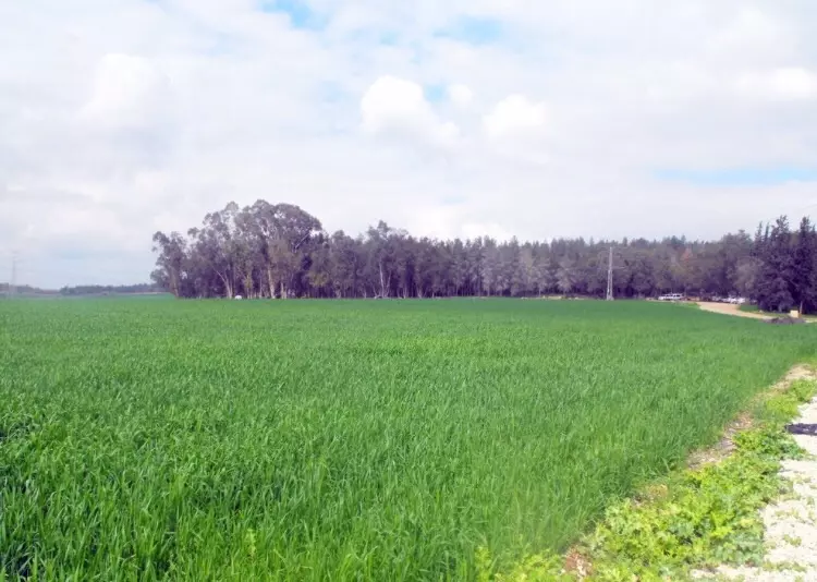
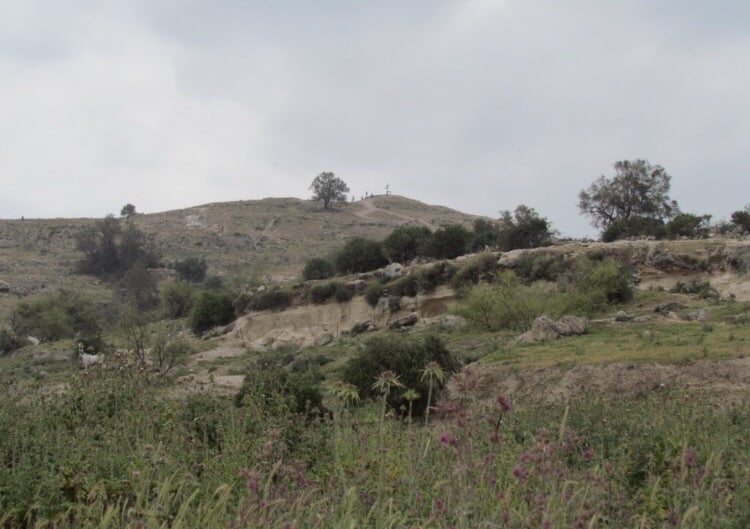
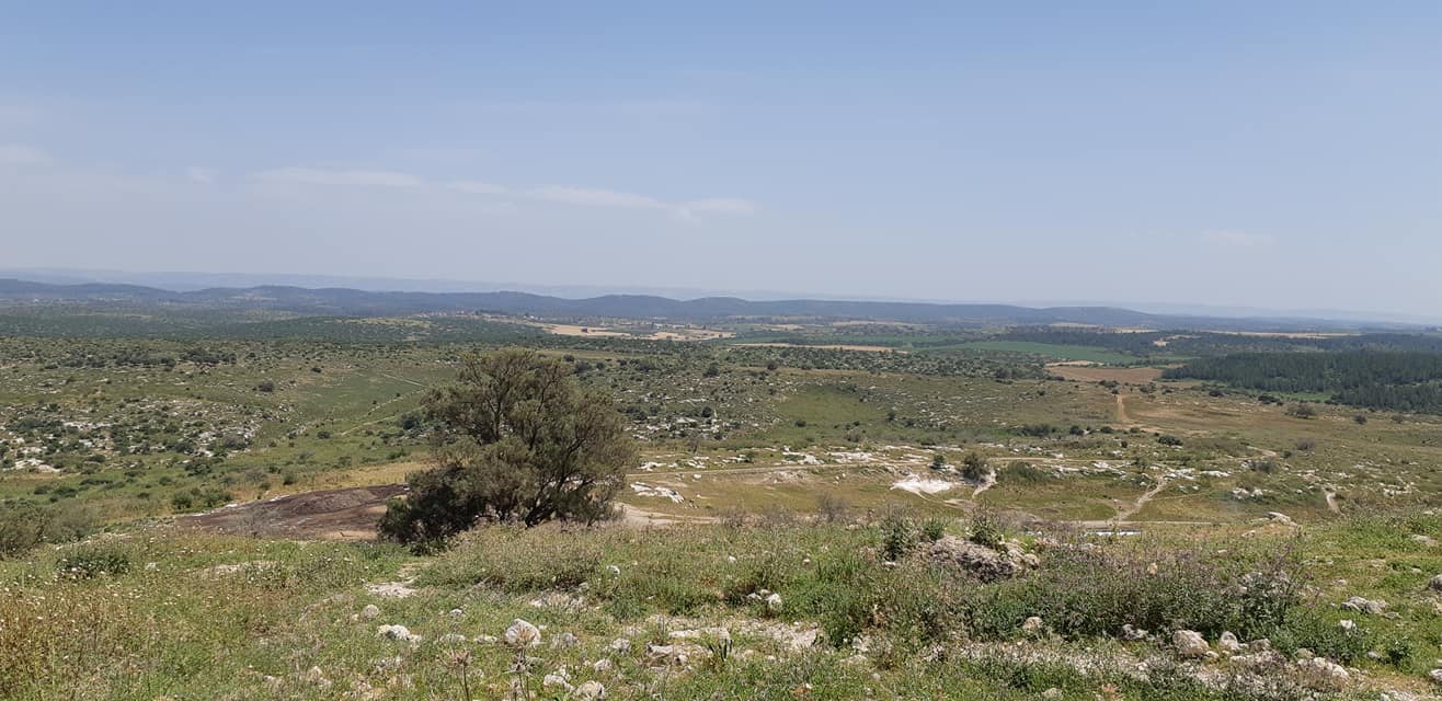
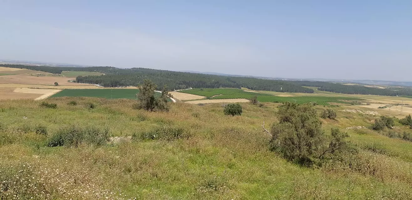
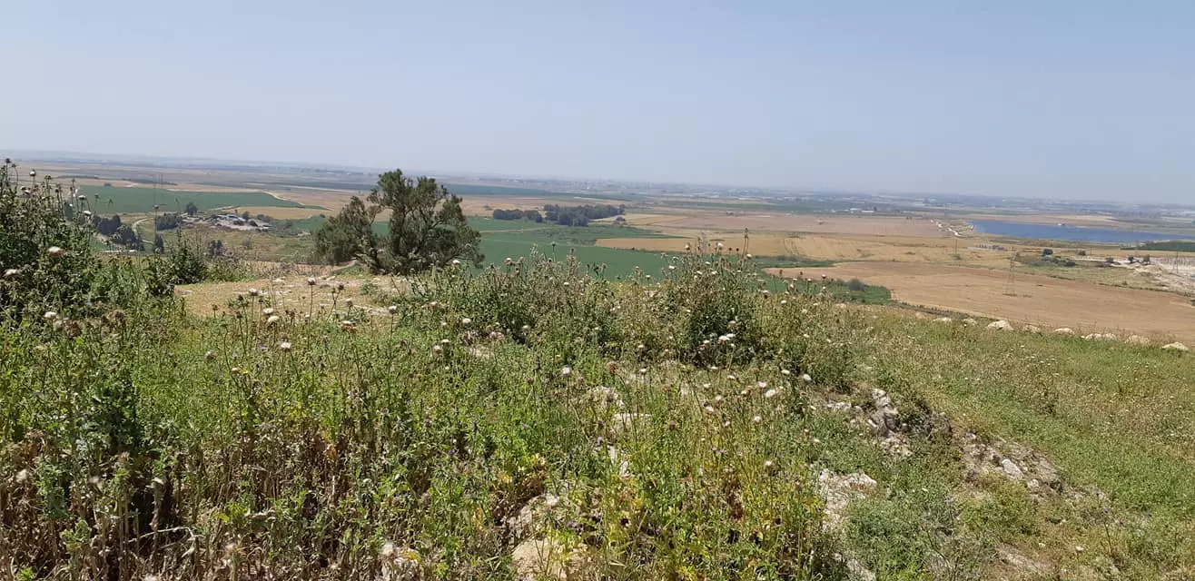
Village Before NakbaTall al-Safi was one of many sites in Palestine with a long history of human habitation; it was occupied from the third millenium B.C. until 1948. A limited excavation which unearthed many pieces of Philistine pottery was conducted on the site for the Palestine Exploration Fund in 1899. This and other evidence indicates that Tall al-Safi was probably the place where Gath, the Philistine city, was located. It appears on the Madaba map (dating from the sixth century B.C.) with the name Saphitha. During the Crusader period a fort was built on the site which was destroyed later by Salah al-Din al-Ayyubi (Saladin). The Crusaders called it Blanch Garde ('white guard'), doubtless referring to the white rock outcrop that was visible on the east side of the mound. Richard the Lion-Heart was nearly captured while inspecting his troops next to the site. The Arab geographer Yaqut al-Hamawi (d. 1228) described it as a fort near Bayt Jibrin in the Ramla sub-disctrict, and the Jerusalem chronicler Mujir al-Din al-Hanbali (d. 1522) noted that Tall al-Safi was within the administrative jurisdiction of Gaza. In 1596, Tall al-Safi was a village in the nahiya of Gaza (liwa' of Gaza), with a population of 484. It paid taxes on a number of crops, including wheat, barley, fruit, and sesame, as well as on other types of produce, such as goats and beehives.In the late nineteenth century, Tall al-Safi was a village built of adobe bricks with a well in the valley to the north. The walls of the village houses were built of stones that were held together by mud and mortar. The houses stood along the roads that wound in and out of the village, forming a star-shaped pattern. Tall al-Safi's population consisted of Muslims. The villagers had a marketplace, a mosque, and a shrine for a Shaykh Muhammad, a local sage. Water for domestic use was drawn from a well. Rainfed agriculture constituted the main source of livelihood for the people of Tall al-Safi, followed by animal husbandry, especially goat and sheep breeding. The cultivated land was uneven in parts and flat in others and was planted in grain, vegetables, and fruits such as grapes, figs, and almonds. Olives were grown on 521 dunums. In 1944, a total of 19,716 dunums was allotted to cereals; 696 dunums were irrigated or used for orchards. Tall al-Safi's antiquities included the remnants of a Crusaders' castle, walls, burial places, a cave, and carved stones. Village Occupation and Ethnic CleaningThe village was a central target of Operation An-Far, launched during the period between the two truces (8-18 July 1948; see Bi'lin, Gaza sub-district). On 7 July, Giv'ati commander Shim'on Avidan issued orders to the First Battalion to take the Tall al-Safi area and 'to expel the refugees encamped in the area, in order to prevent enemy infiltration from the east to this important position.' The position was taken on 9-10 July, and an Israeli army report quoted by Israeli historian Benny Morris later estimated that the capture of Tall al-Safi completely undermined the morale of the surrounding villages.Zionists Colonies on Village LandsThere are no Israeli settlements on village land.Village TodayThe site is overgrown with wild vegetation, consisting mainly of foxtail and thorny plants, interspersed with cactuses, date-palm and olive trees. There are remnants of a well and the crumbling stone walls of a pool. The surrounding land is planted by Israeli farmers with citrus trees, sunflowers, and grain. A few tents belonging to a group of Bedouin are occasionally pitched nearby.SourceDr. Walid al-Khalidi, 1992: All That Remains. |
||||||||||||||||||||||
| Related Maps | Town Lands' Demarcation Maps خرائط للقضاء توضح حدود القرى والاودية Town's map on MapQuest View from satellite Help us map this town at WikiMapia |
|||||||||||||||||||||
| Related Links | Wikipedia's Page Facebook Page Google Search Google For Images Google For Videos |
|||||||||||||||||||||
| More Information | في كتاب كي لا ننسى في كتاب بلادنا فلسطين المزيد من موقع هوية |
|||||||||||||||||||||
- tal-alsafy
- لقاء مع اذاعة البي بي سي
- قصيدة للاستاذ موسى ابراهيم ابو الريش
- مبروك للفائزين في انتخابات جمعية تل الصافي الخيرية الدورة الثانية
- من قصص البطولة والفداء : عشرة بنادق وزعت على سكان البلدة والشهيد محمود عايش قتل بواحدة منها (18) صهيونيا
- جمعية تل الصافي الخيرية...فلسطين
- تل الصافي عبر التاريخ - 1
- تل الصافي عبر التاريخ - 2
- تل الصافي عبر التاريخ - 3
- مقدمة عن القيسية واليمنية
- ملاحظات حول ما كتب عن تل الصافي عبر التاريخ- 2 / للدكتور سمير أيوب
- النظام الداخلي - جمعية تل الصافي الخيرية - الاردن
- اسماء العائلات التي سكنت تل الصافي
- اعضاء الهيئة العامة جمعية تل الصافي الخيرية
- اعضاء الهيئة العامة جمعية تل الصافي الخيرية (1
- اعضاء الهيئة العامة جمعية تل الصافي الخيرية (2
- اعضاء الهيئة العامة جمعية تل الصافي الخيرية (3
- اعضاء الهيئة العامة جمعية تل الصافي الخيرية (4
- Abu- Yaser ( Zeiad )
- انتخاب هيئة ادارية جديدة في جمعية تل الصافي الخيرية
- اسماء اعضاء الهيئة العامة جمعية تل الصافي الخيرية
- اسماء اعضاء الهيئة العامة جمعية تل الصافي الخيرية 1
- اه يا بلدي
- لـمـحـة تـاريـخـيـة عـن قـبـيـلــة الـبـراهــمـيــة ** الكنعانية
- اجتماع الهيئة العامة 6-5-2011
- نبذة تاريخية عن قرية تل الصافي (قضاء الخليل) من كتاب (كي لا ننسى)
- الحاج: عندما سقطت تل الصافي اهتزت فلسطين - Al Jazeera
- جمعية تل الصافي الخيرية
Posted by يوسف معدي 85 - منظر عام
Posted by jamal maghnam 3 - منظر عام

Posted by jamal maghnam 6 - منظر عام
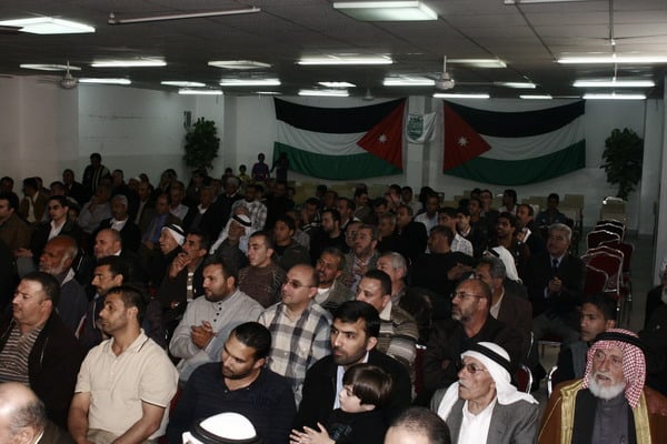
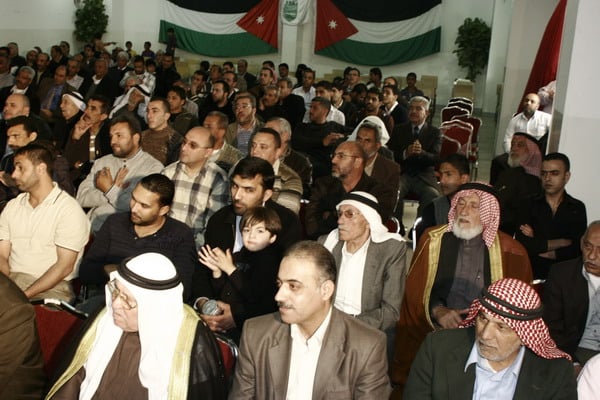
Posted by jamal maghnam 6 - A gathering for Tall al-Safi people in Amman, Jordan
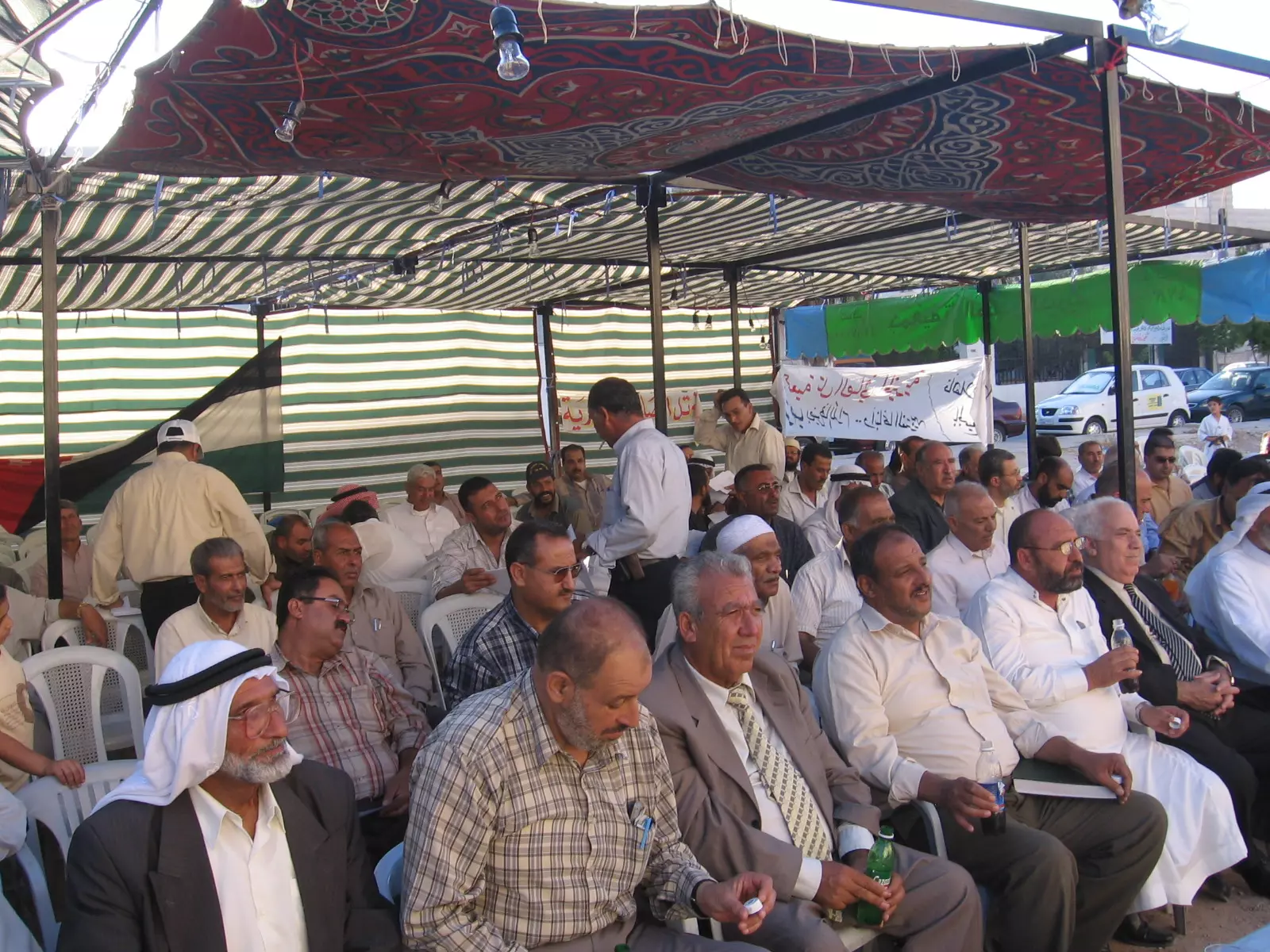
Posted by يوسف معدي 7 - احتفال جمعية تل الصافي بعيد الاستقلال الاردن
Posted by يوسف معدي 1 - منظر عام
Posted by jamal maghnam 6 - الأراضي المغتصبة
Posted by jamal maghnam 1 - الأراضي المغتصبة
Posted by jamal maghnam 1 - التنقيب عن الآثار الموجدة في أراضي القرية
Posted by jamal maghnam 2 - إحدى التلال في أراضي القرية
Posted by jamal maghnam 1 - منظر عام
Posted by jamal maghnam 1 - منظر عام
Posted by jamal maghnam - منظر عام
Posted by jamal maghnam 1 - منظر عام
Posted by jamal maghnam 2 - منظر عام
Posted by jamal maghnam 1 - منظر عام
Posted by jamal maghnam 2 - منظر عام
Posted by jamal maghnam - الكهوف
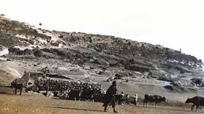
Posted by jamal maghnam 1 - جانب من القرية تعود الصورة لعام 1948
Posted by jamal maghnam 1 - منظر عام
Posted by jamal maghnam - منظر عام
Posted by jamal maghnam 1 - منظر عام
Posted by jamal maghnam 3 - منظر عام
Posted by jamal maghnam 1 - منظر عام
Posted by jamal maghnam - منظر عام
Posted by jamal maghnam - منظر عام
Posted by jamal maghnam 2 - منظر عام
Posted by jamal maghnam 1 - منظر عام
Posted by jamal maghnam - منظر عام
Posted by jamal maghnam - منظر عام
Posted by jamal maghnam - منظر عام
Posted by jamal maghnam 2 - منظر عام
Posted by jamal maghnam 1 - صورة لاعضاء جمعية تل الصافي الخيرية
Posted by يوسف معدي 4 - بير البلد من اشهر المعالم في تل الصافي حيث كان مصدر المياه
Posted by يوسف معدي - صور أقمار صناعية لتل الصافي
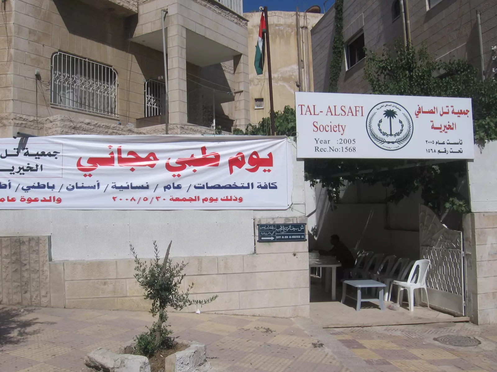
Posted by dj vampire327 - يوم طبي مجاني بجمعية تل الصافي الخيرية
Posted by يوسف معدي 2 - يوم طبي مجاني لجمعية تل الصافي
Posted by يوسف معدي 1 - ضمن نشاطات جمعية تل الصافي
Posted by يوسف معدي - منظر مدخل جمعية تل الصافي
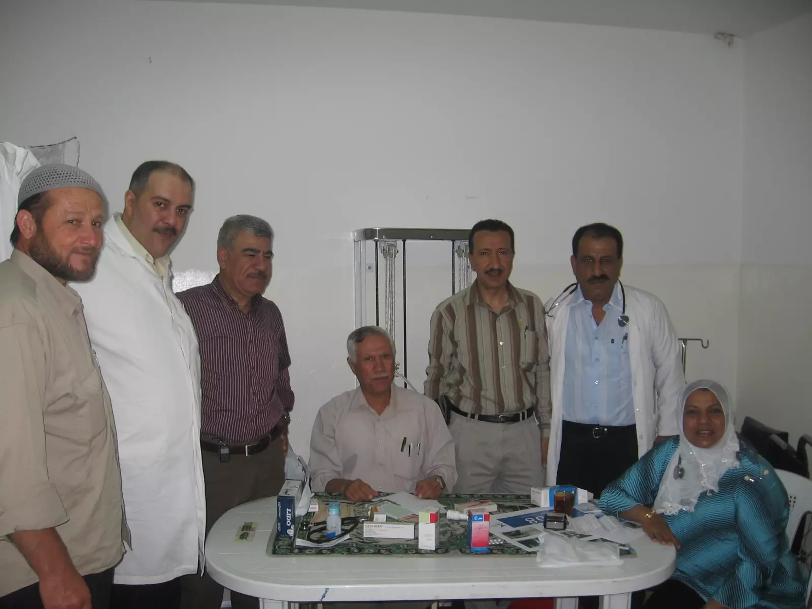
Posted by يوسف معدي - الدكتور علي العايدي والدكتور امجد زهدي
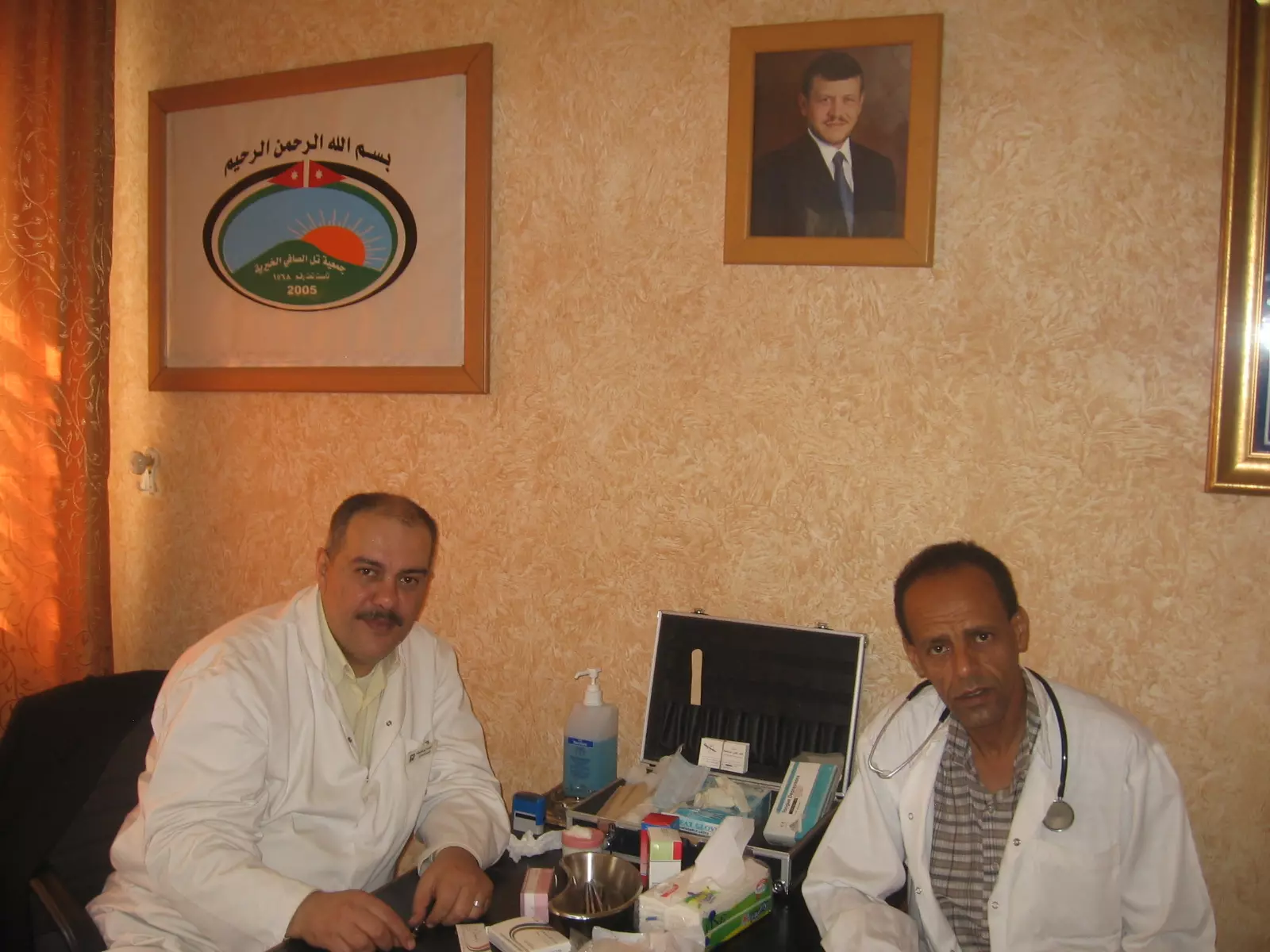
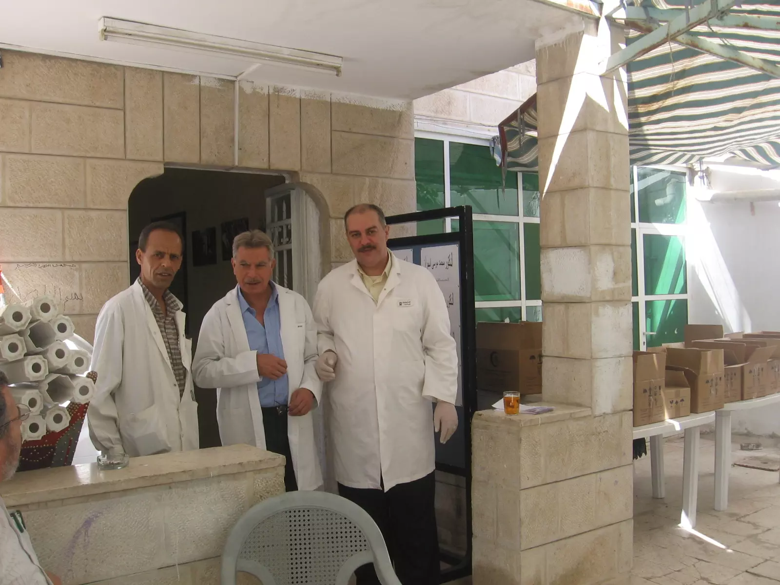
Posted by يوسف معدي - فريق الاطباء واعضاء الهيئة الادارية في اليوم الطبي المجاني
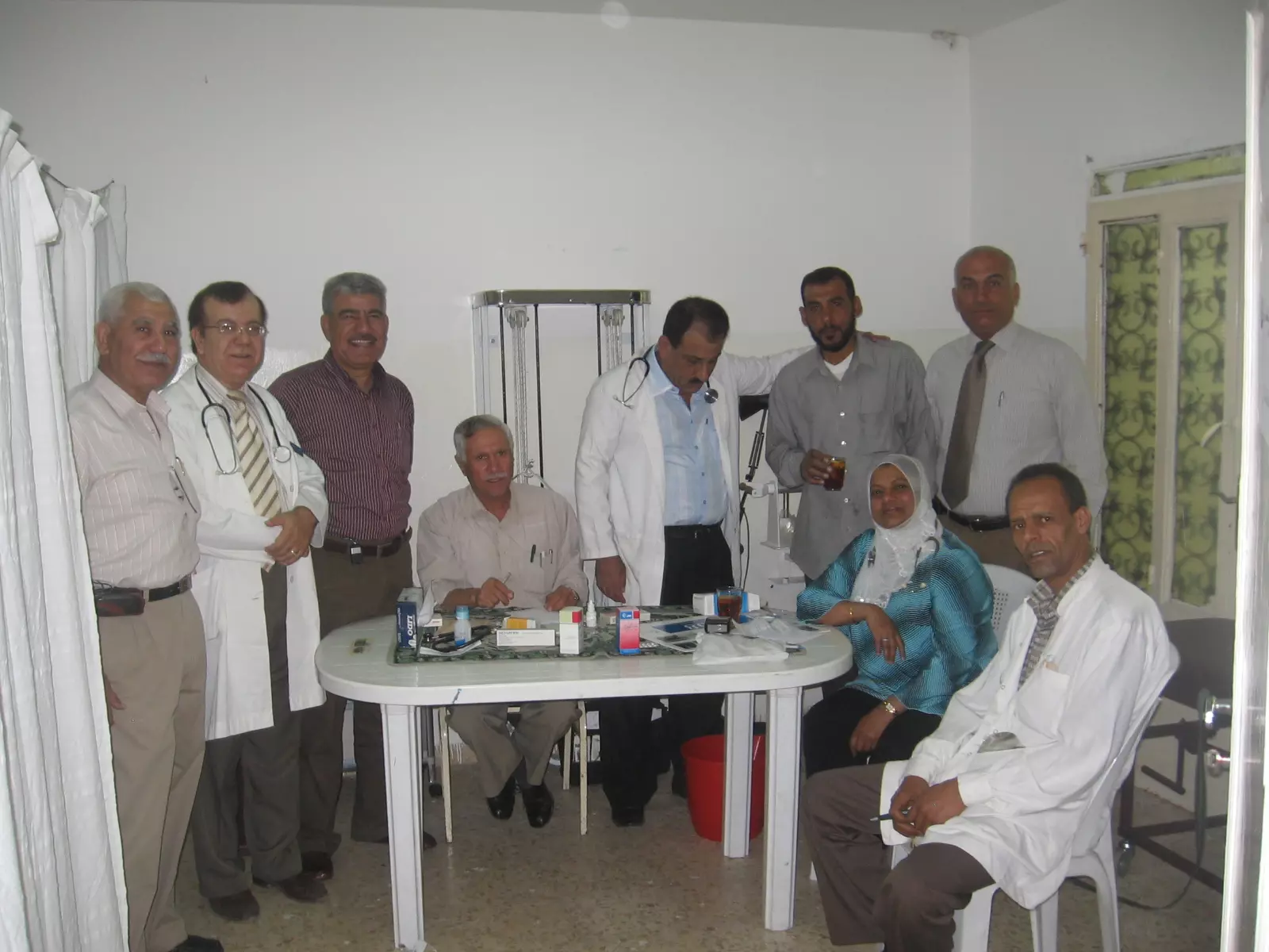
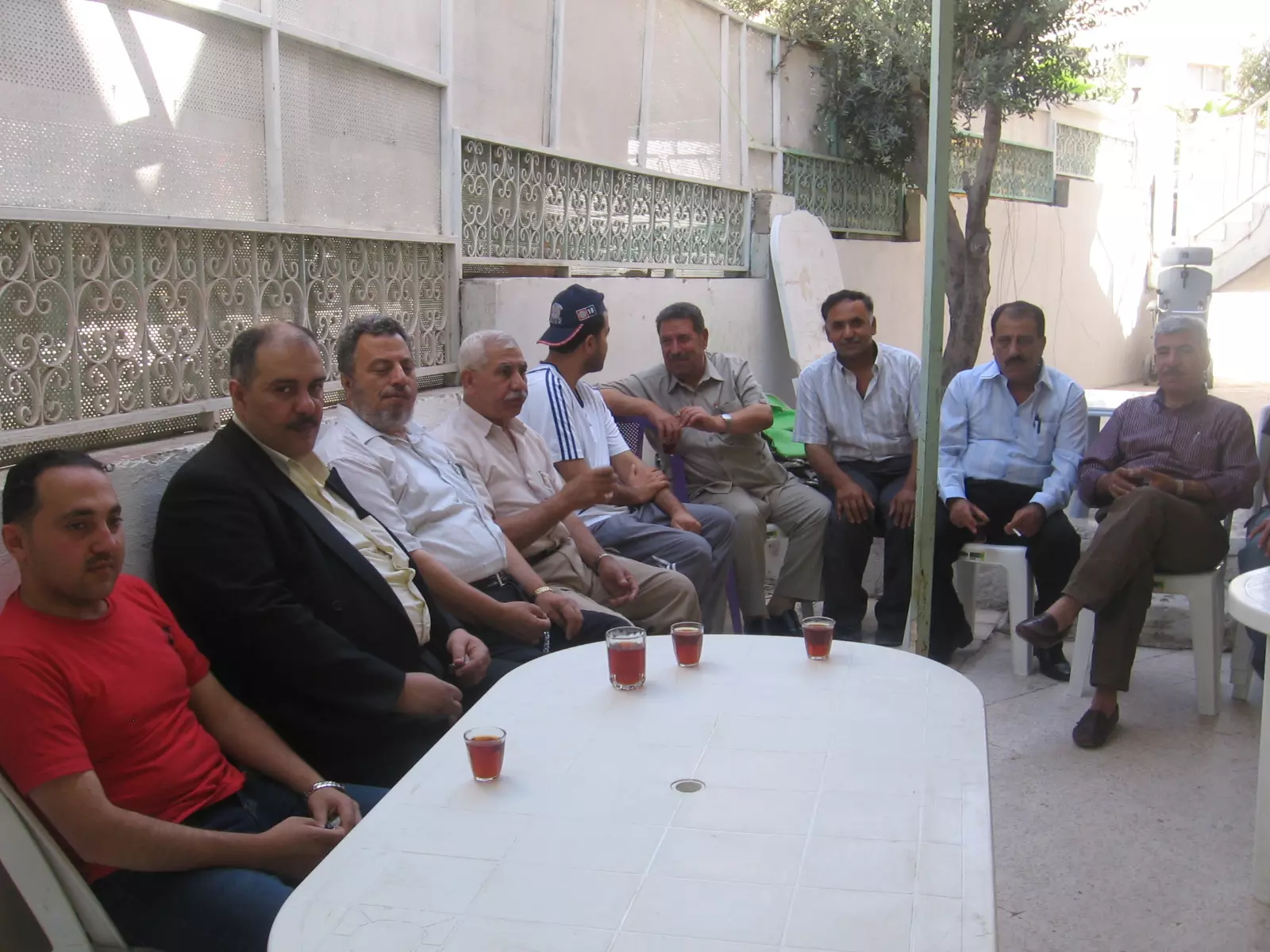
Posted by يوسف معدي 1 - اعضاء الجمعية في متابعة سير النشاط
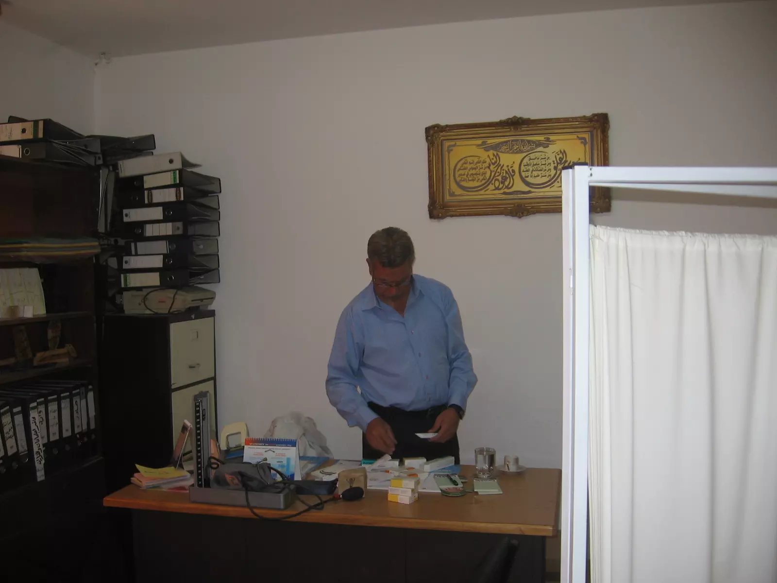
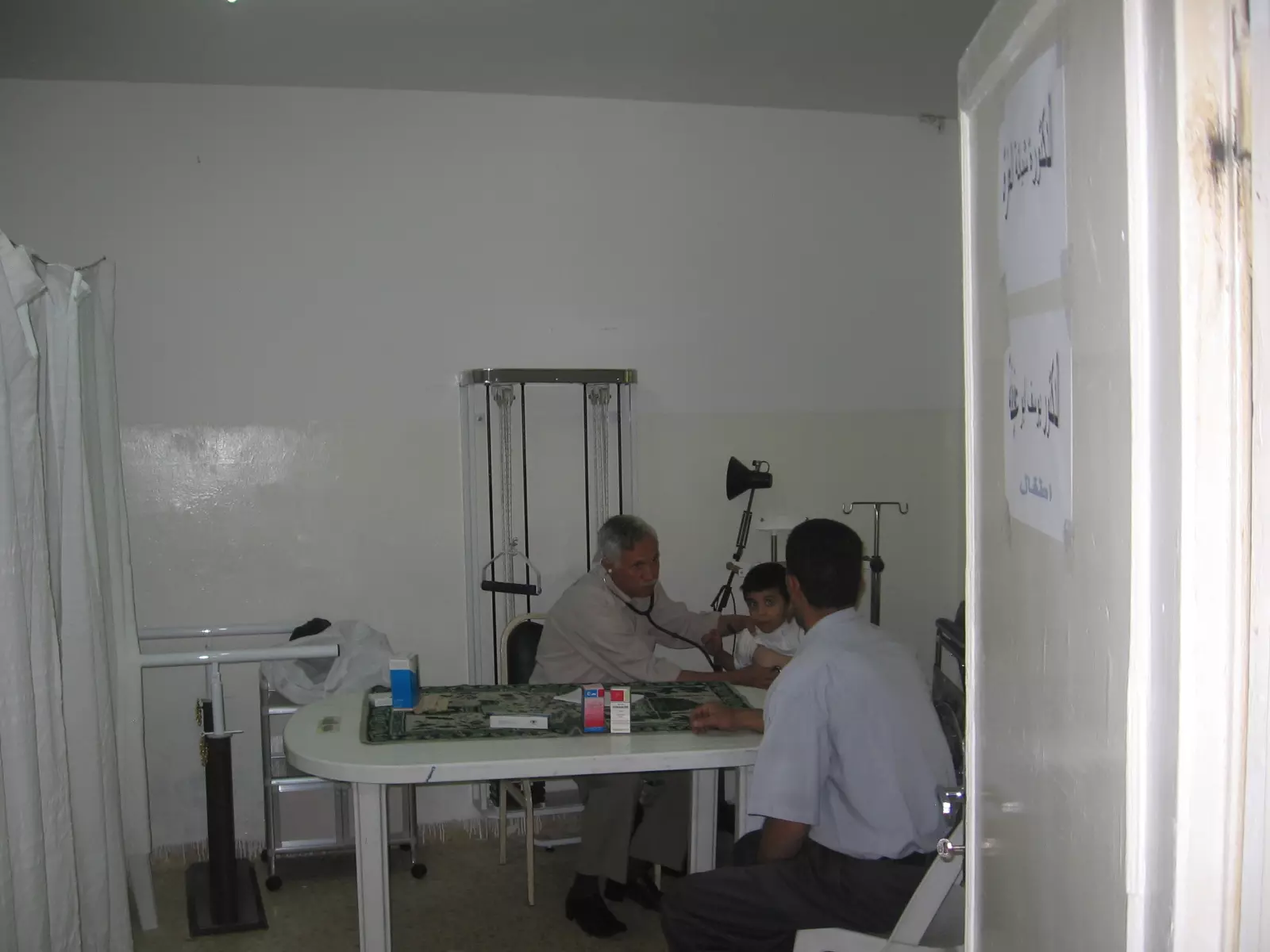
Posted by يوسف معدي - الدكتور يوسف ابو عفيفة اخصائي الاطفال يعاين احد المراجعين في اليوم الطبي المجاني
Posted by يوسف معدي - الدكتور امجد والدكتور محمد اسمران والدكتور علي العايدي في مدخل الجمعية لاستقبال الضيوف
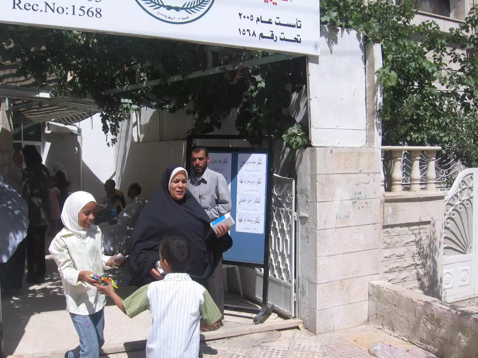
Posted by يوسف معدي - فرحة الاطفال لاستلامهم الهدايا الرمزية وفرحة الام لدى مغادرتهم الجمعية
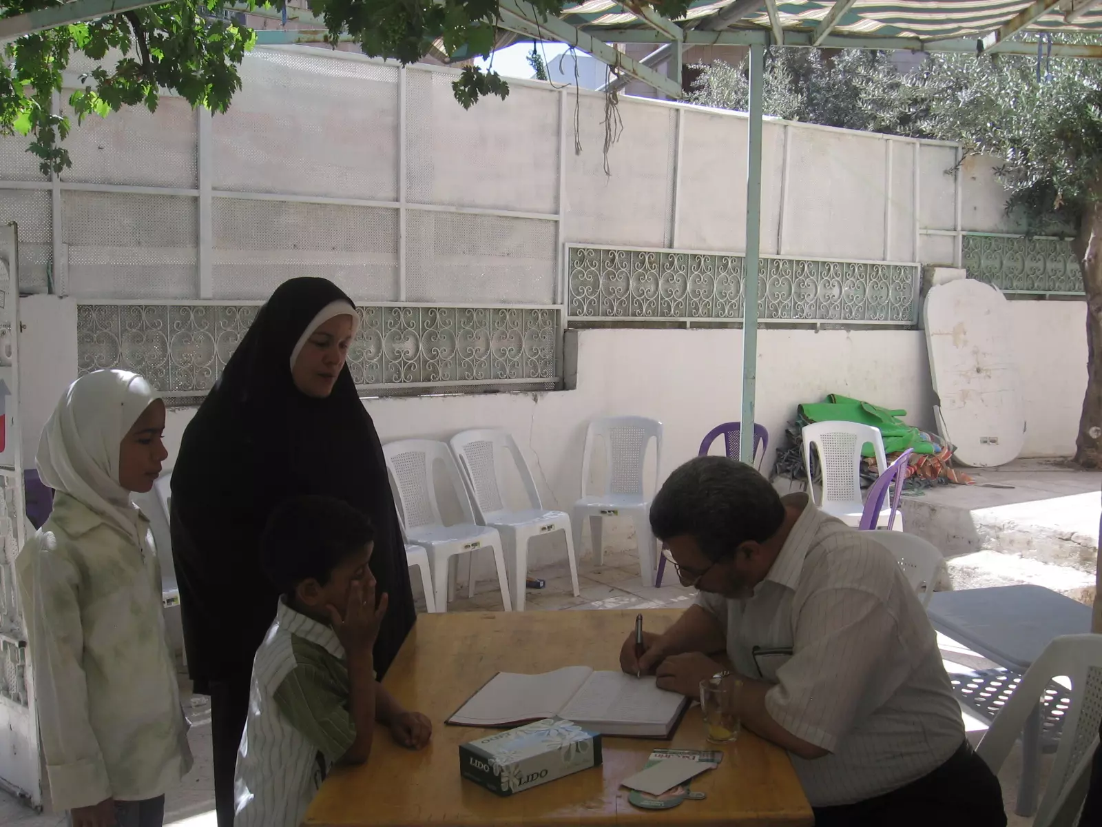
Posted by يوسف معدي - السجل الطبي لتدوين اسماء المراجعين لليوم الطبي المجاني
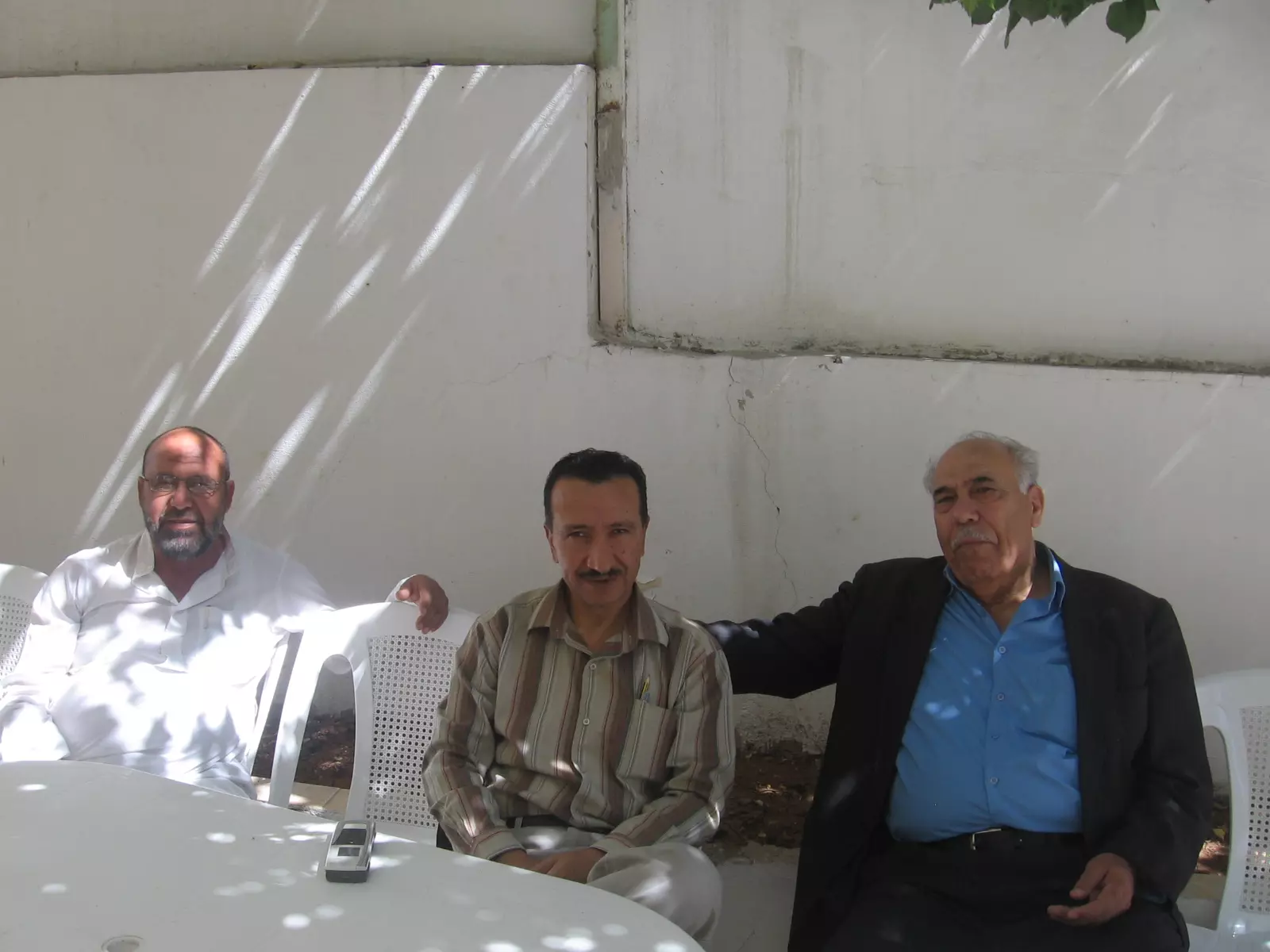
Posted by يوسف معدي - برهان عايش ويوسف معدي ومحمد علان في متابعتهم لليوم الطبي المجاني
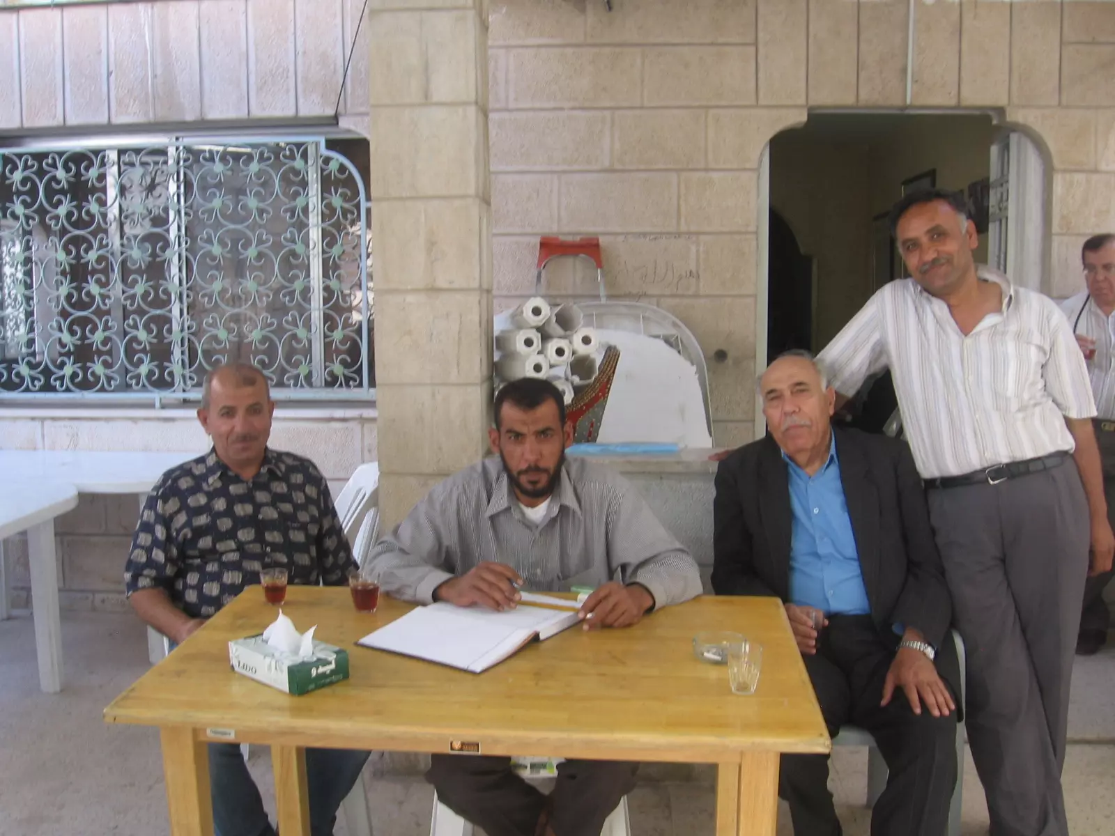
Posted by يوسف معدي - اعضاء الهيئة الادارية يستقبلون الزوار في جمعية تل الصافي الخيرية
Posted by يوسف معدي - اعضاء الهيئة الادارية في مدخل الجمعية اليوم الطبي المجاني
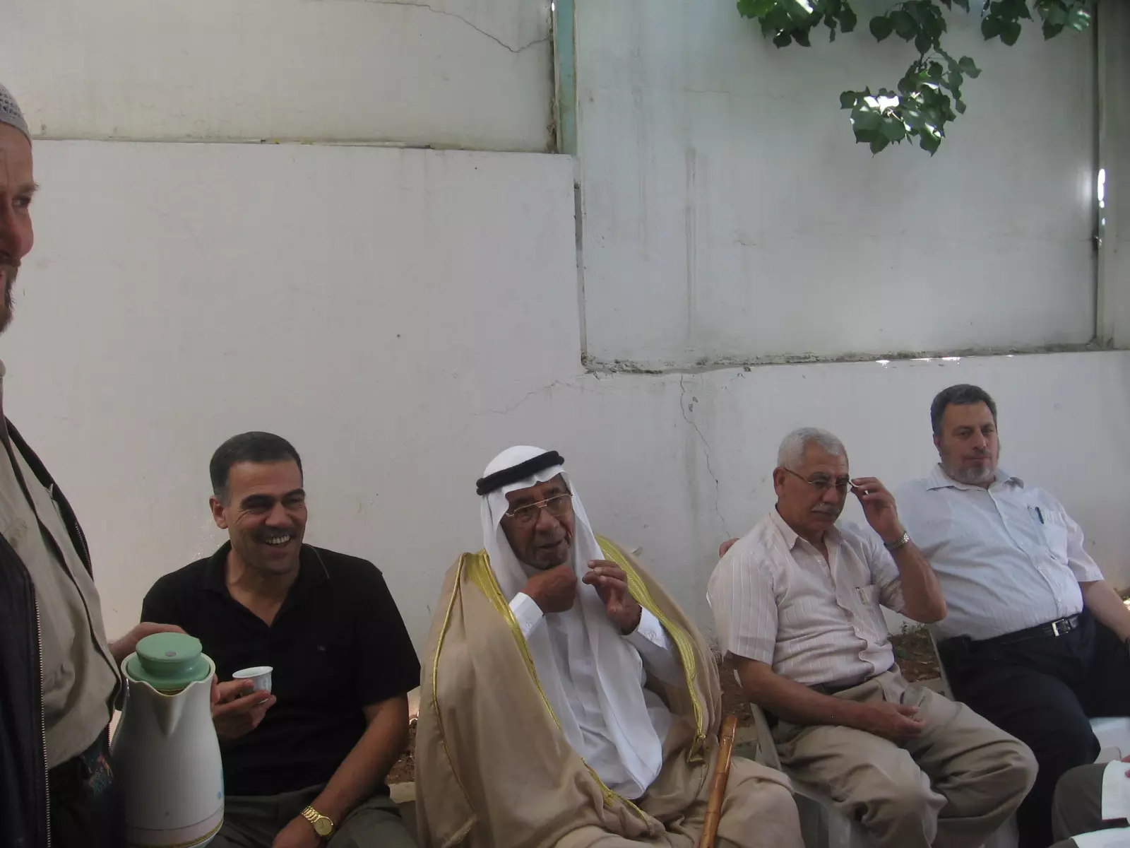
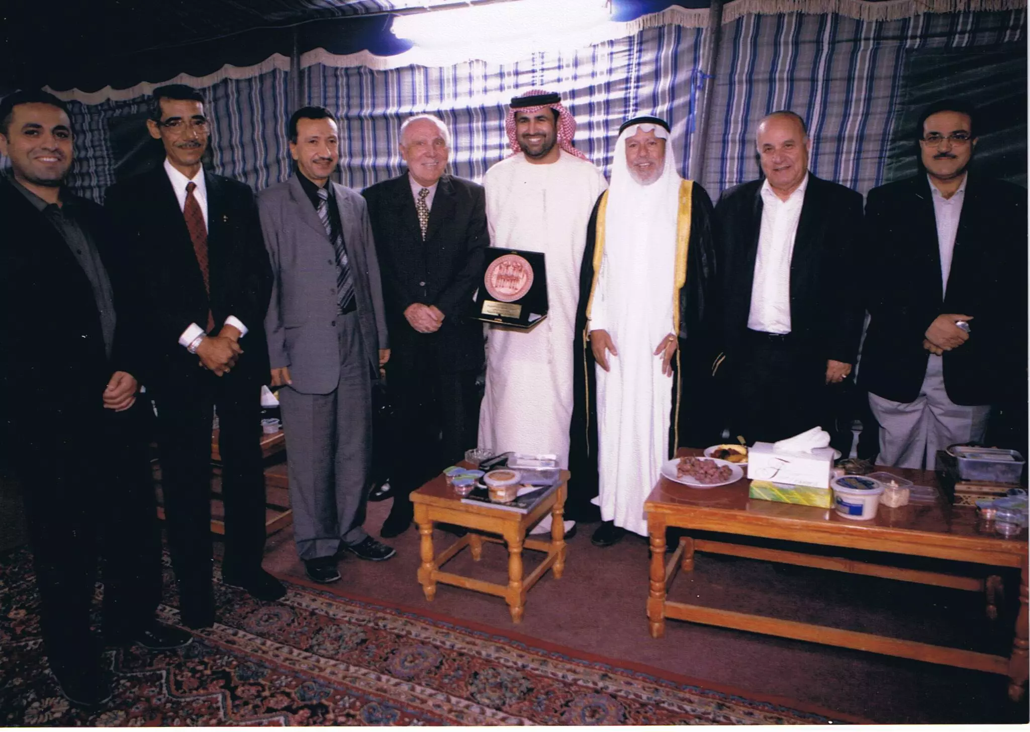
Posted by يوسف معدي - جمعية تل الصافي الخيرية تكرم عميد السلك الدوبلوماسي سعادة سفير دولة الامارات المتحدة رحمة حسين الزعابي تقديرا للجهود التي قدمت للجمعية وللمجتمع الاردني
Posted by يوسف معدي 4 - General view - Khirbet Safi (NE Tall al-Safi) 01/10/08
Posted by Uri Zackhem - Rubble. Khirbet al-Safi, 01/10/08
Posted by Uri Zackhem - In Khirbet al-Safi, 01/10/08
Posted by Uri Zackhem - Cactus and brick wall, 01/10/08
Posted by Uri Zackhem - A deep well, eastern slopes. 01/10/08
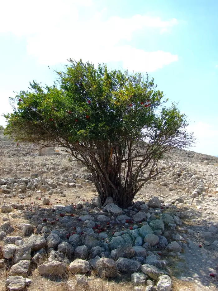
Posted by Uri Zackhem - Pomgranate tree. 01/10/08
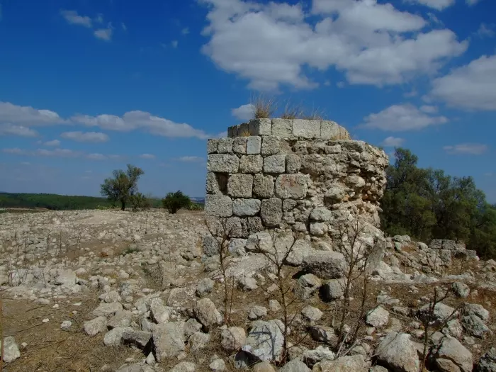
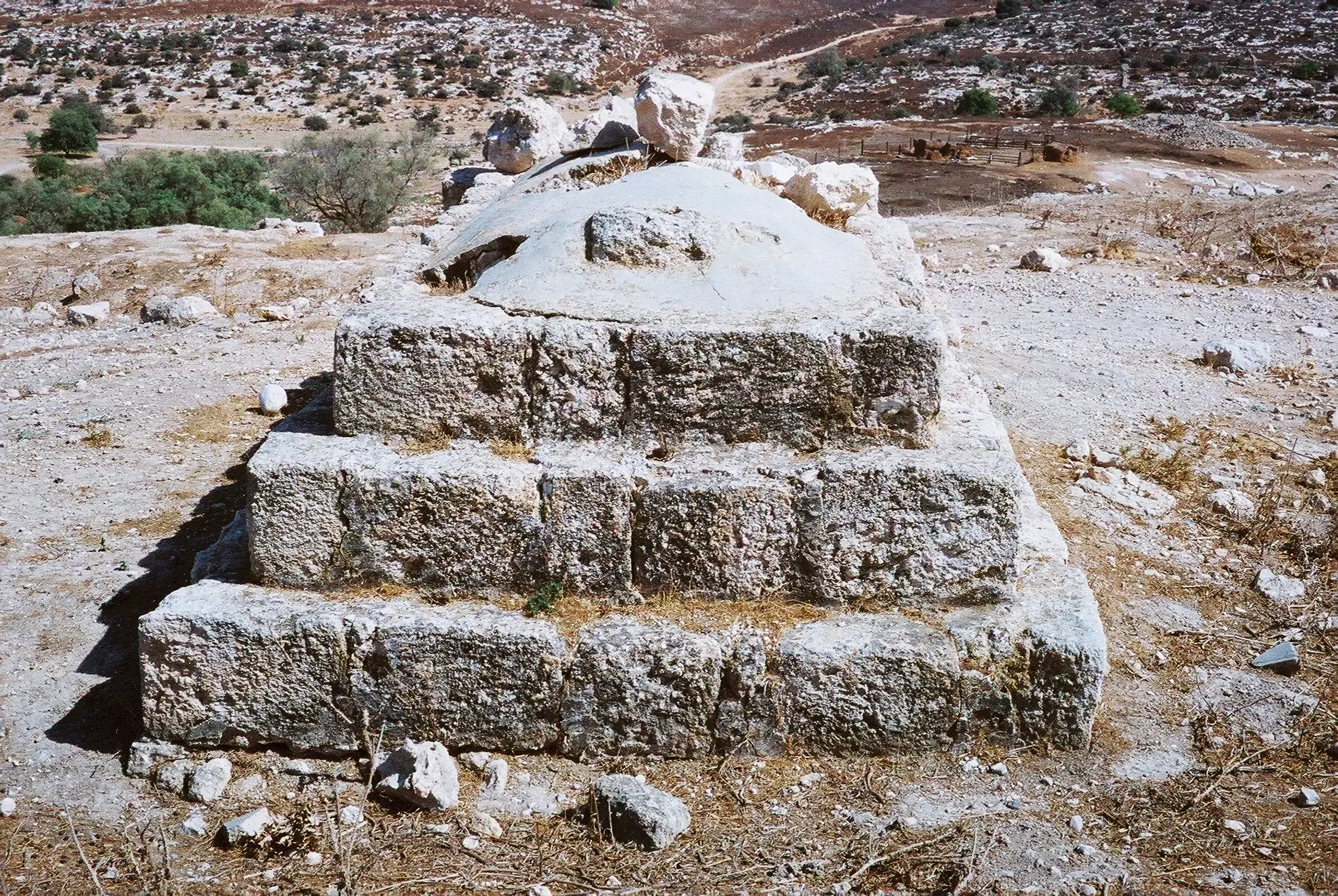
Posted by Uri Zackhem 1 - Remains of Blanche Garde, a Crusader fortress, 01/10/08
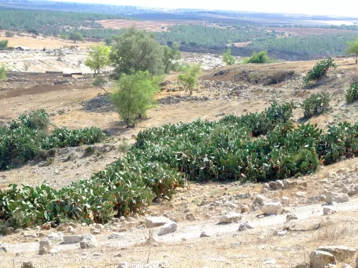
Posted by Uri Zackhem 2 - Cactus hedgrows, 01/10/08
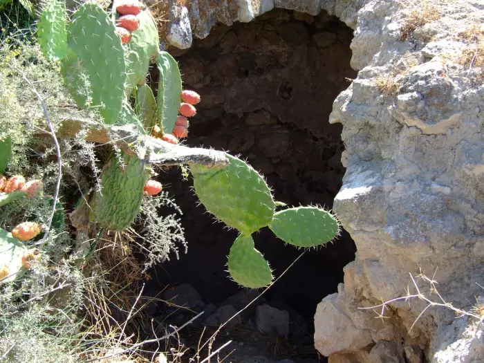
Posted by Uri Zackhem 1 - A cave on the hill, 01/10/08
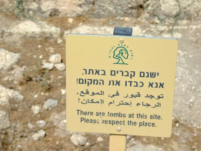
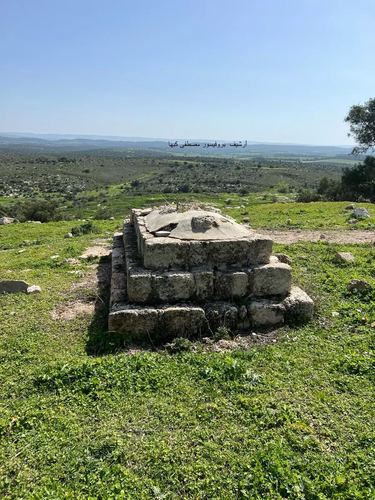
Posted by Uri Zackhem - A sign near a large tomb on the hill, 01/10/08
Posted by Uri Zackhem 1 - A large tomb, 01/10/08

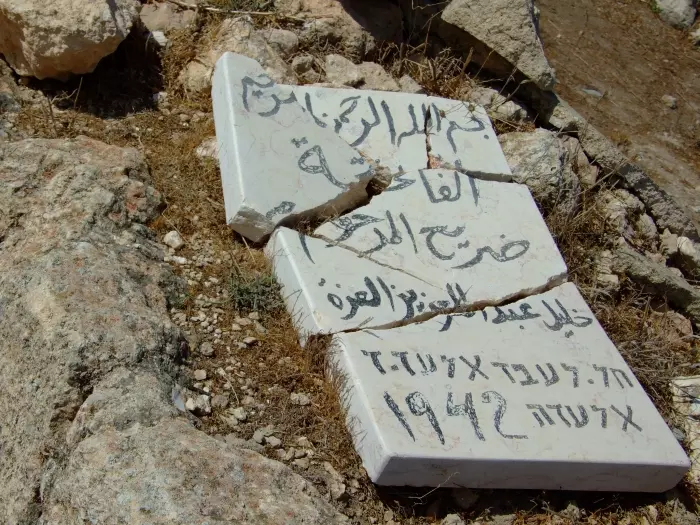
Posted by Uri Zackhem 1 - Inscription on the tomb (El'Aze family), 01/10/08
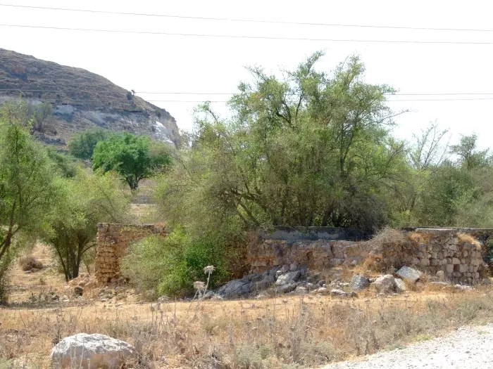
Posted by Uri Zackhem - A large house, at the foot of the hill, near the wadi, 01/10/08
Posted by Uri Zackhem - The tomb on the hill looking eastwards.
Posted by Uri Zackhem - Tall a-Safi looking south-east.
Posted by Uri Zackhem - افتتاح عيادة ذوي الاحتياجات الخاصة في جمعية تل الصافي الخيرية
Posted by يوسف معدي 1 - كعالي وزير التنمية الاجتماعية السيدة هالة بسيسو لطوف وع اعضاء الهيئة الادارية جمعية تل الصافي الخيرية عمان
Posted by يوسف معدي - وجه من بلدي
Posted by jamal maghnam - وجه من بلدي وقصة معبرة
Posted by jamal maghnam - ابو ياسر - زياد
Posted by jamal maghnam 1 - ابو ياسر - زياد 2
Posted by jamal maghnam - صورة من الجو للبلدة
Posted by jamal maghnam - منظر كامل للبلده
Posted by jamal maghnam 2 - تل الصافي
Posted by jamal maghnam - تل الصافي
Posted by jamal maghnam - تل الصافي
Posted by jamal maghnam - صورة للهيئة العامة في انتخابات 2010
Posted by يوسف معدي - صورة(1) للهيئة العامة انتخابات 2010
Posted by يوسف معدي - بلدي
Posted by jamal maghnam - بلدي1
Posted by jamal maghnam - بلدي
Posted by jamal maghnam - بلدي
Posted by jamal maghnam - بلدي
Posted by jamal maghnam - بلدي
Posted by jamal maghnam - بلدي
Posted by jamal maghnam - فريق جمعية تل الصافي الخيرية يشاركون سفارة الامارات العربية المتحدة في الاحتفال بعيد توحيد الجيش
Posted by يوسف معدي - Tel-Alsafi
Posted by jamal maghnam 2 - افتتاح العيادات الشاملة في جمعية تل الصافي الخيرية عمان
Posted by يوسف معدي - تل الصافي
Posted by abu raya - الاثار القديمه في تل الصافي
Posted by abu raya - تل الصافي
Posted by abu raya - تل الصافي
Posted by abu raya - تل الصافي
Posted by abu raya - تل الصافي
Posted by abu raya - تل الصافي
Posted by abu raya - تل الصافي
Posted by abu raya - تا الصافي
Posted by abu raya - تل الصافي
Posted by abu raya - اثار بيوت تل الصافي المهدمه
Posted by abu raya - مغر تل الصافي
Posted by abu raya - مقبره تل الصافي
Posted by abu raya - اراضي تل الصافي
Posted by abu raya - تل الصافي
Posted by abu raya - اراضي تل الصافي
Posted by abu raya - اثار دمار بيوت القريه
Posted by abu raya - اراضي تل الصافي
Posted by abu raya - صبار تل الصافي
Posted by abu raya - تل الصافي
Posted by abu raya - تل الصافي
Posted by abu raya - تل الصافي
Posted by abu raya - تل الصافي
Posted by abu raya - تل الصافي
Posted by abu raya - اراضي تل الصافي
Posted by abu raya - اراضي تل الصافي
Posted by abu raya - تل الصافي
Posted by abu raya - زيارة لقرية تل الصافي المهجرة -- تصوير قيس فحماوي
- زيارة لقرية تل الصافي المهجرة -- تصوير قيس فحماوي #2
- زيارة لقرية تل الصافي المهجرة -- تصوير قيس فحماوي #3
- زيارة لقرية تل الصافي المهجرة -- تصوير قيس فحماوي #4
- زيارة لقرية تل الصافي المهجرة -- تصوير قيس فحماوي #5
- زيارة لقرية تل الصافي المهجرة -- تصوير قيس فحماوي #6
- زيارة لقرية تل الصافي المهجرة -- تصوير قيس فحماوي #7
- زيارة لقرية تل الصافي المهجرة -- تصوير قيس فحماوي #8
- زيارة لقرية تل الصافي المهجرة -- تصوير قيس فحماوي #9
- زيارة لقرية تل الصافي المهجرة -- تصوير قيس فحماوي #10
- مقام الشخ محمد في موقع قرية تل الصافي المهجرة (قضاء الخليل ) --
بروفيسور مصطفى كبها
Want to browse more? 80,000 pictures were grouped in these gallaries:
| Display Name | Clan/Hamolah | Country of Residence |
| اسامه داود | - | Amman, Jordan |
| Hammoda Al-sharqawe | - | Palestine |
| Alqaisi | - | Amman, Amman |
| Imad Dsoqi | - | Modena -, Italia |
| Nidal Alamssi | - | - |
| مصعب خالد ابو الريش | لاجئ | القويسمة, الخليل |
| محمد بهادر | بهادر | غزة |
| يوسف العزه | العزه | عمان , الاردن |
| Bassam | Dauod | genova, italia |
| ابراهيم | بهادر | قضاء الخليل, فلسطين |
| عماد جهاد عيسى لحسه | لحسه | فلسطين, فلسطين |
| رهام | اللحسة | فلسطين |
| زيد مغنم | - | - |
| محمد عايش | - | دبي |
| ابو ريام | العمايره | الزرقاء, الاردن |
| MAHMOOD ALAZZEH | - | - |
| عماد احمد الدسوقي | الدسوقي | مودينا ايطاتيا, ايطاليا |
| عماد عايش محمود سلمان | عايش-البراهميه | الرياض, السعوديه |
| هشام أيوب ابوالحاج | ابوالحاج | الخبر, السعودية |
| omar ismran | ISMRAN | RIYADH, KSA |
| احمد العزة | العزة | - |
| بلال أبو الريش | - | amman |
| مهند تل الصافي | - | - |
| khl | قنديل | amman, jordan |
| NABIL | الحيلة | AMMAN, JORDAN |
| Abdalhafez Shaher Mahmoud Kandil | Kandil | Tabuk, Saudi Arabia |
| هيثم حرب العزه | العزه | ِAmman,Jordan |
| Salwa Al-Azzeh | Al Azzeh | Jordan, Jordan |
| ميرال | العزه | تل الصافي |
| qosayazzeh | العزة | amman - jordan |
| Raed | - | Doha, QATAR |
| dj vampire327 | اللحسة | aroub camp, Palestine |
| Abu Zaki | Al-Amassi | Amman, Jordan |
| hassan alazzeh | - | balqa, balqa |
| محمد جمعة نوفل | - | الاردن, الاردن |
| الشرس | علان | عمان |
| محمد عيسى قنديل | - | الاردن, الاردن |
| ايوب ابو الحاج | - | - |
| Ahmed Al-seidi | - | Amman |
| احمد اللحسة | - | - |
| soliman abdel fattah alazzeh | azzeh | - |
| Hisham AL Dasouqi | الدسوقي | AMMAN, JORDAN |
| zizo | الدسوقي | الصين |
| دجلة | عايش | البلقاء, تل الصافي |
| محمود | اللحسه | عمان, الاردن |
| جمال | اللحسه | عمان, الاردن |
| وليد | اللحسه | عمان, الاردن |
| محمد | - | - |
| اميل | اللحسه | عمان, الاردن |
| Fouad Azzeh | Azzeh | Al-ain, UAE |
| KAMAL | AL-LAHSEH | AMMAN, JORDAN |
| محمد | اللحسة | عمان, الاردن |
| Anas | - | Hebron |
| رائد | البراهمية | ابوظبي |
| ابو مصطفى | ابوعفيفة | - |
| Aysar hirzallah | - | Amman, Jordan |
| abo zeyad | abo_alhaj | - |
| Zaid Maghnam | - | - |
| AM | - | - |
| احمد ابوعفيفه | - | مصر, مصر |
| مهند ابوعفيفه | ابوعفيفه | الرياض, السعودية |
| محمود Mahmoud اسمران Ismran | اسمران Ismran | لندن, بريطانيا |
| Mohanad Maghnam | Maghnam | Amman, Jordan |
| SHAHIR | اللحسه | Hebron |
| azzeh alazzeh | azzeh | amman, jordan |
| رامي حسين | - | - |
| aabuafifeh | Abu-Afifeh | Amman, Jordan |
| Eng. Abdulkareem Abualhaj | Abualhaj | Amman, Jordan |
| Abu Husam | Al amassy | palestine, palestine |
| Professor Mohammad abualhaj | Abualhaj | IL, U.S |
| abu nedal | alamassy | palestine, palestine |
| يوسف معدي | Maddi | Amman, Jordan |
| Salah Qandeel | - | - |
| ibrahem aeysh | aeysh | amman, jordan |
| Ahmad DASOQI | DASOQI | Amman, Jordan |
| Ezz-Edine | Al-Azzeh | Al-Ain, Emirates |
| Yousef Alazzah | Alazzah | - |
| waleed mohamed saleh salameh | - | jordan, jordan |
| barakat salah | salah | falasteen, falasteen |
| - | alazzah | amman-jordan |
| Abu Ramsey | Al-Amassi | Nebraska, USA |
| Dr. Farouq Hijazi | Hijazi | - |
| MAHMOUD AL AZZEH | AL AZZEH | - |
| khader al azzeh | العزه | kuwait, kuwait |
| Ayman Al-Azzeh | - | - |
| jamal maghnam | maghnam | amman, Jordan |
| abdallah maddi | - | - |
| Abu Laith | Dasoqi | Illinois, USA |
| iyad aldasouqi | aldasouqi | amman, Jordan |
| Al-azzeh | al-azzeh | amman, jordan |
| Sameh Al-Azzeh | Al-Azzeh | Riyadh, Saudi Arabia |
| Ayman Abu Ghunaim | Abu Ghunaim | Jordan |
- Tracing All That Remains of Tall al-Safi since Nakba
- افتتاح عيادة ذوي الاحتياجات الخاصة في جمعية تل الصافي الخيرية
- منظر عام لموقع لقرية تل الصافي Duration: 2 min 43 sec
- بئر تل الصافي Duration: 2 min 20 sec
No links have been shared yet, be free to the first to share the first link.
 Fake Valor: Why Did Zionist Jews Hoist Nazis Flag on Their Ships in the 1930s?
What is new?
-
Facts About Oct. 7th Gaza Raid
-
Remined Us Please:: Who Did Rape Who? Palestinians Raped Israelis? Or, was the other way around?
-
When Prof. Edward Said was invited to debate Bibi Netanyahu in the 1980s, watch what happened!
-
Abusing Blood Libel!
-
Zionist FAQ: Isn't it true that Palestinians don't want peace? Palestinians never accepted the two-state solution
- Facts about Haavara (Transfer) Agreement between Ben-Gurion & Hitler
-
Haavara FAQs: Why Did Zionist Jews Hoist Nazis' Flags on Their Ships in the 1930s?
-
Dear ChatGPT: Why did the Jewish Agency suppress news of the Holocaust during WWII?
-
Video Playlist: Jews share their DNA tests to end the conflict for good.
-
A Tale of Two Conflicts: Examining the Definition of Genocide
-
Prof. Abraham Polak And The Suppressed History of the Khazars and European Jewry
-
How Ronald Reagan would have framed the genocide in Gaza if he were still alive?
-
Haavara FAQs: Let us do the math: how many German Jews did The Haavara Agreement save?
-
Zionist FAQs: The Hebron Massacre of 1929, "clearly proves" that Palestinians are antisemitic, how could you deny it?
-
Zionist FAQs: Why Anti-Zionist Is Not Antisemitism?
-
Zionist FAQs: Isn't it true that the KGB create Palestinian Nationalism in the early 1960s?
- Zionist FAQs: Muslims are killing Muslims all the time; why are Israeli Jews being singled out in the media?
- Zionist FAQs: How is Israel an apartheid state when 20% of its citizens are Arabs who enjoy full rights?
-
Haavara FAQs: Analysis of Herzl's Uganda Scheme and how it could have saved millions of Jews.
-
Haavara FAQs: Why did Hayim Greenberg describe American Jewry as "morally bankrupt" in early 1943?
-
Haavara FAQs: What if the Evian Conference was a resounding success? What would have been the impact of saving European Jewry on Zionism?
- Haavara FAQs: What if the six million were saved, how that would have impacted the Zionist project?
-
Haavara FAQs: How did Zionist leaders react when Europe's Jews lingered in the DP camps after WWII ended?
-
Why does the American Jewish community repeat lies that David Ben-Gurion had debunked before he died?
-
Who has the power to rename the Tatar/Khazar Gene Marker to Jewish IV?
-
Zionist FAQs: Why won't Egypt, Syria, and Jordan take their people back? Jews are indigenous to Palestine, and Arabs immigrated after Jews developed the country. Arabs should leave.
-
Haavara FAQs: Did Hitler and the Nazis conflate between Judaism and Zionist? If that wasn't case, then why?
-
Haavara FAQs: Winston Churchill and antisemitism, a collection of articles written Churchill.
-
Haavara FAQs: Broken by country, how many Jews survived vs. killed during the Holocaust?
-
Haavara FAQs: Why did European Jews vote with their feet and to immigrated to the Americas, not Palestine, after WWII?
-
Watch this American Jewish Girl describing Israeli Jews' cognitive dissonance like no other in under two minutes
-
Haavara FAQs: When the Nazis went out of their way to hide the Holocaust, Israeli Jews did the exact opposite by broadcasting their genocide of Gazans. But why?
-
Haavara FAQs: How Zionist Jews went out of their to show their appreciation to Nazism and Fascism?
- Haavara FAQs: Why Zionist leaders were against bombing the death camps & the Railroads leading to them?
-
Haavara FAQs: Hitler's message to the British and American people: If Jews are such noble citizens and you care about them, how come you're not letting them in? I will gladly ship them to you at my expense, even on luxury liners!
-
A shortlist of Zionist and Israeli false flag operations in the name Jews.
-
The Most Moral Army
- The Land of Kapos (Israel): Where the brave are boycotted and Kapos walk free.
- Why did early Zionists often named their communal enterprises "colonial"?
- Zionist Relations with Nazi Germany by Faris Glubb
-
Two NY Times advertisements by Zionists in the early 1943 that exposes Zionists' treason at the height of the calamity
- Facts Not Lies about the Palestinian-Israeli Conflict.
- Site's pictures have been categorized
- Campgain Against Lice
- A Survey of Palestine, the official source about Palestine before Nakba produced by the British Mandate; over 1200 pages.
- Satellite View & Google Earth: Over 6,000 placemarks identifying all destroyed towns, W. Bank & Gaza Strip Towns, & refugee camps.
- PalestineRemembered.com and its Nakba Oral History Project were featured on al-Jazeera Satellite TV.
- Nakba Oral History Video Podcast:
 Over 700 Oral History interviews (including 3,500+ hours of recording) can be viewed online.
 - Palestine Village Statistics Project
- Gaza Jail Break
- النسخة العربية للموقع الان متوفرة
- Videos: Documenting the destroyed villages in video: Tracing all that remains since Nakba.
- Videos: Responding to Zionist Propaganda
- Interview: The ethnic cleansing of Palestine: George Galloway interviews Israeli Historian Ilan Pappe.
- For Palestinians, memory matters. It provides a blueprint for their future By George Bisharat.
- Zionist FAQ now available in Hebrew שאלות שציונים שואלים, עכשיו בעברית
- Video: The Stephen Walt and John Mearsheimer report on the influence of the Israel Lobby on U.S. Foreign Policy
- The Palestinian-Israeli conflict for beginners
