| PalestineRemembered | About Us | Oral History | العربية | |
| Pictures | Zionist FAQs | Haavara | Maps | |
| Search |
| Camps |
| Districts |
| Acre |
| Baysan |
| Beersheba |
| Bethlehem |
| Gaza |
| Haifa |
| Hebron |
| Jaffa |
| Jericho |
| Jerusalem |
| Jinin |
| Nablus |
| Nazareth |
| Ramallah |
| al-Ramla |
| Safad |
| Tiberias |
| Tulkarm |
| Donate |
| Contact |
| Profile |
| Videos |
Welcome To Dayr Rafat - دير رفات (דיר ראפאת)
|
District of Jerusalem
Ethnically cleansed days ago |
العربية Google Earth |
 |
Gallery (50) |
- Statistics & Facts
-
Before & After

- Satellite View
- Articles 1
- Pictures 50
- Members 8
- All That Remains
- Wikipedia
- Videos 7
- Guest Book 4
- Links
| Statistic & Fact | Value | ||||||||||||||
| Occupation Date | July 18, 1948 | ||||||||||||||
| Distance From District | 26 (km) West of Jerusalem | ||||||||||||||
| Elevation | 300 (meters) | ||||||||||||||
| Before & After Nakba, Click Map For Details |
|||||||||||||||
|
|||||||||||||||
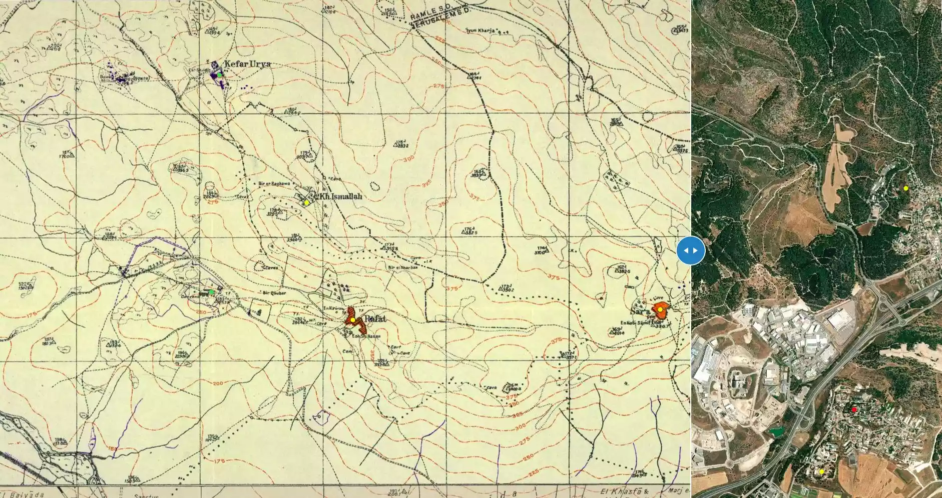
| Map Location | See location #13 on the map View from satellite |
||||||||||||||
| Military Operation | Second stage Operation Dani | ||||||||||||||
| Attacking Units | Har'el Brigade | ||||||||||||||
| Exodus Cause | Military assault by Zionist troops | ||||||||||||||
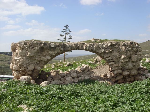
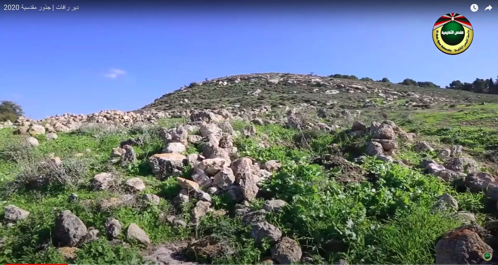
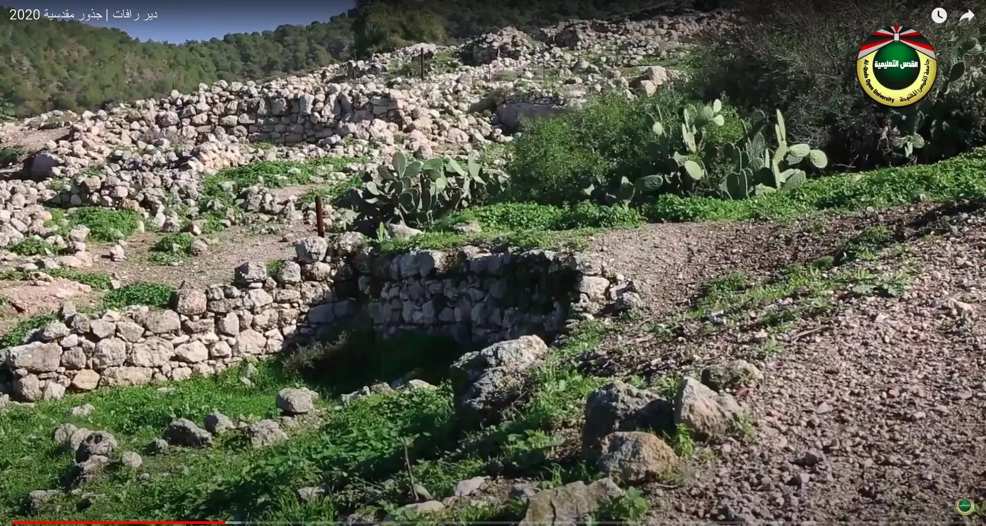
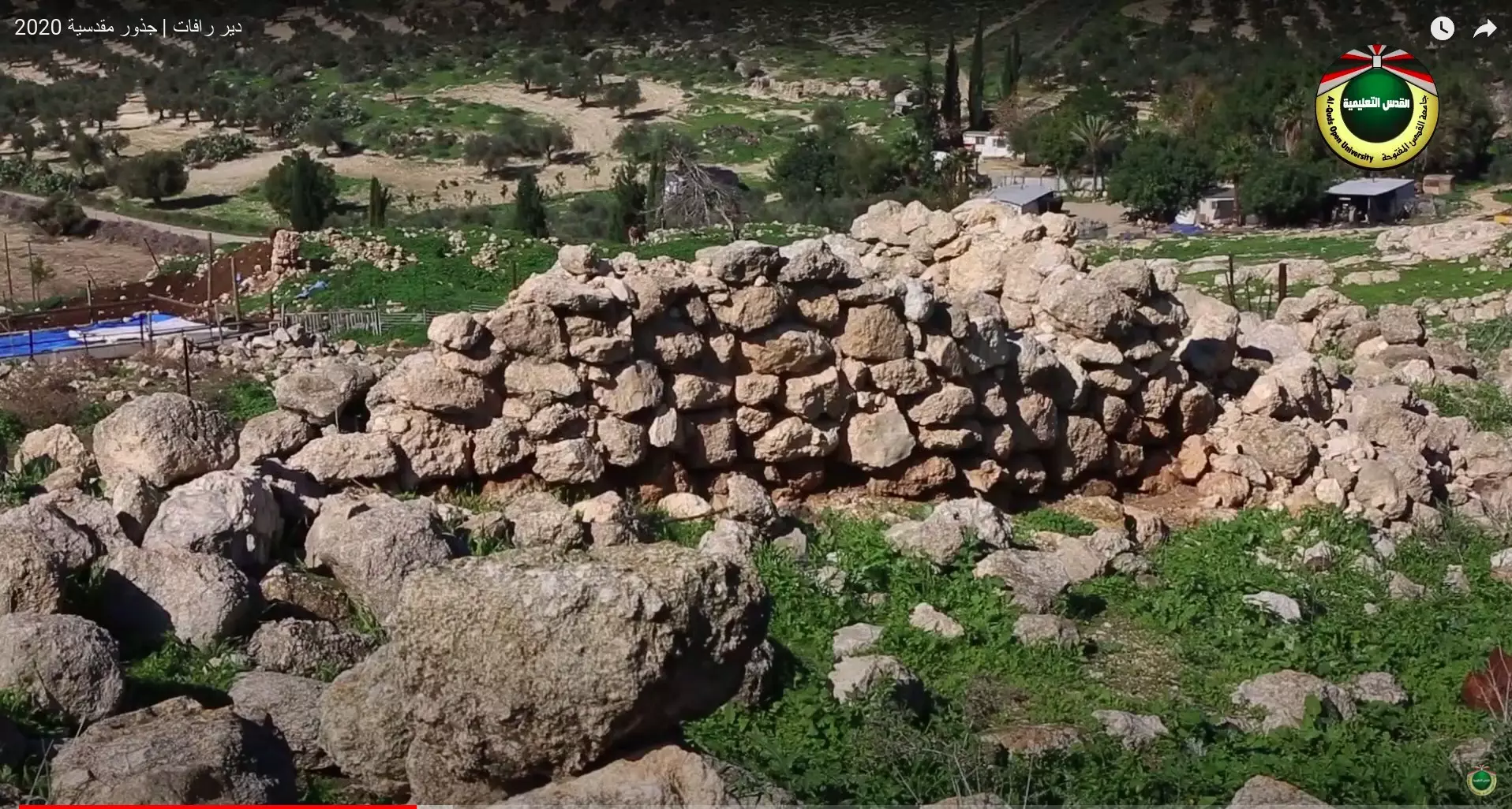
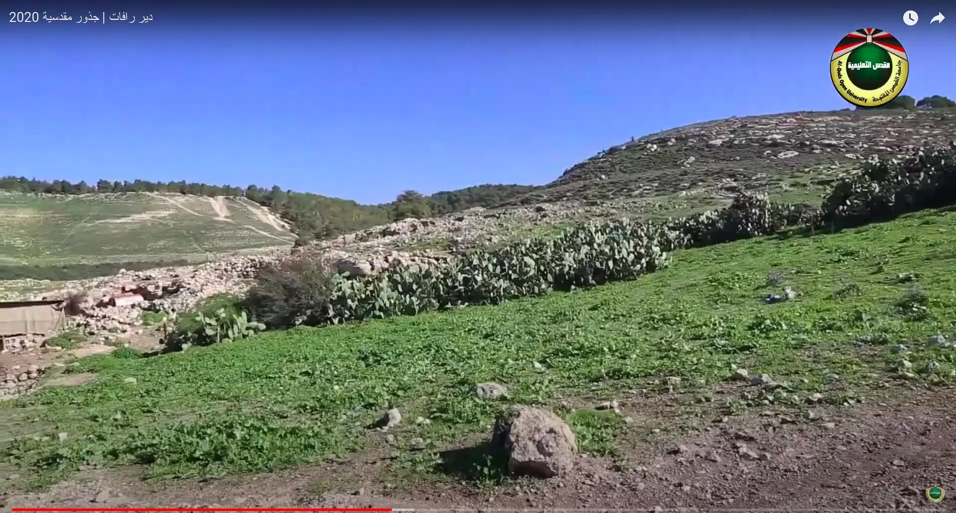
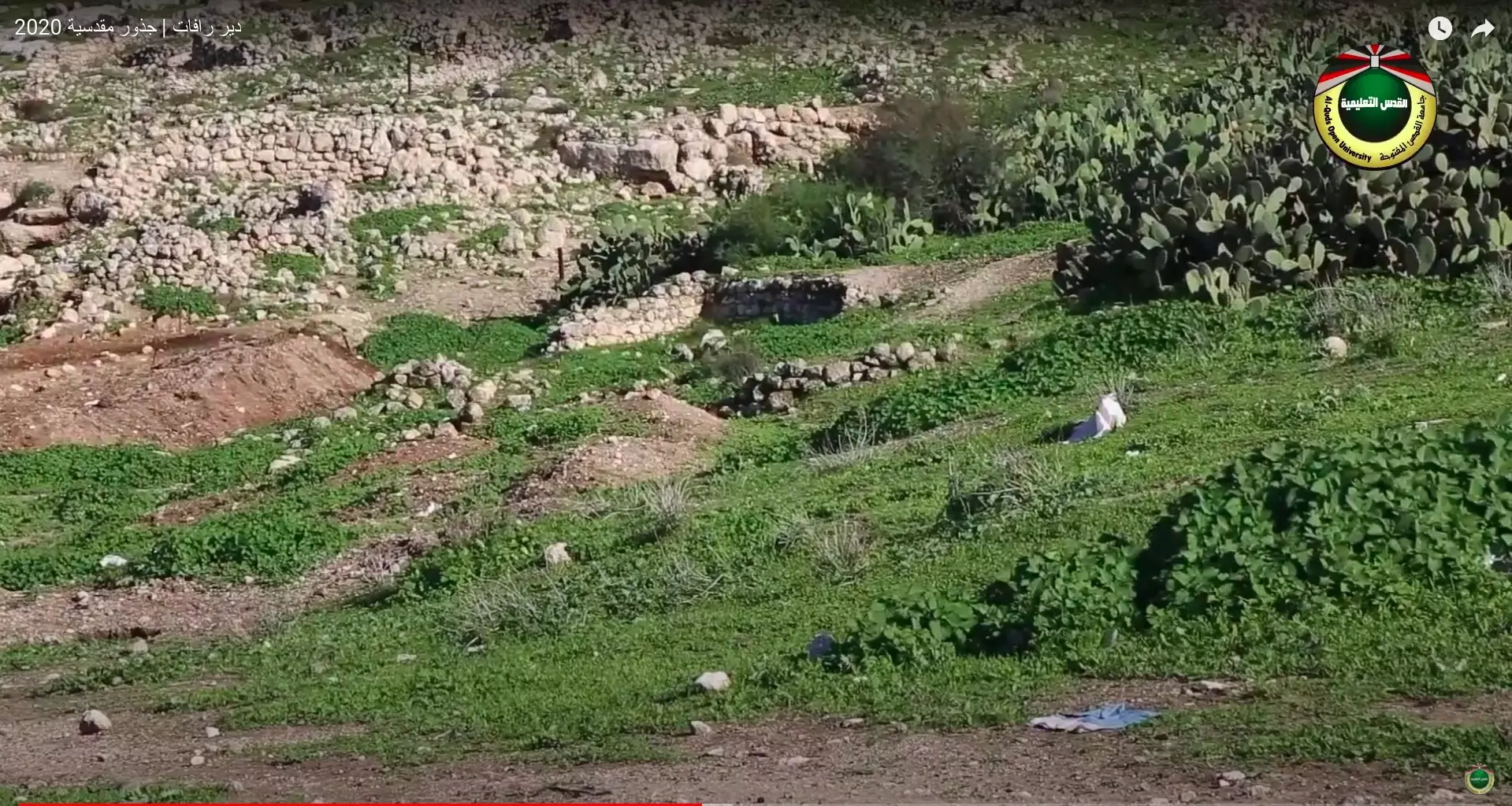
| Village Temains | Dayr Rafat was completely destroyed in the second half of October 1948, and only house rubble left behind. | ||||||||||||||
| Ethnically Cleansing | Dayr Rafat inhabitants were completely ethnically cleansed. | ||||||||||||||
| Pre-Nakba Land Ownership |
**Town Lands' Demarcation Maps |
||||||||||||||
| Land Usage As of 1945 |
|
||||||||||||||
| Population |
|
||||||||||||||
| Number of Houses |
|
||||||||||||||
| Near By Towns |
|||||||||||||||
|
|||||||||||||||
| Town's Name Through History | The village had a mosque named after a al-Hajj Hasan. | ||||||||||||||
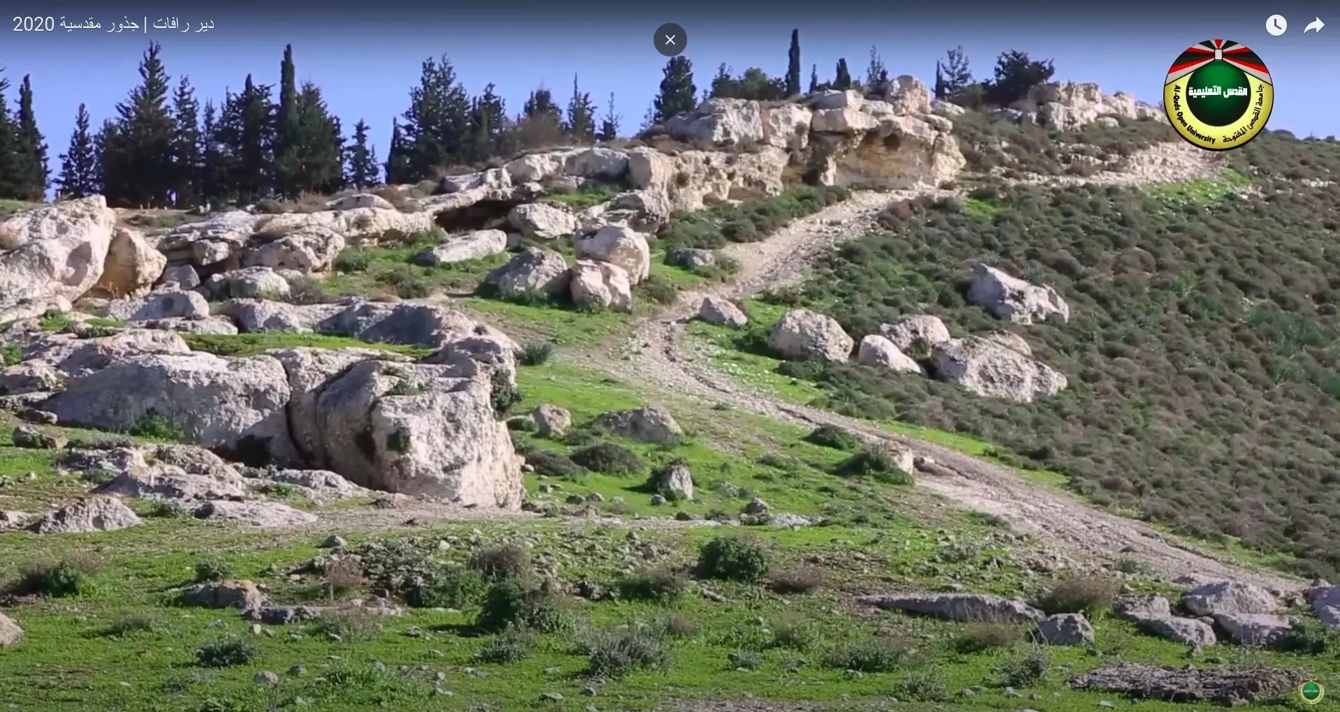
| Archeological Sites | Dayr Rafat has three khirbas which contains the foundations of buildings, grape presses, rock-hewn cisterns, wells, a grindstone, and burial grounds. | ||||||||||||||
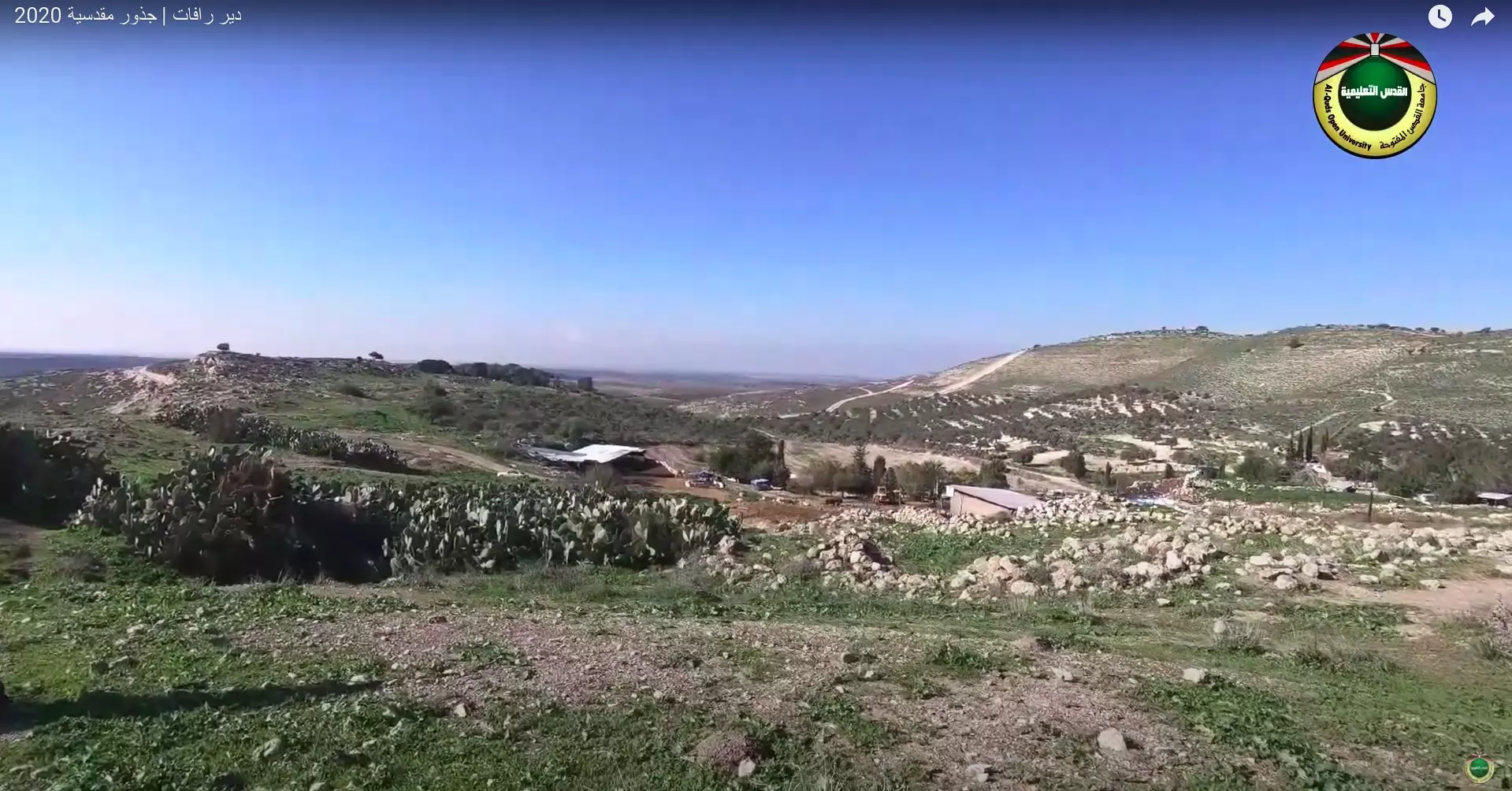
| Exculsive Jewish Colonies That Usurped Village Lands |
Giv'at Shemesh | ||||||||||||||
| Featured Video | |||||||||||||||
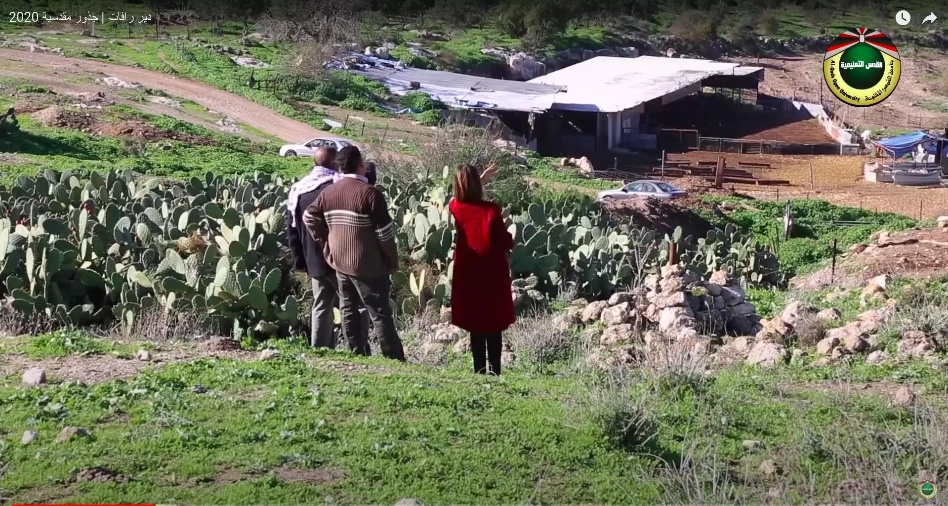
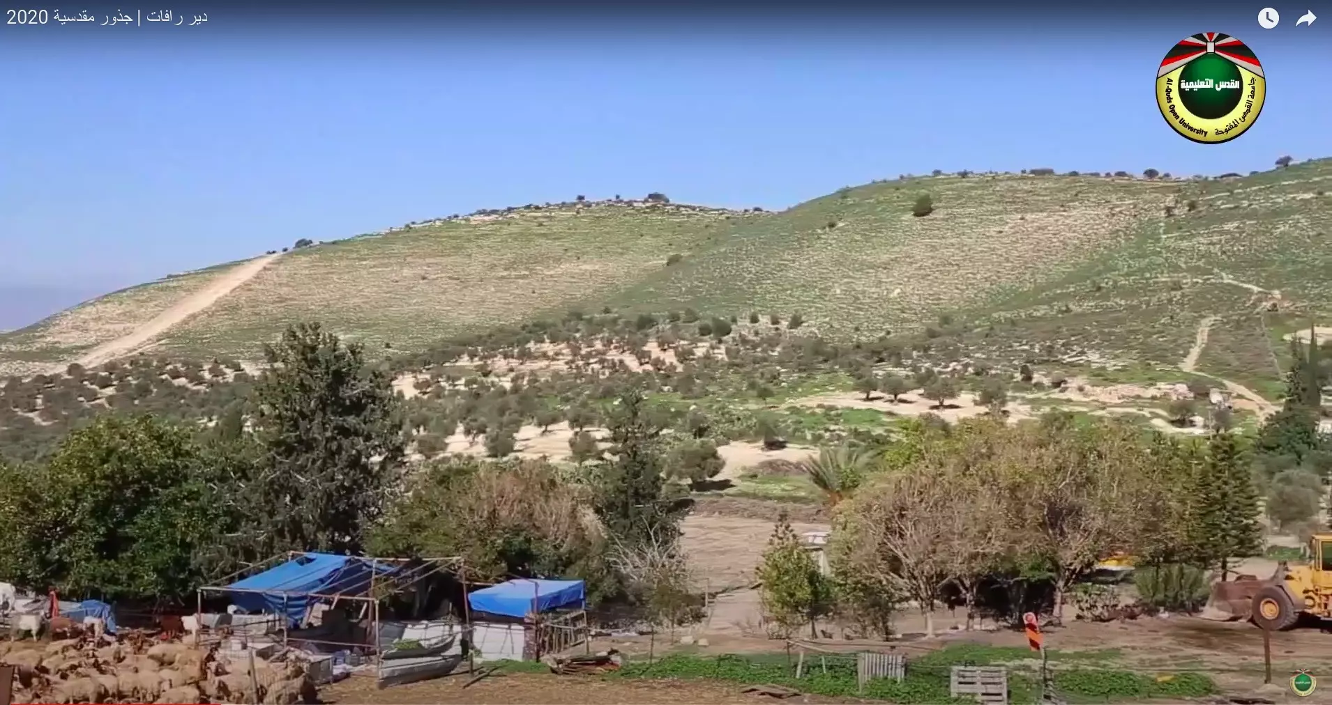
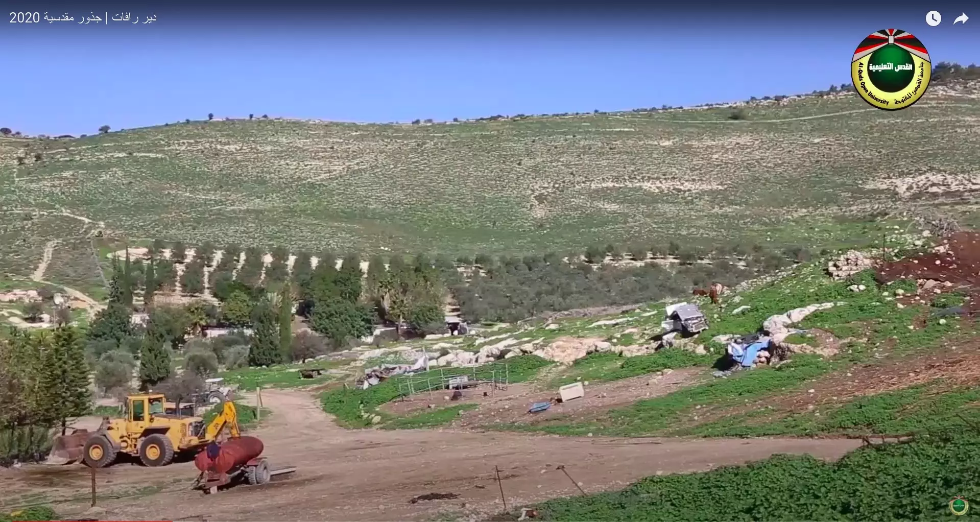
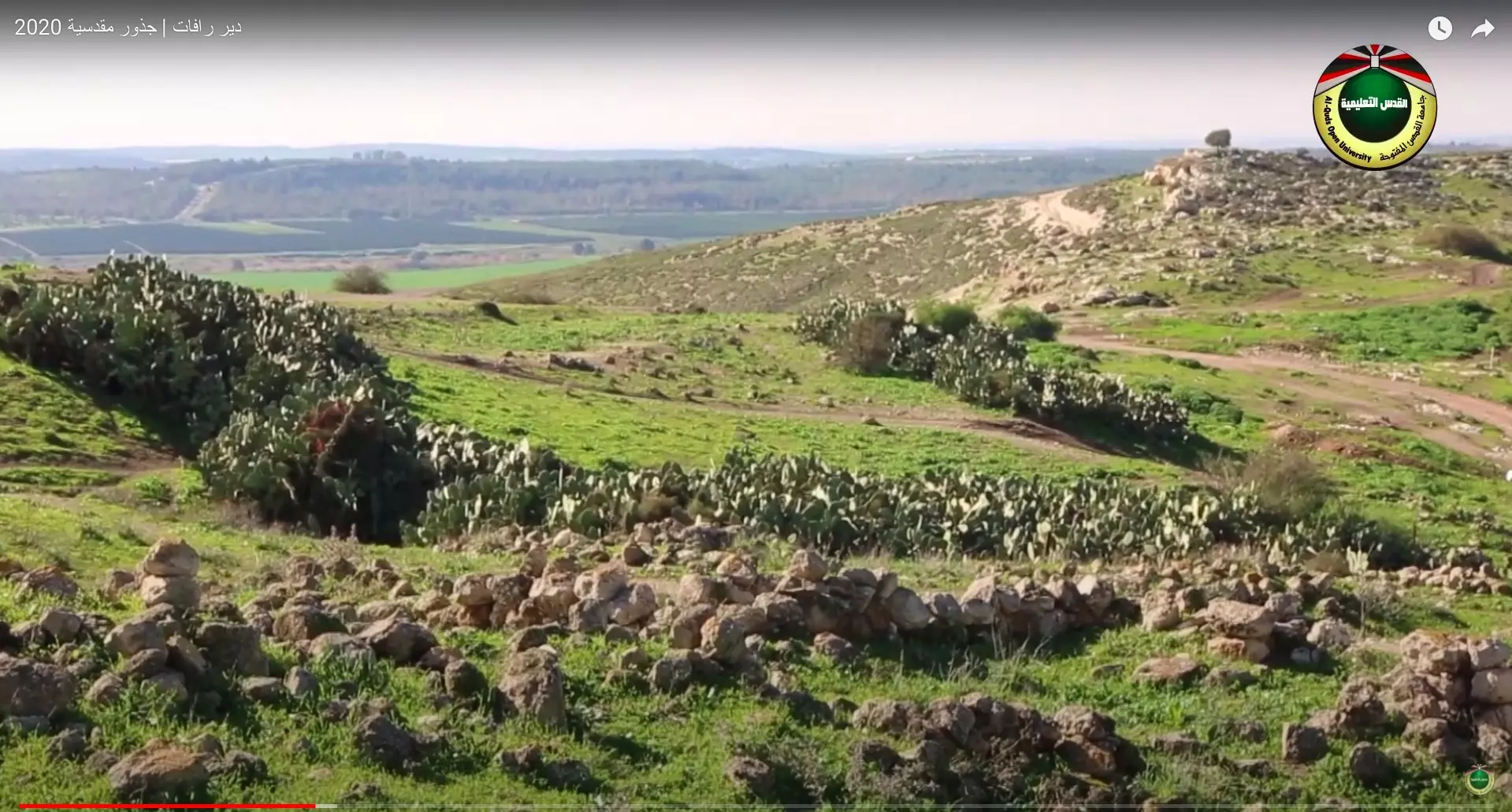
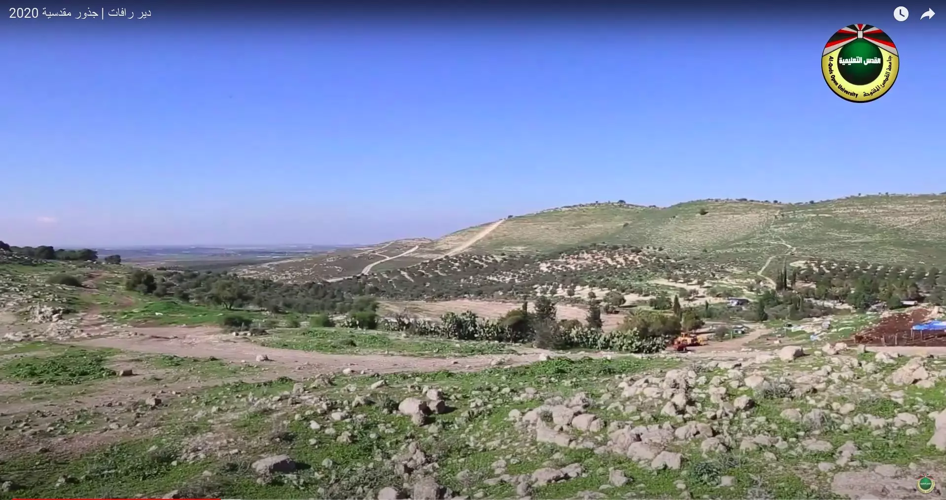
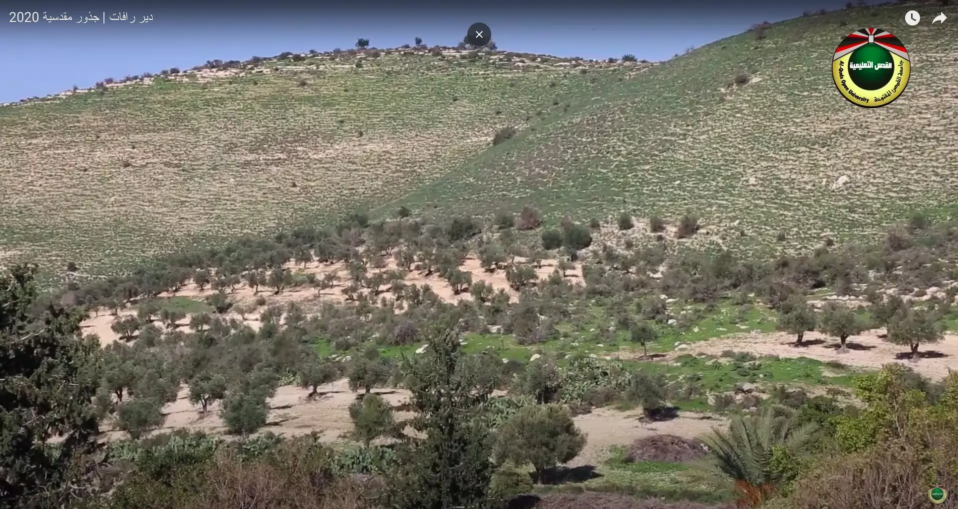
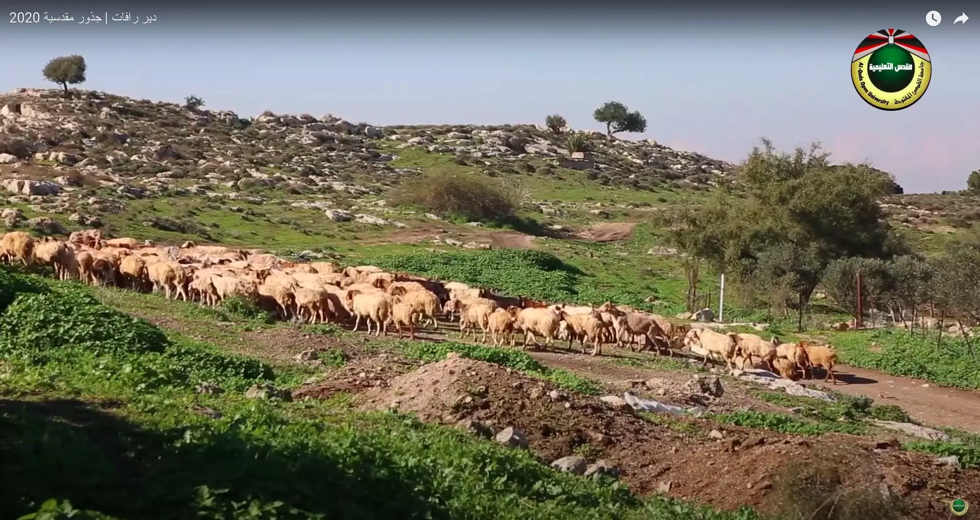
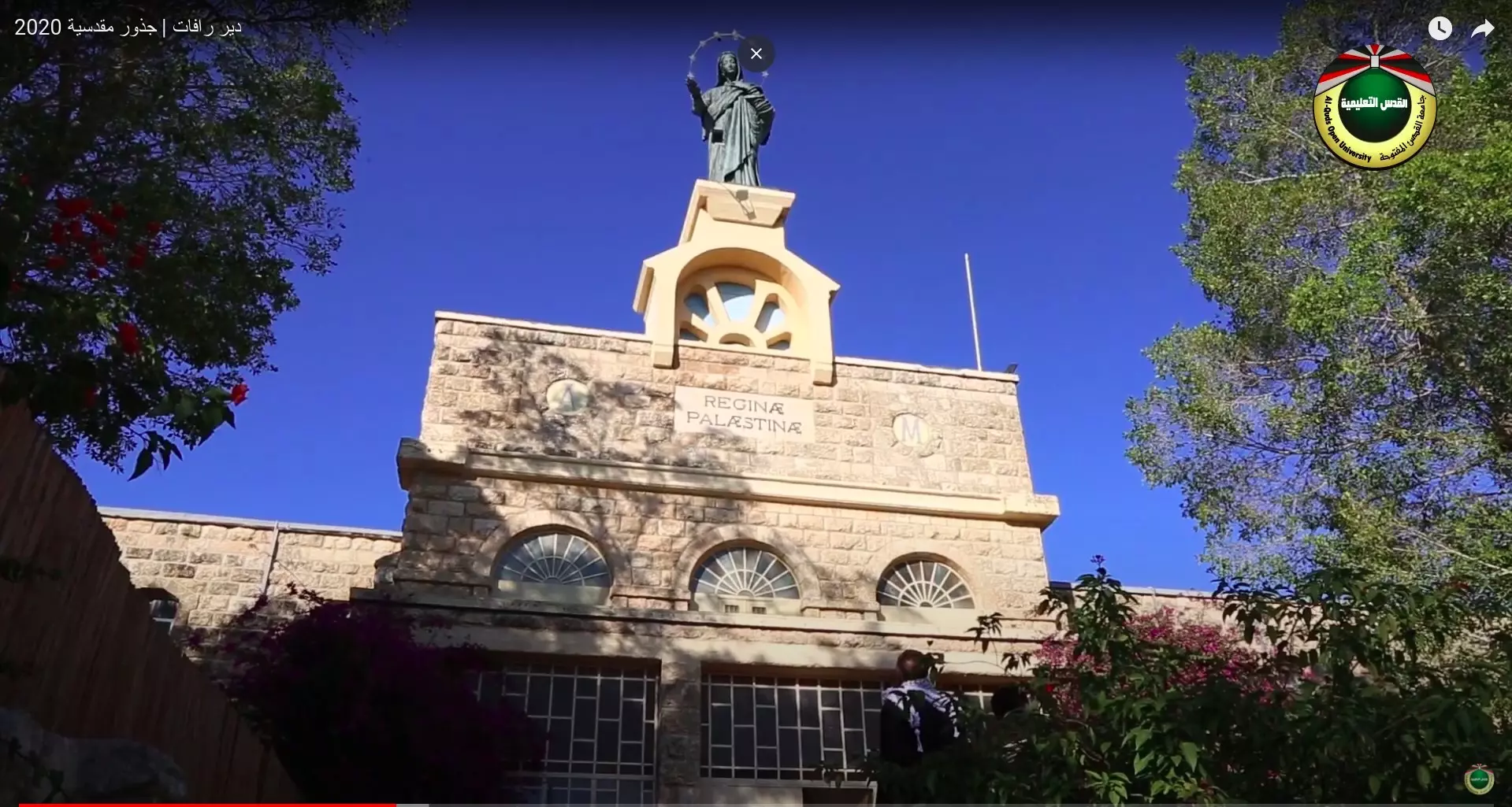
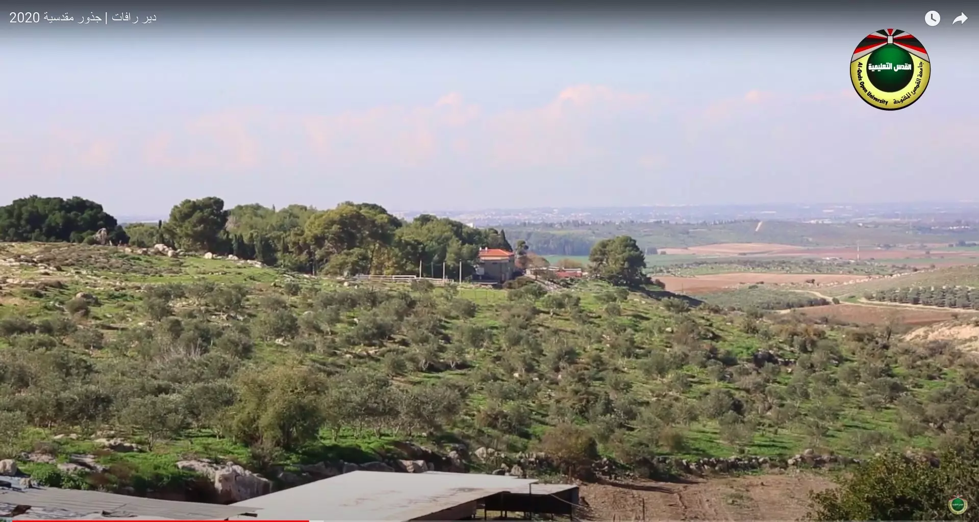
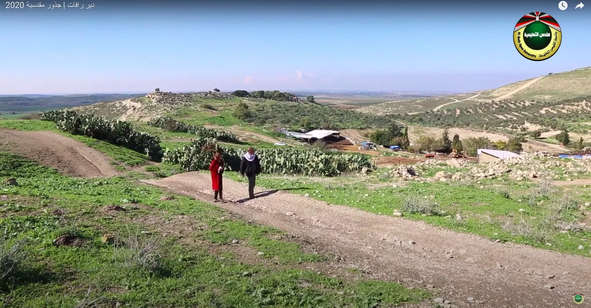
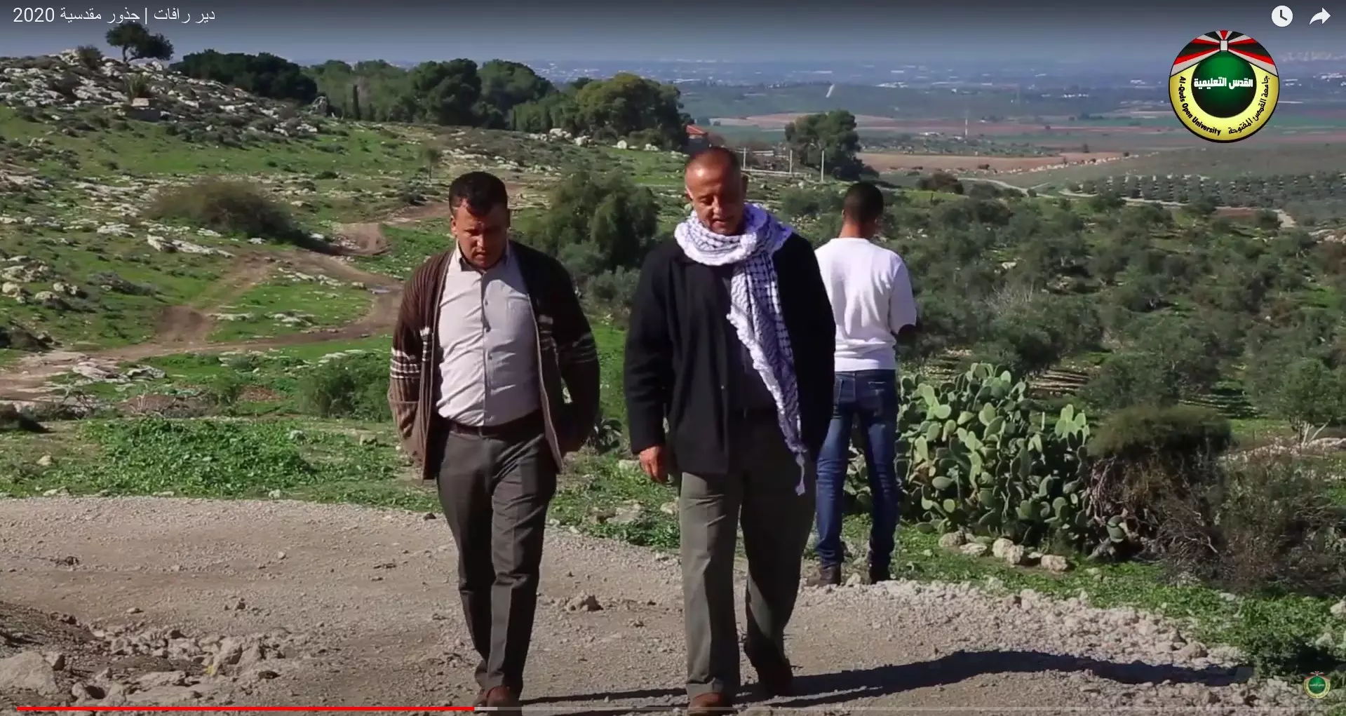
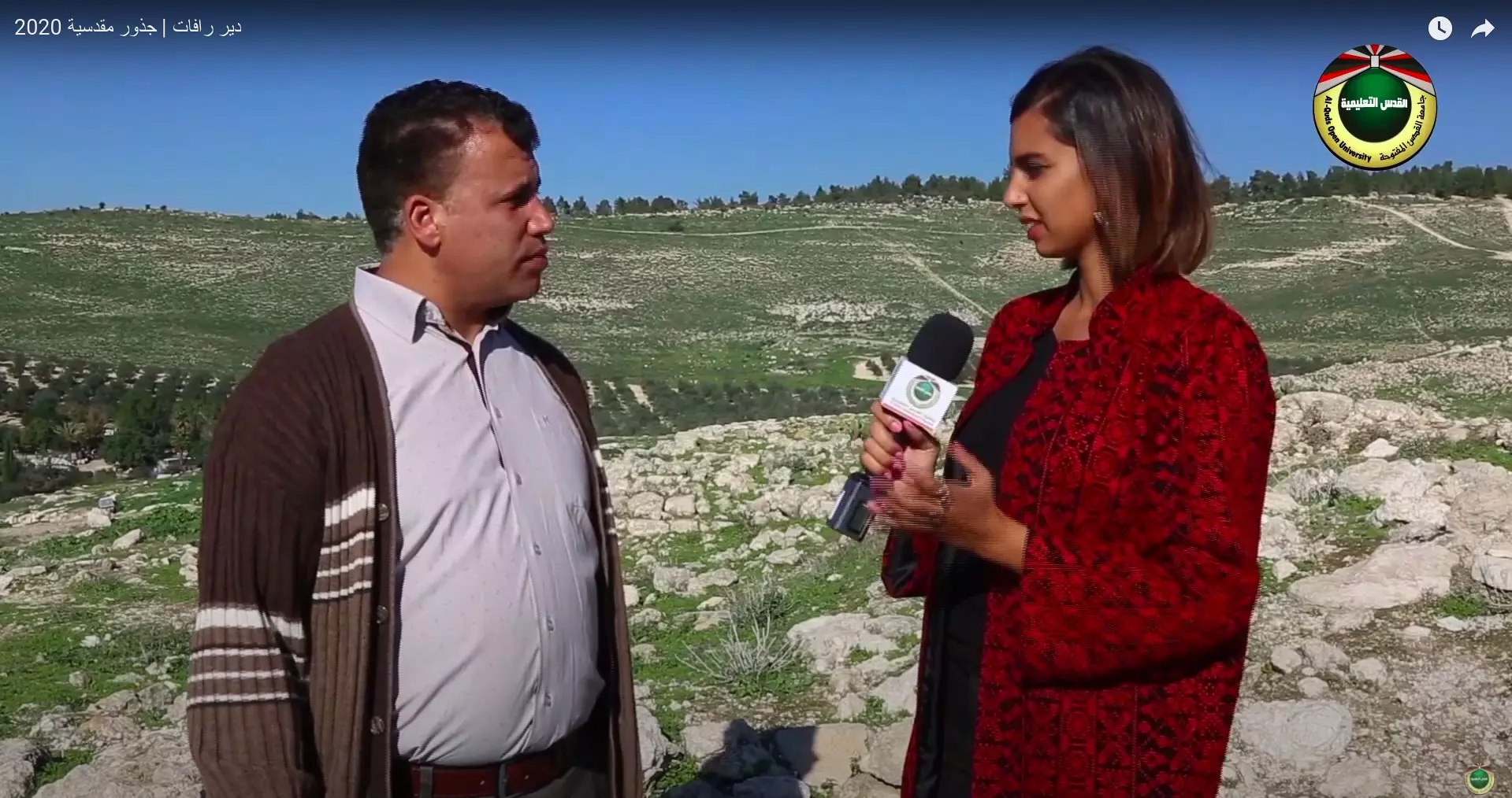
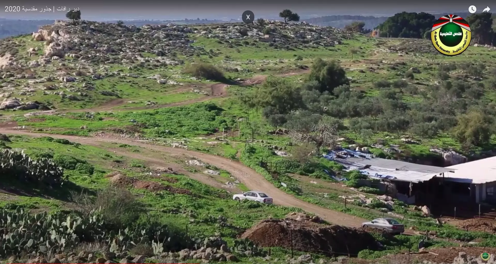
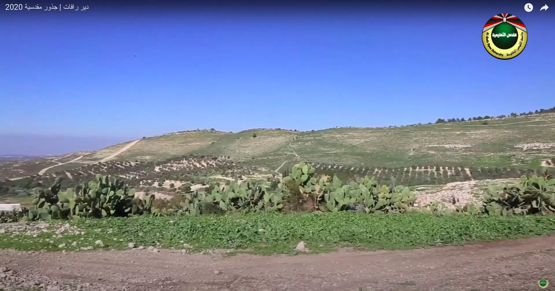
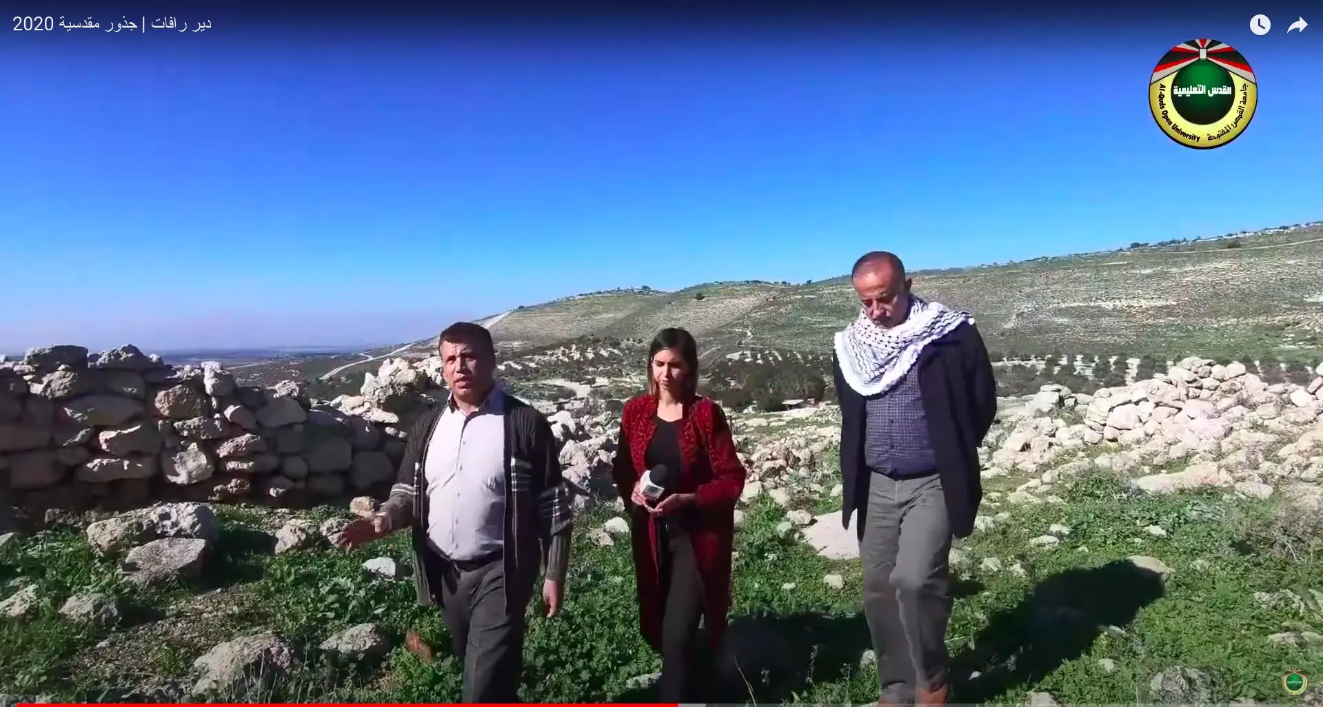
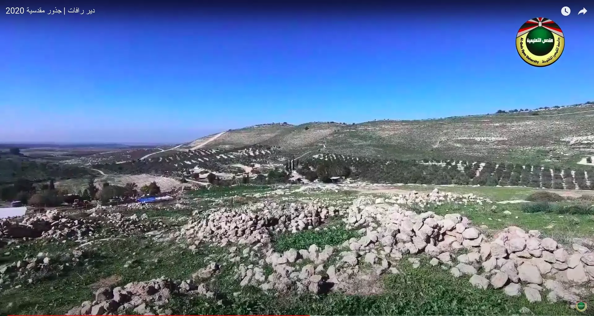
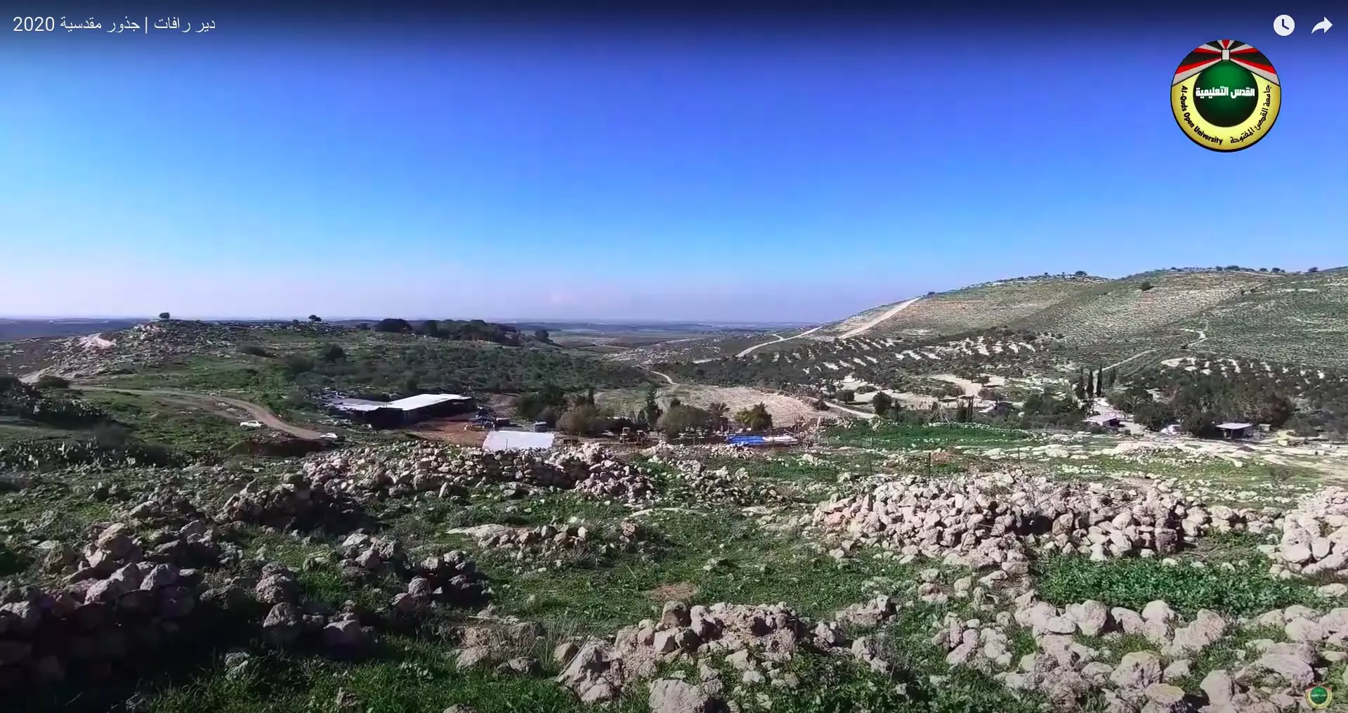
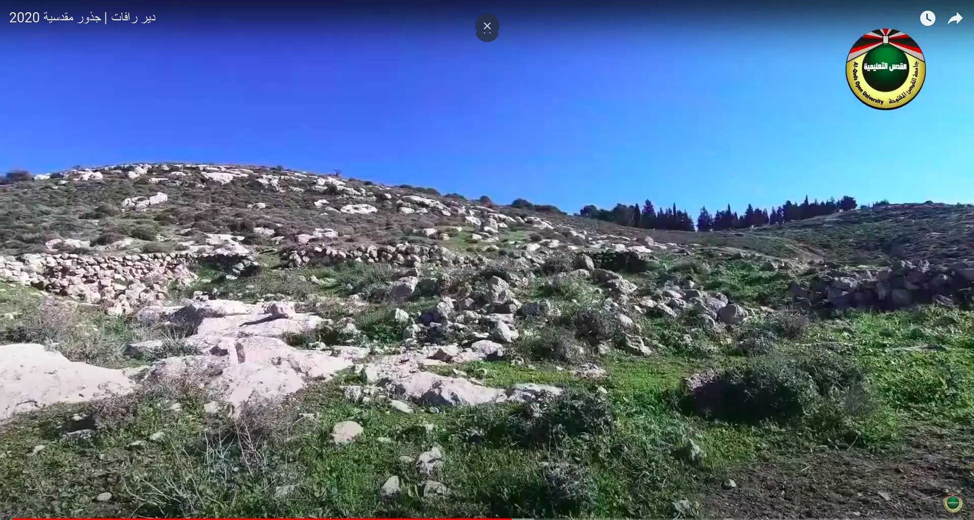
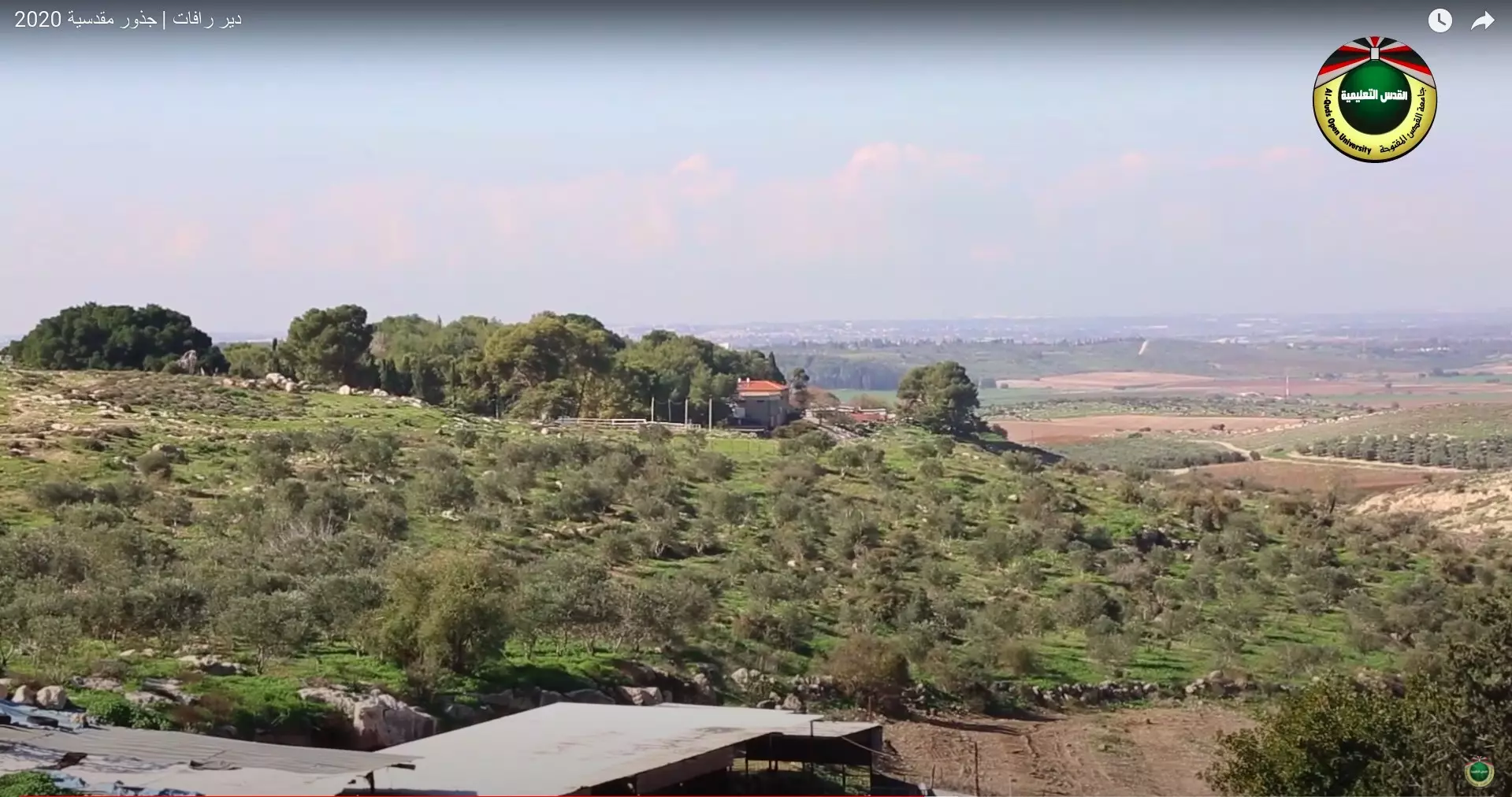
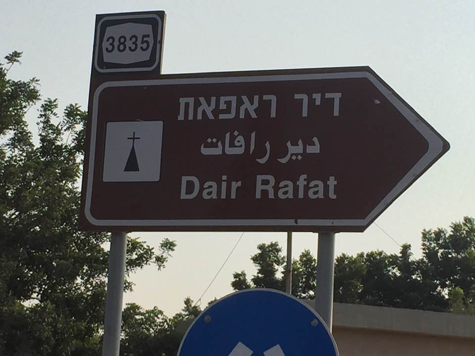
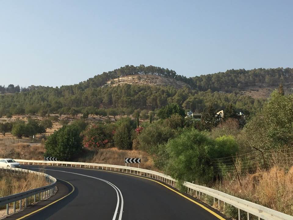
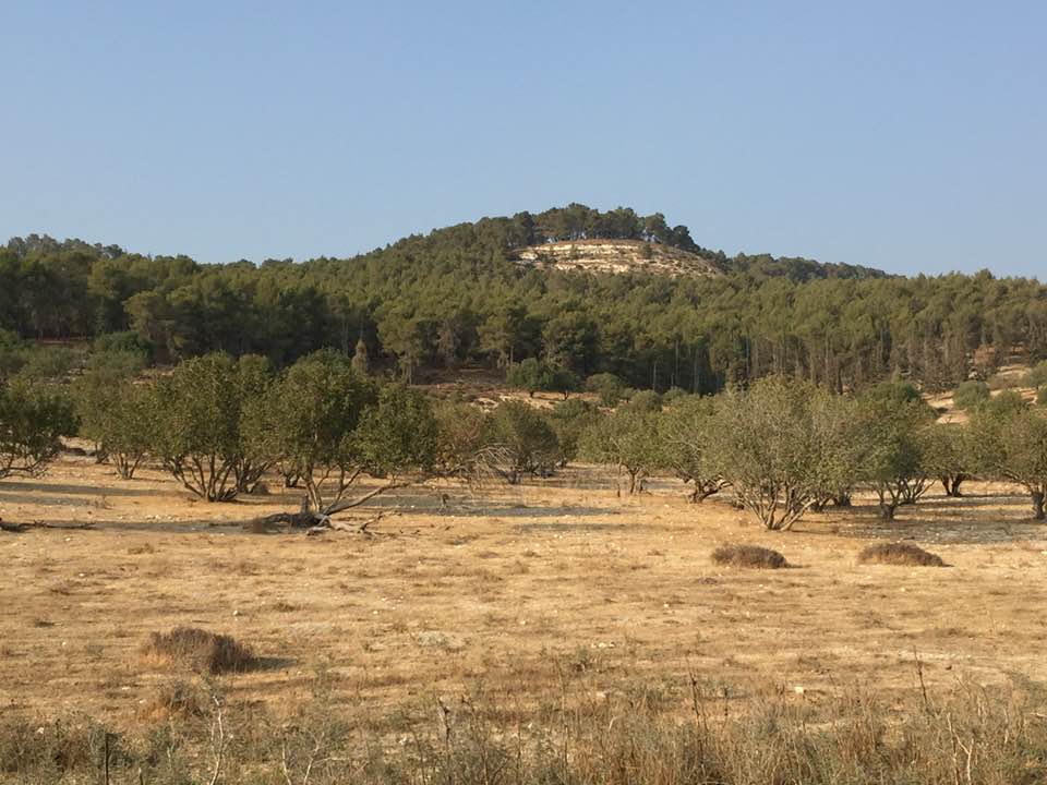
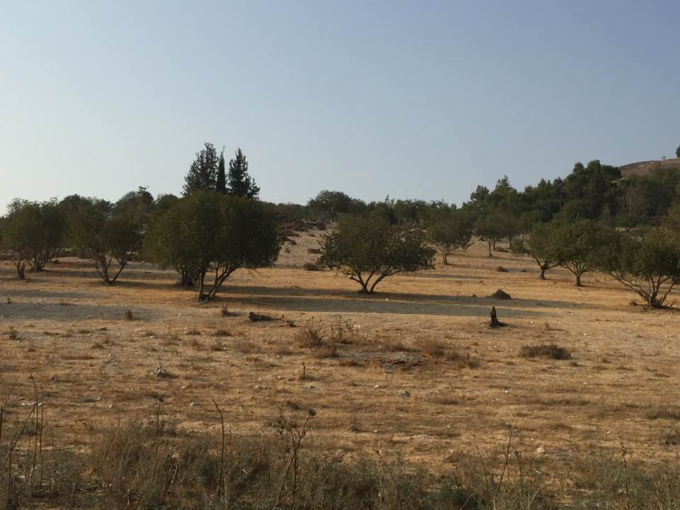
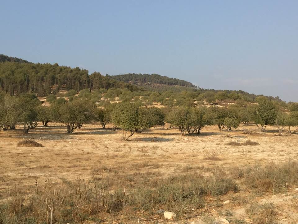
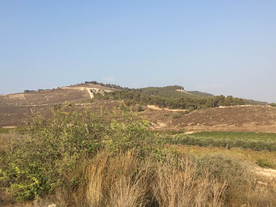
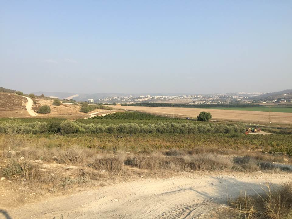
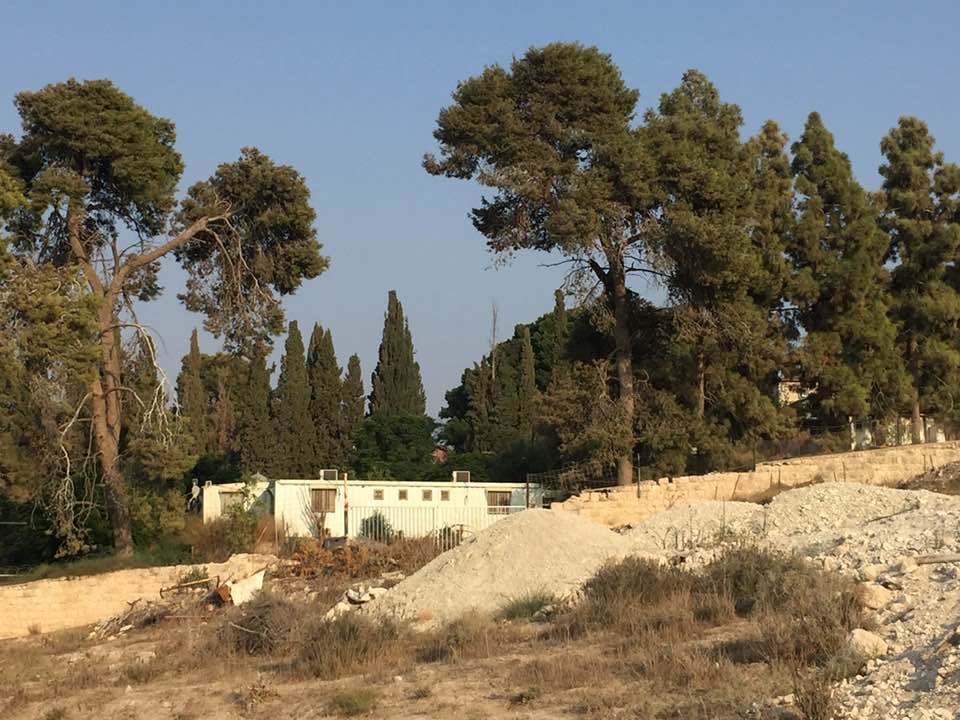
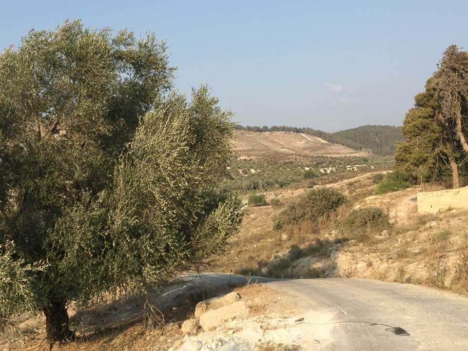
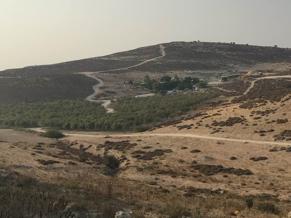
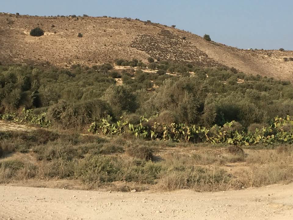
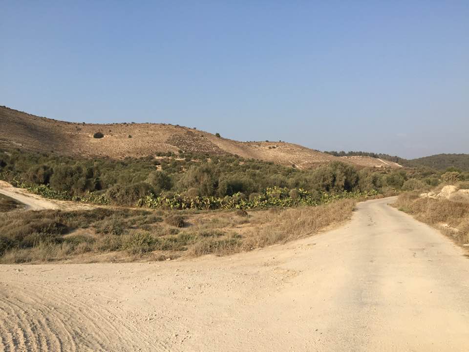
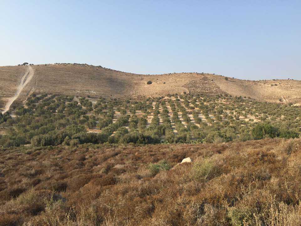
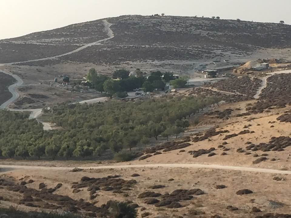
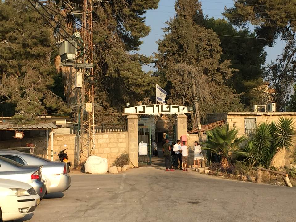
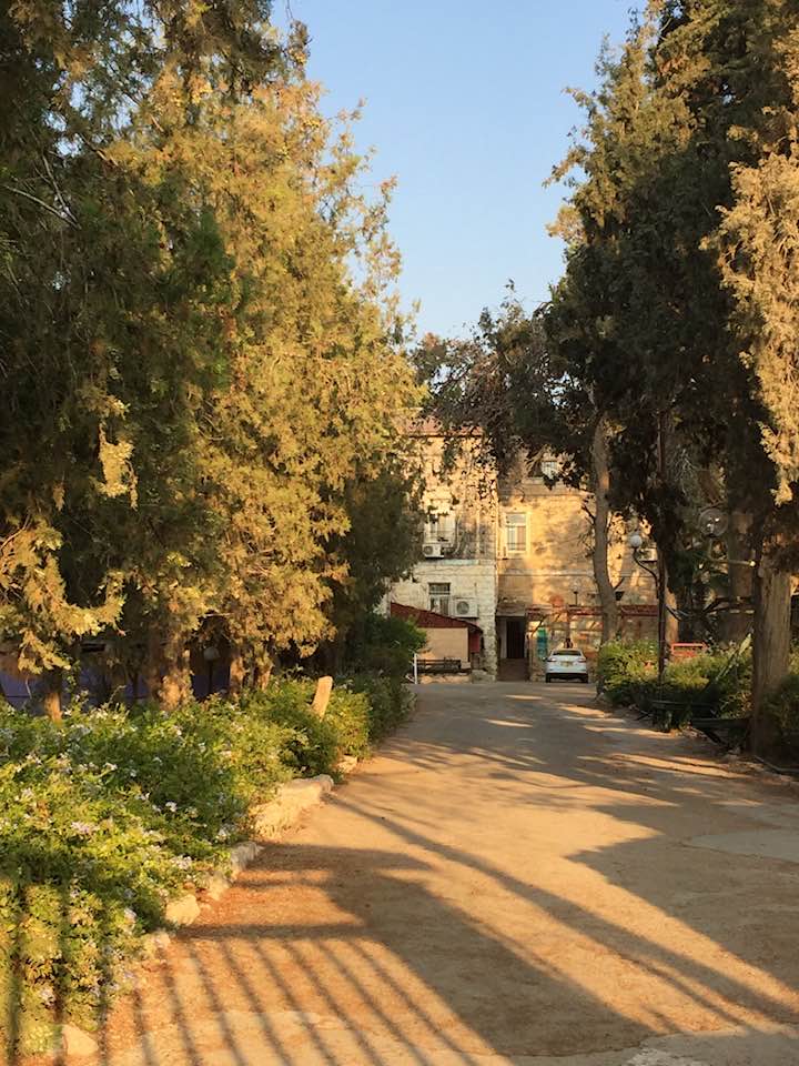
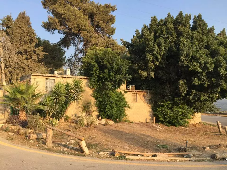
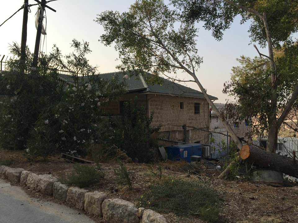
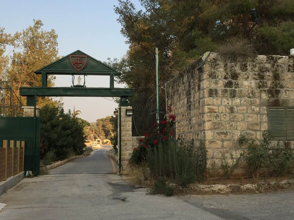
Village Before NakbaThe village was located on the western slope of a moderately high mountain. The first part of its name, Dayr, was Arabic for monastery; the village was the site of a large monastery that belonged to the Latin Patriarchate. The village also had one mosque, named after a Hajj Hasan. In the late nineteenth century, Dayr Rafat was a small hamlet situated on a ridge with a spring to the west. Of the estimated 430 people who were living in Dayr Rafat in 1945, 100 were Christians and the rest Muslims. In 1944/45 a total of 10,563 dunums was allocated to cereals; 216 dunums were irrigated or used for orchards, of which 25 dunums were used for olives. Water was supplied by three springs on the site. Archaeological sites around the village included three khirbas that contained the foundations of buildings, grape presses, rock-hewn cisterns, wells, a grindstone, and burial grounds.Village Occupation and Ethnic CleaningDayr Rafat was overrun on 17−18 July 1948, during the second stage of the Israeli army's Operation Dani (see Abu al-Fadl, Ramla sub-disctrict). The History of the War of Independence relates that it fell to units of the Har'el Brigade towards the end of that operation, when Israeli forces widened the Jerusalem corridor southwards. Israeli researcher Benny Morris reports that most of the people remaining in the vicinity fled with the approach of the Har'el columns and the start of the mortar barrages. He also adds that the remainder were expelled, but it is not clear what transpired at Dayr Rafat, nor what happened to the residents in the adjacent monastery.The village was not destroyed until several weeks later, during the second truce of the war. In his comments on the demolition of villages during this period, Morris specifically mentions the case of Dayr Rafat: 'During the three months of the Second Truce,' he writes, 'from 19 July until mid-October, the army continued to destroy abandoned villages in piecemeal fashion, usually for reasons which were described as military. In the center of the country, for example, most of the village … [was] ... blown up in September.' Zionists Colonies on Village LandsThe settlement of Giv'at Shemesh (145131) was established in 1954 on village land, just to the west of the village site.Village TodayThe site is covered with large piles of stone rubble and stone terraces; some of the latter are still intact, while others have been destroyed and are now mixed with the rubble of the houses. Cactuses grow on the northwestern edge of the site. There are a few tents belonging to the Negev tribe of al-Sani' the members of which have rented land from the monastery, which owns the village lands. The monastery, located 2 km west of the site, has a large statue of the Virgin Mary at the top of its facade, and parts of the structure are covered with red tiles. There is a spring on the western edge of the village and a cemetery lies in the south; one large tomb stands out. To the west there is a large olive grove.SourceDr. Walid al-Khalidi, 1992: All That Remains. |
|||||||||||||||
| Related Maps | Town Lands' Demarcation Maps خرائط للقضاء توضح حدود القرى والاودية Town's map on MapQuest View from satellite Help us map this town at WikiMapia |
||||||||||||||
| Related Links | Wikipedia's Page Google Search Google For Images Google For Videos |
||||||||||||||
| More Information | في كتاب كي لا ننسى في كتاب بلادنا فلسطين المزيد من موقع هوية |
||||||||||||||
- Village House In 1986

Scanned from "All That Remains" by Dr. Walid Khalidi 3 - Arce in Dayr Village ( Remains) 2008
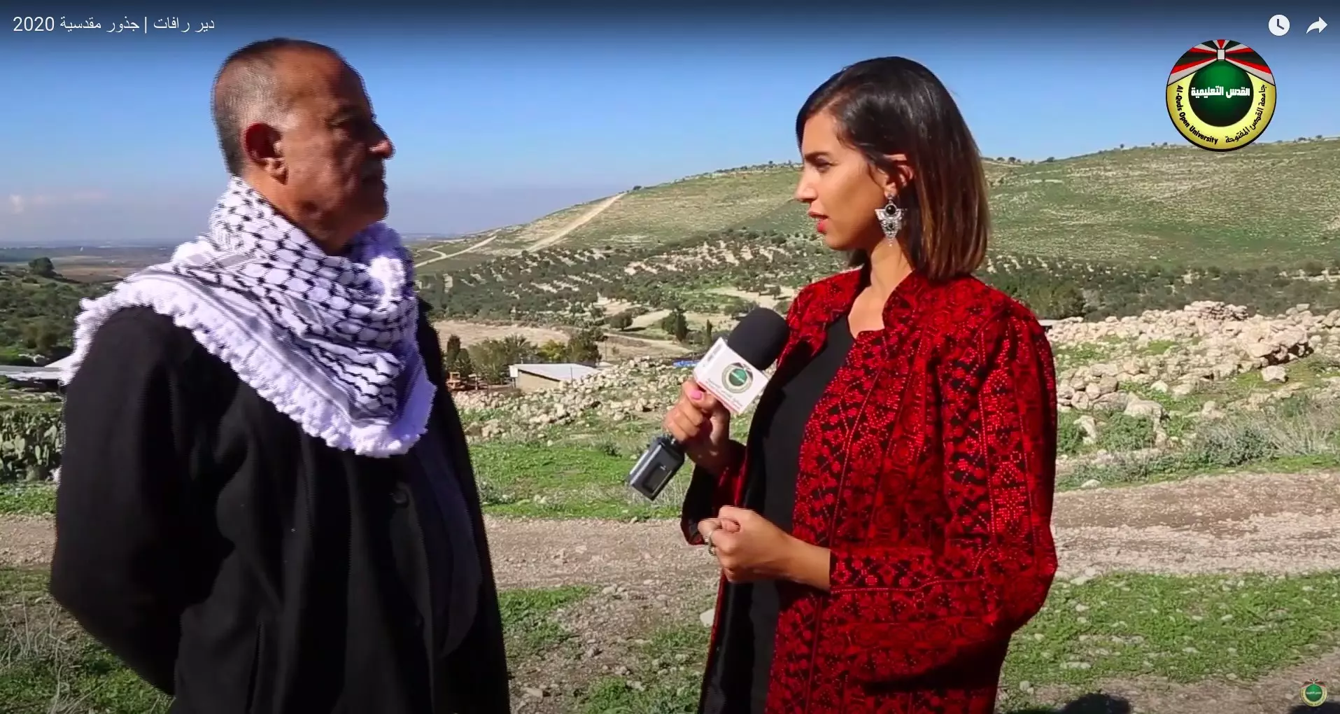
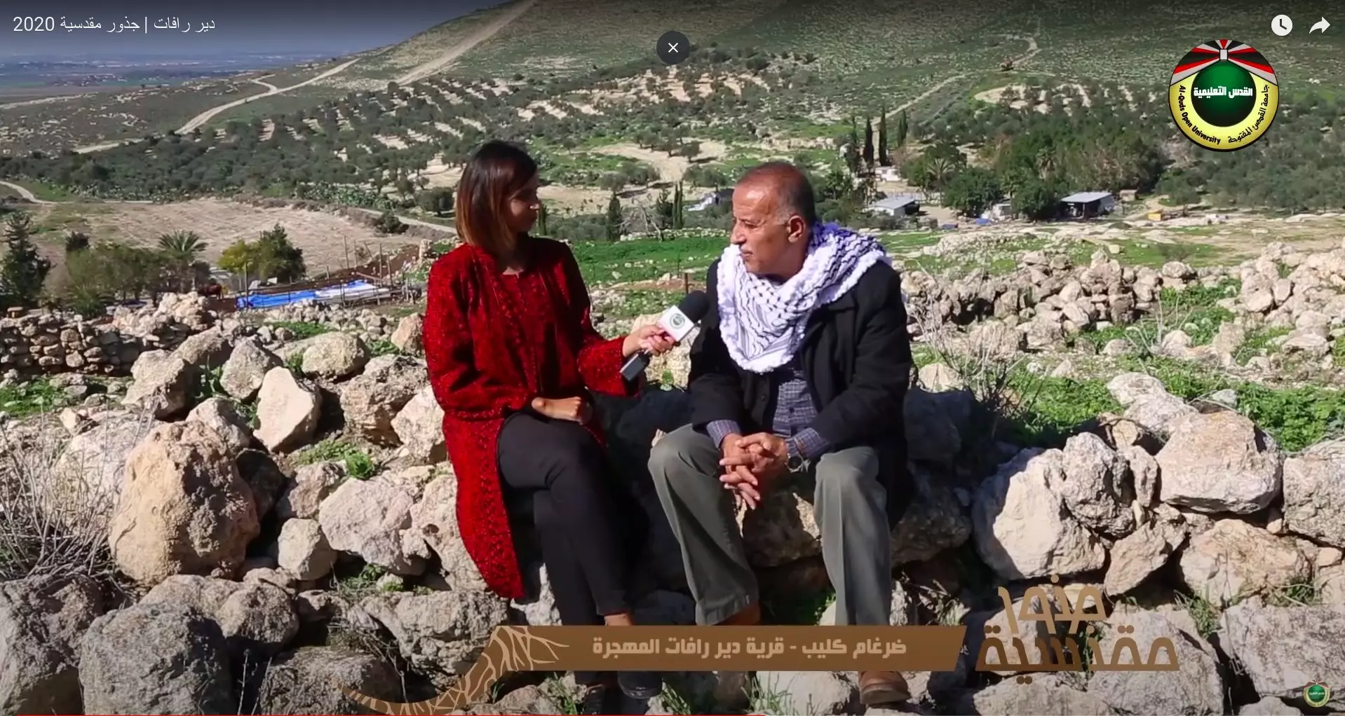
Posted by AJ - جولة بين انقاض واراضي قرية دير رفات امهجرة -- انتاج فضائية القدس التعليمية

- جولة بين انقاض واراضي قرية دير رفات امهجرة -- انتاج فضائية القدس التعليمية #2
- جولة بين انقاض واراضي قرية دير رفات امهجرة -- انتاج فضائية القدس التعليمية #3
- جولة بين انقاض واراضي قرية دير رفات امهجرة -- انتاج فضائية القدس التعليمية #4
- جولة بين انقاض واراضي قرية دير رفات امهجرة -- انتاج فضائية القدس التعليمية #5
- جولة بين انقاض واراضي قرية دير رفات امهجرة -- انتاج فضائية القدس التعليمية #6
- جولة بين انقاض واراضي قرية دير رفات امهجرة -- انتاج فضائية القدس التعليمية #7
- جولة بين انقاض واراضي قرية دير رفات امهجرة -- انتاج فضائية القدس التعليمية #8
- جولة بين انقاض واراضي قرية دير رفات امهجرة -- انتاج فضائية القدس التعليمية #9
- جولة بين انقاض واراضي قرية دير رفات امهجرة -- انتاج فضائية القدس التعليمية #10
- جولة بين انقاض واراضي قرية دير رفات امهجرة -- انتاج فضائية القدس التعليمية #11
- جولة بين انقاض واراضي قرية دير رفات امهجرة -- انتاج فضائية القدس التعليمية #12
- جولة بين انقاض واراضي قرية دير رفات امهجرة -- انتاج فضائية القدس التعليمية #13
- جولة بين انقاض واراضي قرية دير رفات امهجرة -- انتاج فضائية القدس التعليمية #14
- جولة بين انقاض واراضي قرية دير رفات امهجرة -- انتاج فضائية القدس التعليمية #15
- جولة بين انقاض واراضي قرية دير رفات امهجرة -- انتاج فضائية القدس التعليمية #16
- جولة بين انقاض واراضي قرية دير رفات امهجرة -- انتاج فضائية القدس التعليمية #17
- جولة بين انقاض واراضي قرية دير رفات امهجرة -- انتاج فضائية القدس التعليمية #18
- جولة بين انقاض واراضي قرية دير رفات امهجرة -- انتاج فضائية القدس التعليمية #19
- جولة بين انقاض واراضي قرية دير رفات امهجرة -- انتاج فضائية القدس التعليمية #20
- جولة بين انقاض واراضي قرية دير رفات امهجرة -- انتاج فضائية القدس التعليمية #21
- جولة بين انقاض واراضي قرية دير رفات امهجرة -- انتاج فضائية القدس التعليمية #22
- جولة بين انقاض واراضي قرية دير رفات امهجرة -- انتاج فضائية القدس التعليمية #23
- جولة بين انقاض واراضي قرية دير رفات امهجرة -- انتاج فضائية القدس التعليمية #24
- جولة بين انقاض واراضي قرية دير رفات امهجرة -- انتاج فضائية القدس التعليمية #25
- جولة بين انقاض واراضي قرية دير رفات امهجرة -- انتاج فضائية القدس التعليمية #26
- جولة بين انقاض واراضي قرية دير رفات امهجرة -- انتاج فضائية القدس التعليمية #27
- جولة بين انقاض واراضي قرية دير رفات امهجرة -- انتاج فضائية القدس التعليمية #28
- جولة بين انقاض واراضي قرية دير رفات امهجرة -- انتاج فضائية القدس التعليمية #29
- Let us see how the most "liberal and civilized" of world Jewry has obliterated our village. How else will the Jews be great and safe again? -- القرية دمرت بالكامل.. من هنا مر الهمج
- Let us see how the most "liberal and civilized" of world Jewry has obliterated our village. How else will the Jews be great and safe again? -- القرية دمرت بالكامل.. من هنا مر الهمج #2
- Let us see how the most "liberal and civilized" of world Jewry has obliterated our village. How else will the Jews be great and safe again? -- القرية دمرت بالكامل.. من هنا مر الهمج #3
- Let us see how the most "liberal and civilized" of world Jewry has obliterated our village. How else will the Jews be great and safe again? -- القرية دمرت بالكامل.. من هنا مر الهمج #4
- Let us see how the most "liberal and civilized" of world Jewry has obliterated our village. How else will the Jews be great and safe again? -- القرية دمرت بالكامل.. من هنا مر الهمج #5
- Let us see how the most "liberal and civilized" of world Jewry has obliterated our village. How else will the Jews be great and safe again? -- القرية دمرت بالكامل.. من هنا مر الهمج #6
- Let us see how the most "liberal and civilized" of world Jewry has obliterated our village. How else will the Jews be great and safe again? -- القرية دمرت بالكامل.. من هنا مر الهمج #7
- Let us see how the most "liberal and civilized" of world Jewry has obliterated our village. How else will the Jews be great and safe again? -- القرية دمرت بالكامل.. من هنا مر الهمج #8
- Let us see how the most "liberal and civilized" of world Jewry has obliterated our village. How else will the Jews be great and safe again? -- القرية دمرت بالكامل.. من هنا مر الهمج #9
- Let us see how the most "liberal and civilized" of world Jewry has obliterated our village. How else will the Jews be great and safe again? -- القرية دمرت بالكامل.. من هنا مر الهمج #10
- Let us see how the most "liberal and civilized" of world Jewry has obliterated our village. How else will the Jews be great and safe again? -- القرية دمرت بالكامل.. من هنا مر الهمج #11
- Let us see how the most "liberal and civilized" of world Jewry has obliterated our village. How else will the Jews be great and safe again? -- القرية دمرت بالكامل.. من هنا مر الهمج #12
- Let us see how the most "liberal and civilized" of world Jewry has obliterated our village. How else will the Jews be great and safe again? -- القرية دمرت بالكامل.. من هنا مر الهمج #13
- Let us see how the most "liberal and civilized" of world Jewry has obliterated our village. How else will the Jews be great and safe again? -- القرية دمرت بالكامل.. من هنا مر الهمج #14
- Let us see how the most "liberal and civilized" of world Jewry has obliterated our village. How else will the Jews be great and safe again? -- القرية دمرت بالكامل.. من هنا مر الهمج #15
- Let us see how the most "liberal and civilized" of world Jewry has obliterated our village. How else will the Jews be great and safe again? -- القرية دمرت بالكامل.. من هنا مر الهمج #16
- Let us see how the most "liberal and civilized" of world Jewry has obliterated our village. How else will the Jews be great and safe again? -- القرية دمرت بالكامل.. من هنا مر الهمج #17
- Let us see how the most "liberal and civilized" of world Jewry has obliterated our village. How else will the Jews be great and safe again? -- القرية دمرت بالكامل.. من هنا مر الهمج #18
- Let us see how the most "liberal and civilized" of world Jewry has obliterated our village. How else will the Jews be great and safe again? -- القرية دمرت بالكامل.. من هنا مر الهمج #19
Want to browse more? 80,000 pictures were grouped in these gallaries:
| Display Name | Clan/Hamolah | Country of Residence |
| جهاد الرفاتي | كليب(خليل) | بيت لحم |
| محمود حمدان | hamdan, rafat | - |
| AJ | Ja'fari | - |
| RAFATI | - | texas, U.S.A |
| RAFAT ANWER | - | - |
| Rezeq Faraj | Rezeq Faraj | QC, Canada |
| Myriam Faraj | Faraj | Québec, Canada |
| Anan Hamad | Hamad | palestine, palestine |
- زيارة لدير رفات-- جذور مقدسية Duration: 22 min 33 sec
- رافات وادي الصرار (دير رافات) ... ضيعة ضائعة بين الجبال Duration: 7 min 13 sec
- دير رفات المهجرة قضاء القدس. Duration: min
- دير رفات المهجرة قضاء القدس. #2
- من أراضي قرية دير رفات المهجرة قضاء القدس Duration: 14 sec
- كنيسة سيدة فلسطين في دير رافات المهجرة غرب القدس . Duration: 9 sec
- دير رفات غرب القدس Duration: 2 min
No links have been shared yet, be free to the first to share the first link.
 Fake Valor: Why Did Zionist Jews Hoist Nazis Flag on Their Ships in the 1930s?
What is new?
-
Facts About Oct. 7th Gaza Raid
-
Remined Us Please: Who Did Rape Whom? Was it Palestinians who raped Israelis? Or, was the other way around? You'll be the judge
-
When Prof. Edward Said was invited to debate Bibi Netanyahu in the 1980s, watch what happened!
-
Ezra Klein of the NY Times on the "Jewish Race".
-
Abusing Blood Libel!
-
How and why Israeli Jewry has become the most hated cult?
-
Did Israeli Soldiers Activate The Hannibal Direective On Oct. 7th? You Be The Judge
-
Zionist FAQ: Isn't it true that Palestinians don't want peace? Palestinians never accepted the two-state solution
- Facts about Haavara (Transfer) Agreement between Ben-Gurion & Hitler
-
Haavara FAQs: Why Did Zionist Jews Hoist Nazis' Flags on Their Ships in the 1930s?
- Haavara FAQs: When Chaim Weizmann met FDR in mid-1943, why was he silent about rescuing European Jewry?
-
Dear ChatGPT: How did Palestinians resist Napoleon's invasion of their country in 1799?
-
Dear ChatGPT: Gaza had a vibrant Jewish community in the mid-17th century. What happened to them?
-
Dear ChatGPT: Why did the Jewish Agency suppress news of the Holocaust during WWII?
-
Video Playlist: Jews share their DNA tests to end the conflict for good.
-
A Tale of Two Conflicts: Examining the Definition of Genocide
-
Prof. Abraham Polak And The Suppressed History of the Khazars and European Jewry
-
How Ronald Reagan would have framed the genocide in Gaza if he were still alive?
-
Haavara FAQs: Let us do the math: how many German Jews did The Haavara Agreement save?
-
Zionist FAQs: The Hebron Massacre of 1929, "clearly proves" that Palestinians are antisemitic, how could you deny it?
-
Zionist FAQs: Why Anti-Zionist Is Not Antisemitism?
-
Zionist FAQs: Isn't it true that the KGB created Palestinian Nationalism in the early 1960s?
- Zionist FAQs: Muslims are killing Muslims all the time; why are Israeli Jews being singled out in the media?
- Zionist FAQs: How is Israel an apartheid state when 20% of its citizens are Arabs who enjoy full rights?
-
Haavara FAQs: Why Did Dorothy Thompson Flip From A Zionist Advocate to A Silenced Dissenter?
-
Haavara FAQs: Analysis of Herzl's Uganda Scheme and how it could have saved millions of Jews.
-
Haavara FAQs: Why did Hayim Greenberg describe American Jewry as "morally bankrupt" in early 1943?
-
Haavara FAQs: What if the Evian Conference was a resounding success? What would have been the impact of saving European Jewry on Zionism?
- Haavara FAQs: What if the six million were saved, how that would have impacted the Zionist project?
-
Haavara FAQs: How did Zionist leaders react when Europe's Jews lingered in the DP camps after WWII ended?
-
Why does the American Jewish community repeat lies that David Ben-Gurion had debunked before he died?
-
Who has the power to rename the Tatar/Khazar Gene Marker to Jewish IV?
-
Zionist FAQs: Why won't Egypt, Syria, and Jordan take their people back? Jews are indigenous to Palestine, and Arabs immigrated after Jews developed the country. Arabs should leave.
-
Haavara FAQs: Did Hitler and the Nazis conflate between Judaism and Zionist? If that wasn't case, then why?
-
Haavara FAQs: Winston Churchill and antisemitism, a collection of articles written Churchill.
-
Haavara FAQs: Broken by country, how many Jews survived vs. killed during the Holocaust?
-
Haavara FAQs: Why did European Jews vote with their feet and to immigrated to the Americas, not Palestine, after WWII?
-
Watch this American Jewish Girl describing Israeli Jews' cognitive dissonance like no other in under two minutes
-
Haavara FAQs: When the Nazis went out of their way to hide the Holocaust, Israeli Jews did the exact opposite by broadcasting their genocide of Gazans. But why?
-
Haavara FAQs: How Zionist Jews went out of their to show their appreciation to Nazism and Fascism?
- Haavara FAQs: Why Zionist leaders were against bombing the death camps & the Railroads leading to them?
-
Haavara FAQs: Hitler's message to the British and American people: If Jews are such noble citizens and you care about them, how come you're not letting them in? I will gladly ship them to you at my expense, even on luxury liners!
-
A shortlist of Zionist and Israeli false flag operations in the name Jews.
-
The Most Moral Army
- The Land of Kapos (Israel): Where the brave are boycotted and Kapos walk free.
- Why did early Zionists often named their communal enterprises "colonial"?
- Zionist Relations with Nazi Germany by Faris Glubb
-
Two NY Times advertisements by Zionists in the early 1943 that exposes Zionists' treason at the height of the calamity
- Facts Not Lies about the Palestinian-Israeli Conflict.
- Site's pictures have been categorized
- Campgain Against Lice
- A Survey of Palestine, the official source about Palestine before Nakba produced by the British Mandate; over 1200 pages.
- Satellite View & Google Earth: Over 6,000 placemarks identifying all destroyed towns, W. Bank & Gaza Strip Towns, & refugee camps.
- PalestineRemembered.com and its Nakba Oral History Project were featured on al-Jazeera Satellite TV.
- Nakba Oral History Video Podcast:
 Over 700 Oral History interviews (including 3,500+ hours of recording) can be viewed online.
 - Palestine Village Statistics Project
- Gaza Jail Break
- النسخة العربية للموقع الان متوفرة
- Videos: Documenting the destroyed villages in video: Tracing all that remains since Nakba.
- Videos: Responding to Zionist Propaganda
- Interview: The ethnic cleansing of Palestine: George Galloway interviews Israeli Historian Ilan Pappe.
- For Palestinians, memory matters. It provides a blueprint for their future By George Bisharat.
- Zionist FAQ now available in Hebrew שאלות שציונים שואלים, עכשיו בעברית
- Video: The Stephen Walt and John Mearsheimer report on the influence of the Israel Lobby on U.S. Foreign Policy
- The Palestinian-Israeli conflict for beginners
