| PalestineRemembered | About Us | Oral History | العربية | |
| Pictures | Zionist FAQs | Haavara | Maps | |
| Search |
| Camps |
| Districts |
| Acre |
| Baysan |
| Beersheba |
| Bethlehem |
| Gaza |
| Haifa |
| Hebron |
| Jaffa |
| Jericho |
| Jerusalem |
| Jinin |
| Nablus |
| Nazareth |
| Ramallah |
| al-Ramla |
| Safad |
| Tiberias |
| Tulkarm |
| Donate |
| Contact |
| Profile |
| Videos |
Welcome To Bayt Jirja - بيت جرجا (בית ג'ירג'א)
|
District of Gaza
Ethnically cleansed days ago |
العربية Google Earth |
 |
Gallery (27) |
- Statistics & Facts
-
Before & After

- Satellite View
- Articles 2
- Pictures 27
- Aerial Views 4
- Oral History 1
- Members 28
- Families
- All That Remains
- Wikipedia
- Videos 5
- Guest Book 15
- Links 1
| Statistic & Fact | Value | |||||||||||||||||||||
| Occupation Date | October 30, 1948 | |||||||||||||||||||||
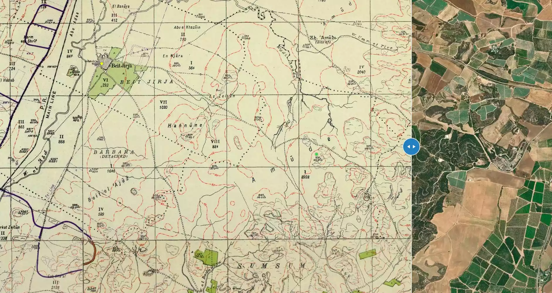
| Distance From District | 15.5 (km) North East of Gaza | |||||||||||||||||||||
| Elevation | 50 (meters) | |||||||||||||||||||||
| Before & After Nakba, Click Map For Details |
||||||||||||||||||||||
|
||||||||||||||||||||||
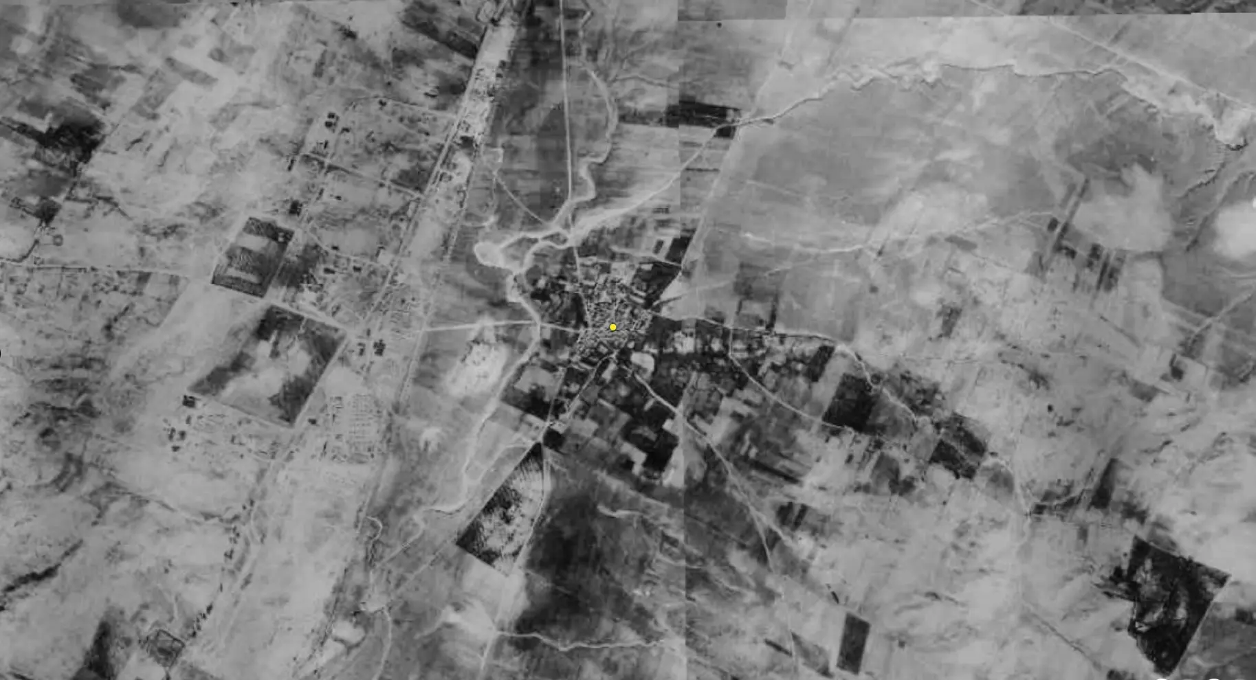
| Pre-Nakba Aerial View |
||||||||||||||||||||||
|
||||||||||||||||||||||
| Map Location | See location #36 on the map View from satellite |
|||||||||||||||||||||
| Military Operation | Operation Yo'av | |||||||||||||||||||||
| Attacking Units | Possibly a combination of Giv'ati, Negev, and Yiftach brigades | |||||||||||||||||||||
| Defenders | Egyptian Army | |||||||||||||||||||||
| Exodus Cause | Military assault by Zionist troops | |||||||||||||||||||||
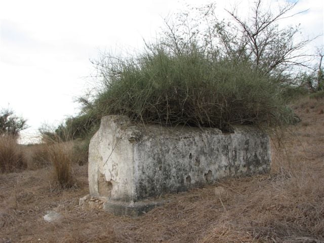
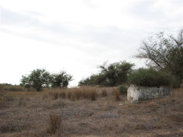
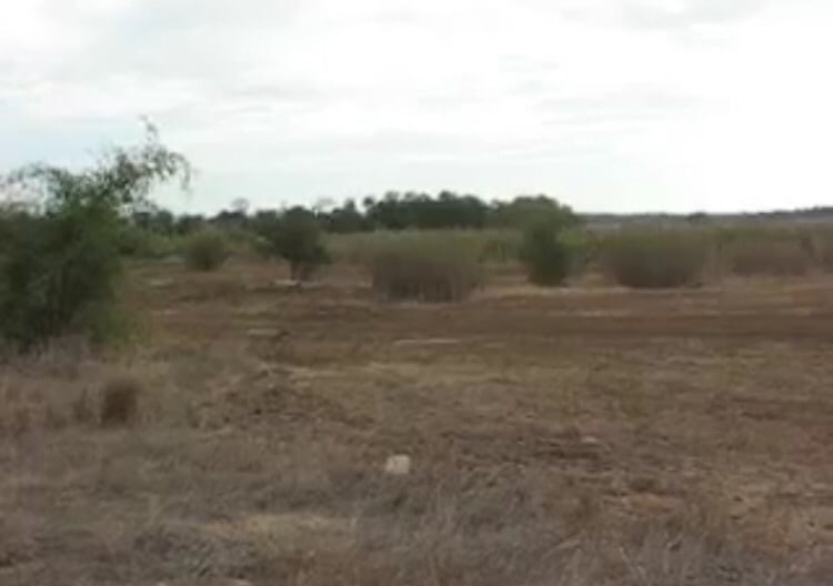
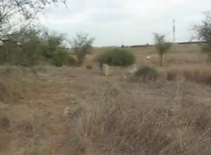
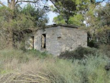
| Village Temains | The village was completely destroyed, and only one house remains. If this house is yours, then your are welcome to claim it back! | |||||||||||||||||||||
| Ethnically Cleansing | Bayt Jirja inhabitants were completely ethnically cleansed. | |||||||||||||||||||||
| Pre-Nakba Land Ownership |
|
|||||||||||||||||||||
| Land Usage As of 1945 |
|
|||||||||||||||||||||
| Population |
|
|||||||||||||||||||||
| Number of Houses |
|
|||||||||||||||||||||
| Near By Towns |
||||||||||||||||||||||
|
||||||||||||||||||||||
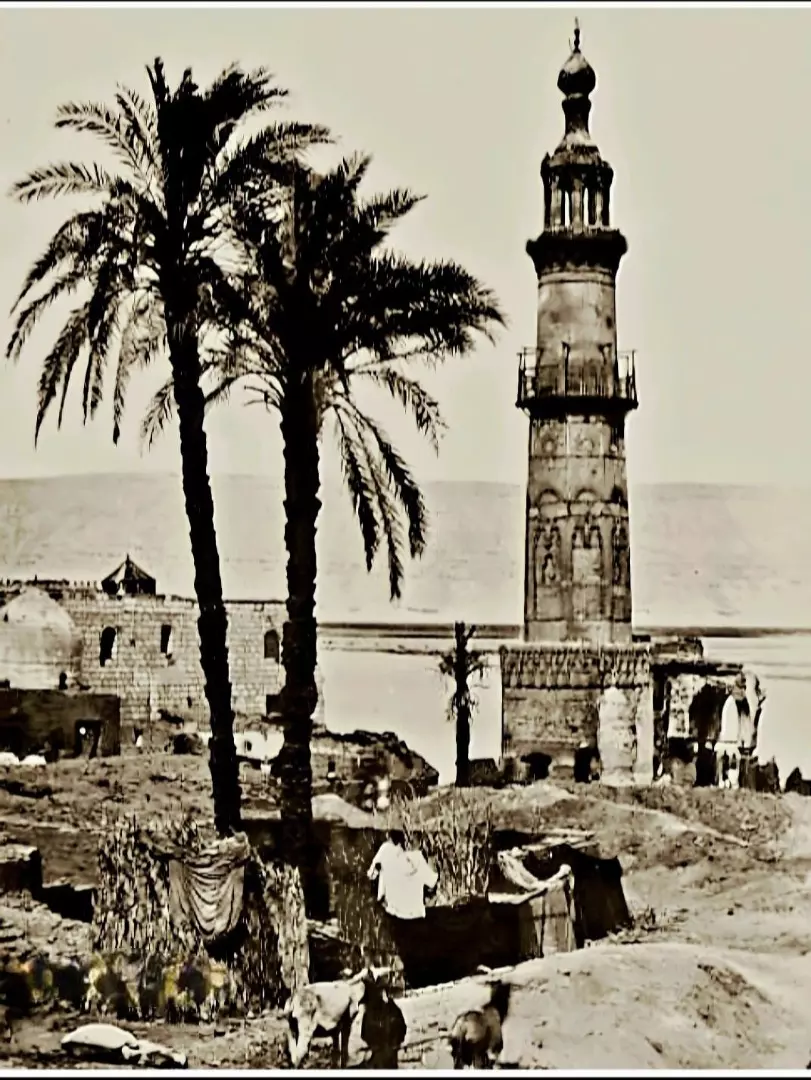
| Places of Warship | One mosque | |||||||||||||||||||||
| Shrines / Maqams | A shrine for al-Nabi Jirja. | |||||||||||||||||||||
| Nearby Wadies & Rivers | Bayt Jirja was overlooking Wadi al-'Abd. | |||||||||||||||||||||
| Water Supply | The village had number of wells, ranging in depth from 30 to 80 meters deep. | |||||||||||||||||||||
| Archeological Sites | Bayt Jirja contained Khirbat 'Amuda, which was known to the Crusades by Amouhde, and it contained pottery fragments, cisterns, and a pool. | |||||||||||||||||||||
| Exculsive Jewish Colonies That Usurped Village Lands |
Mavqi'im, Ge'a, and Talmey Yafe. | |||||||||||||||||||||
| Featured Video | ||||||||||||||||||||||
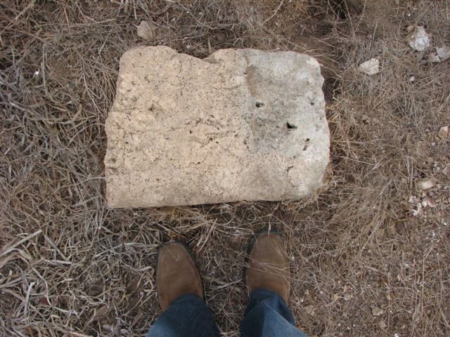
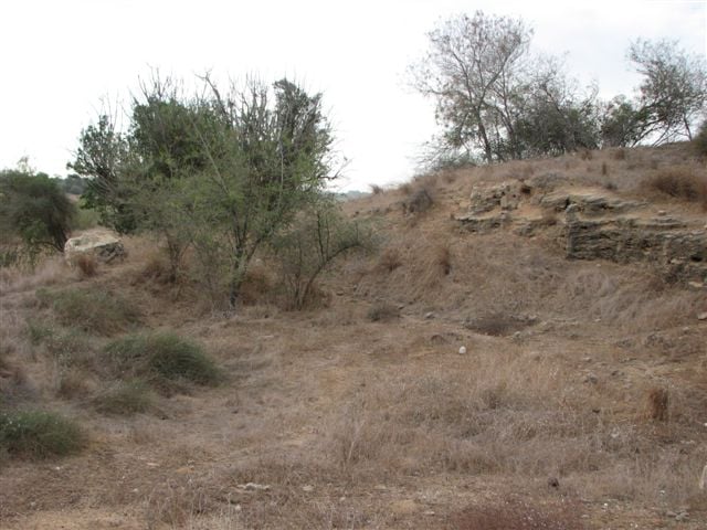
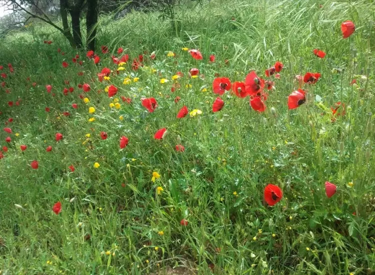
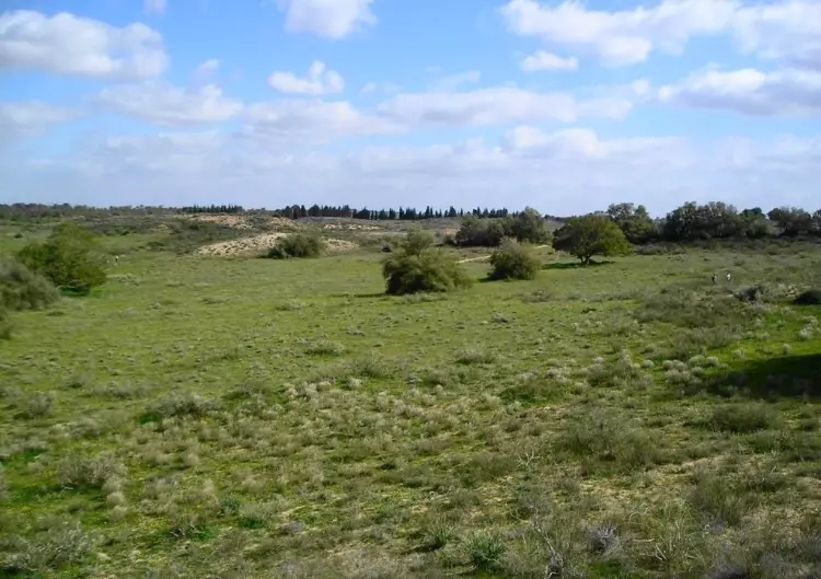
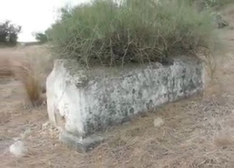
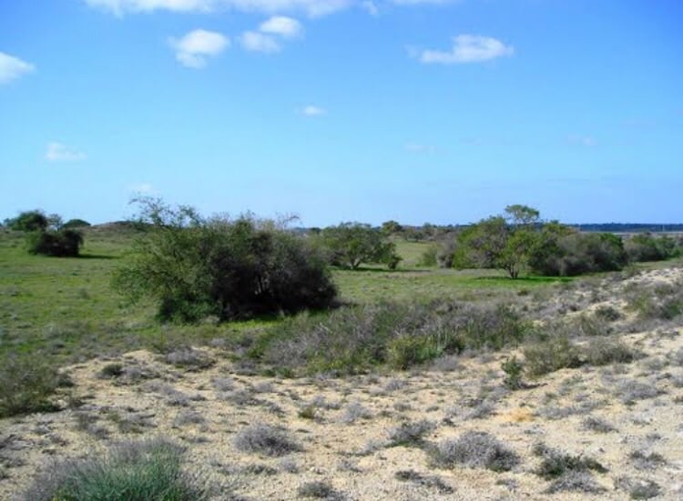
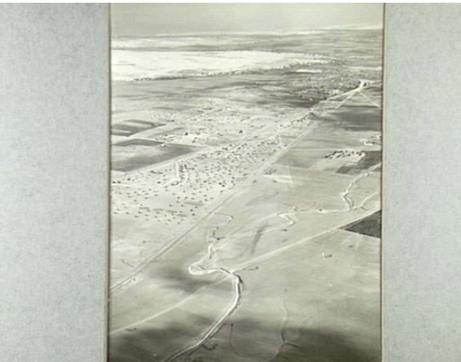
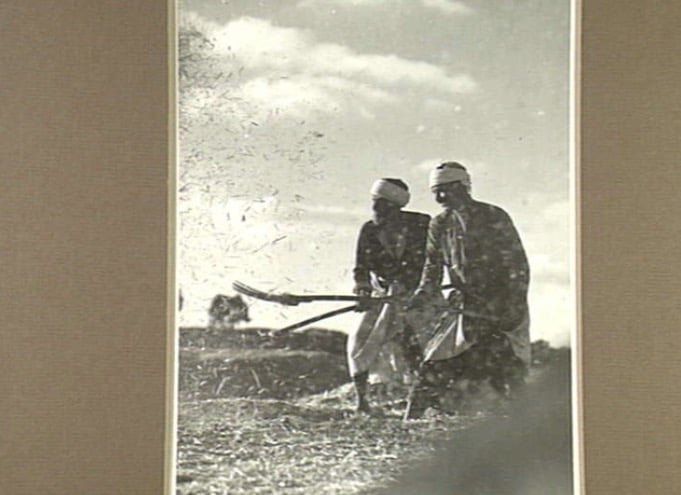
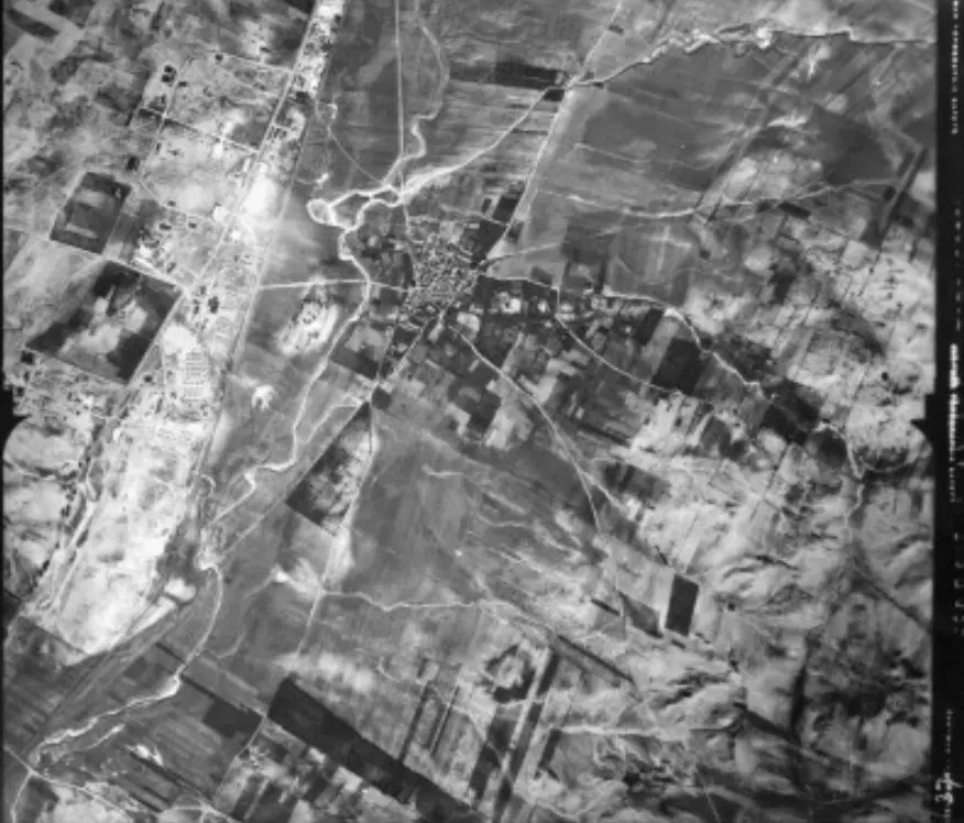
Village Before NakbaThe village was situated in a flat area on the southern coastal plain; a wadi crossed its western periphery. Bayt Jirja lay about 1 km east of the coastal highway―which afforded it access to Gaza, al-Majdal, Jaffa, and other areas―and was at a similar distance from the coastal railway line. A number of secondary roads and dirt paths linked it to adjacent villages. The Arab geographer Yaqut al-Hamawi (d. 1228) called it Jirja, and said that it was the birthplace of Abu al-Fadl al-Jarji, at one time the major authority in Palestine on hadith (the body of reports about the prophet Muhammad's life, an authoritative guide for the pious). In 1596 Bayt Jirja (erroneously named 'Bayt Kharja' in the Ottoman records) was in the nahiya of Gaza (liwa' of Gaza) and had a population of 468. It paid taxes on wheat, barley, fruit trees, goats, and beehives. The Ottoman village disappeared at one point; an inscription on its mosque indicated that the modern Bayt Jirja was founded in 1825 (or perhaps somewhat earlier). In the mid-nineteenth century the village was described as small, with gardens, and supplied with water from cisterns and a pond.The shape of the village resembled a trapezoid; the longest side (where most expansion took place) was on the northwest, along the road to the neighboring village of Barbara. Its mud brick houses were separated by narrow streets. The villagers were Muslims; they maintained a shrine which they believed to be the tomb of the 'prophet' (nabi) Jirja, located on the eastern edge and overlooking Wadi al-Abd. An elementary school, established in the center of the village in 1932, had an enrollment of 67 students in the mid-1940s. The village center also contained some small shops. A number of wells, ranging in depth from 30 to 80 m, supplied drinking and irrigation water. The community cultivated grain, vegetables, and fruits. In 1944/45 a total of 434 dunums was devoted to citrus and bananas and 6,911 dunums were allotted to cereals; 618 dunums were irrigated or used for orchards. The remnants of the pre-nineteenth-century village, including the foundations of old houses and a well, were still visible in Bayt Jirja. Several of the nearby khirbas yielded a variety of ancient relics; Khirbat Amuda, known by the Crusaders as Amouhde, contained pottery fragments, cisterns, and a pool. Village Occupation and Ethnic CleaningIt is very likely that Bayt Jirja was occupied towards the end of Operation Yoav in late October or early November 1948. The circumstances are not given, but Israeli historian Benny Morris indicates that it was captured along with al-Majdal on 4–5 November, if not a few days earlier. The fate of the villagers is also unknown, but Morris states that during the operation almost all inhabitants of the area either fled or were expelled, usually to the Gaza Strip. This was effected by the Israeli commander of the southern front, Palmach chief Yigal Allon, in accordance with the Haganah's Plan Dalet.Zionists Colonies on Village LandsThere are no Israeli settlements on village land. However, the lands of the destroyed village of Barbara, nearby, appear to have interpenetrated those of Bayt Jirja, which means that the three settlements on Barbara's lands (Mavqi'im, Ge'a, and Talmey Yafe) are quite close to the lands of Bayt Jirja.Village TodayThe site is encircled by barbed wire fencing, with only the streets and scattered rubble still visible. One house on the northern edge of the village remains, along with some sycamore trees and cactuses. Some village lands are cultivated, while others are covered by woods.SourceDr. Walid al-Khalidi, 1992: All That Remains. |
||||||||||||||||||||||
| Related Maps | Town Lands' Demarcation Maps خرائط للقضاء توضح حدود القرى والاودية Town's map on MapQuest View from satellite Help us map this town at WikiMapia |
|||||||||||||||||||||
| Related Links | Wikipedia's Page Facebook Page Google Search Google For Images Google For Videos |
|||||||||||||||||||||
| More Information | في كتاب كي لا ننسى في كتاب بلادنا فلسطين المزيد من موقع هوية |
|||||||||||||||||||||
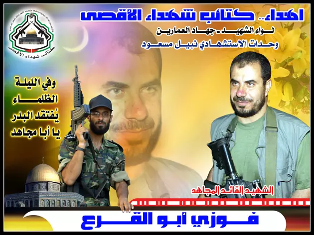
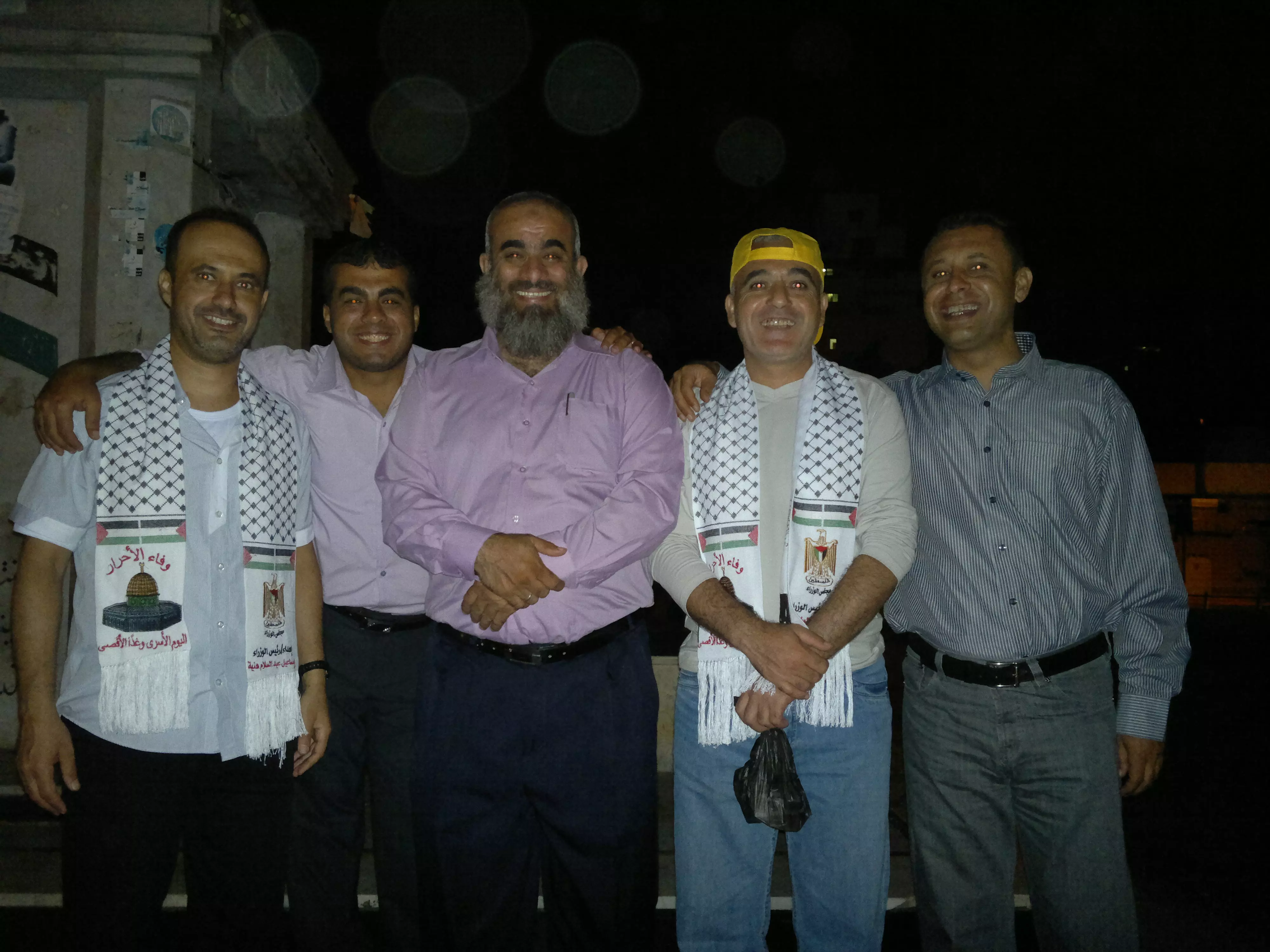
- الشهيد القائد / فوزى أبو القرع
Posted by سامر 1 - ابن بيت جرجا المناضل القائد عطا ابو كرش
Posted by الميدانى 2 - Bayt Jirja 01-11-2010
Posted by said - Bayt Jirja 01-11-2010
Posted by said - Bayt Jirja 01-11-2010
Posted by said - Bayt Jirja 01-11-2010
Posted by said - الاسرى 24 عام في سجون الكيان الصهيوني
Posted by ابو معاذ - بيت جرجا
Posted by abu raya - بيت جرجا
Posted by abu raya - بيت جرجا
Posted by abu raya - بيت جرجا
Posted by abu raya - بيت جرجا
Posted by abu raya - بيت جرجا
Posted by abu raya - بيت جرجا
Posted by abu raya - بيت جرجا
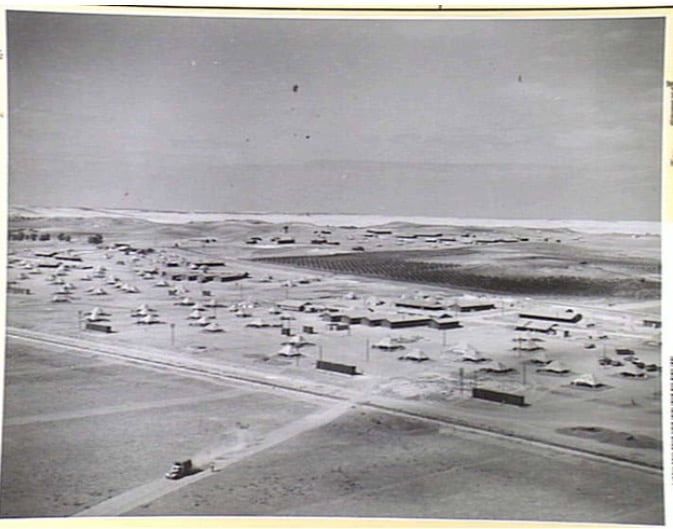
Posted by abu raya - جيش الانتداب البريطاني في بيت جرجا سنه 1940
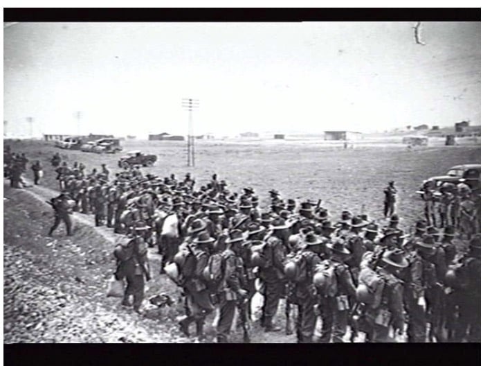
Posted by abu raya - صوره من الجو لقريه بيت جرجا والمعسكر البريطاني على اراضيها سنه 1940
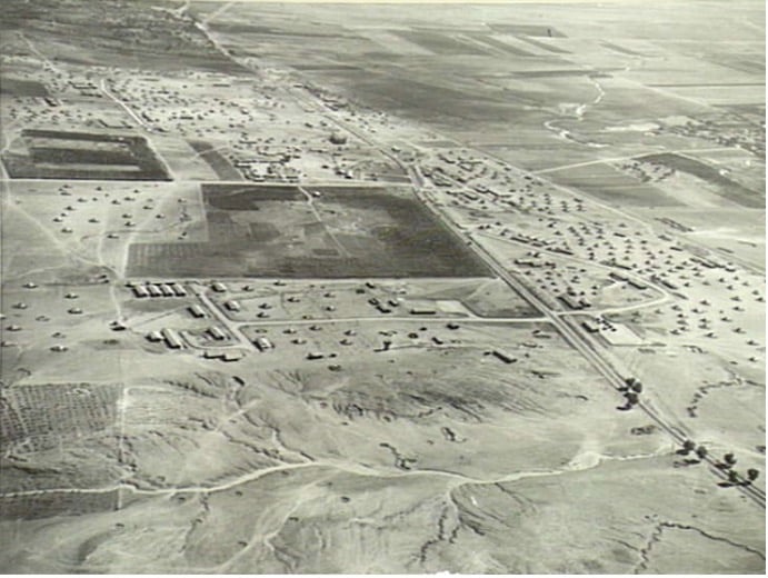
Posted by abu raya - بيت جرجا من الجو سنه 1940
Posted by abu raya - صوره من الجو لمعسكر بيت جرجا سنه 1940
Posted by abu raya - بيادر بيت جرجا سنه 1940
Posted by abu raya - Pre-Nakba Aerial view of the village / صورة من الجو للقرية اخذت قبل النكبة
- صورة نادرة وساحرة لقرية بيت جرجا قضاء غزة بين عام 1857-1867..
- صورة جوية لبيت جرجا 1945
Posted by أبو اليزن السعافين -
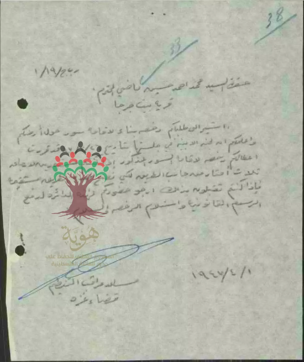
طلب رخصة بناء - محمد أحمد حسين ماضي - بيت جرجا --01/04/1947
-
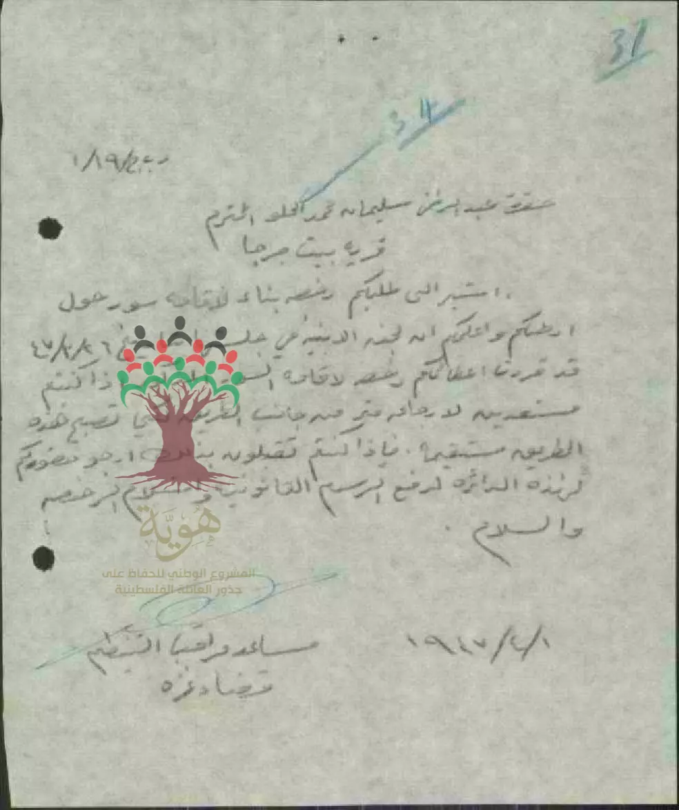
طلب رخصة بناء - عبد الرحمن سليمان محمد الحلو - بيت جرجا
-- 01/04/1947
-
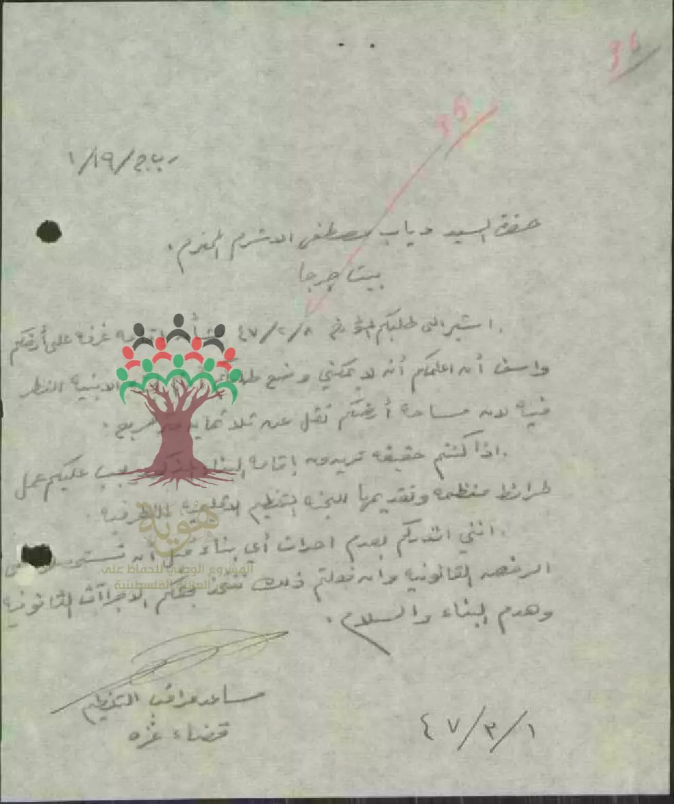
طلب رخصة بناء - دياب مصطفى الأشرم - بيت جرجا -- 01/03/1947
-
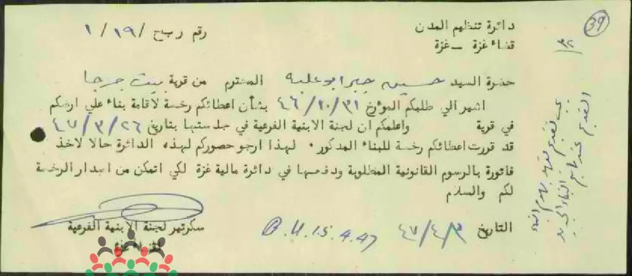
رخصة بناء - حسين جبر أبو علبة - بيت جرجا -- 03/04/1947
Want to browse more? 80,000 pictures were grouped in these gallaries:
| Display Name | Clan/Hamolah | Country of Residence |
| Nour Abou Nada | Beit jerja | Lebanon |
| hanimadi | Madi | Gaza, palestine |
| محمود الحلو | - | - |
| يوسف حسن | - | جدة |
| ابو خليل | - | - |
| Osaamaa | أبو القرع | NRW, Germany |
| ABU HUSSIAN | ابوحسنين | DOHA, QATAR |
| سامر | ابو القرع | غزة, غزة |
| ابو فراس | ابو القرع | جـــــــــدة |
| Abosaeed | negm | Qatar |
| إبن حارتنا | أبو ندى | فلسطين, فلسطين |
| Mohammed Al Araj | - | Amman |
| Mohammed Al Araj | - | Amman |
| خليل ماضي | - | - |
| عبدالحليم عبدالحافظ | ابوندا | qatar, qatar |
| nafezabunasser | abunasser | - |
| خادم أهل البيت | ابوندا | - |
| mahirnaser | - | - |
| Dr. Ahmed Khalil Abu Nasser | Abu Nasser | Abu Dhabi, U.A.E |
| Dr. Mohmood Khalil Abu Nasser | Abu Nasser | Abu Dhabi, U.A.E |
| Khalil Abu Nasser | Abu Nasser | Abu Dhabi, U.A.E |
| سمير ابو ندا | ابوندا | - |
| خليلية | خليلية | جبع |
| ramzi Abohalabia | Abohalabia | jeddaha, suadi arabia |
| Yasser Abu Nasser | Abu Nasser | Kuwait, Kuwait |
| Mohammed Ahmed Mohammed Madi | Madi | Abu Dhabi, UAE |
| amal abohalabia | abohalabia | - |
| jabr abohalabia | abohalabia | - |
- Bayt Jirja 2010
- فيديو حديث من بيت جرجا القرية الفلسطينية كانت تتبع لقضاء غزة، هجر الإسرائيليون أهلها خلال حرب 1948 وتم تدميرها بالكامل Duration: 10 min 26 sec
- أرشيف وطن - بيت جرجا- مع علي نسمان Duration: 30 min 2 sec
- قرية بيت جرجا الفلسطينية - مع الحاج محمود أبو ناصر Duration: 19 min 50 sec
- زيارة لقرية بيت جرجا المدمرة في الجنوب الفلسطيني قضاء غزة.... تصوير قيس فحماوي Duration: 10 min 26 sec
 Fake Valor: Why Did Zionist Jews Hoist Nazis Flag on Their Ships in the 1930s?
What is new?
-
Facts About Oct. 7th Gaza Raid
-
Remined Us Please: Who Did Rape Whom? Was it Palestinians who raped Israelis? Or, was the other way around? You'll be the judge
-
When Prof. Edward Said was invited to debate Bibi Netanyahu in the 1980s, watch what happened!
-
Ezra Klein of the NY Times on the "Jewish Race".
-
Abusing Blood Libel!
-
How and why Israeli Jewry has become the most hated cult?
-
Did Israeli Soldiers Activate The Hannibal Direective On Oct. 7th? You Be The Judge
-
Zionist FAQ: Isn't it true that Palestinians don't want peace? Palestinians never accepted the two-state solution
- Facts about Haavara (Transfer) Agreement between Ben-Gurion & Hitler
-
Haavara FAQs: Why Did Zionist Jews Hoist Nazis' Flags on Their Ships in the 1930s?
- Haavara FAQs: When Chaim Weizmann met FDR in mid-1943, why was he silent about rescuing European Jewry?
-
Dear ChatGPT: How did Palestinians resist Napoleon's invasion of their country in 1799?
-
Dear ChatGPT: Gaza had a vibrant Jewish community in the mid-17th century. What happened to them?
-
Dear ChatGPT: Why did the Jewish Agency suppress news of the Holocaust during WWII?
-
Video Playlist: Jews share their DNA tests to end the conflict for good.
-
A Tale of Two Conflicts: Examining the Definition of Genocide
-
Prof. Abraham Polak And The Suppressed History of the Khazars and European Jewry
-
How Ronald Reagan would have framed the genocide in Gaza if he were still alive?
-
Haavara FAQs: Let us do the math: how many German Jews did The Haavara Agreement save?
-
Zionist FAQs: The Hebron Massacre of 1929, "clearly proves" that Palestinians are antisemitic, how could you deny it?
-
Zionist FAQs: Why Anti-Zionist Is Not Antisemitism?
-
Zionist FAQs: Isn't it true that the KGB created Palestinian Nationalism in the early 1960s?
- Zionist FAQs: Muslims are killing Muslims all the time; why are Israeli Jews being singled out in the media?
- Zionist FAQs: How is Israel an apartheid state when 20% of its citizens are Arabs who enjoy full rights?
-
Haavara FAQs: Why Did Dorothy Thompson Flip From A Zionist Advocate to A Silenced Dissenter?
-
Haavara FAQs: Analysis of Herzl's Uganda Scheme and how it could have saved millions of Jews.
-
Haavara FAQs: Why did Hayim Greenberg describe American Jewry as "morally bankrupt" in early 1943?
-
Haavara FAQs: What if the Evian Conference was a resounding success? What would have been the impact of saving European Jewry on Zionism?
- Haavara FAQs: What if the six million were saved, how that would have impacted the Zionist project?
-
Haavara FAQs: How did Zionist leaders react when Europe's Jews lingered in the DP camps after WWII ended?
-
Why does the American Jewish community repeat lies that David Ben-Gurion had debunked before he died?
-
Who has the power to rename the Tatar/Khazar Gene Marker to Jewish IV?
-
Zionist FAQs: Why won't Egypt, Syria, and Jordan take their people back? Jews are indigenous to Palestine, and Arabs immigrated after Jews developed the country. Arabs should leave.
-
Haavara FAQs: Did Hitler and the Nazis conflate between Judaism and Zionist? If that wasn't case, then why?
-
Haavara FAQs: Winston Churchill and antisemitism, a collection of articles written Churchill.
-
Haavara FAQs: Broken by country, how many Jews survived vs. killed during the Holocaust?
-
Haavara FAQs: Why did European Jews vote with their feet and to immigrated to the Americas, not Palestine, after WWII?
-
Watch this American Jewish Girl describing Israeli Jews' cognitive dissonance like no other in under two minutes
-
Haavara FAQs: When the Nazis went out of their way to hide the Holocaust, Israeli Jews did the exact opposite by broadcasting their genocide of Gazans. But why?
-
Haavara FAQs: How Zionist Jews went out of their to show their appreciation to Nazism and Fascism?
- Haavara FAQs: Why Zionist leaders were against bombing the death camps & the Railroads leading to them?
-
Haavara FAQs: Hitler's message to the British and American people: If Jews are such noble citizens and you care about them, how come you're not letting them in? I will gladly ship them to you at my expense, even on luxury liners!
-
A shortlist of Zionist and Israeli false flag operations in the name Jews.
-
The Most Moral Army
- The Land of Kapos (Israel): Where the brave are boycotted and Kapos walk free.
- Why did early Zionists often named their communal enterprises "colonial"?
- Zionist Relations with Nazi Germany by Faris Glubb
-
Two NY Times advertisements by Zionists in the early 1943 that exposes Zionists' treason at the height of the calamity
- Facts Not Lies about the Palestinian-Israeli Conflict.
- Site's pictures have been categorized
- Campgain Against Lice
- A Survey of Palestine, the official source about Palestine before Nakba produced by the British Mandate; over 1200 pages.
- Satellite View & Google Earth: Over 6,000 placemarks identifying all destroyed towns, W. Bank & Gaza Strip Towns, & refugee camps.
- PalestineRemembered.com and its Nakba Oral History Project were featured on al-Jazeera Satellite TV.
- Nakba Oral History Video Podcast:
 Over 700 Oral History interviews (including 3,500+ hours of recording) can be viewed online.
 - Palestine Village Statistics Project
- Gaza Jail Break
- النسخة العربية للموقع الان متوفرة
- Videos: Documenting the destroyed villages in video: Tracing all that remains since Nakba.
- Videos: Responding to Zionist Propaganda
- Interview: The ethnic cleansing of Palestine: George Galloway interviews Israeli Historian Ilan Pappe.
- For Palestinians, memory matters. It provides a blueprint for their future By George Bisharat.
- Zionist FAQ now available in Hebrew שאלות שציונים שואלים, עכשיו בעברית
- Video: The Stephen Walt and John Mearsheimer report on the influence of the Israel Lobby on U.S. Foreign Policy
- The Palestinian-Israeli conflict for beginners
