| PalestineRemembered | About Us | Oral History | العربية | |
| Pictures | Zionist FAQs | Haavara | Maps | |
| Search |
| Camps |
| Districts |
| Acre |
| Baysan |
| Beersheba |
| Bethlehem |
| Gaza |
| Haifa |
| Hebron |
| Jaffa |
| Jericho |
| Jerusalem |
| Jinin |
| Nablus |
| Nazareth |
| Ramallah |
| al-Ramla |
| Safad |
| Tiberias |
| Tulkarm |
| Donate |
| Contact |
| Profile |
| Videos |
Welcome To al-Lawz, Khirbat - خربة اللوز (ח'ירבת א-לוז)
|
District of Jerusalem
Ethnically cleansed days ago |
العربية Google Earth |
 |
Gallery (144) |
- Statistics & Facts
-
Before & After

- Satellite View
- Articles 9
- Pictures 144
- Aerial Views 2
- Oral History 3
- Members 24
- Families
- All That Remains
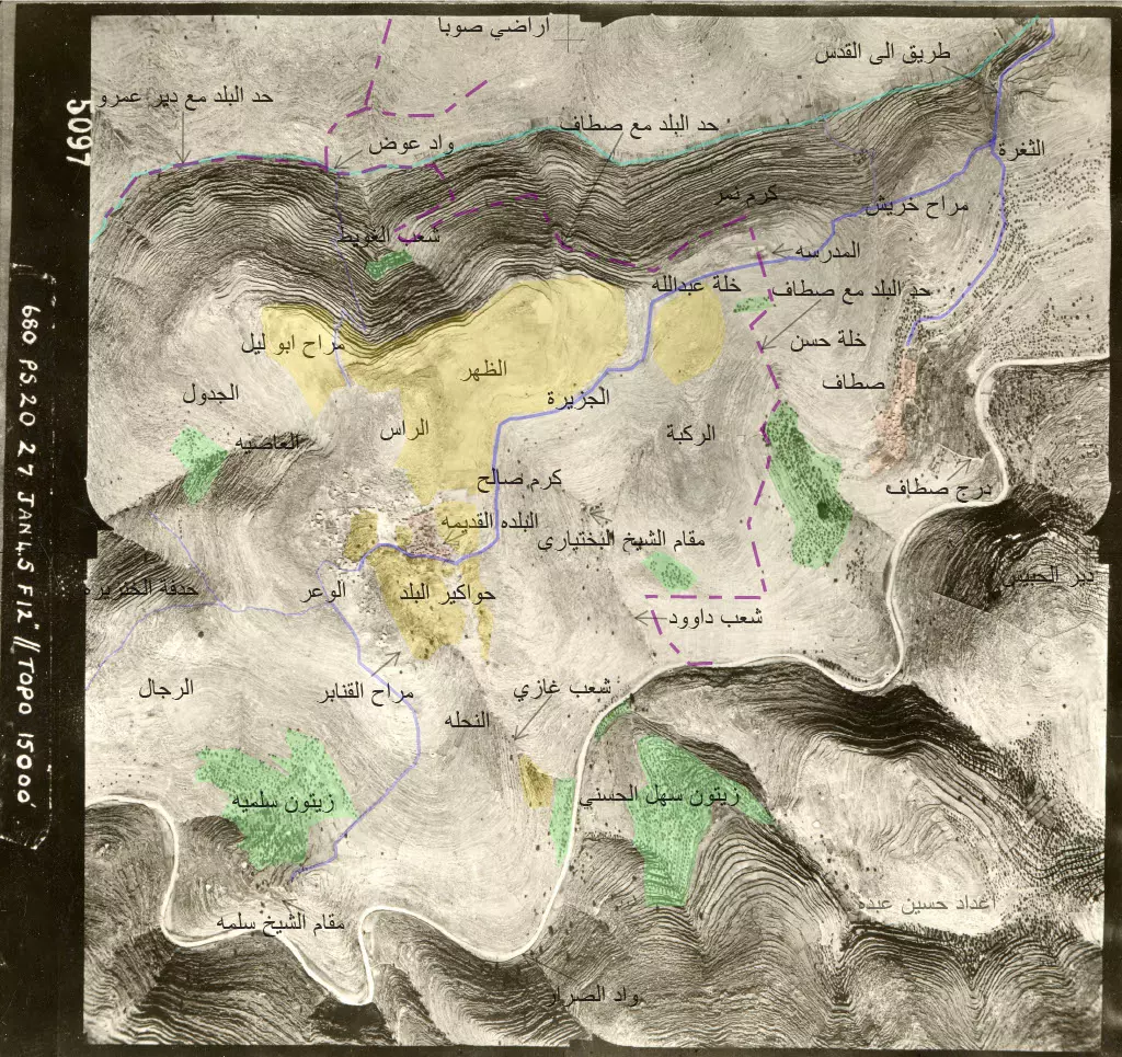
- Town's Map
- Wikipedia
- Videos 4
- Guest Book 11
- Links 2
| Statistic & Fact | Value | ||||||||||||||
| Occupation Date | July 13, 1948 | ||||||||||||||
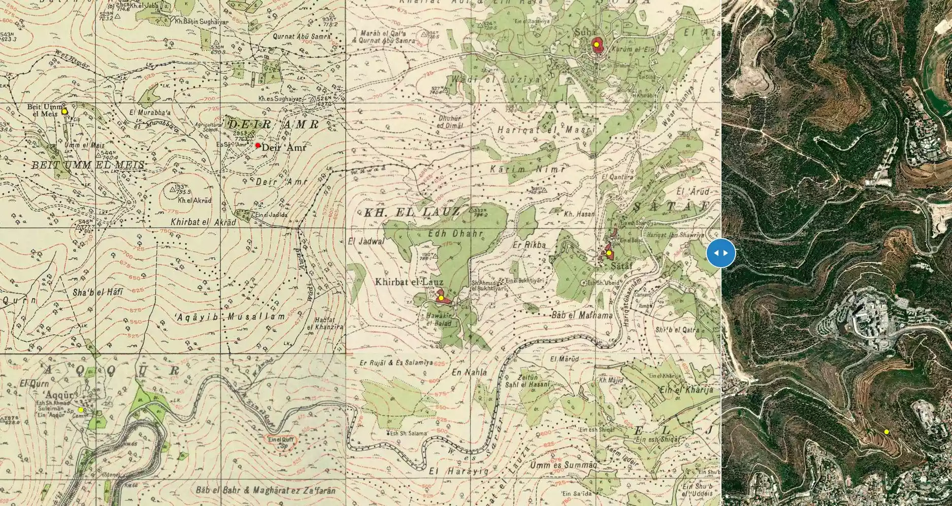
| Distance From District | 11 (km) West of Jerusalem | ||||||||||||||
| Elevation | 750 (meters) | ||||||||||||||
| Before & After Nakba, Click Map For Details |
|||||||||||||||
|
|||||||||||||||
| Pre-Nakba Aerial View |
|||||||||||||||
|
|||||||||||||||
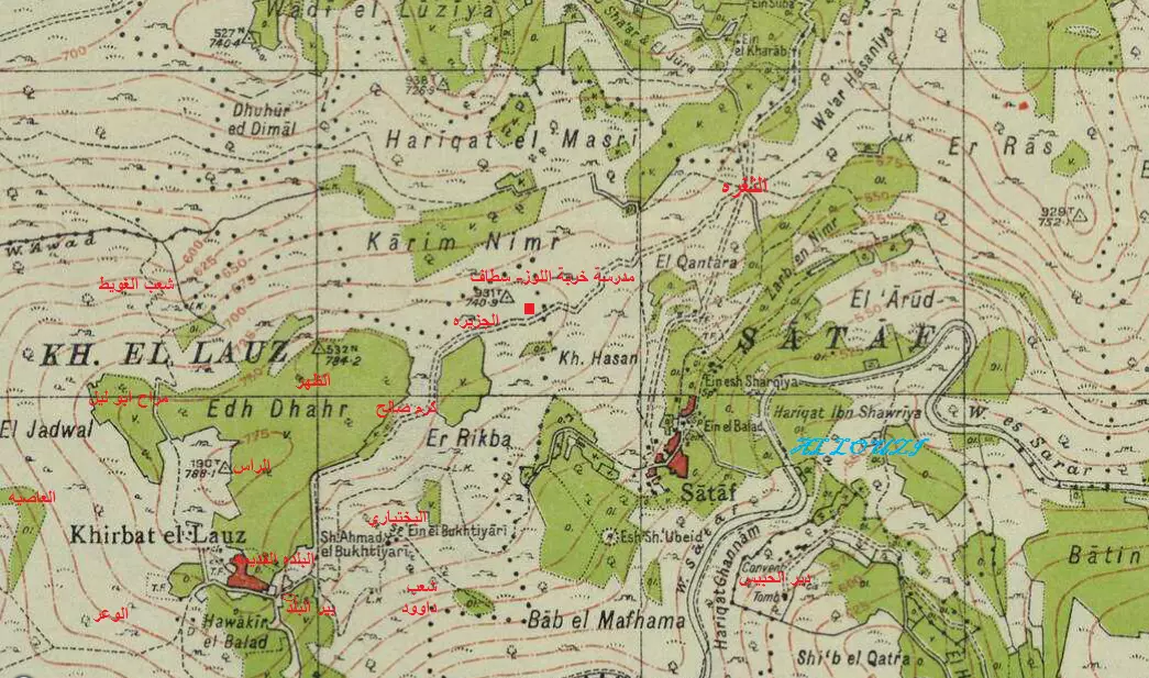
| Map Location | See location #22 on the map View from satellite |
||||||||||||||
| Military Operation | Operation Dani | ||||||||||||||
| Attacking Units | Har'el Brigade | ||||||||||||||
| Exodus Cause | Military assault by Zionist troops | ||||||||||||||
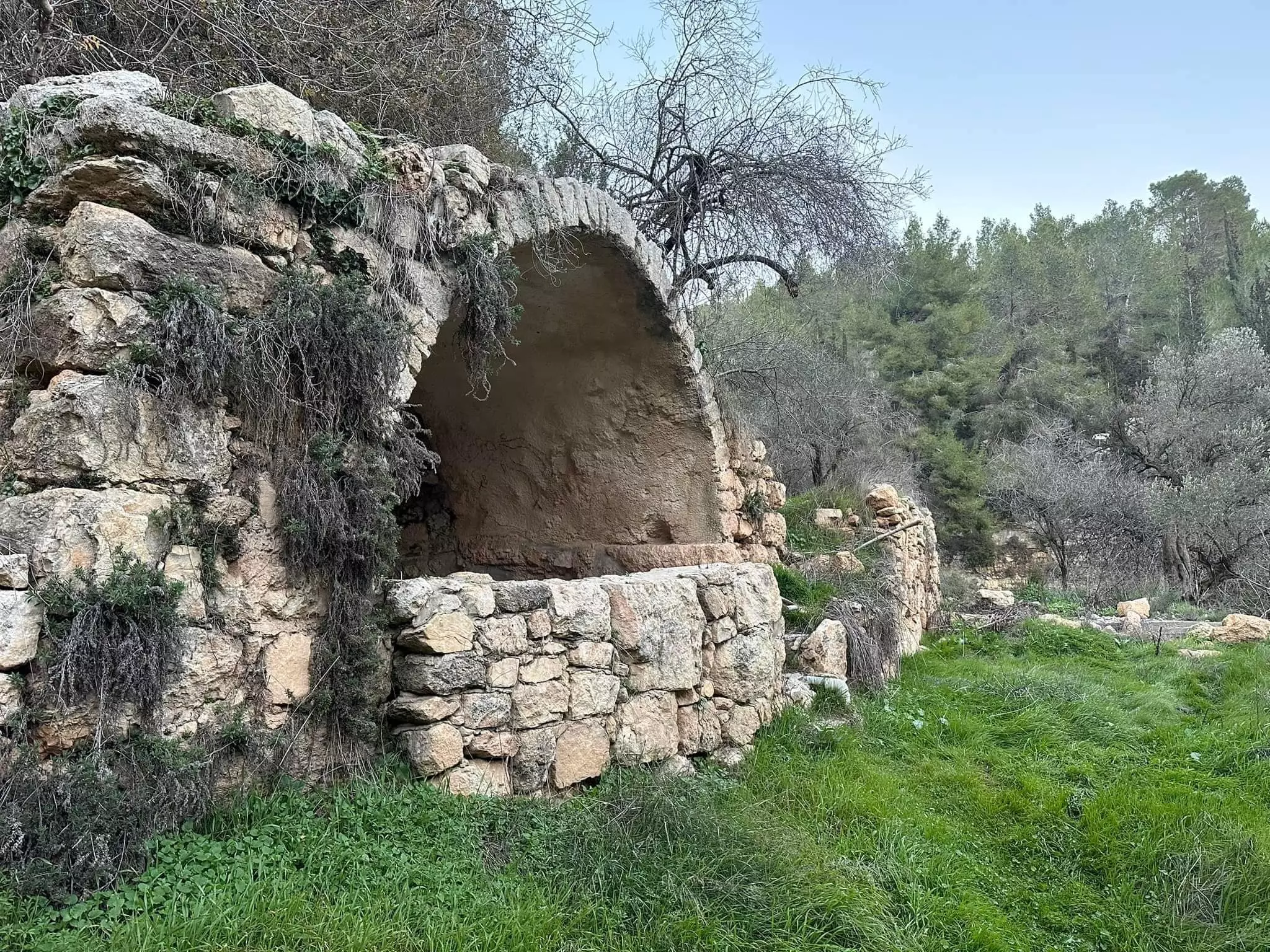
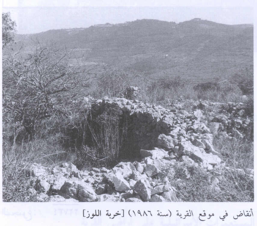
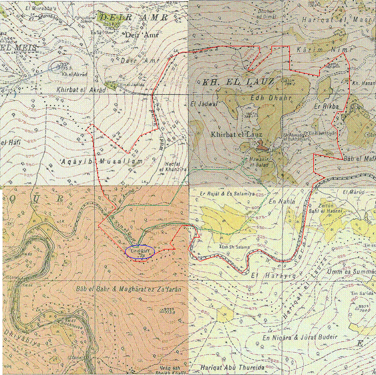
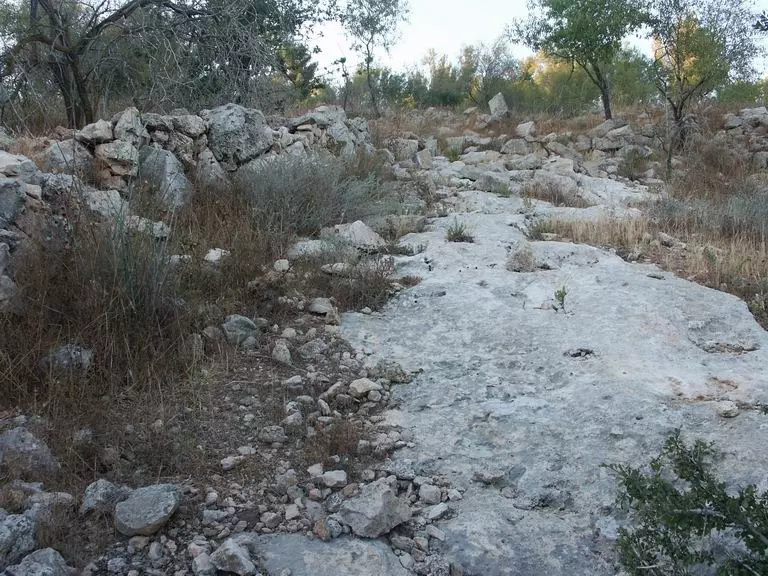
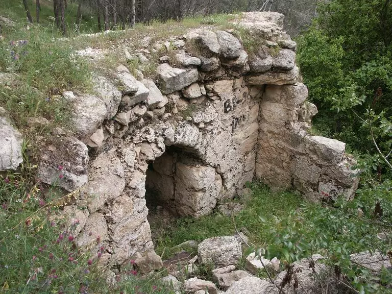
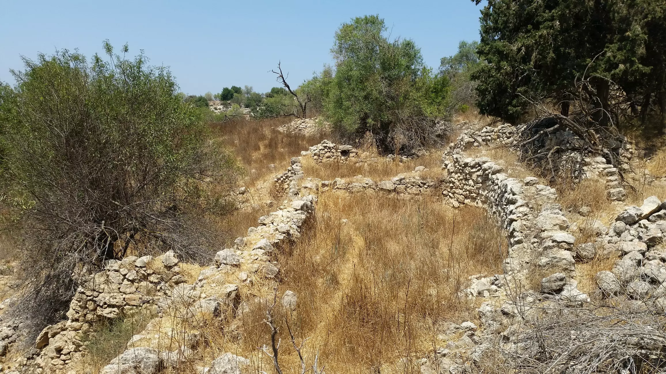
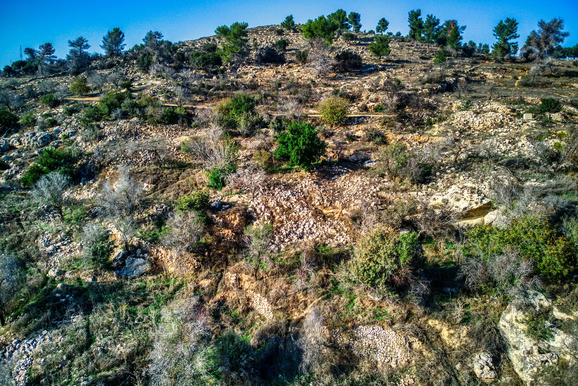
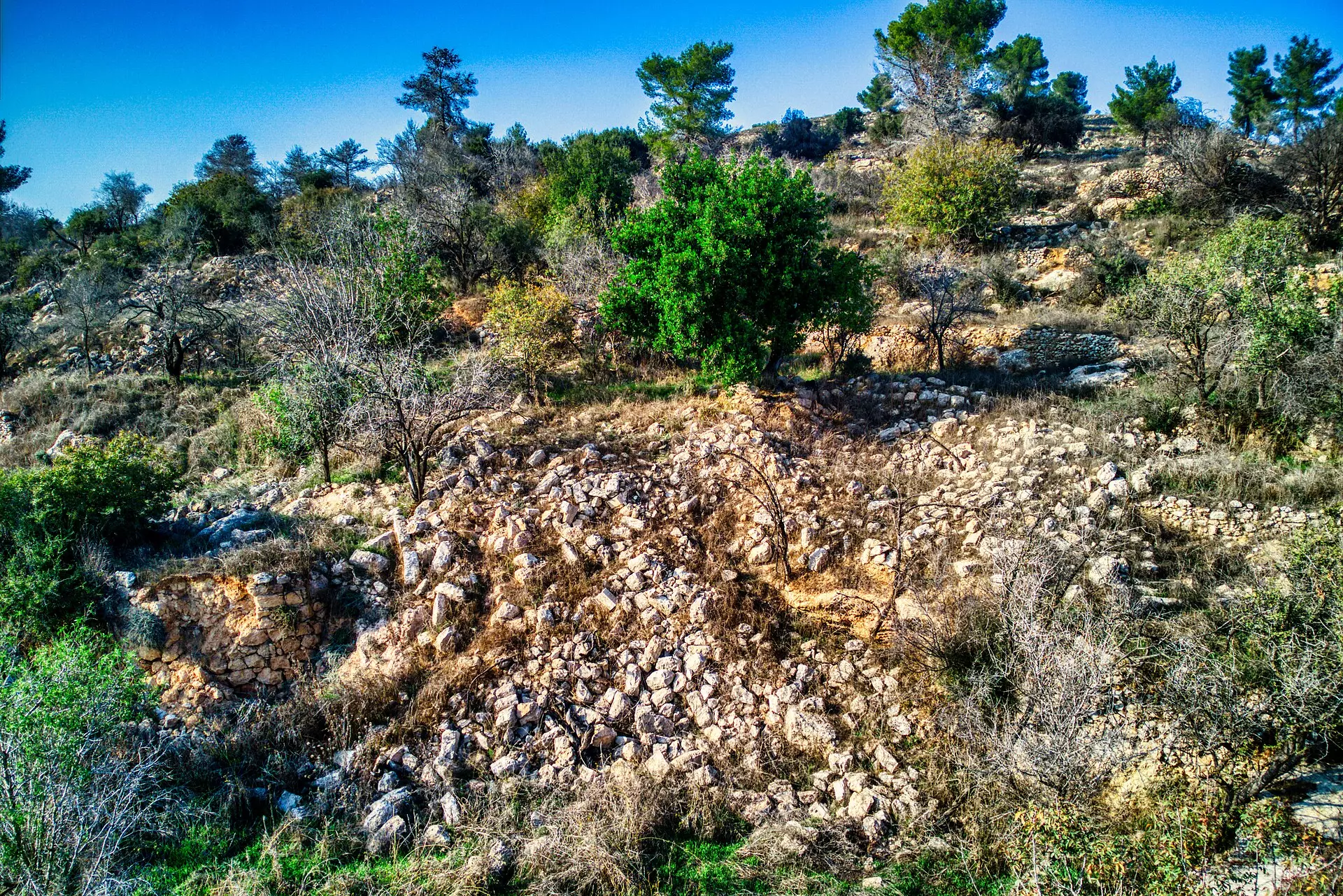
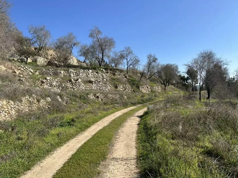
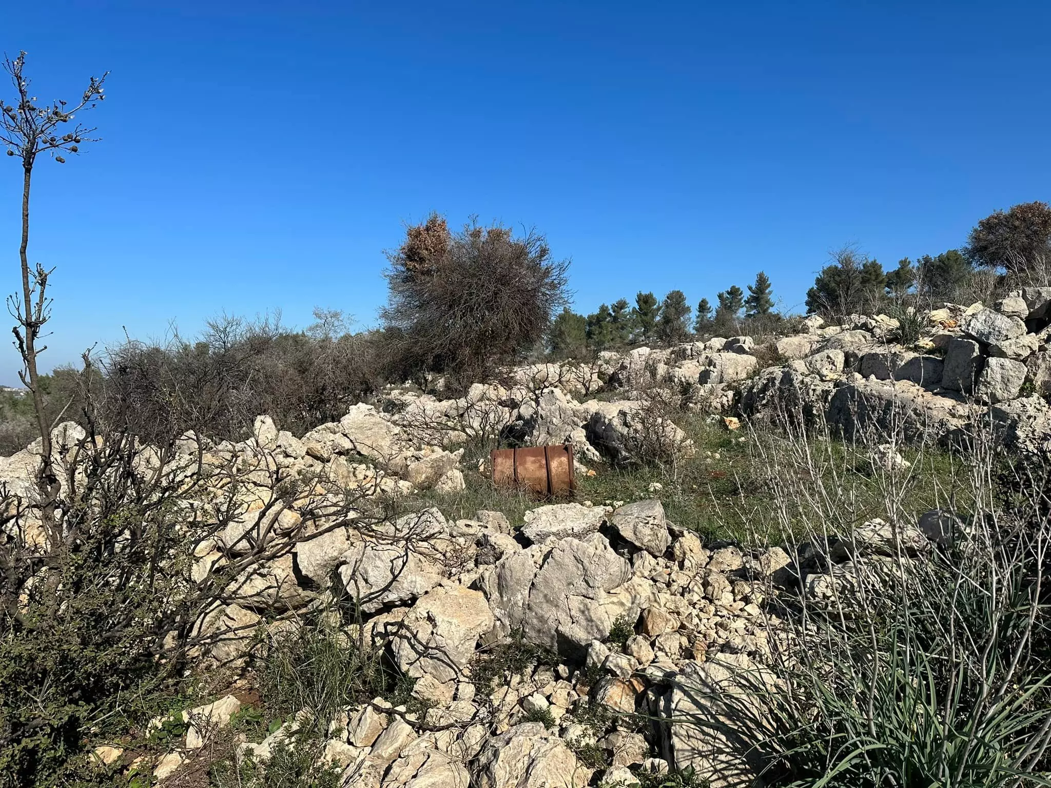
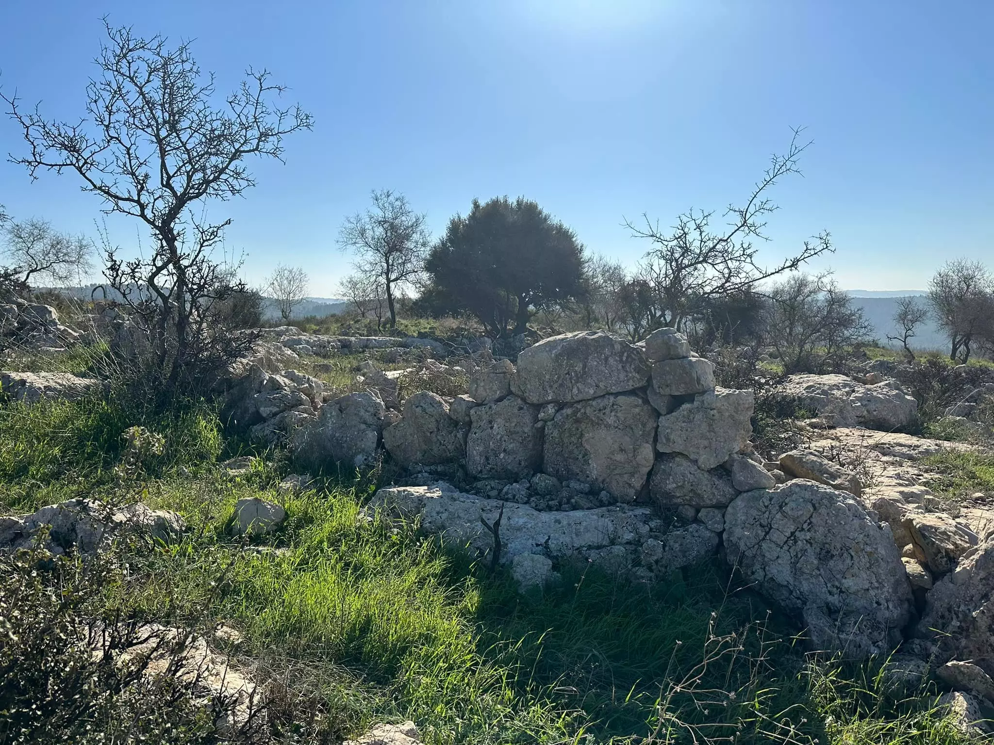
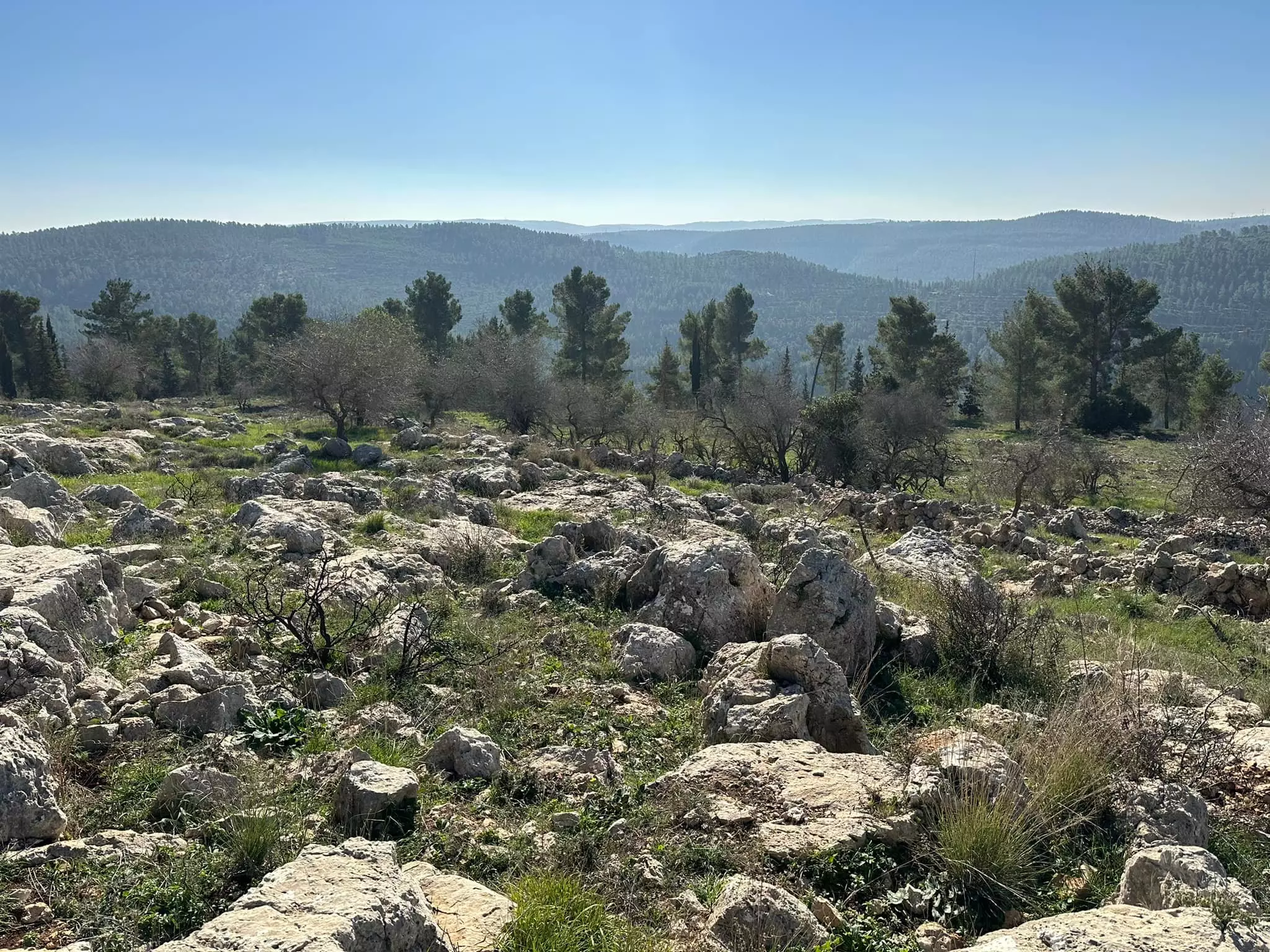
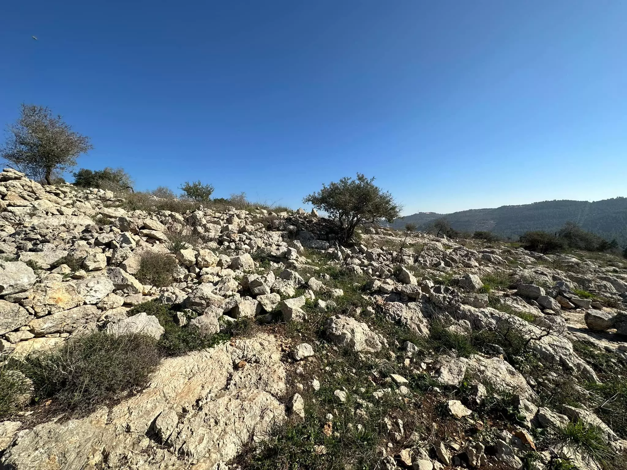
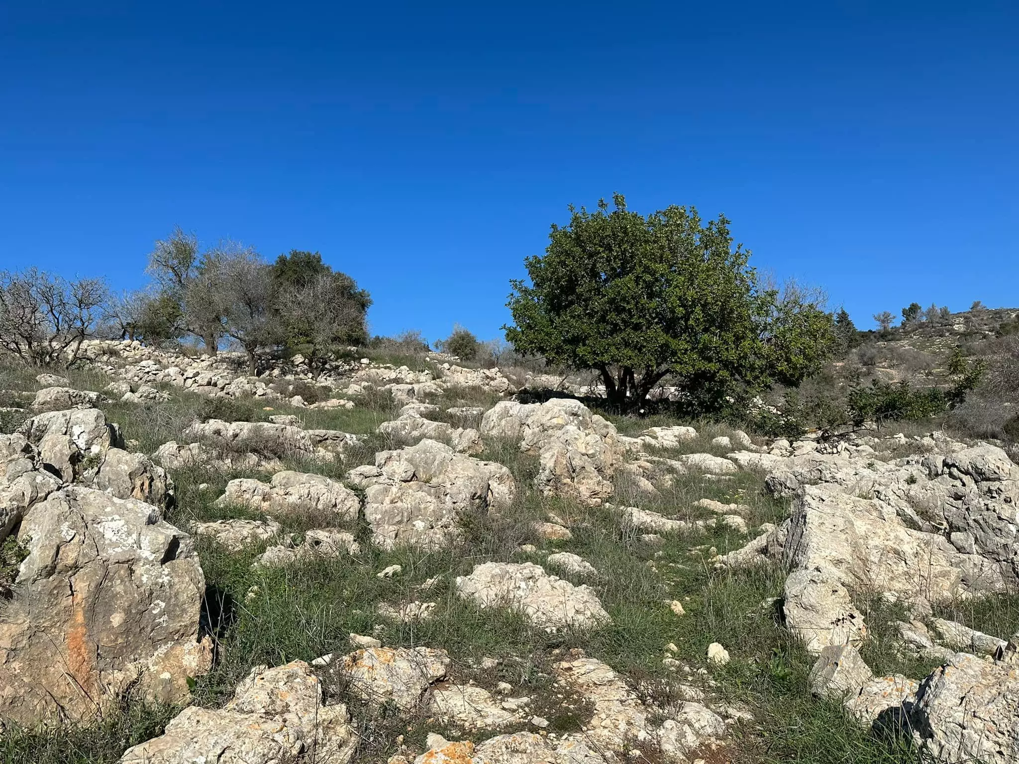
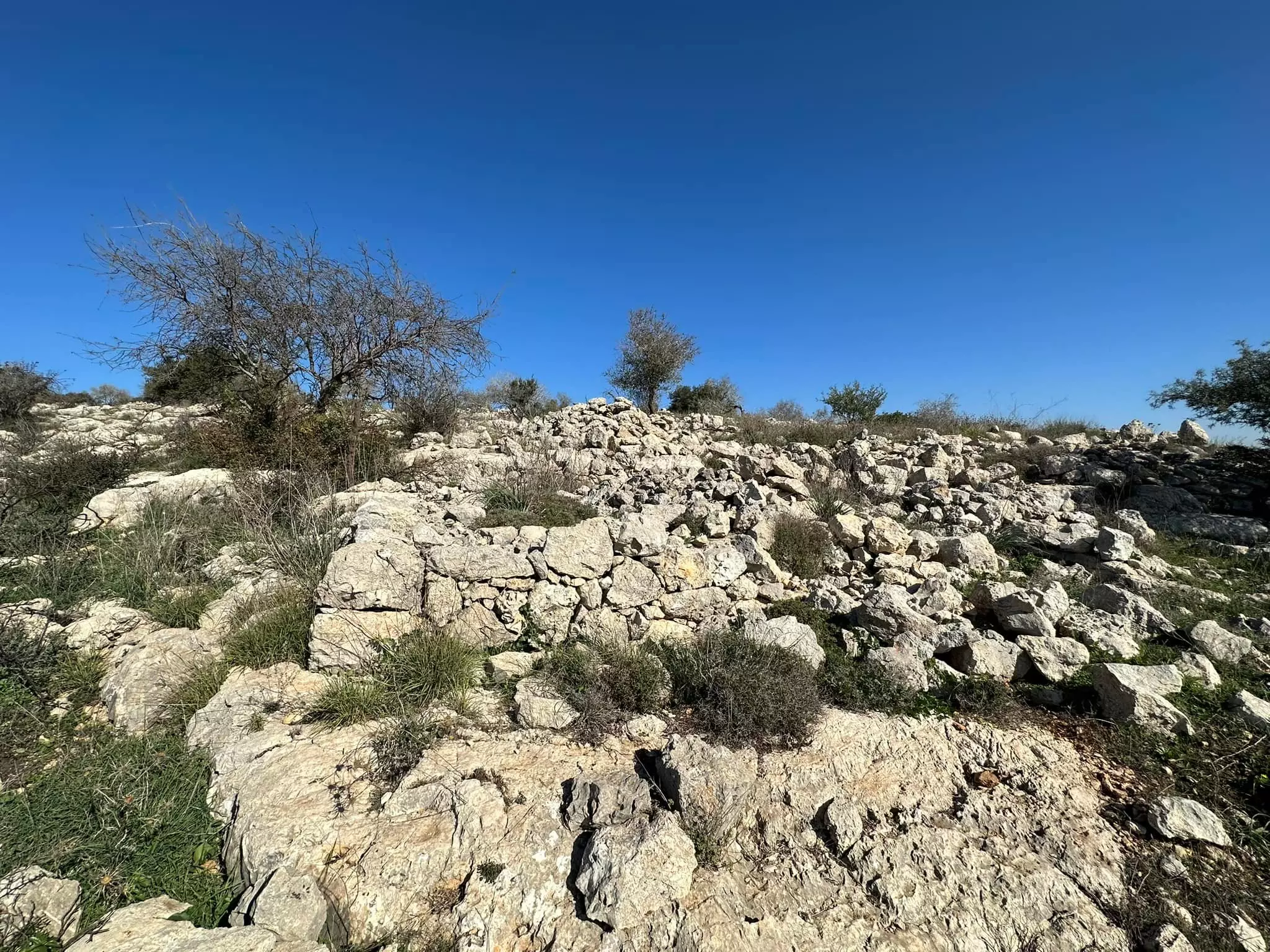
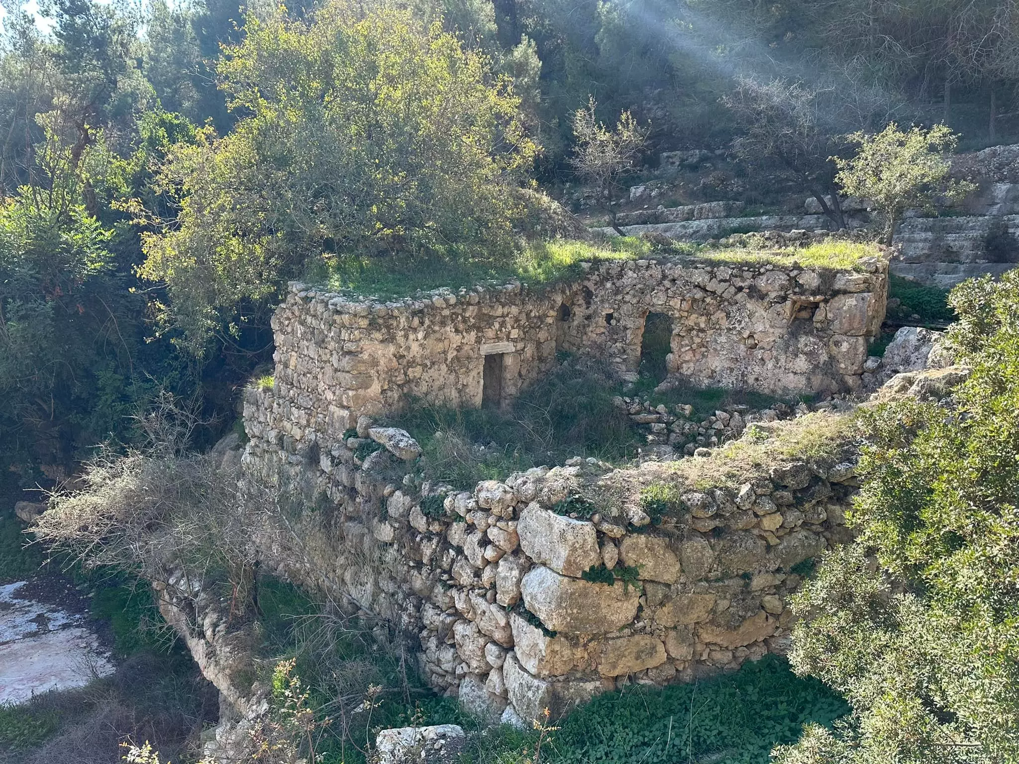
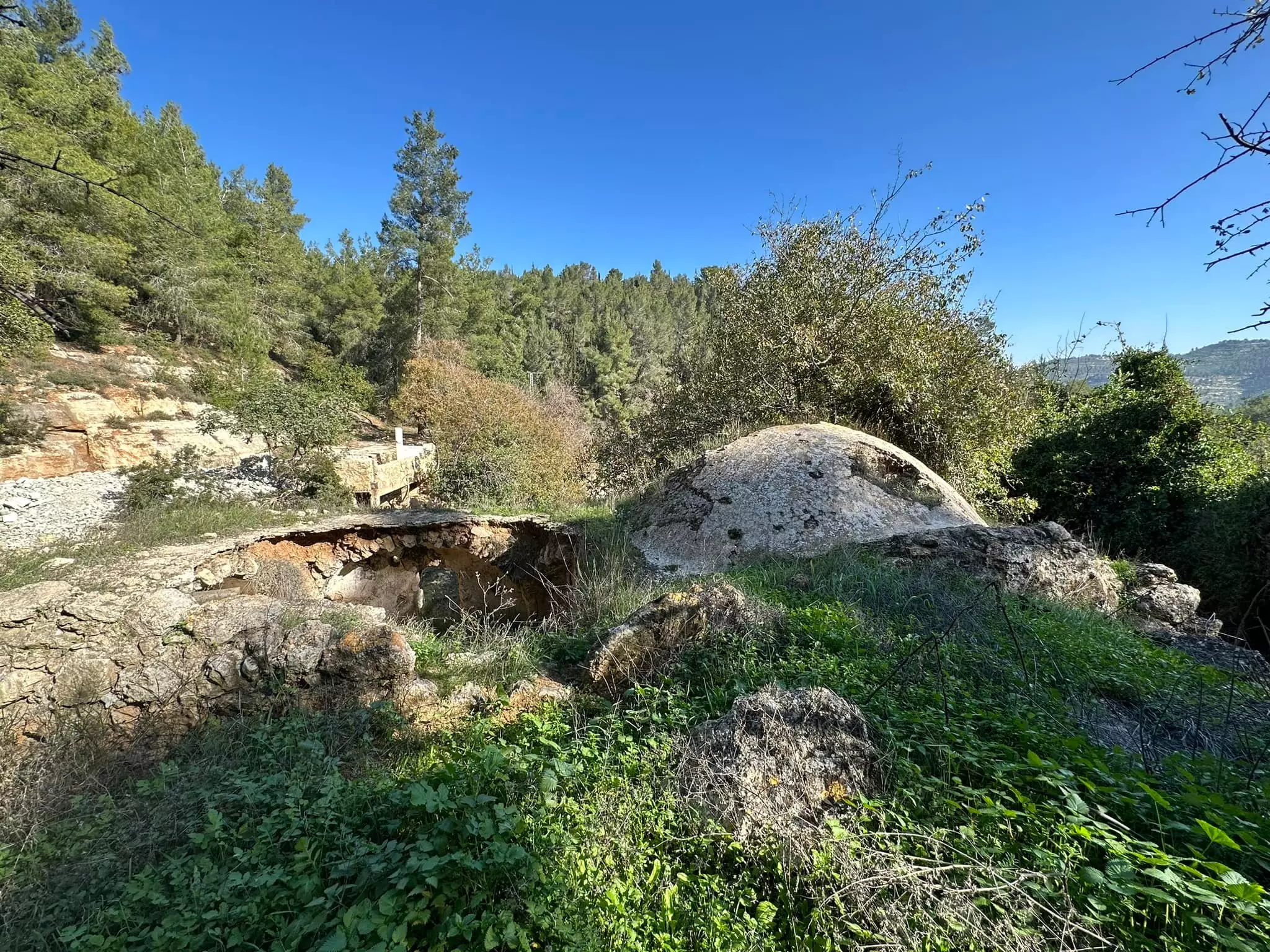
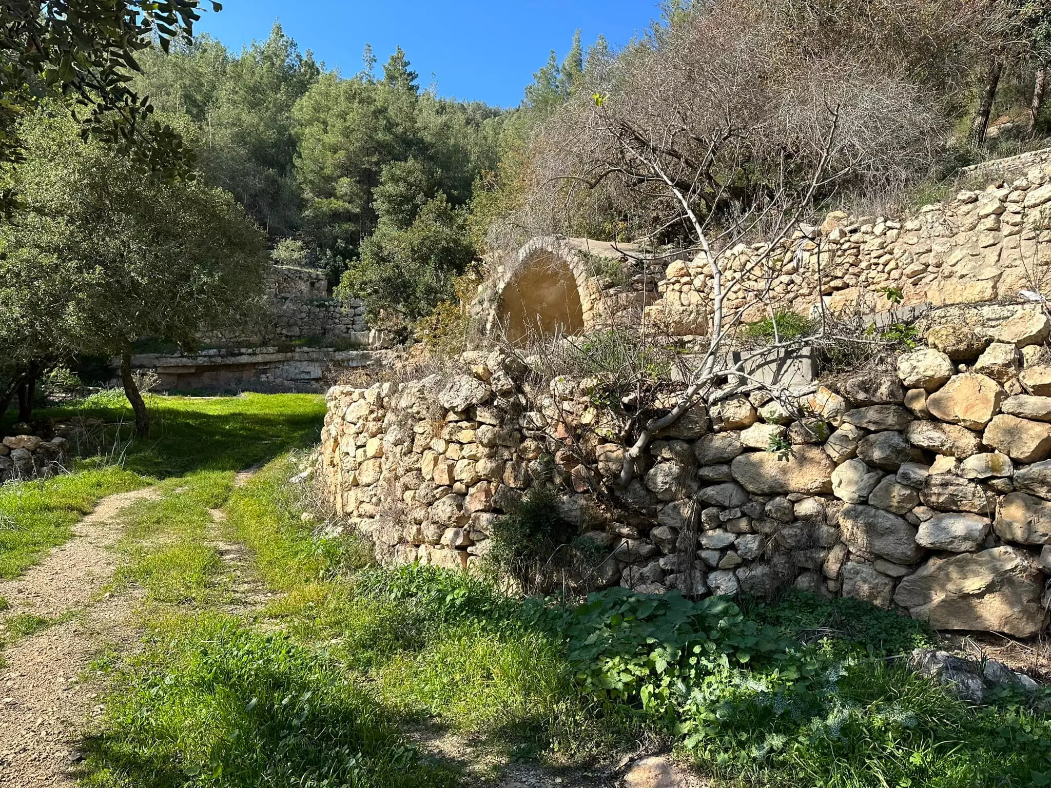
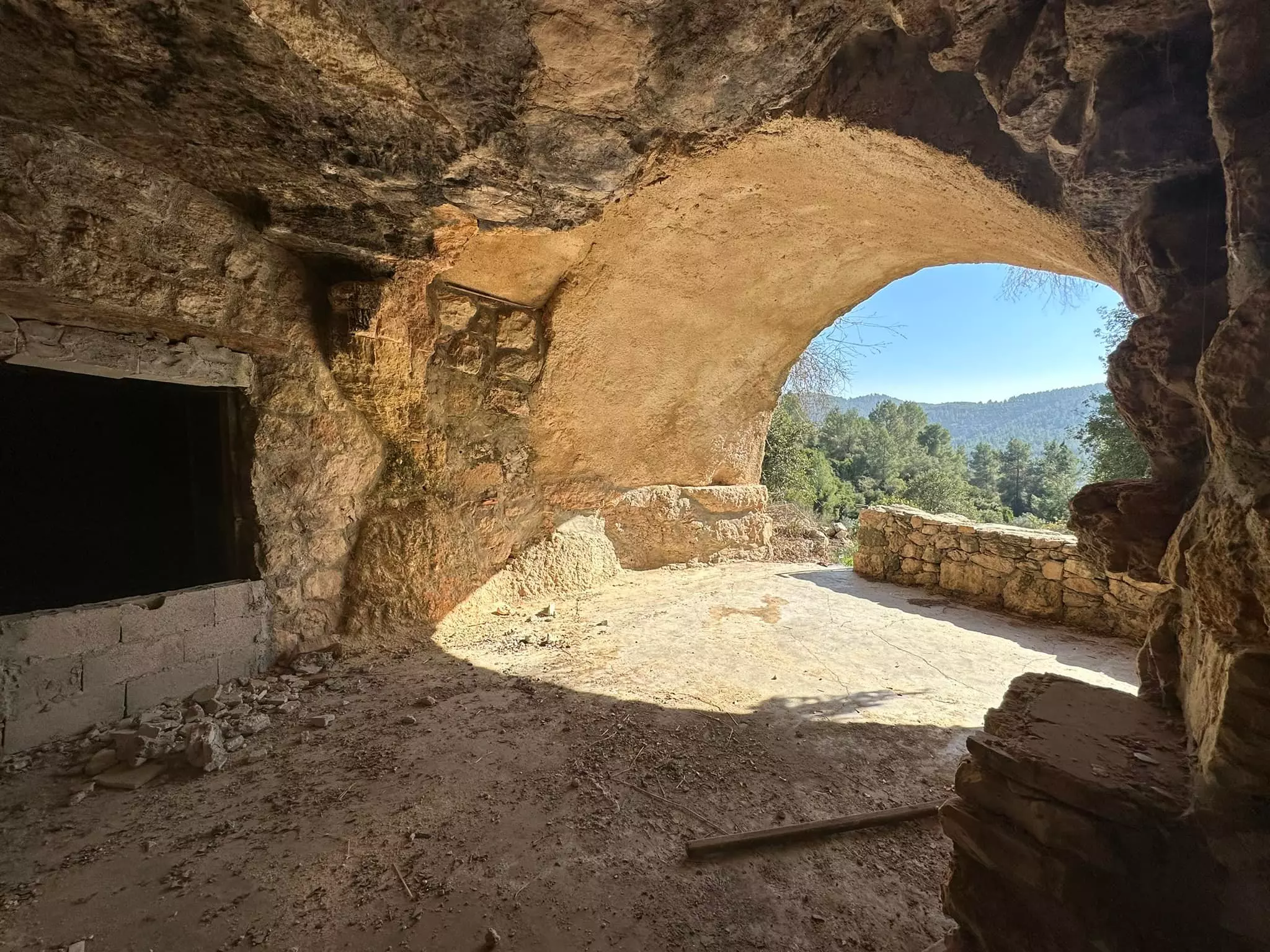
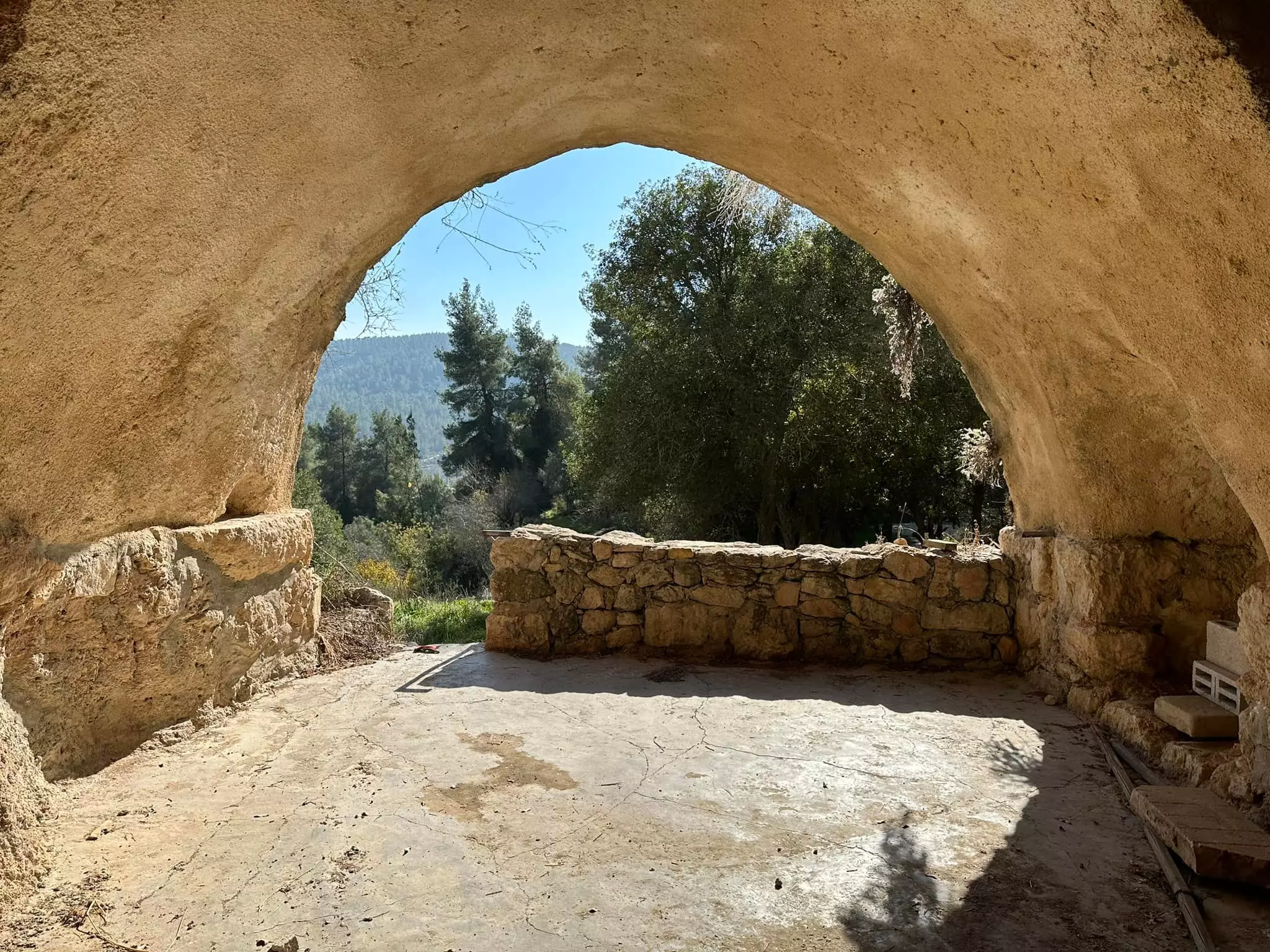
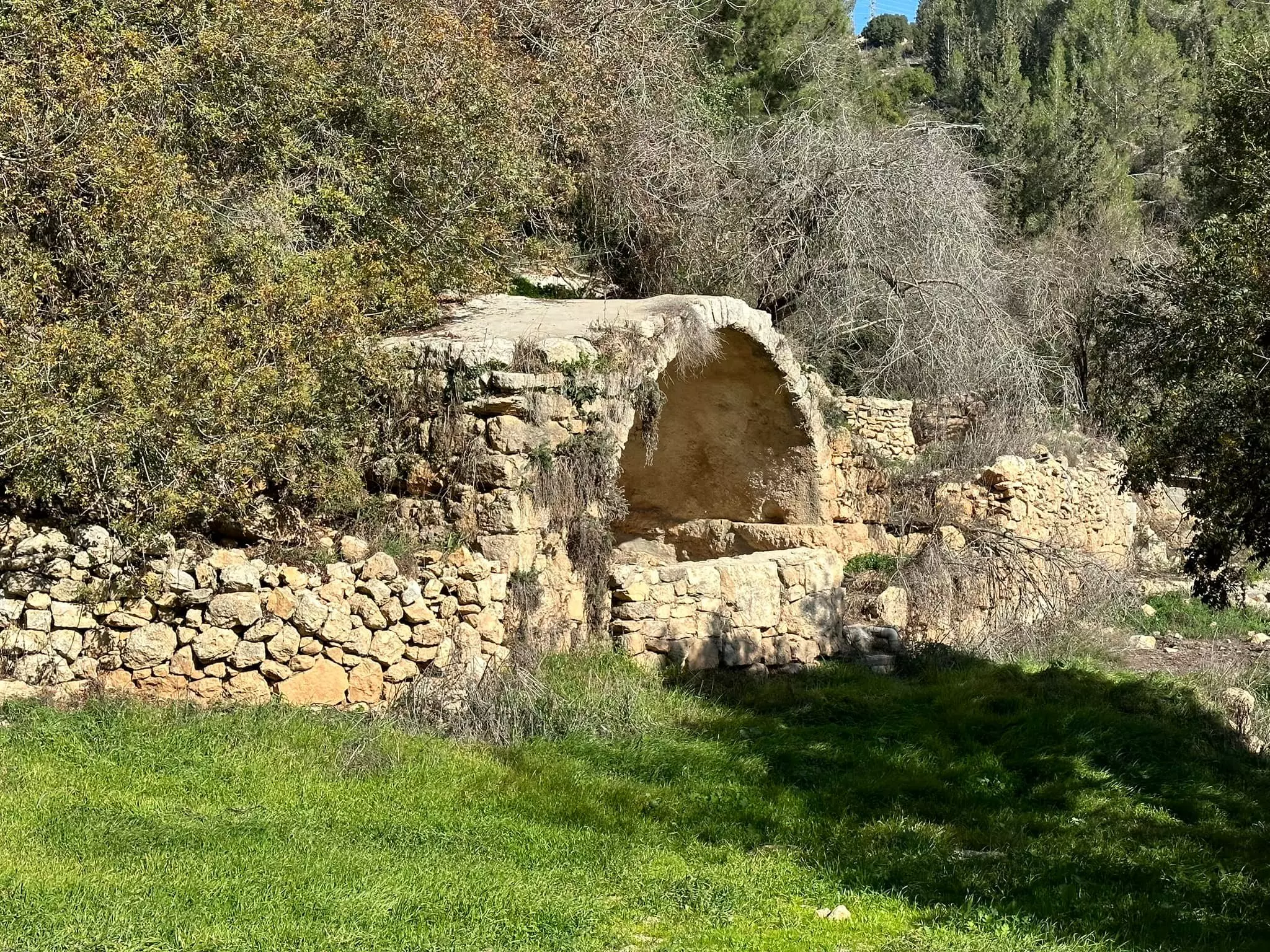
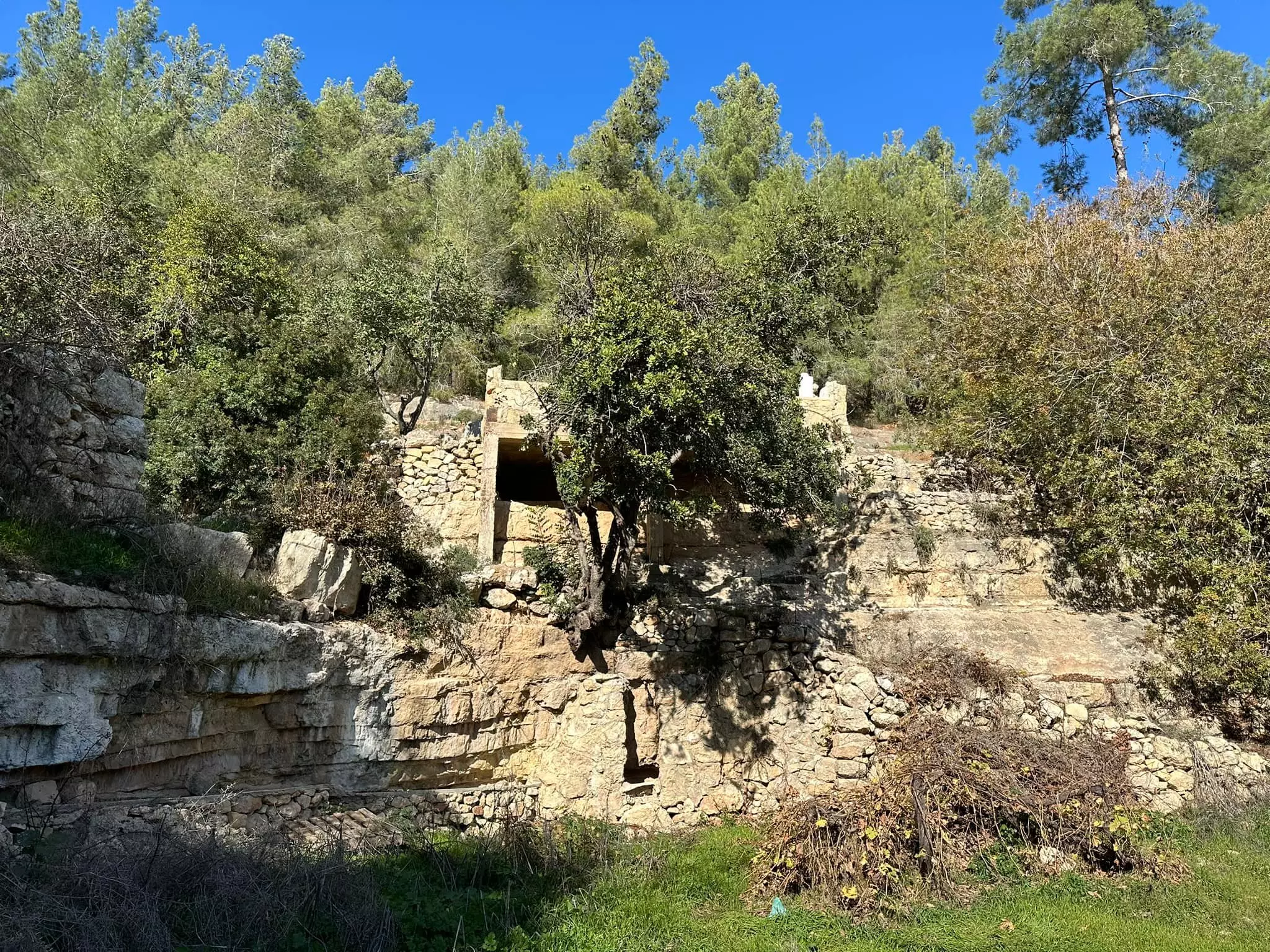
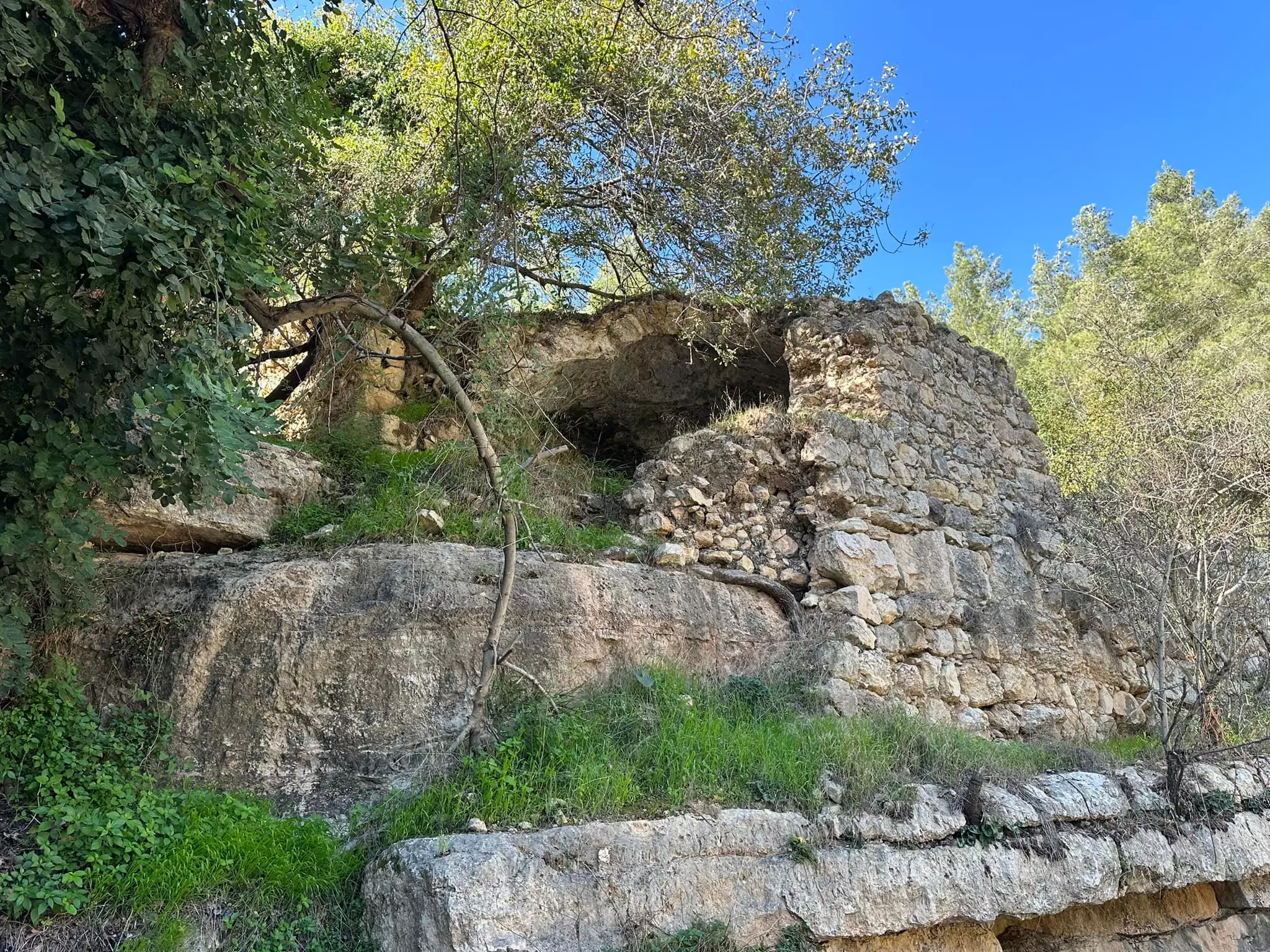
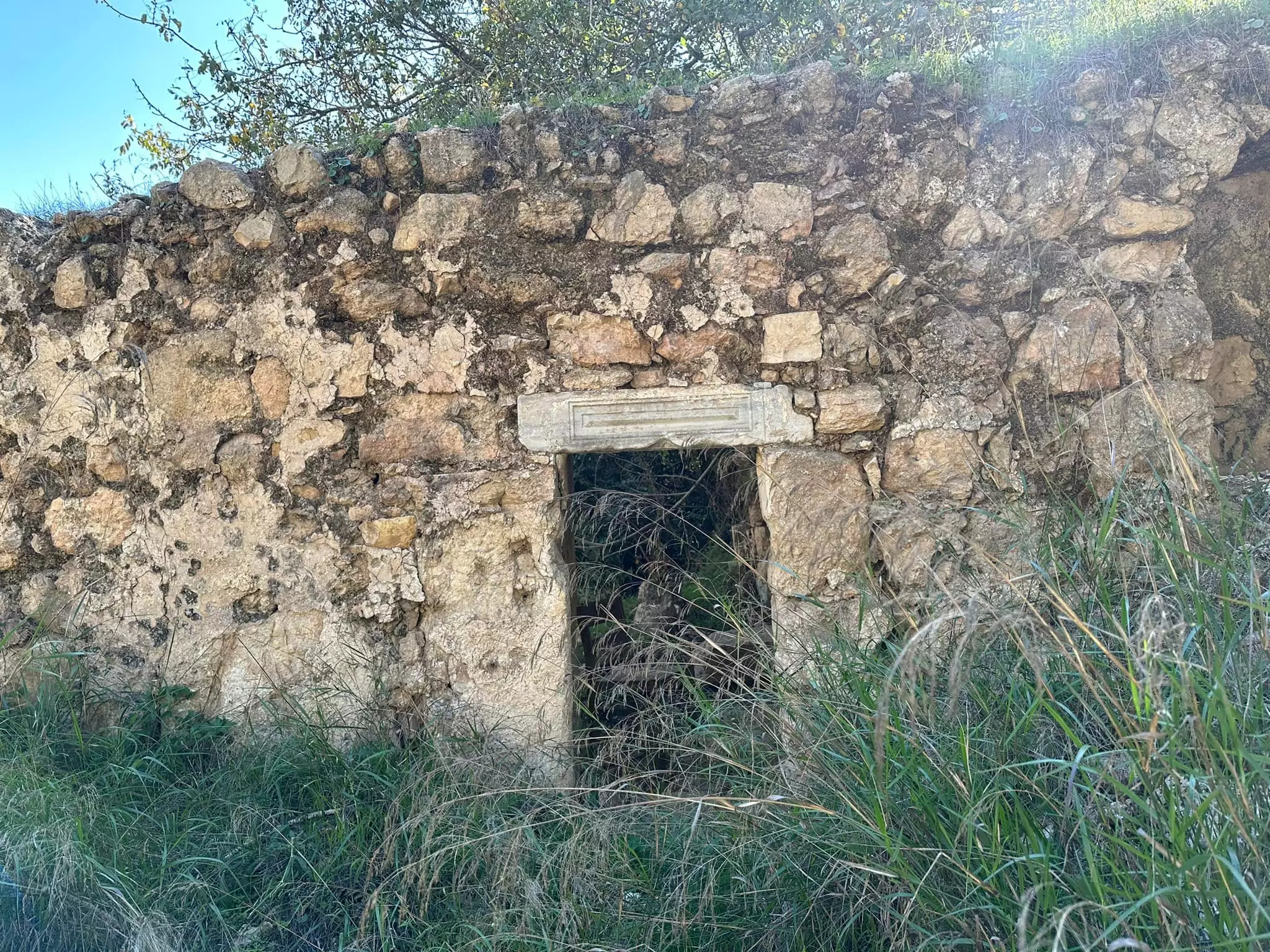
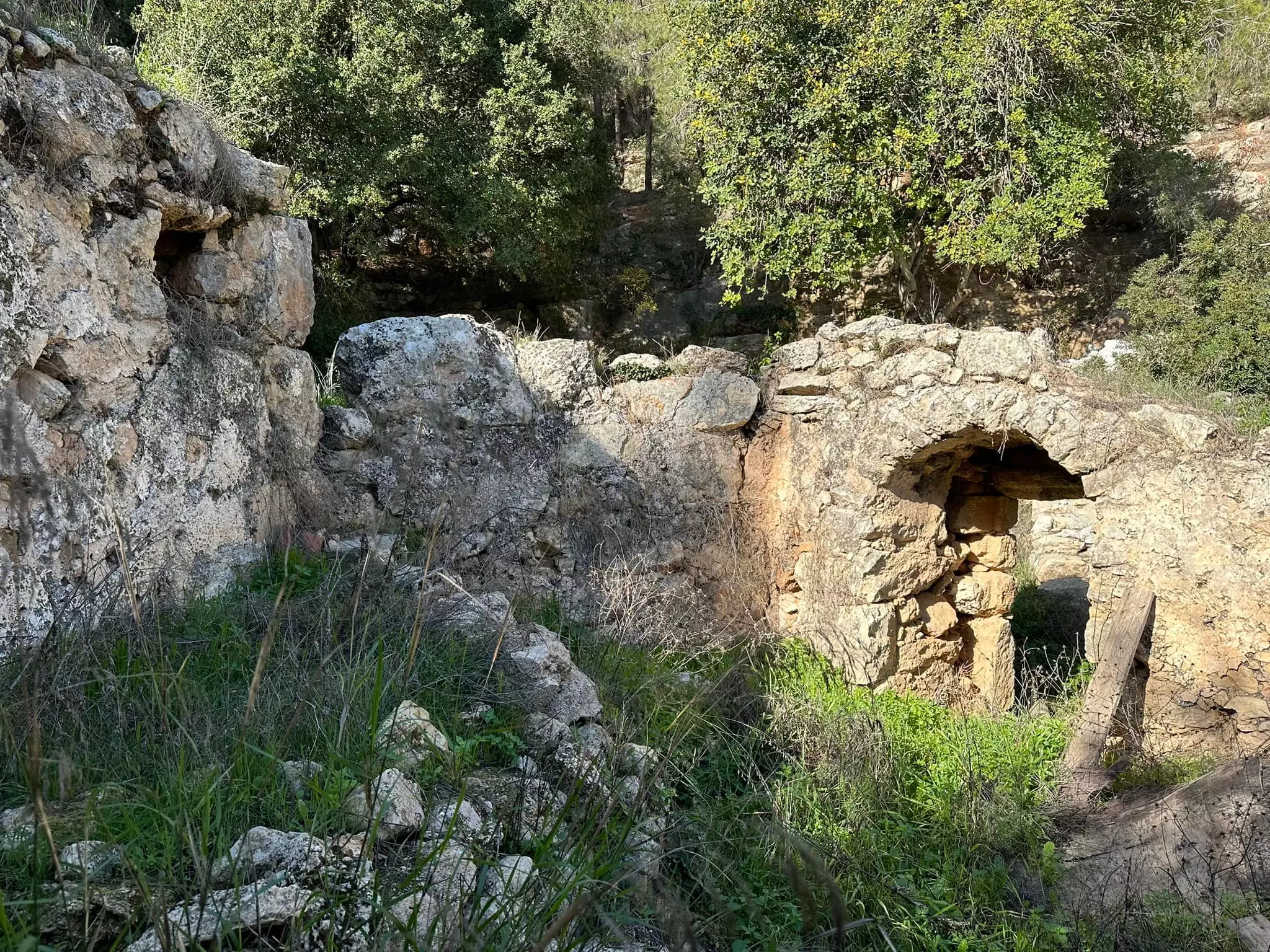
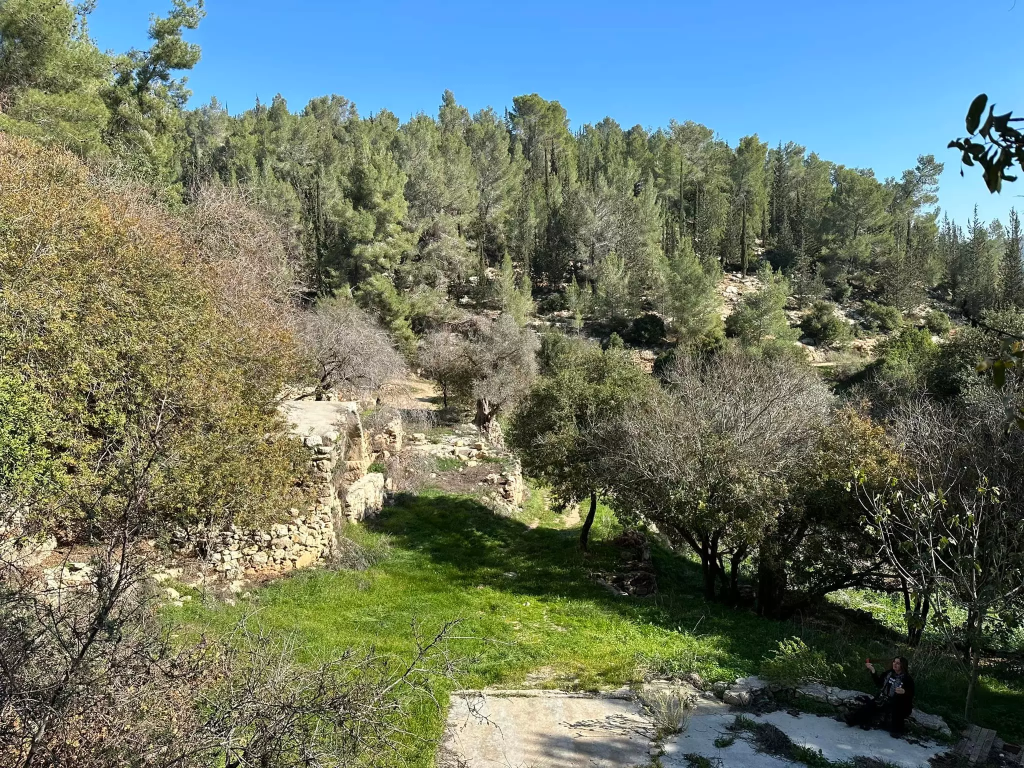
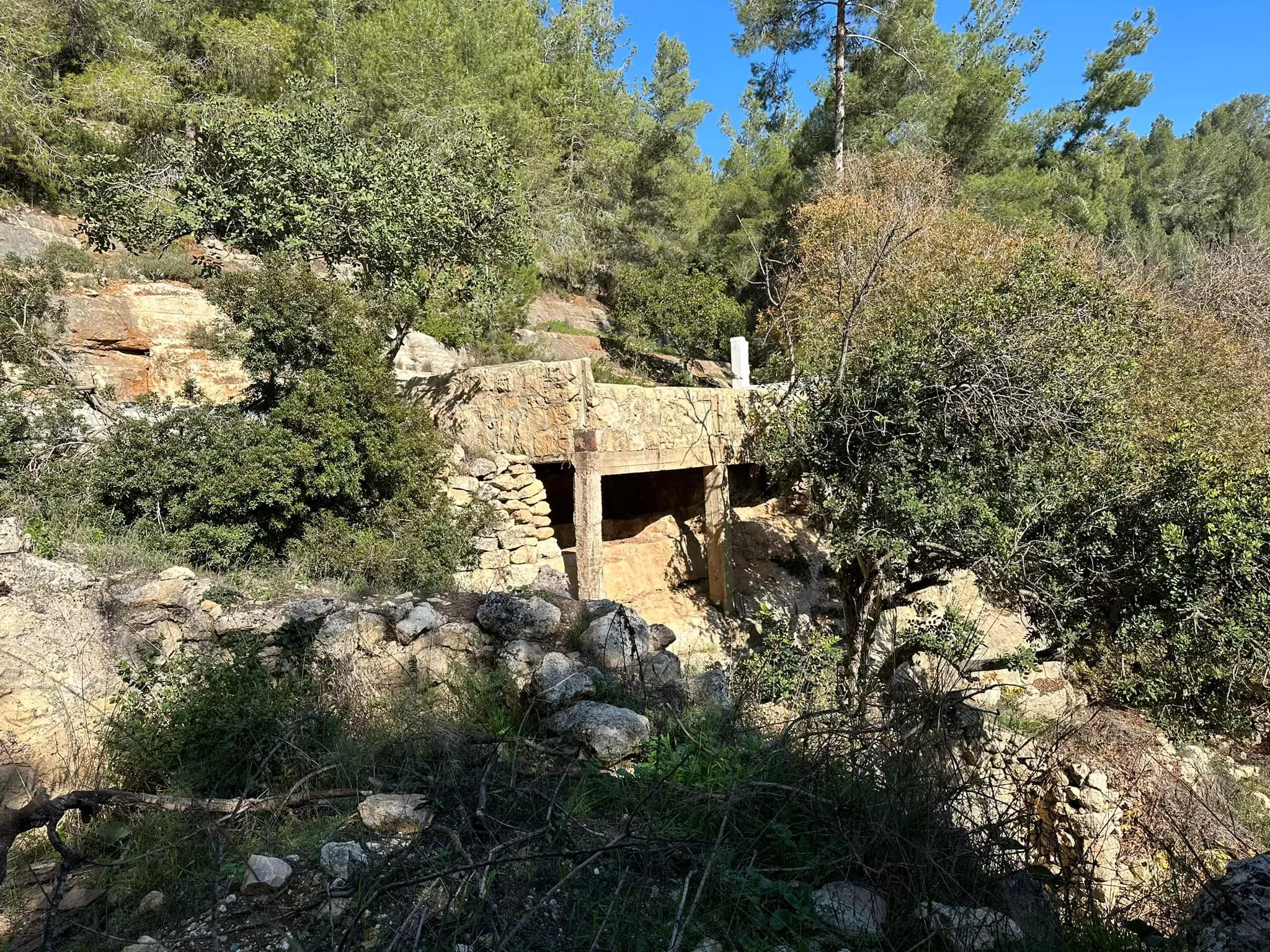
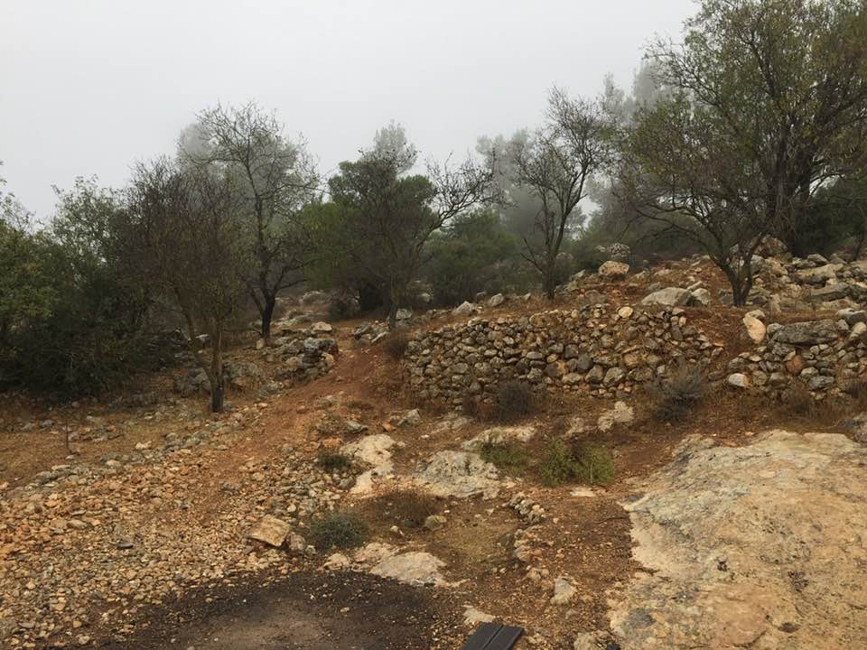
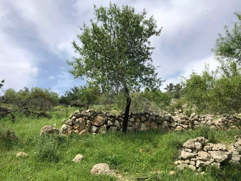
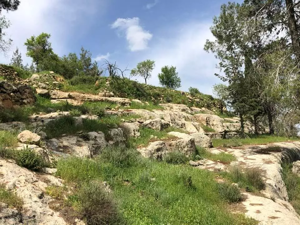
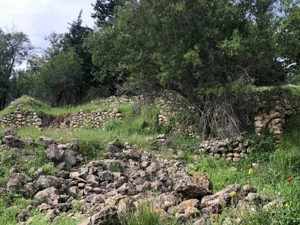
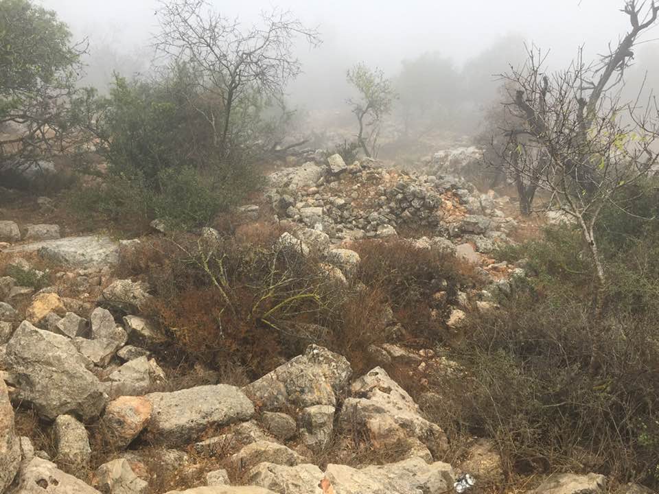
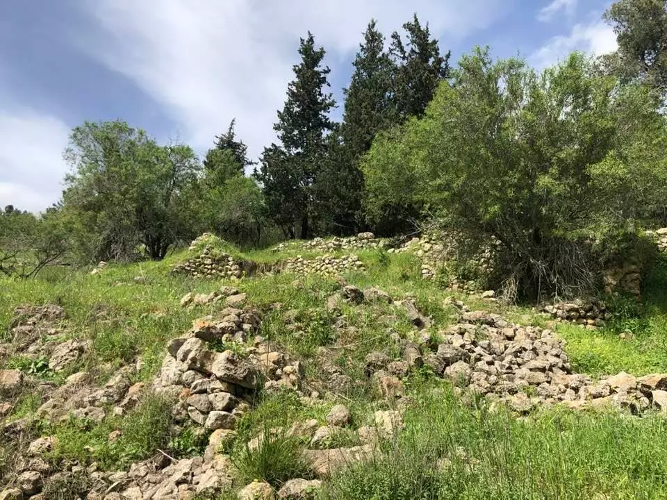
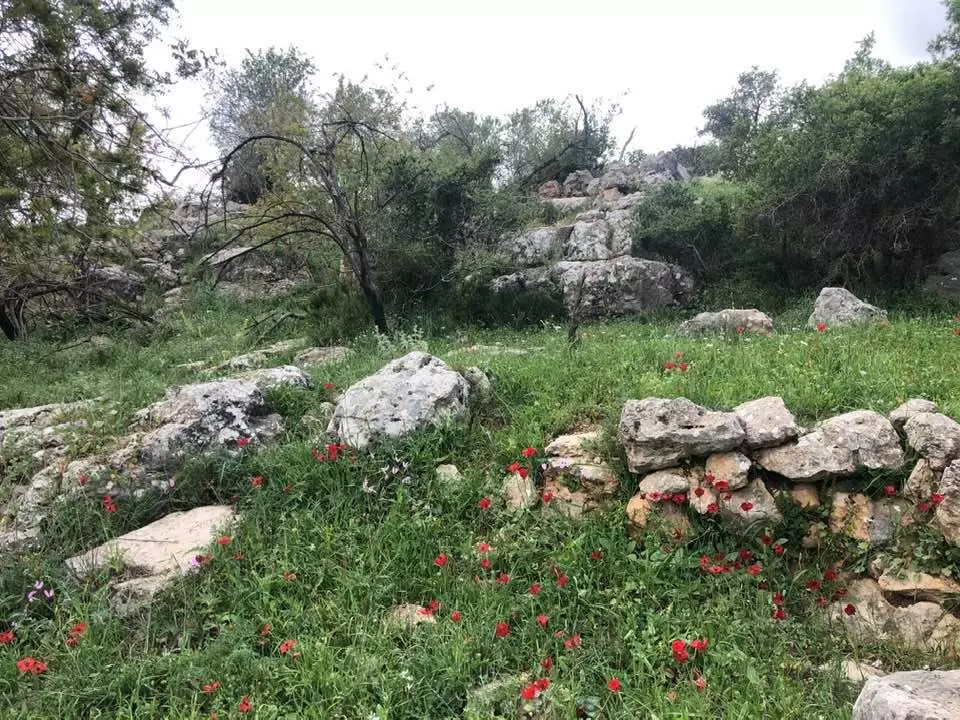
| Village Temains | Khirbat al-Lawz was completely destroyed and defaced. | ||||||||||||||
| Ethnically Cleansing | In November 1948, Khirbat al-Lawz was completely ethnically cleansed. | ||||||||||||||
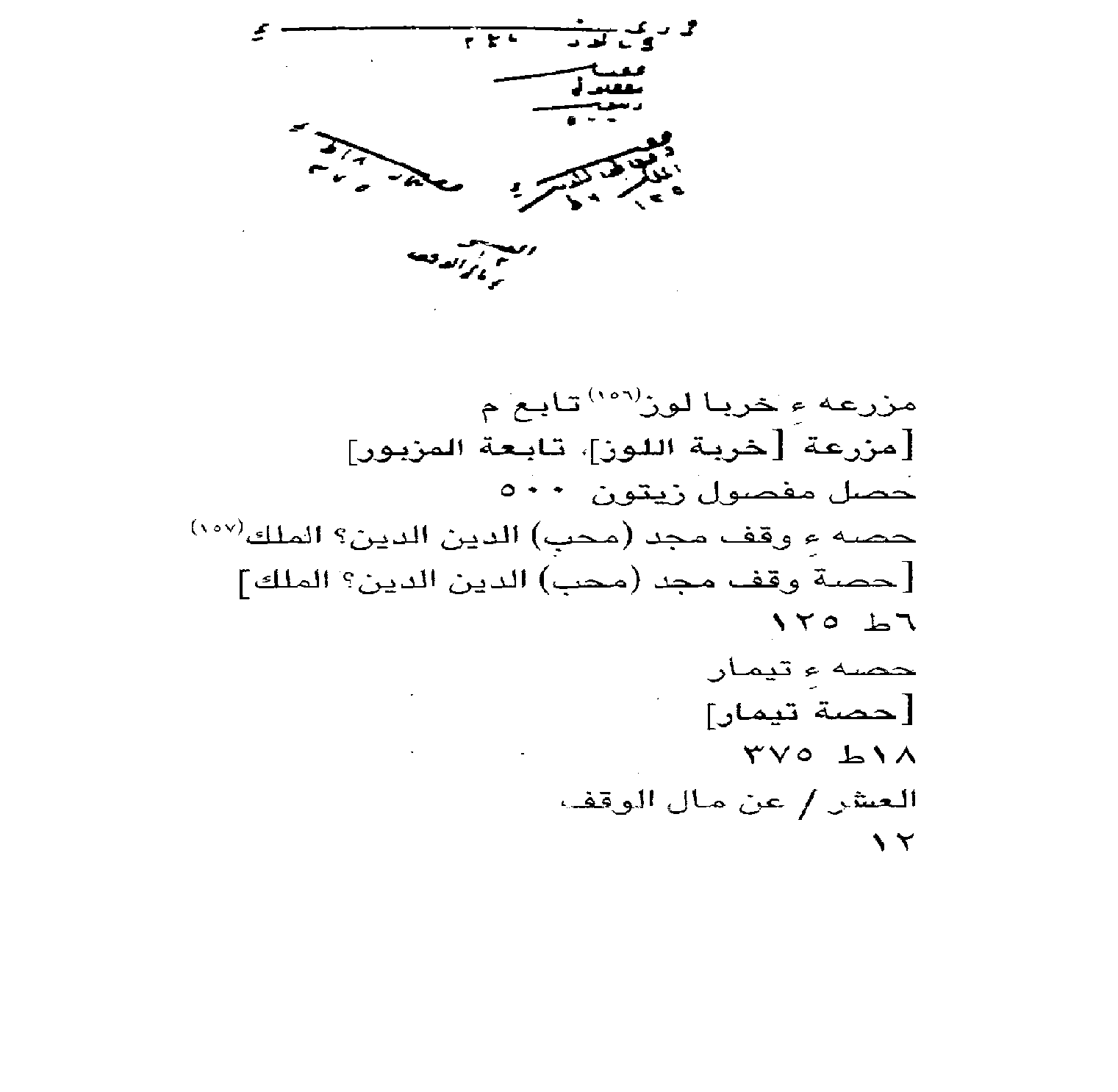
| Pre-Nakba Land Ownership |
**Town Lands' Demarcation Maps |
||||||||||||||
| Land Usage As of 1945 |
|
||||||||||||||
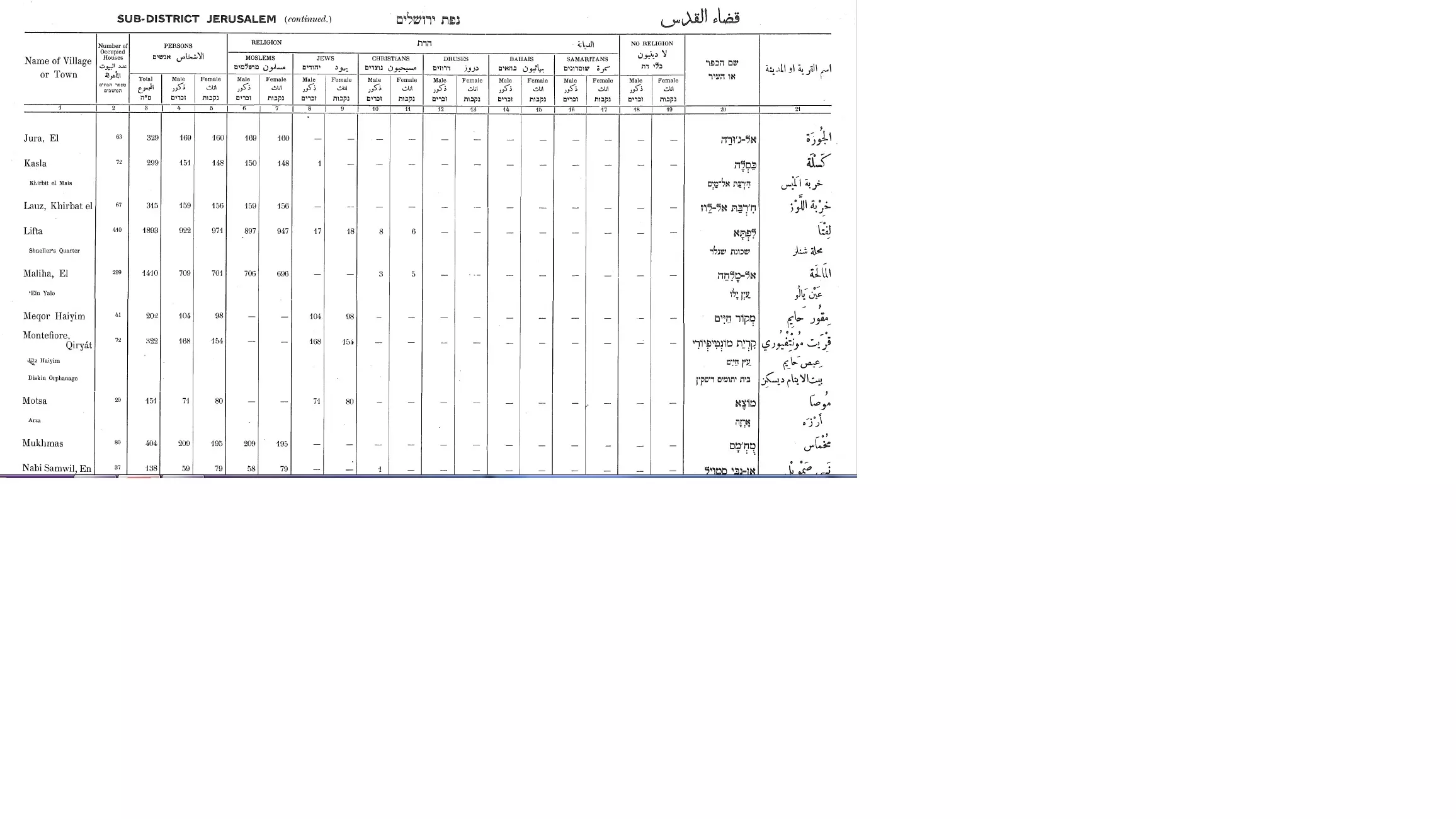
| Population |
|
||||||||||||||
| Number of Houses |
|
||||||||||||||
| Near By Towns |
|||||||||||||||
|
|||||||||||||||
| Places of Warship | One Mosque | ||||||||||||||
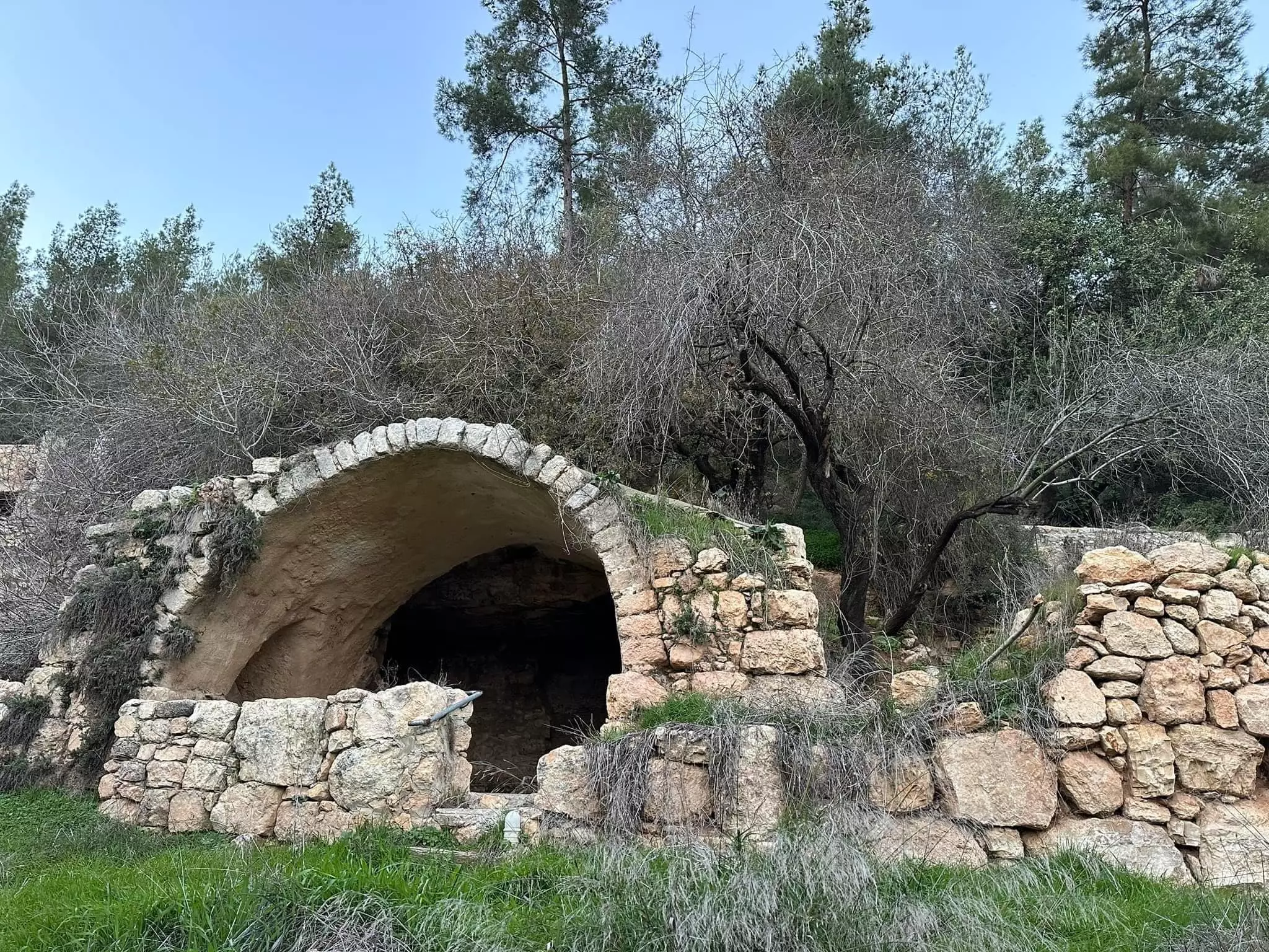
| Shrines / Maqams | Khirbat al-Lawz had a shrine for local sage known by al-Shaykh Salama. | ||||||||||||||
| Nearby Wadies & Rivers | Khirbat al-Lawz is situated north of Wadi al-Sarar. | ||||||||||||||
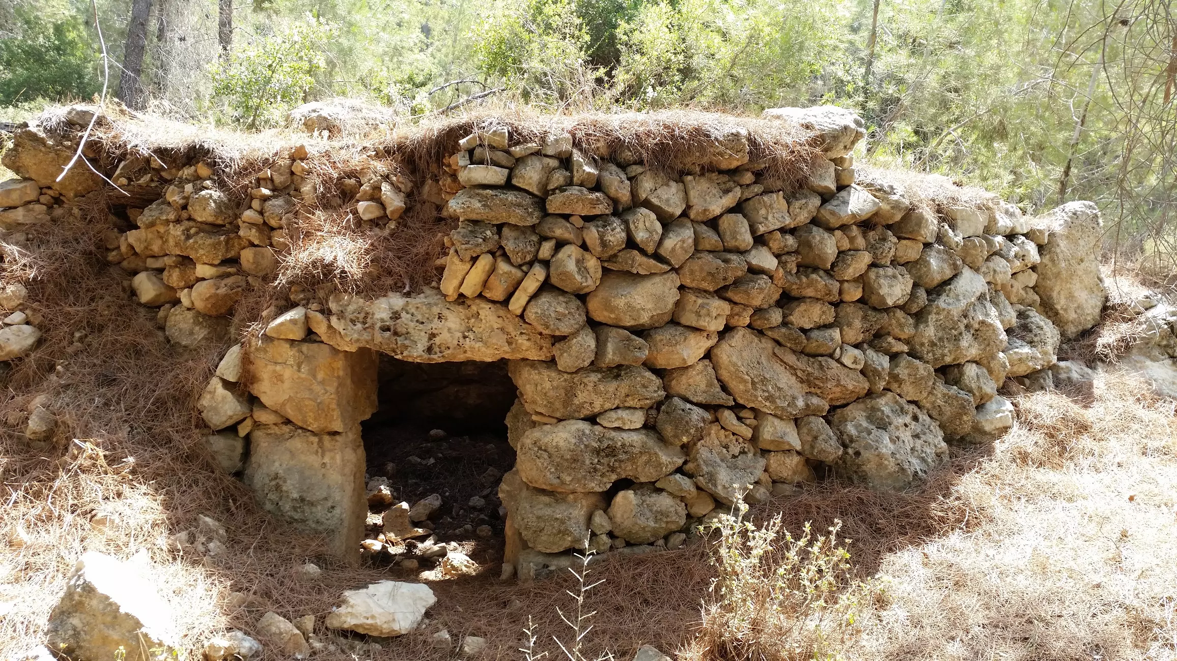
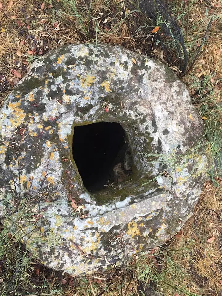
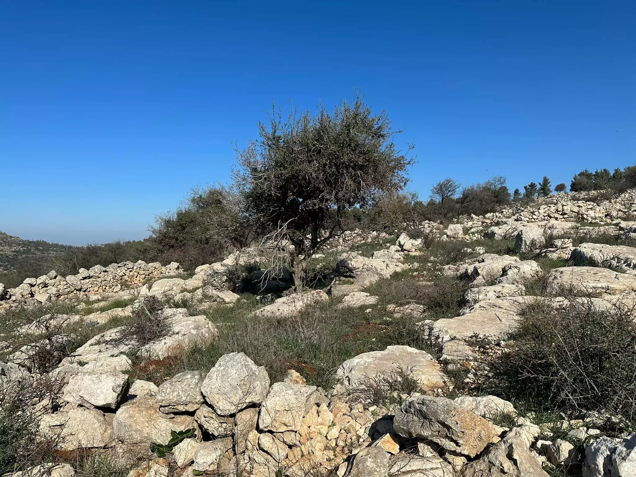
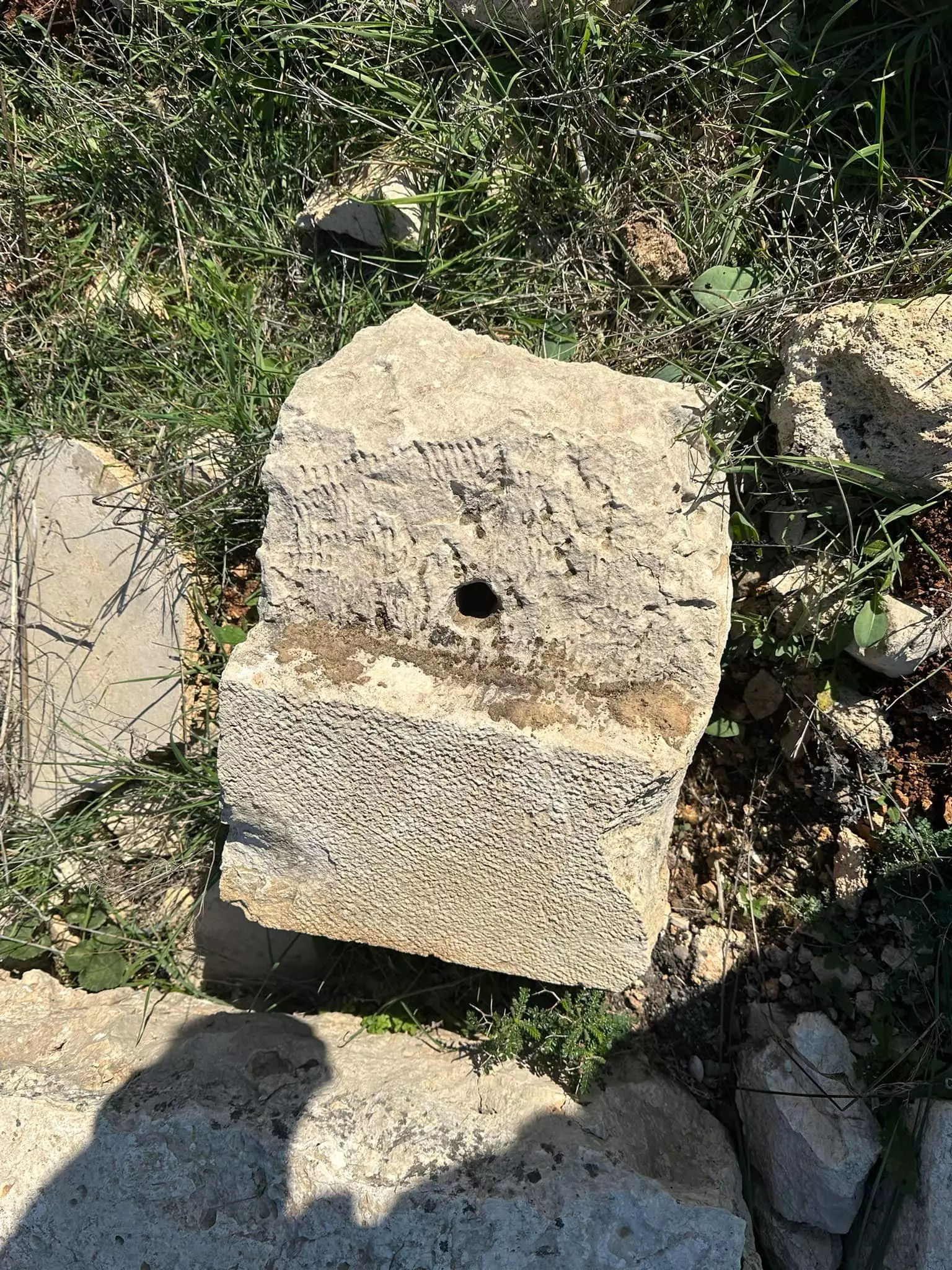
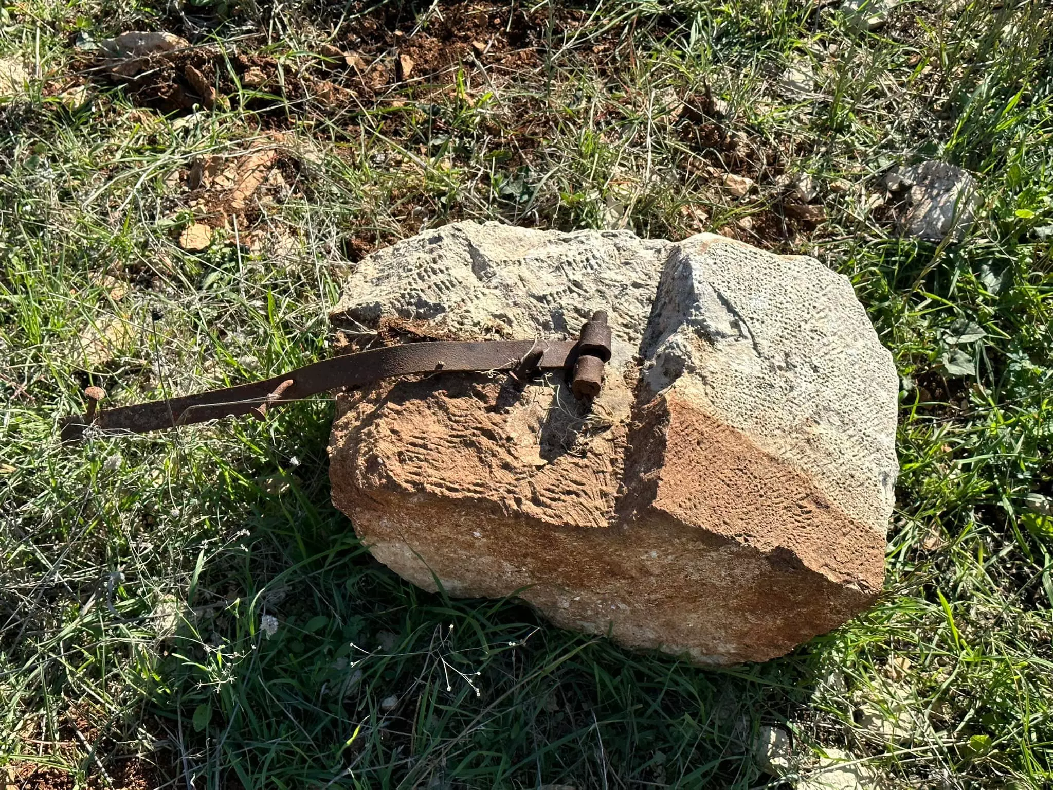
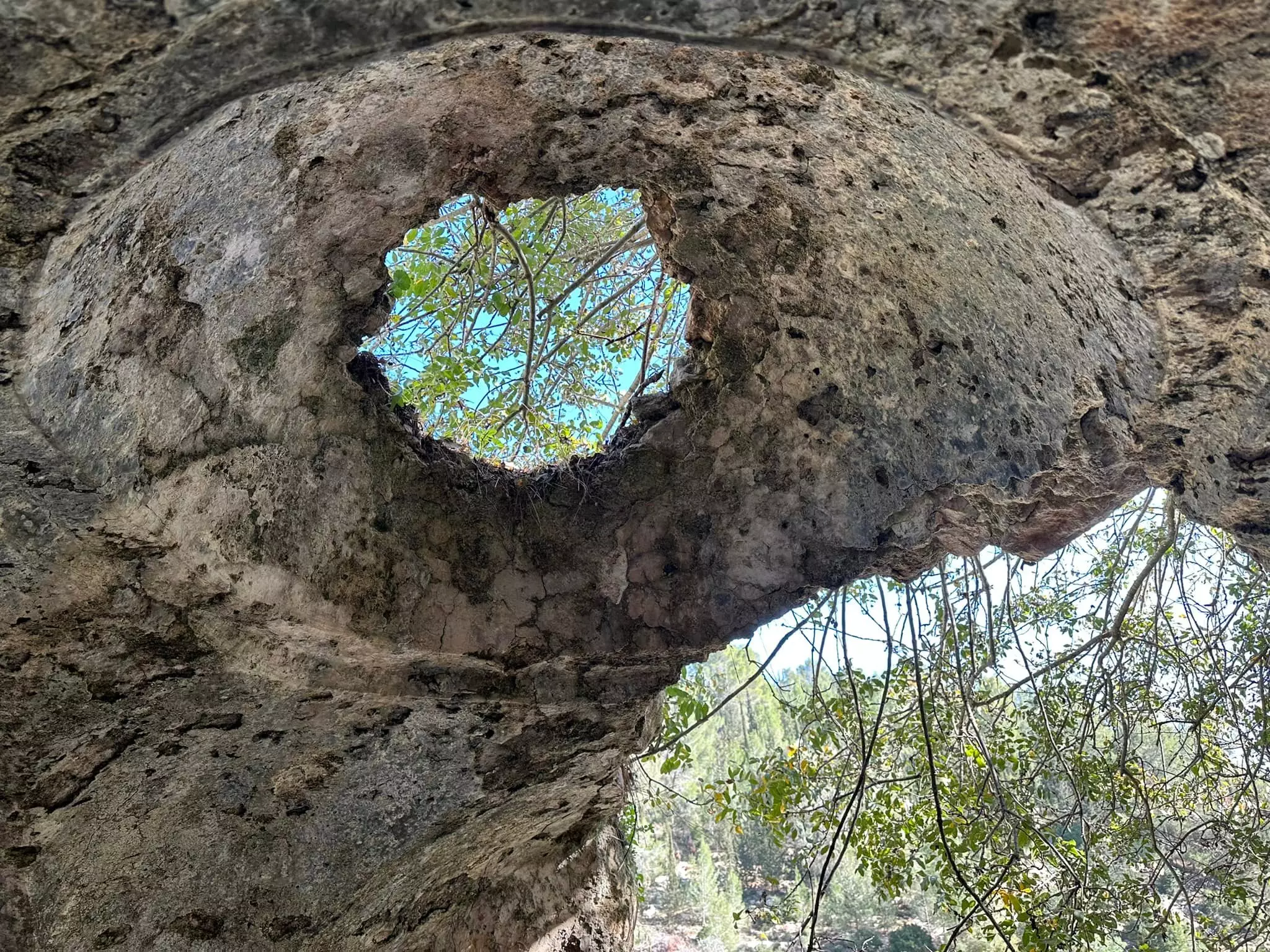
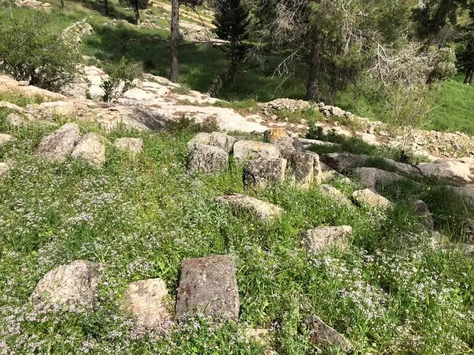
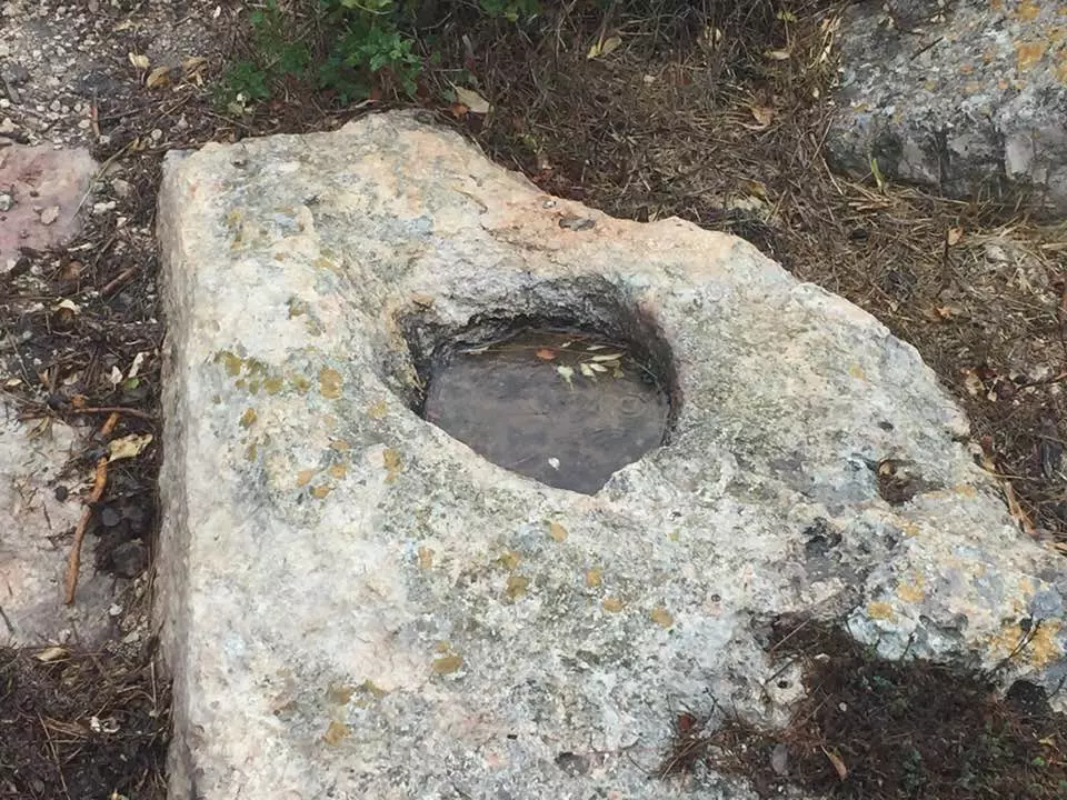
| Archeological Sites | The village contains tombs, the ruins of buildings, a millstone, and other material evidence of earlier occupation. | ||||||||||||||
| Exculsive Jewish Colonies Who Usurped Village Lands |
No settlements on village lands | ||||||||||||||
| Featured Video | |||||||||||||||
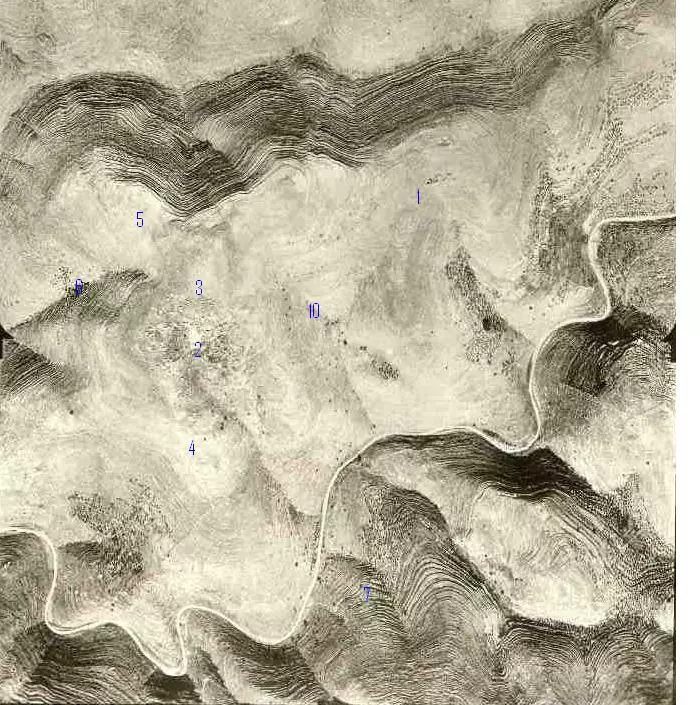
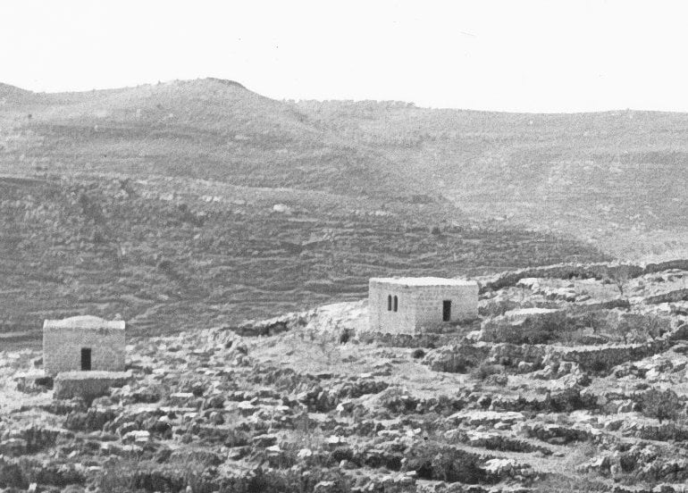
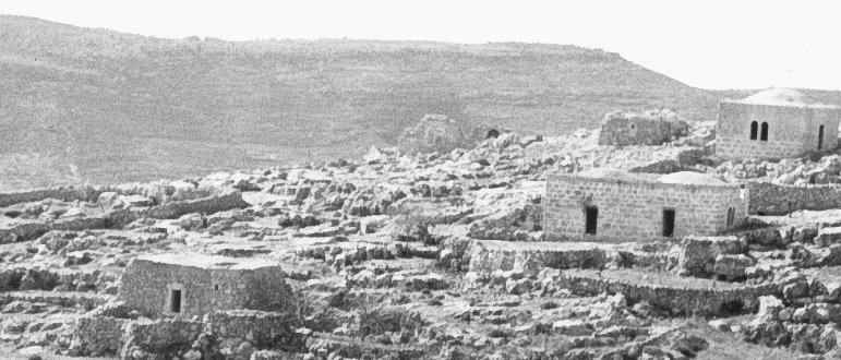
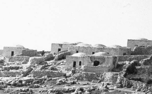
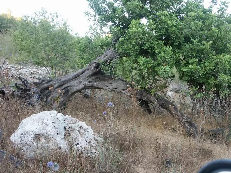
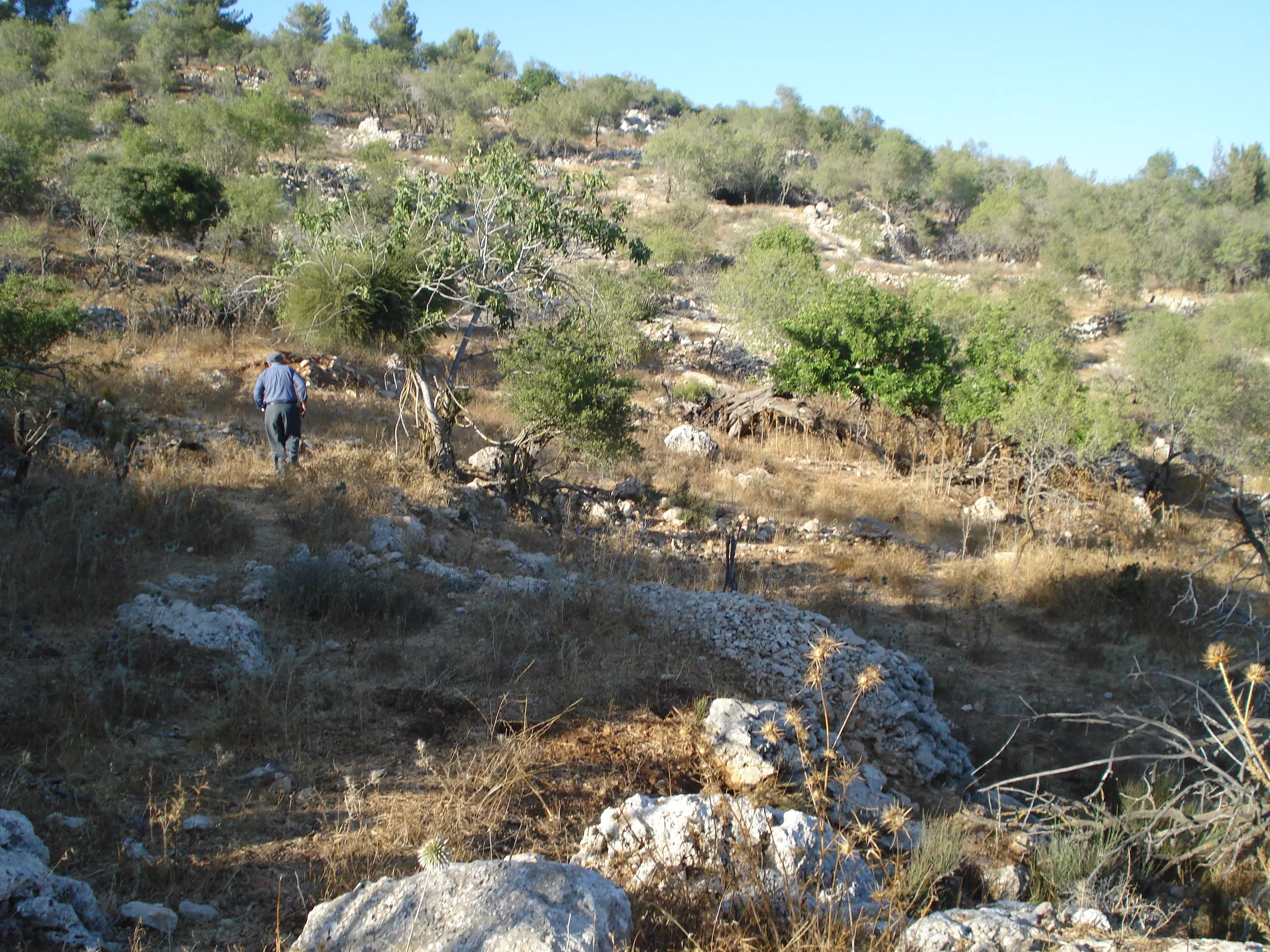
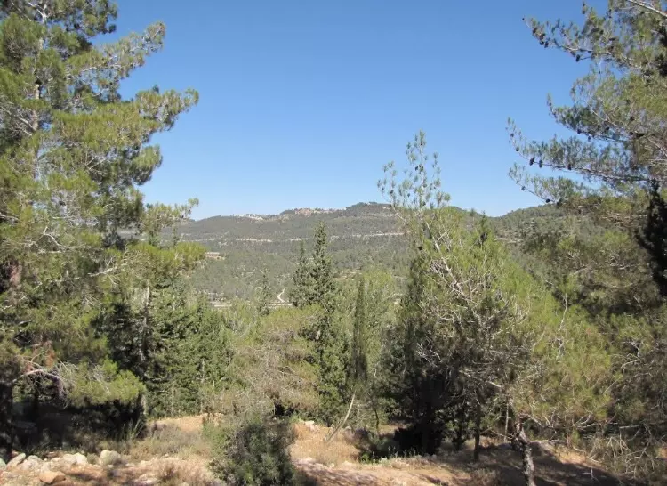
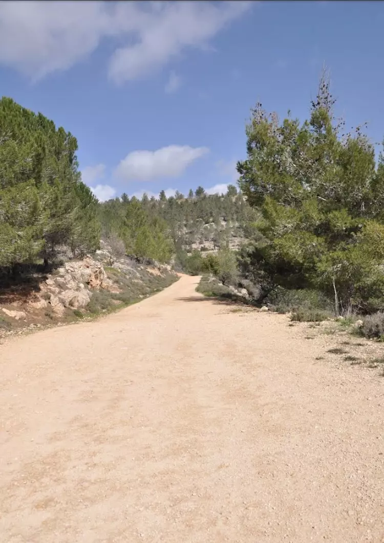
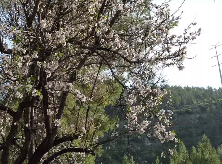
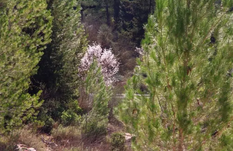
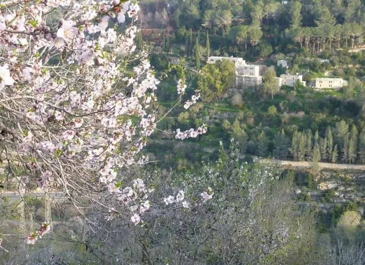
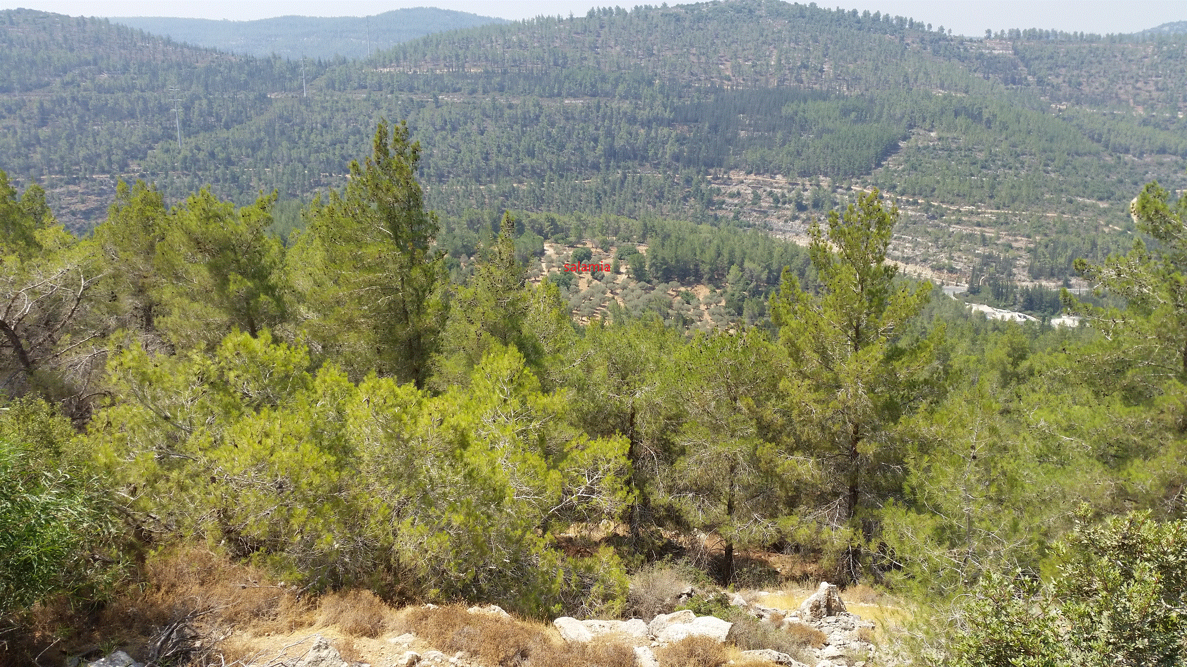
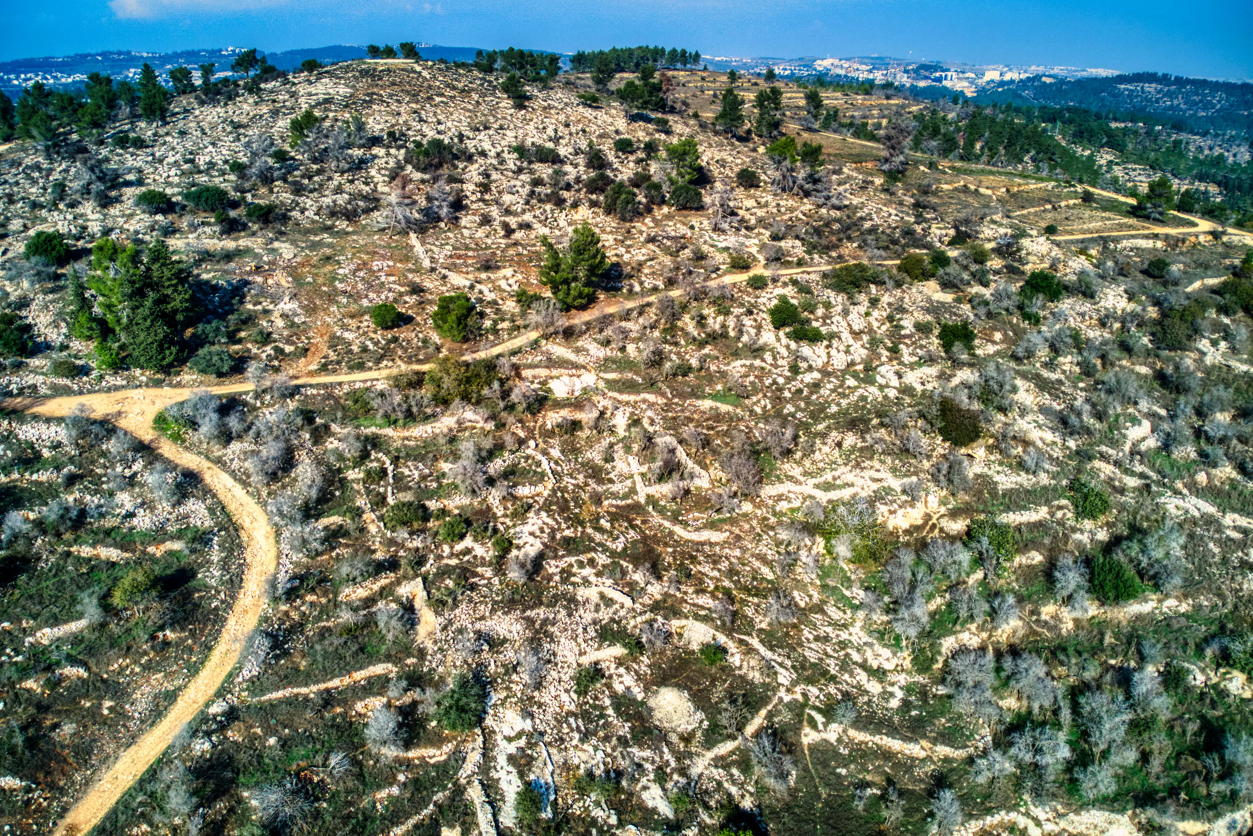
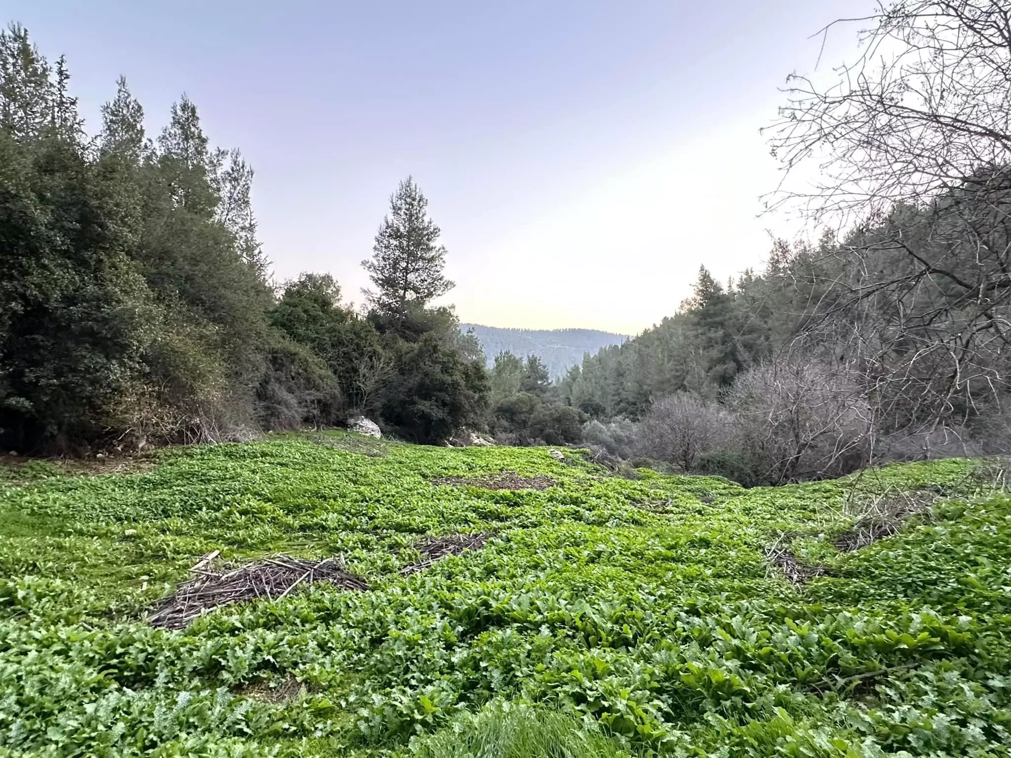
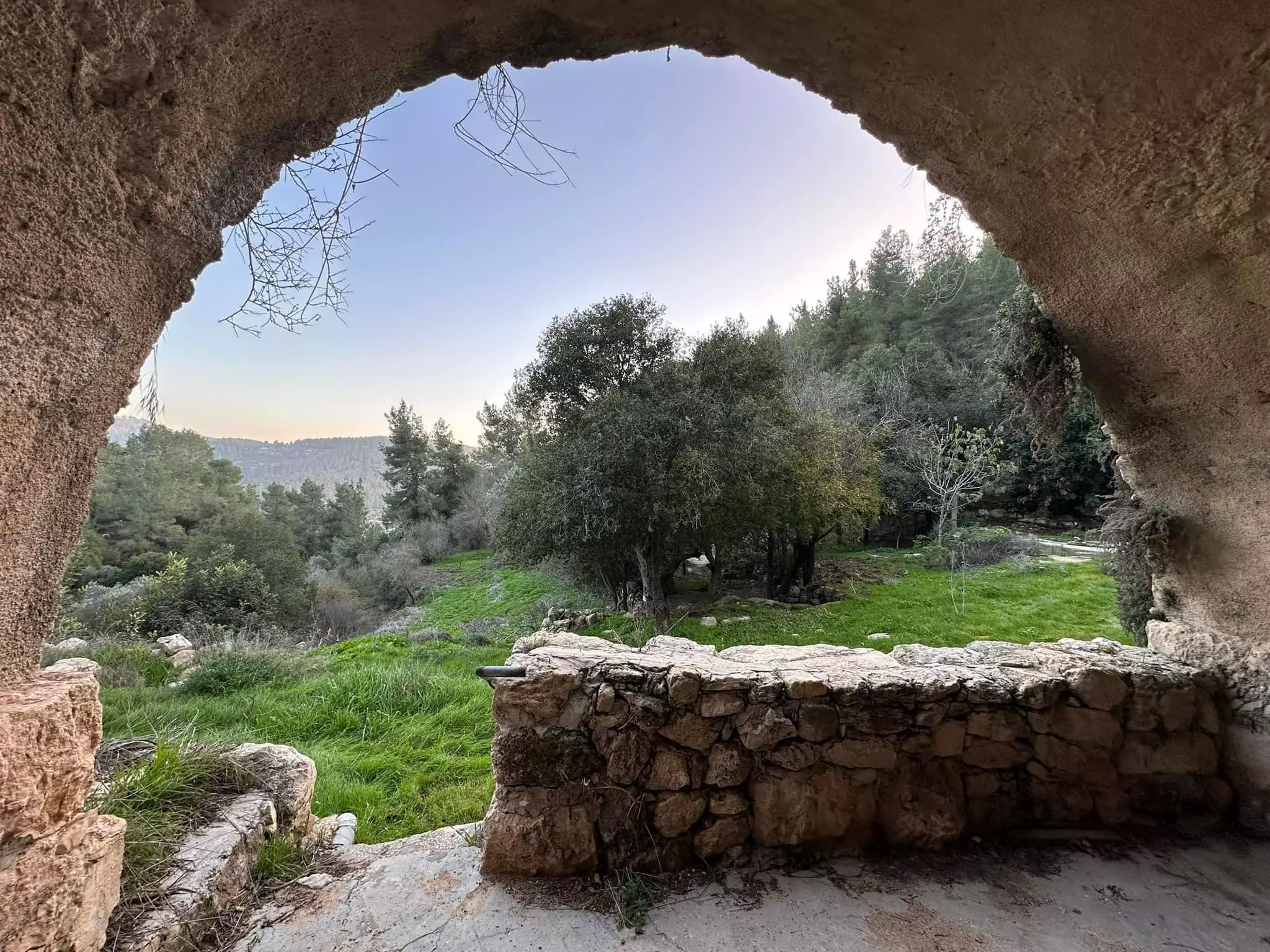
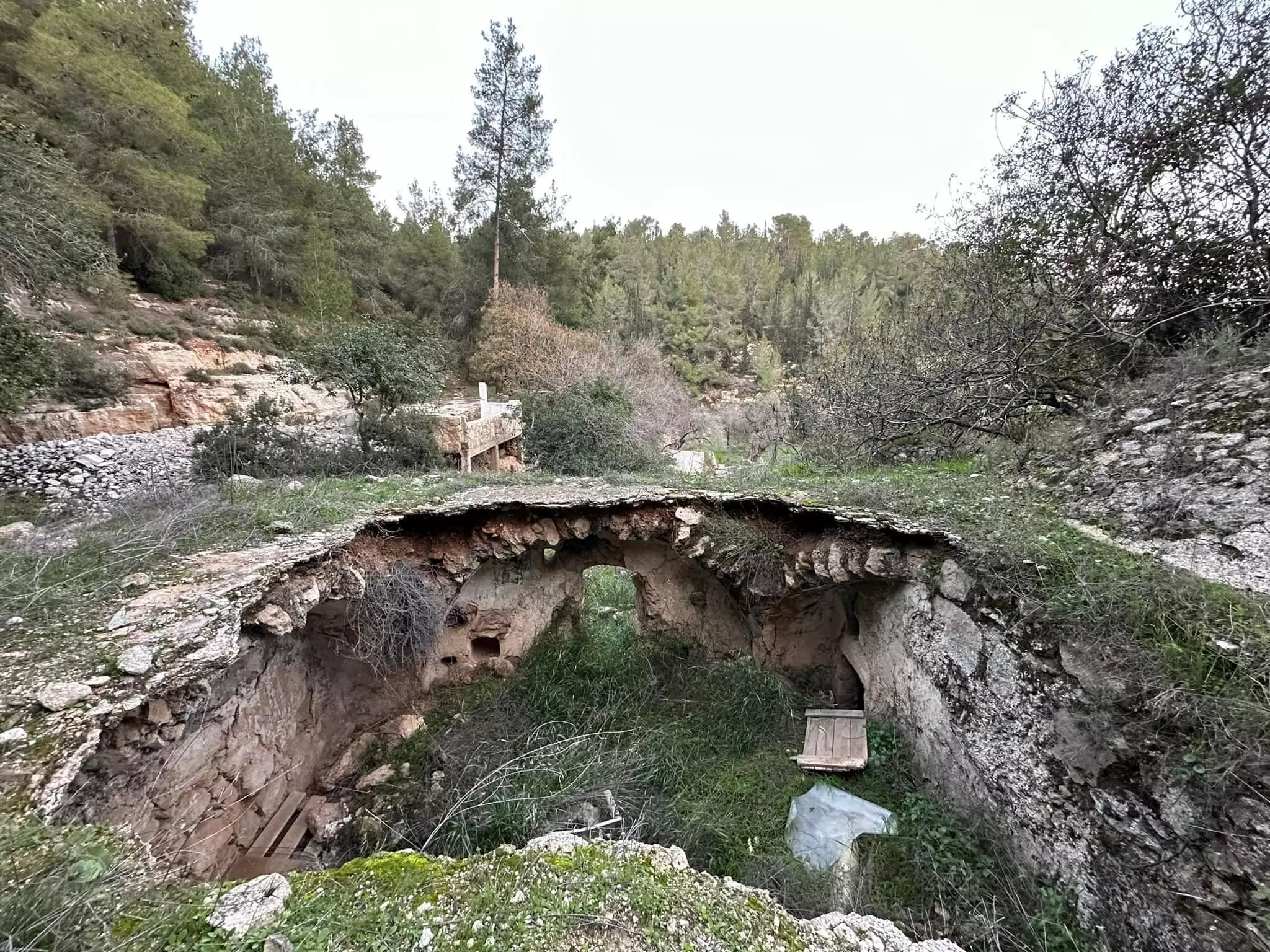
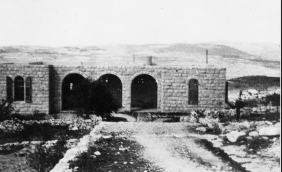
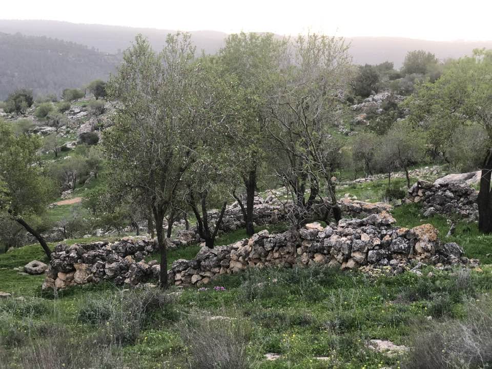
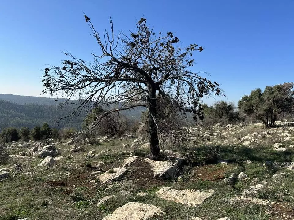
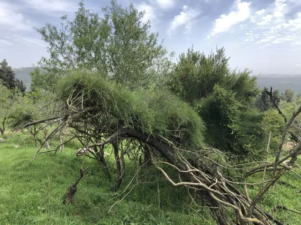
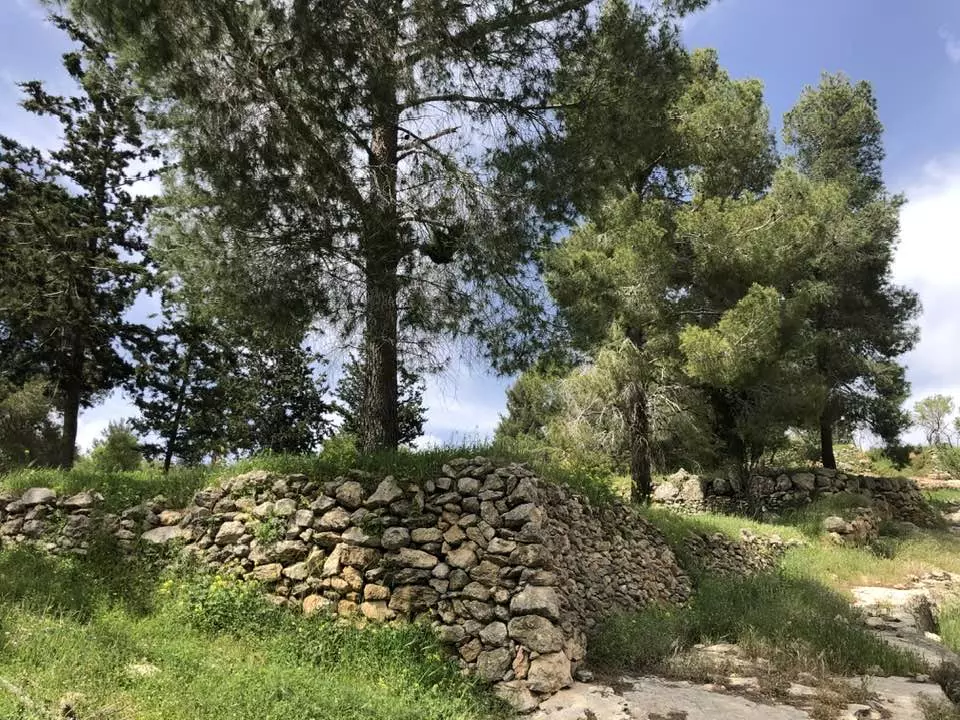
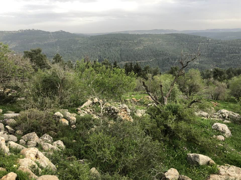
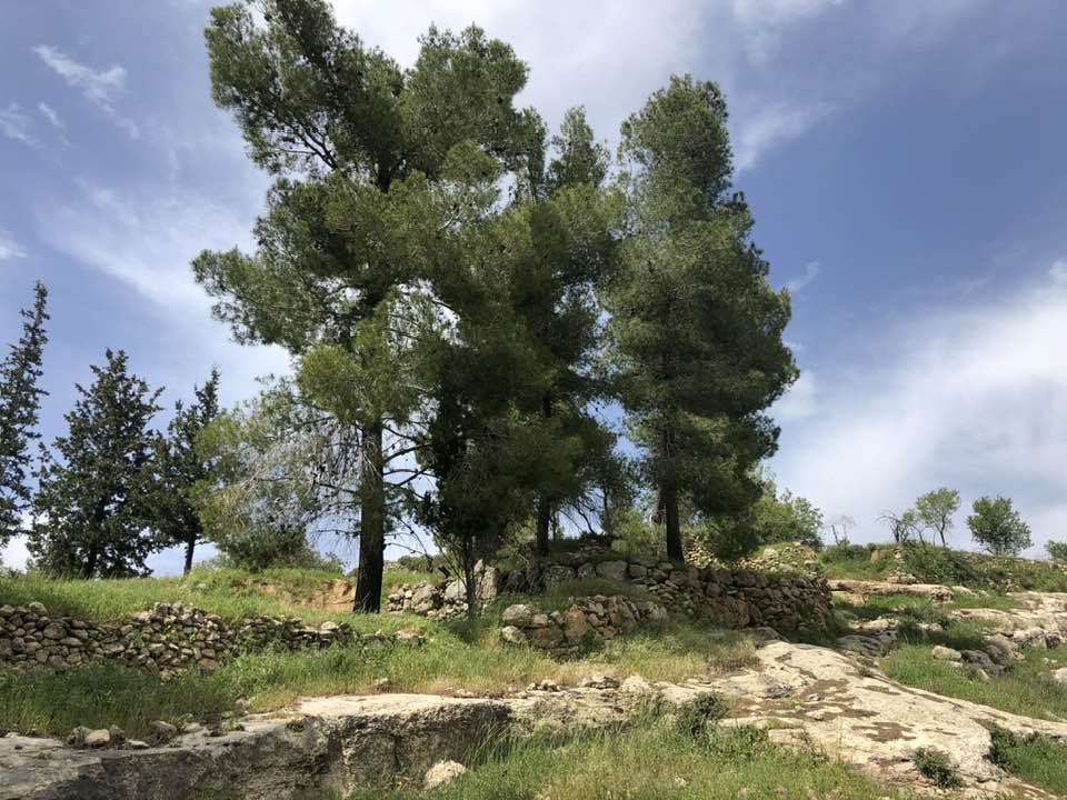
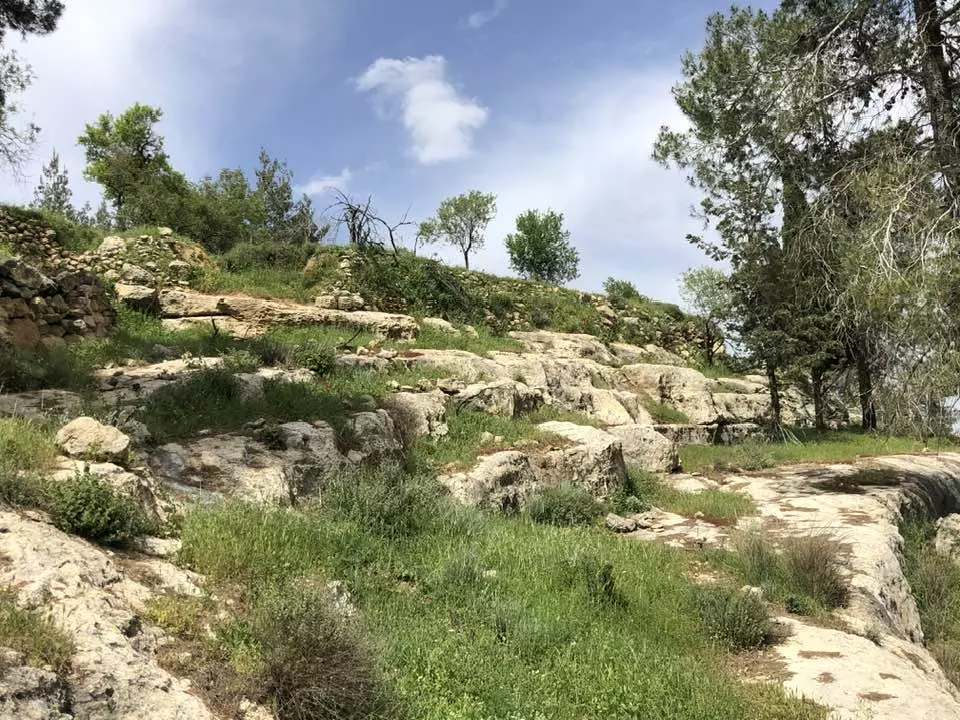
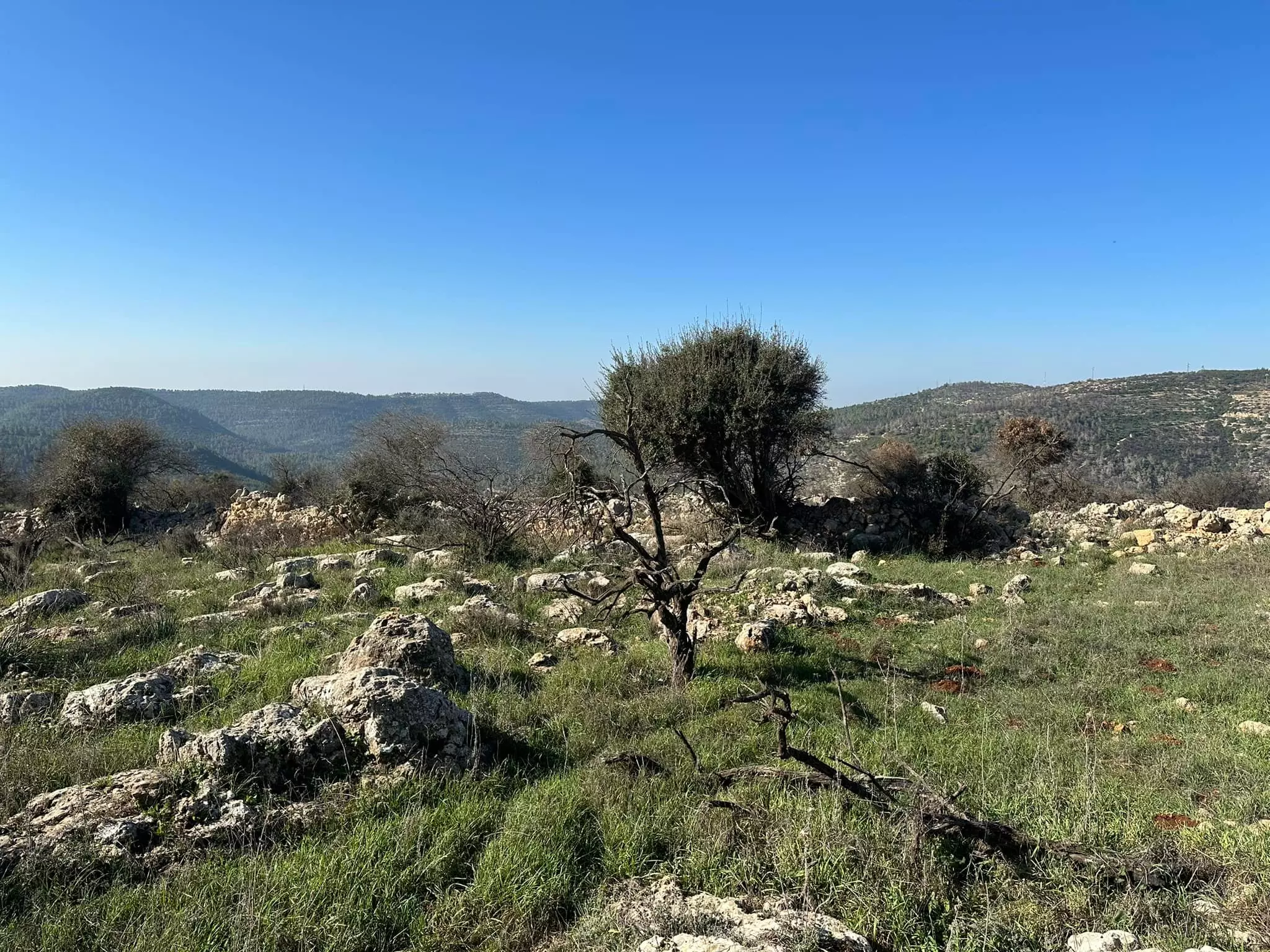
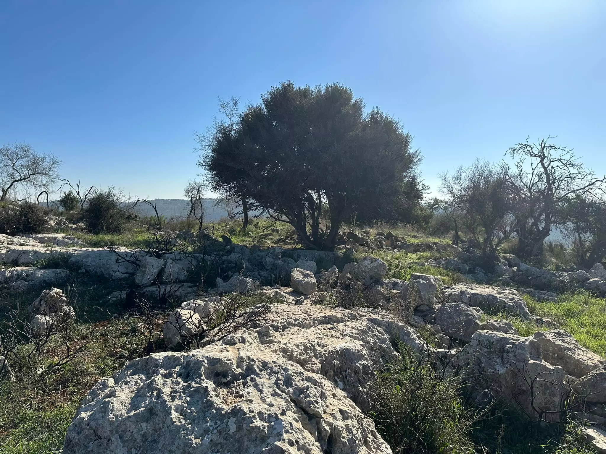
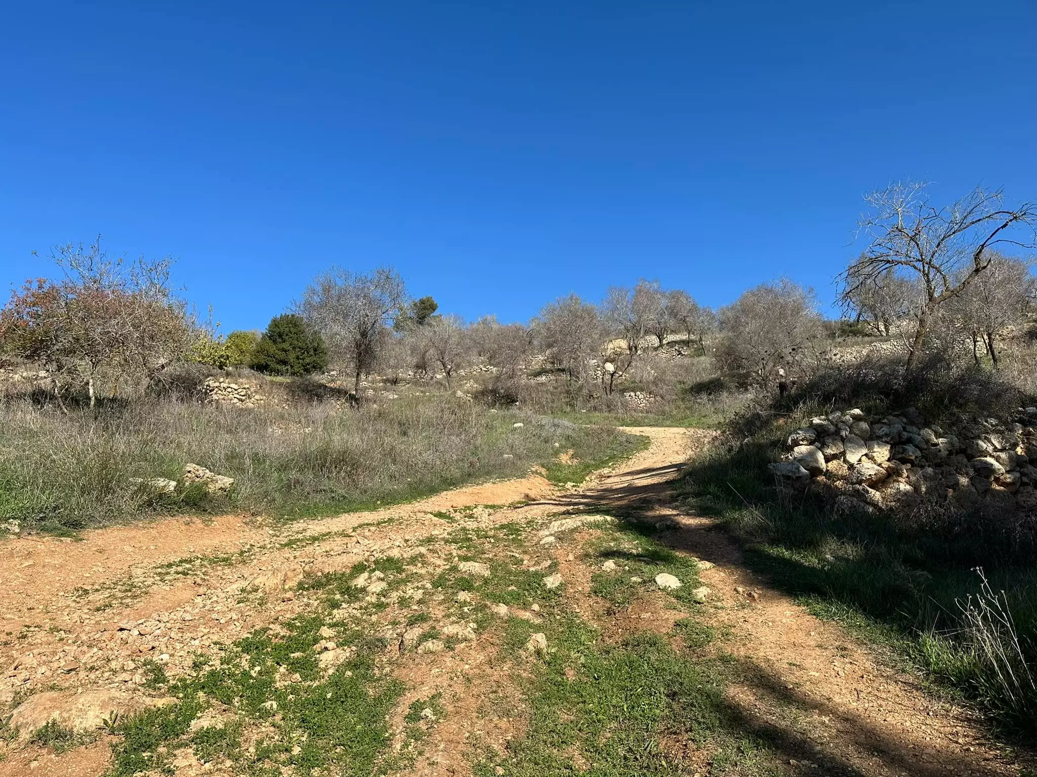
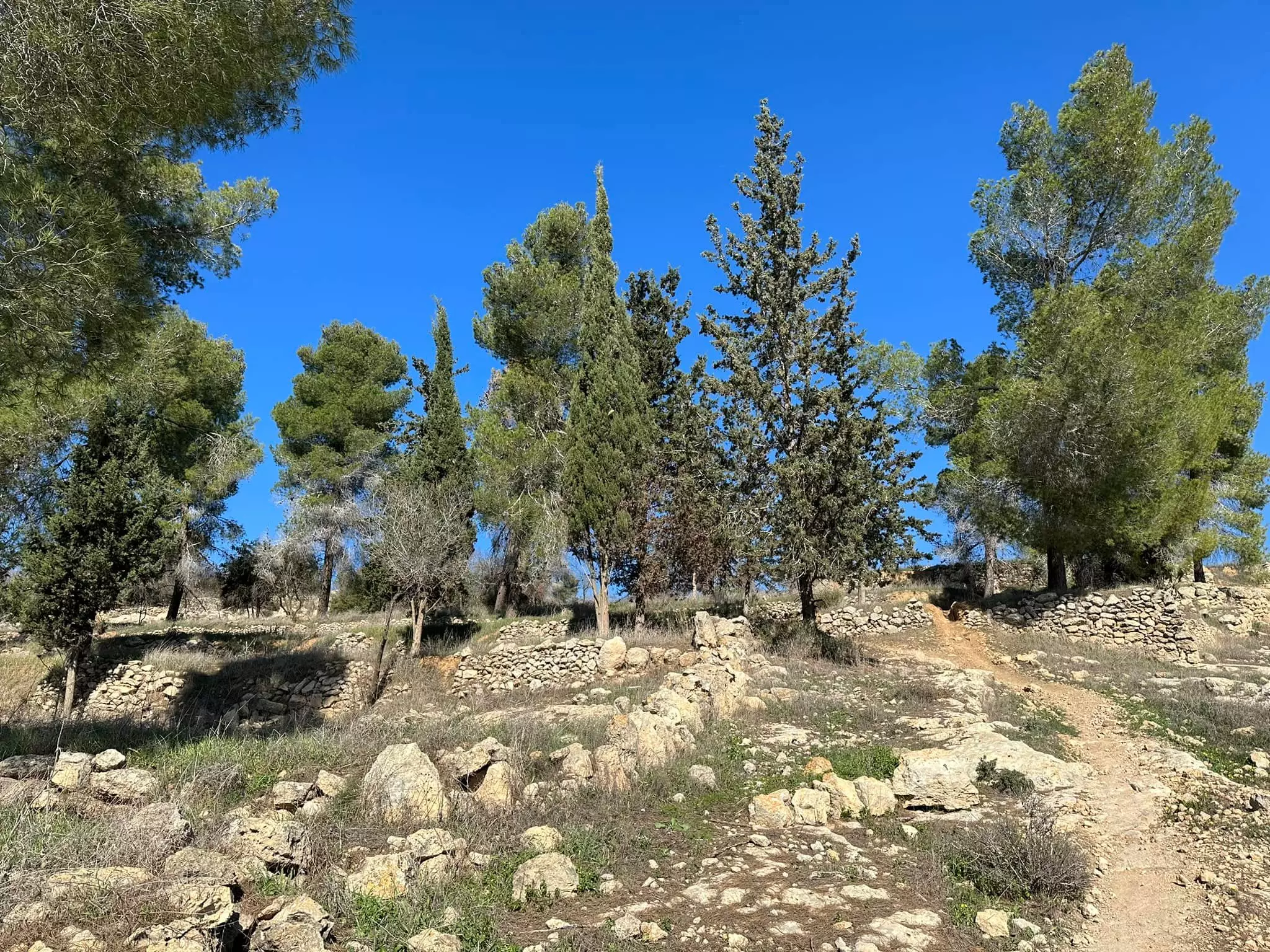
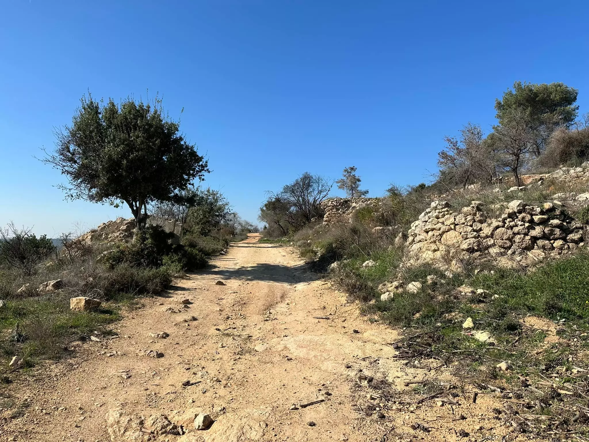
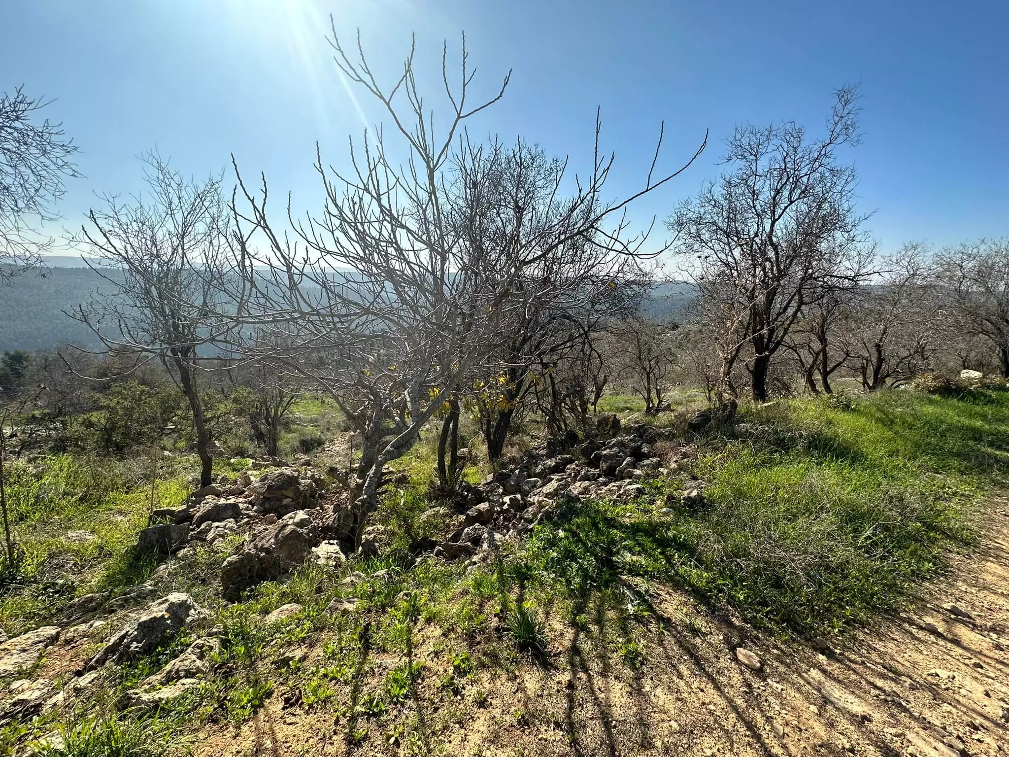
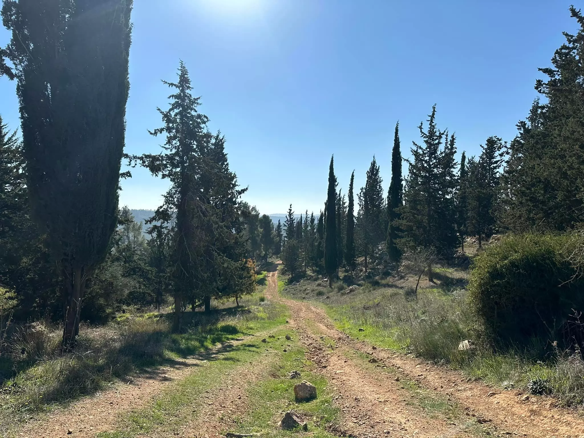
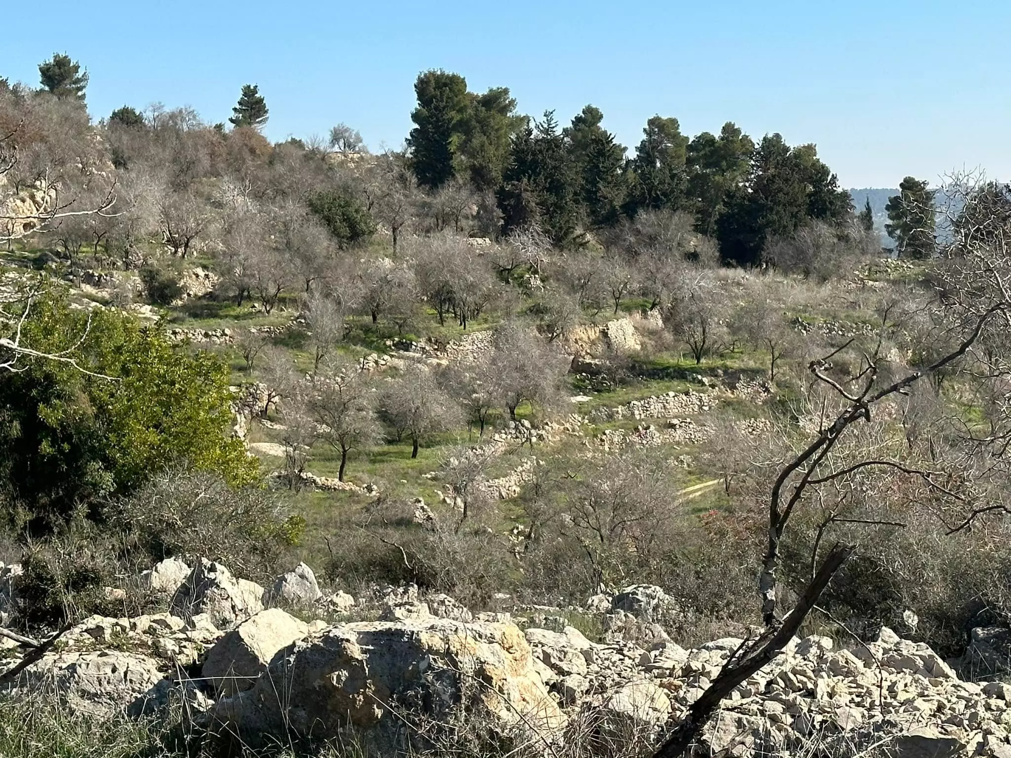
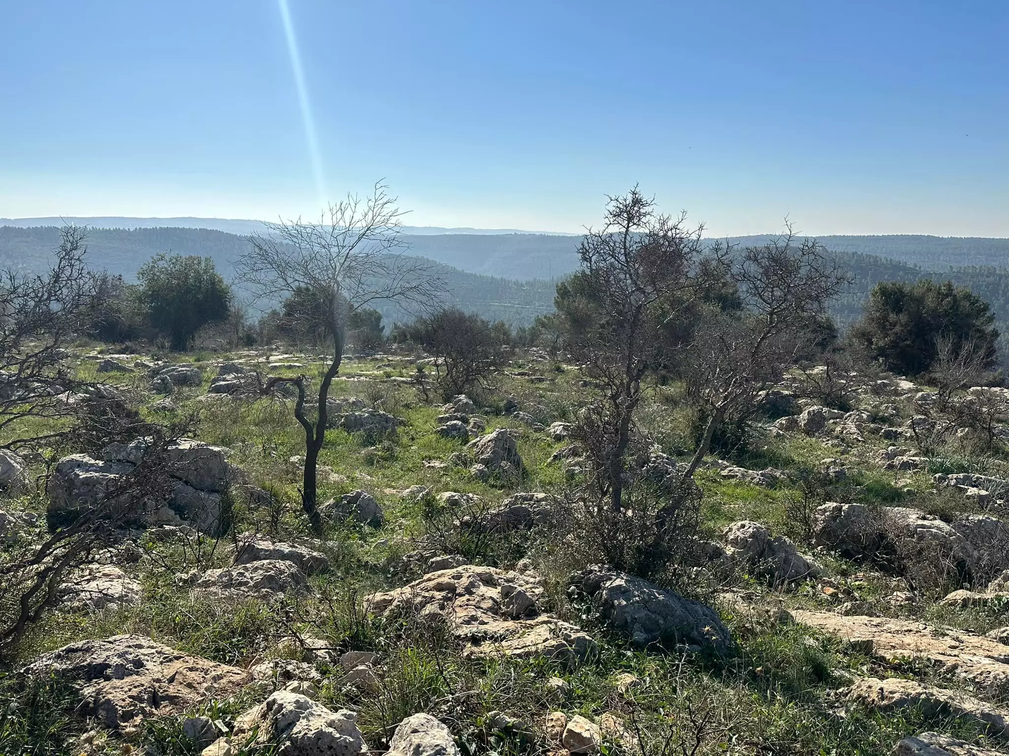
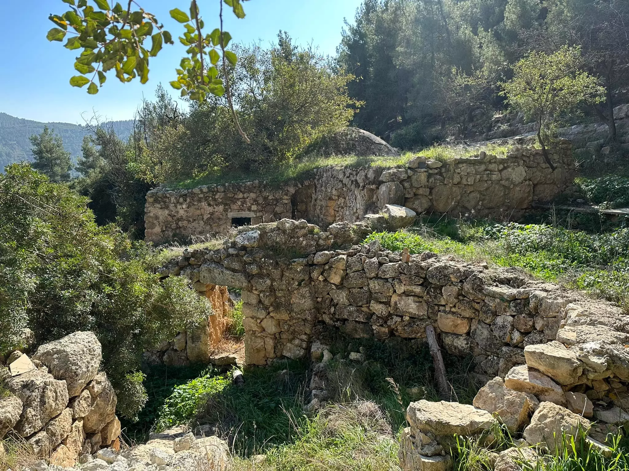
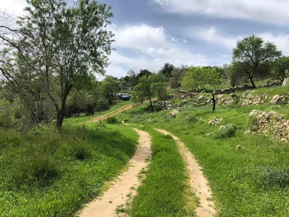
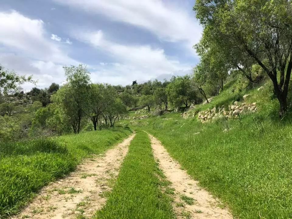
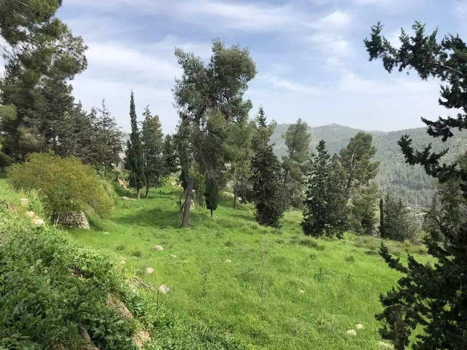
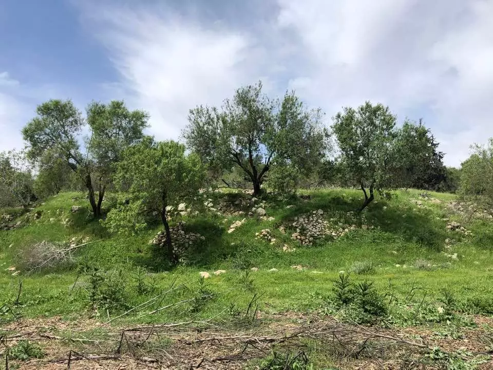
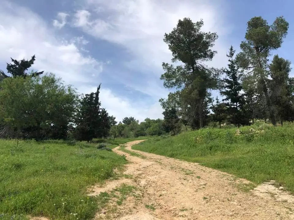
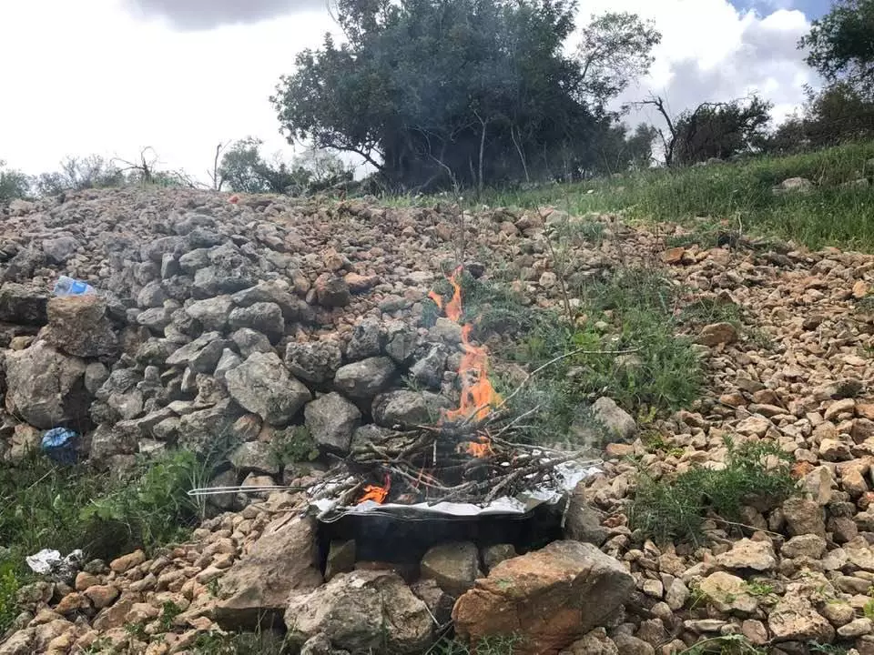
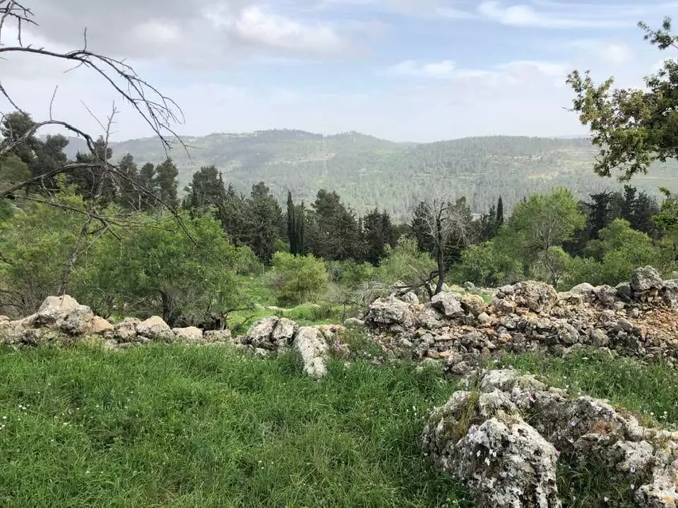
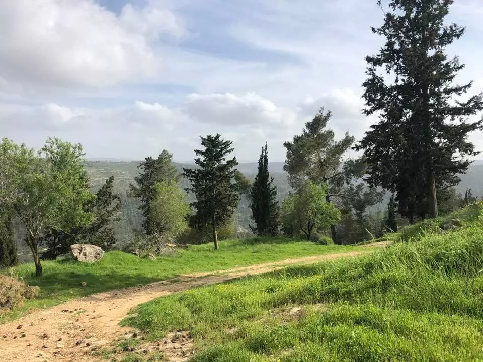
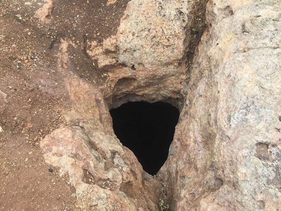
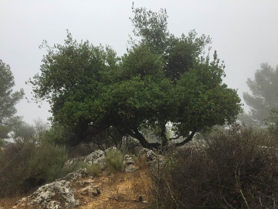
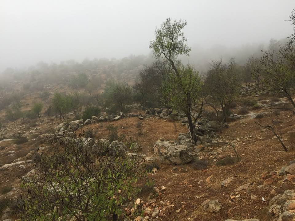
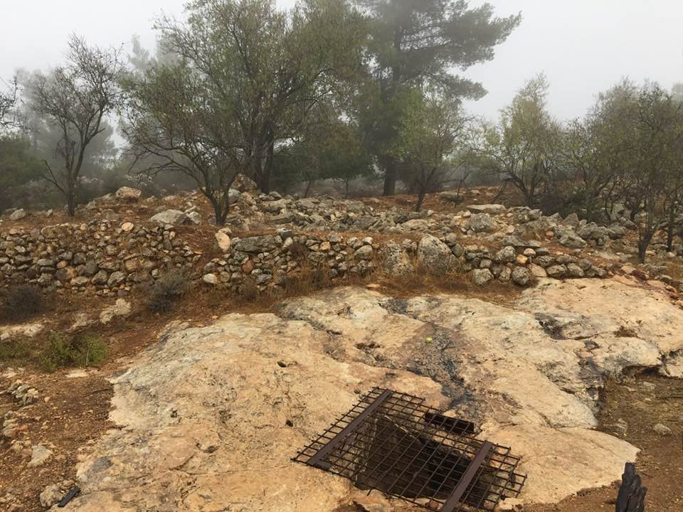
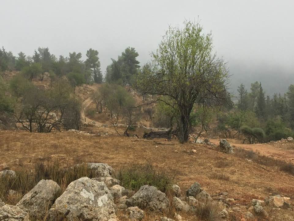
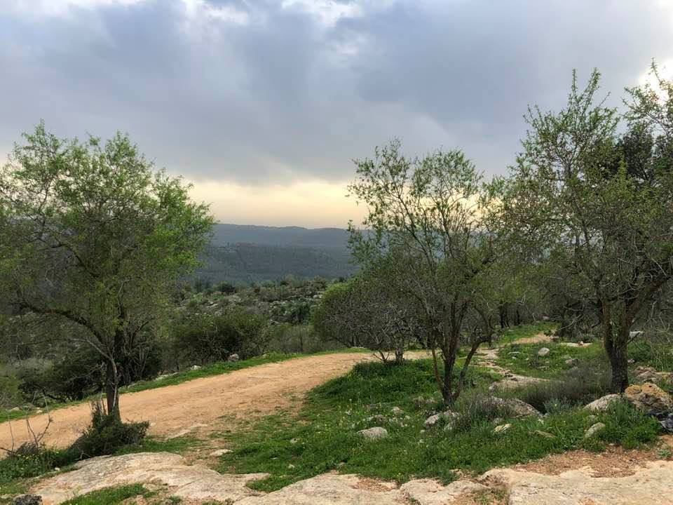
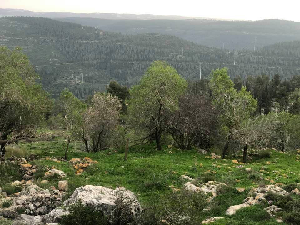
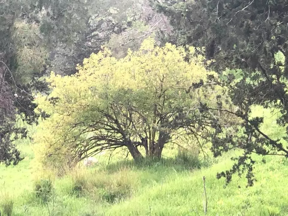
Village Before NakbaThe village stood on the southern side of a mountain crest, overlooking a wide area to the south, east, and west. Wadi al-Sarar flowed past the southern fields of the village, going west on its descent to the Mediterranean. A secondary road linked Khirbat al-Lawz to the village of Ayn Karim (and hence, to Jerusalem) to the east. In the late nineteenth century, the village of Khirbat al-Lawz was located on the upper slope of a ridge, and stood 245 m above a valley to the south. The slope below the village was terraced for cultivation.The village plan took the form of an arc extending in an east-west direction. Its houses were built mainly of limestone. In the 1940s new houses were constructed west of the village. The residents, who were Muslim, worshipped in a village mosque and maintained a shrine for a local religious figure, Shaykh Salama. Their lands were used for cultivating vineyards, olive and almond trees, vegetables, and grain. Some of these crops were rainfed and others were irrigated from the village springs. Wild vegetation grew on the slopes and was used for grazing. In 1944/45 a total of 693 dunums was allocated to cereals; 728 dunums were irrigated or used for orchards, of which 186 dunums were planted with olive trees. The village was an archaeological site that contained tombs, the ruins of buildings, a millstone, and other material evidence of earlier occupation. Village Occupation and Ethnic CleaningIn July 1948, in the course of Operation Dani, the Israeli army's Har'el Brigade was assigned the task of occupying a number of villages to expand the Zionist-held Jerusalem corridor. Khirbat al-Lawz was occupied on 13−14 July, along with a string of nearby villages. The Brigade continued to hold and patrol the area at least until the signing of the Armistice Agreement with Transjordan in April 1949, according to Israeli historian Benny Morris. Many refugees who remained in the area or attempted to return in the interim period were forcibly expelled. Morris reports that in November 1948, a platoon from the Har'el Brigade confronted dozens of refugees near the village who were moving westwards. Israeli army records of the incident said that 'the platoon ordered them to get out [of Israeli held territory],' confiscating their livestock in the process.Zionists Colonies on Village LandsThere are no Israeli settlements on village land.Village TodayGrass and thorns grow among the stone rubble and terraces all across the site, as well as almond, fig, and carob trees. A thick forest of cypress and fir trees has been planted around the site. South of it, in the forest, is a well surrounded by several almond and fig trees. The forest is dedicated to the memory of Moshe Dayan, the Israeli general.SourceDr. Walid al-Khalidi, 1992: All That Remains. |
|||||||||||||||
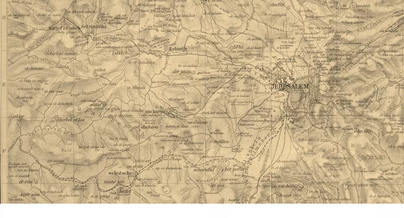
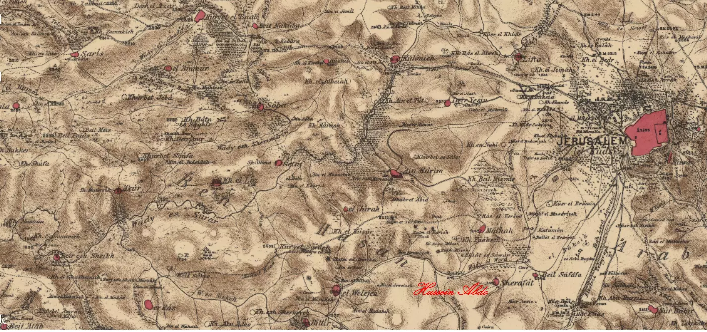
| Related Maps | Town Lands' Demarcation Maps خرائط للقضاء توضح حدود القرى والاودية Town's map on MapQuest View from satellite Help us map this town at WikiMapia |
||||||||||||||
| Related Links | Wikipedia's Page Google Search Google For Images Google For Videos |
||||||||||||||
| More Information | مخطط البلد في كتاب كي لا ننسى في كتاب بلادنا فلسطين المزيد من موقع هوية |
||||||||||||||
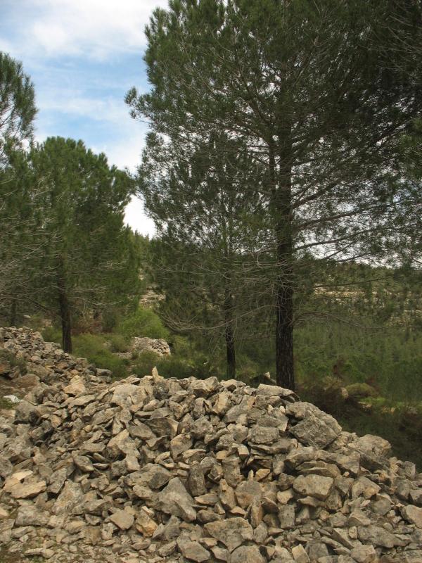
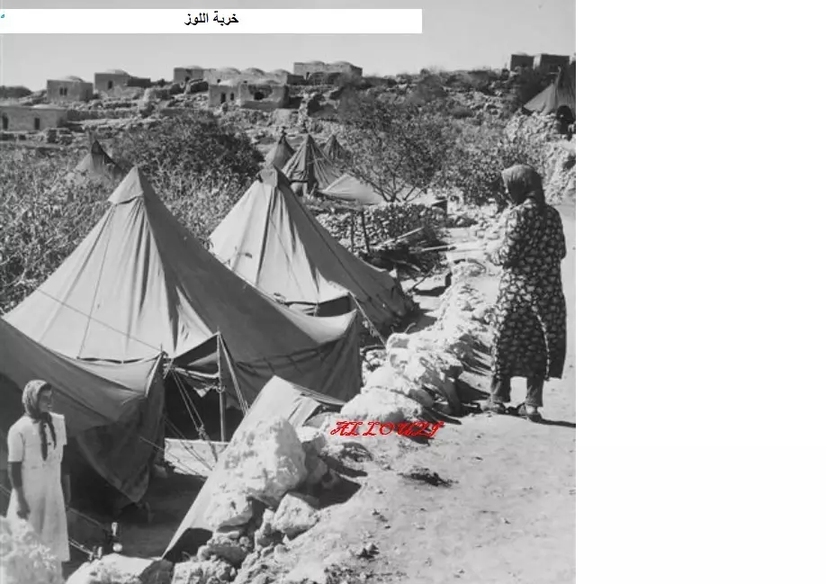
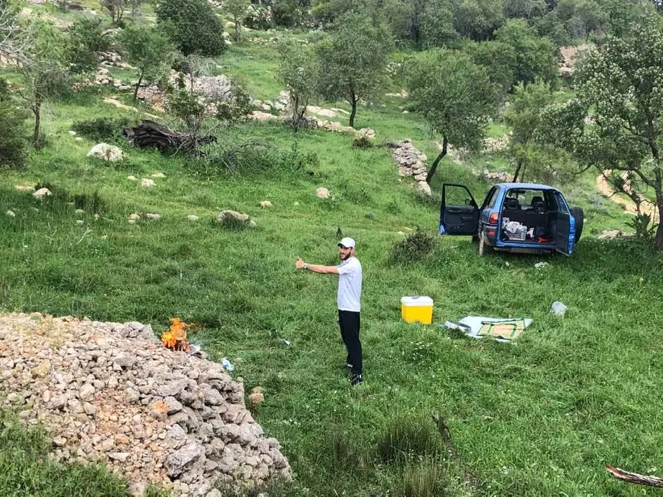
- Village Rubble In 1986
Scanned from "All That Remains" by Dr. Walid Khalidi 1 - Khirbat el-Lawz 1950 left side (edited from ZA-PHG-1012569)
Posted by Dan Golan 2 - Khirbat el-Lawz 1950 center (edited from ZA-PHG-1012569)
Posted by Dan Golan 4 - Khirbat el-Lawz 1950 right side (edited from ZA-PHG-1012569)
Posted by Dan Golan 1 - Khirbat el-Lawz homes layout map
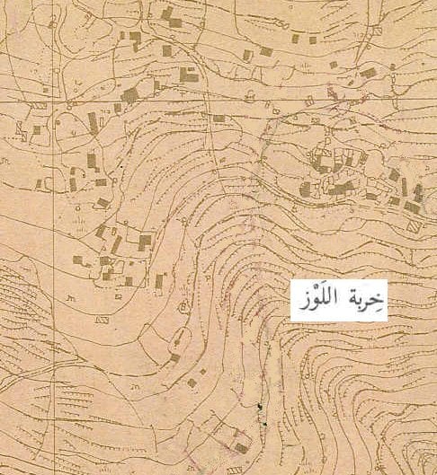
Posted by Dan Golan - Khirbat el-Lawz edited from British maps printed 1945
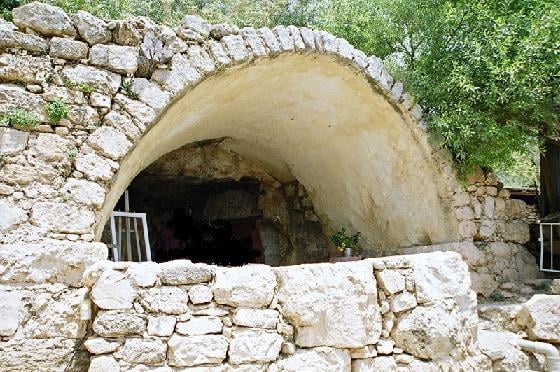
Posted by Dan Golan - Kirbat al-Lawz home 2005
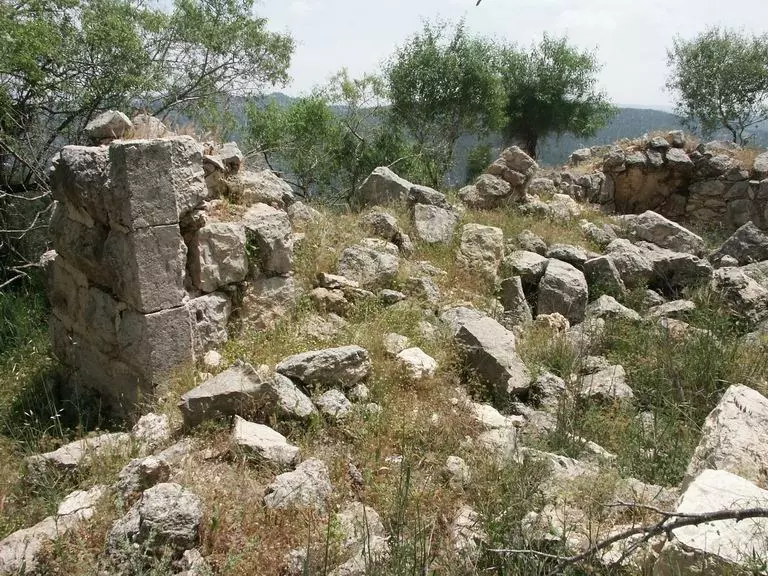
Posted by Dan Golan 2 - Khirbat al_Lawz 2005 inside a home located on the trail to wadi sarar
Posted by Dan Golan - Khirbat al-lawz 2005 entry to home located on trail to wadi sarar
Posted by Dan Golan - Khirbat al-Lawaz 2005 village main street
Posted by Dan Golan - Khirbat al-Lawz 2005 Sheik Salama shrine
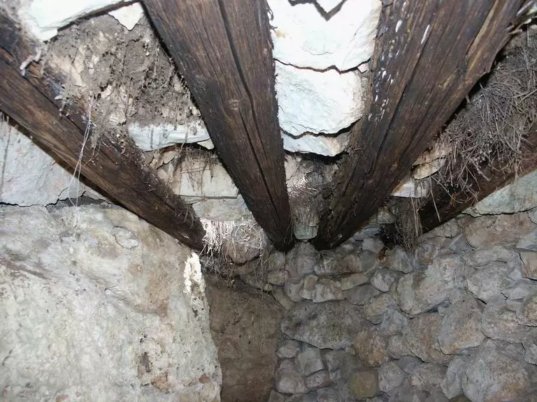
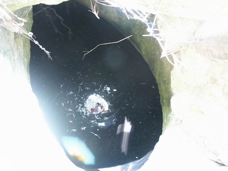
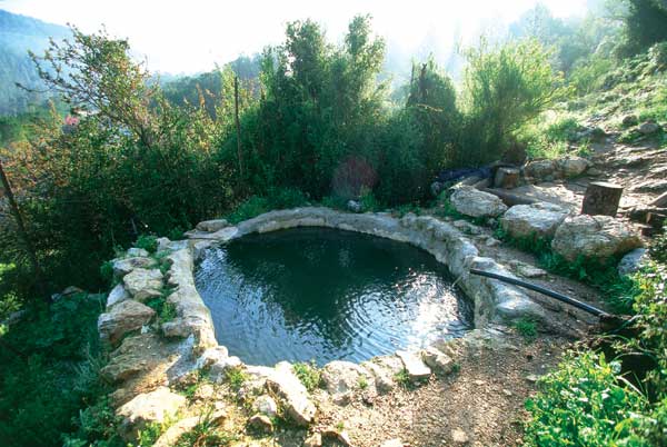
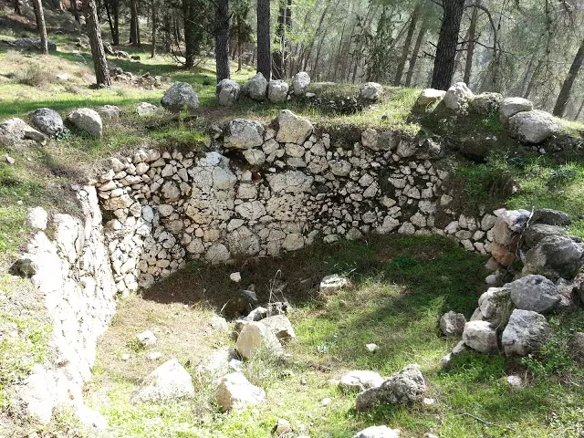
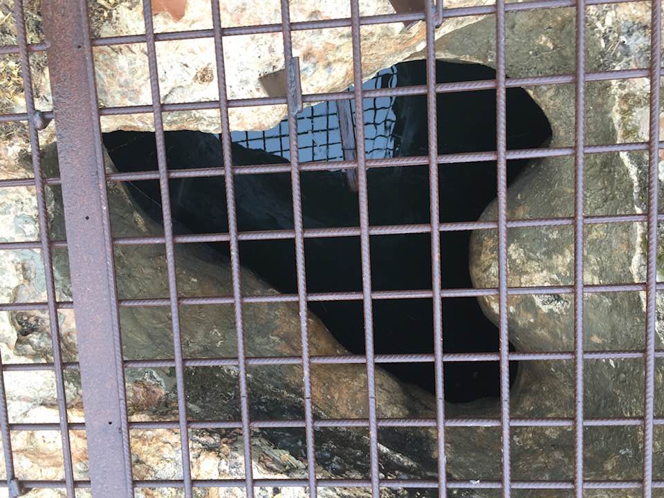
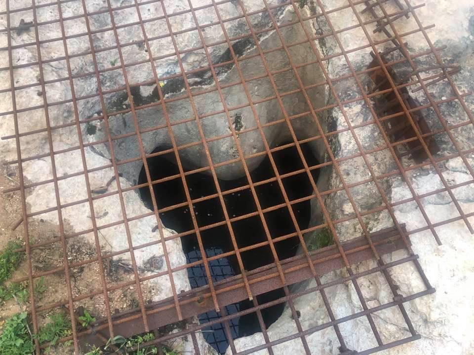
Posted by Dan Golan 1 - Khirbat al-Lawz water well
Posted by Dan Golan - Khirbat al-Lawz 2005 old Harrub tree in village center
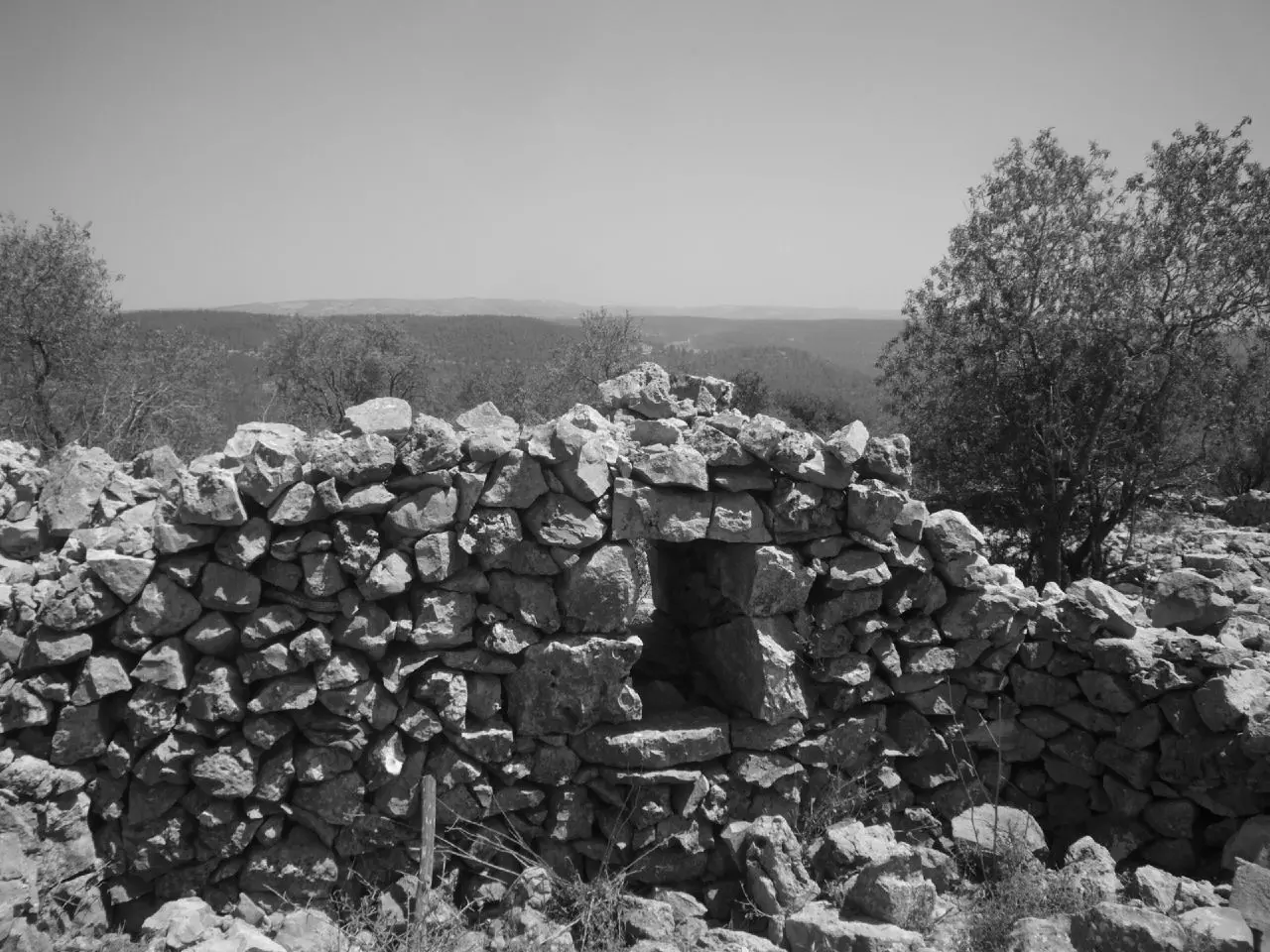
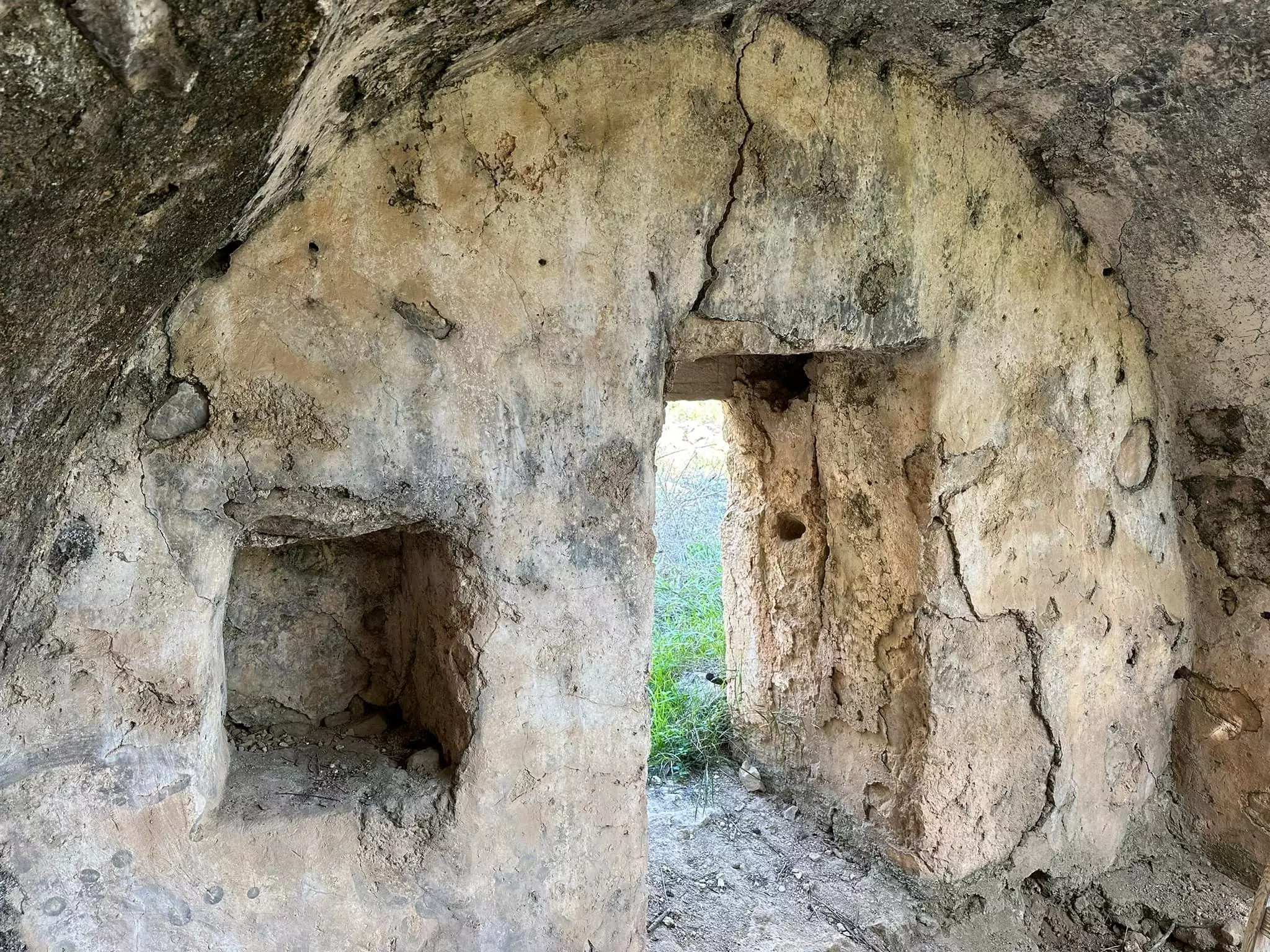
Posted by Dan Golan 3 - Ruins of the destroyed Palestinian village
Posted by Noga Kadman 3 - اطلال احد بيوت القريه المدمره
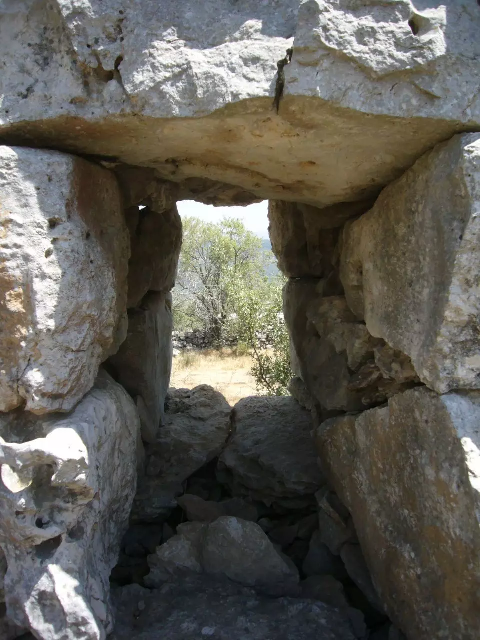
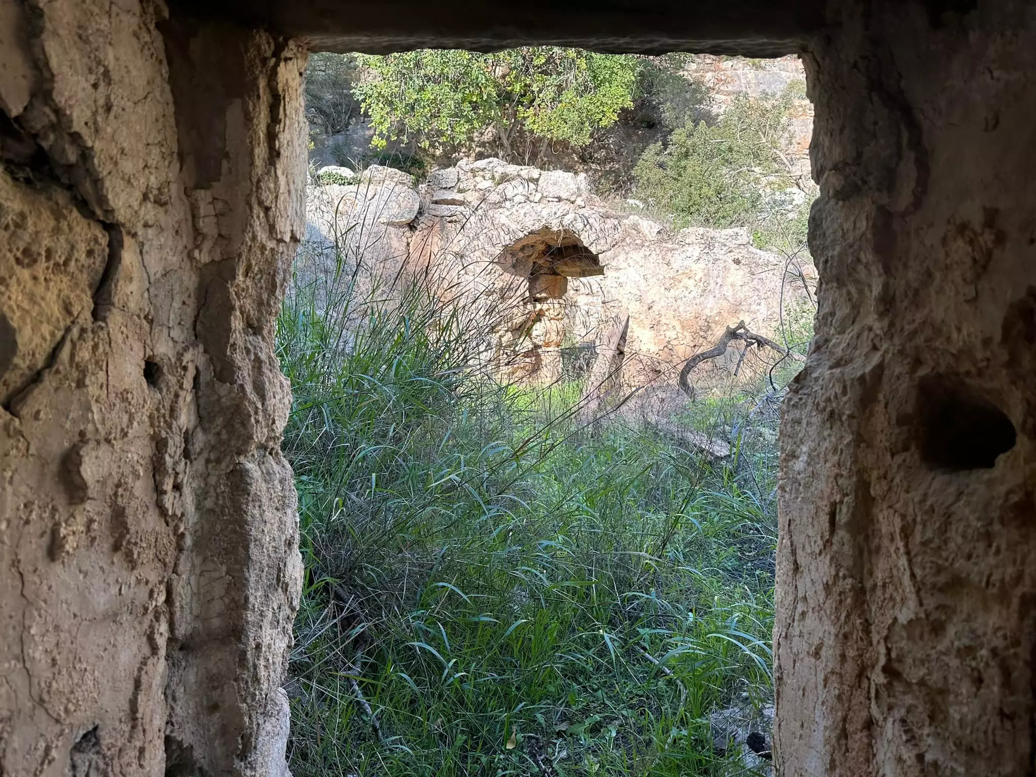
Posted by hussein abdo - شباك لاحد بيوت البلد القديمه
Posted by hussein abdo - اراضي خربه اللوز من منطقه عين القف
Posted by hussein abdo 2 - اراضي خربة اللوز من الغرب كما تظهر من دير عمرو. في الوسط واد عوض.

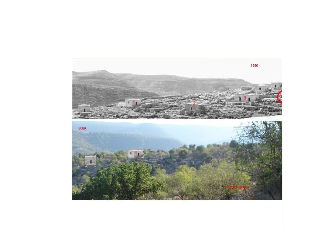
Posted by hussein abdo 1 - صوره اخذت عام ٢٠٠٩ من البلده القديمه باتجه الغرب لنفس المنطقه ونفس الزاويه التي اخذت فيها صورة ١٩٥٠ المعروضه سابقا. البيوت في الصوره الحديثه غير موجوده فعليا.
Posted by hussein abdo - منظر من خربة اللوز باتجاه الجنوب الغربي والمنظر الثاني للمنطقه وسط الصوره الاولى من مكان اقرب
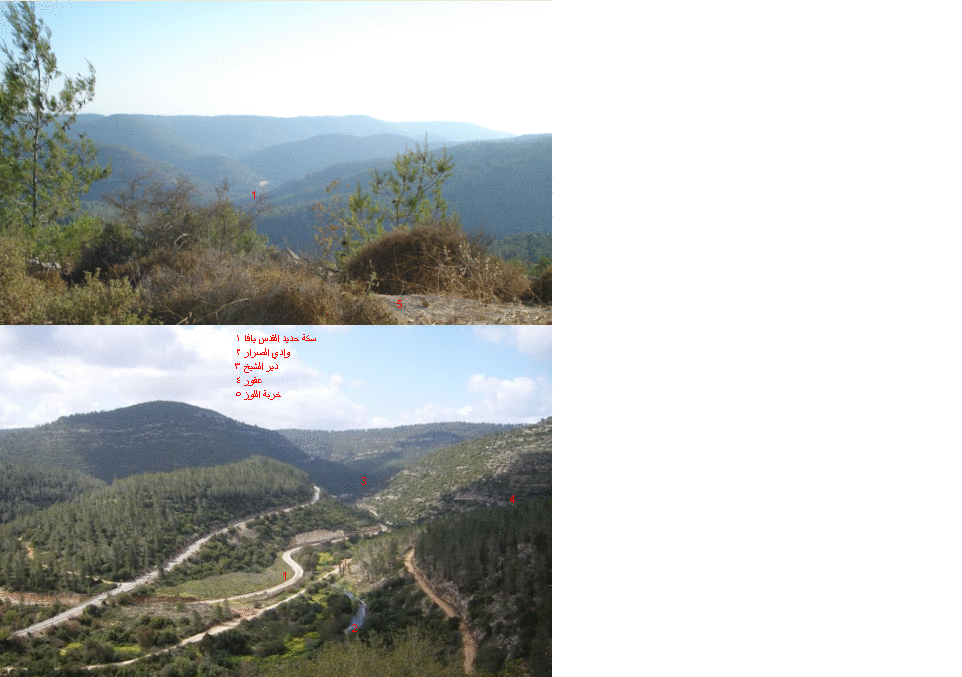
Posted by hussein abdo - منظر من شرق خربة اللوز باتجاه الجنوب
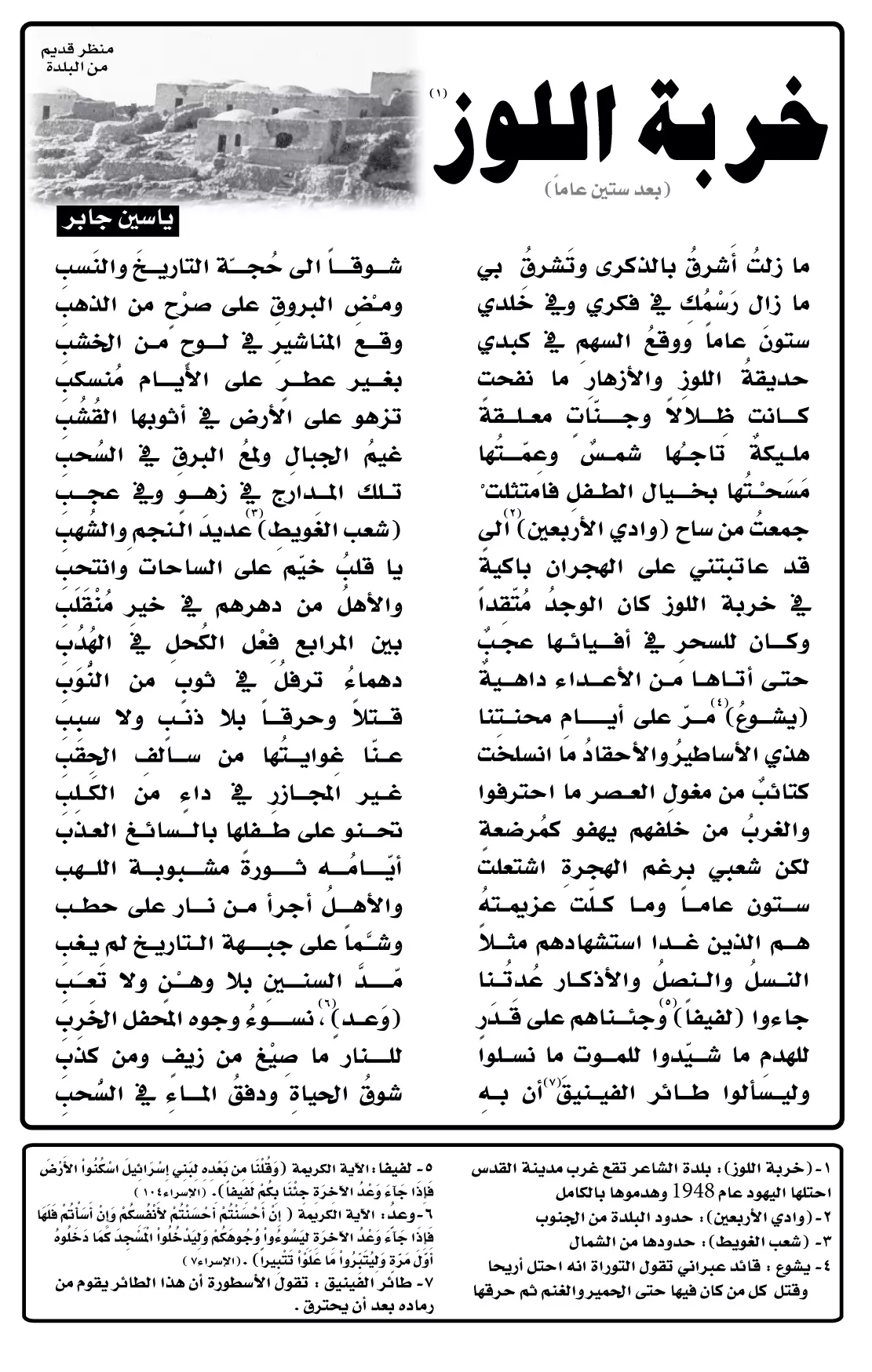
Posted by hussein abdo - قصيدة للشاعر ياسين جابر
Posted by وليــــد ياسين جابر 3 - عين القف في اقصى الجنوب الغربي لاراضي البلد في الجهه الجنوبيه لواد سلميه
Posted by hussein abdo 1 - مقام الشيخ البختياري شرق خربه اللوز
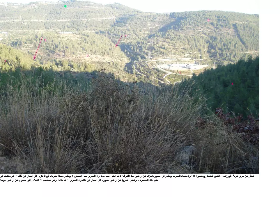
Posted by hussein abdo - منطقه قرب مقام الشيخ البختياري شرق خربه اللوز
Posted by hussein abdo - صوره جويه لخربه اللوز في شهر كانون ثاني من عام 1945 تظهر فيها المدرسه 1 عند طرف البلد من الشرق ووسط البلد 2
Posted by hussein abdo 1 - وسط البلد وتظهر شجره الخروب وسط الصوره
Posted by hussein abdo - خارطه قضاء القدس عام 1898
Posted by hussein abdo 1 - خارطه القدس والقرى المحيطه بها عام 1880
Posted by hussein abdo - نموذج لحجه وردة في السجل الشرعي لمحكمه القدس ص 212 بتاريخ 1 شباط 1531 م.
Posted by hussein abdo - صوره نادره لخربة اللوز بهد الاحتلال عام 1950
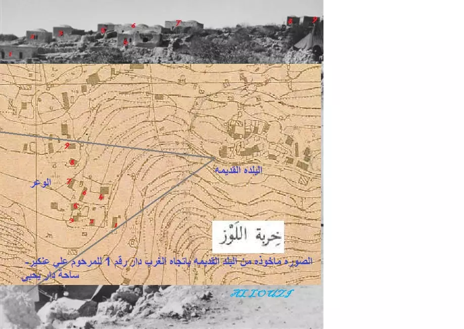
Posted by hussein abdo - خارطة خربة اللوز عام 1933 مع اضافة بعض المعالم منطقة الوعر كانت خاليه من البيوت في تلك الفتره
Posted by hussein abdo - خربة اللوز 1950
Posted by hussein abdo - خربة اللوز - عشرات الامتار الى الجنوب من سلميه
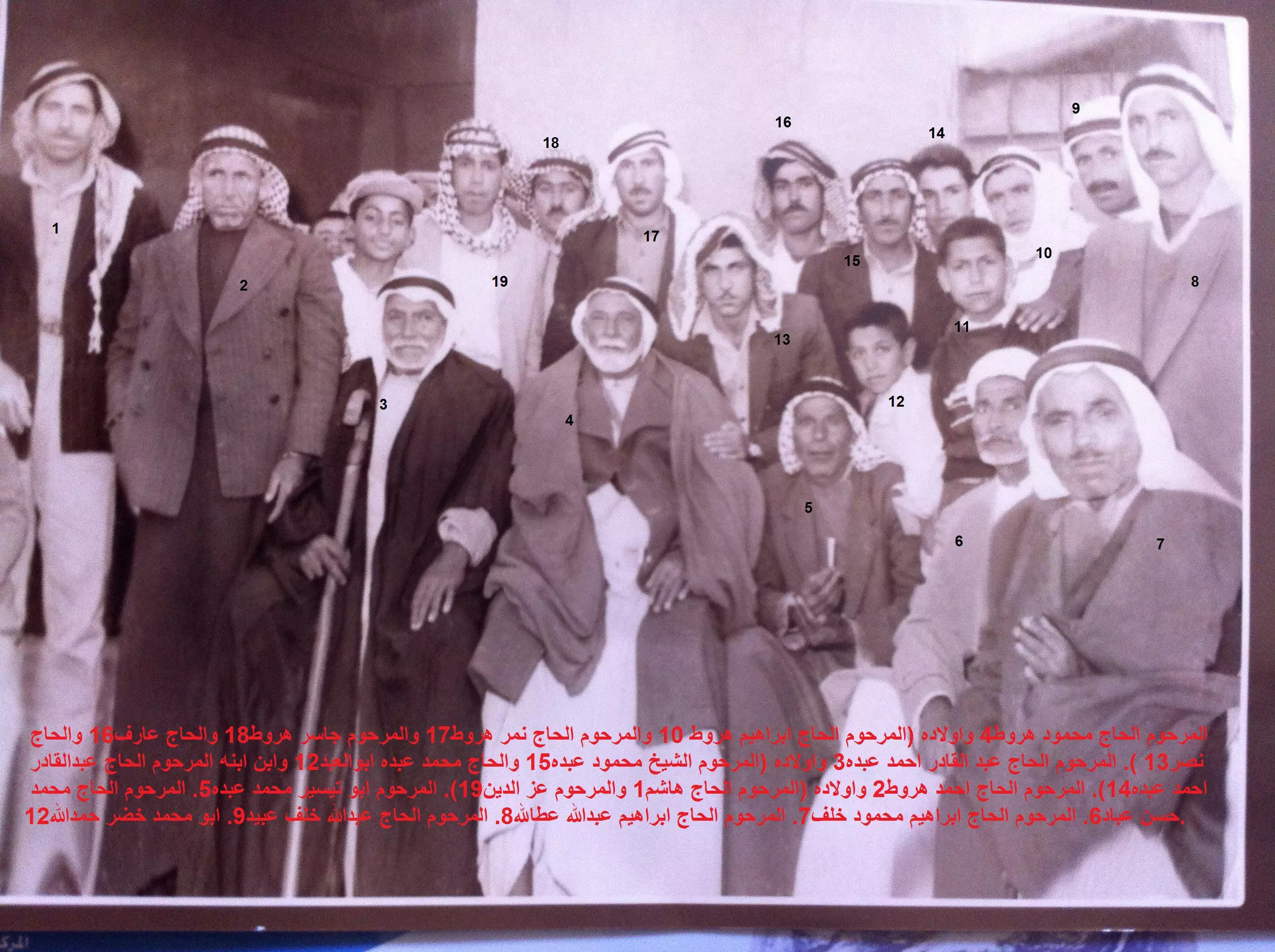
Posted by hussein abdo - صوره اواءل الستينات تجمع عدد من ابناء خربة اللوز اثناء وداع المرحوم الحاج محمود محمد هروط الى الج.
Posted by hussein abdo - خربه اللوز
Posted by abu raya - خربه اللوز
Posted by abu raya - خربه اللوز
Posted by abu raya - خربه اللوز
Posted by abu raya - خربه اللوز
Posted by abu raya - خربه اللوز
Posted by abu raya - خربه اللوز
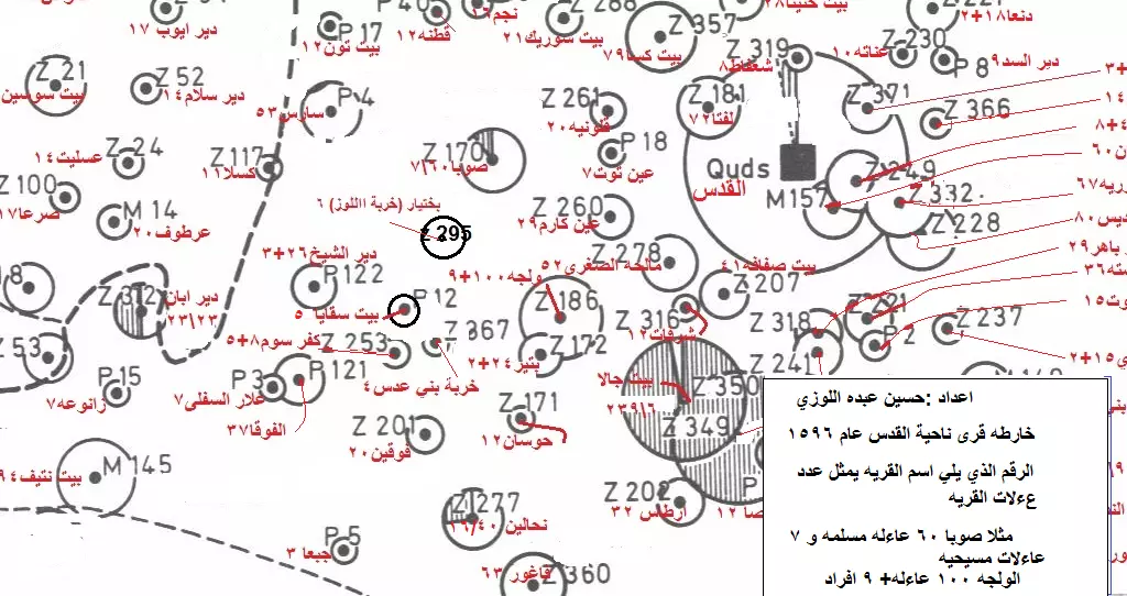
Posted by abu raya - عدد سكان خربة اللوز عام 1596 هو 6 عاءلات اي حوالي 30 نسمه
Posted by hussein abdo - منطار في منطقة الرجال
Posted by hussein abdo - اثار من دور البلده القديمه
Posted by hussein abdo - باتجاه جنوب البلد ويظهر زيتون سلميه وسط الصوره
Posted by hussein abdo - من احصاء نفوس فلسطين عام 1931
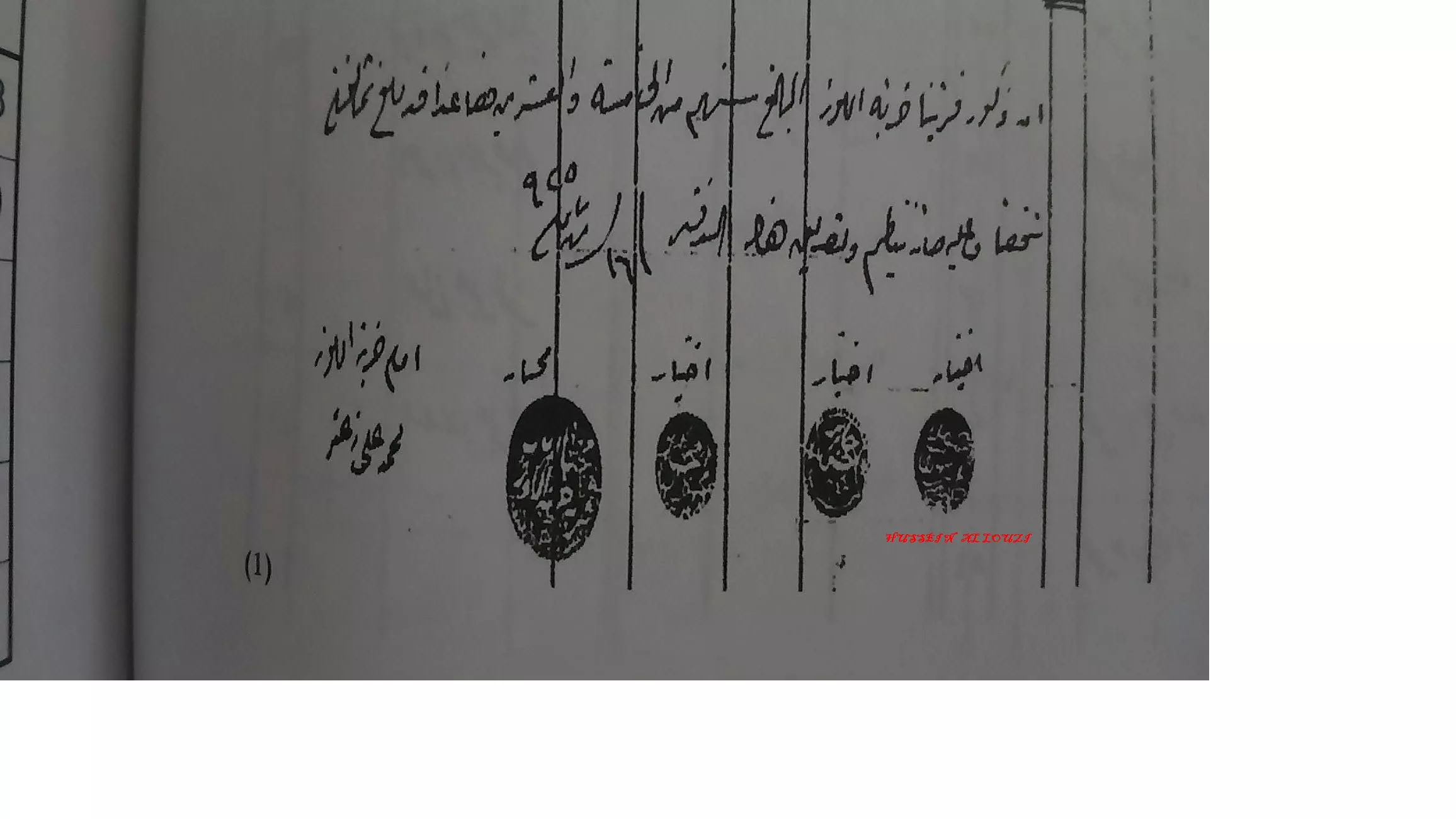
Posted by hussein abdo - أختام ثلاثة ختيارية ومختار قرية خربة اللوز وتوقيع إمام المسجد الشيخ محمد علي زعتر عام 1925, الختم الثاني في الصوره على ما يبدو لجابر حسن ابو طبيخ.
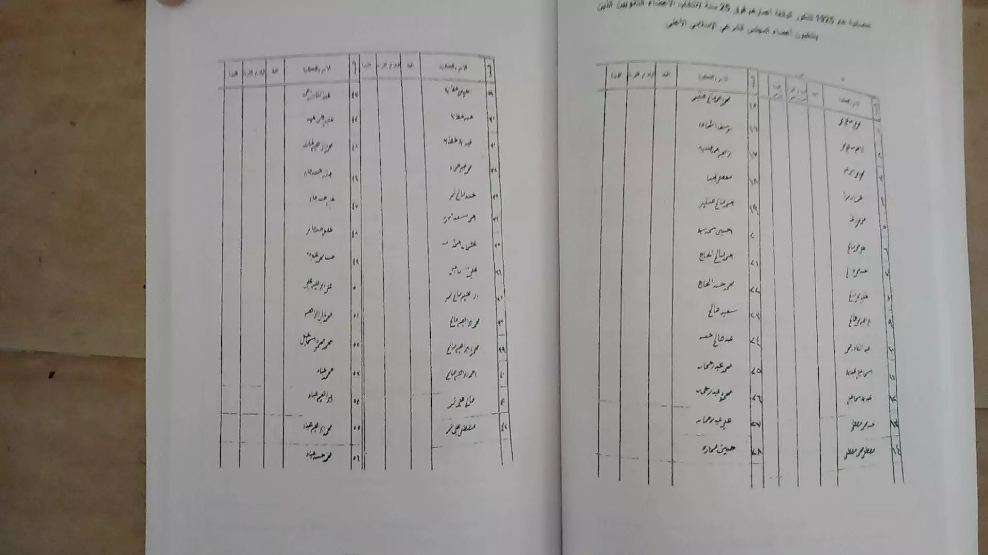
Posted by hussein abdo - وثيقه عام 1925 باسماء ذكور خربة اللوز البالغه اعمارهم اكثر من 25 سنه ص 1 و 2.
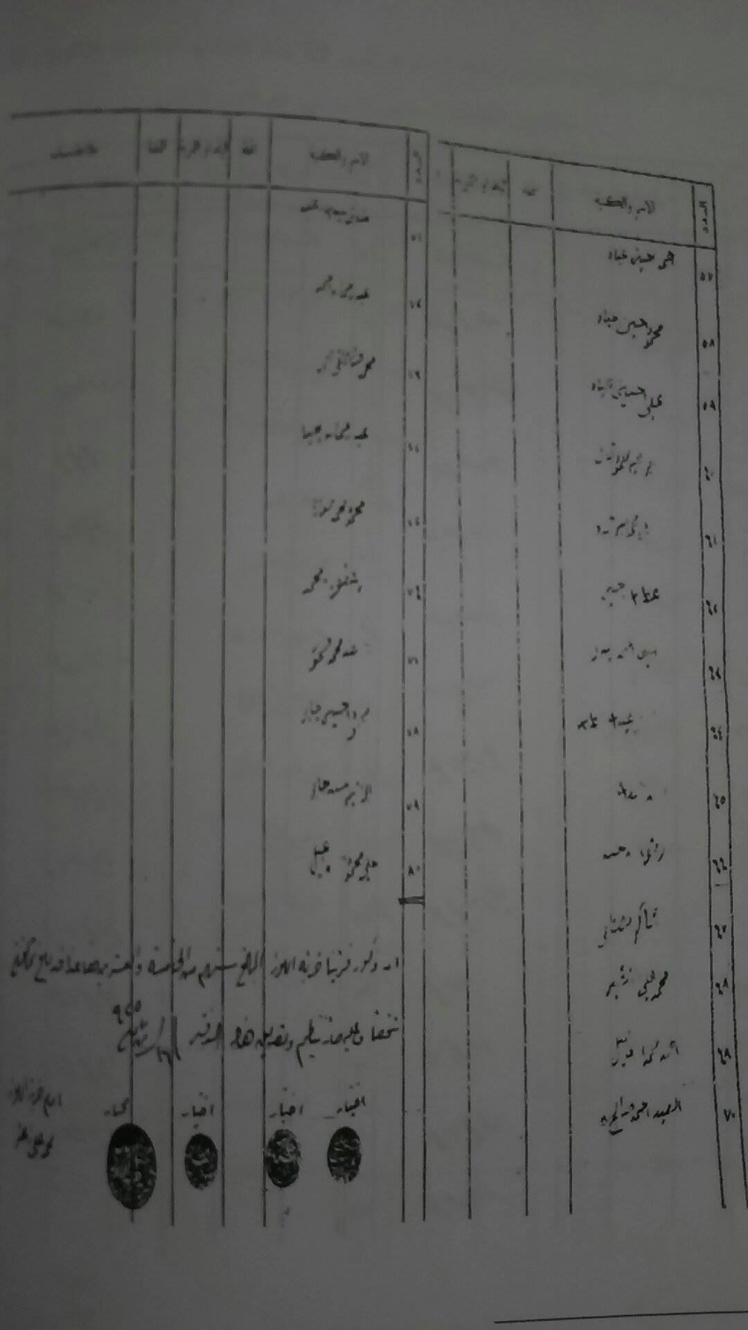
Posted by hussein abdo - وثيقه عام 1925 باسماء ذكور خربة اللوز البالغه اعمارهم اكثر من 25 سنه ص 3.
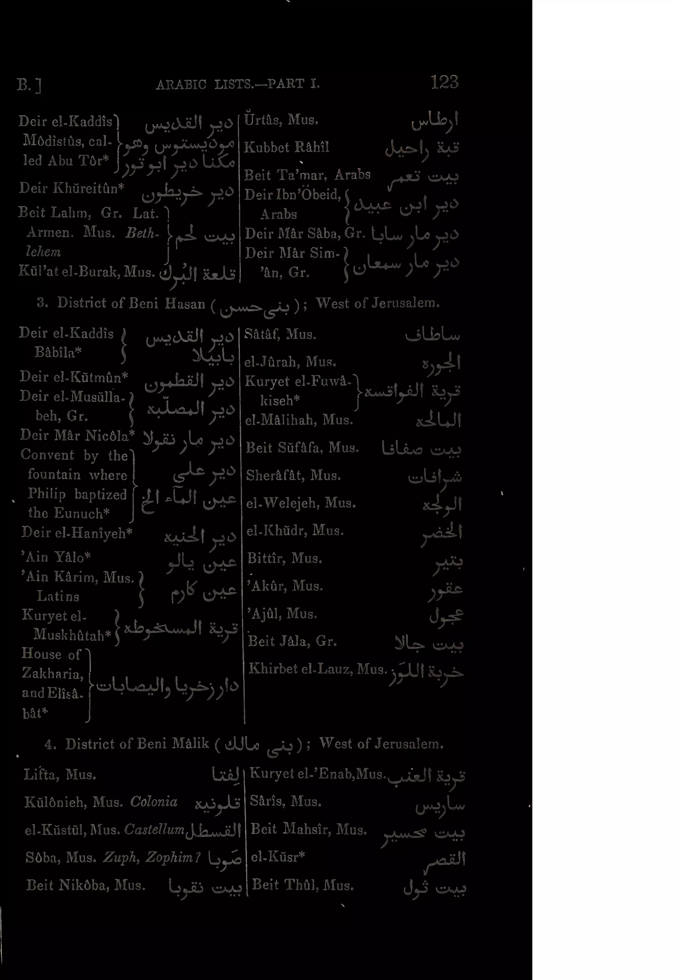
Posted by hussein abdo - قرى ناحية بني حسن غرب القدس من كتاب ل Robinson and Smith عام 1841
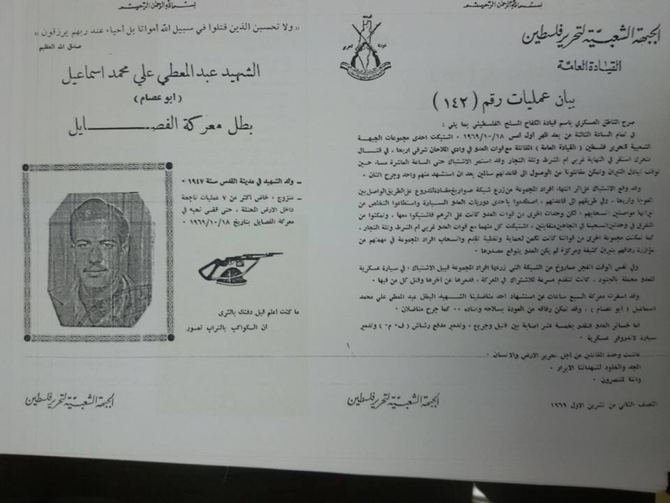
Posted by hussein abdo - الشهيد عبد المعطي علي هروط عام 1969
Posted by hussein abdo - تصوير جوي بتاريخ January 27, 1945
Posted by hussein abdo 1 - A closer look of the Mulberry tree and the remains
- An Aerial view of the village site. Note how the "civilized" completely erased it. How else will the Jews be safe and great again?
- An Aerial view of the village site. Note how the "civilized" completely erased it. How else will the Jews be safe and great again? #2
- More house rubble, courtesy of the most "civilized"
- That is how the "civilized" erased and replaced us: Khirbat al-Lawz was completely obliterated except for Maqam al-Shiekh Bukhari / Bukhtyari, as you see -- خربة اللوز باتت أثر بعد عين ولم يبقى الا مقام الشيخ البخاري او البختياري في المنحدرات الشرقية من اراضي خربة اللوز المهجرة. من هنا مر الهمجّ
- That is how the "civilized" erased and replaced us: Khirbat al-Lawz was completely obliterated except for Maqam al-Shiekh Bukhari / Bukhtyari, as you see -- خربة اللوز باتت أثر بعد عين ولم يبقى الا مقام الشيخ البخاري او البختياري في المنحدرات الشرقية من اراضي خربة اللوز المهجرة. من هنا مر الهمجّ #2
- That is how the "civilized" erased and replaced us: Khirbat al-Lawz was completely obliterated except for Maqam al-Shiekh Bukhari / Bukhtyari, as you see -- خربة اللوز باتت أثر بعد عين ولم يبقى الا مقام الشيخ البخاري او البختياري في المنحدرات الشرقية من اراضي خربة اللوز المهجرة. من هنا مر الهمجّ #3

- That is how the "civilized" erased and replaced us: Khirbat al-Lawz was completely obliterated except for Maqam al-Shiekh Bukhari / Bukhtyari, as you see -- خربة اللوز باتت أثر بعد عين ولم يبقى الا مقام الشيخ البخاري او البختياري في المنحدرات الشرقية من اراضي خربة اللوز المهجرة. من هنا مر الهمجّ #4
- That is how the "civilized" erased and replaced us: Khirbat al-Lawz was completely obliterated except for Maqam al-Shiekh Bukhari / Bukhtyari, as you see -- خربة اللوز باتت أثر بعد عين ولم يبقى الا مقام الشيخ البخاري او البختياري في المنحدرات الشرقية من اراضي خربة اللوز المهجرة. من هنا مر الهمجّ #5
- That is how the "civilized" erased and replaced us: Khirbat al-Lawz was completely obliterated except for Maqam al-Shiekh Bukhari / Bukhtyari, as you see -- خربة اللوز باتت أثر بعد عين ولم يبقى الا مقام الشيخ البخاري او البختياري في المنحدرات الشرقية من اراضي خربة اللوز المهجرة. من هنا مر الهمجّ #6

- That is how the "civilized" erased and replaced us: Khirbat al-Lawz was completely obliterated except for Maqam al-Shiekh Bukhari / Bukhtyari, as you see -- خربة اللوز باتت أثر بعد عين ولم يبقى الا مقام الشيخ البخاري او البختياري في المنحدرات الشرقية من اراضي خربة اللوز المهجرة. من هنا مر الهمجّ #7
- That is how the "civilized" erased and replaced us: Khirbat al-Lawz was completely obliterated except for Maqam al-Shiekh Bukhari / Bukhtyari, as you see -- خربة اللوز باتت أثر بعد عين ولم يبقى الا مقام الشيخ البخاري او البختياري في المنحدرات الشرقية من اراضي خربة اللوز المهجرة. من هنا مر الهمجّ #8
- That is how the "civilized" erased and replaced us: Kh. al-Lawz was completely obliterated except for a few remaining structures, as you see -- خربة اللوز باتت أثر بعد عين. من هنا مر الهمجّ
- That is how the "civilized" erased and replaced us: Kh. al-Lawz was completely obliterated except for a few remaining structures, as you see -- خربة اللوز باتت أثر بعد عين. من هنا مر الهمجّ
#2
- That is how the "civilized" erased and replaced us: Kh. al-Lawz was completely obliterated except for a few remaining structures, as you see -- خربة اللوز باتت أثر بعد عين. من هنا مر الهمجّ
#3
- That is how the "civilized" erased and replaced us: Kh. al-Lawz was completely obliterated except for a few remaining structures, as you see -- خربة اللوز باتت أثر بعد عين. من هنا مر الهمجّ
#4
- That is how the "civilized" erased and replaced us: Kh. al-Lawz was completely obliterated except for a few remaining structures, as you see -- خربة اللوز باتت أثر بعد عين. من هنا مر الهمجّ
#5
- That is how the "civilized" erased and replaced us: Kh. al-Lawz was completely obliterated except for a few remaining structures, as you see -- خربة اللوز باتت أثر بعد عين. من هنا مر الهمجّ
#6
- That is how the "civilized" erased and replaced us: Kh. al-Lawz was completely obliterated except for a few remaining structures, as you see -- خربة اللوز باتت أثر بعد عين. من هنا مر الهمجّ
#7
- That is how the "civilized" erased and replaced us: Kh. al-Lawz was completely obliterated except for a few remaining structures, as you see -- خربة اللوز باتت أثر بعد عين. من هنا مر الهمجّ
#8
- That is how the "civilized" erased and replaced us: Kh. al-Lawz was completely obliterated except for a few remaining structures, as you see -- خربة اللوز باتت أثر بعد عين. من هنا مر الهمجّ
#9
- That is how the "civilized" erased and replaced us: Kh. al-Lawz was completely obliterated except for a few remaining structures, as you see -- خربة اللوز باتت أثر بعد عين. من هنا مر الهمجّ
#10
- That is how the "civilized" erased and replaced us: Kh. al-Lawz was completely obliterated except for a few remaining structures, as you see -- خربة اللوز باتت أثر بعد عين. من هنا مر الهمجّ
#11

- That is how the "civilized" erased and replaced us: Kh. al-Lawz was completely obliterated except for a few remaining structures, as you see -- خربة اللوز باتت أثر بعد عين. من هنا مر الهمجّ
#12

- Our village was completely obliterated way after the battle ended. Actually, our village was occupied intact, and the "civilized" who landed on us from Europe opted to destroy it to hinder our return.

- Our village was completely obliterated way after the battle ended. Actually, our village was occupied intact, and the "civilized" who landed on us from Europe opted to destroy it to hinder our return. #2
- Our village was completely obliterated way after the battle ended. Actually, our village was occupied intact, and the "civilized" who landed on us from Europe opted to destroy it to hinder our return. #3
- Our village was completely obliterated way after the battle ended. Actually, our village was occupied intact, and the "civilized" who landed on us from Europe opted to destroy it to hinder our return. #4
- Our village was completely obliterated way after the battle ended. Actually, our village was occupied intact, and the "civilized" who landed on us from Europe opted to destroy it to hinder our return. #5
- Our village was completely obliterated way after the battle ended. Actually, our village was occupied intact, and the "civilized" who landed on us from Europe opted to destroy it to hinder our return. #6
- Our village was completely obliterated way after the battle ended. Actually, our village was occupied intact, and the "civilized" who landed on us from Europe opted to destroy it to hinder our return. #7
- Our village was completely obliterated way after the battle ended. Actually, our village was occupied intact, and the "civilized" who landed on us from Europe opted to destroy it to hinder our return. #8
- Our village was completely obliterated way after the battle ended. Actually, our village was occupied intact, and the "civilized" who landed on us from Europe opted to destroy it to hinder our return. #9
- Our village was completely obliterated way after the battle ended. Actually, our village was occupied intact, and the "civilized" who landed on us from Europe opted to destroy it to hinder our return. #10
- Our village was completely obliterated way after the battle ended. Actually, our village was occupied intact, and the "civilized" who landed on us from Europe opted to destroy it to hinder our return. #11
- Our village was completely obliterated way after the battle ended. Actually, our village was occupied intact, and the "civilized" who landed on us from Europe opted to destroy it to hinder our return. #12
- Our village was completely obliterated way after the battle ended. Actually, our village was occupied intact, and the "civilized" who landed on us from Europe opted to destroy it to hinder our return. #13
- Our village was completely obliterated way after the battle ended. Actually, our village was occupied intact, and the "civilized" who landed on us from Europe opted to destroy it to hinder our return. #14
- Our village was completely obliterated way after the battle ended. Actually, our village was occupied intact, and the "civilized" who landed on us from Europe opted to destroy it to hinder our return. #15
- Our village was completely obliterated way after the battle ended. Actually, our village was occupied intact, and the "civilized" who landed on us from Europe opted to destroy it to hinder our return. #16
- Our village was completely obliterated way after the battle ended. Actually, our village was occupied intact, and the "civilized" who landed on us from Europe opted to destroy it to hinder our return. #17
- Our village was completely obliterated way after the battle ended. Actually, our village was occupied intact, and the "civilized" who landed on us from Europe opted to destroy it to hinder our return. #18
- Our village was completely obliterated way after the battle ended. Actually, our village was occupied intact, and the "civilized" who landed on us from Europe opted to destroy it to hinder our return. #19
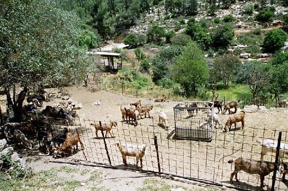
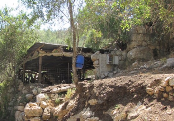
- في محيط مقام الشيخ البخاري او البختياري في المنحدرات الشرقية من اراضي خربة اللوز المهجرة ، والتي كانت تستعمل حظيرة للاغنام من قبل عائلية يهودية اشتهرت بتصنيع الجبنة المعتقة الى ان تم اخلائهم من سلطة الطبيعة -- December, 2022 -- Iyad Jaber
- في محيط مقام الشيخ البخاري او البختياري في المنحدرات الشرقية من اراضي خربة اللوز المهجرة ، والتي كانت تستعمل حظيرة للاغنام من قبل عائلية يهودية اشتهرت بتصنيع الجبنة المعتقة الى ان تم اخلائهم من سلطة الطبيعة -- December, 2022 -- Iyad Jaber #2
- في محيط مقام الشيخ البخاري او البختياري في المنحدرات الشرقية من اراضي خربة اللوز المهجرة ، والتي كانت تستعمل حظيرة للاغنام من قبل عائلية يهودية اشتهرت بتصنيع الجبنة المعتقة الى ان تم اخلائهم من سلطة الطبيعة -- December, 2022 -- Iyad Jaber #3
- في محيط مقام الشيخ البخاري او البختياري في المنحدرات الشرقية من اراضي خربة اللوز المهجرة ، والتي كانت تستعمل حظيرة للاغنام من قبل عائلية يهودية اشتهرت بتصنيع الجبنة المعتقة الى ان تم اخلائهم من سلطة الطبيعة -- December, 2022 -- Iyad Jaber #4
- في محيط مقام الشيخ البخاري او البختياري في المنحدرات الشرقية من اراضي خربة اللوز المهجرة ، والتي كانت تستعمل حظيرة للاغنام من قبل عائلية يهودية اشتهرت بتصنيع الجبنة المعتقة الى ان تم اخلائهم من سلطة الطبيعة -- December, 2022 -- Iyad Jaber #5
- في محيط مقام الشيخ البخاري او البختياري في المنحدرات الشرقية من اراضي خربة اللوز المهجرة ، والتي كانت تستعمل حظيرة للاغنام من قبل عائلية يهودية اشتهرت بتصنيع الجبنة المعتقة الى ان تم اخلائهم من سلطة الطبيعة -- December, 2022 -- Iyad Jaber #6
- في محيط مقام الشيخ البخاري او البختياري في المنحدرات الشرقية من اراضي خربة اللوز المهجرة ، والتي كانت تستعمل حظيرة للاغنام من قبل عائلية يهودية اشتهرت بتصنيع الجبنة المعتقة الى ان تم اخلائهم من سلطة الطبيعة -- December, 2022 -- Iyad Jaber #7
- في محيط مقام الشيخ البخاري او البختياري في المنحدرات الشرقية من اراضي خربة اللوز المهجرة ، والتي كانت تستعمل حظيرة للاغنام من قبل عائلية يهودية اشتهرت بتصنيع الجبنة المعتقة الى ان تم اخلائهم من سلطة الطبيعة -- December, 2022 -- Iyad Jaber #8
- في محيط مقام الشيخ البخاري او البختياري في المنحدرات الشرقية من اراضي خربة اللوز المهجرة ، والتي كانت تستعمل حظيرة للاغنام من قبل عائلية يهودية اشتهرت بتصنيع الجبنة المعتقة الى ان تم اخلائهم من سلطة الطبيعة -- December, 2022 -- Iyad Jaber #9
- في محيط مقام الشيخ البخاري او البختياري في المنحدرات الشرقية من اراضي خربة اللوز المهجرة ، والتي كانت تستعمل حظيرة للاغنام من قبل عائلية يهودية اشتهرت بتصنيع الجبنة المعتقة الى ان تم اخلائهم من سلطة الطبيعة -- December, 2022 -- Iyad Jaber #10
- في محيط مقام الشيخ البخاري او البختياري في المنحدرات الشرقية من اراضي خربة اللوز المهجرة ، والتي كانت تستعمل حظيرة للاغنام من قبل عائلية يهودية اشتهرت بتصنيع الجبنة المعتقة الى ان تم اخلائهم من سلطة الطبيعة -- December, 2022 -- Iyad Jaber #11
- في محيط مقام الشيخ البخاري او البختياري في المنحدرات الشرقية من اراضي خربة اللوز المهجرة ، والتي كانت تستعمل حظيرة للاغنام من قبل عائلية يهودية اشتهرت بتصنيع الجبنة المعتقة الى ان تم اخلائهم من سلطة الطبيعة -- December, 2022 -- Iyad Jaber #12
- في محيط مقام الشيخ البخاري او البختياري في المنحدرات الشرقية من اراضي خربة اللوز المهجرة ، والتي كانت تستعمل حظيرة للاغنام من قبل عائلية يهودية اشتهرت بتصنيع الجبنة المعتقة الى ان تم اخلائهم من سلطة الطبيعة -- December, 2022 -- Iyad Jaber #13
- في محيط مقام الشيخ البخاري او البختياري في المنحدرات الشرقية من اراضي خربة اللوز المهجرة ، والتي كانت تستعمل حظيرة للاغنام من قبل عائلية يهودية اشتهرت بتصنيع الجبنة المعتقة الى ان تم اخلائهم من سلطة الطبيعة -- December, 2022 -- Iyad Jaber #14
- في محيط مقام الشيخ البخاري او البختياري في المنحدرات الشرقية من اراضي خربة اللوز المهجرة ، والتي كانت تستعمل حظيرة للاغنام من قبل عائلية يهودية اشتهرت بتصنيع الجبنة المعتقة الى ان تم اخلائهم من سلطة الطبيعة -- December, 2022 -- Iyad Jaber #15
- في محيط مقام الشيخ البخاري او البختياري في المنحدرات الشرقية من اراضي خربة اللوز المهجرة ، والتي كانت تستعمل حظيرة للاغنام من قبل عائلية يهودية اشتهرت بتصنيع الجبنة المعتقة الى ان تم اخلائهم من سلطة الطبيعة -- December, 2022 -- Iyad Jaber #16
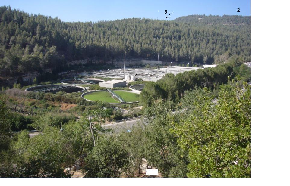
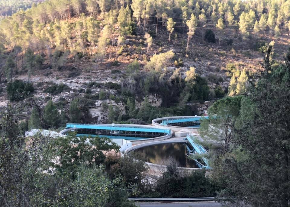
- مصنع تنقية المياه
- Let us tour the rubble which the "civilized one" left behind. How else will the Jews be great again?
- Let us tour the rubble which the "civilized one" left behind. How else will the Jews be great again? #2
- Let us tour the rubble which the "civilized one" left behind. How else will the Jews be great again? #3
- Let us tour the rubble which the "civilized one" left behind. How else will the Jews be great again? #4
- Let us tour the rubble which the "civilized one" left behind. How else will the Jews be great again? #5
- Let us tour the rubble which the "civilized one" left behind. How else will the Jews be great again? #6
- Let us tour the rubble which the "civilized one" left behind. How else will the Jews be great again? #7
- Let us tour the rubble which the "civilized one" left behind. How else will the Jews be great again? #8
- Let us tour the rubble which the "civilized one" left behind. How else will the Jews be great again? #9

- Let us tour the rubble which the "civilized one" left behind. How else will the Jews be great again? #10
- Let us tour the rubble which the "civilized one" left behind. How else will the Jews be great again? #11
- Let us tour the rubble which the "civilized one" left behind. How else will the Jews be great again? #12

- Let us tour the rubble which the "civilized one" left behind. How else will the Jews be great again? #13
- Let us tour the rubble which the "civilized one" left behind. How else will the Jews be great again? #14
- Let us tour the rubble which the "civilized one" left behind. How else will the Jews be great again? #15
- Let us see how the most "liberal and civilized" of world Jewry has obliterated our village. How else will the Jews be great and safe again? -- القرية دمرت بالكامل.. من هنا مر الهمج
- Let us see how the most "liberal and civilized" of world Jewry has obliterated our village. How else will the Jews be great and safe again? -- القرية دمرت بالكامل.. من هنا مر الهمج #2
- Let us see how the most "liberal and civilized" of world Jewry has obliterated our village. How else will the Jews be great and safe again? -- القرية دمرت بالكامل.. من هنا مر الهمج #3
- Let us see how the most "liberal and civilized" of world Jewry has obliterated our village. How else will the Jews be great and safe again? -- القرية دمرت بالكامل.. من هنا مر الهمج #4
- Let us see how the most "liberal and civilized" of world Jewry has obliterated our village. How else will the Jews be great and safe again? -- القرية دمرت بالكامل.. من هنا مر الهمج #5

- Let us see how the most "liberal and civilized" of world Jewry has obliterated our village. How else will the Jews be great and safe again? -- القرية دمرت بالكامل.. من هنا مر الهمج #6
- Let us see how the most "liberal and civilized" of world Jewry has obliterated our village. How else will the Jews be great and safe again? -- القرية دمرت بالكامل.. من هنا مر الهمج #7
- Let us see how the most "liberal and civilized" of world Jewry has obliterated our village. How else will the Jews be great and safe again? -- القرية دمرت بالكامل.. من هنا مر الهمج #8
- Let us see how the most "liberal and civilized" of world Jewry has obliterated our village. How else will the Jews be great and safe again? -- القرية دمرت بالكامل.. من هنا مر الهمج #9

- Let us see how the most "liberal and civilized" of world Jewry has obliterated our village. How else will the Jews be great and safe again? -- القرية دمرت بالكامل.. من هنا مر الهمج #10
- Let us see how the most "liberal and civilized" of world Jewry has obliterated our village. How else will the Jews be great and safe again? -- القرية دمرت بالكامل.. من هنا مر الهمج #11
- Let us see how the most "liberal and civilized" of world Jewry has obliterated our village. How else will the Jews be great and safe again? -- القرية دمرت بالكامل.. من هنا مر الهمج #12
- Let us see how the most "liberal and civilized" of world Jewry has obliterated our village. How else will the Jews be great and safe again? -- القرية دمرت بالكامل.. من هنا مر الهمج #13
- Let us see how the most "liberal and civilized" of world Jewry has obliterated our village. How else will the Jews be great and safe again? -- القرية دمرت بالكامل.. من هنا مر الهمج #14
- Let us see how the most "liberal and civilized" of world Jewry has obliterated our village. How else will the Jews be great and safe again? -- القرية دمرت بالكامل.. من هنا مر الهمج #15
- Let us see how the most "liberal and civilized" of world Jewry has obliterated our village. How else will the Jews be great and safe again? -- القرية دمرت بالكامل.. من هنا مر الهمج #16
Want to browse more? 80,000 pictures were grouped in these gallaries:
| Display Name | Clan/Hamolah | Country of Residence |
| Shireen Allozy | Yahya | Fresno, United States |
| عماد اللوزي | يحيى | - |
| اكرم عبده | شكله | عمان |
| عطاف | - | - |
| علاءالدين القيسي | يحيى | AMMAN, JORDAN |
| قلب الاسد | ابو طبيخ | الاردن |
| وليــــد ياسين جابر | جابر | عمان - حي نزال, الاردن |
| amani obaid | عبيد | amman |
| محمدحسن عنكير | عنكير | عمان راس العين |
| Adnan Ghosheh | - | Dubai, United Arab Emirates |
| ahmad abbad | - | حي نزال |
| يحيى اللوزي | عنكير | عمان |
| عوض اللوزي | شكلة | النظيف, النظيف |
| الدكتور | شكلة | عمان, الأردن |
| طارق عبيد | shaklah | - |
| ahmed obeid | shaklah | amman, jordan |
| hussein abdo | _ | Palestine |
| YOUSEF TALEEP | TALEEP | amman, JORDAN |
| Mohammad Abbad | Abbad | Jordan, Jordan |
| Malek Zatar | - | New York, America |
| hani nemer | - | - |
| Atallah | Shaklah | Tx, USA |
| Ayman hussien | atallah | - |
| Murad Abdullah Ibrahim Khalaf | Shakleh | Amman, Jordan |
- خربة اللوز المهجرة | جذور مقدسية 2020 Duration: 25 min 24 sec
- القدس عين نقوبا عين رافا خربة اللوز
- لقاء عن قرية خربة اللوز مع المرحوم الحج عبدالله جبر مواليد خربة اللوز عام 1917
- في محيط مقام الشيخ البخاري او البختياري في المنحدرات الشرقية من اراضي خربة اللوز المهجرة قضاء القدس ، والتي كانت تستعمل حظيرة للاغنام من قبل عائلية يهودية اشتهرت بتصنيع الجبنة المعتقة الى ان تم اخلائهم من سلطة اللطبيعة . Duration: 3 min
 Fake Valor: Why Did Zionist Jews Hoist Nazis Flag on Their Ships in the 1930s?
What is new?
-
Facts About Oct. 7th Gaza Raid
-
Remined Us Please:: Who Did Rape Who? Palestinians Raped Israelis? Or, was the other way around?
-
When Prof. Edward Said was invited to debate Bibi Netanyahu in the 1980s, watch what happened!
-
Ezra Klein of the NY Times on the "Jewish Race".
-
Abusing Blood Libel!
-
Did Israeli Soldiers Activate The Hanniba Direective On Oct. 7th? You Be The Judge
-
Zionist FAQ: Isn't it true that Palestinians don't want peace? Palestinians never accepted the two-state solution
- Facts about Haavara (Transfer) Agreement between Ben-Gurion & Hitler
-
Haavara FAQs: Why Did Zionist Jews Hoist Nazis' Flags on Their Ships in the 1930s?
- Haavara FAQs: When Chaim Weizmann met FDR in mid-1943, why was he silent about rescuing European Jewry?
-
Dear ChatGPT: How did Palestinians resist Napoleon's invasion of their country in 1799?
-
Dear ChatGPT: Gaza had a vibrant Jewish community in the mid-17th century. What happened to them?
-
Dear ChatGPT: Why did the Jewish Agency suppress news of the Holocaust during WWII?
-
Video Playlist: Jews share their DNA tests to end the conflict for good.
-
A Tale of Two Conflicts: Examining the Definition of Genocide
-
Prof. Abraham Polak And The Suppressed History of the Khazars and European Jewry
-
How Ronald Reagan would have framed the genocide in Gaza if he were still alive?
-
Haavara FAQs: Let us do the math: how many German Jews did The Haavara Agreement save?
-
Zionist FAQs: The Hebron Massacre of 1929, "clearly proves" that Palestinians are antisemitic, how could you deny it?
-
Zionist FAQs: Why Anti-Zionist Is Not Antisemitism?
-
Zionist FAQs: Isn't it true that the KGB created Palestinian Nationalism in the early 1960s?
- Zionist FAQs: Muslims are killing Muslims all the time; why are Israeli Jews being singled out in the media?
- Zionist FAQs: How is Israel an apartheid state when 20% of its citizens are Arabs who enjoy full rights?
-
Haavara FAQs: Why Did Dorothy Thompson Flip From A Zionist Advocate to A Silenced Dissenter?
-
Haavara FAQs: Analysis of Herzl's Uganda Scheme and how it could have saved millions of Jews.
-
Haavara FAQs: Why did Hayim Greenberg describe American Jewry as "morally bankrupt" in early 1943?
-
Haavara FAQs: What if the Evian Conference was a resounding success? What would have been the impact of saving European Jewry on Zionism?
- Haavara FAQs: What if the six million were saved, how that would have impacted the Zionist project?
-
Haavara FAQs: How did Zionist leaders react when Europe's Jews lingered in the DP camps after WWII ended?
-
Why does the American Jewish community repeat lies that David Ben-Gurion had debunked before he died?
-
Who has the power to rename the Tatar/Khazar Gene Marker to Jewish IV?
-
Zionist FAQs: Why won't Egypt, Syria, and Jordan take their people back? Jews are indigenous to Palestine, and Arabs immigrated after Jews developed the country. Arabs should leave.
-
Haavara FAQs: Did Hitler and the Nazis conflate between Judaism and Zionist? If that wasn't case, then why?
-
Haavara FAQs: Winston Churchill and antisemitism, a collection of articles written Churchill.
-
Haavara FAQs: Broken by country, how many Jews survived vs. killed during the Holocaust?
-
Haavara FAQs: Why did European Jews vote with their feet and to immigrated to the Americas, not Palestine, after WWII?
-
Watch this American Jewish Girl describing Israeli Jews' cognitive dissonance like no other in under two minutes
-
Haavara FAQs: When the Nazis went out of their way to hide the Holocaust, Israeli Jews did the exact opposite by broadcasting their genocide of Gazans. But why?
-
Haavara FAQs: How Zionist Jews went out of their to show their appreciation to Nazism and Fascism?
- Haavara FAQs: Why Zionist leaders were against bombing the death camps & the Railroads leading to them?
-
Haavara FAQs: Hitler's message to the British and American people: If Jews are such noble citizens and you care about them, how come you're not letting them in? I will gladly ship them to you at my expense, even on luxury liners!
-
A shortlist of Zionist and Israeli false flag operations in the name Jews.
-
The Most Moral Army
- The Land of Kapos (Israel): Where the brave are boycotted and Kapos walk free.
- Why did early Zionists often named their communal enterprises "colonial"?
- Zionist Relations with Nazi Germany by Faris Glubb
-
Two NY Times advertisements by Zionists in the early 1943 that exposes Zionists' treason at the height of the calamity
- Facts Not Lies about the Palestinian-Israeli Conflict.
- Site's pictures have been categorized
- Campgain Against Lice
- A Survey of Palestine, the official source about Palestine before Nakba produced by the British Mandate; over 1200 pages.
- Satellite View & Google Earth: Over 6,000 placemarks identifying all destroyed towns, W. Bank & Gaza Strip Towns, & refugee camps.
- PalestineRemembered.com and its Nakba Oral History Project were featured on al-Jazeera Satellite TV.
- Nakba Oral History Video Podcast:
 Over 700 Oral History interviews (including 3,500+ hours of recording) can be viewed online.
 - Palestine Village Statistics Project
- Gaza Jail Break
- النسخة العربية للموقع الان متوفرة
- Videos: Documenting the destroyed villages in video: Tracing all that remains since Nakba.
- Videos: Responding to Zionist Propaganda
- Interview: The ethnic cleansing of Palestine: George Galloway interviews Israeli Historian Ilan Pappe.
- For Palestinians, memory matters. It provides a blueprint for their future By George Bisharat.
- Zionist FAQ now available in Hebrew שאלות שציונים שואלים, עכשיו בעברית
- Video: The Stephen Walt and John Mearsheimer report on the influence of the Israel Lobby on U.S. Foreign Policy
- The Palestinian-Israeli conflict for beginners
