| PalestineRemembered | About Us | Oral History | العربية | |
| Pictures | Zionist FAQs | Haavara | Maps | |
| Search |
| Camps |
| Districts |
| Acre |
| Baysan |
| Beersheba |
| Bethlehem |
| Gaza |
| Haifa |
| Hebron |
| Jaffa |
| Jericho |
| Jerusalem |
| Jinin |
| Nablus |
| Nazareth |
| Ramallah |
| al-Ramla |
| Safad |
| Tiberias |
| Tulkarm |
| Donate |
| Contact |
| Profile |
| Videos |
Welcome To Qatra - قطرة (קטרה)
|
District of al-Ramla
Ethnically cleansed days ago |
العربية Google Earth |
 |
Gallery (108) |
- Statistics & Facts
-
Before & After

- Satellite View
- Articles 13
- Pictures 108
- Aerial Views 2
- Land Deeds 4
- Oral History 1
- Members 45
- Families
- All That Remains
- Town's Map
- Wikipedia
- Videos 3
- Guest Book 16
- Links 1
| Statistic & Fact | Value | |||||||||||||||||||||
| Occupation Date | May 17, 1948 | |||||||||||||||||||||
| Distance From District | 15 (km) Southwest of al-Ramla | |||||||||||||||||||||
| Elevation | 50 (meters) | |||||||||||||||||||||
| Before & After Nakba, Click Map For Details |
||||||||||||||||||||||
|
||||||||||||||||||||||
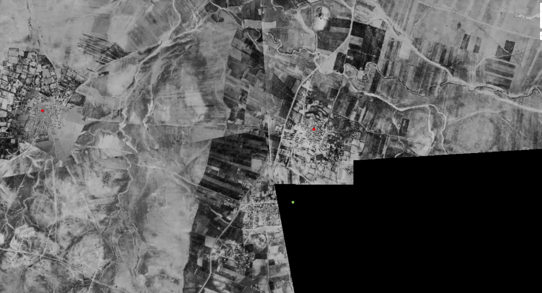
| Pre-Nakba Aerial View |
||||||||||||||||||||||
|
||||||||||||||||||||||
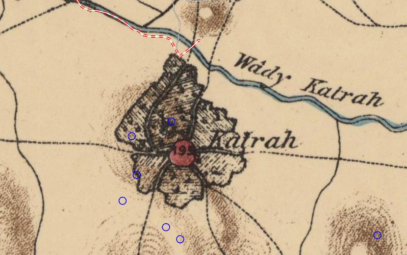
| Map Location | See location #42 on the map View from satellite |
|||||||||||||||||||||
| Attacking Units | Giv'ati Brigade | |||||||||||||||||||||
| Exodus Cause | Military assault by Zionist troops | |||||||||||||||||||||
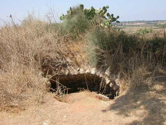
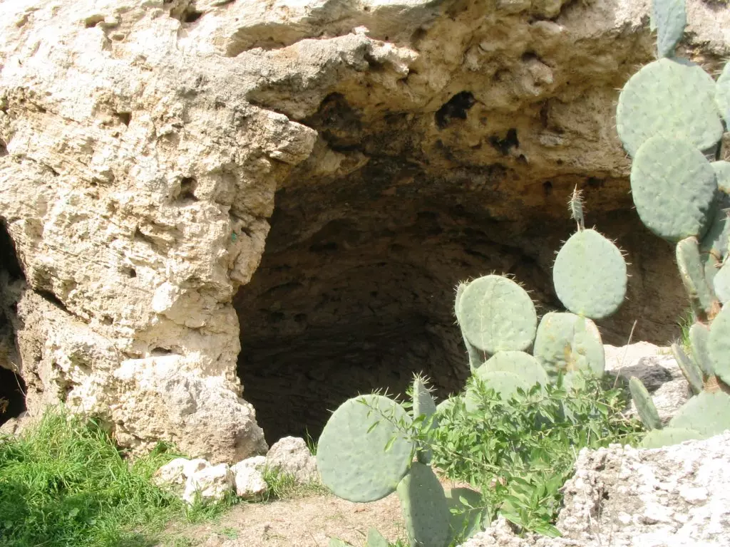
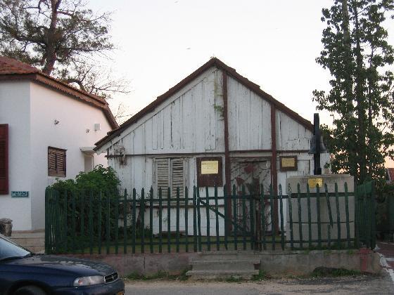
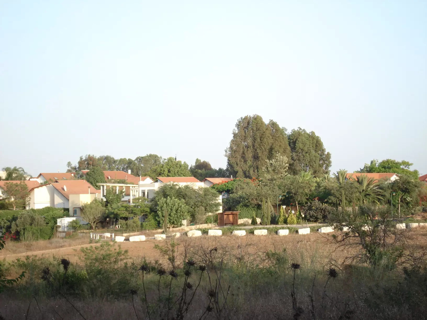
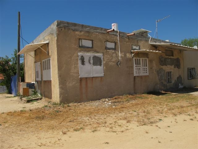
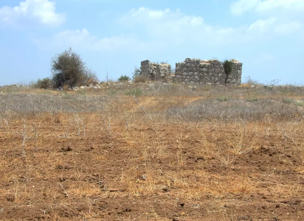
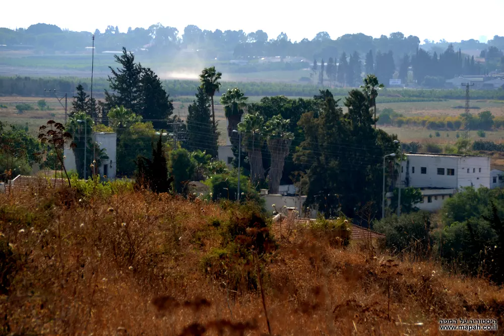
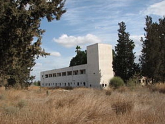
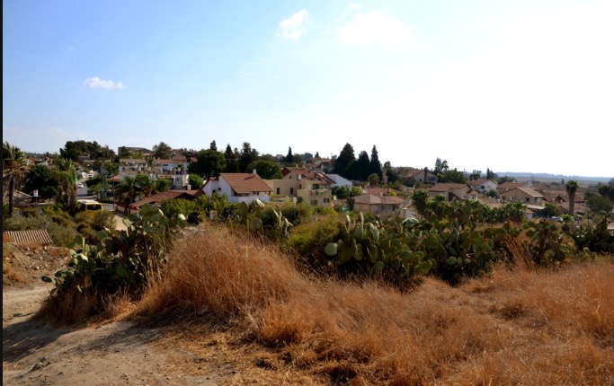
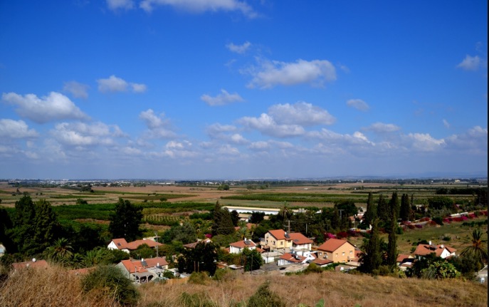
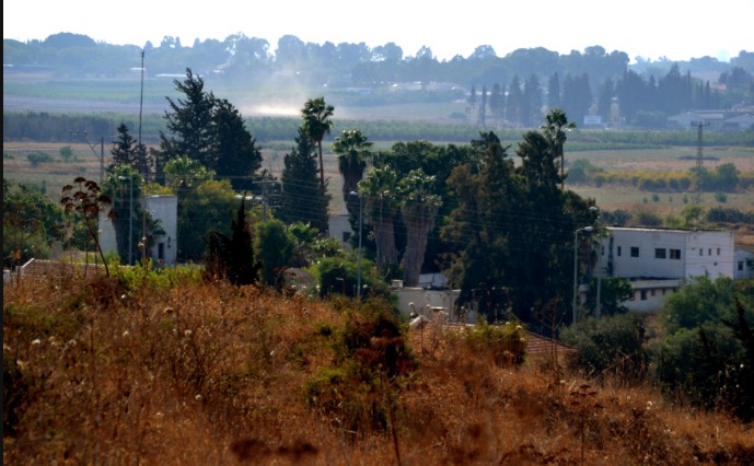
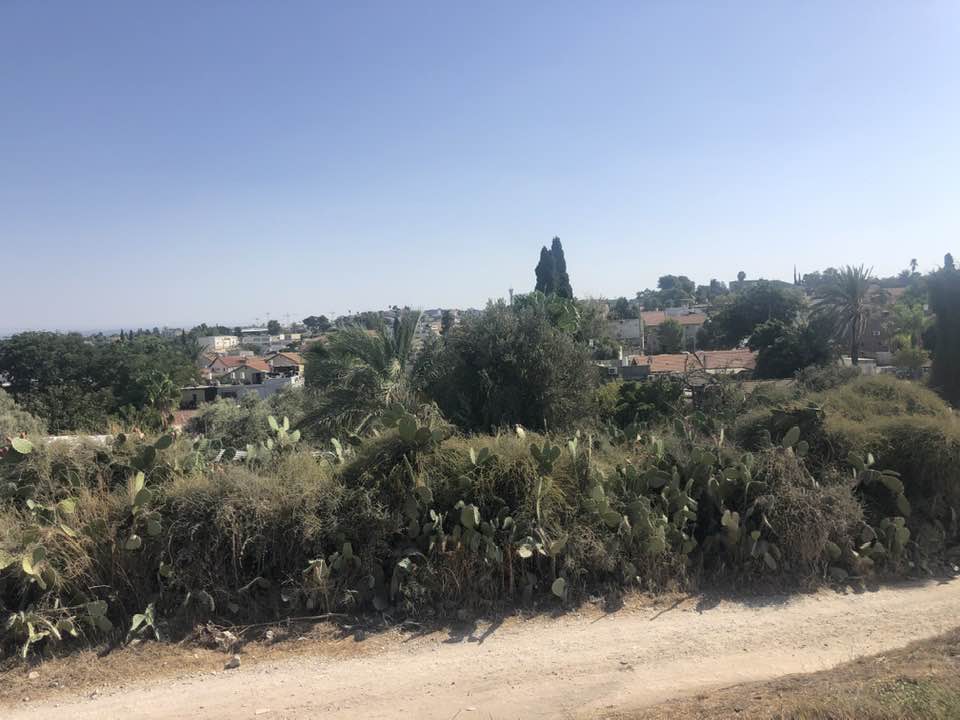
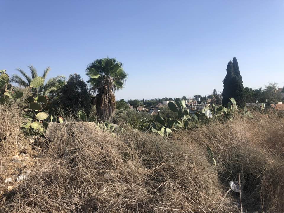
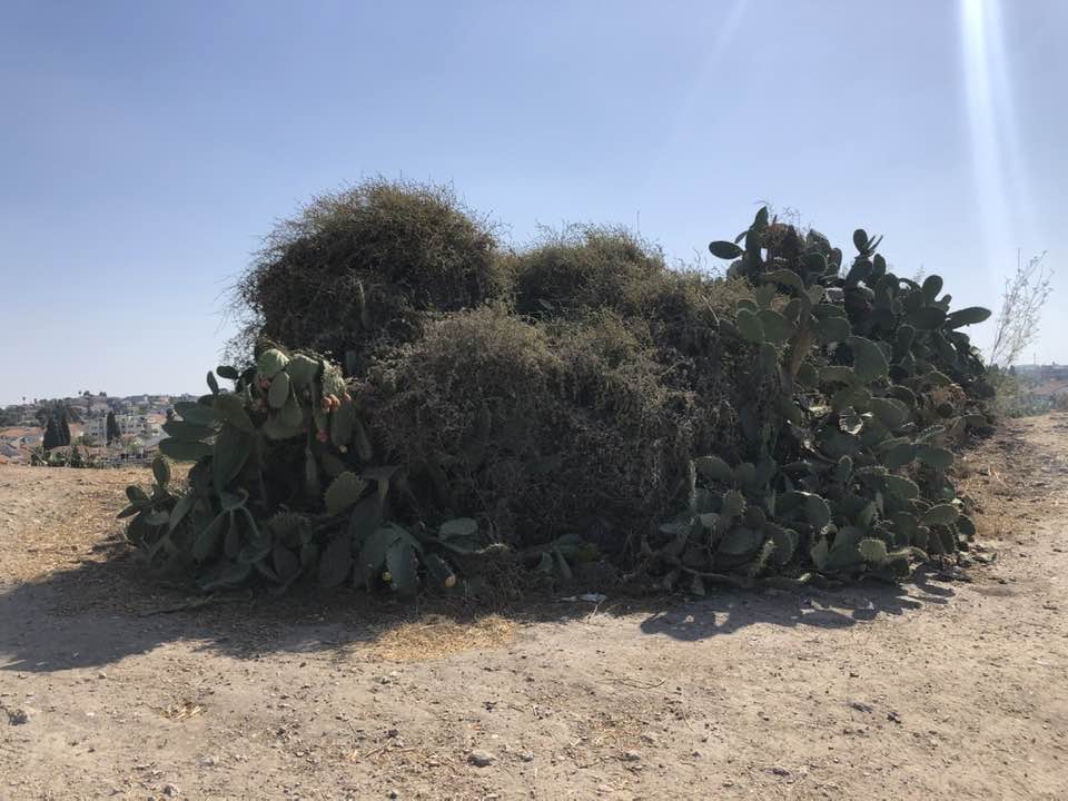
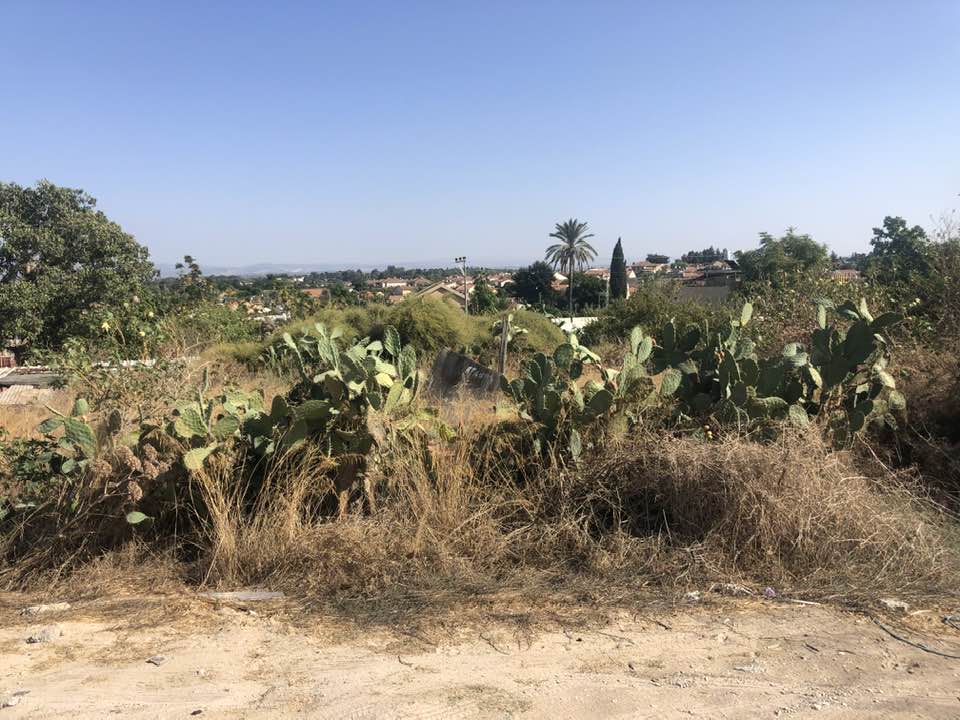
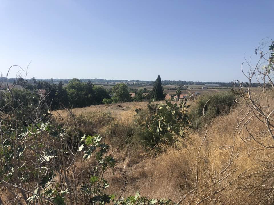
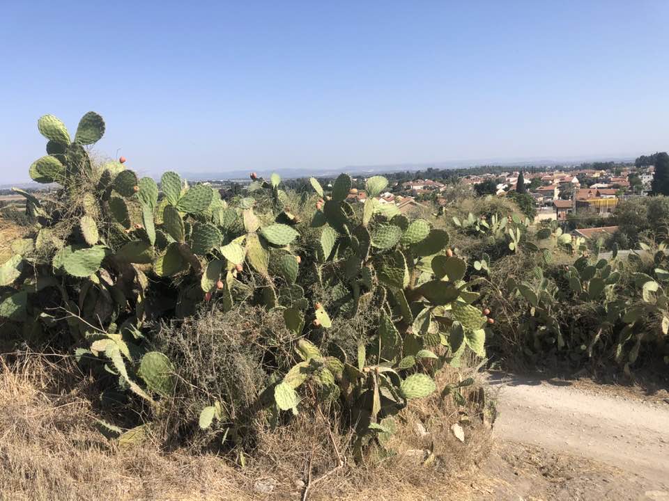
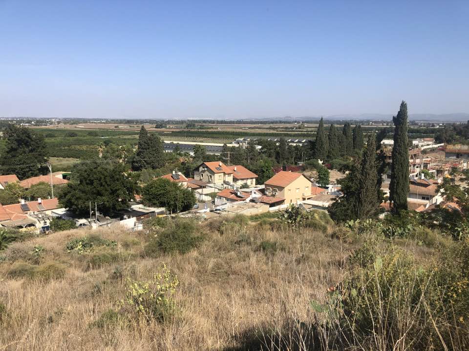
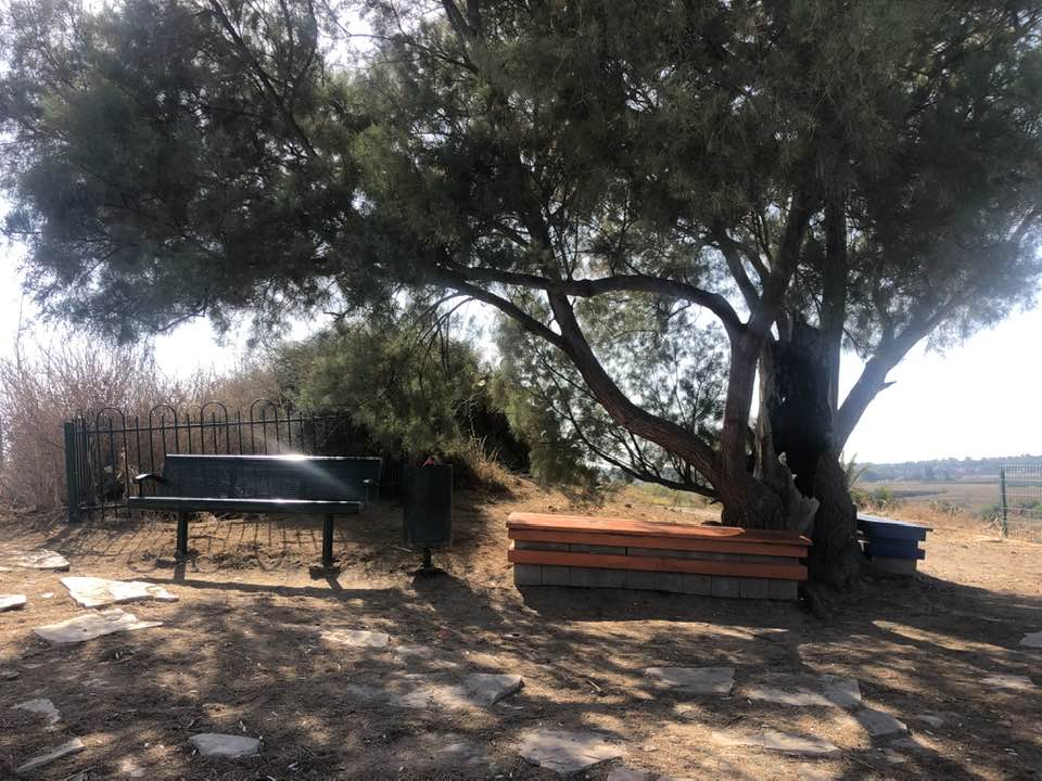
| Village Temains | Qatra was mostly destroyed with the exception of its school and few houses remain standing to this date. | |||||||||||||||||||||
| Ethnically Cleansing | Qatra inhabitants were completely ethnically cleansed. | |||||||||||||||||||||
| Pre-Nakba Land Ownership |
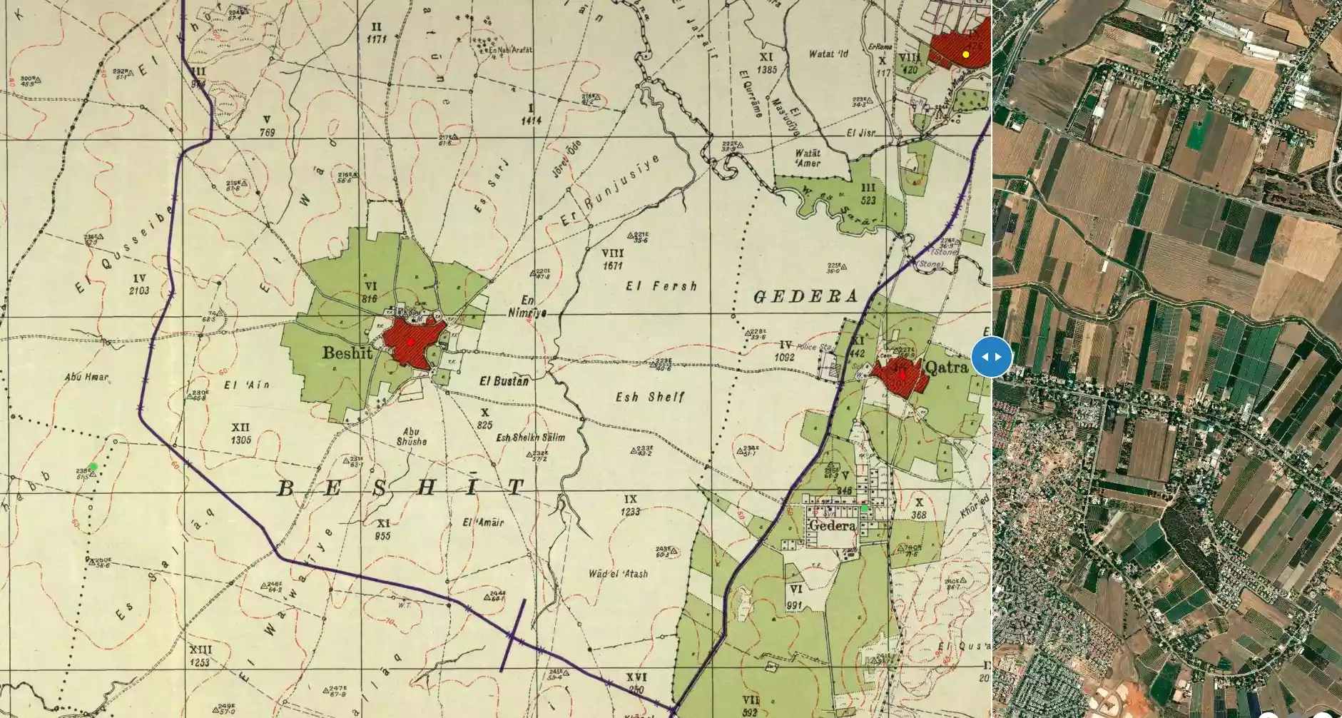
**Town Lands' Demarcation Maps |
|||||||||||||||||||||
| Land Usage As of 1945 |
|
|||||||||||||||||||||
| Population |
|
|||||||||||||||||||||
| Number of Houses |
|
|||||||||||||||||||||
| Near By Towns |
||||||||||||||||||||||
|
||||||||||||||||||||||
| Town's Name Through History | During the Roman period Qatra was known by Kidron, and during the British Mandate it was called Qatrat Islam, to distinguish it from the nearby Zionist collony of Qatrat Yahud. | |||||||||||||||||||||
| Schools | Qatra had an elementary school which was founded in 1923, and in 1945 it had an enrollment of 123 boys and 8 girls. | |||||||||||||||||||||
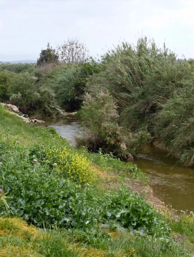
| Nearby Wadies & Rivers | The village is situated about 1 km south of Wadi al-Sarar. | |||||||||||||||||||||
| Archeological Sites | Modern Qatra was built over a Roman and Byzantine site, which produced evidence of mosaic floors, building foundations, and ceramic fragments. | |||||||||||||||||||||
| Exculsive Jewish Colonies That Usurped Village Lands |
Gedera and Qidron | |||||||||||||||||||||
| Featured Video | ||||||||||||||||||||||
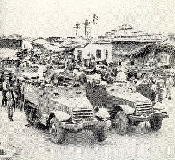
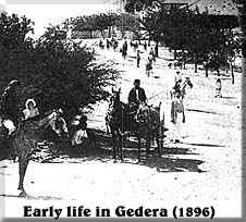
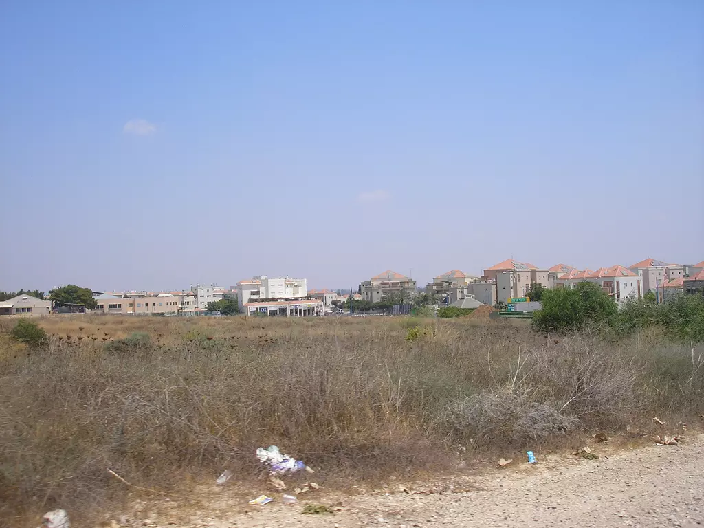
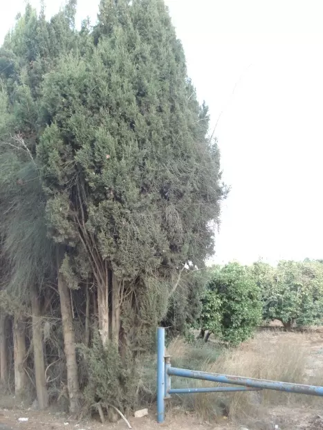
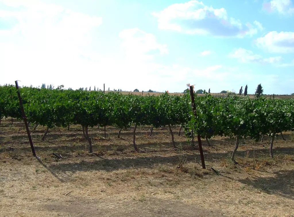
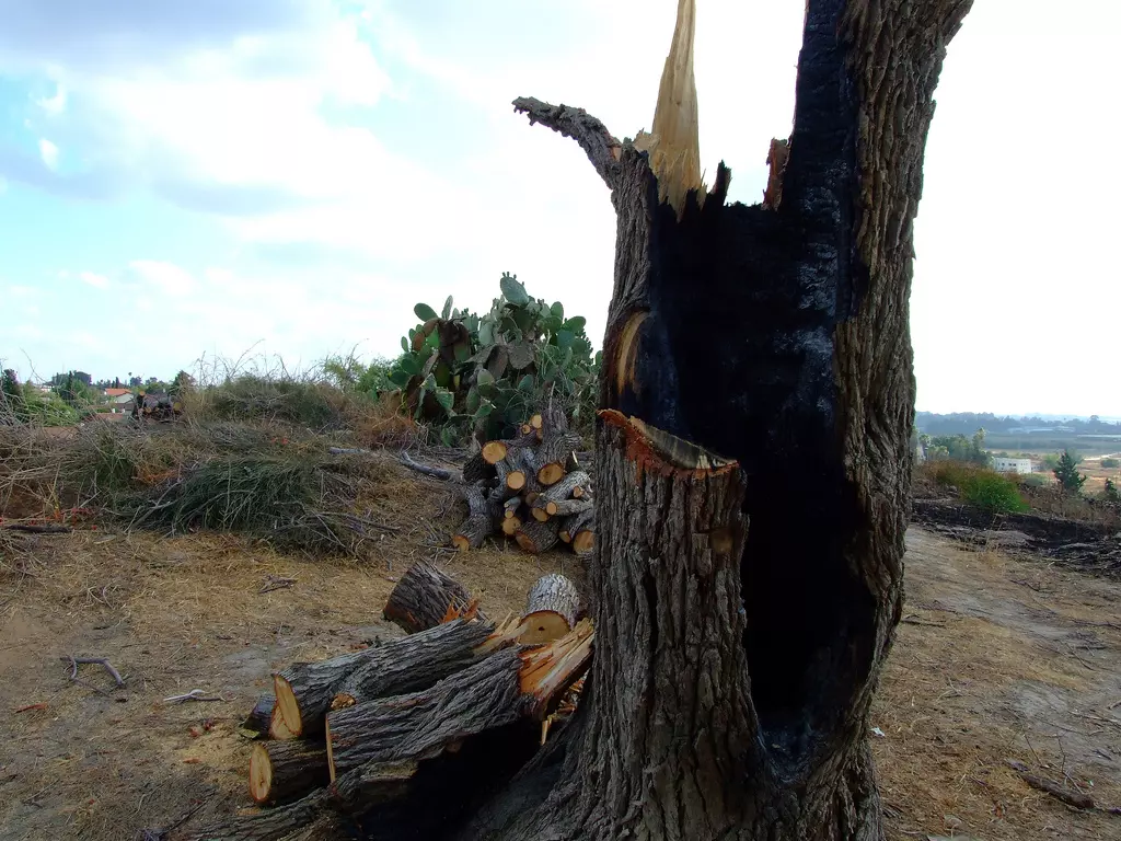
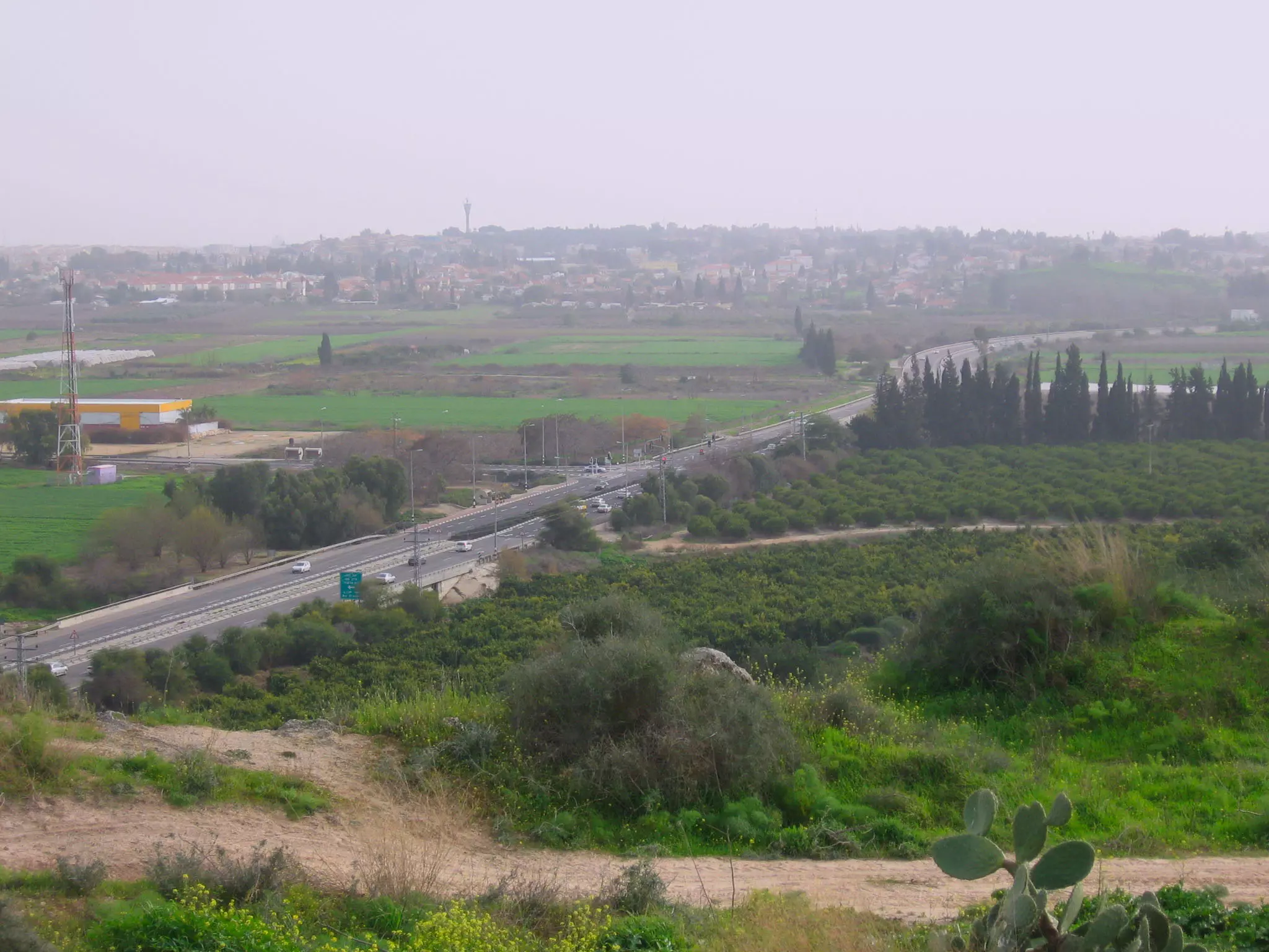
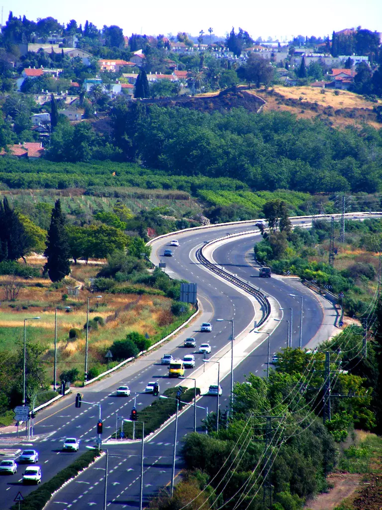
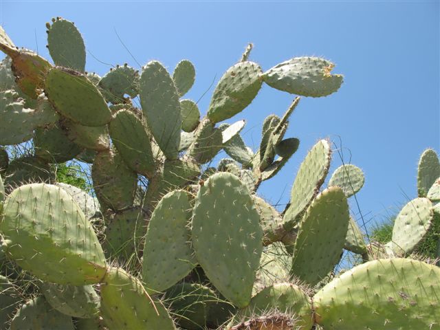
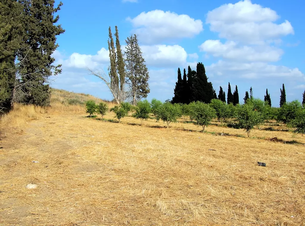
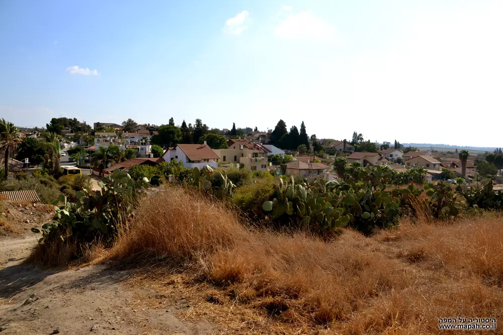
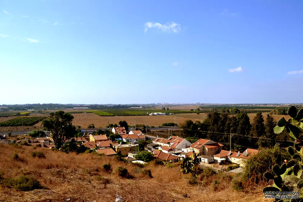
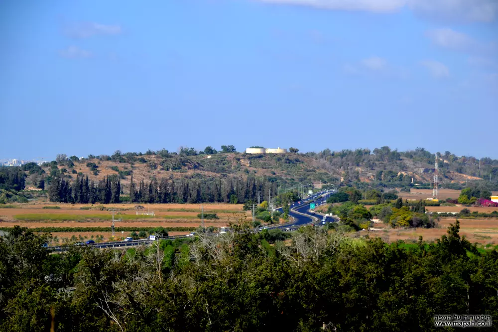
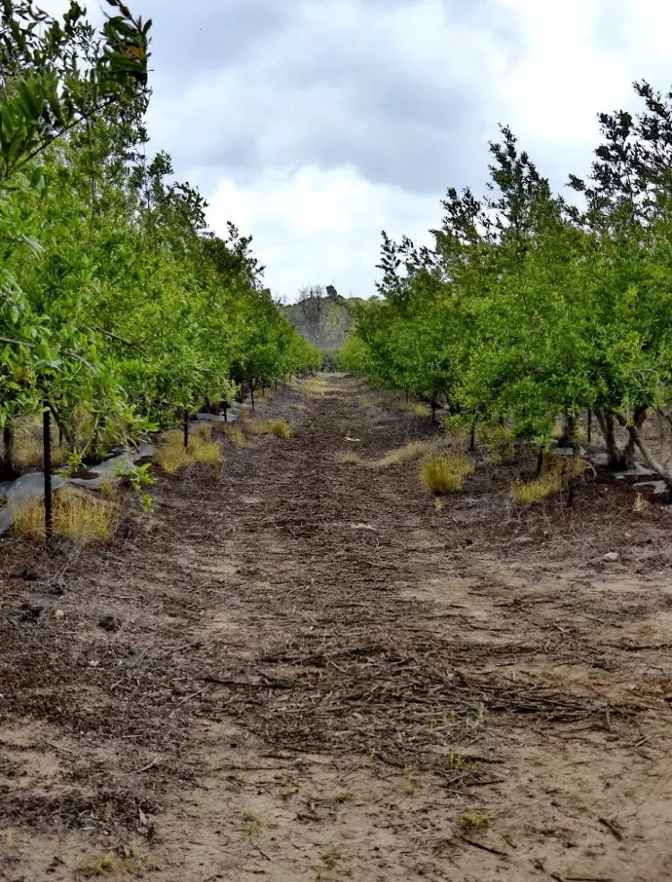
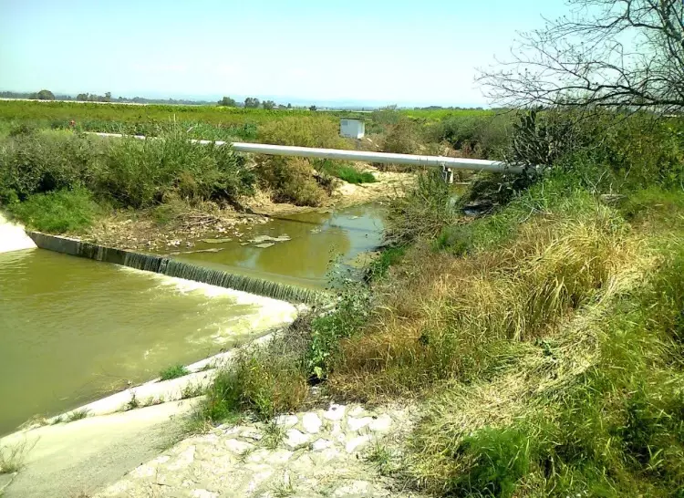
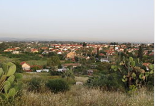
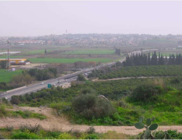
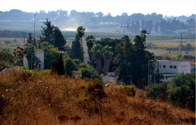
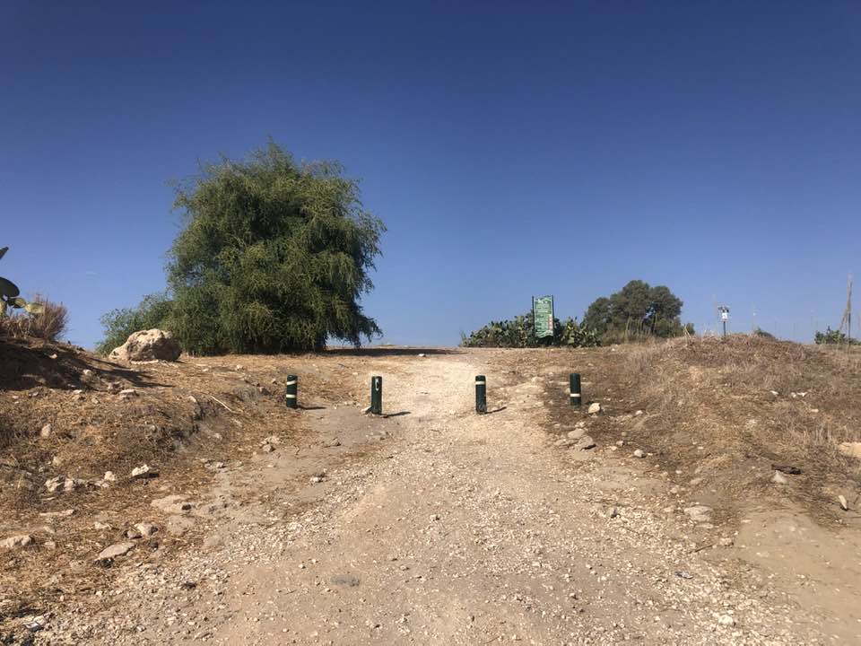
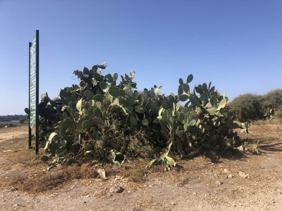
Village Before NakbaThe village was situated on a hilly spot underlain by limestone rock on the central coastal plain, about 1 km south of Wadi al-Sarar. It was linked by a spur to a highway leading to Ramla and other urban centers, and by secondary roads to a number of villages in the vicinity. It has been identified with the Hellenistic town of Kidron, also called Cedron or Gedrus (1 Maccabees 15:39). During the Roman period Kidron fell within the administrative jurisdiction of Azotus Hippenus (lsdud). In the fourth century A.D. it appears to have been a large town. Little is known about the site in the early Islamic period. In 1596, Qatra was a village in the nahiya of Gaza (liwa' of Gaza) with a population of 336. It paid taxes on a number of crops (including wheat, barley, sesame, and fruit), as well as on other types of produce, such as goats and beehives.Robinson visited Qatra in 1852 and said that it was of considerable size. In the late nineteenth century it was a village built of adobe bricks and surrounded by gardens. During the Mandate it was also referred to as Qatrat Islam, to distinguish it from Qatrat Yahud, the adjacent Jewish fort. The village had a rectangular layout and its houses were built either of adobe brick or cement. A mosque and several shops were located at the village center. The population was predominantly Muslim. A coeducational elementary school was founded in 1923, in which 123 boys and 8 girls were enrolled in the mid-I940s. During the Mandate, when new housing was constructed on what had been farmland, the built-up area expanded toward the southeast. Agriculture represented the chief economic activity of the villagers, due in part to ample ground water and rich soil. The residents grew an assortment of crops, including grain, vegetables, and fruit, which were rainfed and irrigated from artesian wells. Orchards and cultivated fields surrounded the village on all sides. In 1944/45 a total of 391 dunums was devoted to citrus and bananas and 4,320 dunums were allocated to cereals. Two hundred fifteen dunums were irrigated or used for orchards; 30 dunums of this land were covered by olive trees. Modern Qatra was built over the Roman and Byzantine site, which produced evidence of mosaic floors, building foundations, and ceramic fragments. Village Occupation and Ethnic CleaningThe earliest report of Haganah military activity at Qatra was on 13 March 1948, when the Palestinian newspaper Filastin reported a shooting incident involving Arab fruit-pickers working in an orchard that left five workers wounded. A month later, a New York Times story indicated that Haganah squads moved into the police fortress at Qatra on 17 April, after its evacuation by the British.Israeli historian Benny Morris states that units of the Giv'ati Brigade surrounded the village on 6 May and demanded that the villagers hand over all their weapons. After that, Morris reports the following sequence of events: several dozen armed men tried to break out of the village but were stopped by the Haganah. The villagers handed over several rifles to the Giv'ati Brigade troops, who nevertheless proceeded to move into the village. After that, the soldiers began looting the village and one of them was shot dead by a villager. The Haganah arrested several villagers, and according to Morris, 'within a few days, either intimidated the rest of the villagers into leaving or ordered them to leave.' The official Haganah account agrees that Qatra was occupied around this time but cites the Alexandroni Brigade (probably erroneously) as the occupying force. Zionists Colonies on Village LandsZionists established the settlement of Gedera (129136) just south of the village site in 1884; it is now a town, and many of its buildings are on village land. Qidron (131136) was built on village land in 1949.Village TodayOnly the school and a few deserted houses remain. A number of palm trees and cactuses grow on the site, and the surrounding lands are cultivated by Israelis.SourceDr. Walid al-Khalidi, 1992: All That Remains. |
||||||||||||||||||||||
| Related Maps | Town Lands' Demarcation Maps خرائط للقضاء توضح حدود القرى والاودية Town's map on MapQuest View from satellite Help us map this town at WikiMapia |
|||||||||||||||||||||
| Related Links | Wikipedia's Page Google Search Google For Images Google For Videos |
|||||||||||||||||||||
| More Information | مخطط البلد في كتاب كي لا ننسى في كتاب بلادنا فلسطين المزيد من موقع هوية |
|||||||||||||||||||||
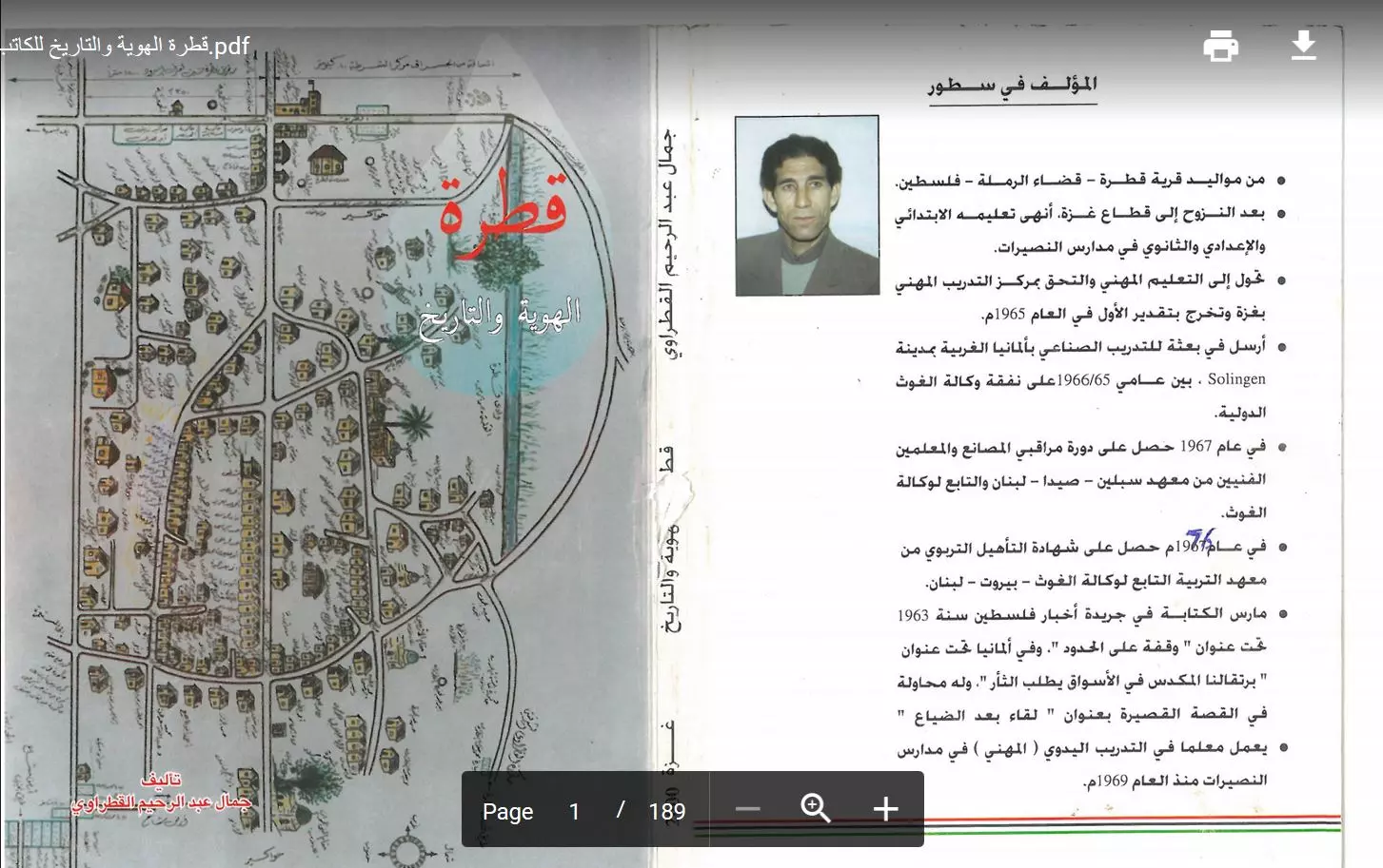
- قطرة الهوية والتاريخ للكاتب جمال عبد الرحيم القطراوي
- كتاب قرية قطرة المهجرة -- إعداد شهيناز أبو شبيكة
- عدنا يا قطرة .. ولكن
- عائلات قطرة قبل النكبة 1948
- تابع/عائلات قطرة
- تابع/ عائلات قطرة
- تابع عائلات قطرة
- تابع عائلات قطرة - تكملة
- عائلة ابوشرف
- زعيم ثوار قطرة الشهيد المجاهد عبد الحفيظ القطراوي
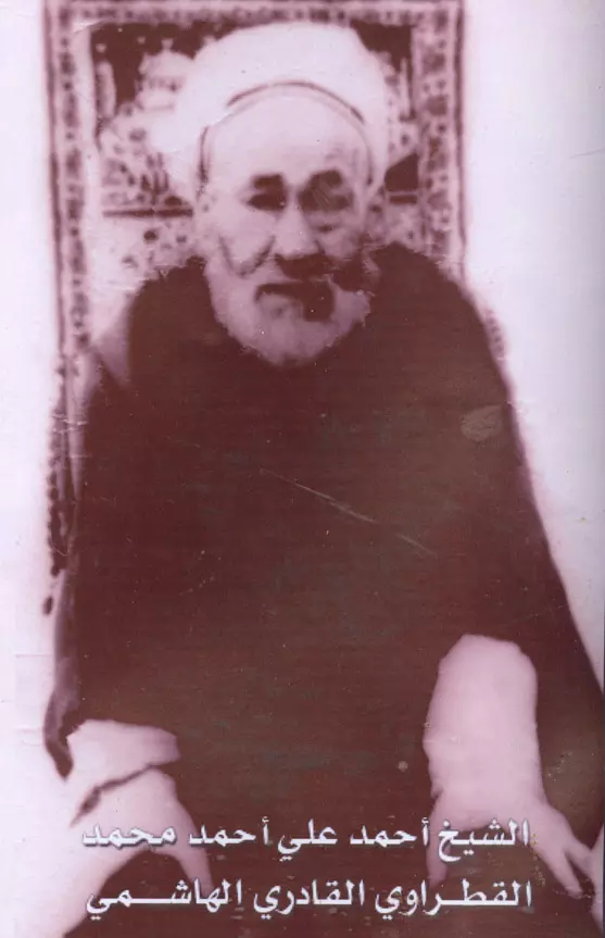
- الشيخ احمد القطراوني
- من عائلات قطرة
- نبذة تاريخية عن قرية قطرة (قضاء الرملة) من كتاب (
كي لا ننسى )
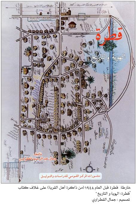
- خارطة قطرة قبل النكبة-- تأليف عبد الرحيم القطراوي -- أنقر الصورة لتكبيرها وإنقر هنا إن اردت قرآءة كتاب المؤلف
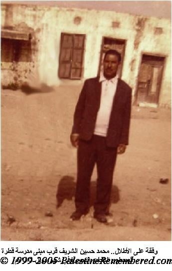
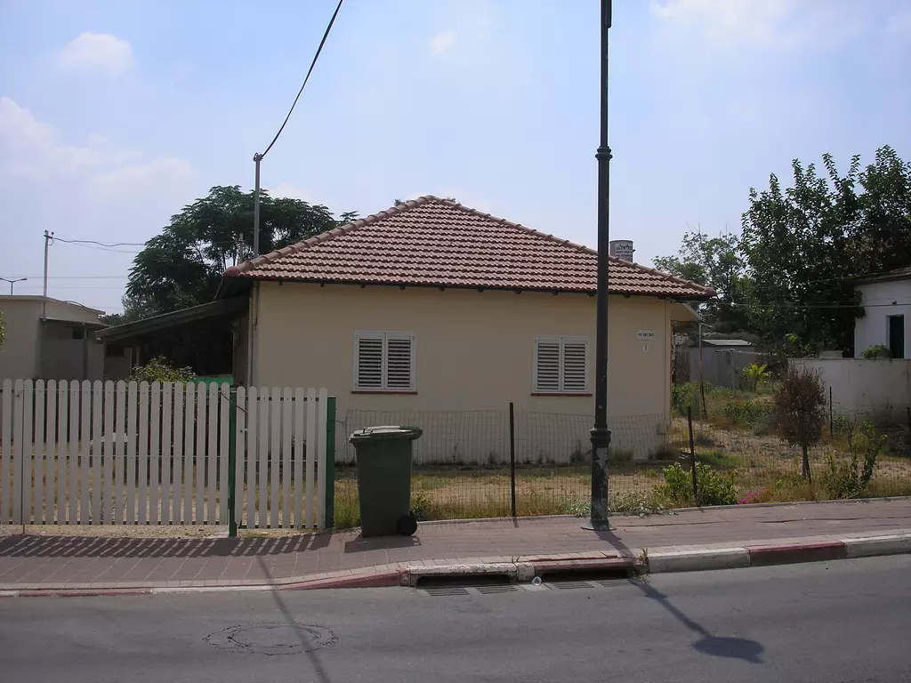
Posted by jamal 2 - picture to side of qatra village
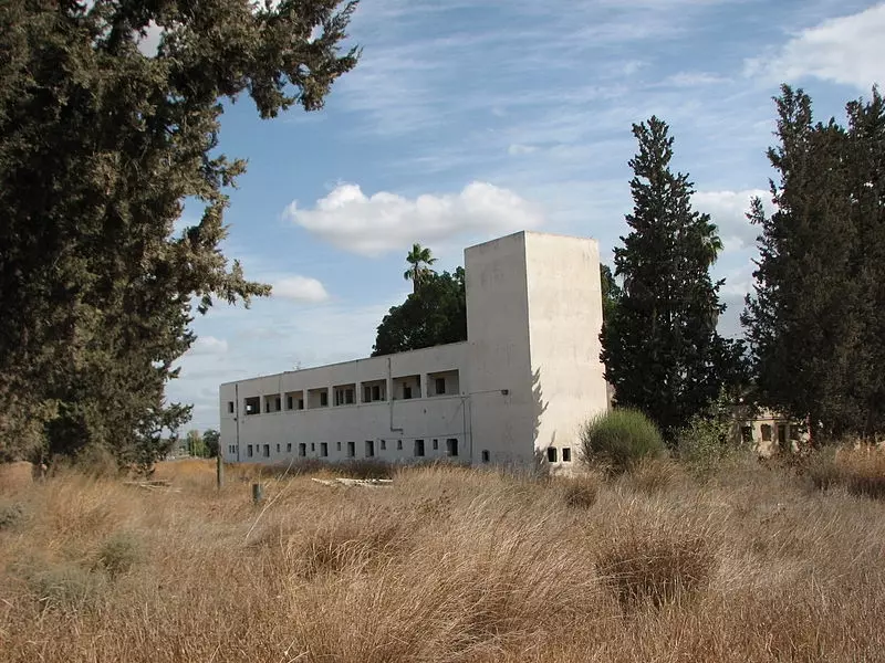
Posted by jamal 6 - The destroyed Qatra school in 1976
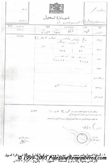
Posted by jamal 2 - Palestinian land deed from Qatra date Sept. 30th, 1937
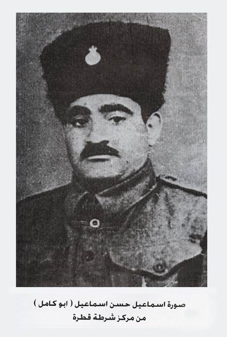
Posted by jamal 3 - اسماعيل حسن اسماعيل - مركز شرطة قطرة
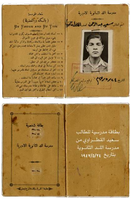
Posted by jamal 14 - بطاقة سعيد القطراوي - مدرسة اللد الثانوية
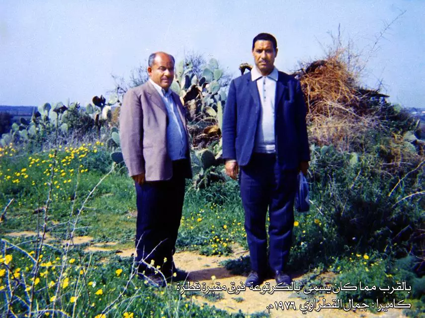
Posted by jamal 11 - بالقرب مما كان يسمى بالكرتوعة فوق مقبرة القرية-1976
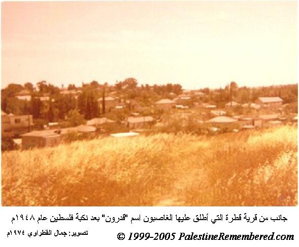
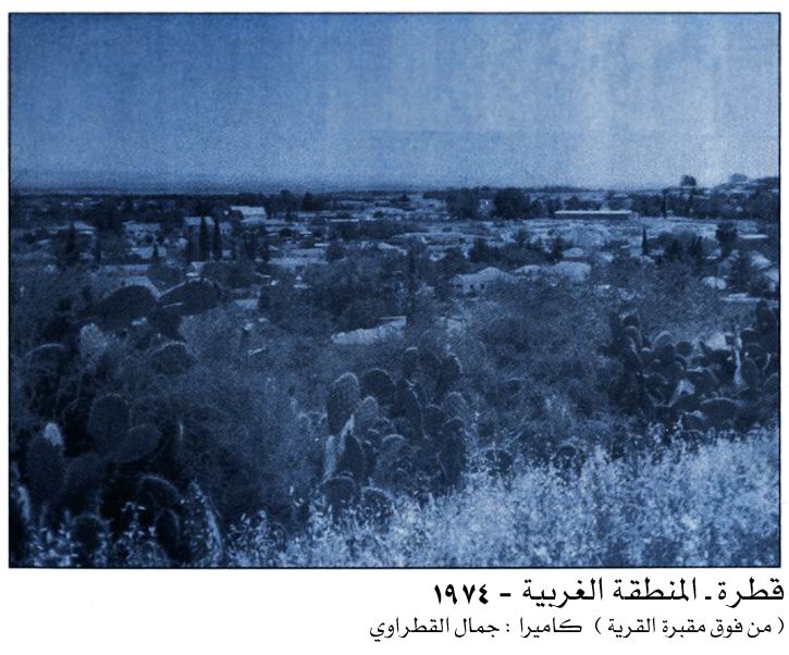
Posted by jamal 2 - المنطقة الغربية من قرية قطرة من فوق منطقة المقبرة-1974
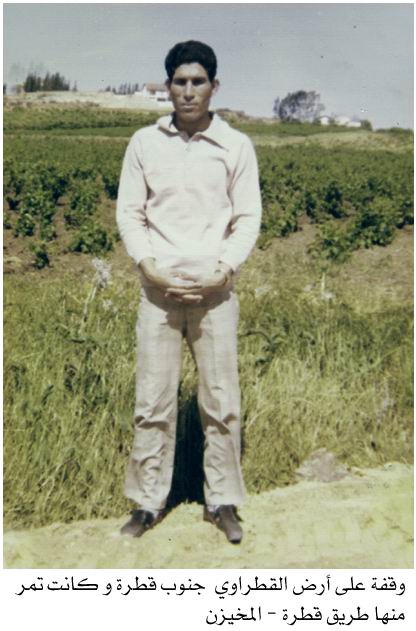
Posted by jamal - طريق قطرة - المخيزن جنوب شرق قطرة
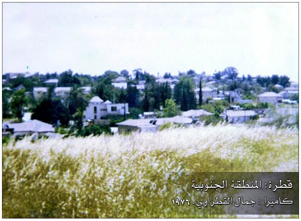
Posted by jamal 3 - قطرة - المنطقة الجنوبية-1976
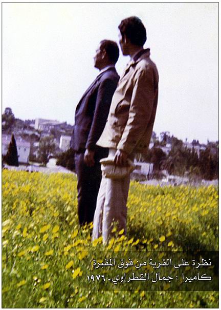
Posted by jamal 2 - نظرة من فوق المقبرة-1976
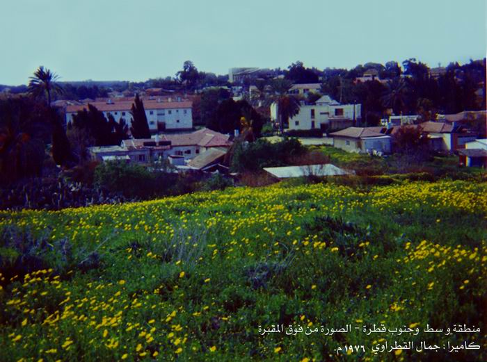
Posted by jamal 1 - وسط وجنوب قطرة - فوق المقبرة-1976
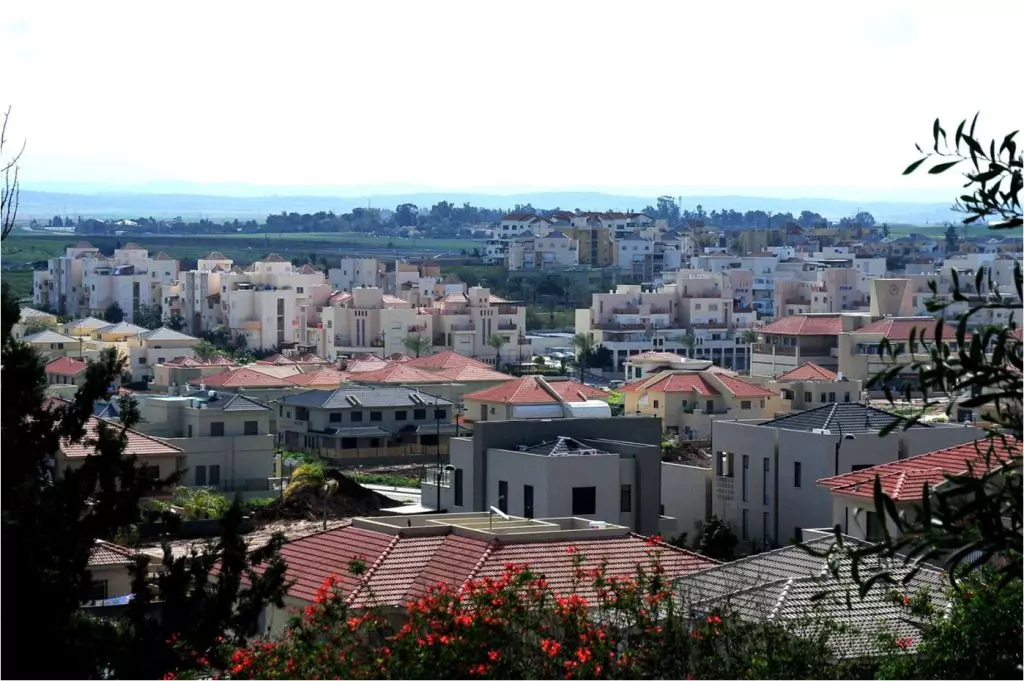
Posted by jamal 1 - جانب من مغتصبة جديرة التى اقيمت على اراضىقرية قطرة
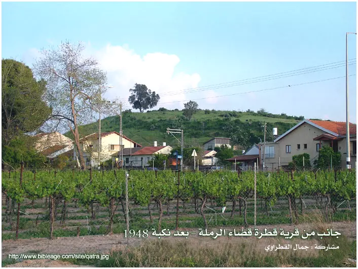
Posted by jamal 2 - جانب من قرية قطرة بعد نكبة العام 1948م.
Posted by jamal 3 - قرية قطرة عشية الاحتلال الصهيوني وطرد سكانها عام 1948م - صورة من متحف المستعمرة المجاورة
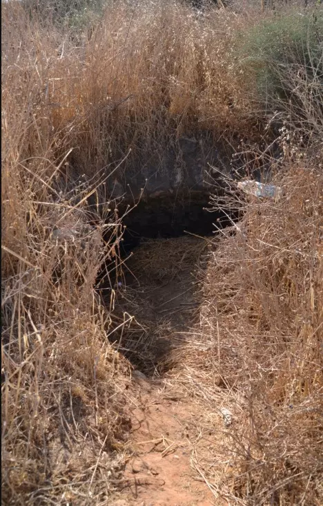
Posted by jamal 2 - بئر مهدوم فوق مقبرة قطرة
Posted by jamal - نواة الاستيطان على أرض قطرة عام 1896م (مستعمرة غديرة)
Posted by jamal - نبات الصبار في أرض الشقيف - قرية قطرة
Posted by jamal 1 - أول بيت بني على أرض قطرة في مستعمرة جديرة - صورة من متحف المستعمرة المجاورة
Posted by jamal 7 - منظر لجانب من مستعمرة غديرة المقامة على أراضي قرية قطرة المغتصبة
Posted by jamal 3 - جانب من مستعمرة غديرة المقامة على اراضي قرية قطرة
Posted by jamal - جنوب قرية قطرة
Posted by jamal - أحد منازل مستعمرة غديرة المقامة على أراضي قرية قطرة
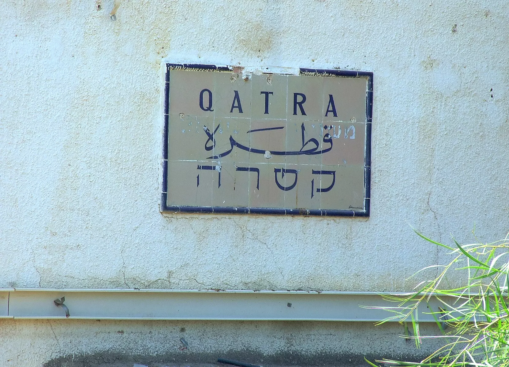
Posted by jamal 2 - Qatra police fort. British mandate period, Note the original sign still there. Clkearly it says the name of the village in three languages
Posted by Uri Zackhem - A trilingual sign over the Qatra police fort. British mandate period.
Posted by Uri Zackhem 2 - قطرة بعد النكبة 2009
Posted by jamal - قطرة بعد النكبة 2009
Posted by jamal - احدى بيارات قرية قطرة المغتصبة
Posted by jamal 1 - احدى بيارات قطرة المغتصبة
Posted by jamal - شجرة سدر قديمة فوق المقبرة طلما استظل تحتها ابناء القرية وقد حطمتها ايدى الغزاة
Posted by jamal 2 - الشيخ حسن اسماعيل علي القادري مختار بلدة قطره (طيب الله ثراه)
Posted by أبو الأمير القادري 14 - جتوب قرية قطرة
Posted by jamal - شارع فى مستعمرة غديرة على اراضى قرية قطرة
Posted by jamal - منظر منمستعمرة غديرة على اراضى قرية قطرة
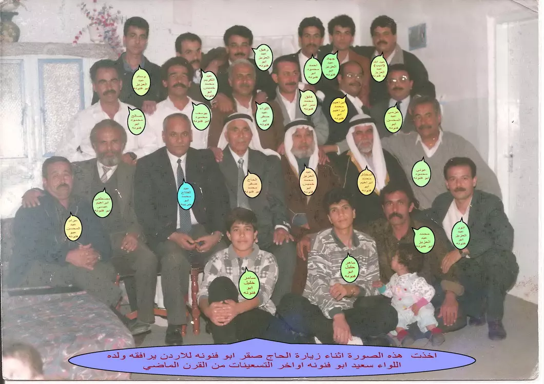
Posted by jamal 1 - الحاج صقر ابو فنونه-ابو عبد السلام - اثناء زيارته للاردن اواخر تسعينات القرن الماضي
Posted by ابوفنونه - Qatra 2012
Posted by said - Qatra 2012
Posted by said - Qatra 2012
Posted by said - Qatra 2012
Posted by said - Qatra 2012
Posted by said - Qatra 2012
Posted by said - صورة من مستعمرة غديرة المقامة على اراضى قرية قطرة
Posted by jamal - مقام الشيخ عمران فى شرق قطرة هدمه المحتلون بعد النكبة
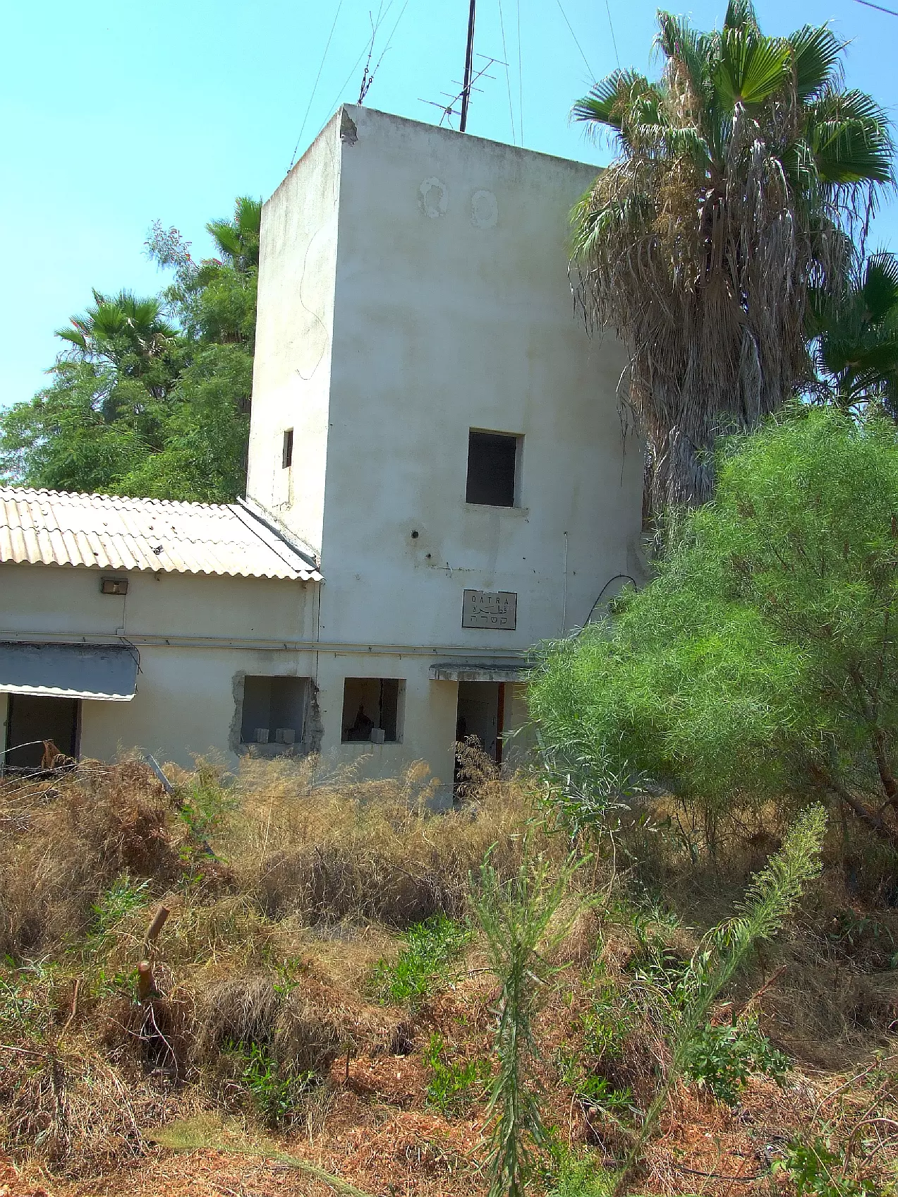
Posted by jamal 1 - مركزشرطة قطرة
Posted by jamal 1 - منطقة تل الفول شمال غرب قطرة
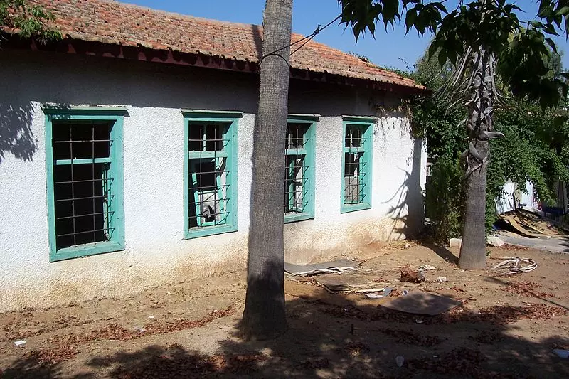
Posted by jamal - مدرسة قطرة
Posted by jamal 1 - مدرسة قطرة
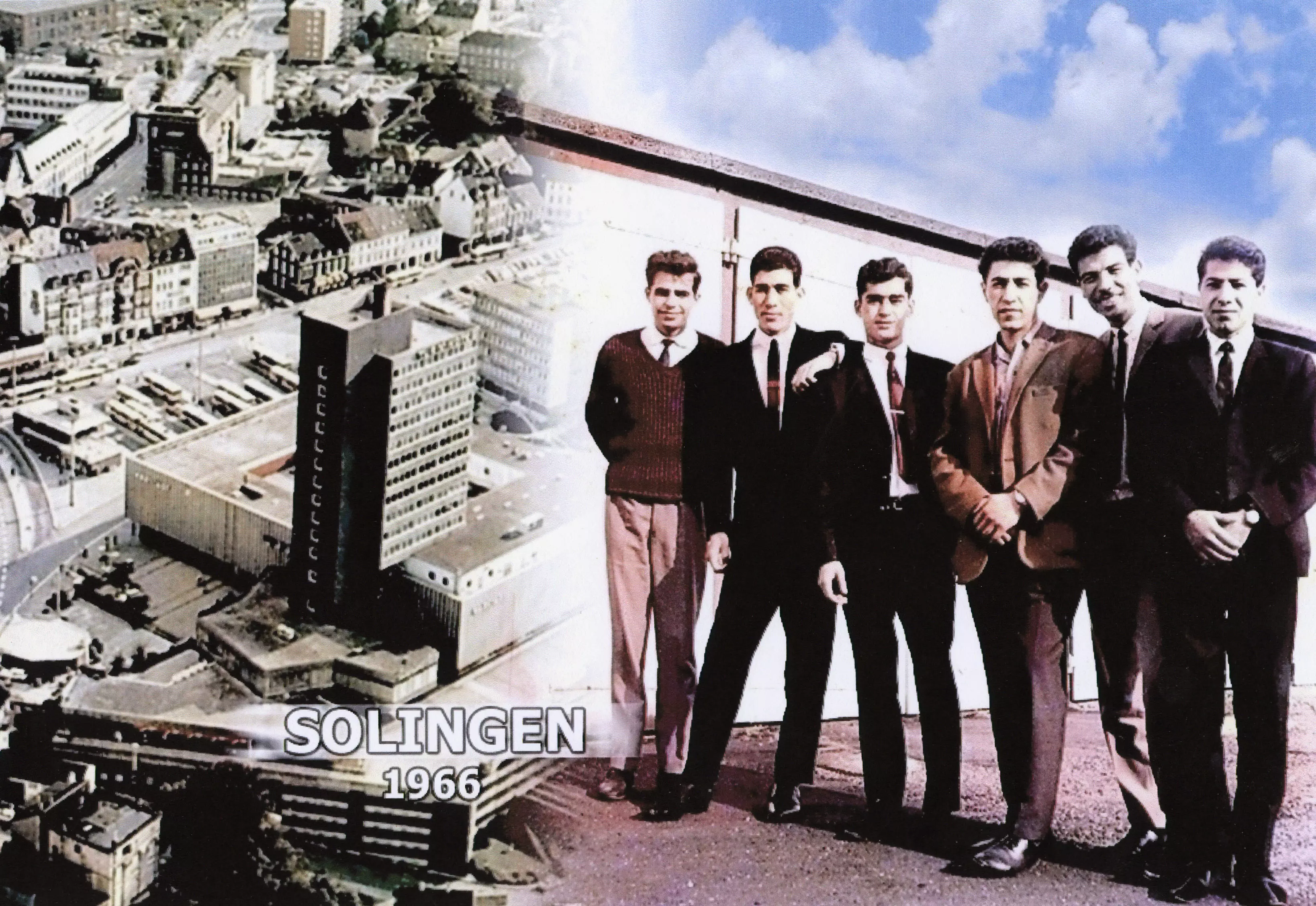
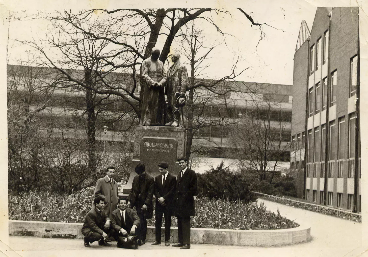
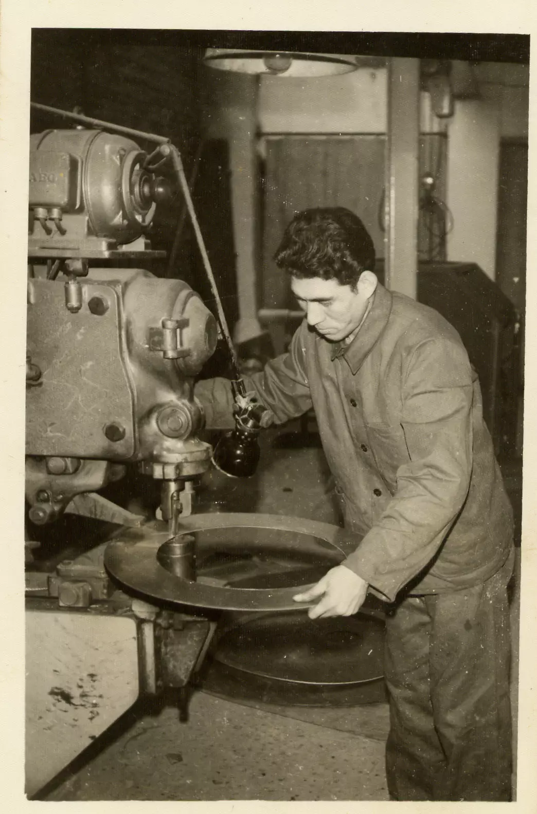
Posted by jamal - مجموعة من بعثة التدريب الصناعى الى المانيا الغربية 1965م/1966م
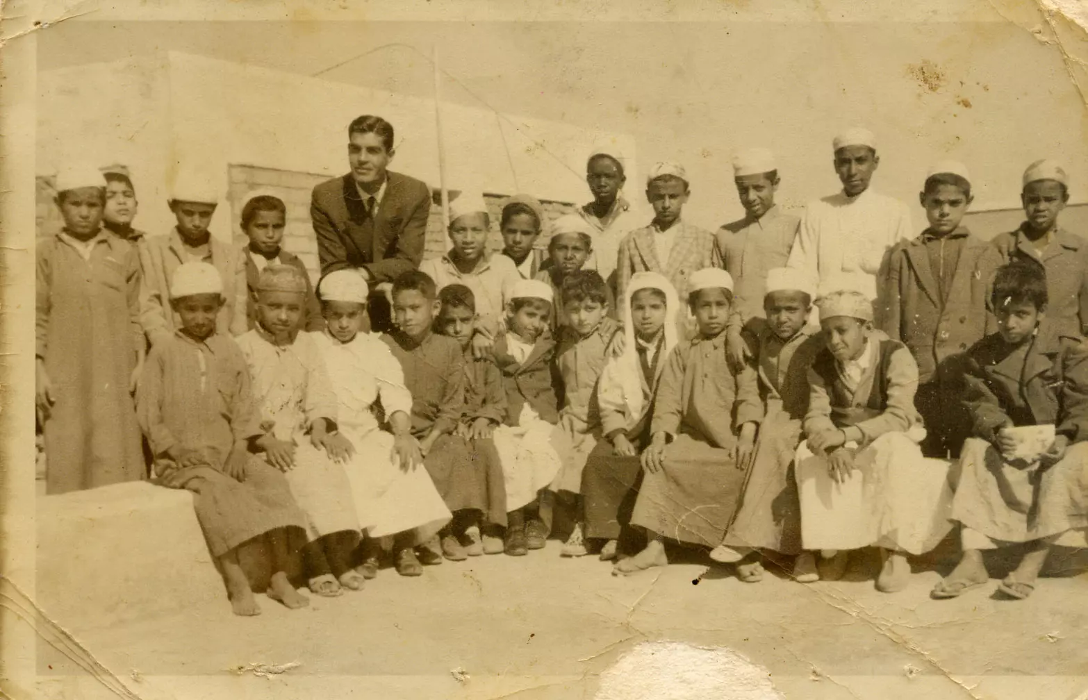
Posted by jamal - الاستاذ/ سعيد القطراوى مع تلاميذه بمدينة الطائف - السعودية عام 1963م
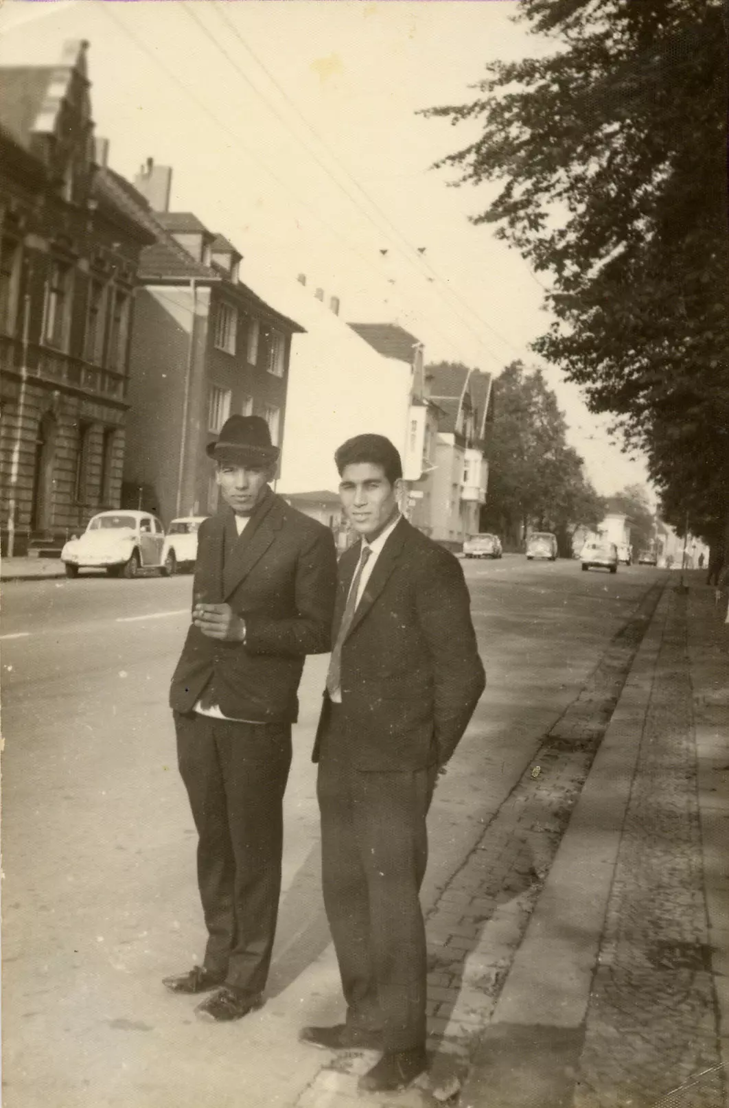
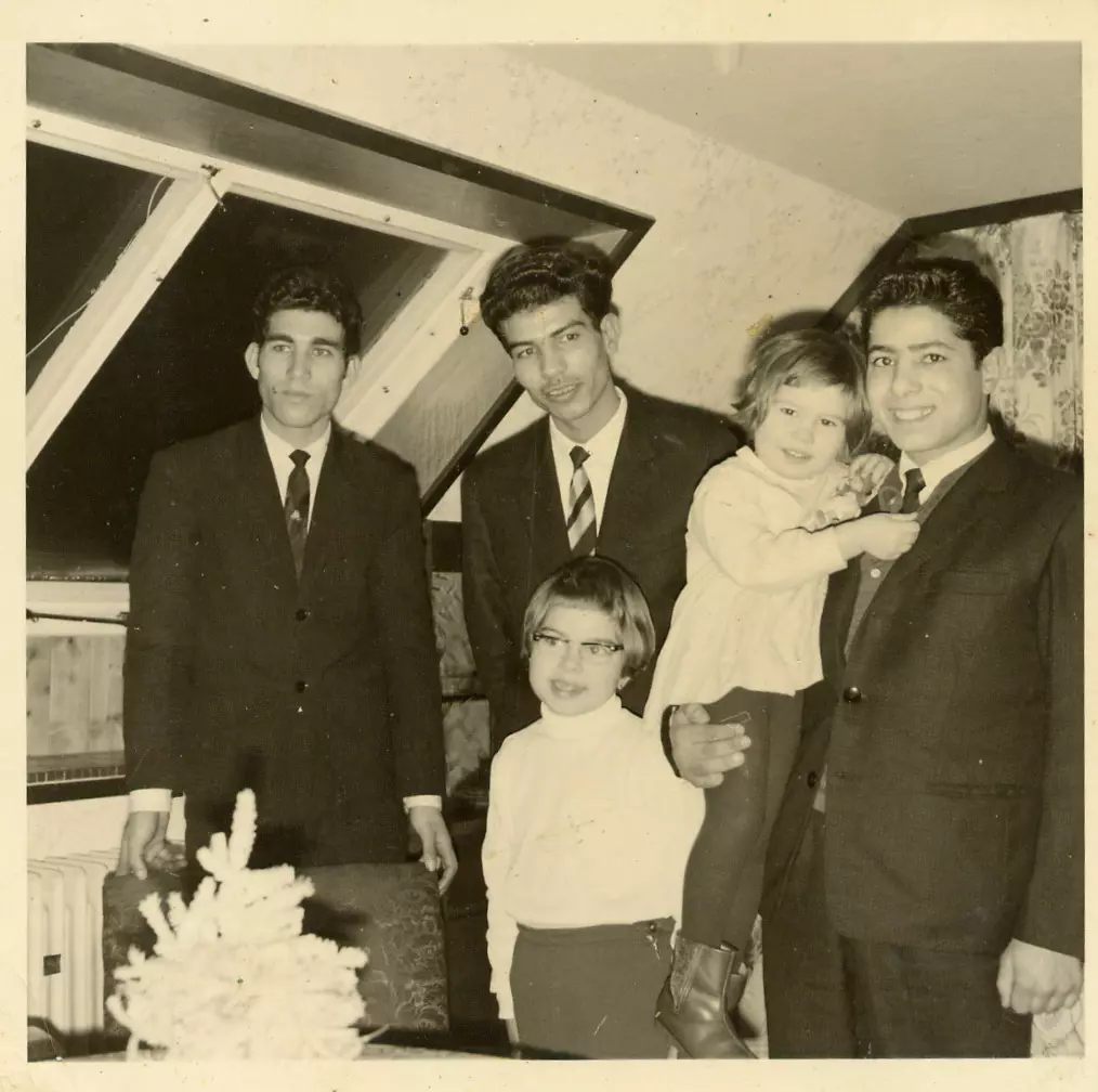
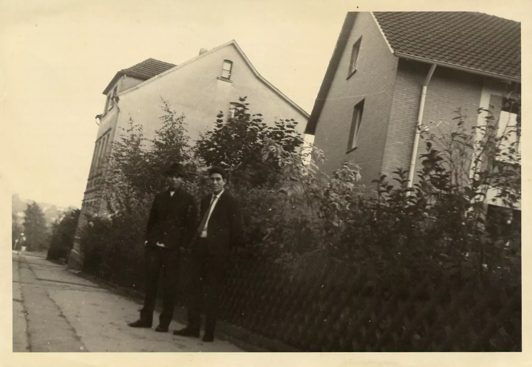
Posted by jamal 1 - جمال القطراوى وحسن مشة بمدينةsolingen بالمانيا الغربية عام 1965 م
Posted by jamal - فاروق امين من يافا وحسن مشة من قرية سلمة وجمال القطراوى من قطرة فى المانيا 1965م
Posted by jamal - عبد الهادى الحديدىوجمال القطراوىوحسن مشة ورفيق ابو حمرة ومحمود حماد وجمال قفة بالمانيا 1966م
Posted by jamal - جمال القطراوى وحسن مشة بمدينةsolingen بالمانيا الغربية عام 1965م
Posted by jamal - جمال القطراوى فى احد مصانع مدينةsolingen بالمانيا وزملاء العمل 1965م
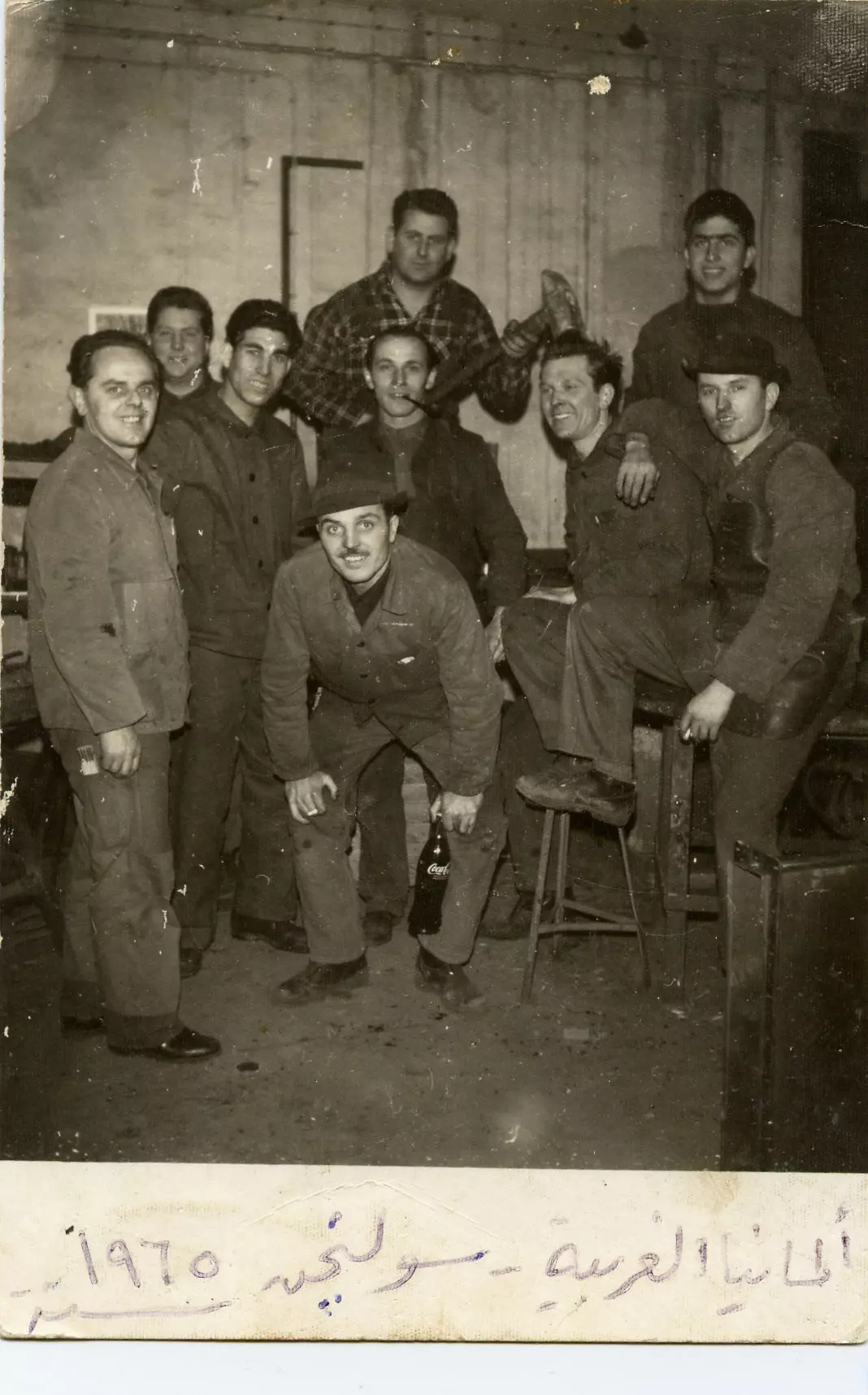
Posted by jamal - جمال القطراوى فى مصنع fielenbach بمدينة solingen عام1965م
Posted by jamal - قرية قطرة قضا ء الرملة 2012
Posted by jamal - قرية قطرة قضا ء الرملة 2012
Posted by jamal 1 - قرية قطرة قضا ء الرملة 2012
Posted by jamal - قرية قطرة2012 مركز الشرطة فى الجهة الغربية من القرية
Posted by jamal - موقع قرية قطرة على خارطة قديمة عام 1880م
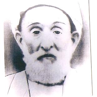
Posted by jamal - الشيخ أحمد علي القطراوي عميد عائلة القطراوي من 1878 - 1978م
Posted by jamal - الشيخ عبد الرحيم بن احمدعلى القطراوى من1919م-2011
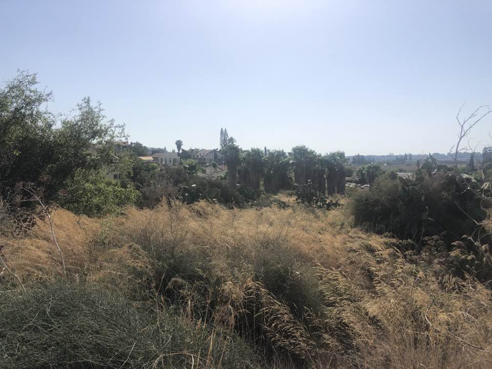
Posted by jamal 1 - وادي الصرار شمال القريه
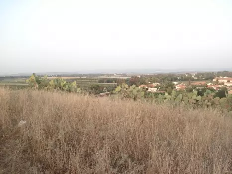
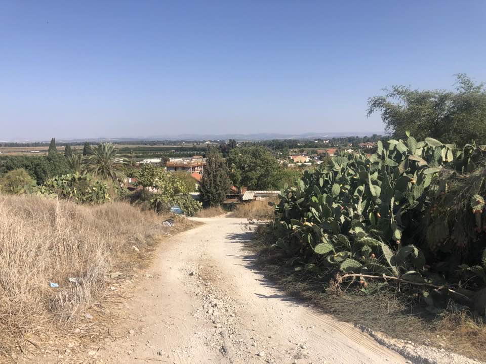
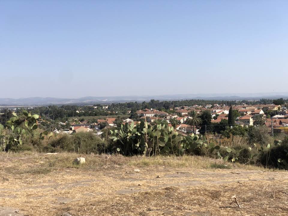
Posted by abu raya - اراضي القريه
Posted by abu raya - وادي الصرار من شمال القريه
Posted by abu raya - منظر من موقع القريه باتجاه المستعمره المقامه على اراضيها
Posted by abu raya - اراضي قطره
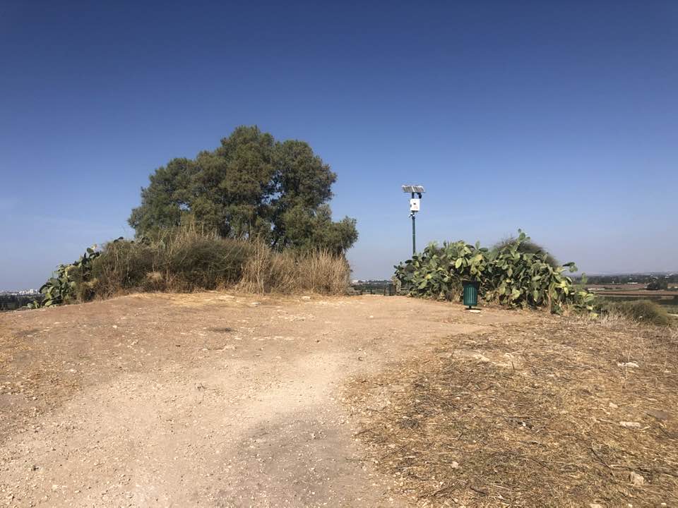
Posted by abu raya - من موقع القريه
Posted by abu raya - مركز شرطه قطره
Posted by abu raya - اثار بيوت القريه
Posted by abu raya - موقع القريه والمستعمره على اراضيها
Posted by abu raya - موقع القريه
Posted by abu raya - قطره
Posted by abu raya - قطرة الهوية والتاريخ للكاتب جمال عبد الرحيم القطراوي - رابطة الكتاب في أول تعليق
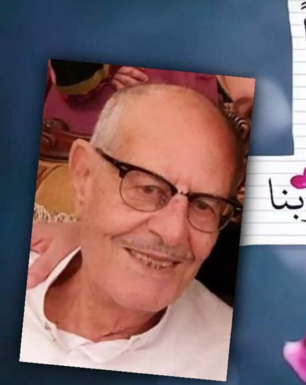
1 - الوالد المغفور له بإذن الله/ خميس علي حسن إسماعيل حسن
Posted by Ali Ismail - Pre-Nakba Aerial view of the village / صورة من الجو للقرية اخذت قبل النكبة
- That is how the "civilized" erased and replaced us: Qatra was completely obliterated, as you see -- قطرة باتت أثر بعد عين. من هنا مر الهمجّ
- That is how the "civilized" erased and replaced us: Qatra was completely obliterated, as you see -- قطرة باتت أثر بعد عين. من هنا مر الهمجّ
#2
- That is how the "civilized" erased and replaced us: Qatra was completely obliterated, as you see -- قطرة باتت أثر بعد عين. من هنا مر الهمجّ
#3
- That is how the "civilized" erased and replaced us: Qatra was completely obliterated, as you see -- قطرة باتت أثر بعد عين. من هنا مر الهمجّ
#4
- That is how the "civilized" erased and replaced us: Qatra was completely obliterated, as you see -- قطرة باتت أثر بعد عين. من هنا مر الهمجّ
#5
- That is how the "civilized" erased and replaced us: Qatra was completely obliterated, as you see -- قطرة باتت أثر بعد عين. من هنا مر الهمجّ
#6
- That is how the "civilized" erased and replaced us: Qatra was completely obliterated, as you see -- قطرة باتت أثر بعد عين. من هنا مر الهمجّ
#7
- That is how the "civilized" erased and replaced us: Qatra was completely obliterated, as you see -- قطرة باتت أثر بعد عين. من هنا مر الهمجّ
#8
- That is how the "civilized" erased and replaced us: Qatra was completely obliterated, as you see -- قطرة باتت أثر بعد عين. من هنا مر الهمجّ
#9
- That is how the "civilized" erased and replaced us: Qatra was completely obliterated, as you see -- قطرة باتت أثر بعد عين. من هنا مر الهمجّ
#10
- That is how the "civilized" erased and replaced us: Qatra was completely obliterated, as you see -- قطرة باتت أثر بعد عين. من هنا مر الهمجّ
#11
- That is how the "civilized" erased and replaced us: Qatra was completely obliterated, as you see -- قطرة باتت أثر بعد عين. من هنا مر الهمجّ
#12
- That is how the "civilized" erased and replaced us: Qatra was completely obliterated, as you see -- قطرة باتت أثر بعد عين. من هنا مر الهمجّ
#13
- That is how the "civilized" erased and replaced us: Qatra was completely obliterated, as you see -- قطرة باتت أثر بعد عين. من هنا مر الهمجّ
#14
- That is how the "civilized" erased and replaced us: Qatra was completely obliterated, as you see -- قطرة باتت أثر بعد عين. من هنا مر الهمجّ
#15
- That is how the "civilized" erased and replaced us: Qatra was completely obliterated, as you see -- قطرة باتت أثر بعد عين. من هنا مر الهمجّ
#16
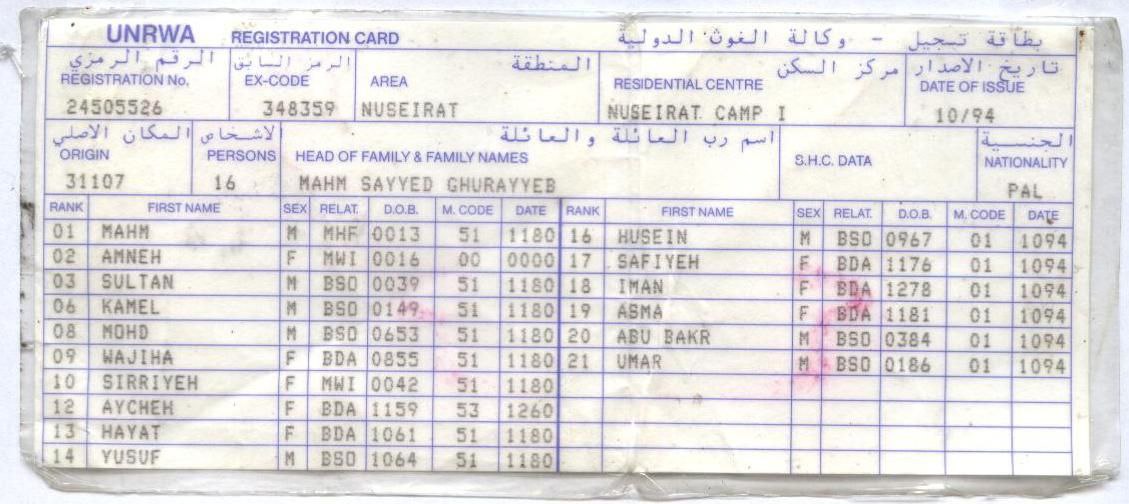
- بطاقة تسجيل العائلة لدى وكالة الغوث الدولية و هى بطاقة تهدف لتسجيل العائلات النازحة من قراها و مدنها الأصلية لضمان حق العودة و التى كانت تجدد كل عام منذ 1948 و نزوح العائلة من قرية قطرة_ قضاء الرملة .
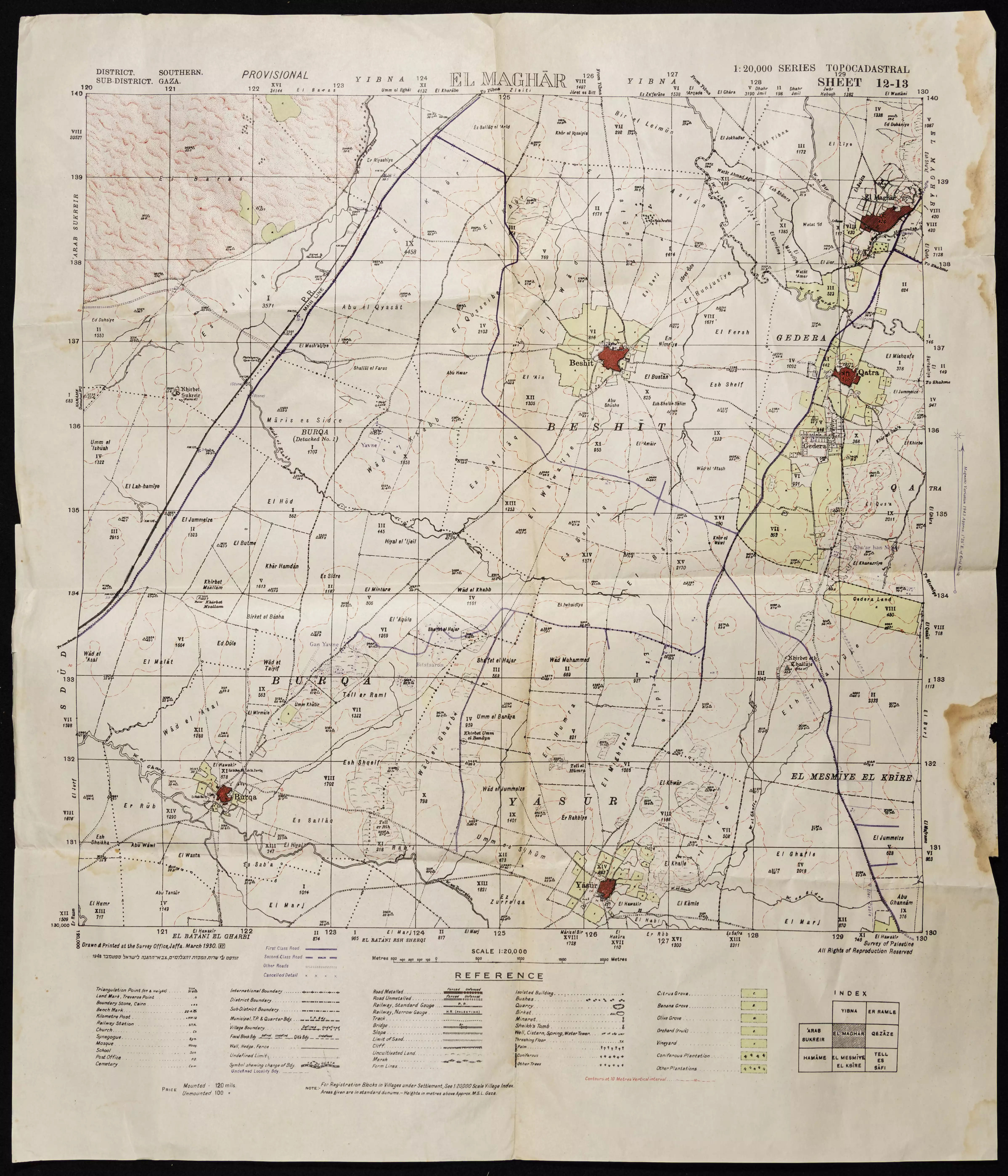
- خارطة تُظهِر الحدود والطرق بأنواعها والأماكن المقدسة والطبيعة الطوبغرافية من تلال وسهول ومنحدرات والتشكيلة الطبيعية للأرض وأنواع المزروعات. نُشرت الخريطة فترة الانتداب البريطاني، تم إضافة تعديلات عليها من قِبَل خدمة الخرائط والصور التابعة للقوات العسكرية الاسرائيلية فترة الأربعينيات.
- رسائل بخصوص نقل المعلم عبد الوهاب الدجاني - (الداودي) - من مدرسة قطرة اسلام الى مدرسة الطنطورة -- 18/08/1939 -- أنقر الصورة لتكبيرها
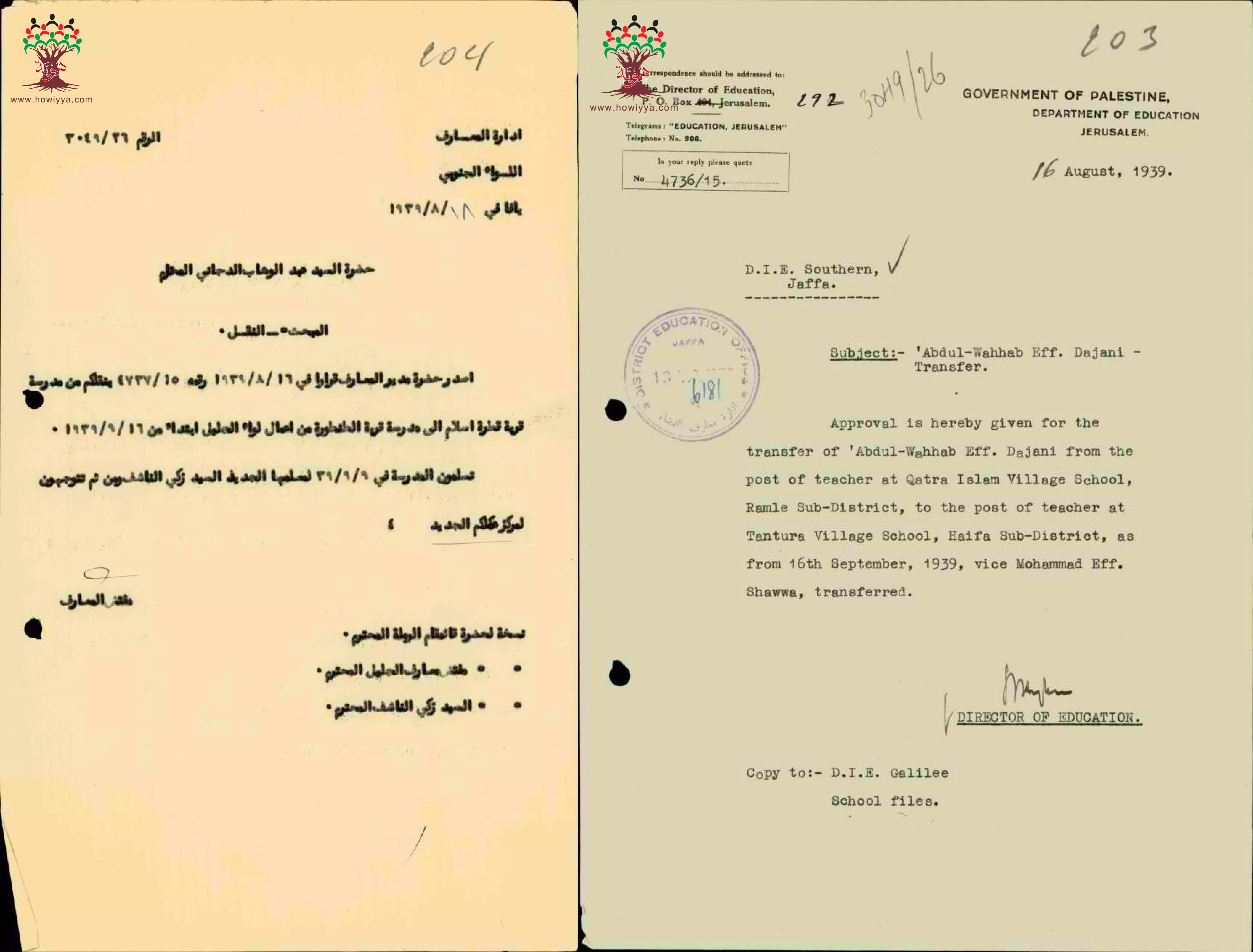
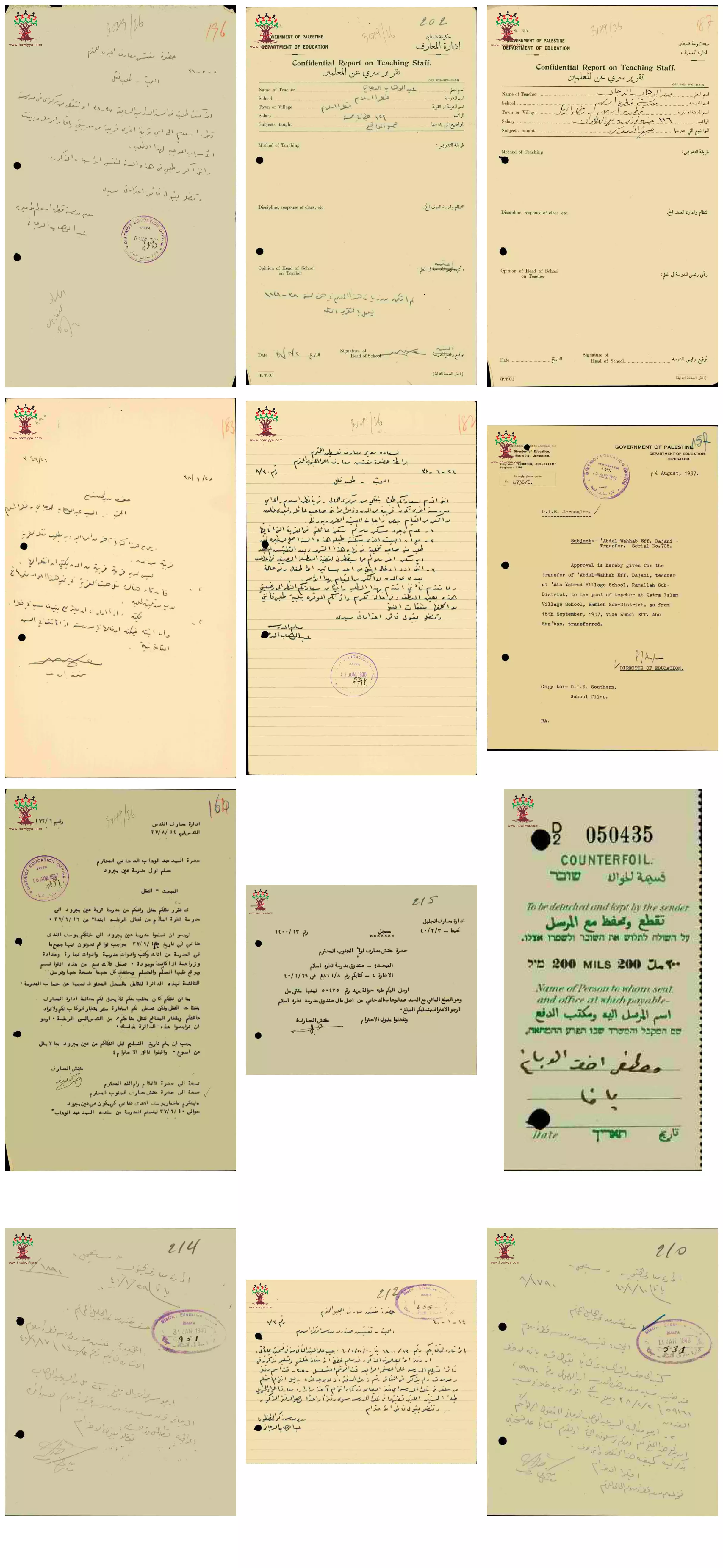
- مجموعة من الوثائق التي تخص تعين المعلم عبد الوهاب الدجاني (الداودي) --من القدس -- في مدرسة قطرة إسلام -- من 1937 الى 1940-- أنقر الصورة لتكبيرها
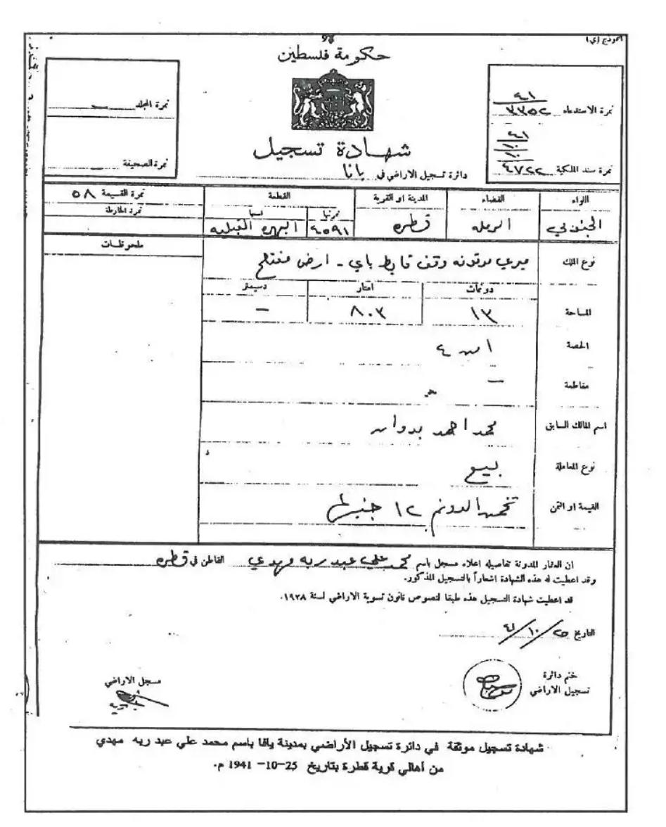
- شهادة تسجيل أرض- طابو صدر عام 1941 بإسم محمد علي عبد ربه مهدي
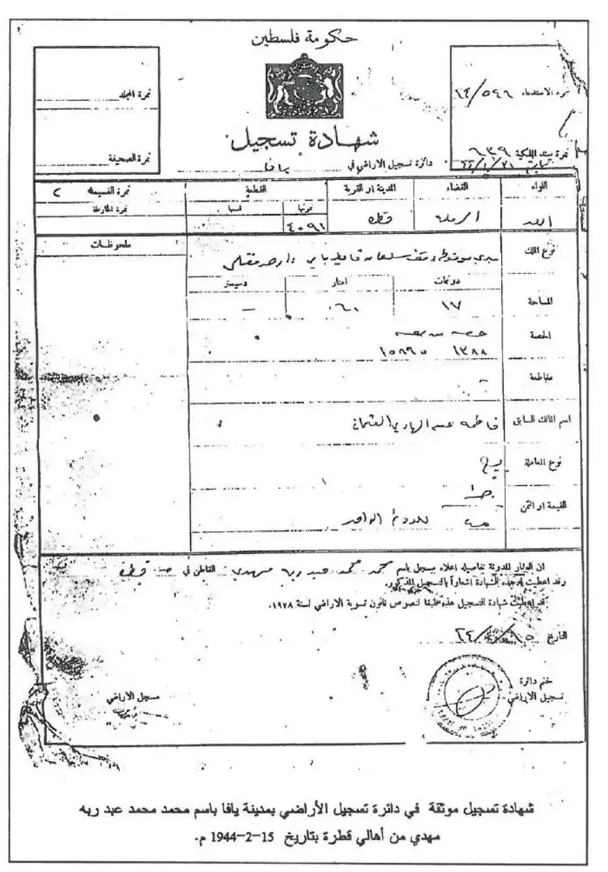
- شهادة تسجيل أرض- طابو صدر عام 1944 بإسم محمد علي عبد ربه مهدي
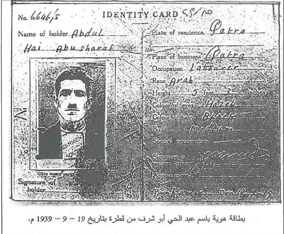
- بطاقة هوية لعبد الحي أبو شرف من قطره -- 19-09-1939
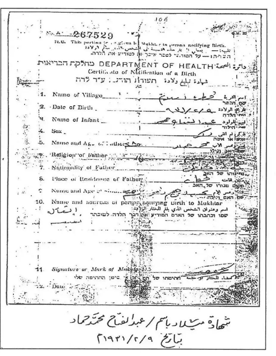
- شهادة ميلاد عبدالفتاح محمد حمد -- 09-02-1931
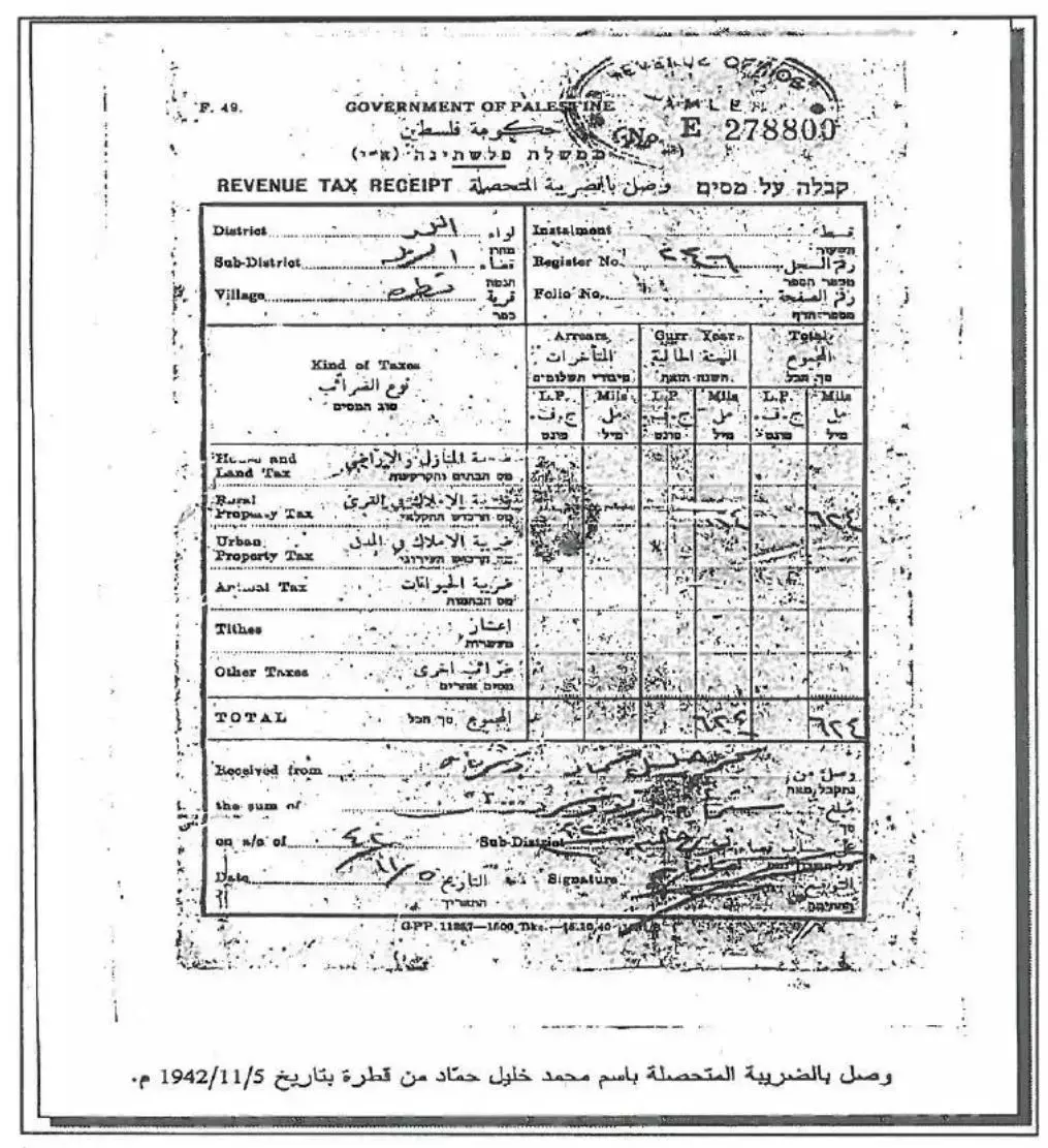
- ضريبة متحصلة عن اﻷملاك بإسم محمد خليل حمّاد في قطرة -- 05-11-1942
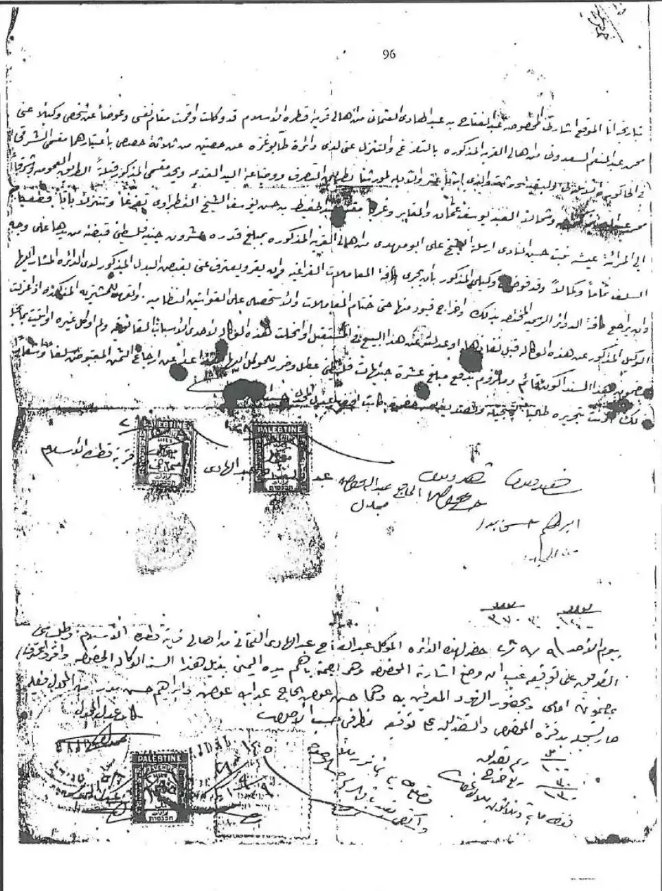
- مستند توكيل بيع وشراء بخط الشيخ أحمد أبو مهدي -09-09-1928
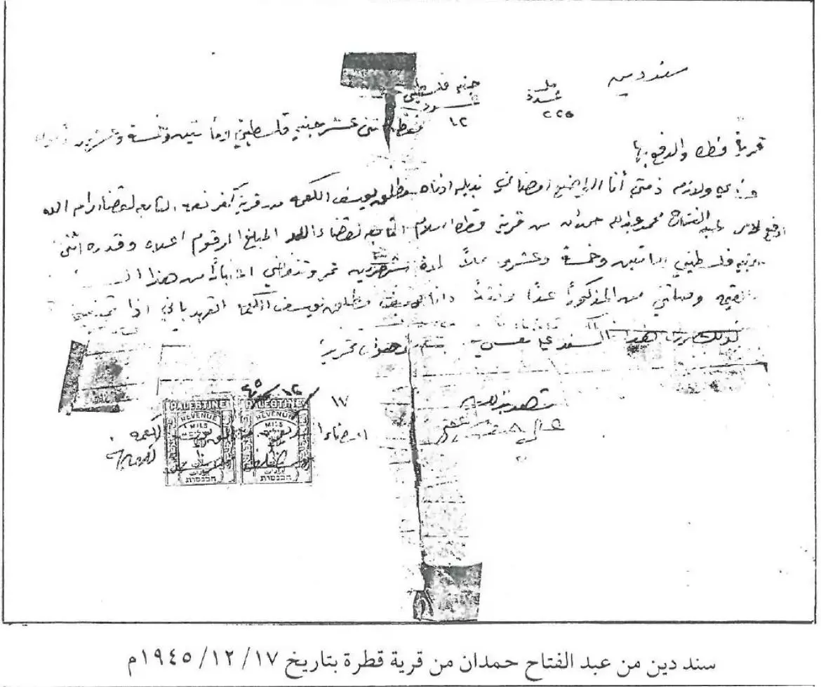
- سند دين من عبد الفتاح حمدان في قطرة -- 17-12-1945
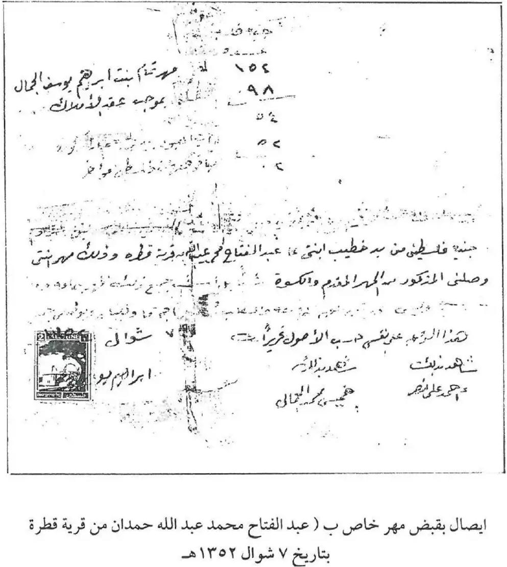
- إيصال بقبض مهر خاص ب عبد الفتاح عبد الله حمدان من قرية قطرة في فترة قبل النكبة سنة 1352 هجرة
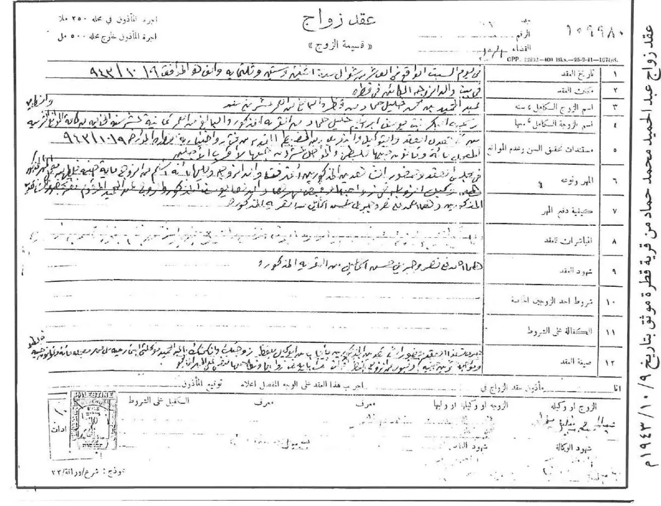
- عقد زواج عبد الحميد محمد حماد من قطرة -- 09-10-1943 -- أنقر الصورة لتكبيرها
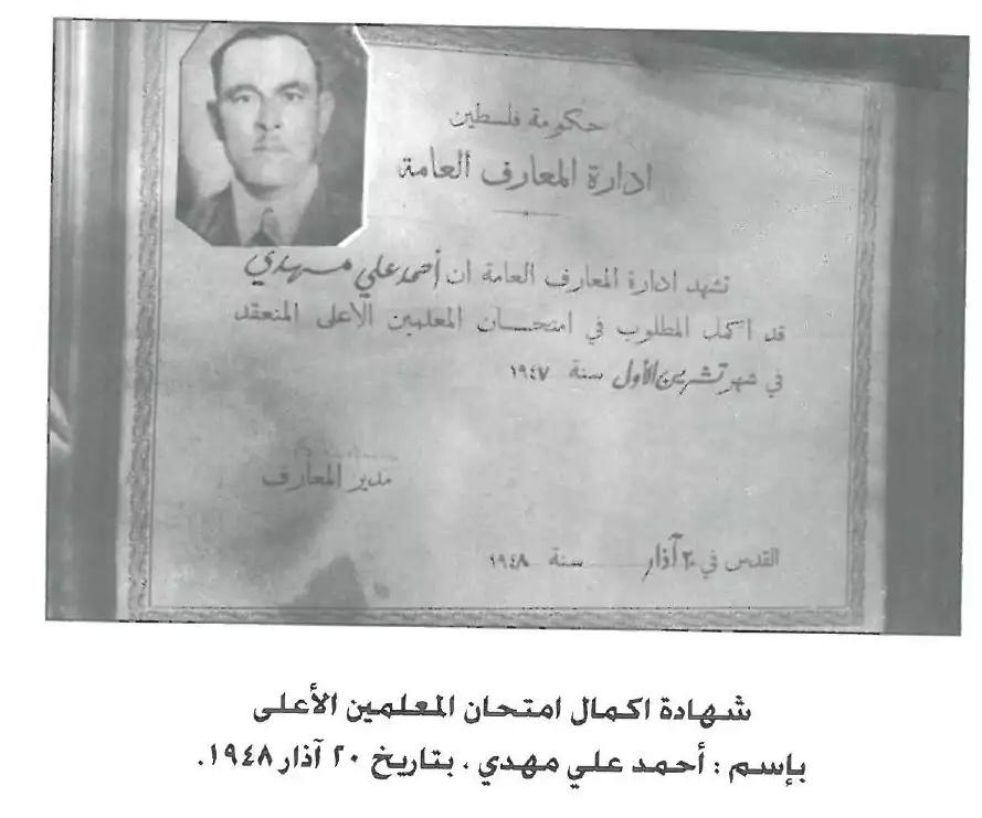
- إكمال إمتحان المعلمين اﻷعلى ل أحمد علي مهدي -- 20 اذار 1948
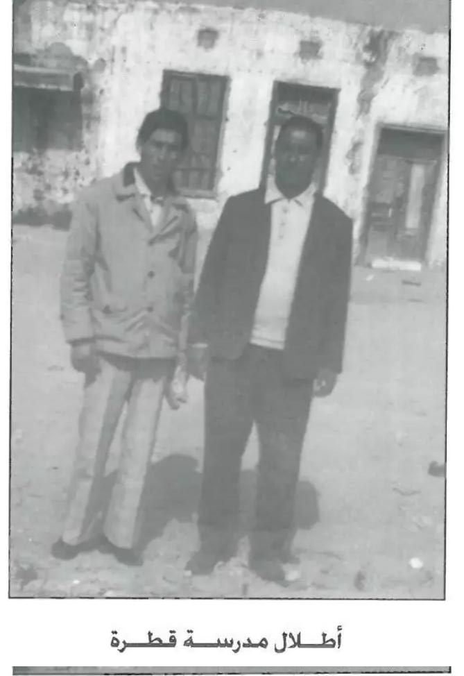
- أطلال مدرسة قطرة
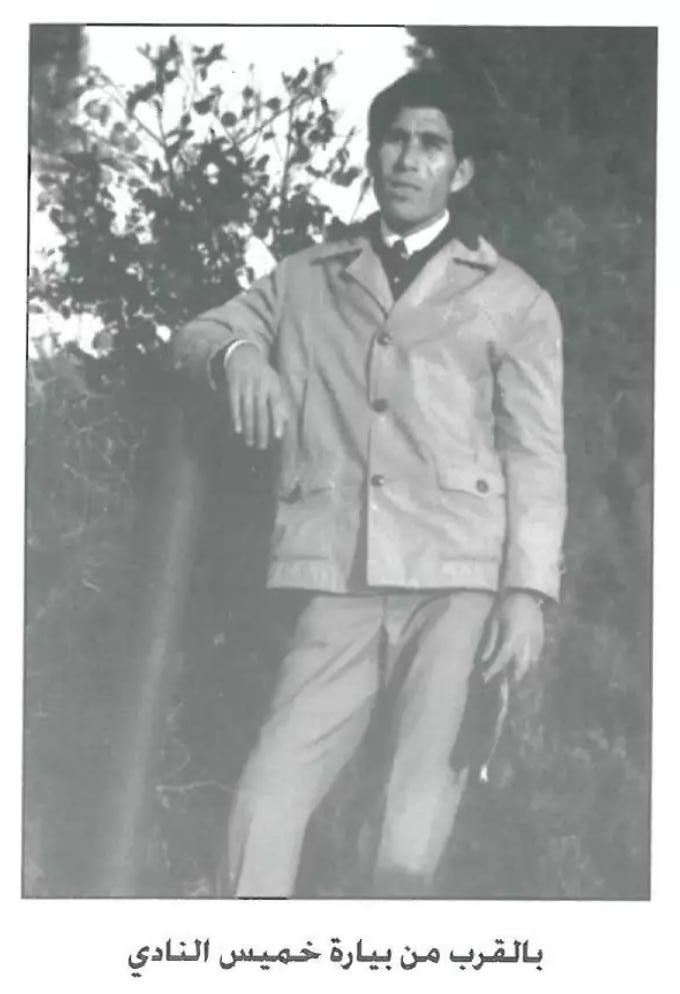
- بالقرب من بيارة خميس النادي
Want to browse more? 80,000 pictures were grouped in these gallaries:
- خارطة قطرة قبل النكبة-- تأليف عبد الرحيم القطراوي -- أنقر الصورة لتكبيرها وإنقر هنا إن اردت قرآءة كتاب المؤلف
Posted by jamal 2 - Pre-Nakba Aerial view of the village / صورة من الجو للقرية اخذت قبل النكبة
| Display Name | Clan/Hamolah | Country of Residence |
| Esraa | التوم/عليان | Toronto, Canada |
| ابو غريب ريان | - | غزة, قطرة |
| ثائر عليان | عليان | Palestine |
| akram qtrawi | - | gaza |
| bent-falastin | - | - |
| فلسطيني | - | - |
| ساره الهرباوي | - | الكويت |
| ناصر ابوشرف | - | السعودية |
| العثمان | العثمان | الرياض, السعودية |
| جمال محمد عبدالله | القطراوي | القدس, فلسطين |
| محمد مخيرز | مخيرز | غزه |
| ahmad>y | ابو جمـــــ.....ـــــــ.....ـــــــعــــه | - |
| a.s | ابو جمعة | - |
| حموووووود | ابو جمعة | - |
| abu joma | ابو جمعة | القدس |
| خالد الشامي | - | ابو ظبي, الامارات |
| محمد | - | - |
| عبدالله | مخيرز | خانيونس |
| al_qadry7 | - | - |
| الحافي | الحافي | - |
| Ehab Naser | نصر | عمان, الاردن |
| damo _rajab | دامو | الاردن, الاردن |
| قصي | ابوشرف | عمان |
| احمد ابو جمعة | - | - |
| عصام ابو جمعة | ابو جمعة | قطاع غزة, قطاع غزة |
| عماد القطراوي | القطراوي | عمان, الأردن |
| اياد محمد | - | الزرقاء |
| sweet saja | - | ontario, canada |
| ابهاب القادري | القادري | - |
| محمود ابو سعيفان | - | الاردن, الاردن |
| walla karaja | karaja | gaza strip, palestine |
| haissam | ابوشرف | jordan, jordan |
| علاء كراجة | كراجة | - |
| أبو جمعة | أبو جمعة | - |
| أسامة | أبو جمعة | القدس |
| ابو المر | نصر | NSW, Ausrtalia |
| Eben Damo | Damo | - |
| عرفات احمد اسماعيل | حسن اسماعيل | قرية دهمش |
| jamal | alqatrawi | gazastrip, gazastrip |
| Ali Karajeh | - | Syria, Syria |
| Ameen Al-Othman | Al-Othman | Riyad, KSA |
| abo al ali alfalana | - | - |
| Palsetinian | Al_Qaderi | amman, sdsd |
| Riyad abukhater | abukhater | alkhobar, saudia arabia |
| Munther Karajeh | Karajah (Karajeh) | U.A.E., United Arab Emirates |
- Tracing All That Remains of Qatra since Nakba
- "قرية قطرة" الفلسطينية - حلقة جديدة من برنامج #أهل_البلاد من انتاج قناة القدس اليوم Duration: 29 min 48 sec
- مقدمة في تاريخ قطرة إسلام (قضاء الرملة) Duration: 4 min 9 sec
 Fake Valor: Why Did Zionist Jews Hoist Nazis Flag on Their Ships in the 1930s?
What is new?
-
Facts About Oct. 7th Gaza Raid
-
Remined Us Please: Who Did Rape Whom? Was it Palestinians who raped Israelis? Or, was the other way around? You'll be the judge
-
When Prof. Edward Said was invited to debate Bibi Netanyahu in the 1980s, watch what happened!
-
Ezra Klein of the NY Times on the "Jewish Race".
-
Abusing Blood Libel!
-
How and why Israeli Jewry has become the most hated cult?
-
Did Israeli Soldiers Activate The Hannibal Direective On Oct. 7th? You Be The Judge
-
Zionist FAQ: Isn't it true that Palestinians don't want peace? Palestinians never accepted the two-state solution
- Facts about Haavara (Transfer) Agreement between Ben-Gurion & Hitler
-
Haavara FAQs: Why Did Zionist Jews Hoist Nazis' Flags on Their Ships in the 1930s?
- Haavara FAQs: When Chaim Weizmann met FDR in mid-1943, why was he silent about rescuing European Jewry?
-
Dear ChatGPT: How did Palestinians resist Napoleon's invasion of their country in 1799?
-
Dear ChatGPT: Gaza had a vibrant Jewish community in the mid-17th century. What happened to them?
-
Dear ChatGPT: Why did the Jewish Agency suppress news of the Holocaust during WWII?
-
Video Playlist: Jews share their DNA tests to end the conflict for good.
-
A Tale of Two Conflicts: Examining the Definition of Genocide
-
Prof. Abraham Polak And The Suppressed History of the Khazars and European Jewry
-
How Ronald Reagan would have framed the genocide in Gaza if he were still alive?
-
Haavara FAQs: Let us do the math: how many German Jews did The Haavara Agreement save?
-
Zionist FAQs: The Hebron Massacre of 1929, "clearly proves" that Palestinians are antisemitic, how could you deny it?
-
Zionist FAQs: Why Anti-Zionist Is Not Antisemitism?
-
Zionist FAQs: Isn't it true that the KGB created Palestinian Nationalism in the early 1960s?
- Zionist FAQs: Muslims are killing Muslims all the time; why are Israeli Jews being singled out in the media?
- Zionist FAQs: How is Israel an apartheid state when 20% of its citizens are Arabs who enjoy full rights?
-
Haavara FAQs: Why Did Dorothy Thompson Flip From A Zionist Advocate to A Silenced Dissenter?
-
Haavara FAQs: Analysis of Herzl's Uganda Scheme and how it could have saved millions of Jews.
-
Haavara FAQs: Why did Hayim Greenberg describe American Jewry as "morally bankrupt" in early 1943?
-
Haavara FAQs: What if the Evian Conference was a resounding success? What would have been the impact of saving European Jewry on Zionism?
- Haavara FAQs: What if the six million were saved, how that would have impacted the Zionist project?
-
Haavara FAQs: How did Zionist leaders react when Europe's Jews lingered in the DP camps after WWII ended?
-
Why does the American Jewish community repeat lies that David Ben-Gurion had debunked before he died?
-
Who has the power to rename the Tatar/Khazar Gene Marker to Jewish IV?
-
Zionist FAQs: Why won't Egypt, Syria, and Jordan take their people back? Jews are indigenous to Palestine, and Arabs immigrated after Jews developed the country. Arabs should leave.
-
Haavara FAQs: Did Hitler and the Nazis conflate between Judaism and Zionist? If that wasn't case, then why?
-
Haavara FAQs: Winston Churchill and antisemitism, a collection of articles written Churchill.
-
Haavara FAQs: Broken by country, how many Jews survived vs. killed during the Holocaust?
-
Haavara FAQs: Why did European Jews vote with their feet and to immigrated to the Americas, not Palestine, after WWII?
-
Watch this American Jewish Girl describing Israeli Jews' cognitive dissonance like no other in under two minutes
-
Haavara FAQs: When the Nazis went out of their way to hide the Holocaust, Israeli Jews did the exact opposite by broadcasting their genocide of Gazans. But why?
-
Haavara FAQs: How Zionist Jews went out of their to show their appreciation to Nazism and Fascism?
- Haavara FAQs: Why Zionist leaders were against bombing the death camps & the Railroads leading to them?
-
Haavara FAQs: Hitler's message to the British and American people: If Jews are such noble citizens and you care about them, how come you're not letting them in? I will gladly ship them to you at my expense, even on luxury liners!
-
A shortlist of Zionist and Israeli false flag operations in the name Jews.
-
The Most Moral Army
- The Land of Kapos (Israel): Where the brave are boycotted and Kapos walk free.
- Why did early Zionists often named their communal enterprises "colonial"?
- Zionist Relations with Nazi Germany by Faris Glubb
-
Two NY Times advertisements by Zionists in the early 1943 that exposes Zionists' treason at the height of the calamity
- Facts Not Lies about the Palestinian-Israeli Conflict.
- Site's pictures have been categorized
- Campgain Against Lice
- A Survey of Palestine, the official source about Palestine before Nakba produced by the British Mandate; over 1200 pages.
- Satellite View & Google Earth: Over 6,000 placemarks identifying all destroyed towns, W. Bank & Gaza Strip Towns, & refugee camps.
- PalestineRemembered.com and its Nakba Oral History Project were featured on al-Jazeera Satellite TV.
- Nakba Oral History Video Podcast:
 Over 700 Oral History interviews (including 3,500+ hours of recording) can be viewed online.
 - Palestine Village Statistics Project
- Gaza Jail Break
- النسخة العربية للموقع الان متوفرة
- Videos: Documenting the destroyed villages in video: Tracing all that remains since Nakba.
- Videos: Responding to Zionist Propaganda
- Interview: The ethnic cleansing of Palestine: George Galloway interviews Israeli Historian Ilan Pappe.
- For Palestinians, memory matters. It provides a blueprint for their future By George Bisharat.
- Zionist FAQ now available in Hebrew שאלות שציונים שואלים, עכשיו בעברית
- Video: The Stephen Walt and John Mearsheimer report on the influence of the Israel Lobby on U.S. Foreign Policy
- The Palestinian-Israeli conflict for beginners
