| PalestineRemembered | About Us | Oral History | العربية | |
| Pictures | Zionist FAQs | Haavara | Maps | |
| Search |
| Camps |
| Districts |
| Acre |
| Baysan |
| Beersheba |
| Bethlehem |
| Gaza |
| Haifa |
| Hebron |
| Jaffa |
| Jericho |
| Jerusalem |
| Jinin |
| Nablus |
| Nazareth |
| Ramallah |
| al-Ramla |
| Safad |
| Tiberias |
| Tulkarm |
| Donate |
| Contact |
| Profile |
| Videos |
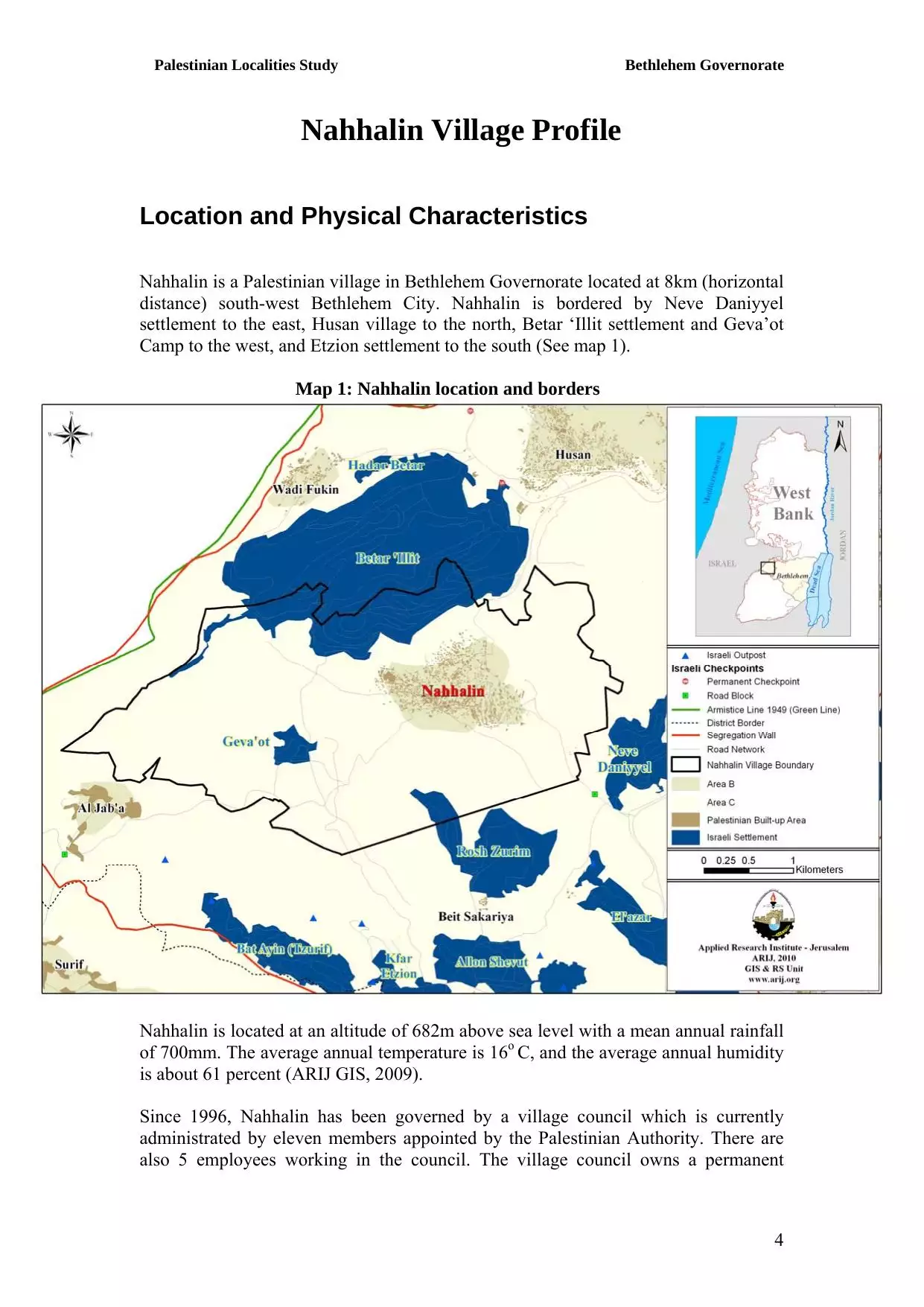
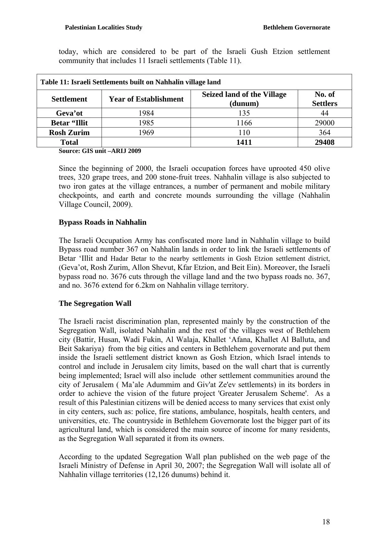
Welcome To Nahhalin - نحّالين (נחאלין)
|
District of Bethlehem
Occupied days ago |
العربية Google Earth |
 |
Gallery (35) |
- Statistics & Facts
-
Before & After

- Satellite View
- Articles 38
- Pictures 35
- Land Deeds 1
- Members 11
- Families
- Wikipedia
- ARIJ Guide
- Videos 2
- Guest Book 39
- Links
| Statistic & Fact | Value | ||||||||||||||||||||||
| Distance From District | 14 km southwest of Bethlehem | ||||||||||||||||||||||
| Elevation | 620 meters | ||||||||||||||||||||||
| Before & After Nakba, Click Map For Details |
|||||||||||||||||||||||
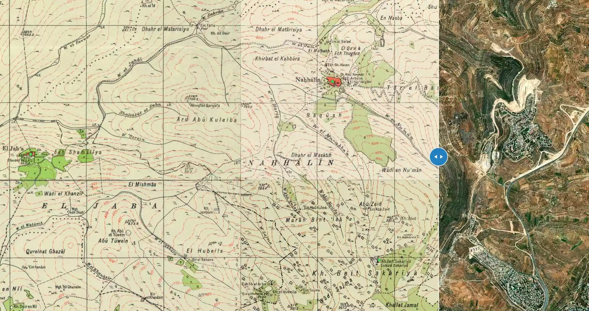
|
|||||||||||||||||||||||
| Land Ownership |
**Town Lands' Demarcation Maps |
||||||||||||||||||||||
| Land Usage As of 1945 |
|
||||||||||||||||||||||
| Population |
|
||||||||||||||||||||||
| Near By Towns |
|||||||||||||||||||||||
|
|||||||||||||||||||||||
| Featured Video | |||||||||||||||||||||||
| ARIJ Guide | |||||||||||||||||||||||
|
Click here to browse online. |
|||||||||||||||||||||||
| Related Maps | Town Lands' Demarcation Maps خرائط للقضاء توضح حدود القرى والاودية View from satellite Town's map on MapQuest Help us map this town at WikiMapia |
||||||||||||||||||||||
| Related Links | Wikipedia's Page Facebook Page ARIJ Guide Google Search Google For Images Google For Videos في كتاب بلادنا فلسطين دليل أريج المزيد من موقع هوية |
||||||||||||||||||||||
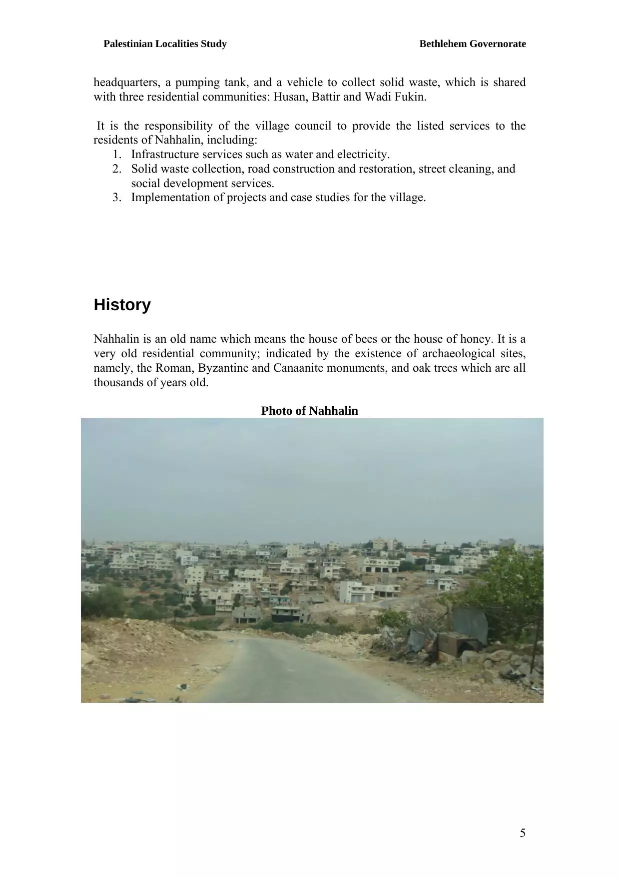
- نحالين بين اليوم والامس
- Nahalin, General Information
- نحالين بلدي اصلي وفصلي
- نحالــــــــــــين
- تأسيس ديوان لنحالين في الاردن\ياجوز
- بطاقة تهنئة بمناسبة عيد الفطر السعيد
- الـــى امـــــــي
- الشوق والحنين
- دعوة للمشاركة
- من قال اننا كبرنا
- ورشة عمل في قرية نحالين حول العنف ضد النساء
- الحياة البرية
- قطف ثمار الزيتون في نحالين
- نحالين
- كنز ادهش المنقبين في نحالين
- رحيـــــــــل
- على طريق التقدم والنجاح
- عيد الاضحى المبارك
- ارحموا هذا البلد
- قناعــــــــــــــــــــــــات
- [email protected]
- البعض نحبهــــــــــــــم
- يحدث في رمضان
- يحدث في ايـــــــلول
- نحالين في سطور
- السياحة البيئية وأثرها على التنمية الاقتصادية في المناطق الريفية
- من الذي سيدفع الثمن
- الحب والكراهية
- القـــــــــــــــــــراءة
- همســــــــــــــات
- التوجيهي
- ترنيمة ............................... الروح
- الراي والراي الاخر............................................ في زمن العولمة
- رجب...................................طيب
- قديسة عشق ........................................ امي
- اسرج رفاتك .......................................... غمدا للسيف
- على طريق الفشــــــــــــــــــــــــــل
- عائلة ابو مصطفى الادهمــــــــــــــــــــــــــــــــي
- نحالين كما تبدو من بانياس

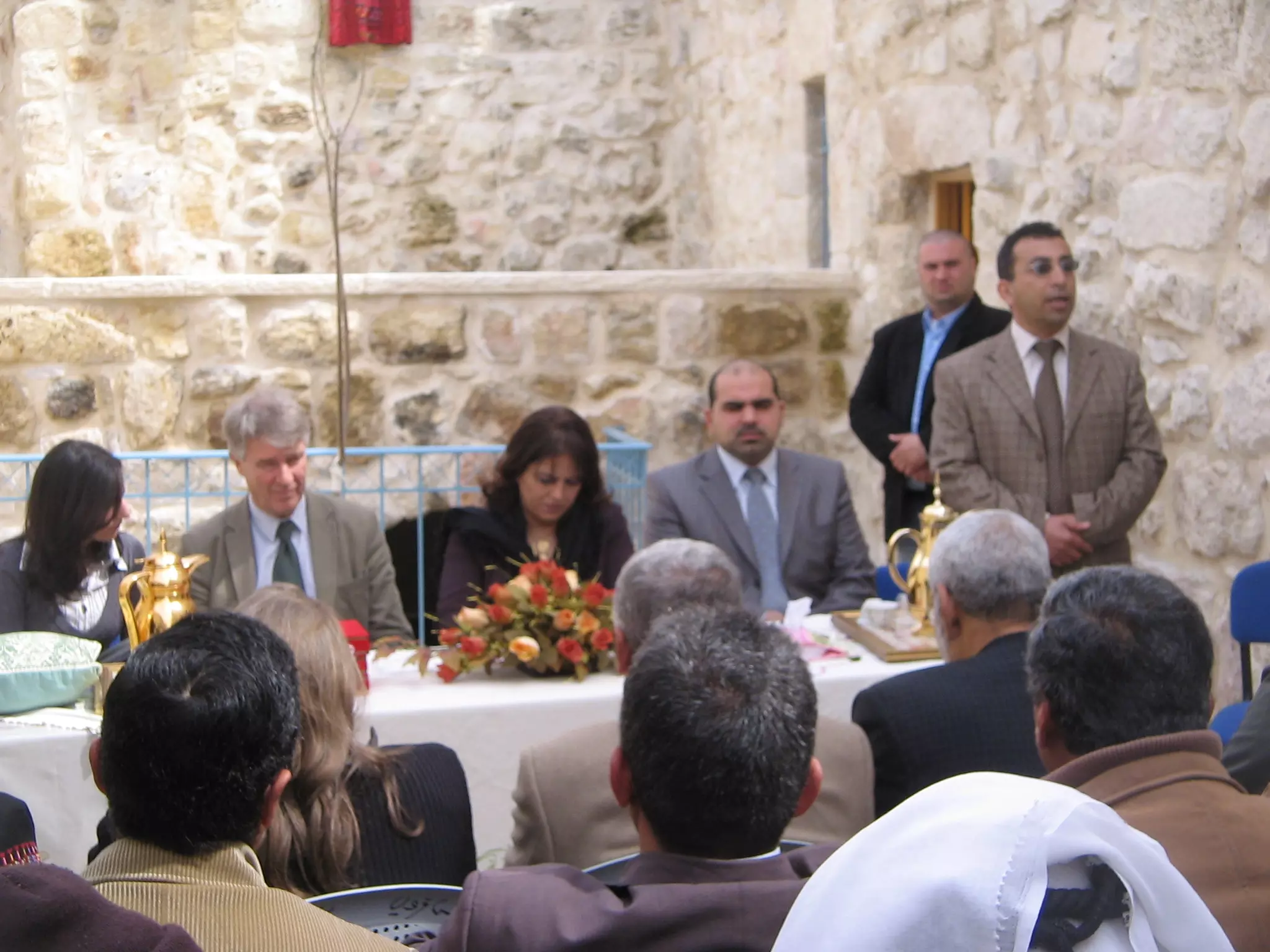
Posted by Safwat Safi - اول مدرسة تنشء في نحالين
Posted by خليلية 3 - منظر عام
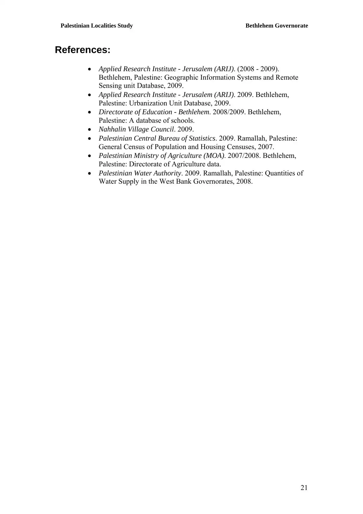
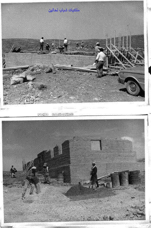
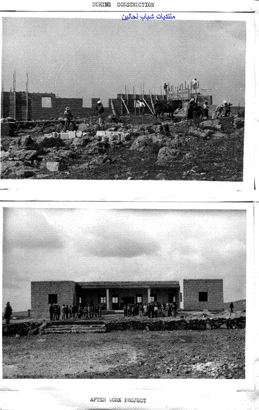
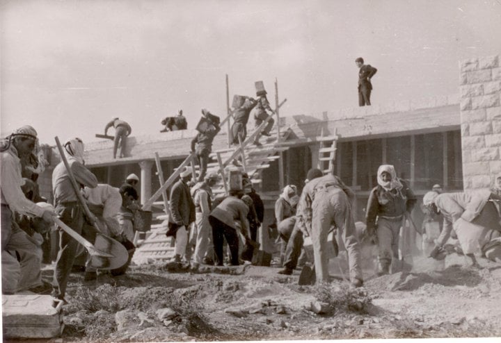
Posted by خليلية 9 - بناء اول مدرسة في قرية نحالين في الستينات
Posted by خليلية 3 - اول مدرسة في نحالين
Posted by خليلية 3 - منظر عام
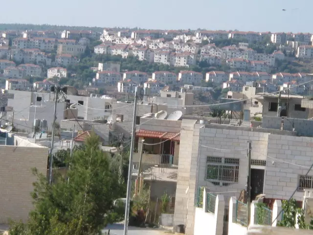
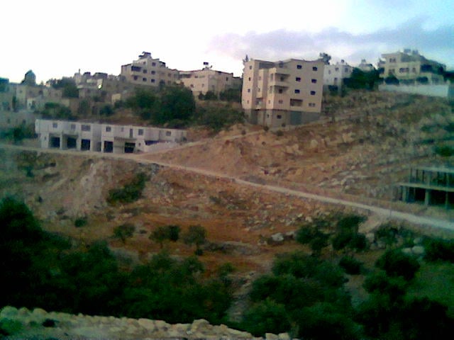
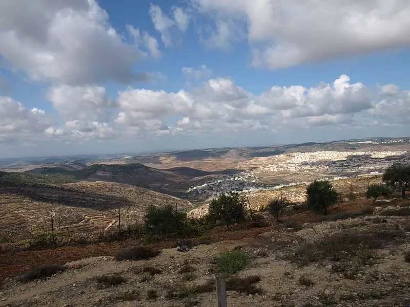
Posted by خليلية 3 - منظر عام تظهر فيه مغتصبة بيتار عليت
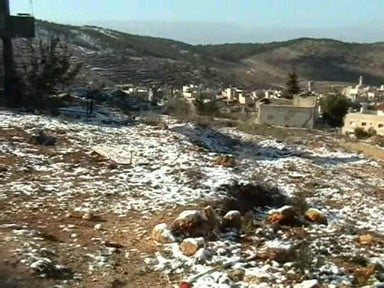
Posted by خليلية 5 - نحالين تكسوها الثلوج
Posted by خليلية 3 - نحالين منطقة شويحه والقاعه
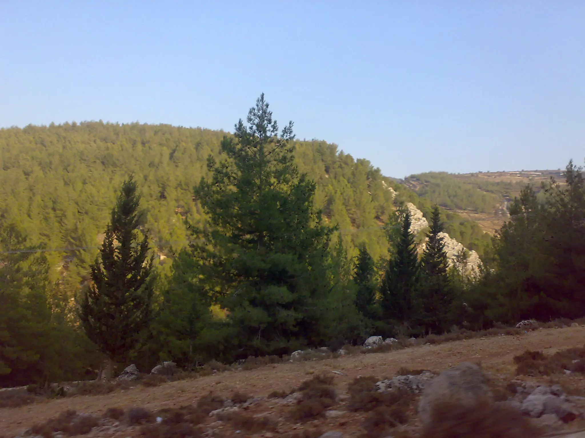
Posted by Mukhles Najajreh 4 - أحراج القرية
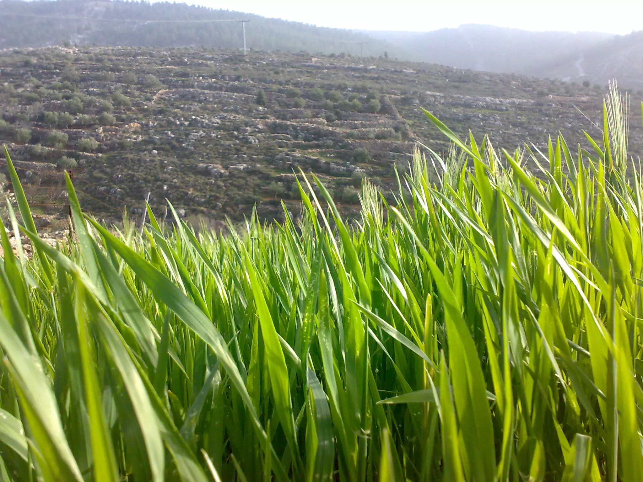
Posted by BlueSky 1 - الربيع في القرية
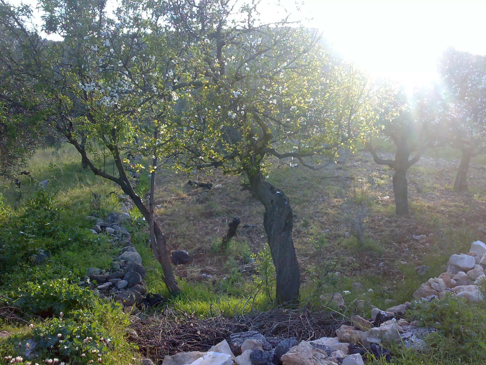
Posted by BlueSky 1 - منطقة عين فارس
Posted by BlueSky 1 - شعب العرب
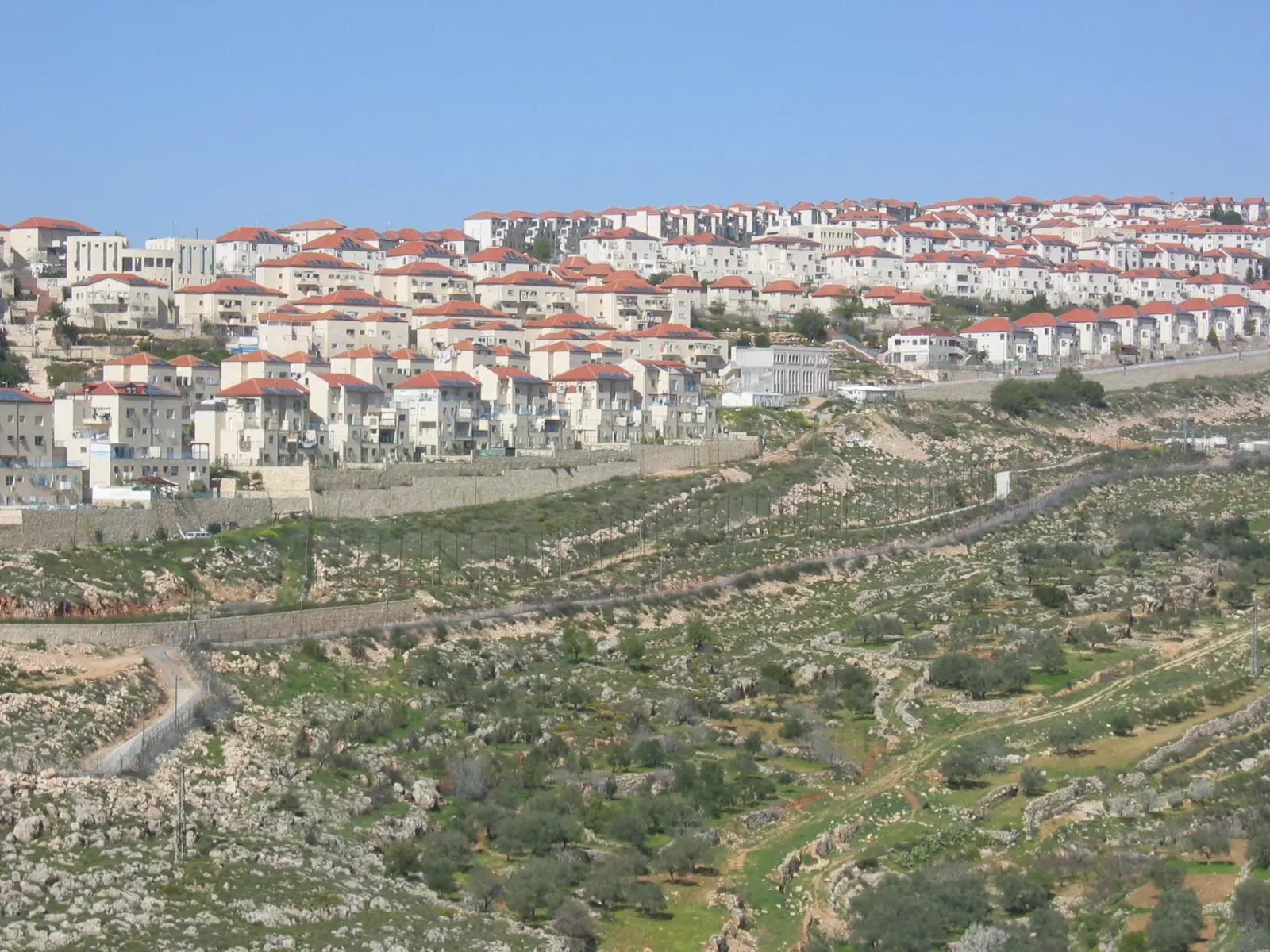
Posted by نحاليني 2 - مستوطنة بيتار المقامة على أراضي نحالين ,حوسان ووادي فوكين
Posted by نحاليني 4 - غرب القرية
Posted by نحاليني 1 - غرب القرية 2
Posted by نحاليني 1 - افتتاح حوش ابو فنون
Posted by ابو النور 2 - Nice vew
Posted by Mukhles Najajreh 1 - قرية نحالين
Posted by ابن قرية نحالين 2 - Nahalin 1964
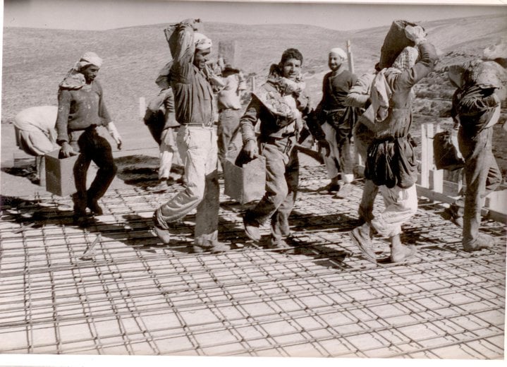
Posted by Mukhles Najajreh - Nahalin school 1964
Posted by Mukhles Najajreh - Nahaleen
Posted by A. Najajreh - Nahaleen
Posted by A. Najajreh - Nahaleen
Posted by A. Najajreh - Nahaleen
Posted by A. Najajreh - Nahaleen
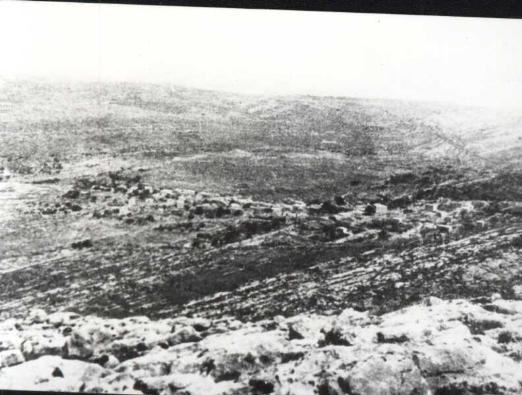
Posted by A. Najajreh - نحالين : صورة لقرية نحالين عام 1947 - مشاركة صفافي
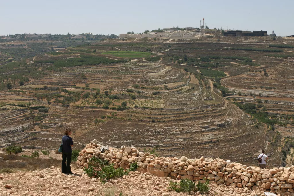
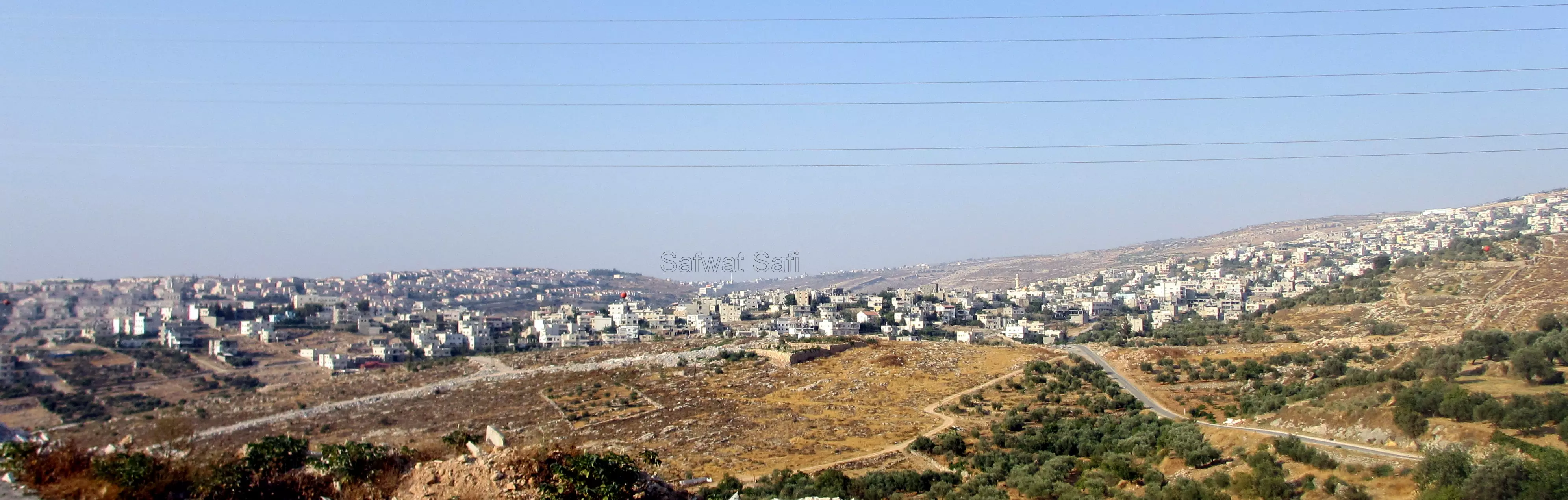
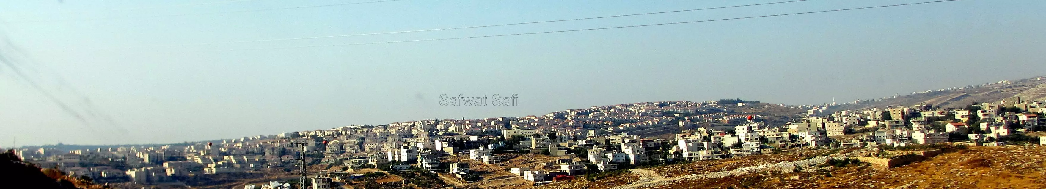
Posted by صفافي أصيل - منظر عام لقرية نجالين من الجنوب، وتظهر على اليسار في الصورة مستعمرة بيتار عيليت
Posted by Safwat Safi - صورة لنحالين من الجنوب
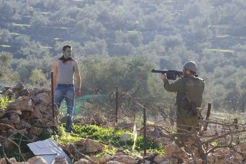
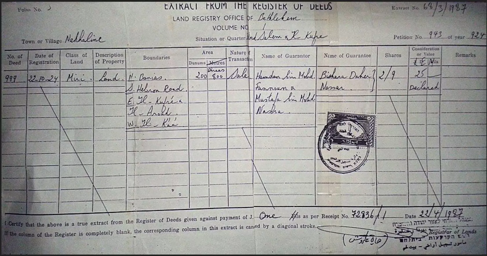
Posted by Safwat Safi - The land deed that belongs to Daher Nassar which his family owned for over 100 year, the details from BBC in the comments section
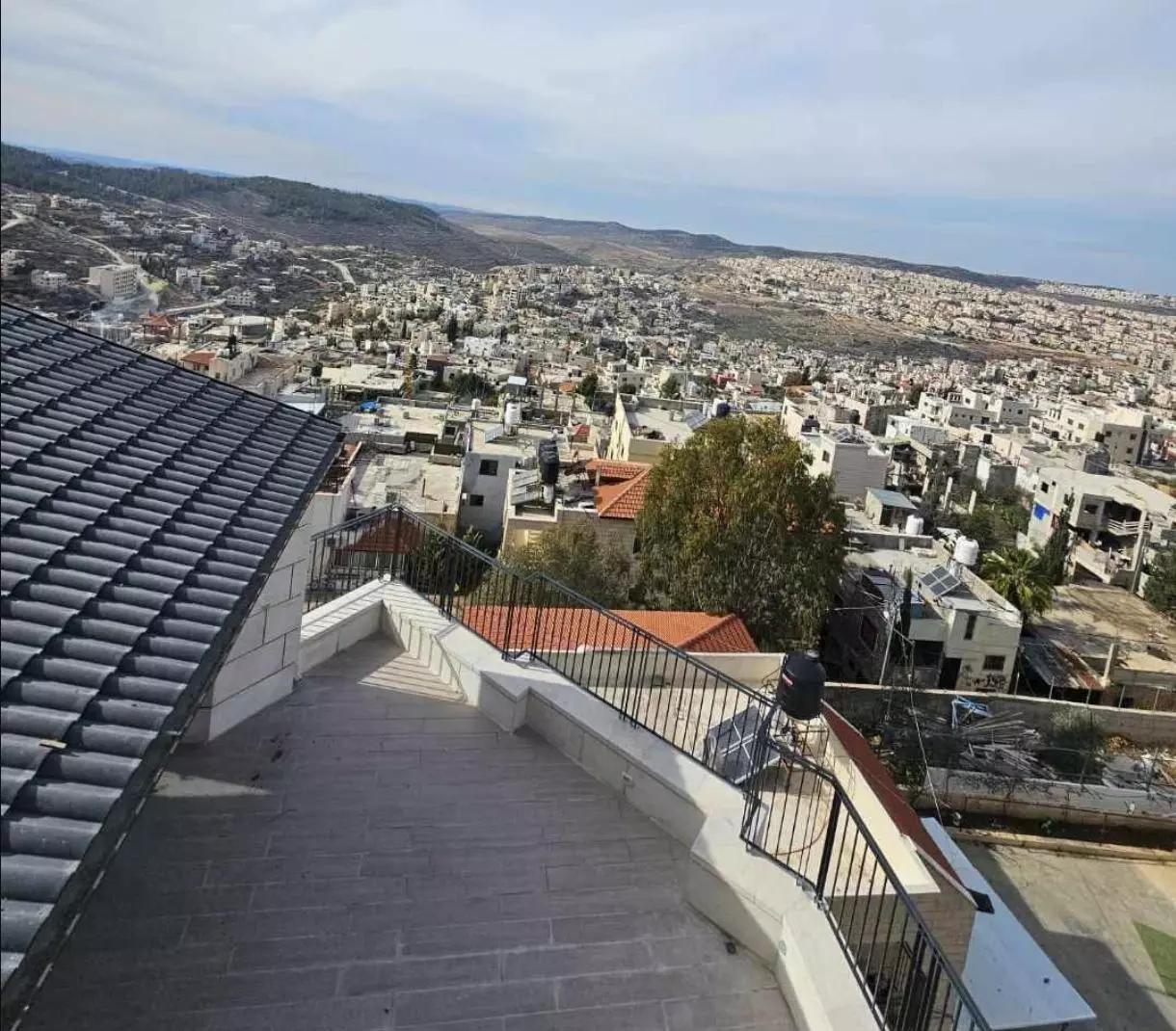
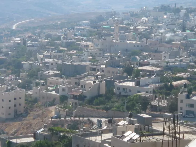
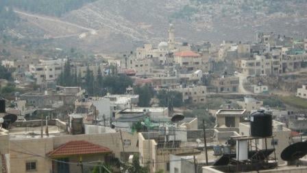
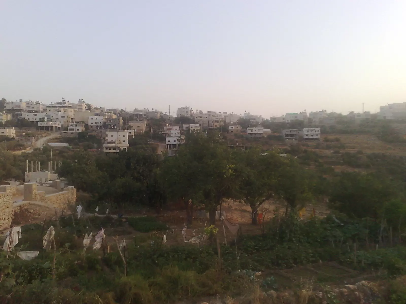
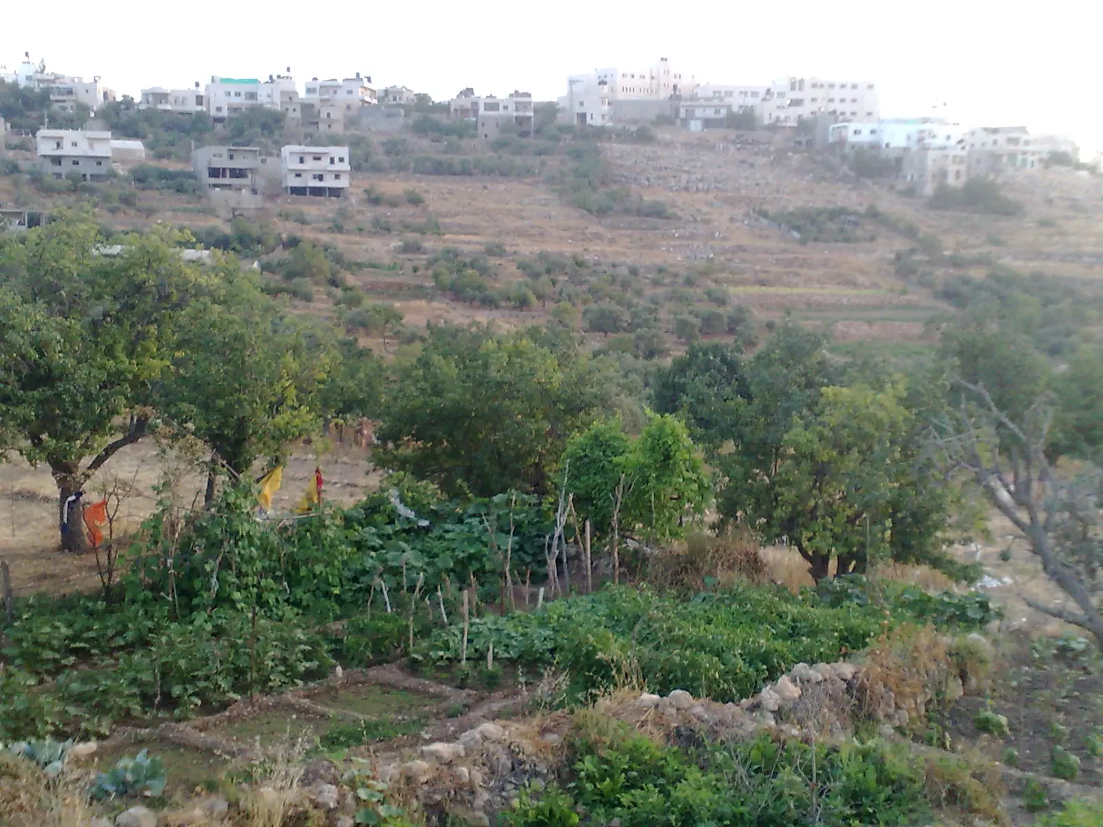
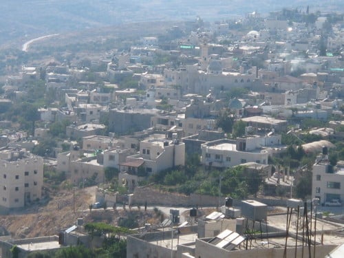
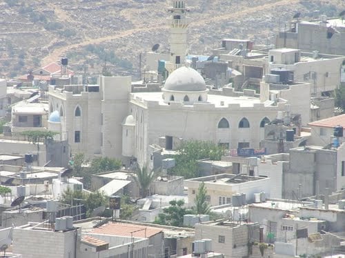
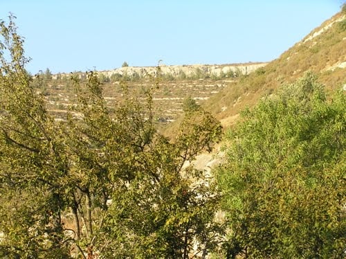
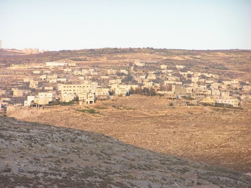
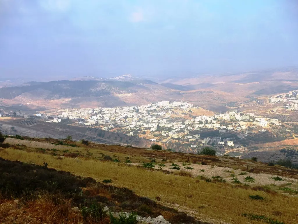
1 - General view of the town -- منظر عام
- General view of the town -- منظر عام #2
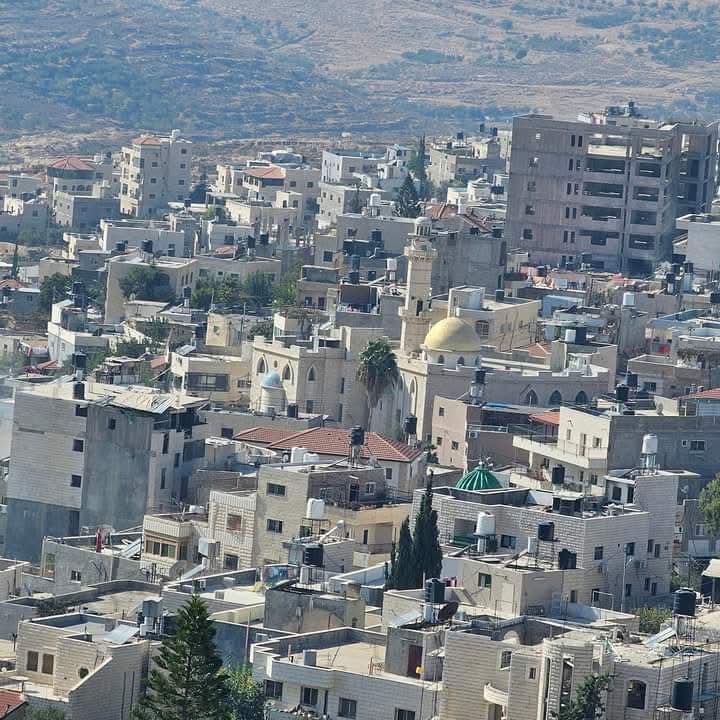
- General view of the town -- منظر عام #3
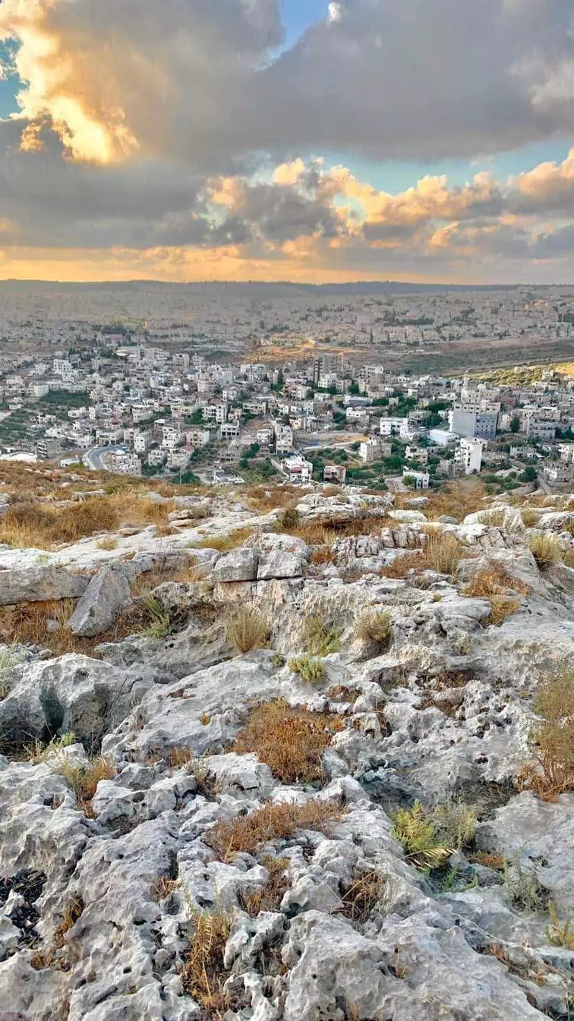
- General view of the town -- منظر عام #4
- منظر عام
Want to browse more? 80,000 pictures were grouped in these gallaries:
| Display Name | Clan/Hamolah | Country of Residence |
| Safwat Safi | - | - |
| موسى نجاجرة | نجاجرة | الاردن , الاردن |
| Abu Thaer | - | - |
| ابو النور | - | - |
| BlueSky | - | Bethlehem, Palestine |
| فادي | - | - |
| Mukhles Najajreh | - | Bethlehem |
| abu amar | شكارنة | بيت لحم, نحالين |
| khaled musallam | نجاجرة | الاردن, الاردن |
| اولك | - | بيت لحم |
| د.نايف عمر لافي | لافي | الدوحة, قطر |
No links have been shared yet, be free to the first to share the first link.
 Fake Valor: Why Did Zionist Jews Hoist Nazis Flag on Their Ships in the 1930s?
What is new?
-
Facts About Oct. 7th Gaza Raid
-
Remined Us Please:: Who Did Rape Who? Palestinians Raped Israelis? Or, was the other way around?
-
When Prof. Edward Said was invited to debate Bibi Netanyahu in the 1980s, watch what happened!
-
Abusing Blood Libel!
-
Zionist FAQ: Isn't it true that Palestinians don't want peace? Palestinians never accepted the two-state solution
- Facts about Haavara (Transfer) Agreement between Ben-Gurion & Hitler
-
Haavara FAQs: Why Did Zionist Jews Hoist Nazis' Flags on Their Ships in the 1930s?
-
Dear ChatGPT: Why did the Jewish Agency suppress news of the Holocaust during WWII?
-
Video Playlist: Jews share their DNA tests to end the conflict for good.
-
A Tale of Two Conflicts: Examining the Definition of Genocide
-
Prof. Abraham Polak And The Suppressed History of the Khazars and European Jewry
-
How Ronald Reagan would have framed the genocide in Gaza if he were still alive?
-
Haavara FAQs: Let us do the math: how many German Jews did The Haavara Agreement save?
-
Zionist FAQs: The Hebron Massacre of 1929, "clearly proves" that Palestinians are antisemitic, how could you deny it?
-
Zionist FAQs: Why Anti-Zionist Is Not Antisemitism?
-
Zionist FAQs: Isn't it true that the KGB create Palestinian Nationalism in the early 1960s?
- Zionist FAQs: Muslims are killing Muslims all the time; why are Israeli Jews being singled out in the media?
- Zionist FAQs: How is Israel an apartheid state when 20% of its citizens are Arabs who enjoy full rights?
-
Haavara FAQs: Analysis of Herzl's Uganda Scheme and how it could have saved millions of Jews.
-
Haavara FAQs: Why did Hayim Greenberg describe American Jewry as "morally bankrupt" in early 1943?
-
Haavara FAQs: What if the Evian Conference was a resounding success? What would have been the impact of saving European Jewry on Zionism?
- Haavara FAQs: What if the six million were saved, how that would have impacted the Zionist project?
-
Haavara FAQs: How did Zionist leaders react when Europe's Jews lingered in the DP camps after WWII ended?
-
Why does the American Jewish community repeat lies that David Ben-Gurion had debunked before he died?
-
Who has the power to rename the Tatar/Khazar Gene Marker to Jewish IV?
-
Zionist FAQs: Why won't Egypt, Syria, and Jordan take their people back? Jews are indigenous to Palestine, and Arabs immigrated after Jews developed the country. Arabs should leave.
-
Haavara FAQs: Did Hitler and the Nazis conflate between Judaism and Zionist? If that wasn't case, then why?
-
Haavara FAQs: Winston Churchill and antisemitism, a collection of articles written Churchill.
-
Haavara FAQs: Broken by country, how many Jews survived vs. killed during the Holocaust?
-
Haavara FAQs: Why did European Jews vote with their feet and to immigrated to the Americas, not Palestine, after WWII?
-
Watch this American Jewish Girl describing Israeli Jews' cognitive dissonance like no other in under two minutes
-
Haavara FAQs: When the Nazis went out of their way to hide the Holocaust, Israeli Jews did the exact opposite by broadcasting their genocide of Gazans. But why?
-
Haavara FAQs: How Zionist Jews went out of their to show their appreciation to Nazism and Fascism?
- Haavara FAQs: Why Zionist leaders were against bombing the death camps & the Railroads leading to them?
-
Haavara FAQs: Hitler's message to the British and American people: If Jews are such noble citizens and you care about them, how come you're not letting them in? I will gladly ship them to you at my expense, even on luxury liners!
-
A shortlist of Zionist and Israeli false flag operations in the name Jews.
-
The Most Moral Army
- The Land of Kapos (Israel): Where the brave are boycotted and Kapos walk free.
- Why did early Zionists often named their communal enterprises "colonial"?
- Zionist Relations with Nazi Germany by Faris Glubb
-
Two NY Times advertisements by Zionists in the early 1943 that exposes Zionists' treason at the height of the calamity
- Facts Not Lies about the Palestinian-Israeli Conflict.
- Site's pictures have been categorized
- Campgain Against Lice
- A Survey of Palestine, the official source about Palestine before Nakba produced by the British Mandate; over 1200 pages.
- Satellite View & Google Earth: Over 6,000 placemarks identifying all destroyed towns, W. Bank & Gaza Strip Towns, & refugee camps.
- PalestineRemembered.com and its Nakba Oral History Project were featured on al-Jazeera Satellite TV.
- Nakba Oral History Video Podcast:
 Over 700 Oral History interviews (including 3,500+ hours of recording) can be viewed online.
 - Palestine Village Statistics Project
- Gaza Jail Break
- النسخة العربية للموقع الان متوفرة
- Videos: Documenting the destroyed villages in video: Tracing all that remains since Nakba.
- Videos: Responding to Zionist Propaganda
- Interview: The ethnic cleansing of Palestine: George Galloway interviews Israeli Historian Ilan Pappe.
- For Palestinians, memory matters. It provides a blueprint for their future By George Bisharat.
- Zionist FAQ now available in Hebrew שאלות שציונים שואלים, עכשיו בעברית
- Video: The Stephen Walt and John Mearsheimer report on the influence of the Israel Lobby on U.S. Foreign Policy
- The Palestinian-Israeli conflict for beginners
