| PalestineRemembered | About Us | Oral History | العربية | |
| Pictures | Zionist FAQs | Haavara | Maps | |
| Search |
| Camps |
| Districts |
| Acre |
| Baysan |
| Beersheba |
| Bethlehem |
| Gaza |
| Haifa |
| Hebron |
| Jaffa |
| Jericho |
| Jerusalem |
| Jinin |
| Nablus |
| Nazareth |
| Ramallah |
| al-Ramla |
| Safad |
| Tiberias |
| Tulkarm |
| Donate |
| Contact |
| Profile |
| Videos |
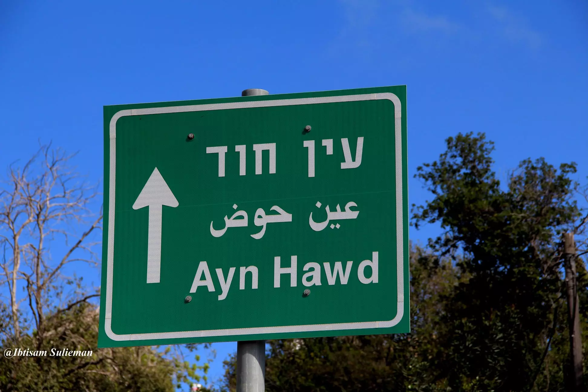
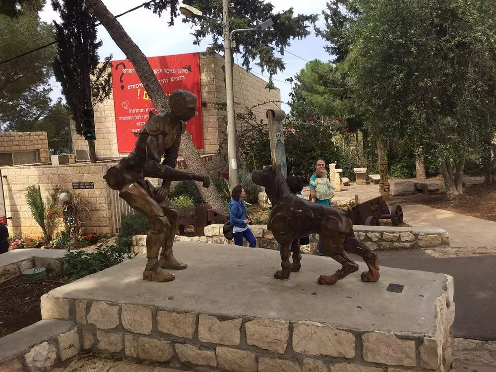
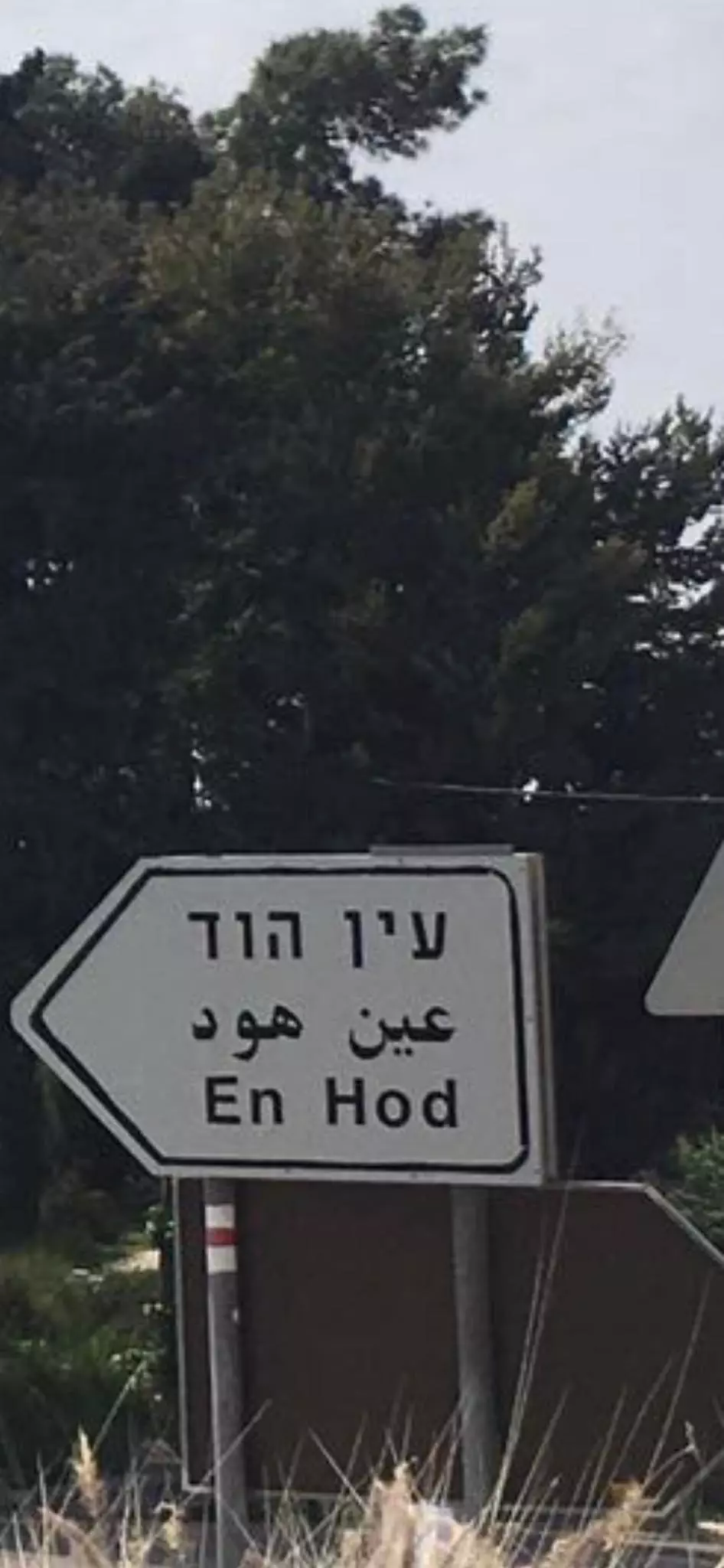
Welcome To 'Ayn Hawd - عين حوض (עין חוד)
|
District of Haifa
Ethnically cleansed days ago |
العربية Google Earth |
 |
Gallery (308) |
- Statistics & Facts
-
Before & After

- Satellite View
- Articles 27
- Pictures 308
- Aerial Views 1
- Oral History 2
- Members 40
- Families
- All That Remains
- Town's Map
- Wikipedia
- Videos 5
- Guest Book 267
- Links 1
| Statistic & Fact | Value | ||||||||||||||||
| Occupation Date | July 15, 1948 | ||||||||||||||||
| Distance From District | 14.5 (km) South of Haifa | ||||||||||||||||
| Elevation | 125 (meters) | ||||||||||||||||
| Before & After Nakba, Click Map For Details |
|||||||||||||||||
|
|||||||||||||||||
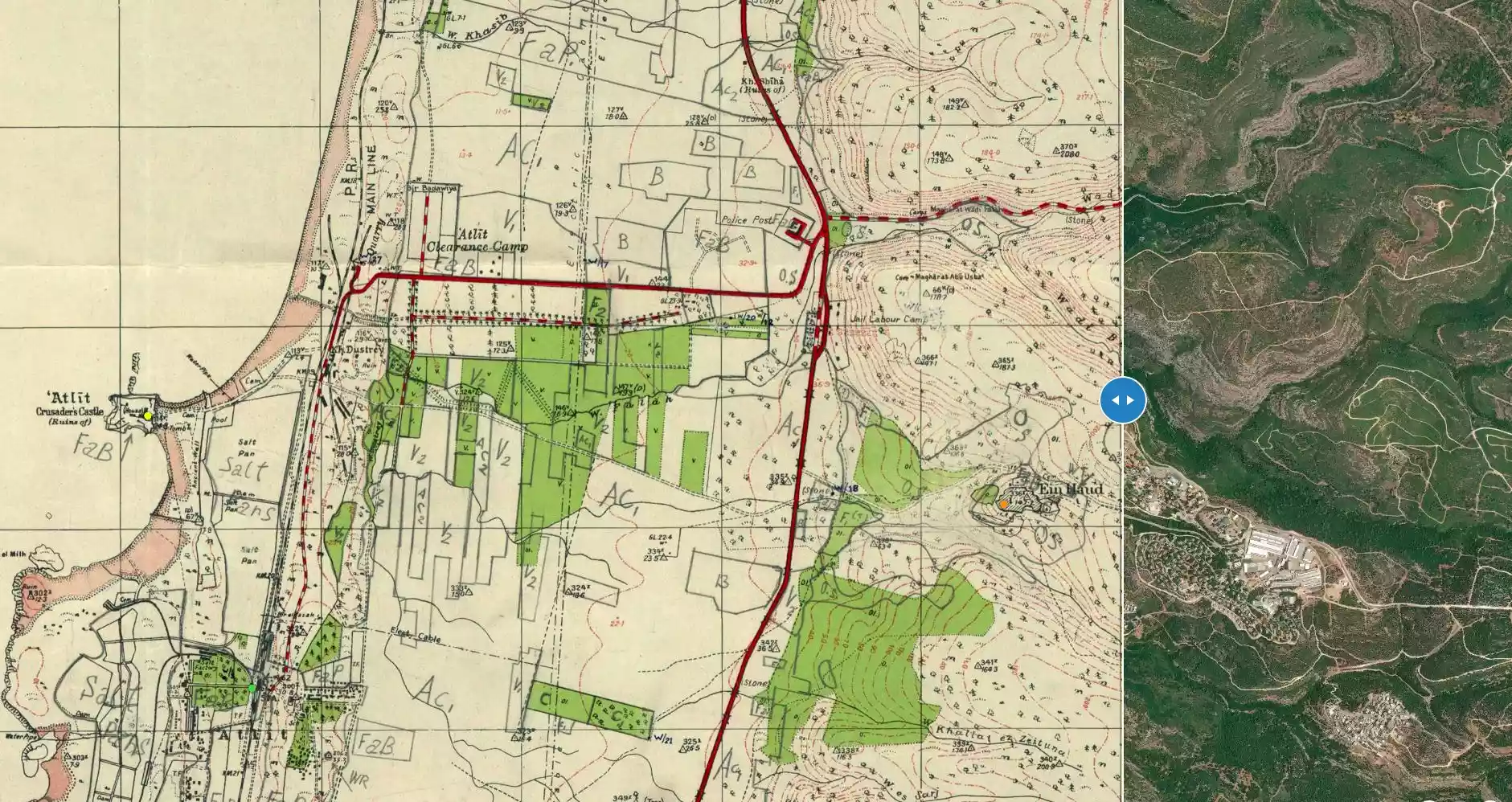
| Map Location | See location #10 on the map View from satellite |
||||||||||||||||
| Military Operation | Operation Shoter (Police) | ||||||||||||||||
| Attacking Units | A special force drawn from units of the Israeli Navy, Golani, Carmeli, and Alexandroni brigades | ||||||||||||||||
| Defenders | Local Arab militia, Arab Liberation Army volunteers, and some support from the Iraqi Army in Tulkarm | ||||||||||||||||
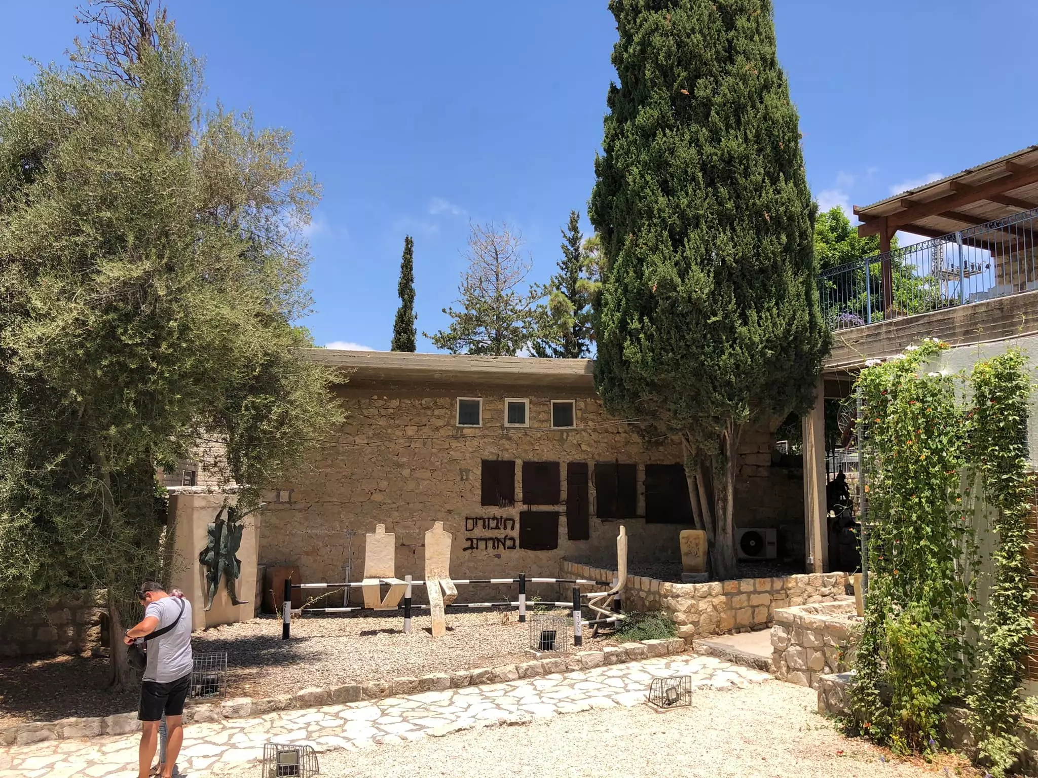
| Acts of Terror | Soon after occupation in September 1948, UN investigators stated that 130 villagers were unaccounted for. | ||||||||||||||||
| Refugees' Migration Routes | 'Ayn Hawd inhabitants were mostly expelled eastward to Jinin (West Bank). On the other hand, few people were allowed to stay behind. | ||||||||||||||||
| Exodus Cause | Influence of fall of, or exoduce from, neighboring town | ||||||||||||||||
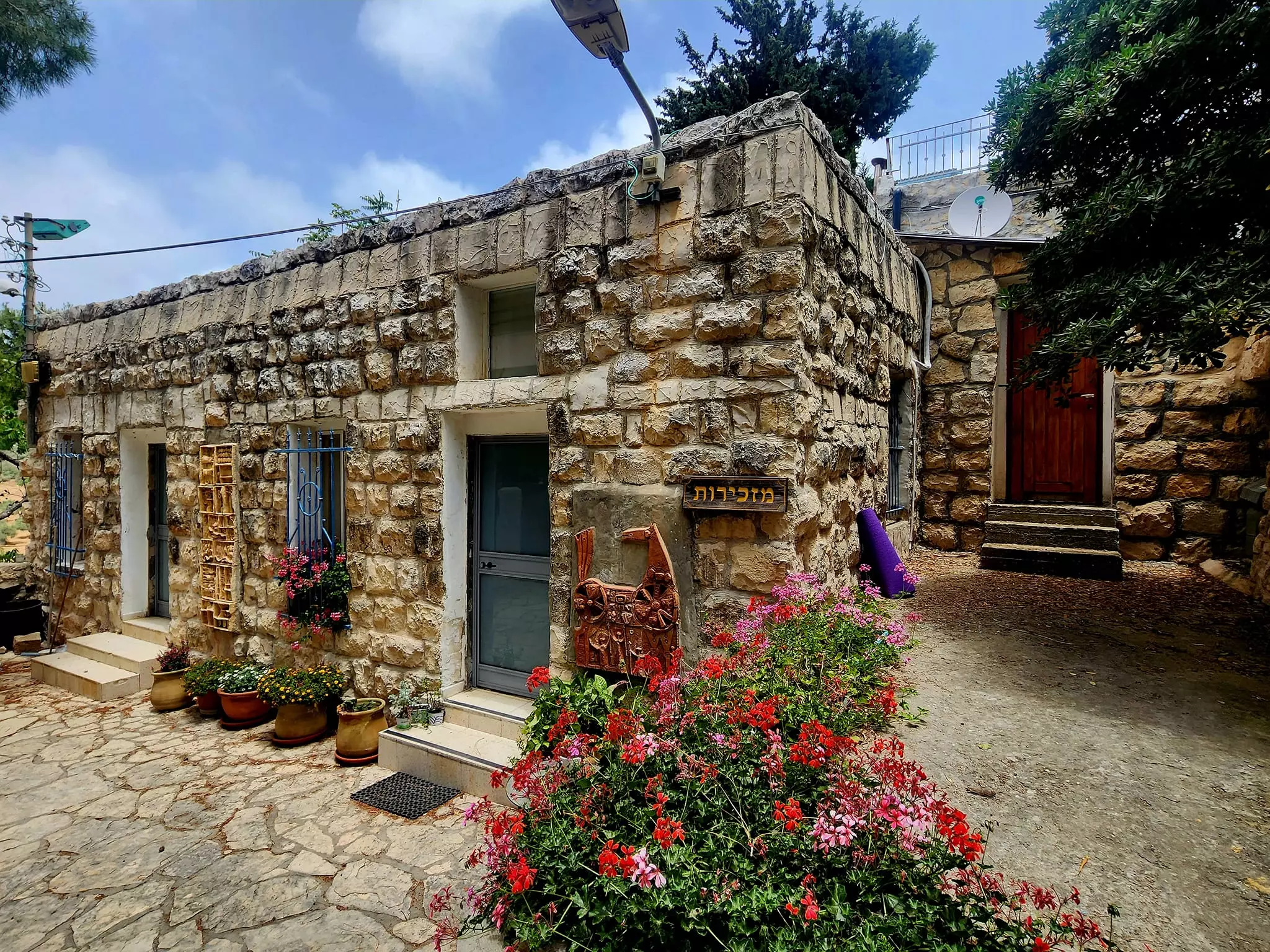
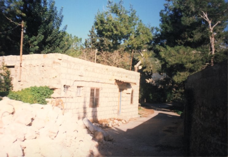
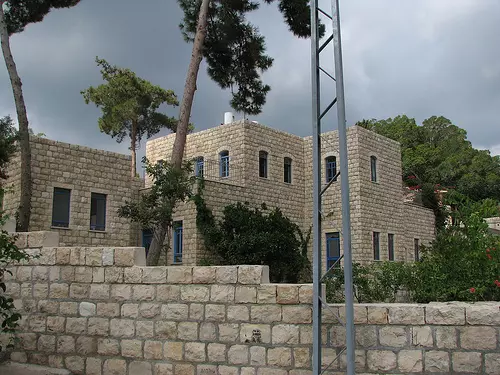
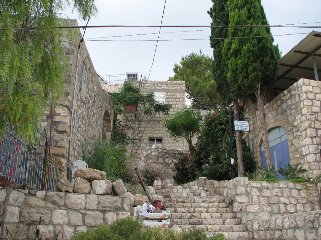
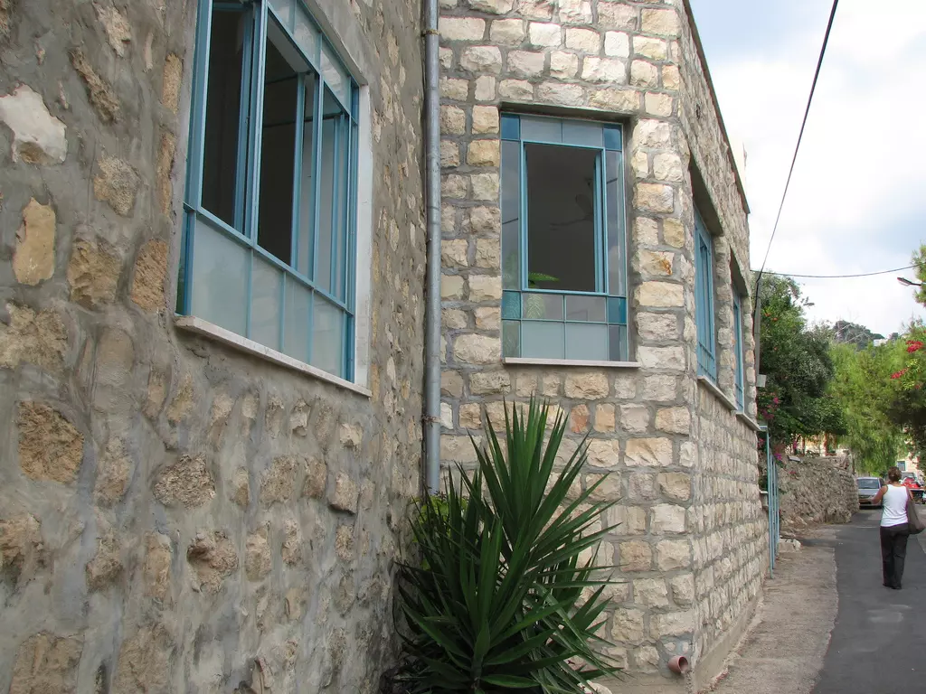
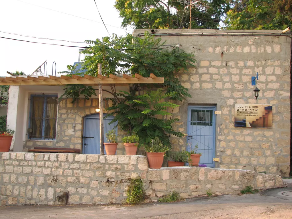
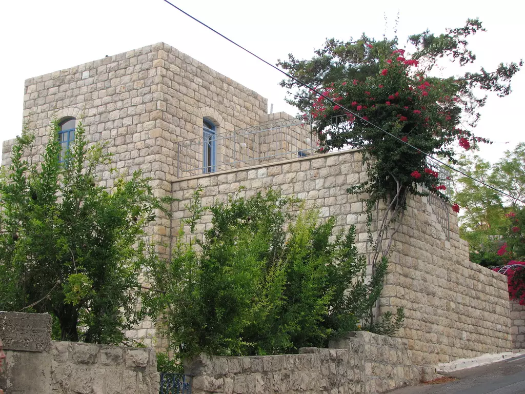
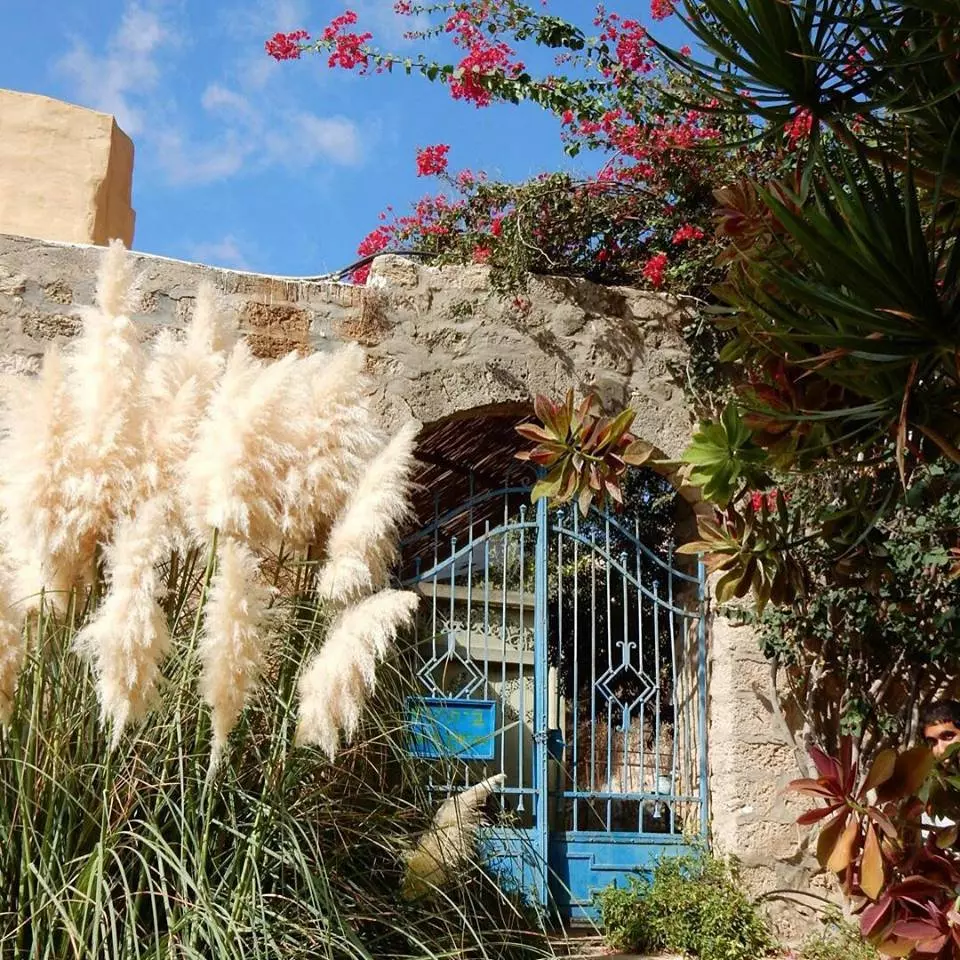
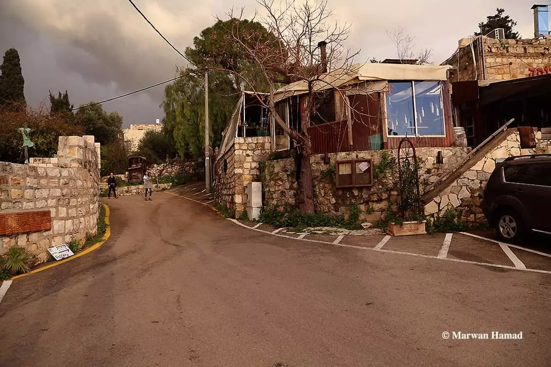
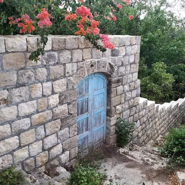
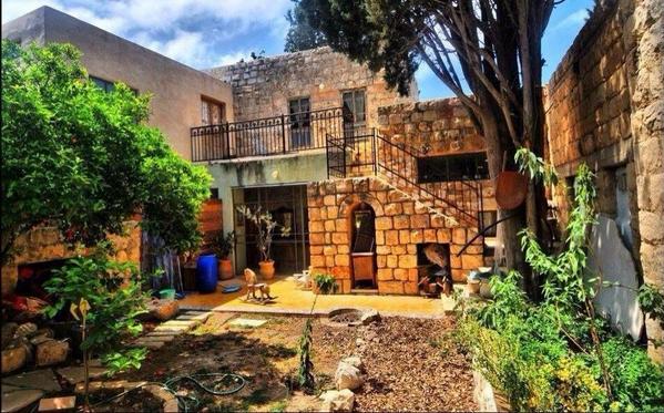
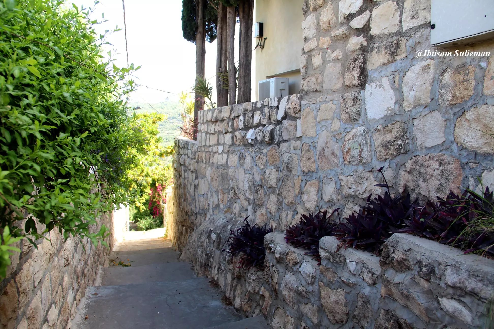
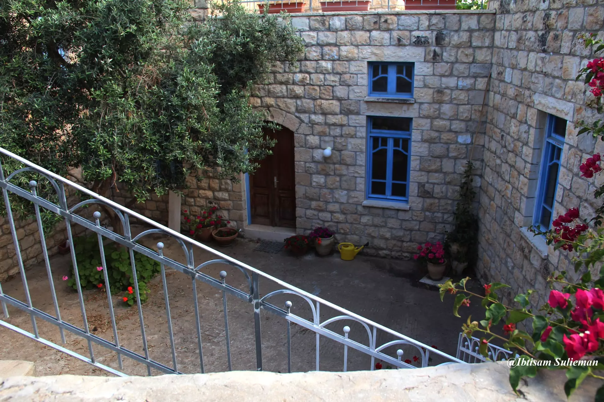
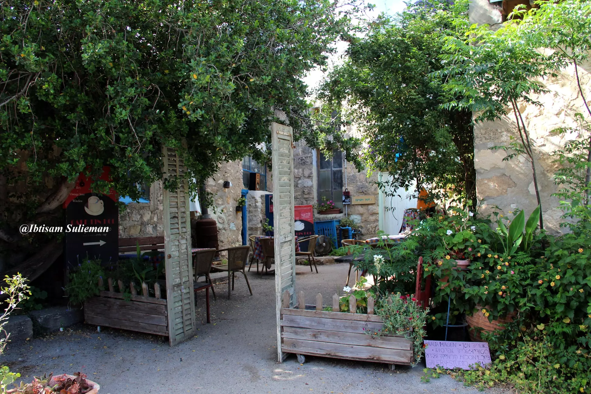
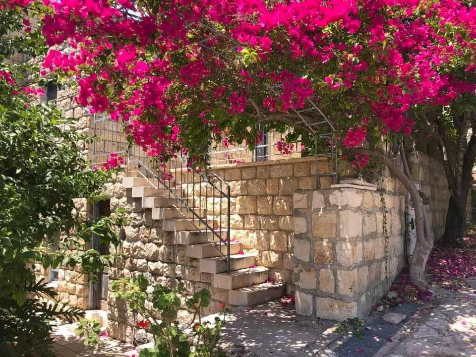
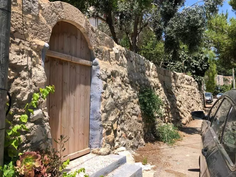
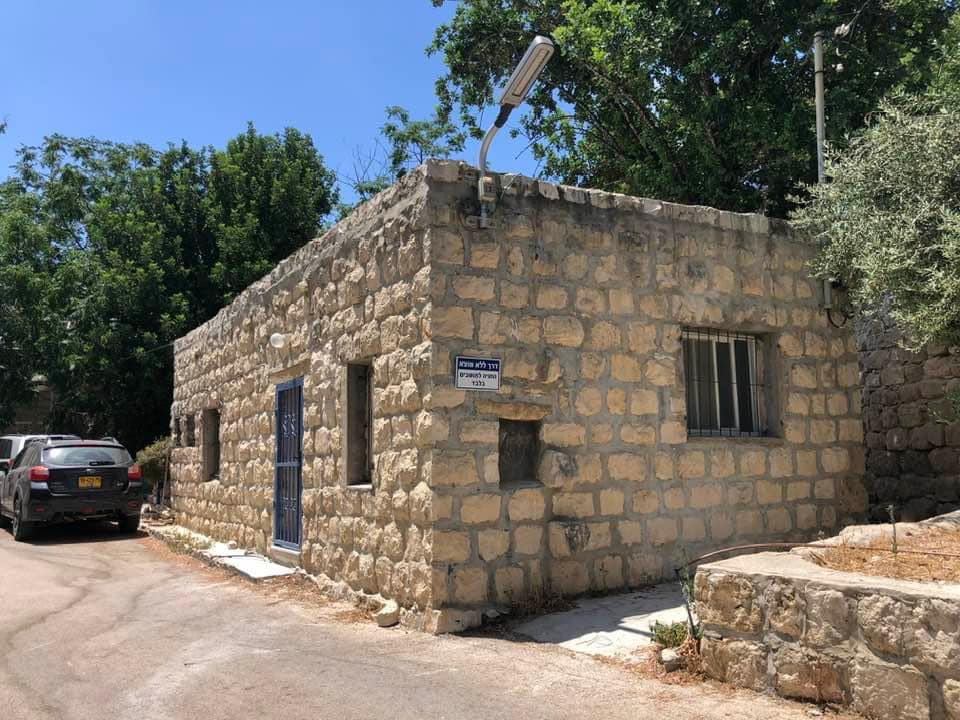
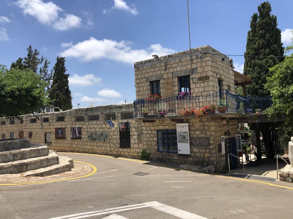
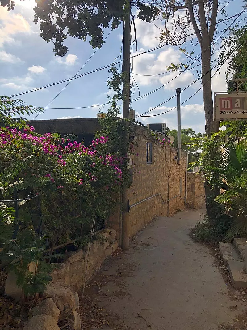
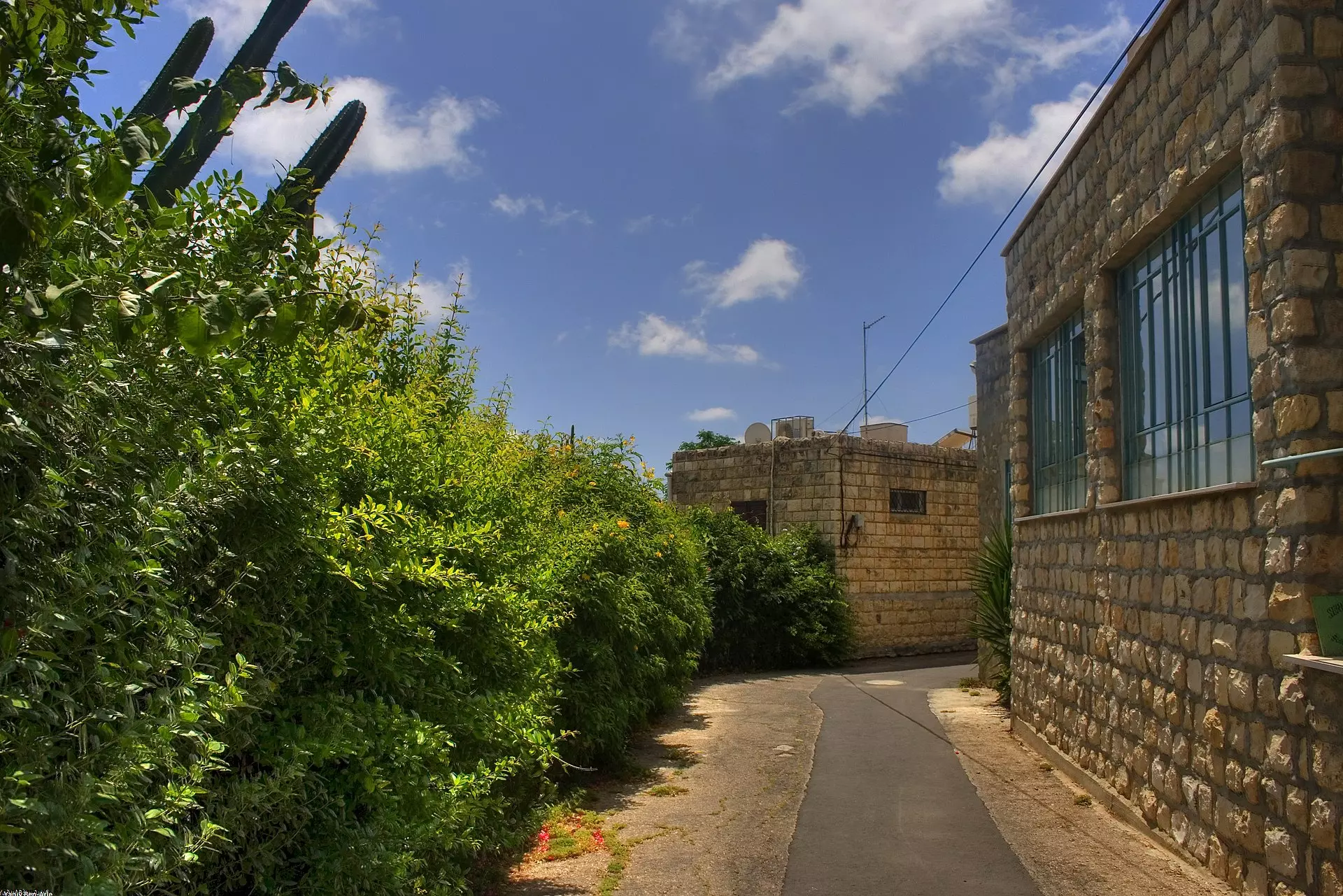
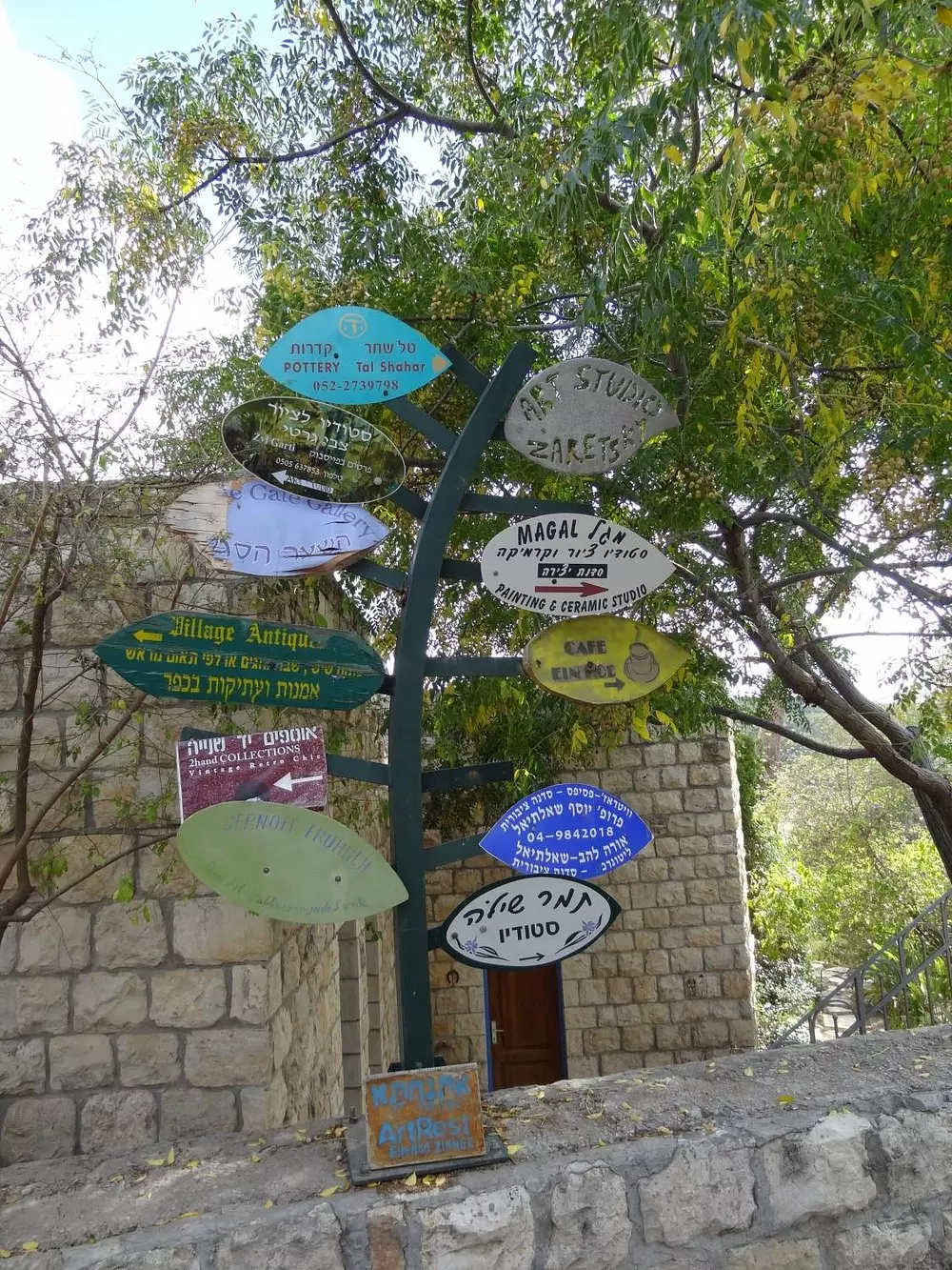
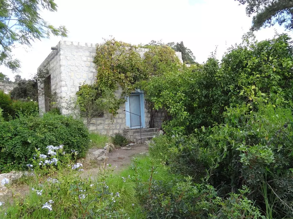
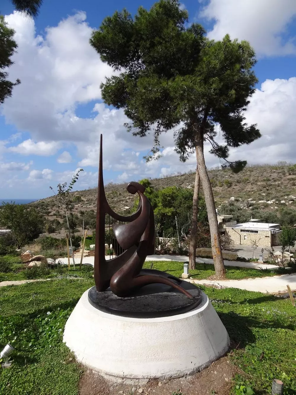
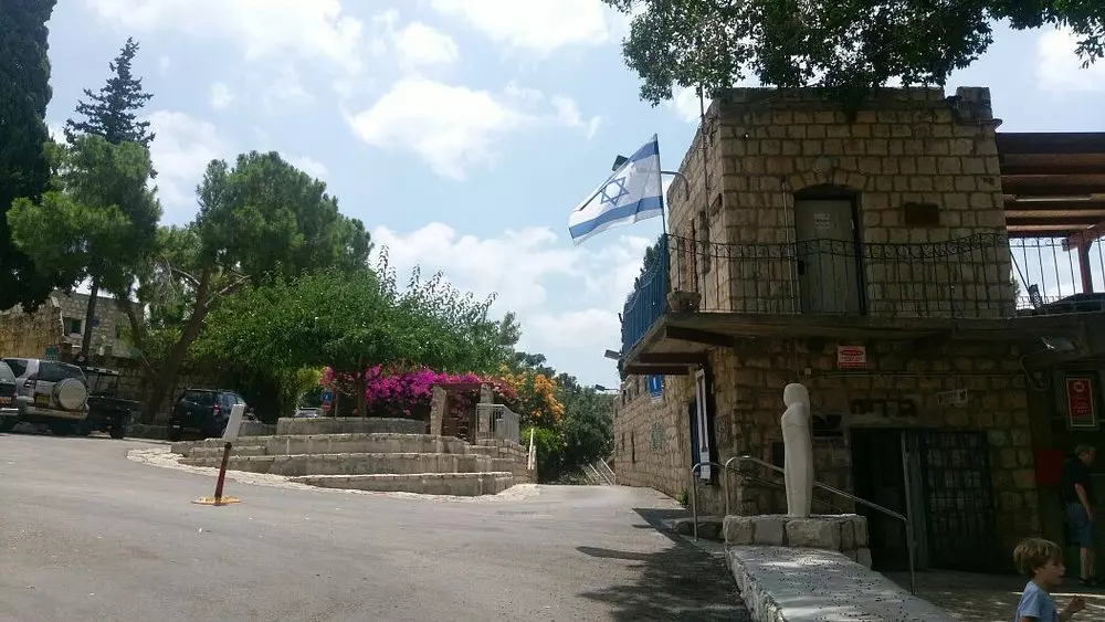
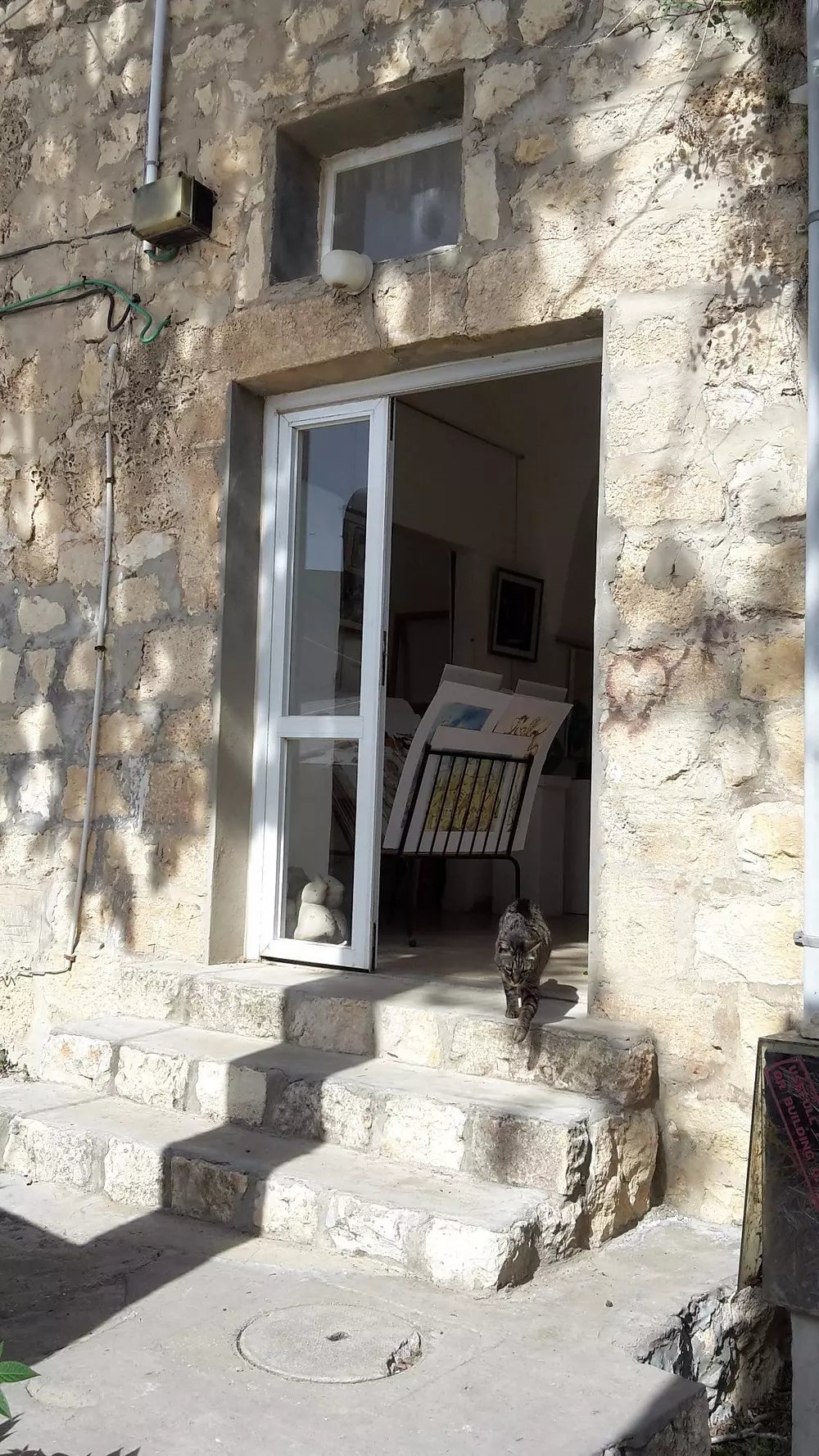
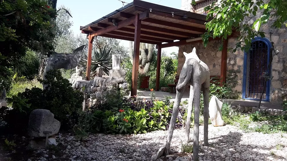
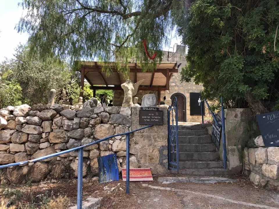
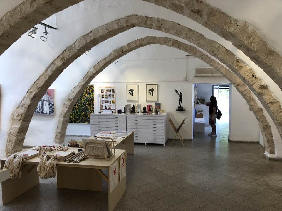
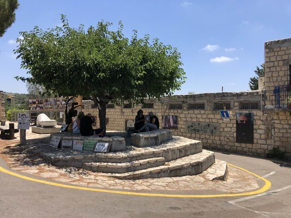
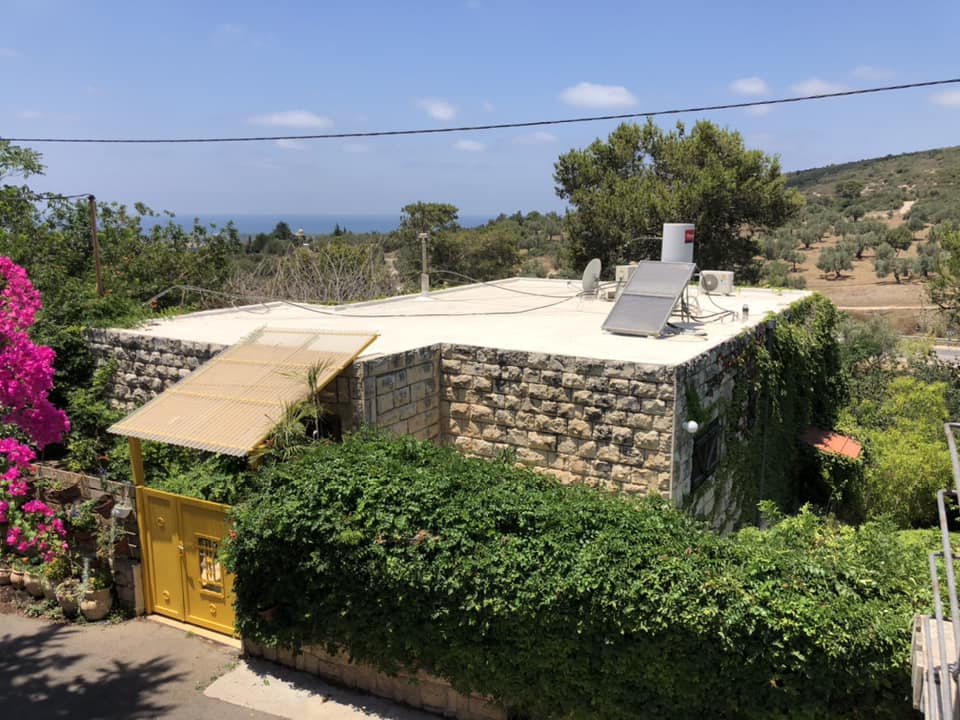
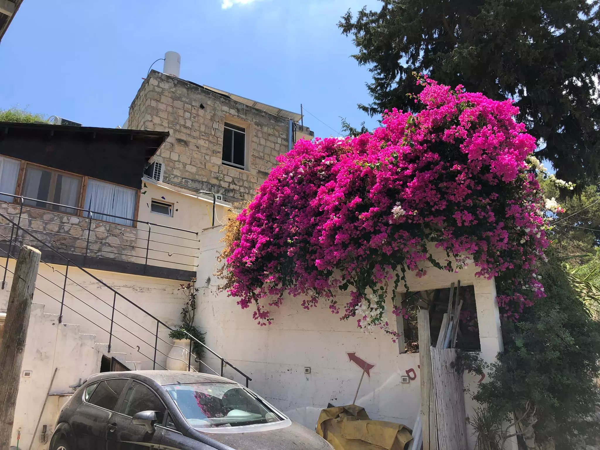
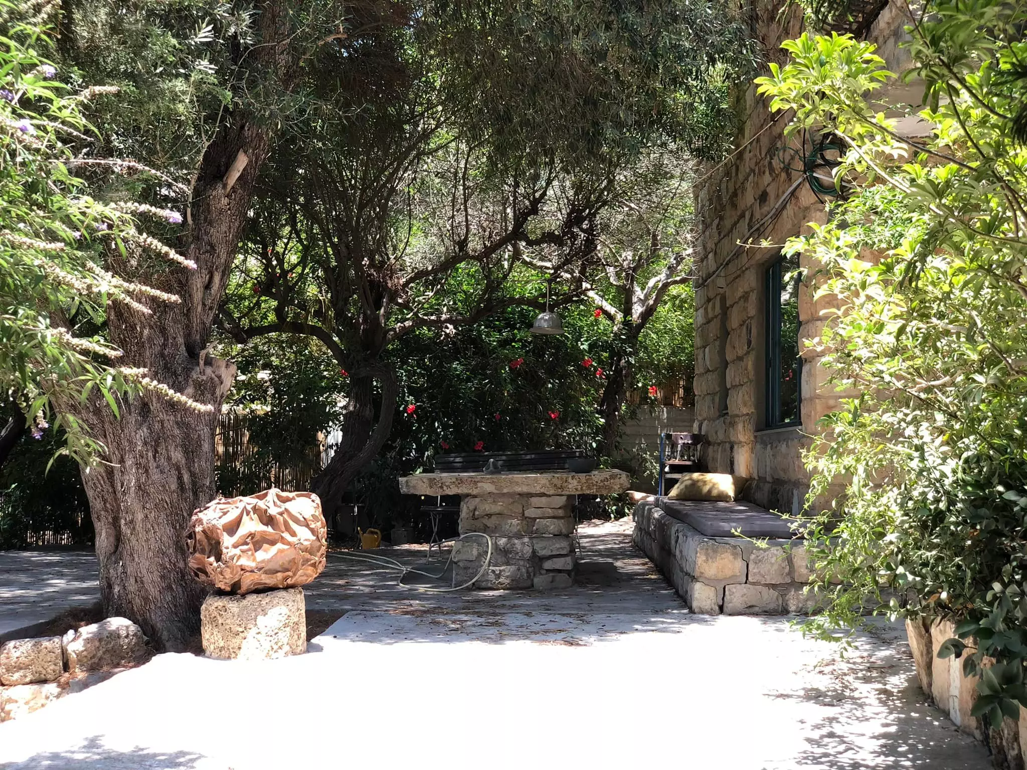
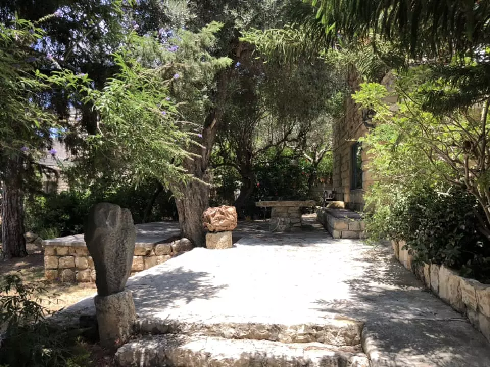
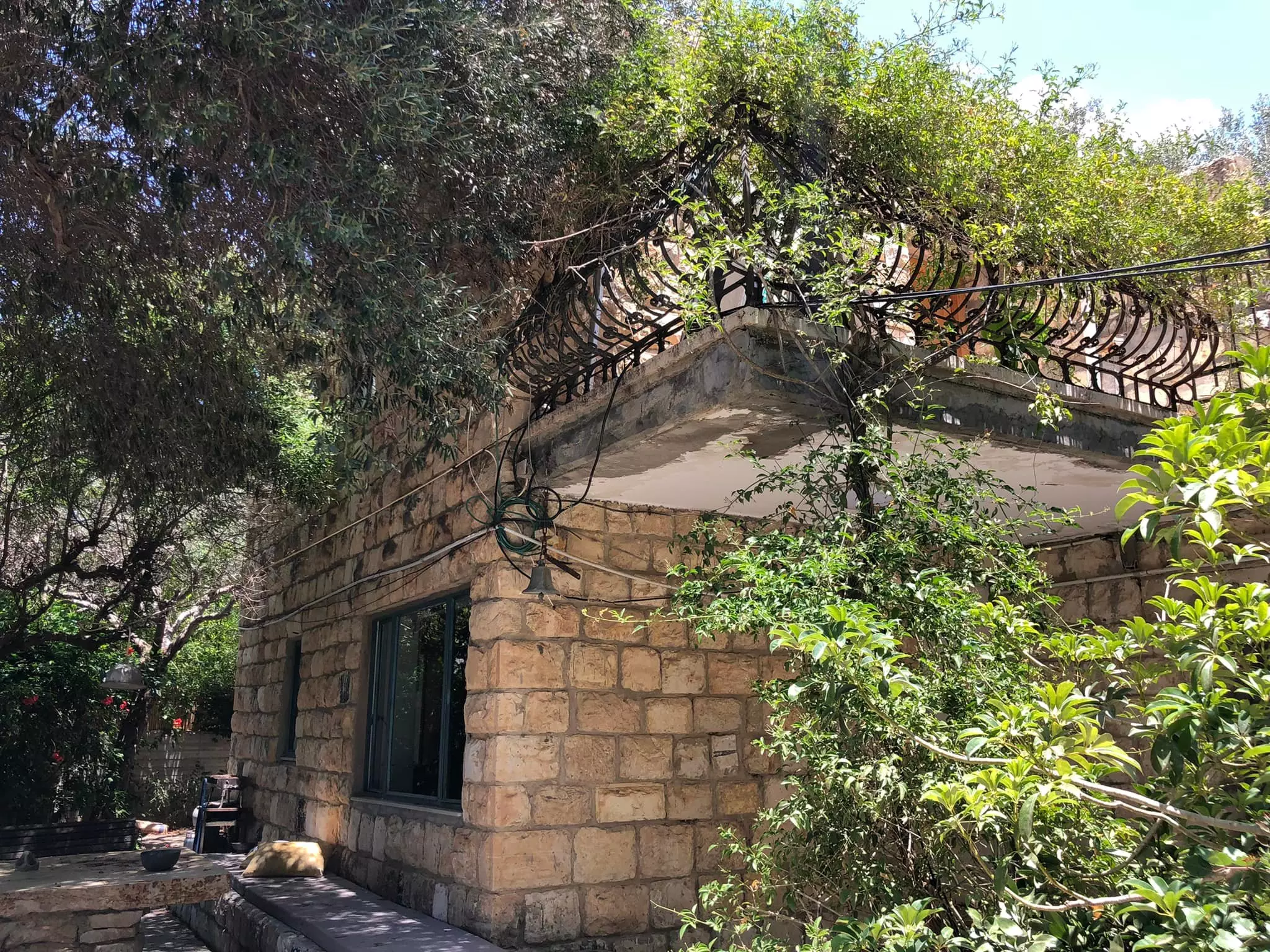
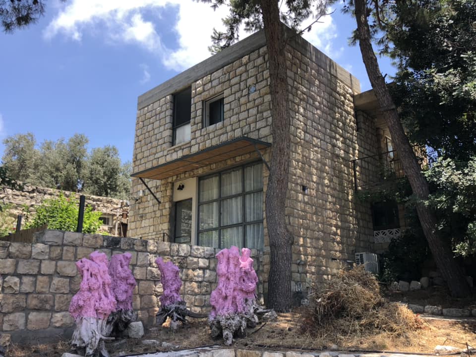
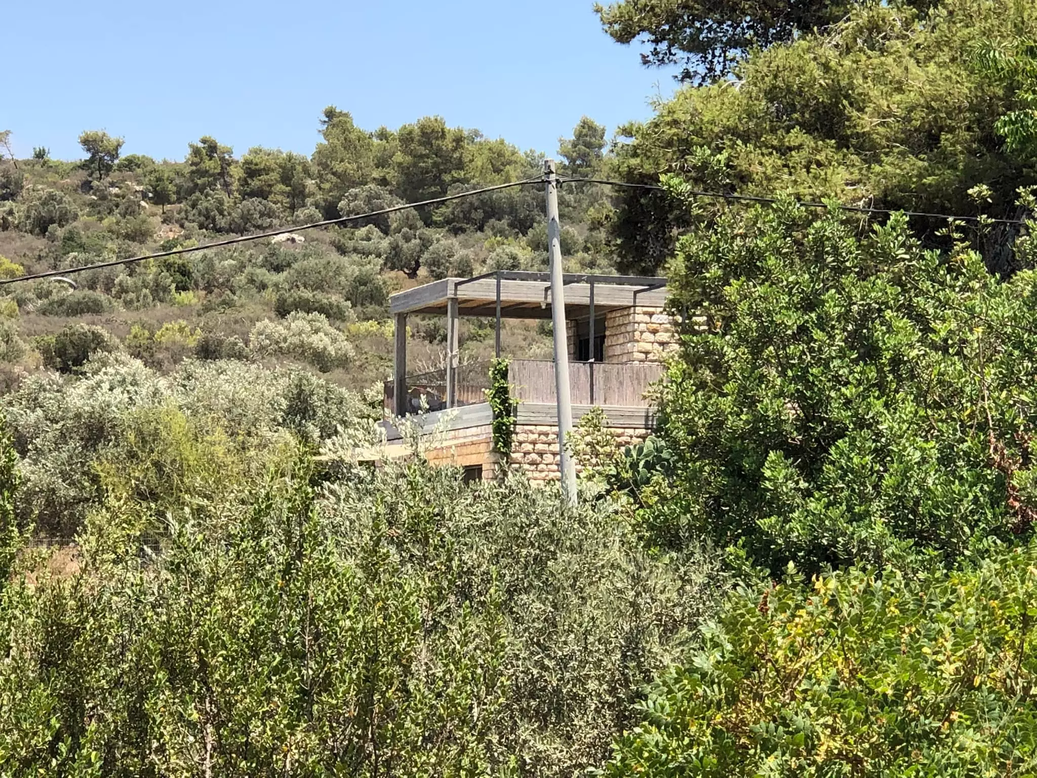
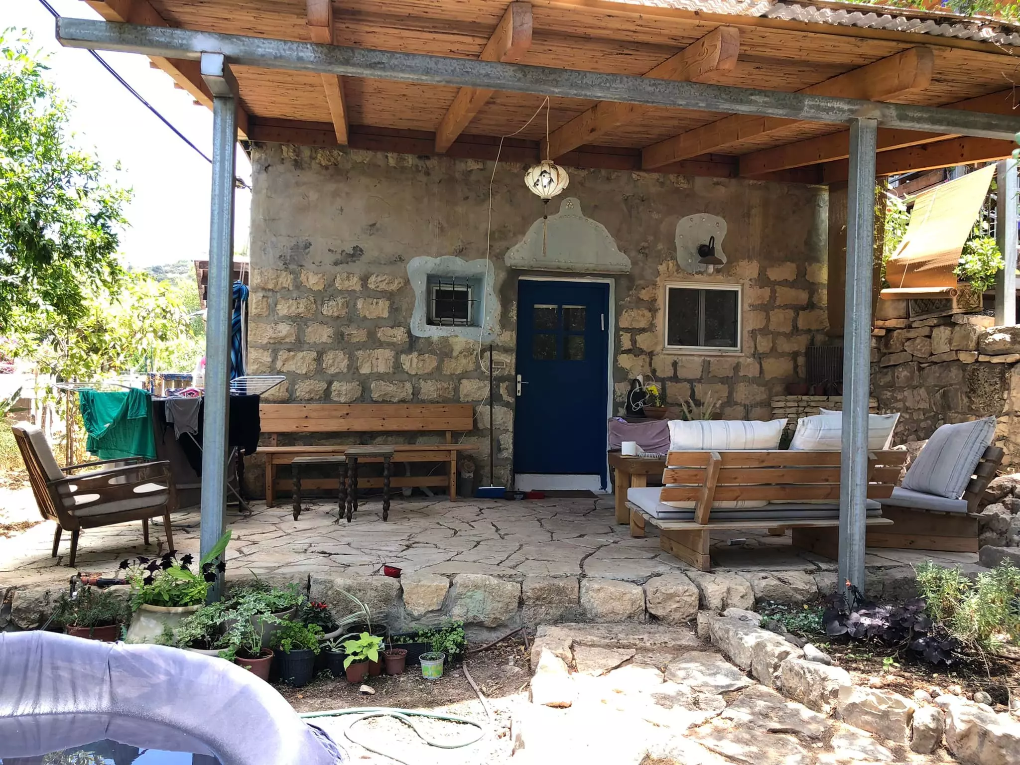
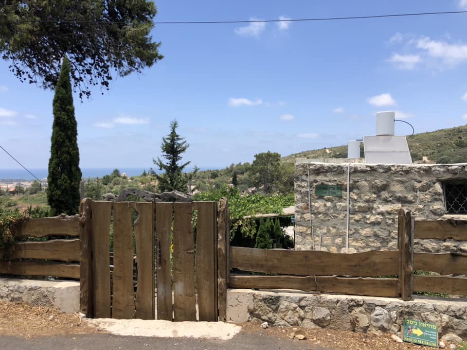
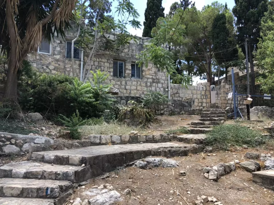
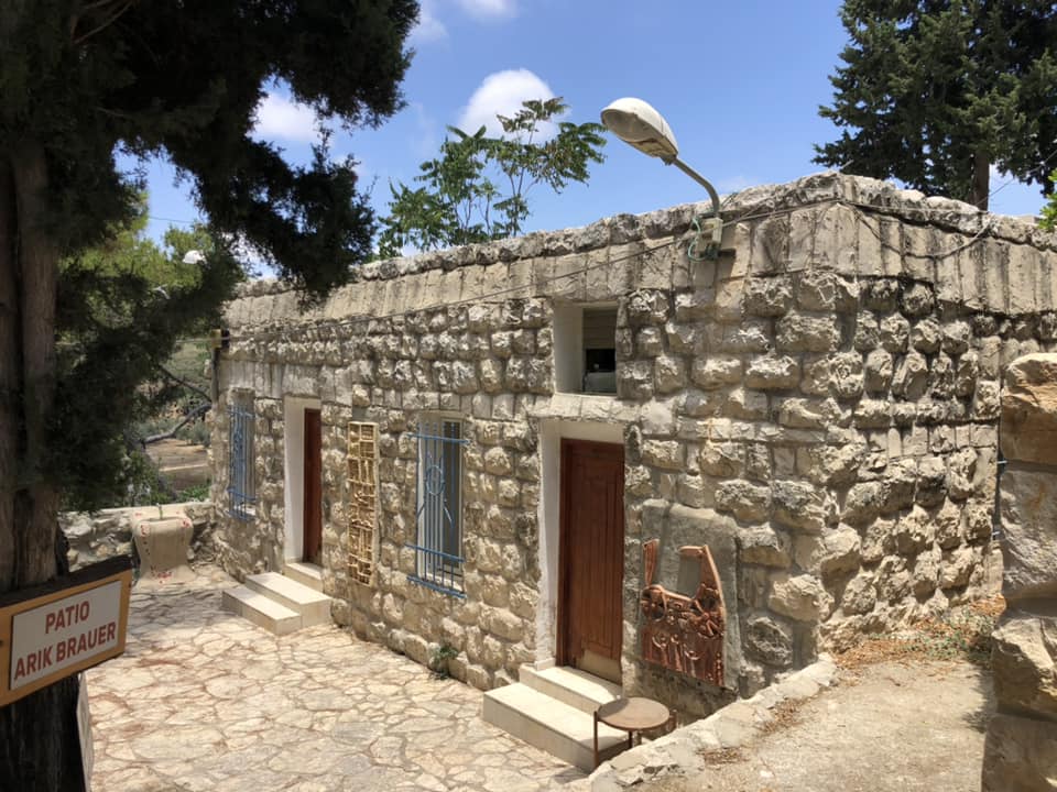
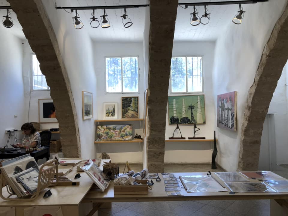
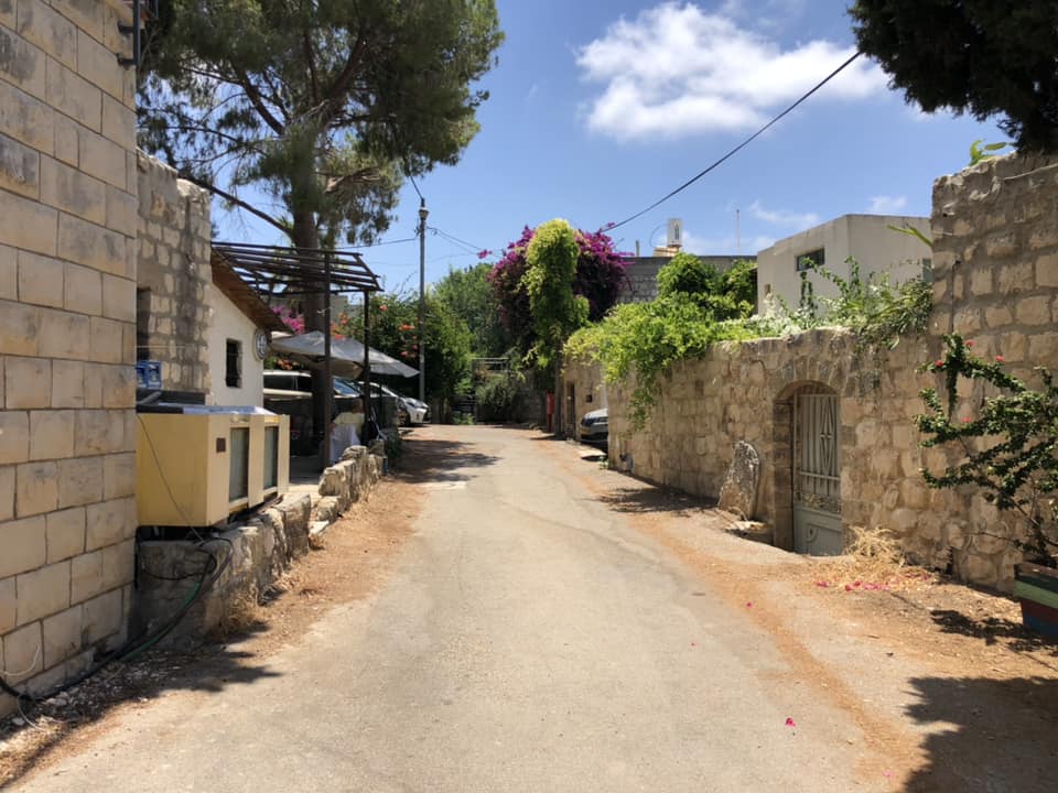
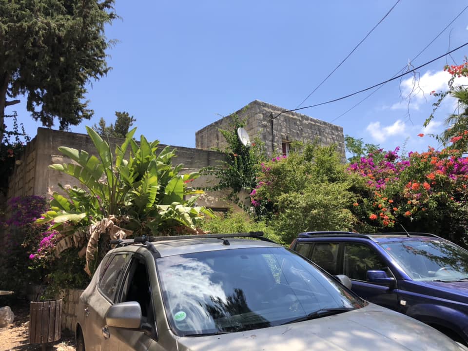
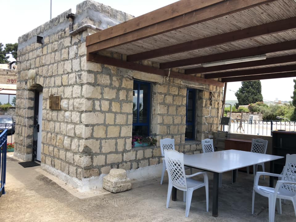
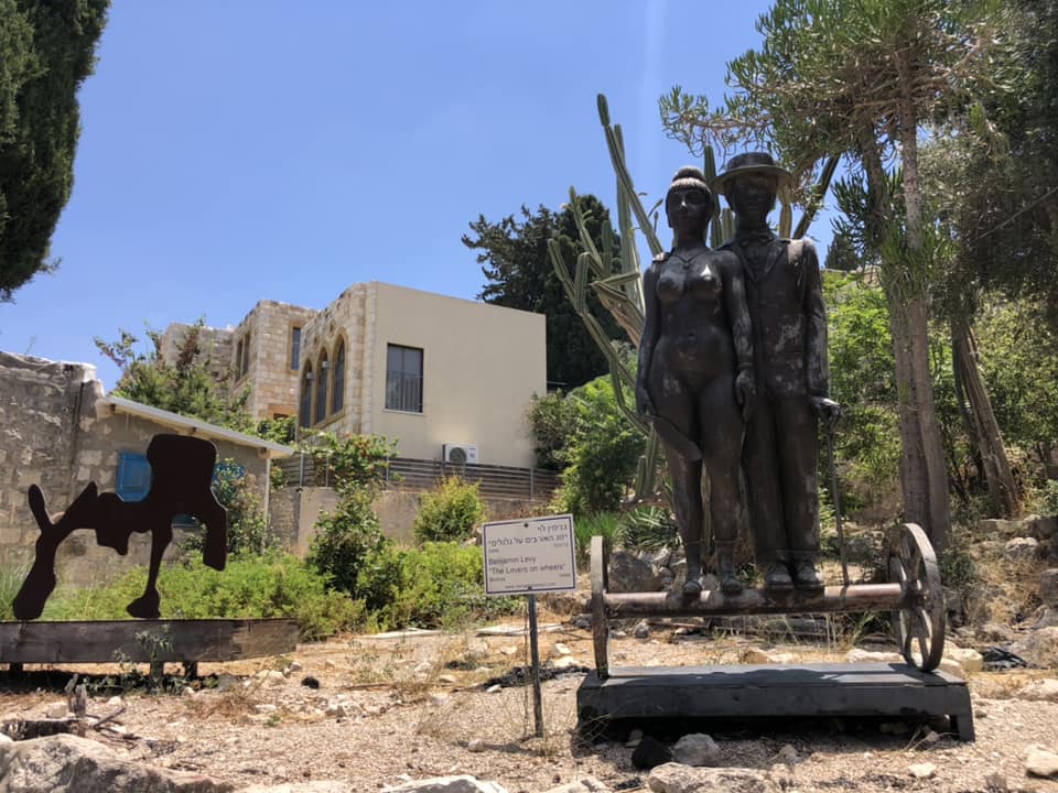
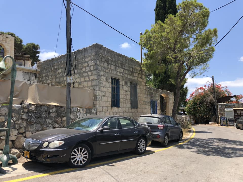
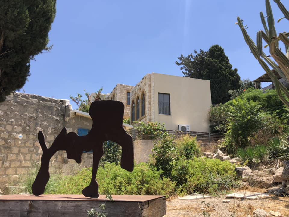
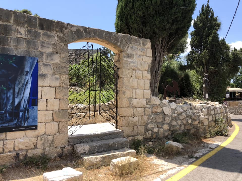
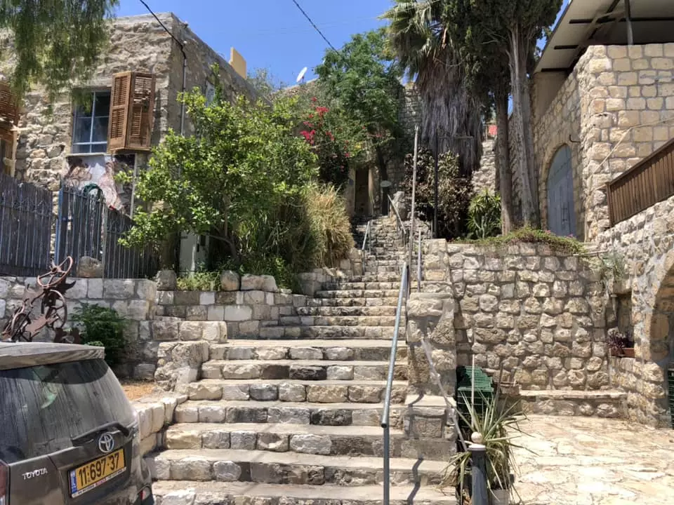
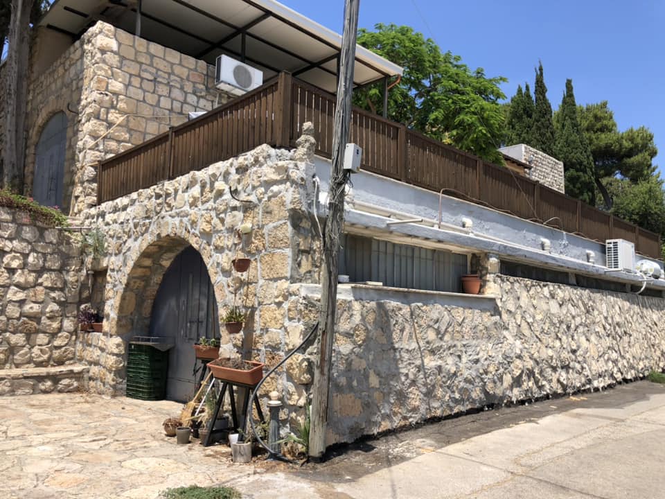
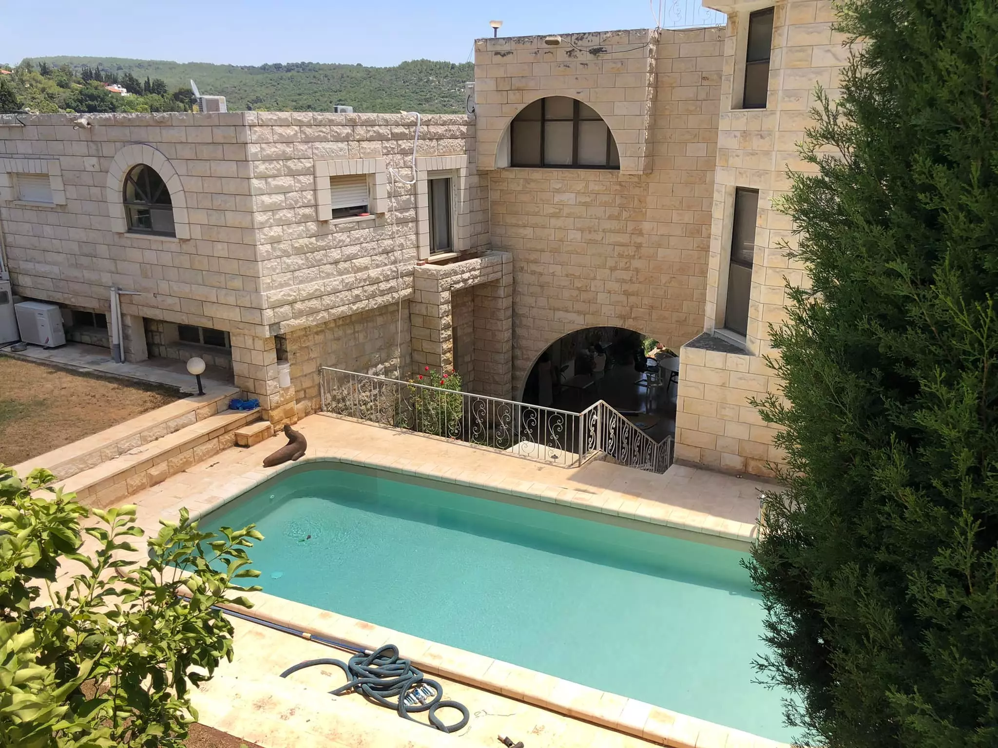
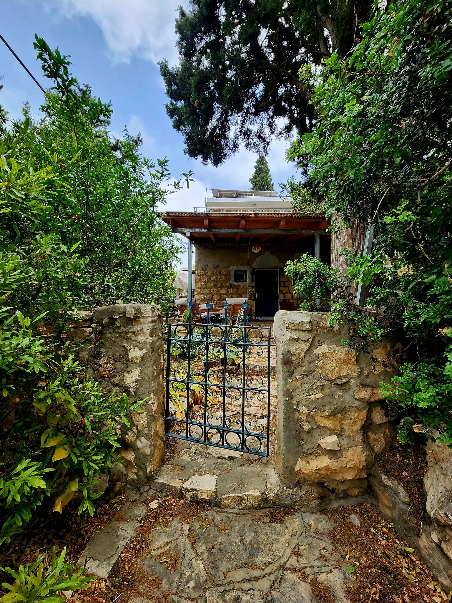
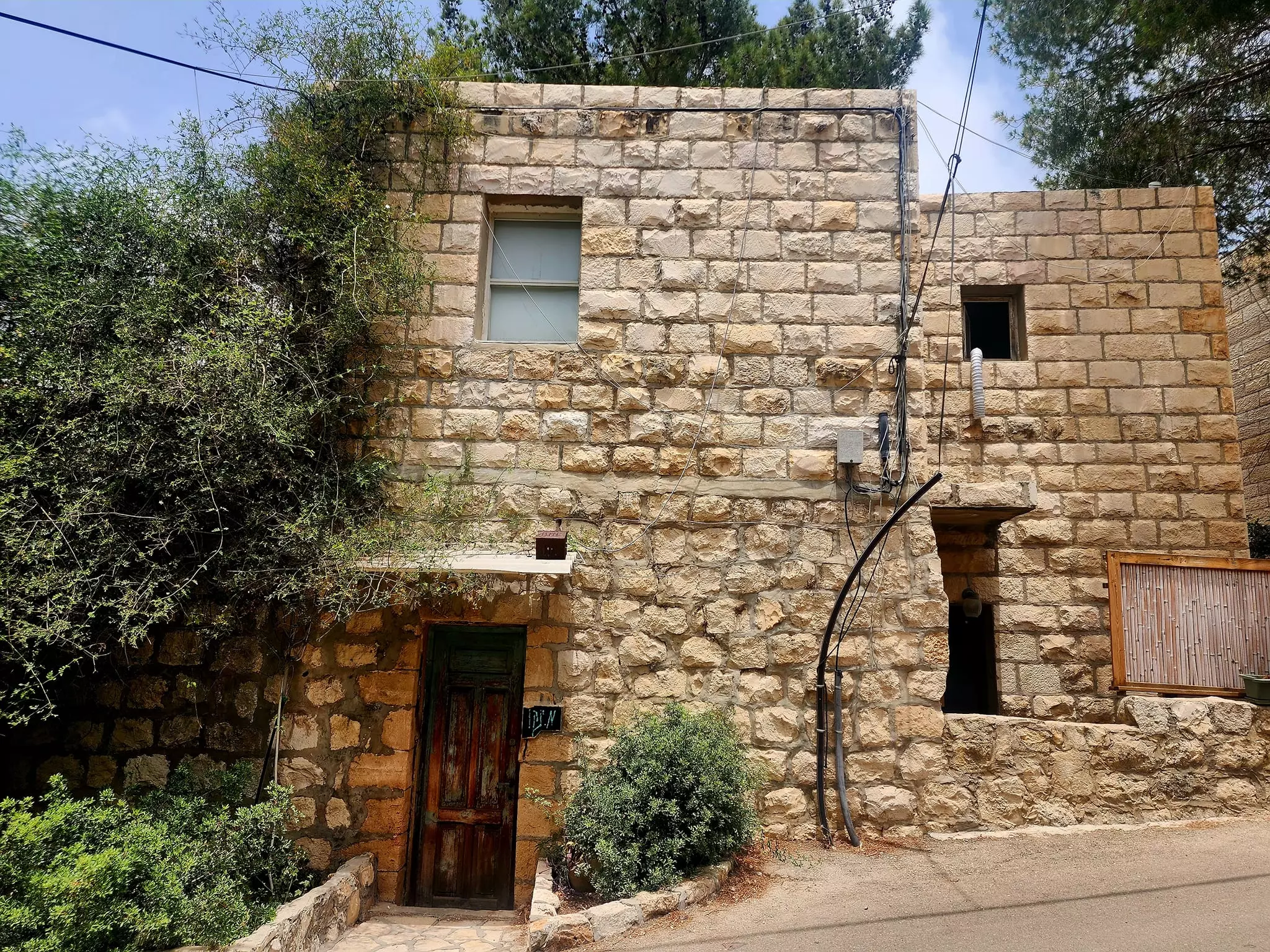
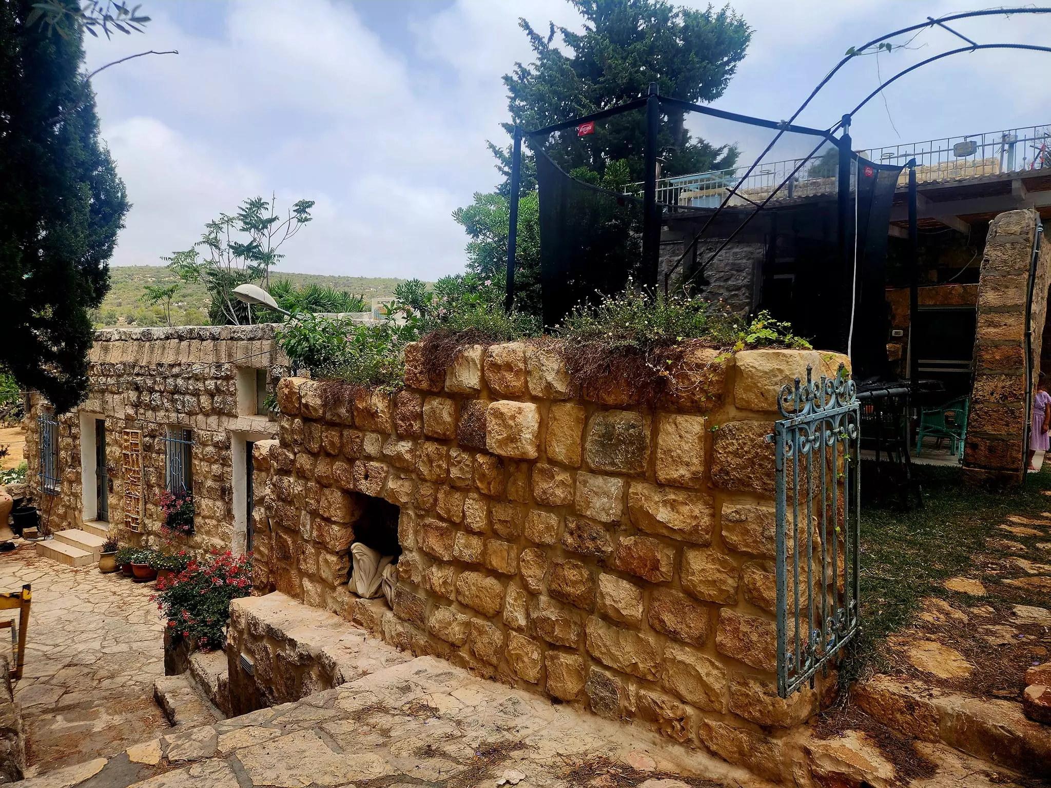
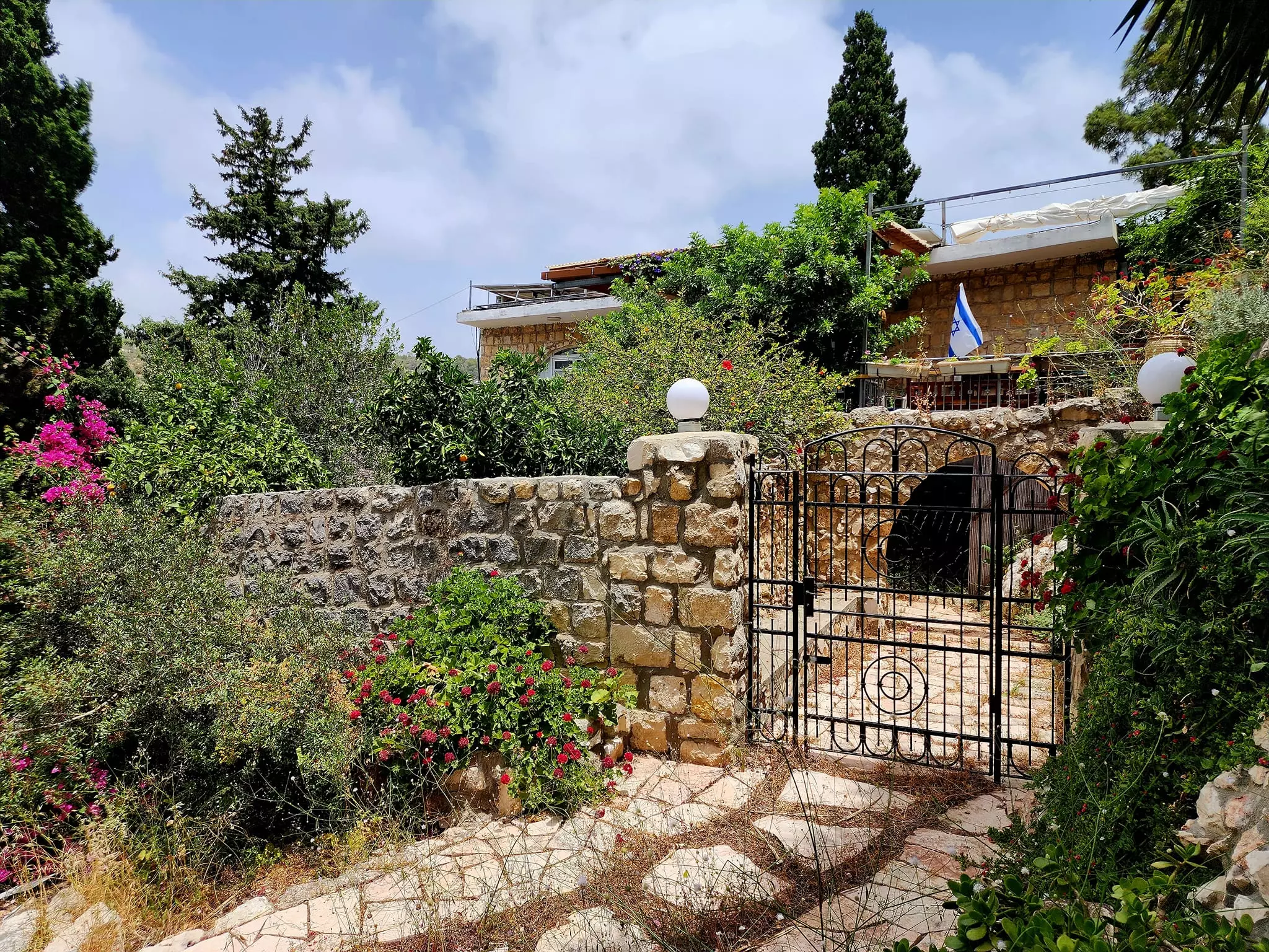
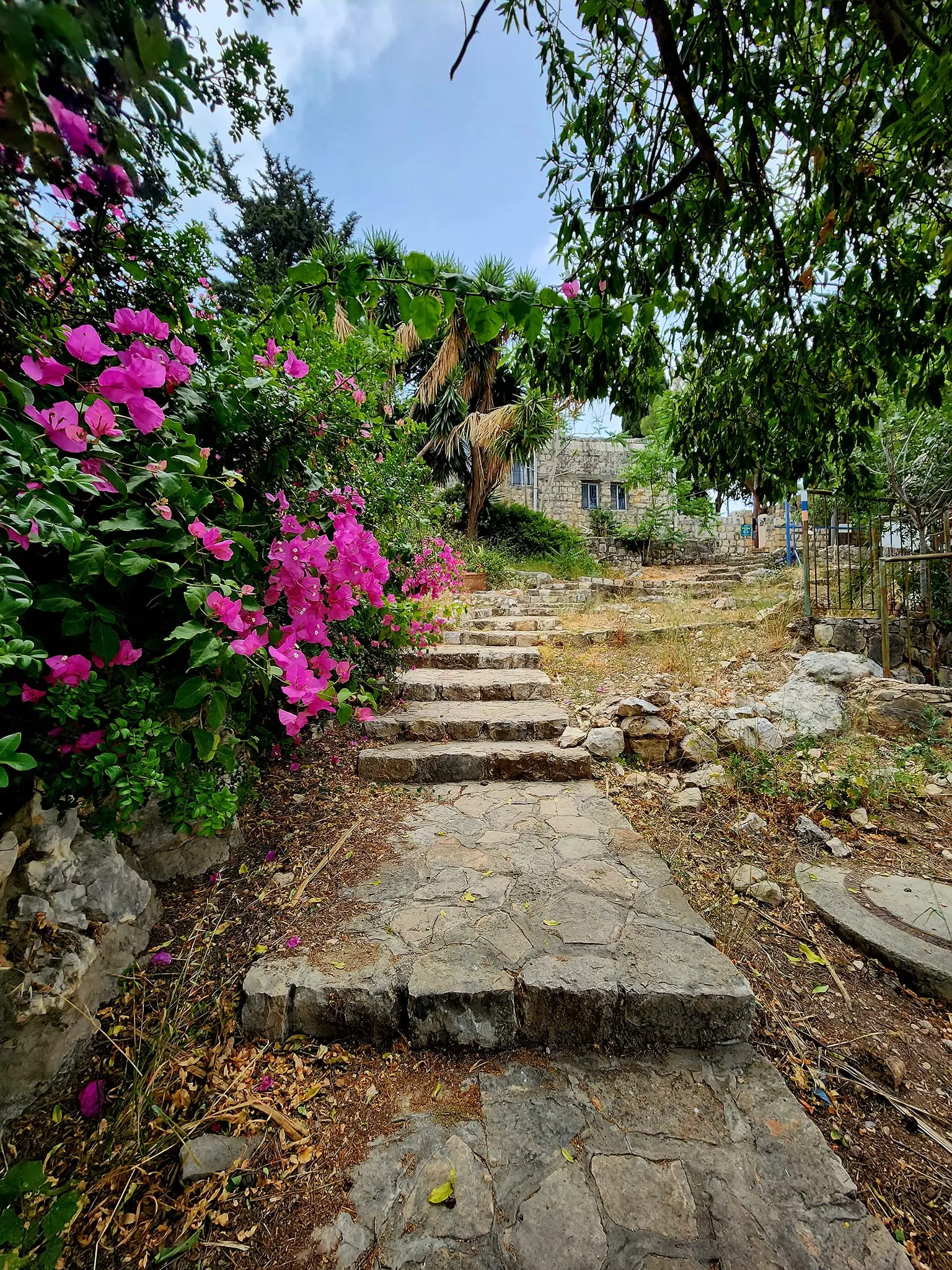
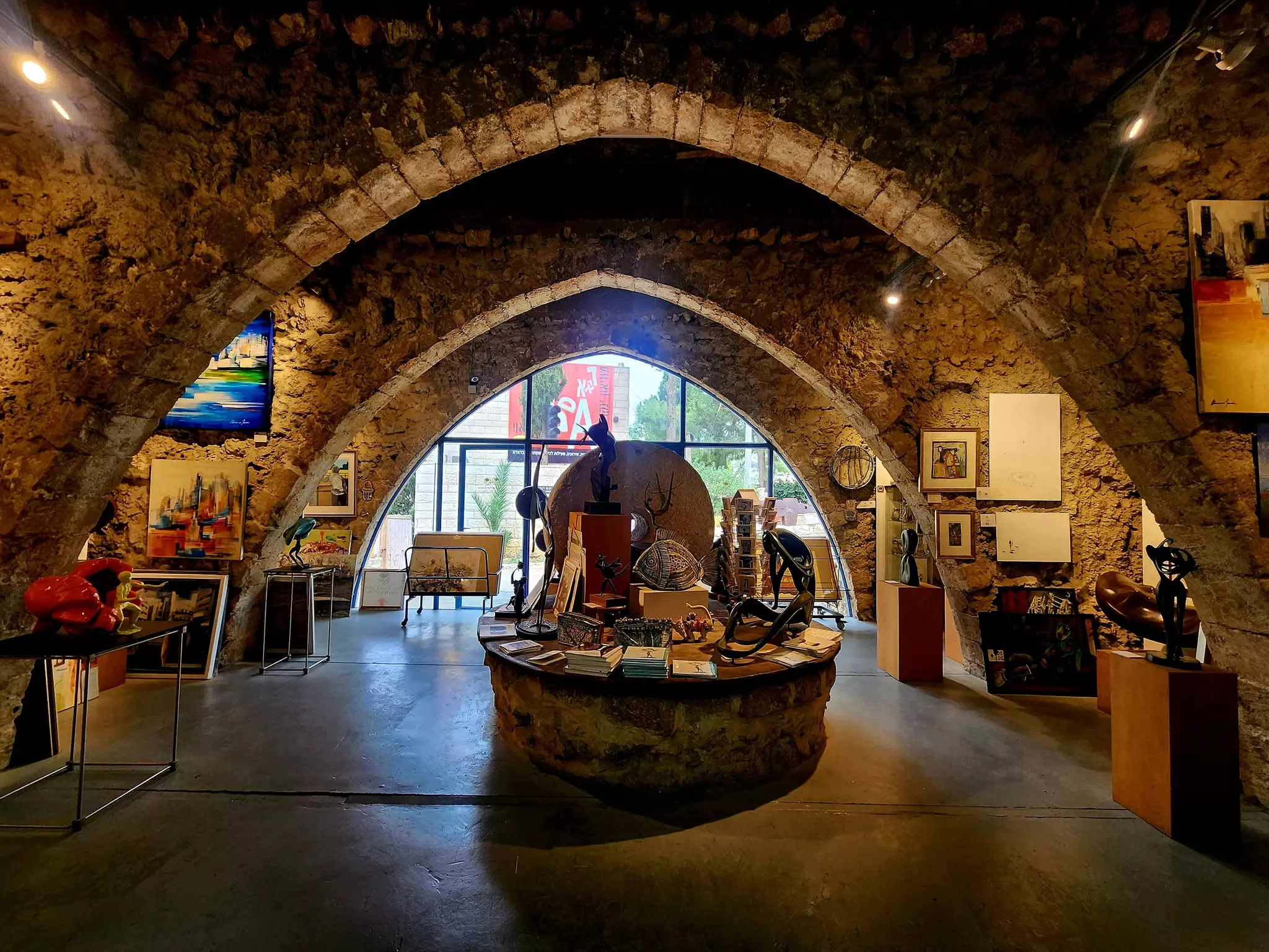
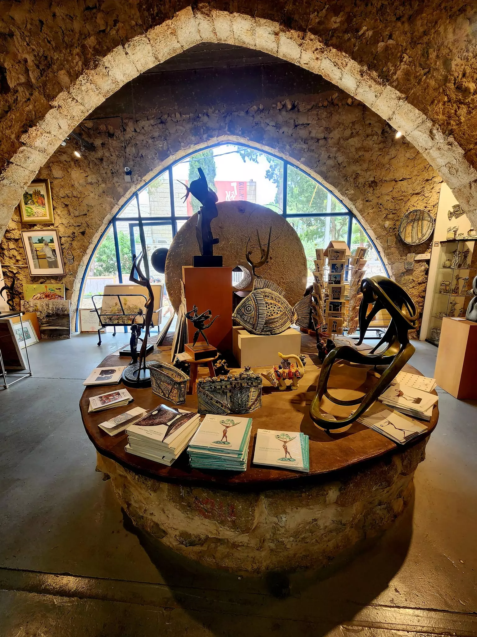
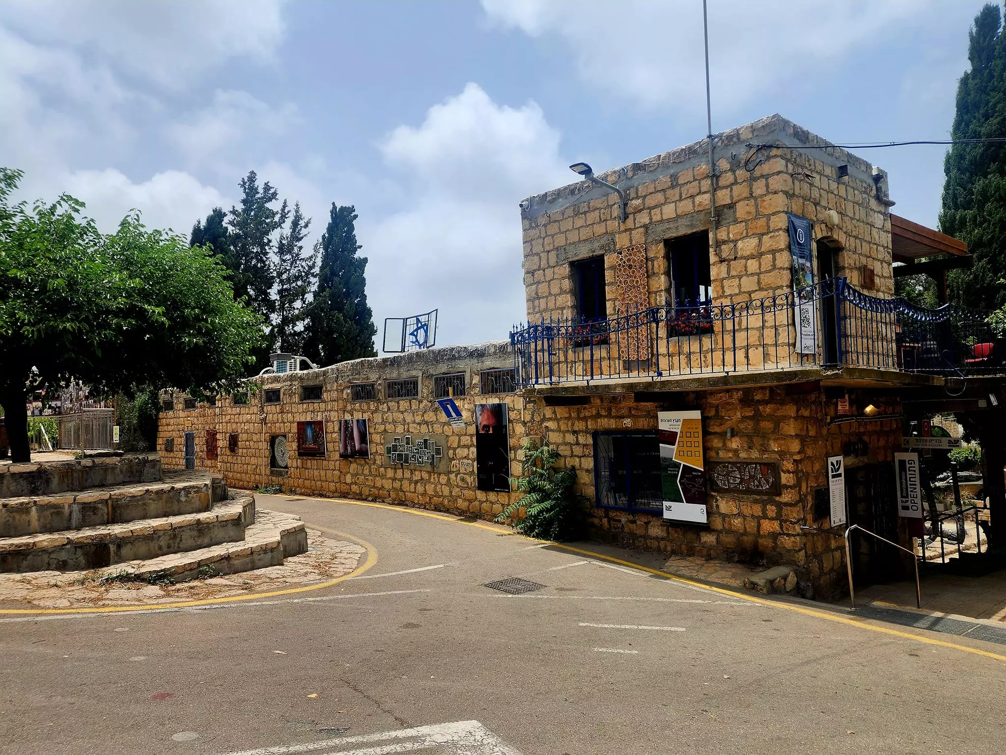
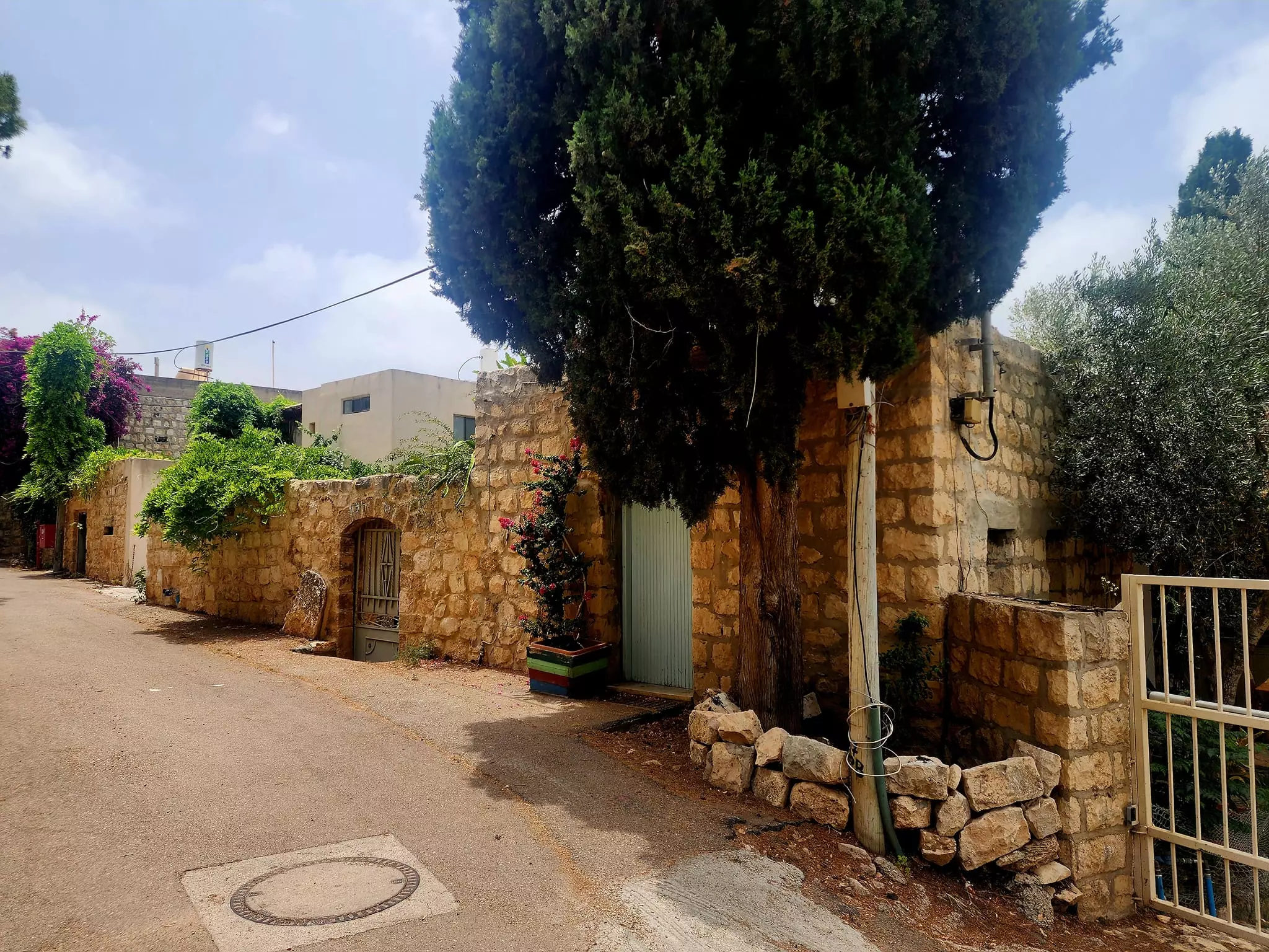
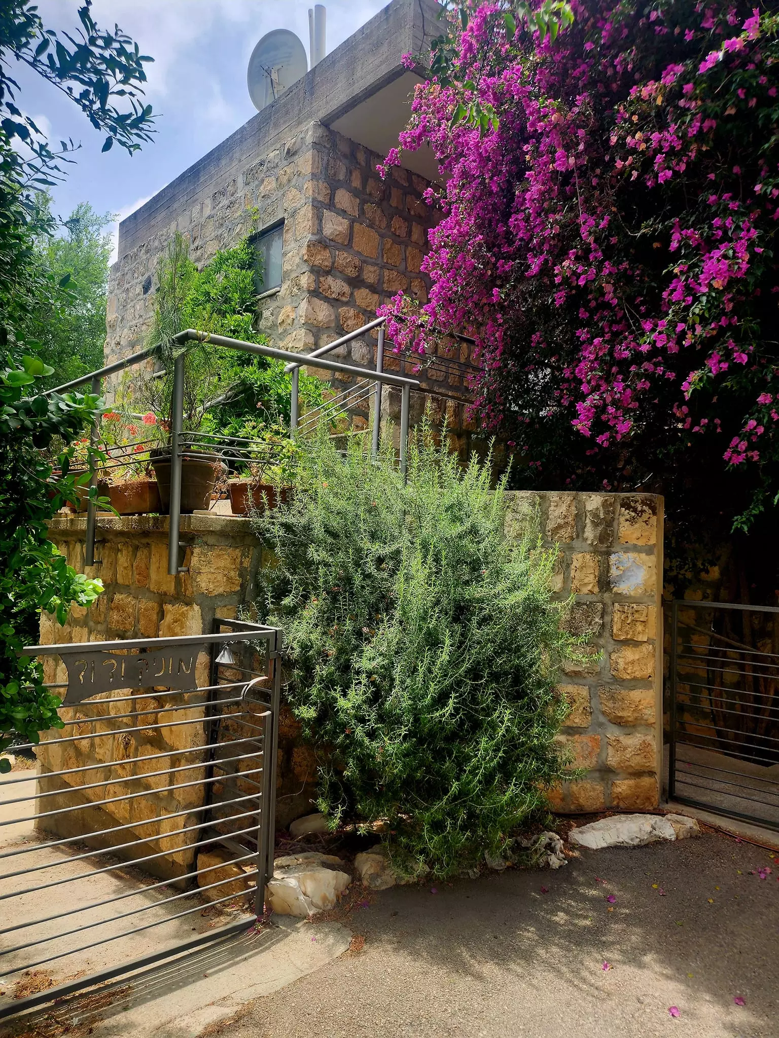
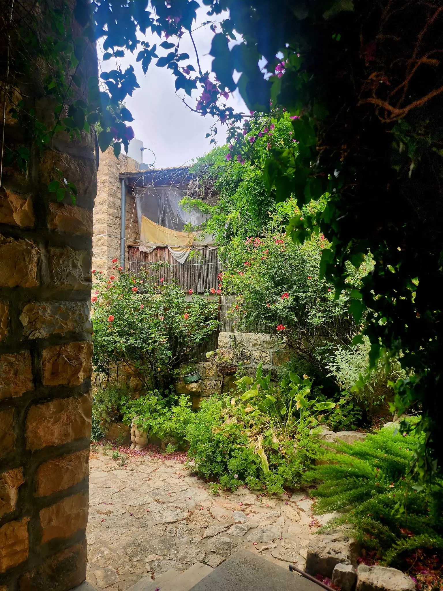
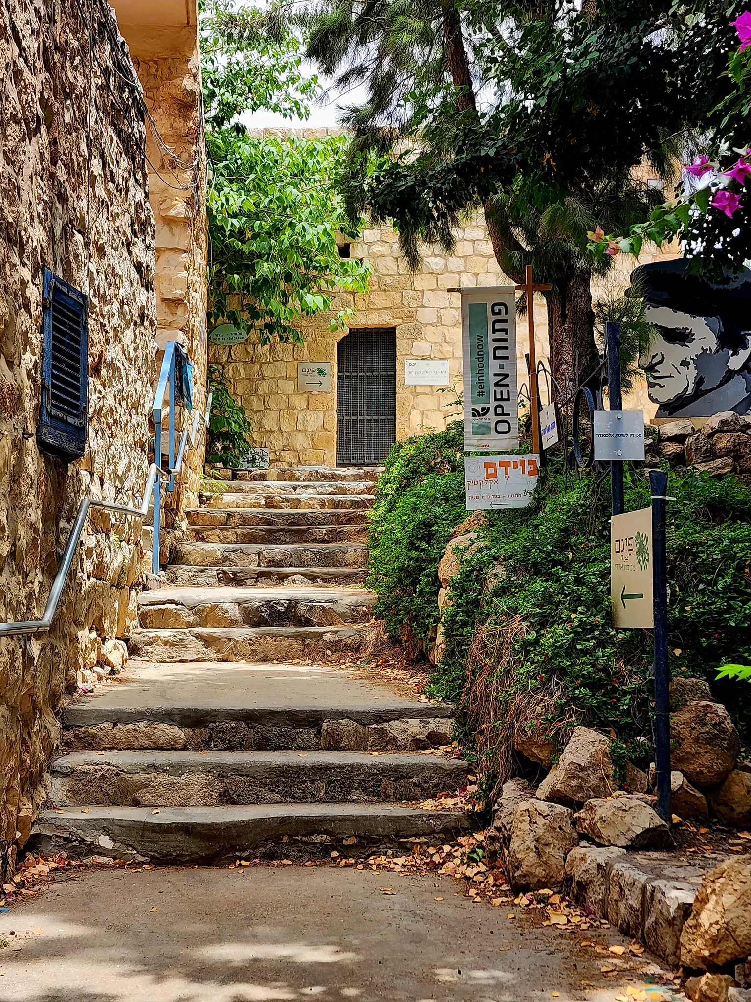
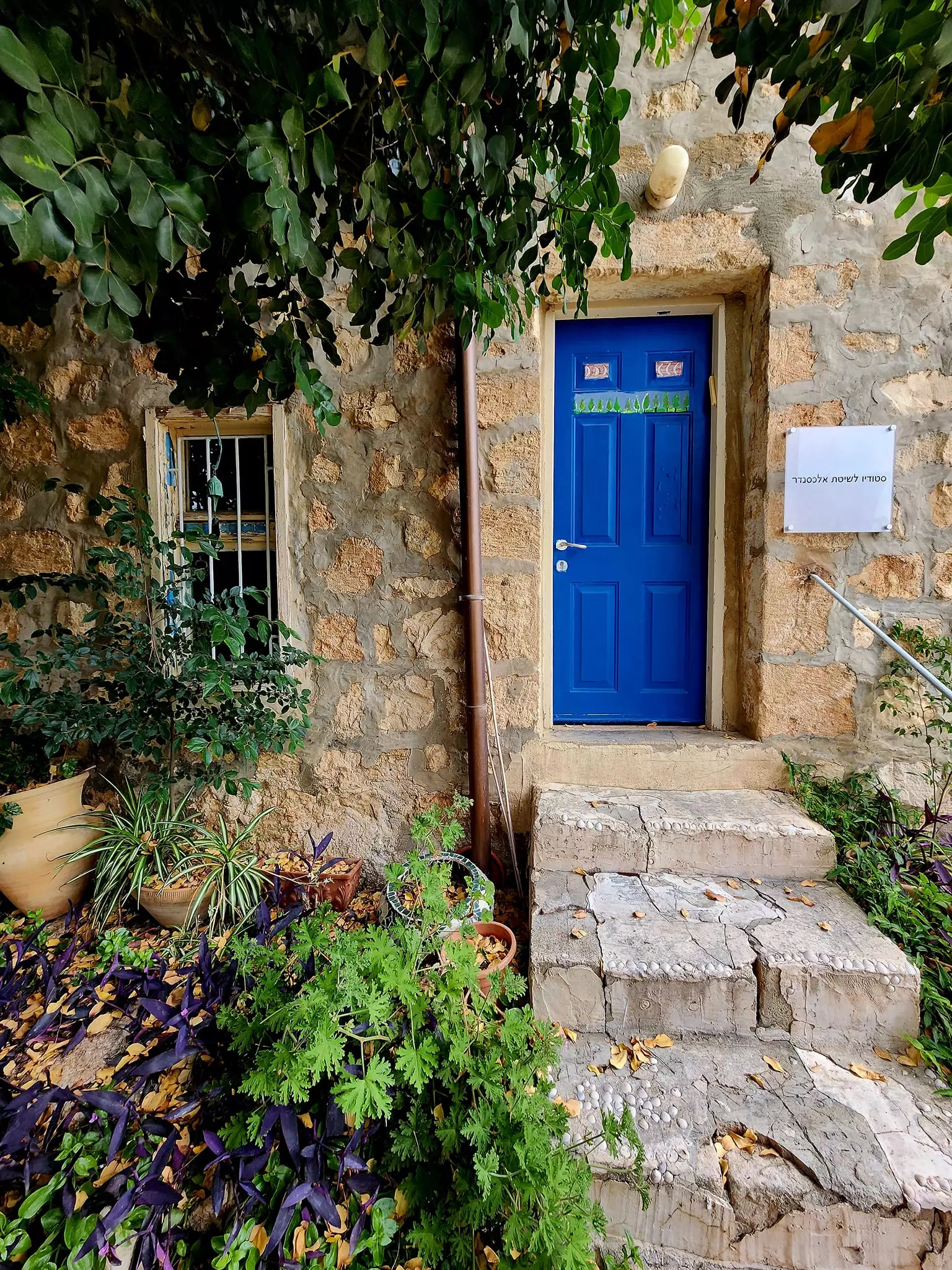
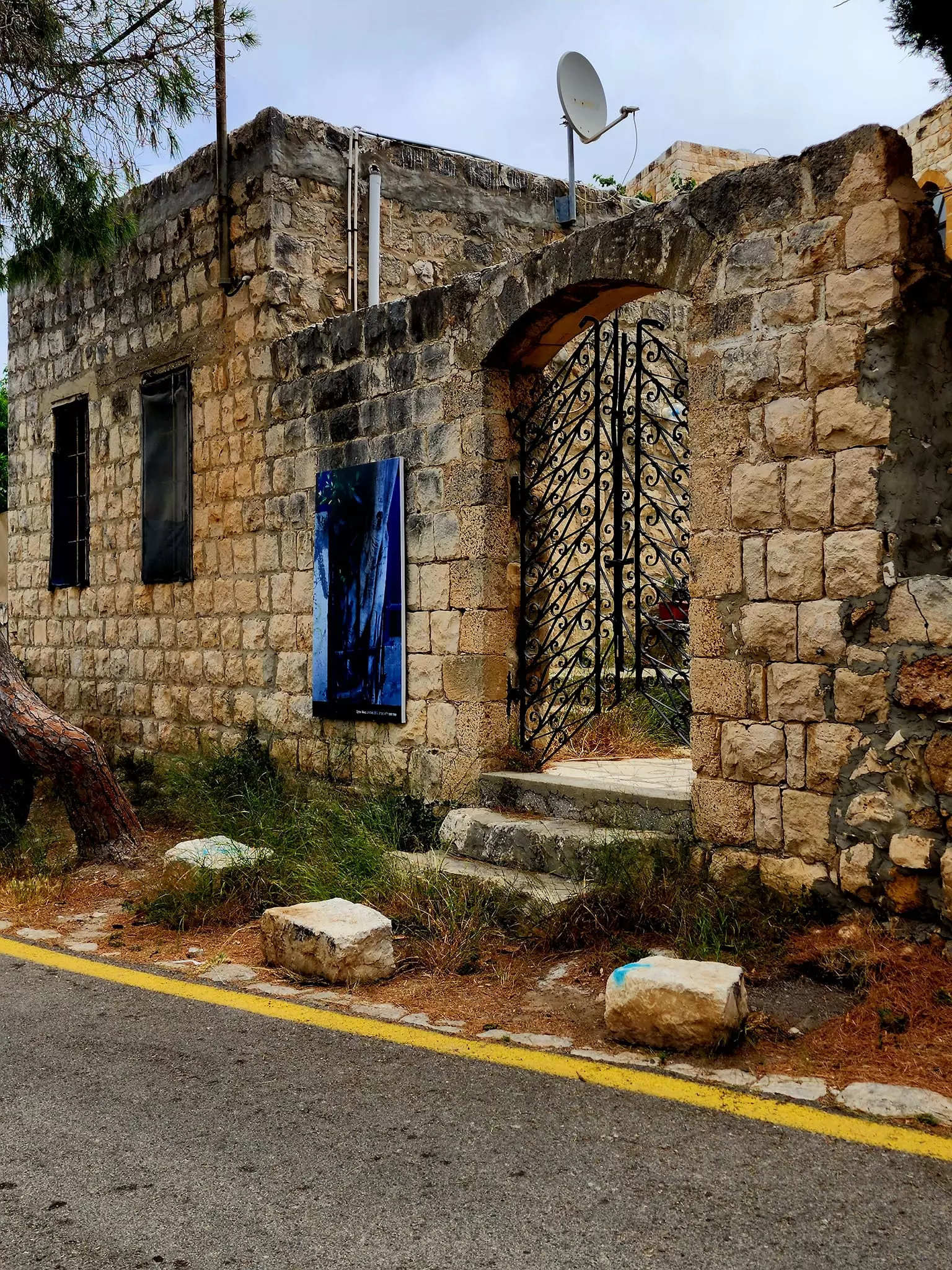
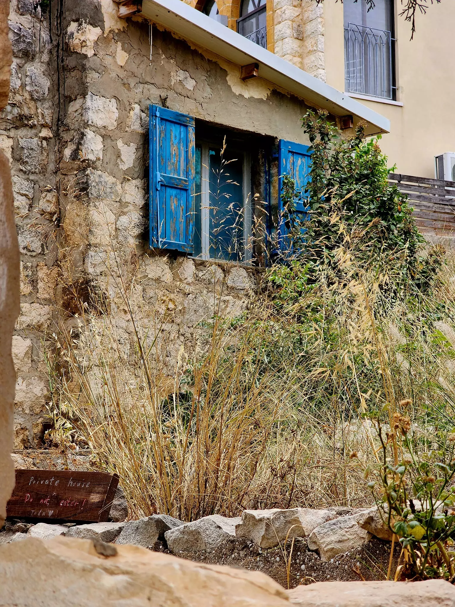
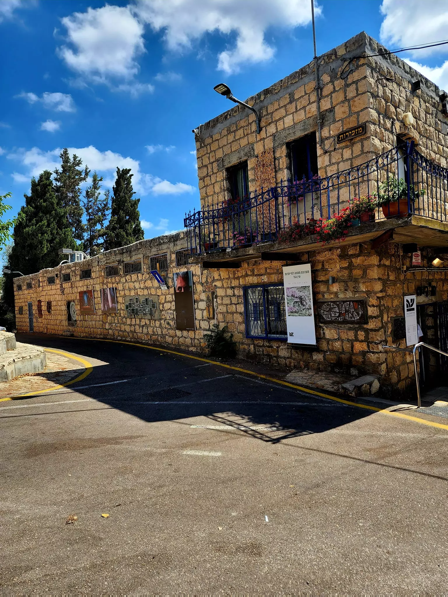
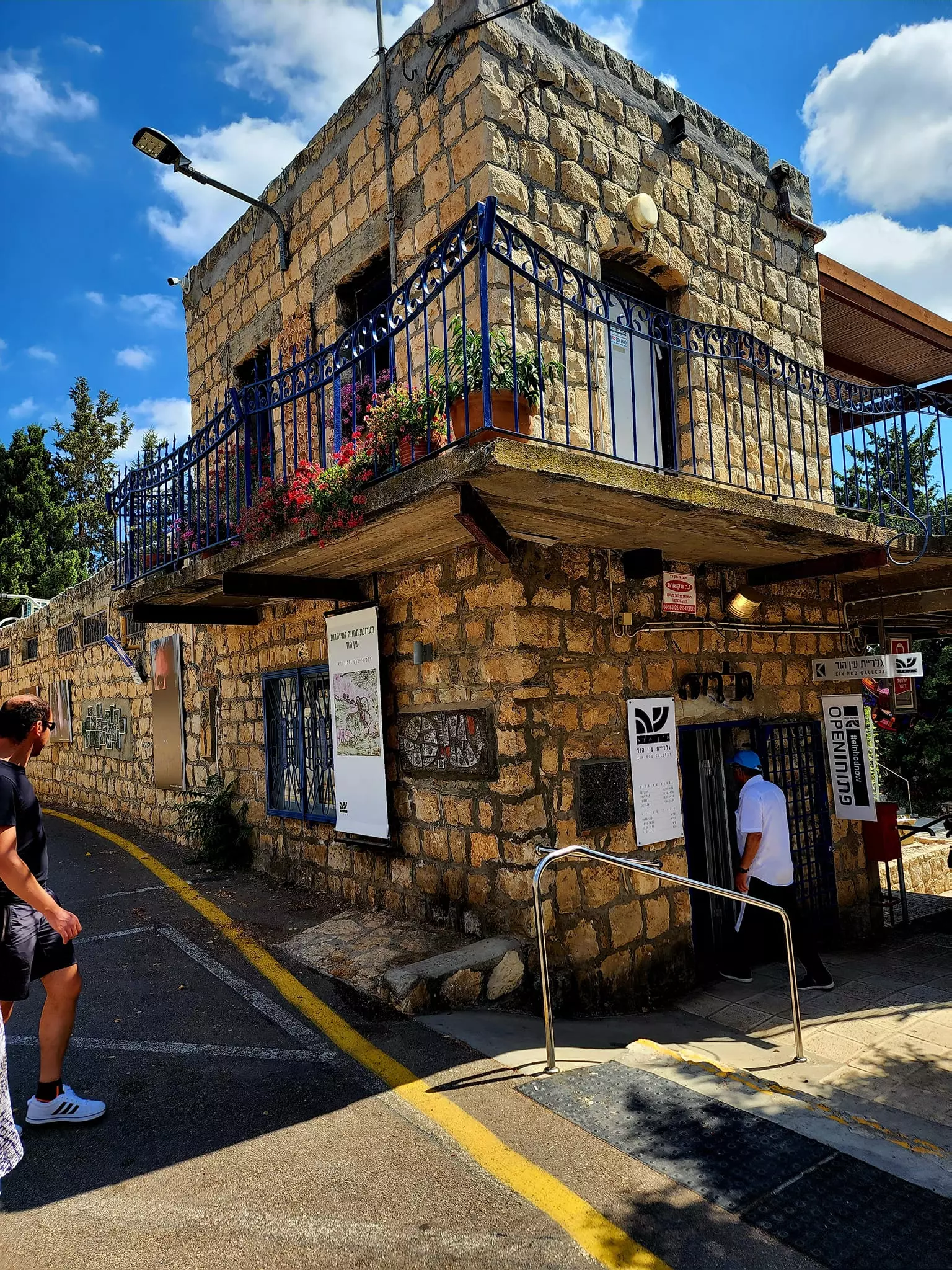
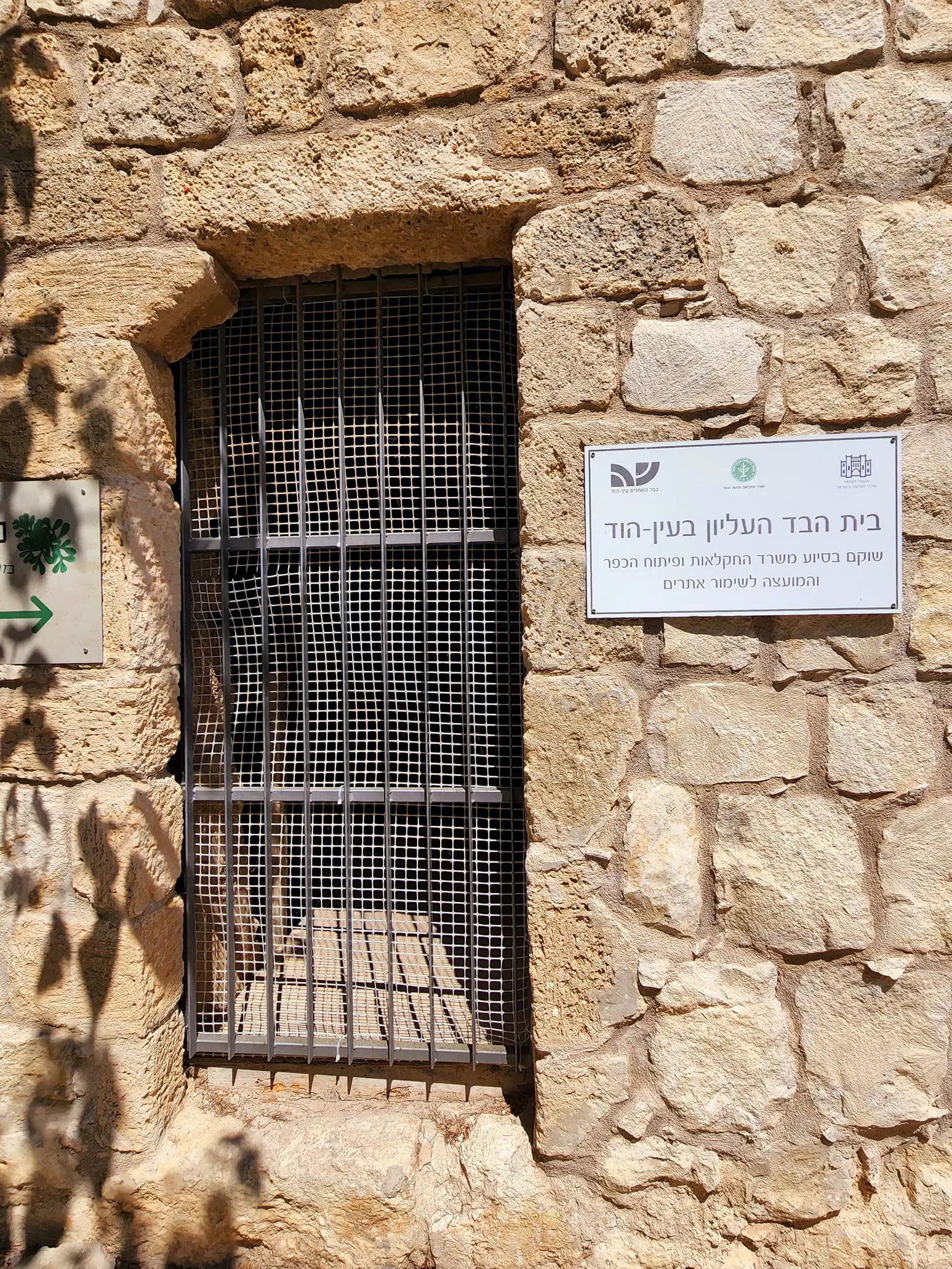
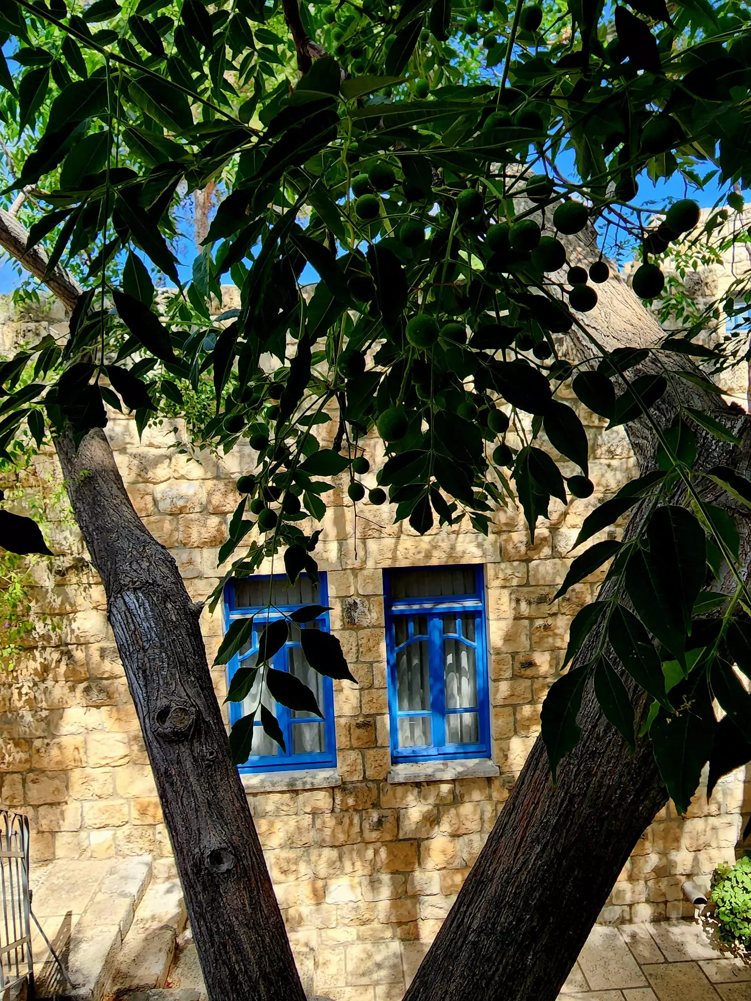
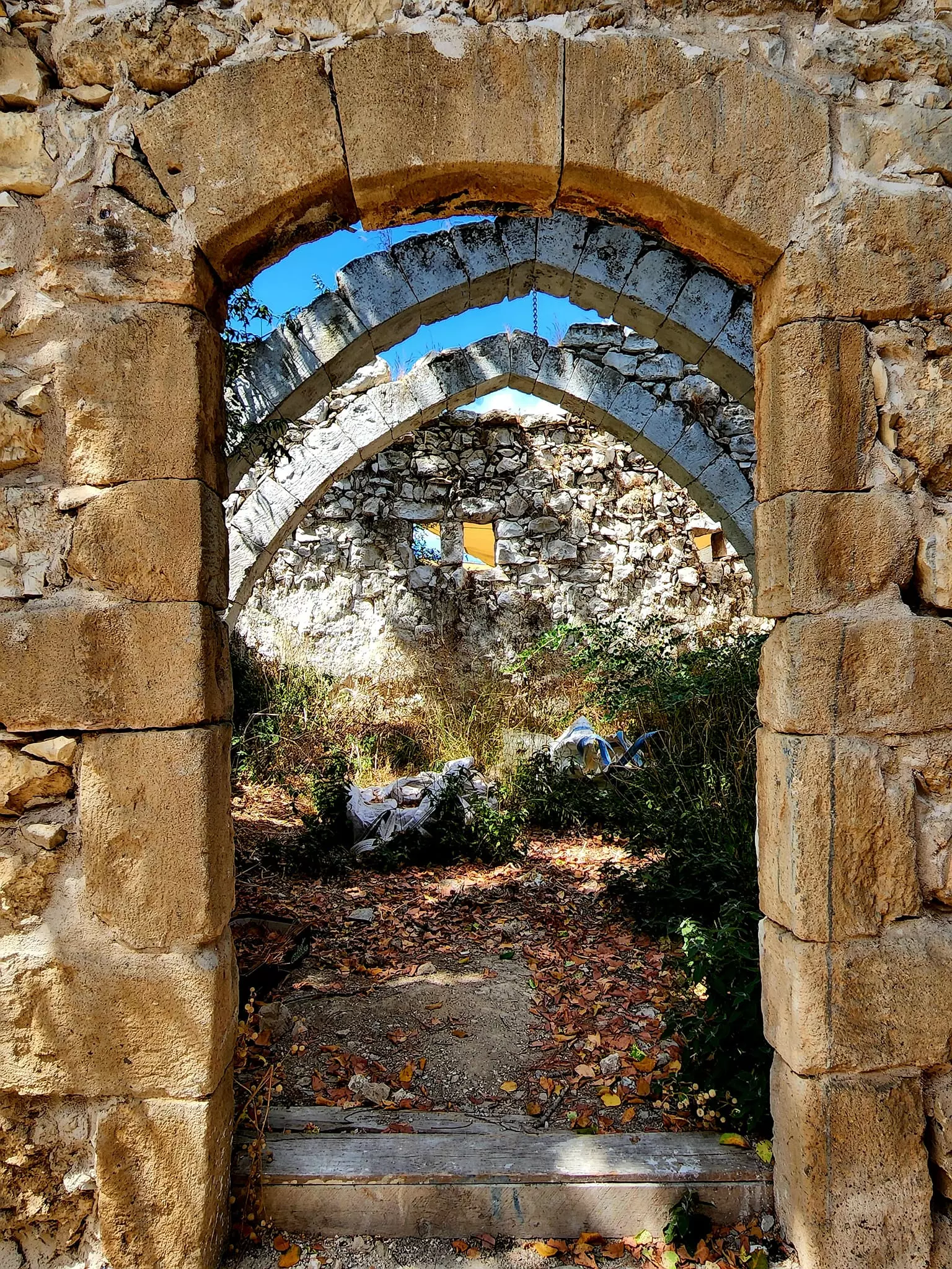
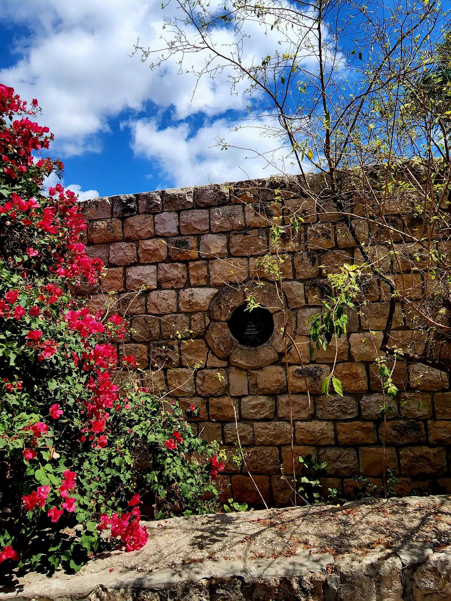
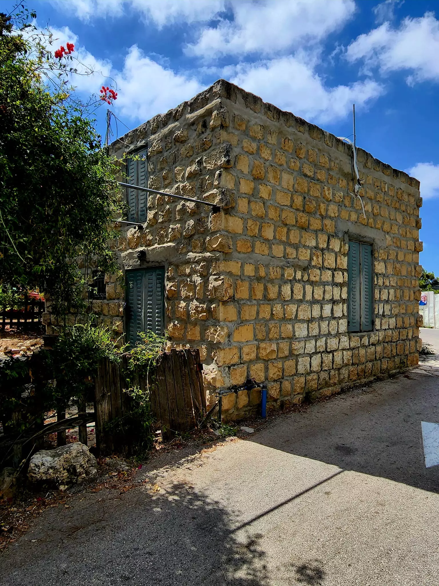
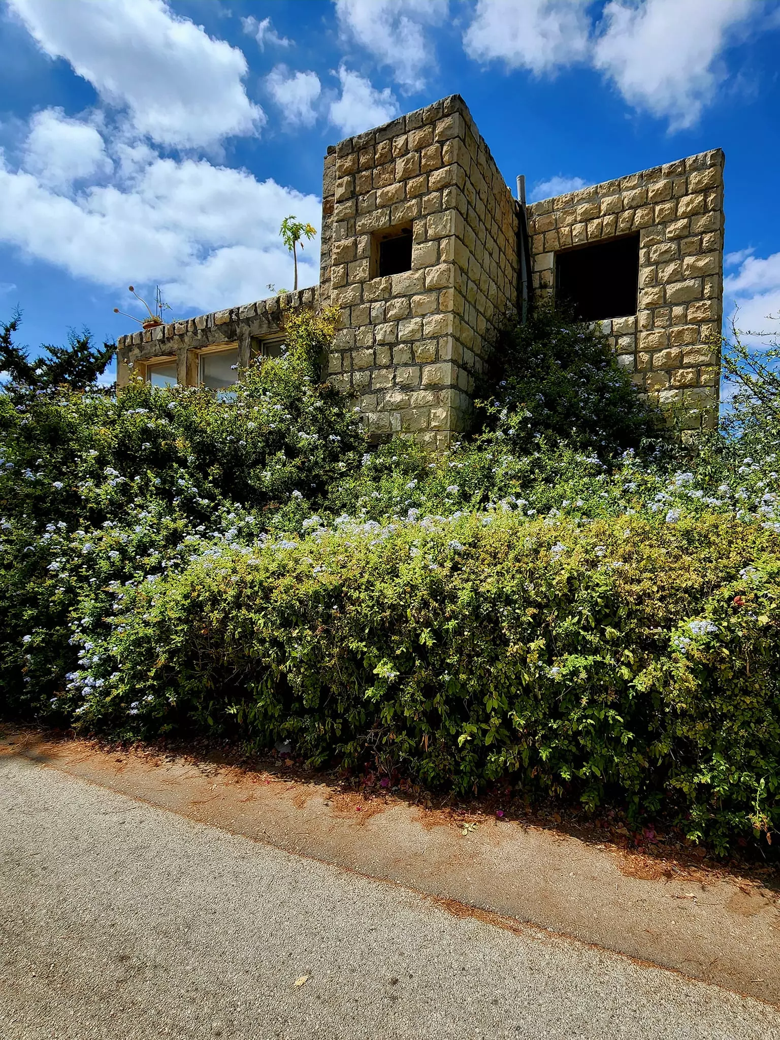
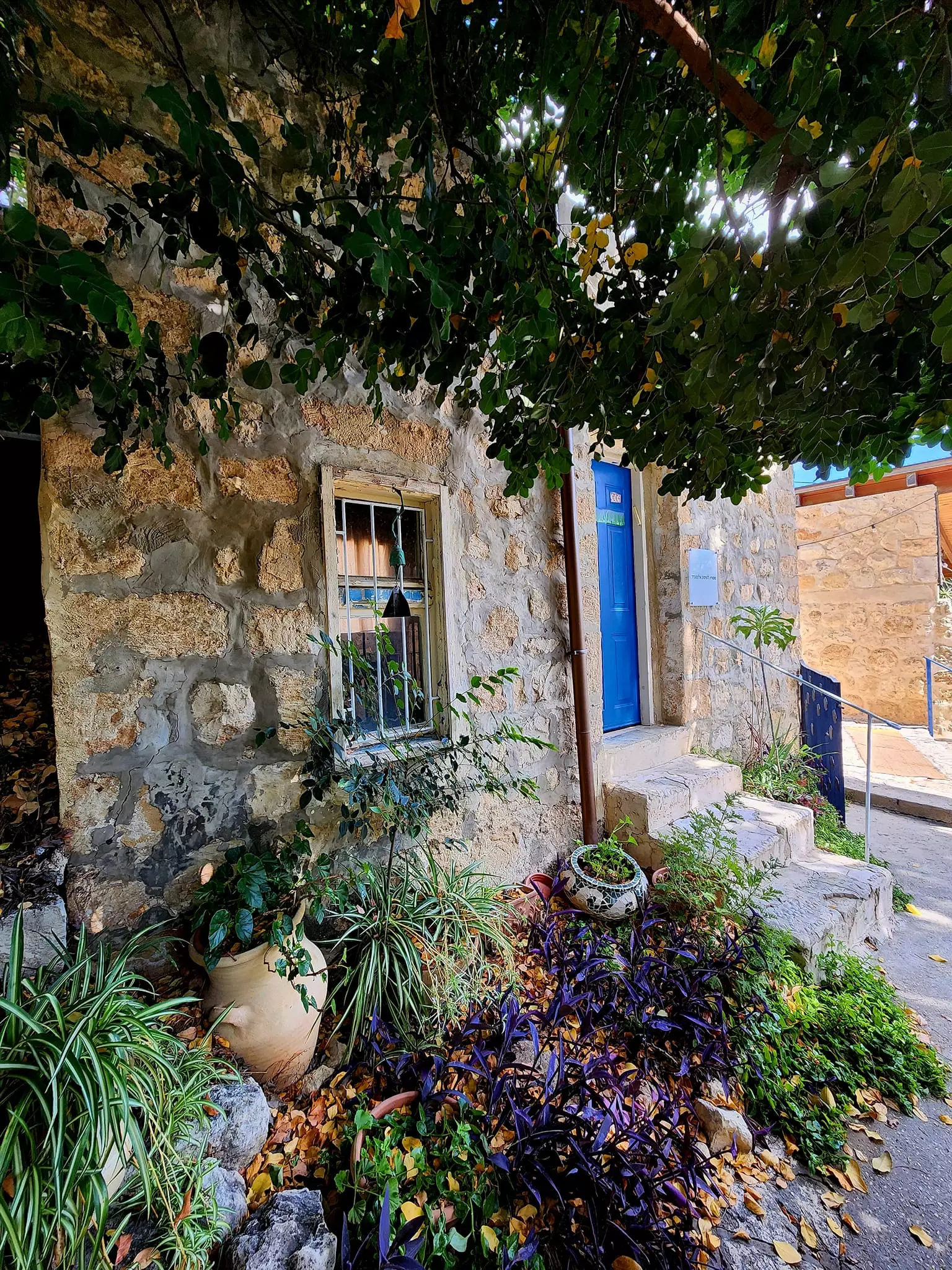
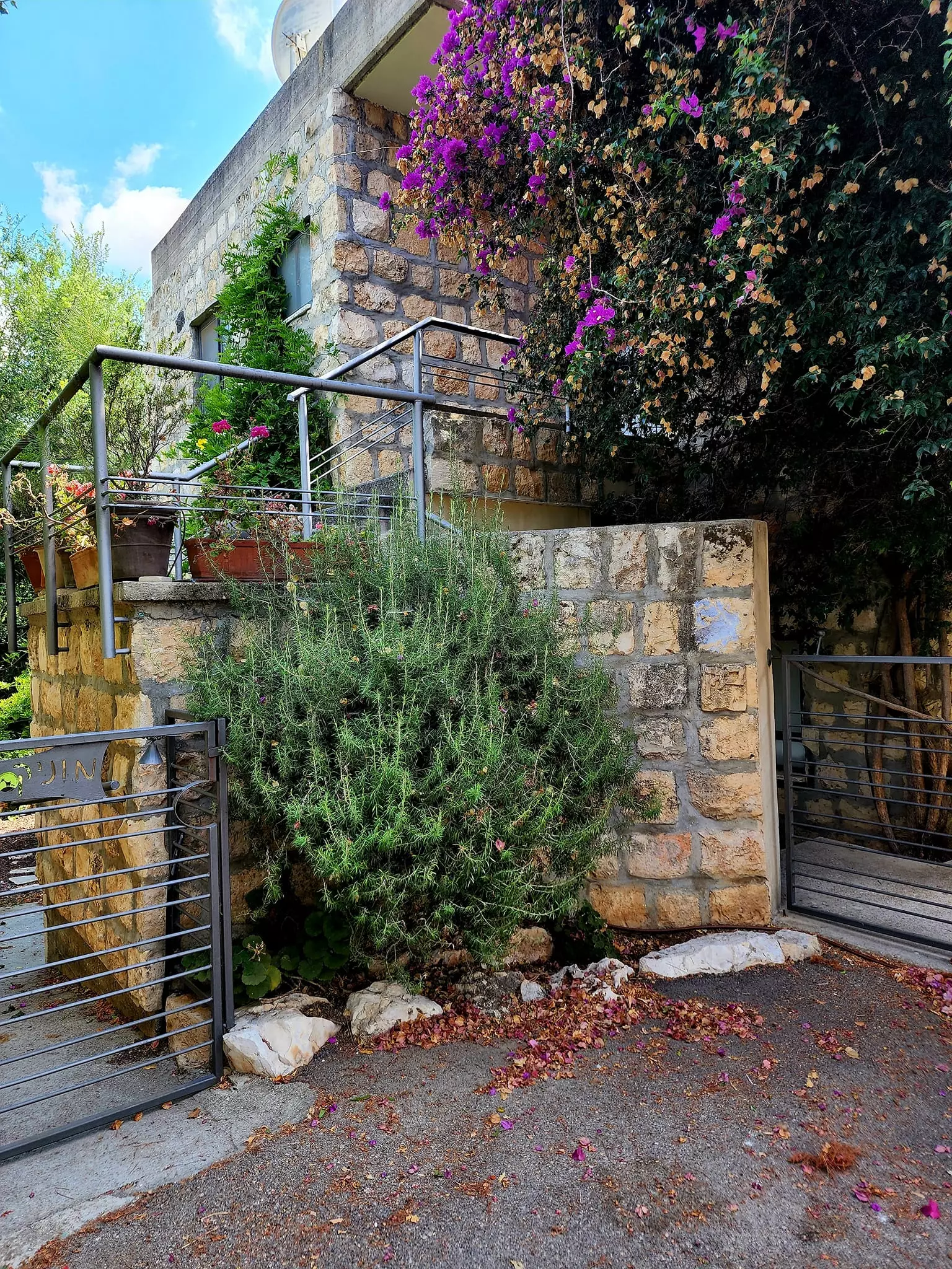
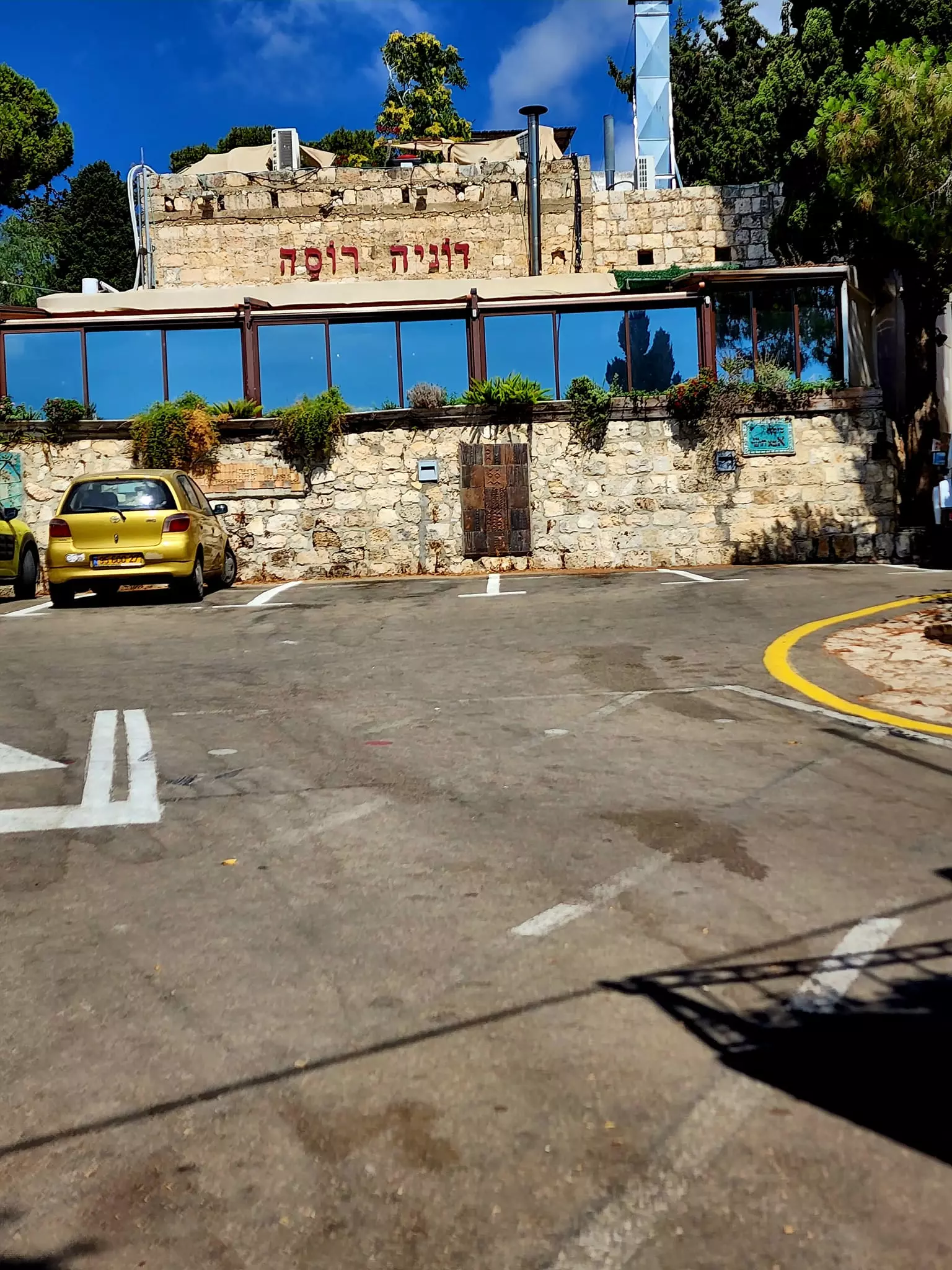
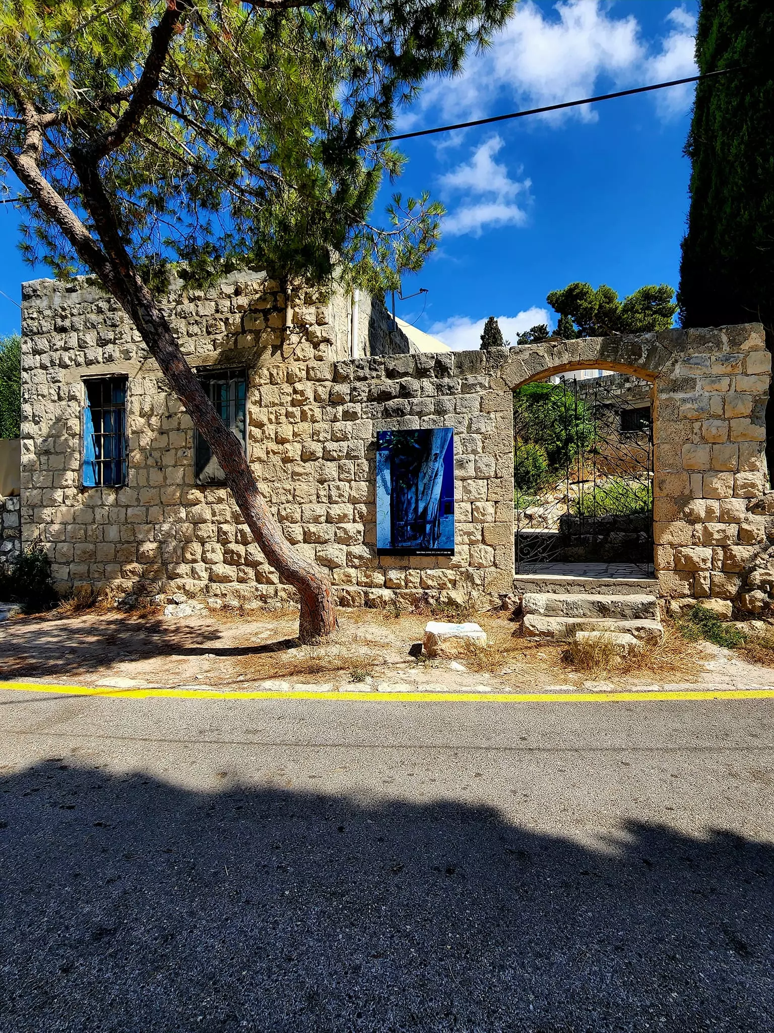
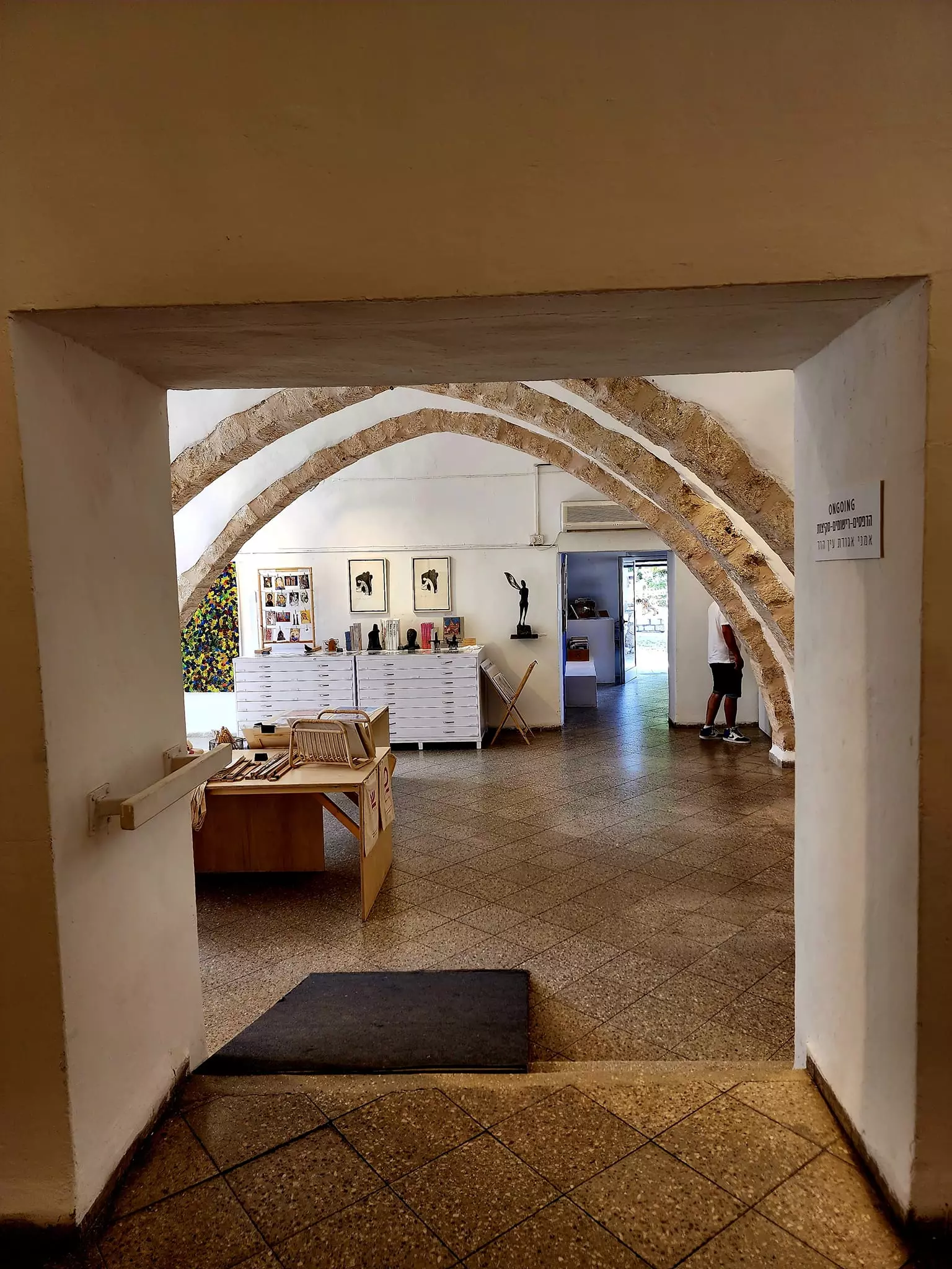
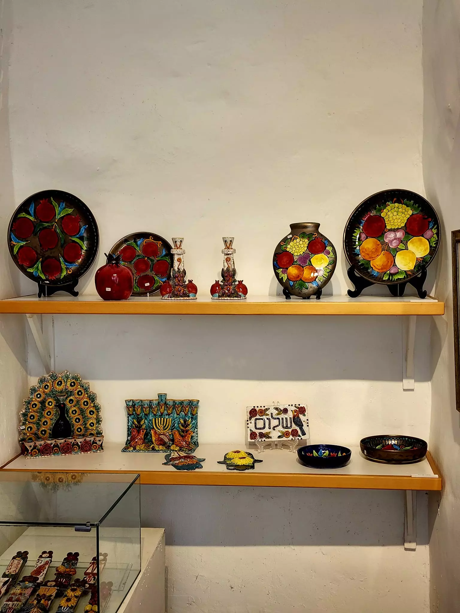
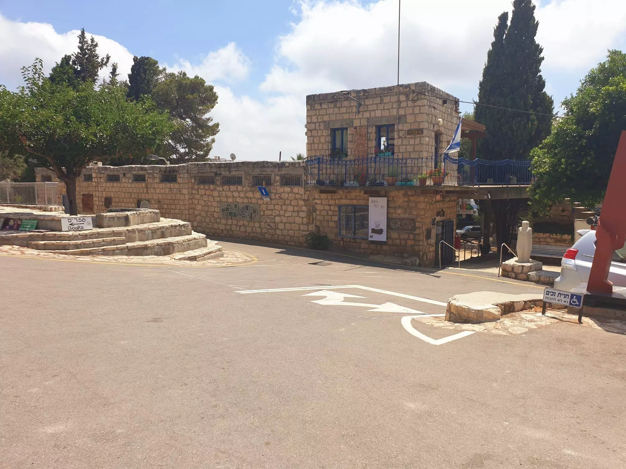
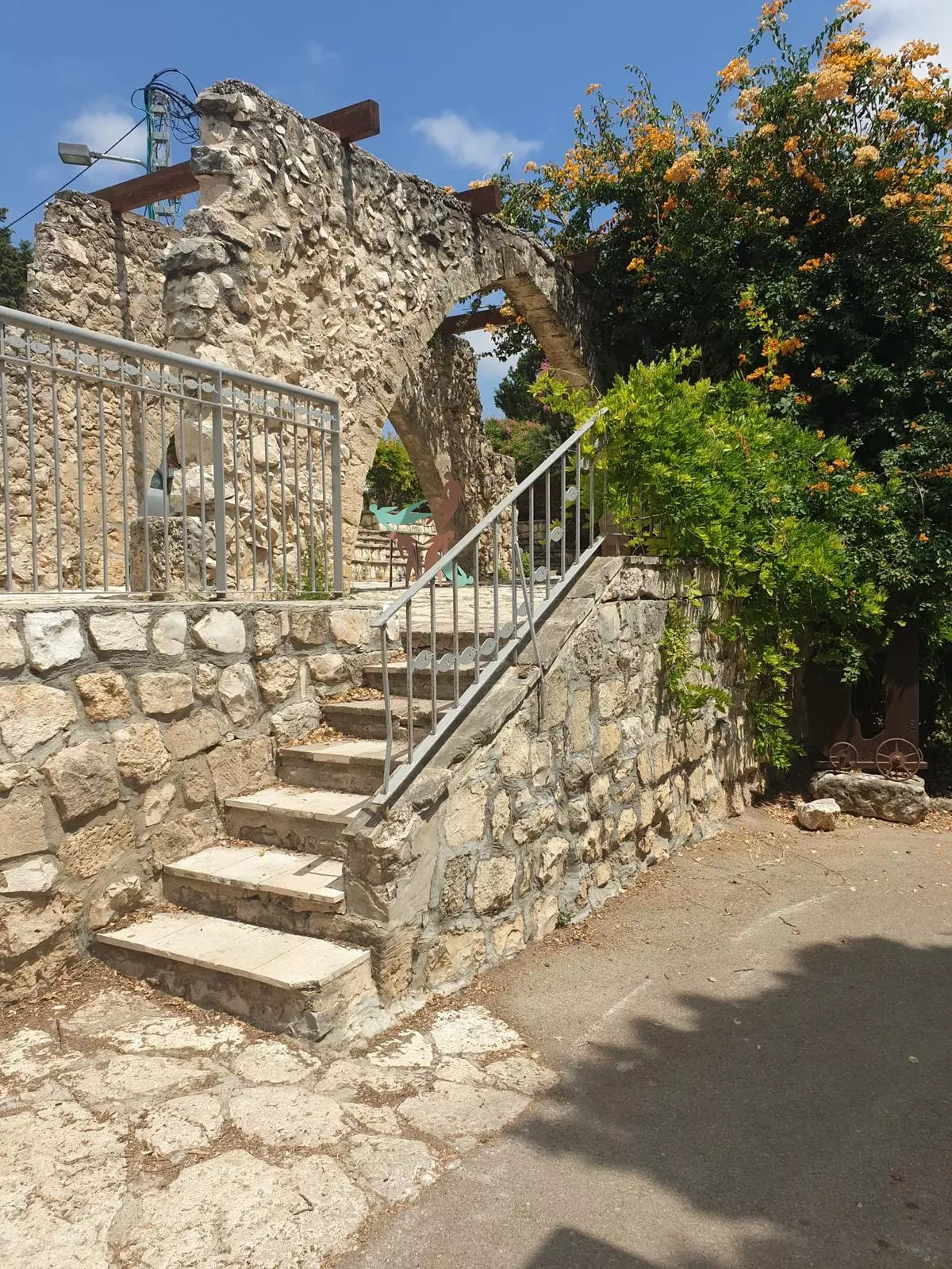
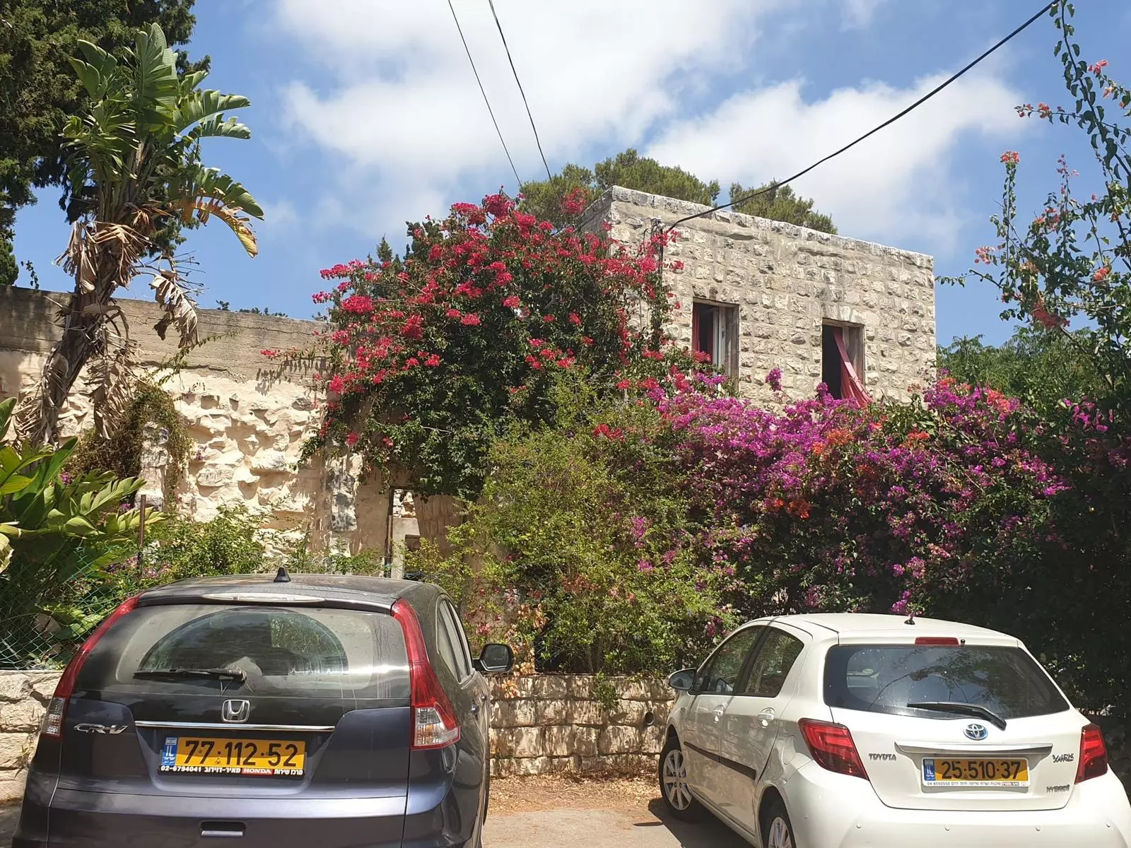
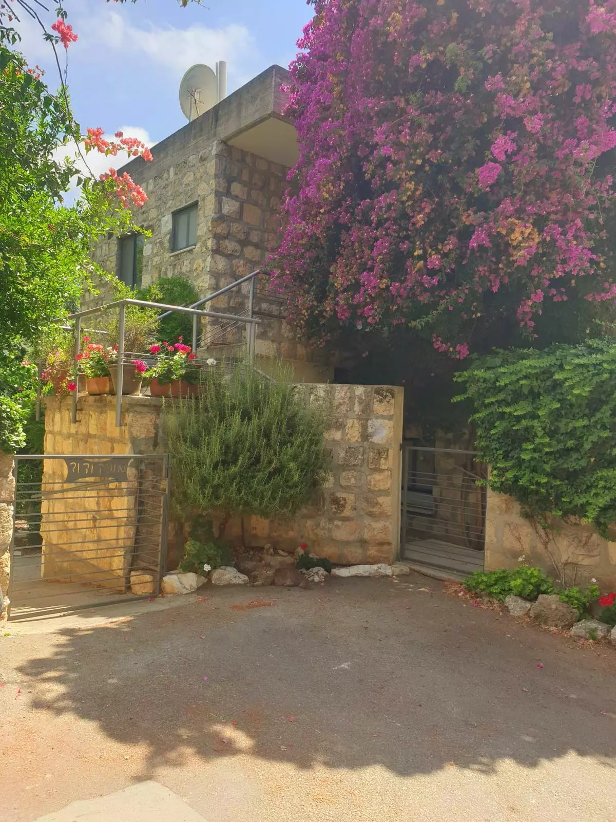
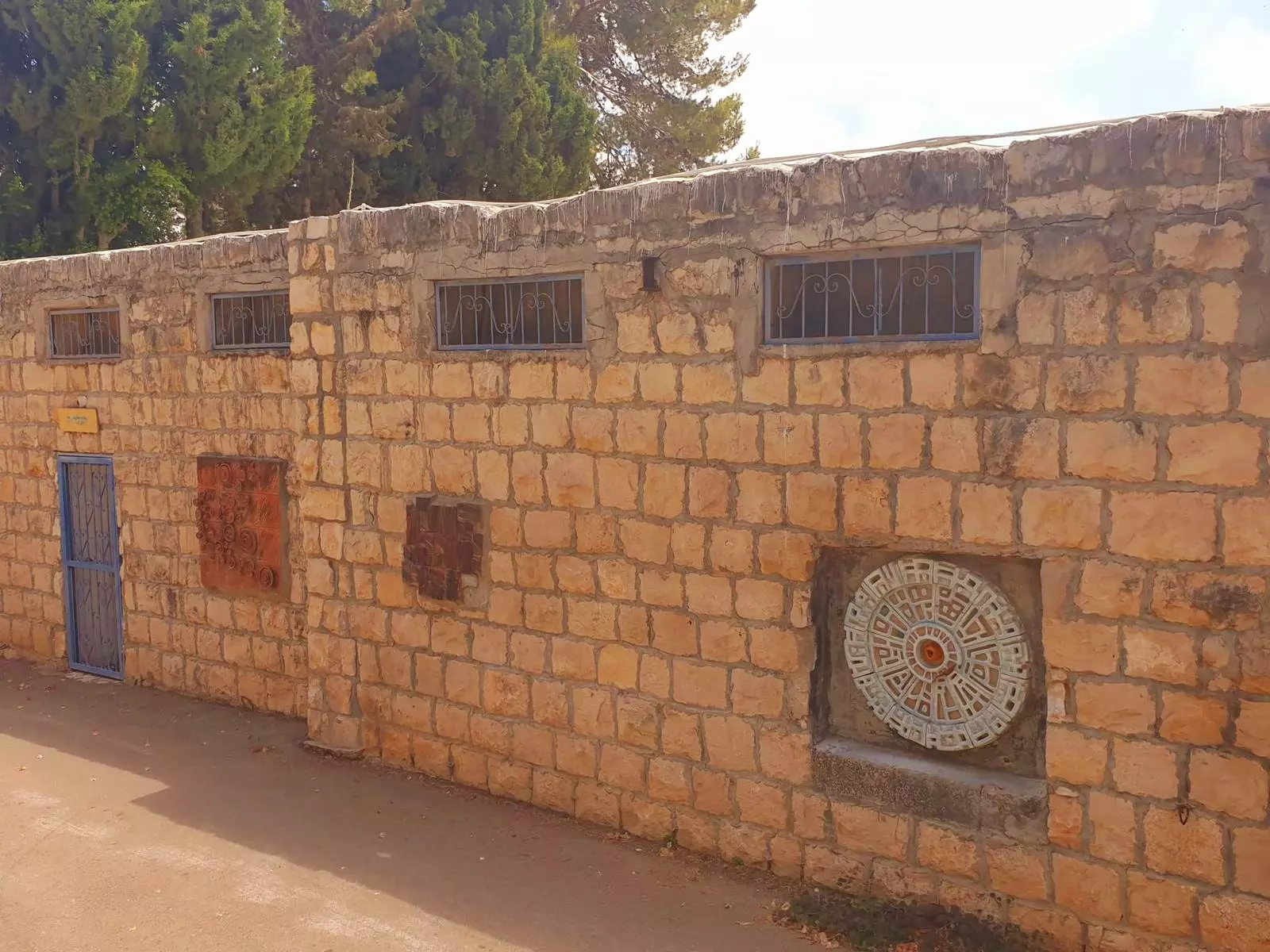
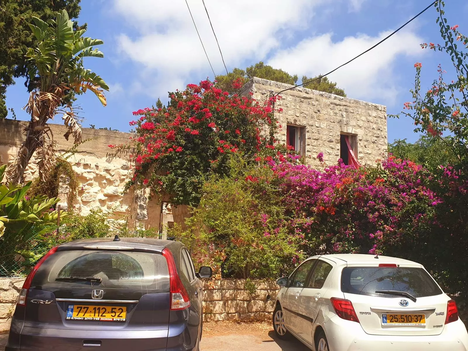
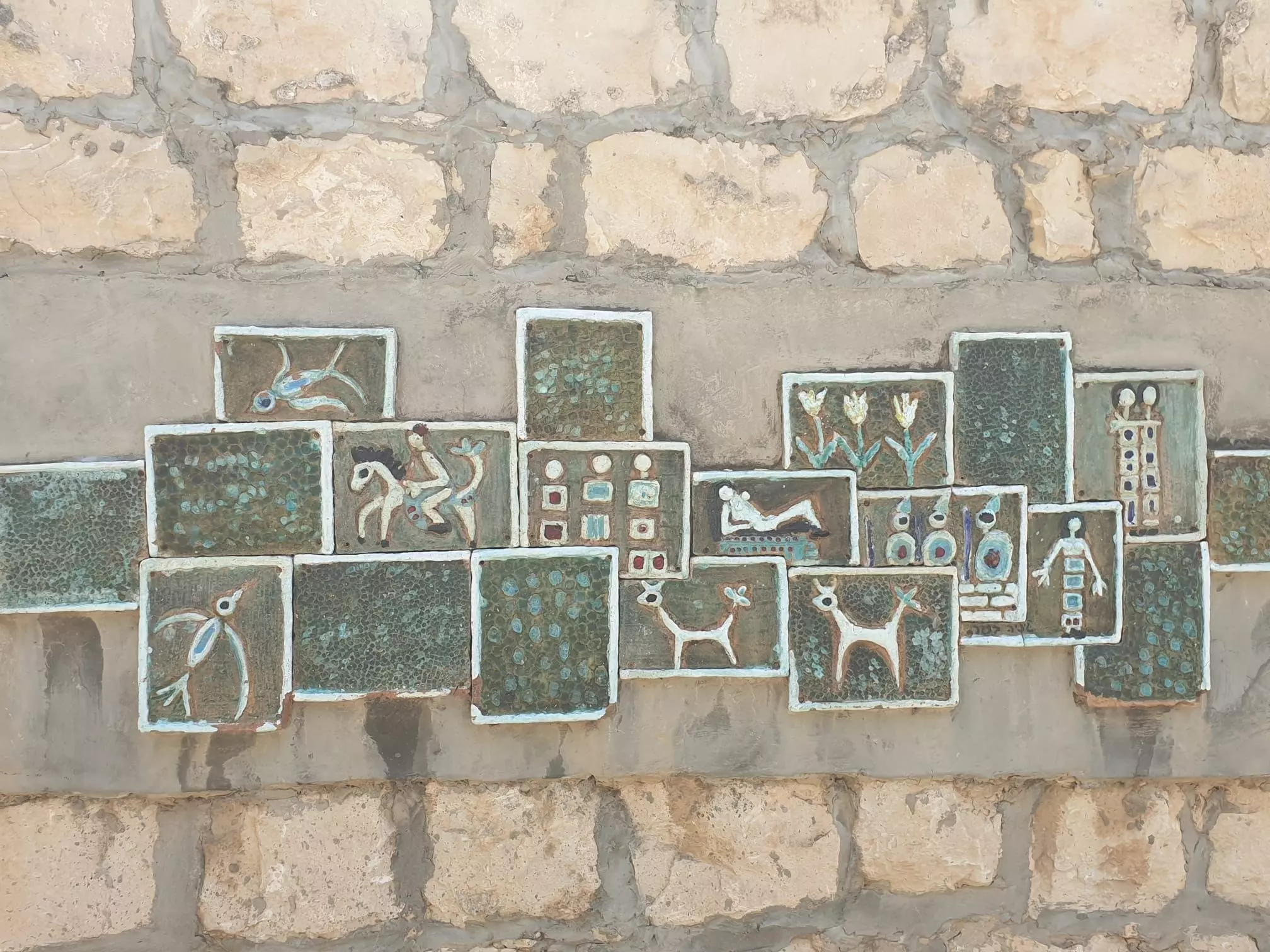
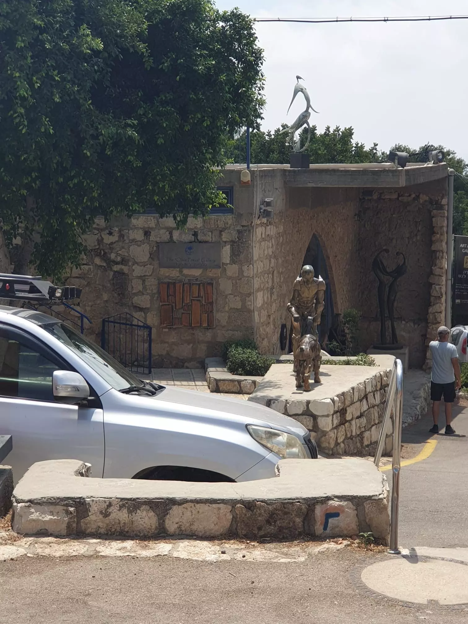
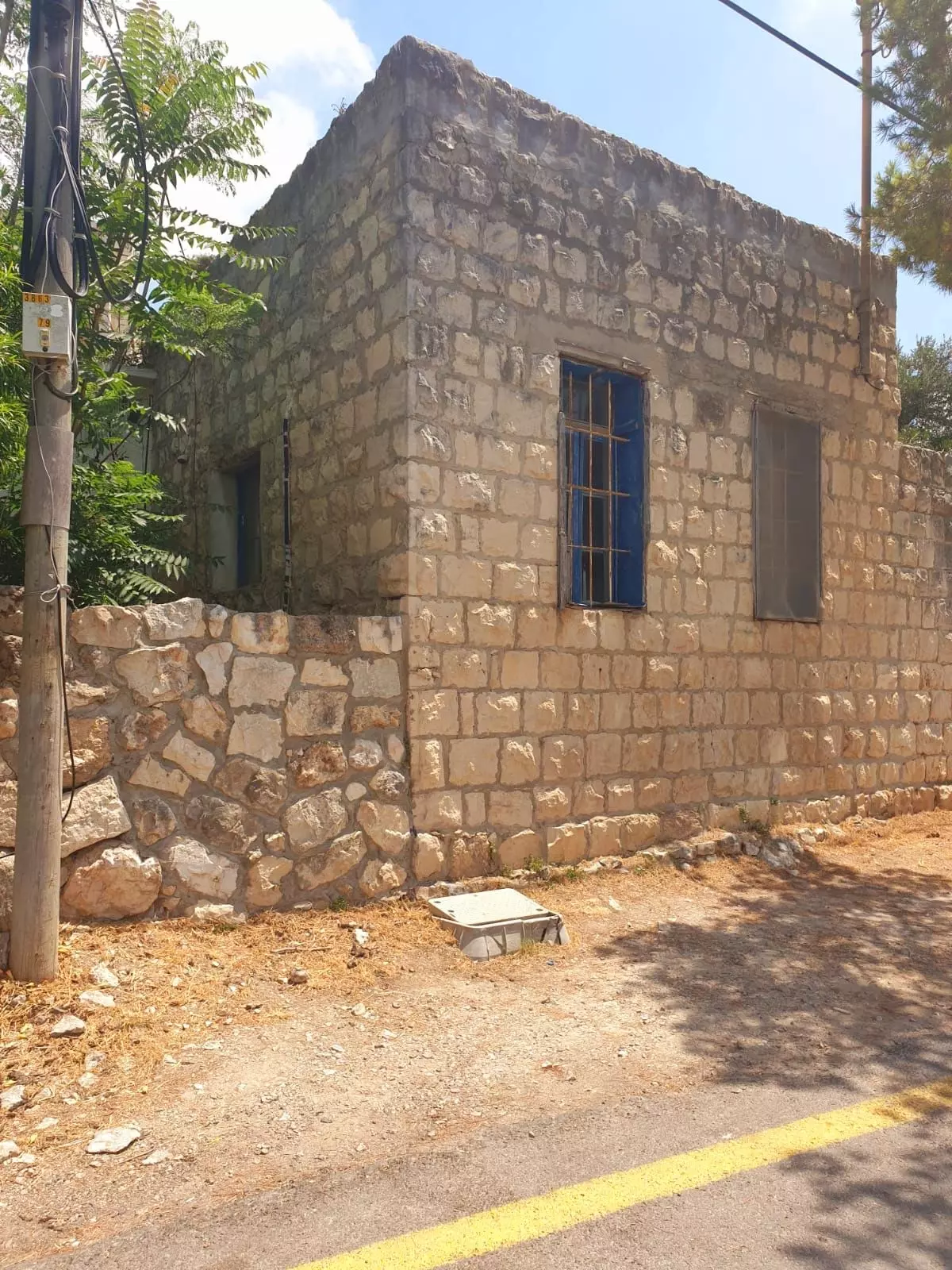
| Village Temains | The village was not destroyed, and since 1954 it has been converted into an artists' colony. | ||||||||||||||||
| Ethnically Cleansing | 'Ayn Hawd inhabitants were completely ethnically cleansed. | ||||||||||||||||
| Pre-Nakba Land Ownership |
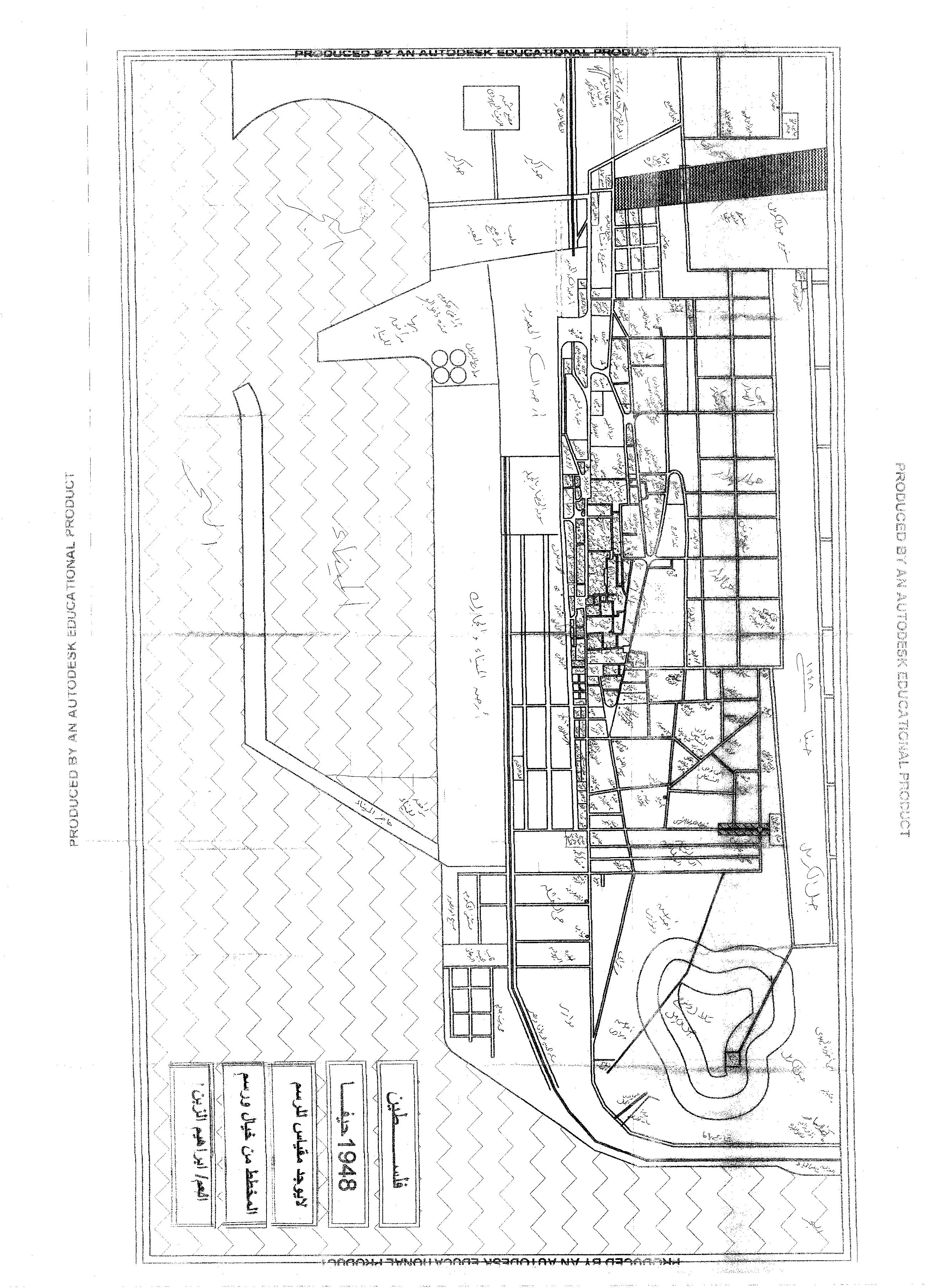
**Town Lands' Demarcation Maps |
||||||||||||||||
| Land Usage As of 1945 |
|
||||||||||||||||
| Population |
|
||||||||||||||||
| Number of Houses |
|
||||||||||||||||
| Near By Towns |
|||||||||||||||||
|
|||||||||||||||||
| Schools | 'Ayn Hawd had an elementary school for boys, which was founded by the Ottomans in 1888. | ||||||||||||||||
| Places of Warship | One mosque now restaurant or bar | ||||||||||||||||
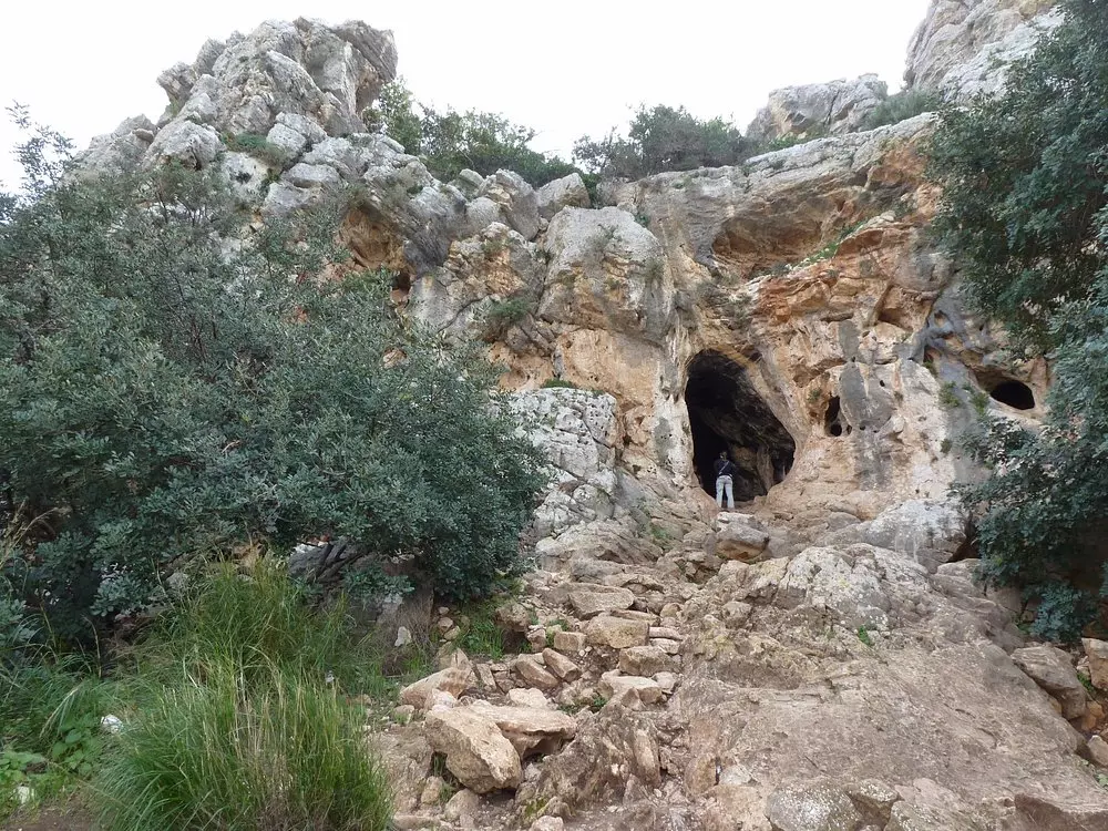
| Archeological Sites | 'Ayn Hawd had Khirba al Hajla, which contained the foundations of buildings, dressed stones, and rock-hewn cisterns. | ||||||||||||||||
| Exculsive Jewish Colonies Who Usurped Village Lands |
Nir 'Etziyon and 'En Hod | ||||||||||||||||
| Featured Video | |||||||||||||||||
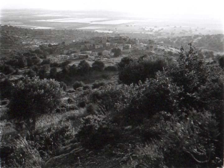
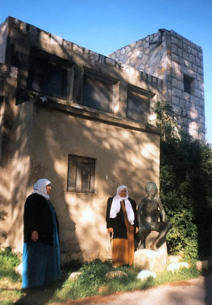
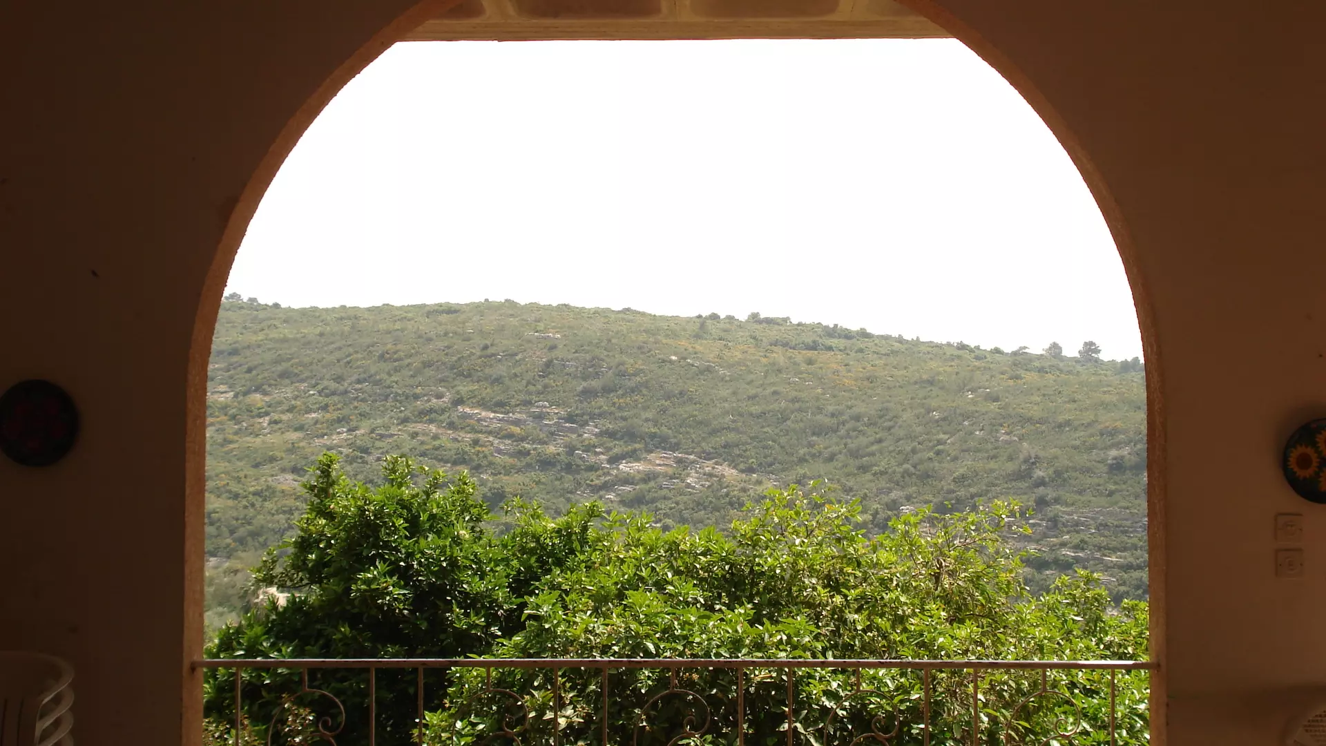
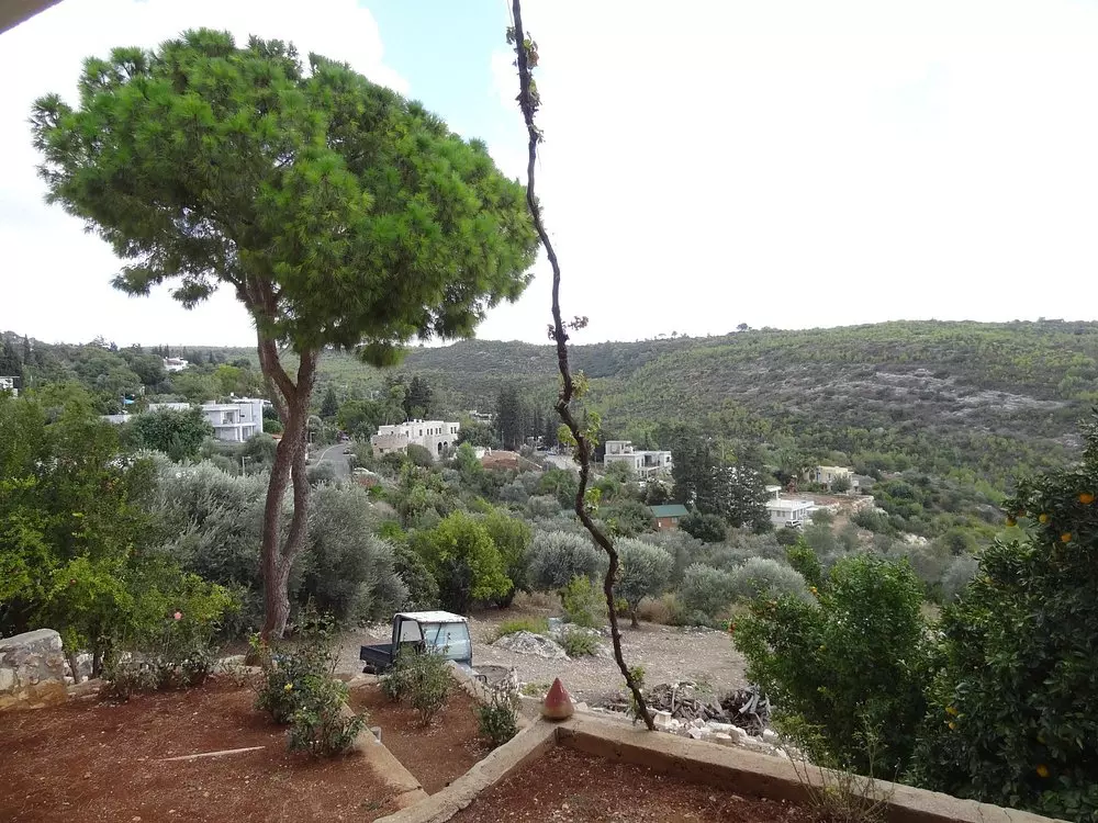
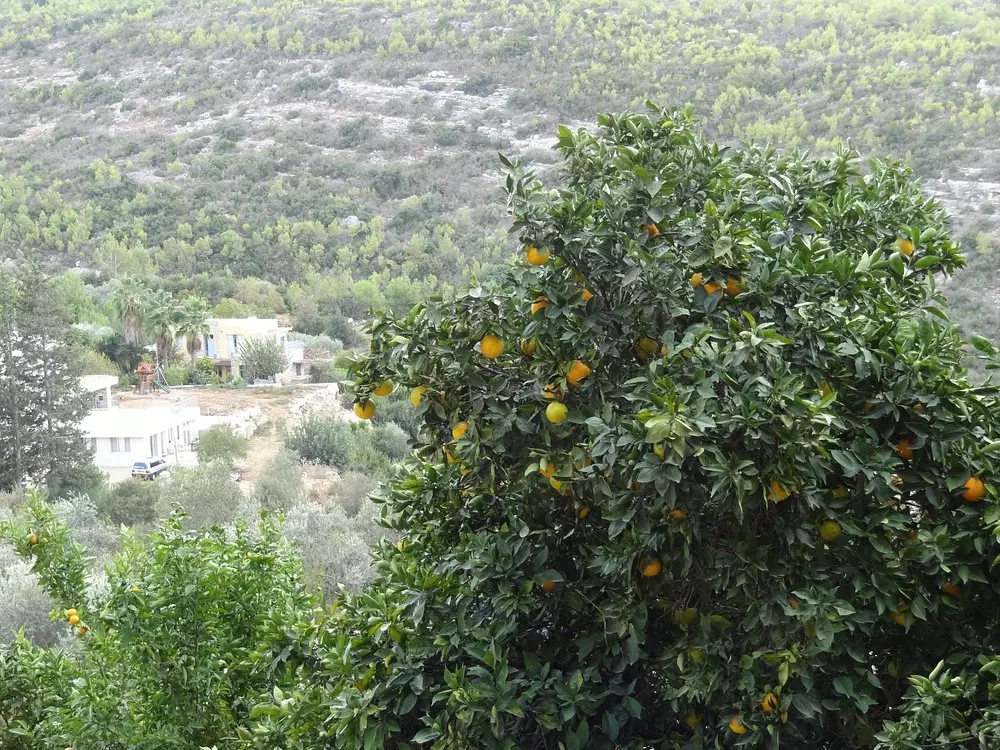
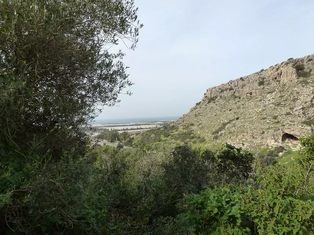
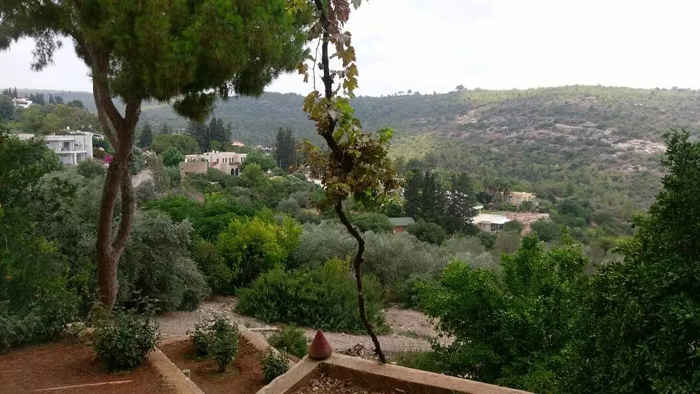
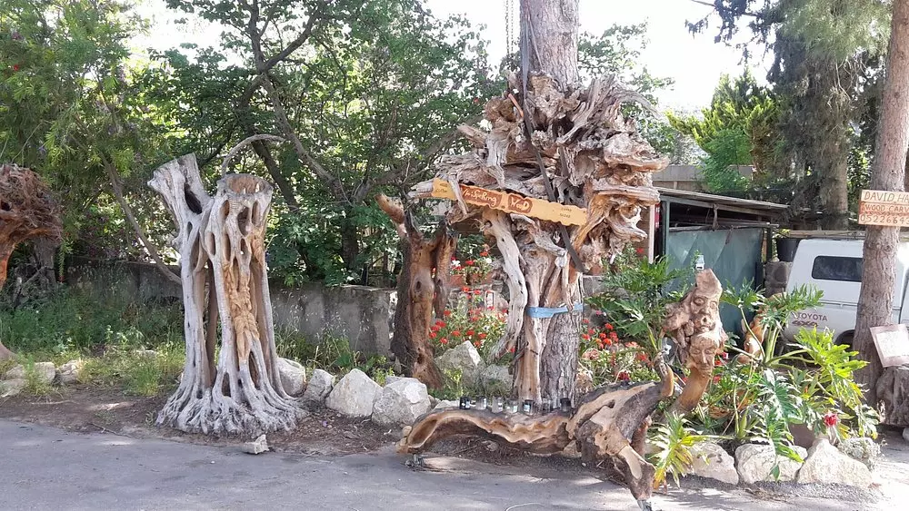
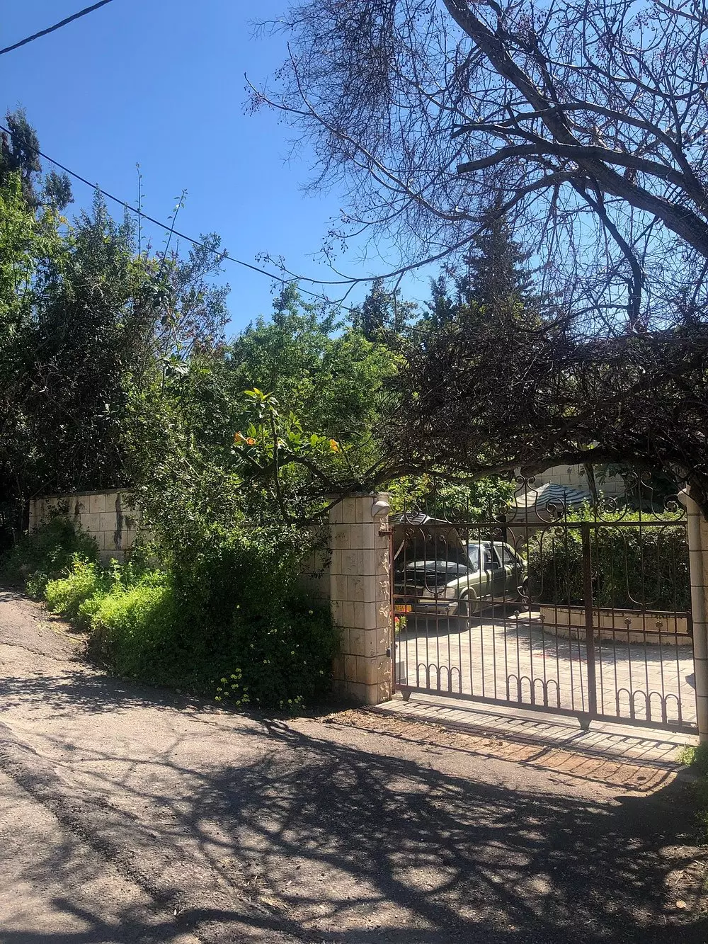
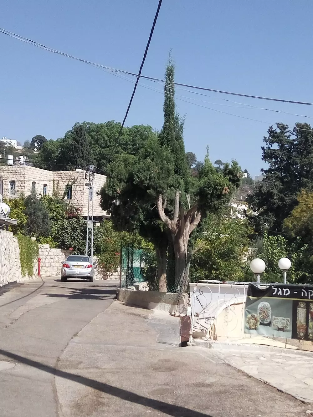
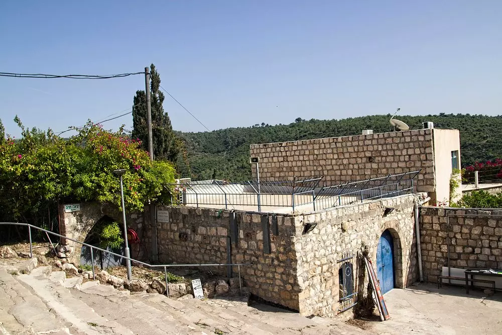
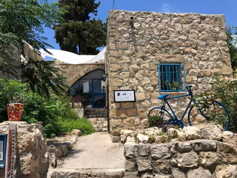
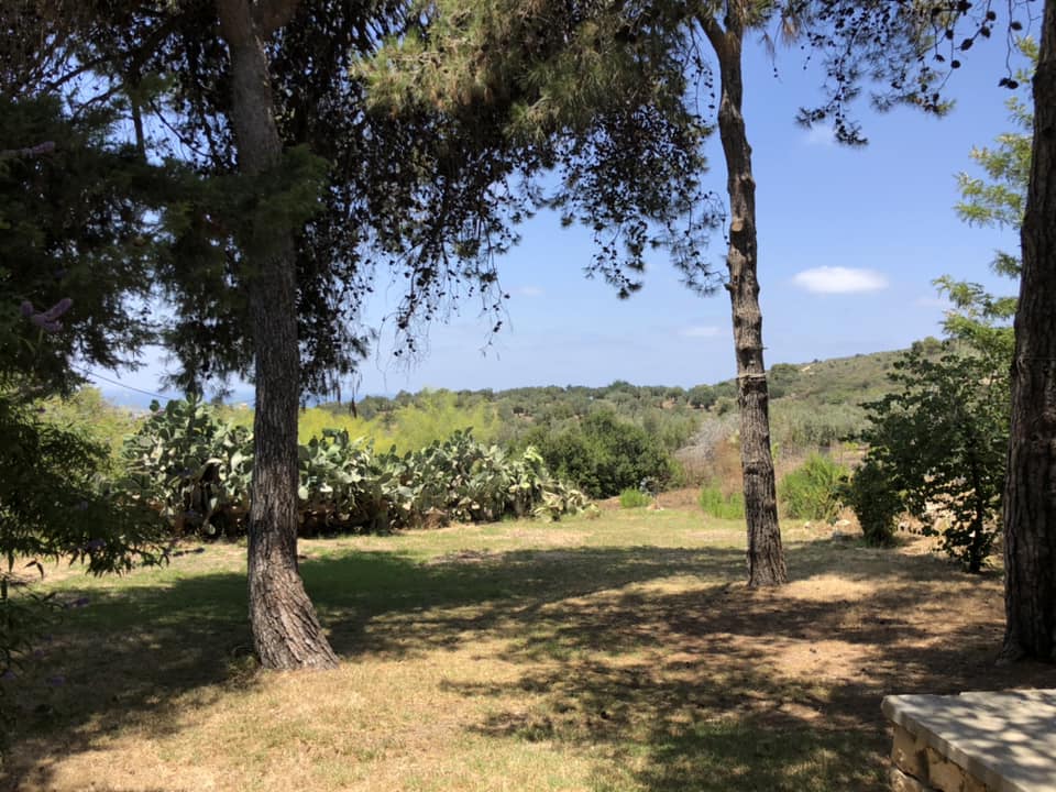
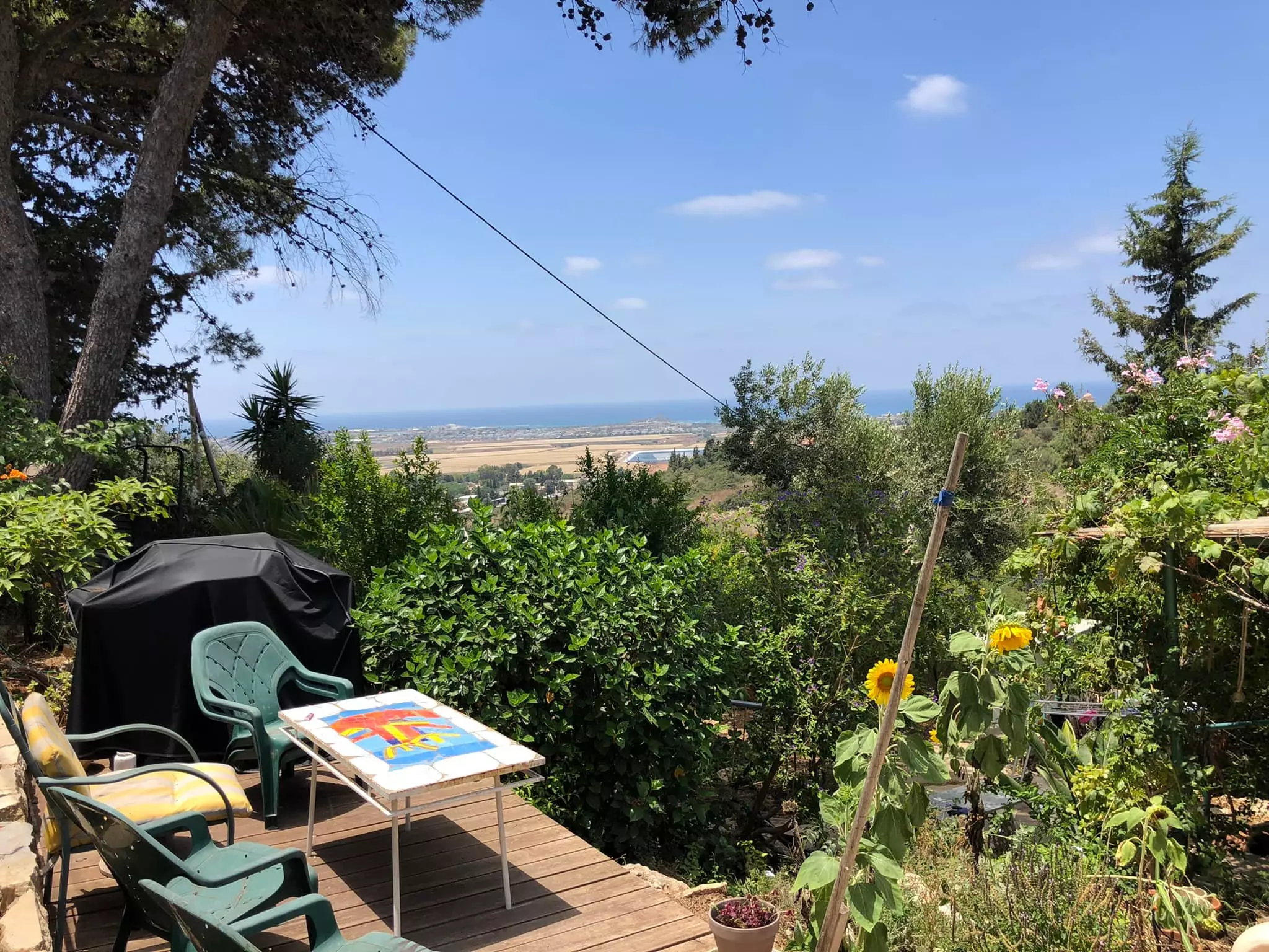
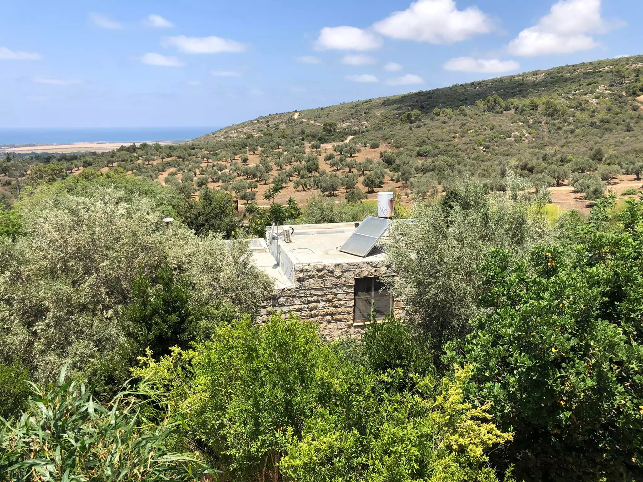
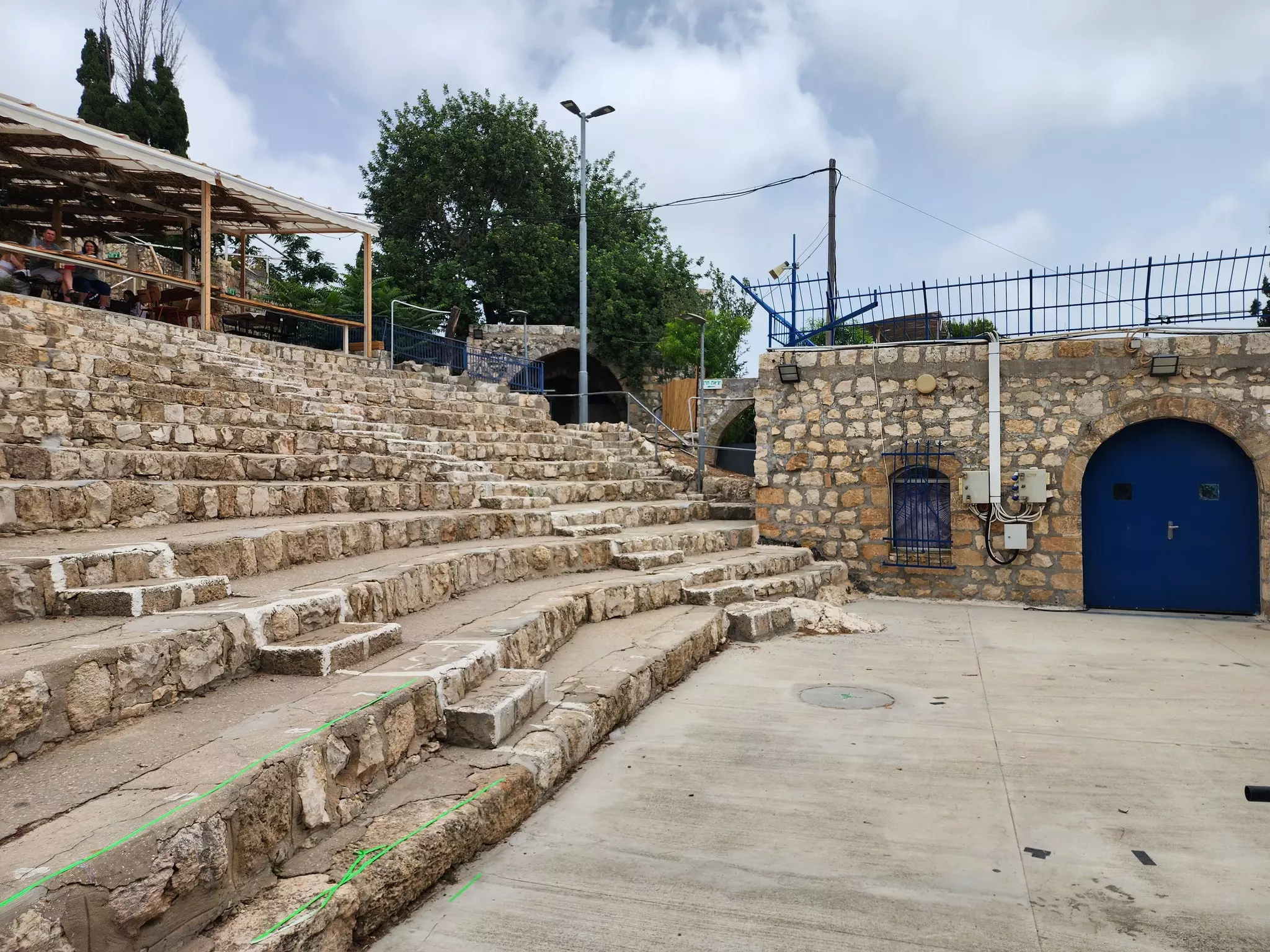
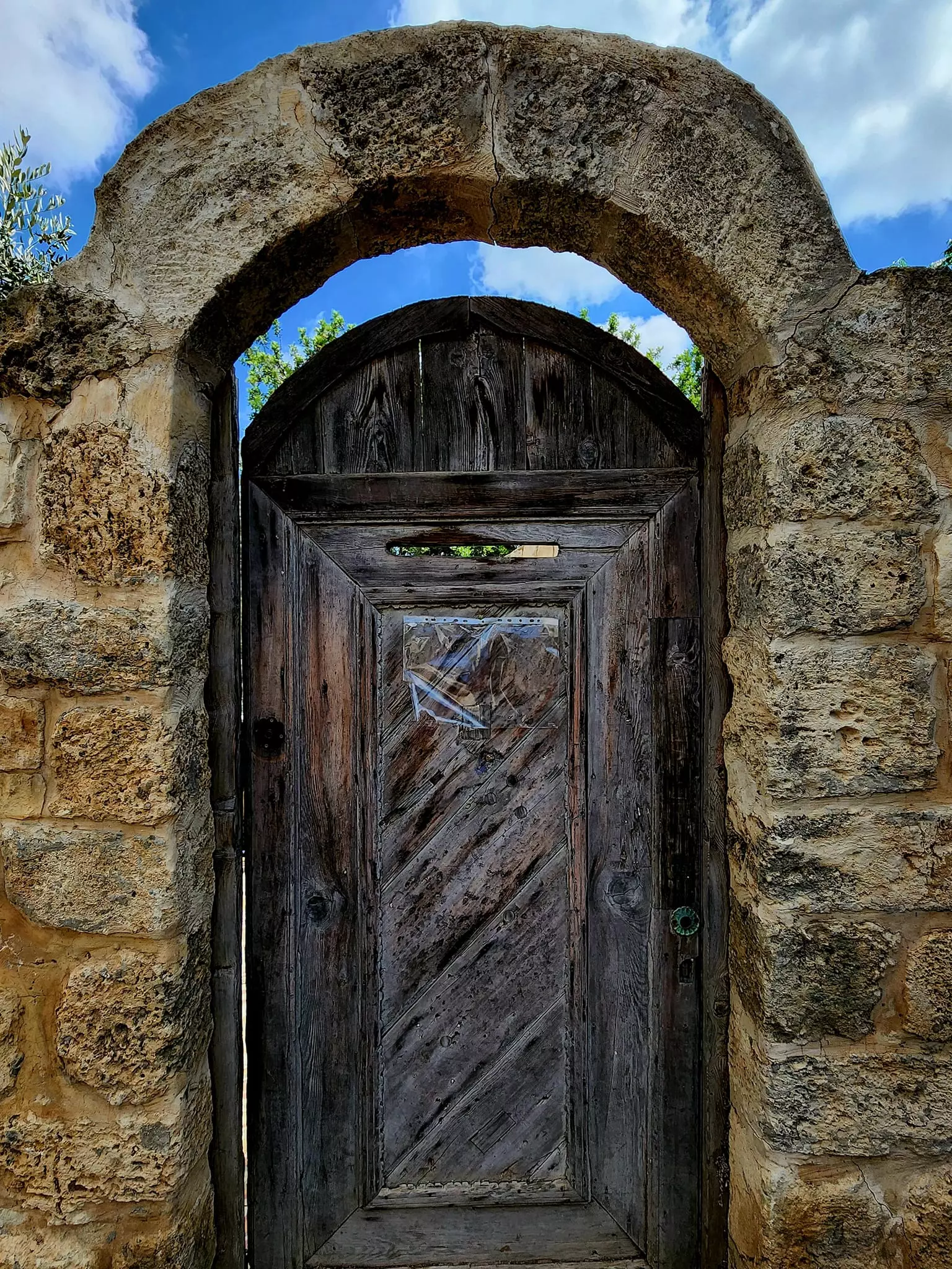
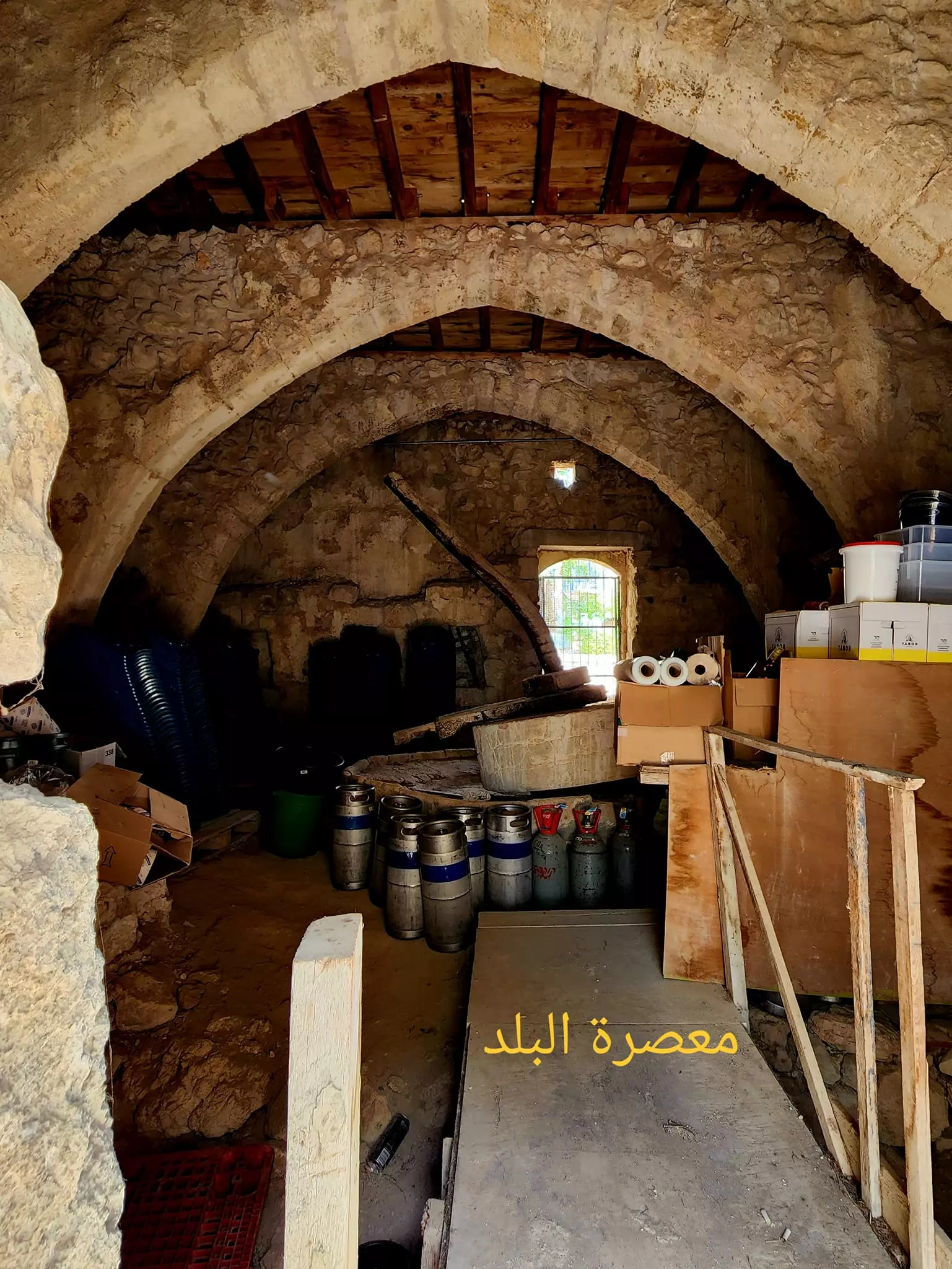
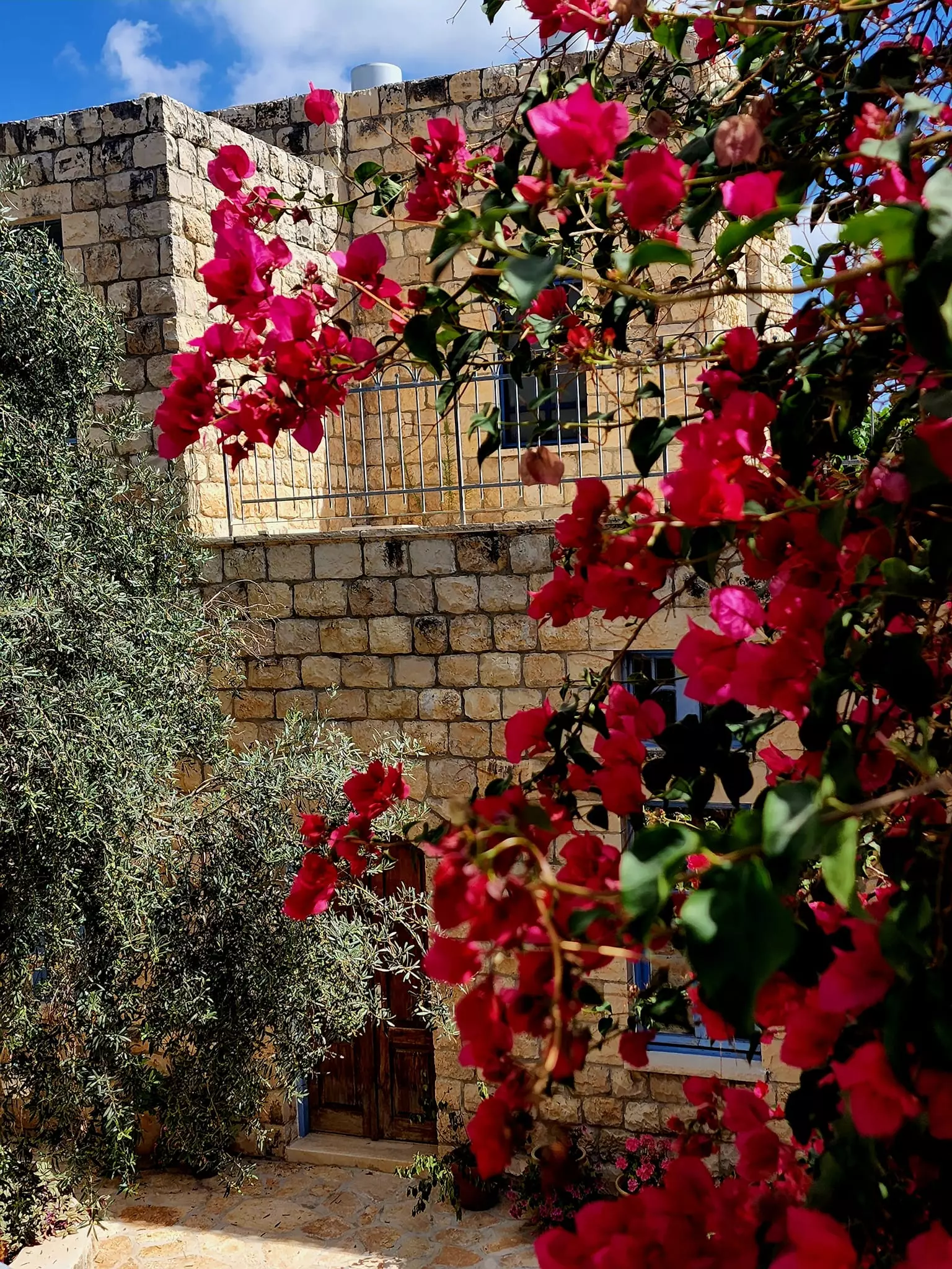
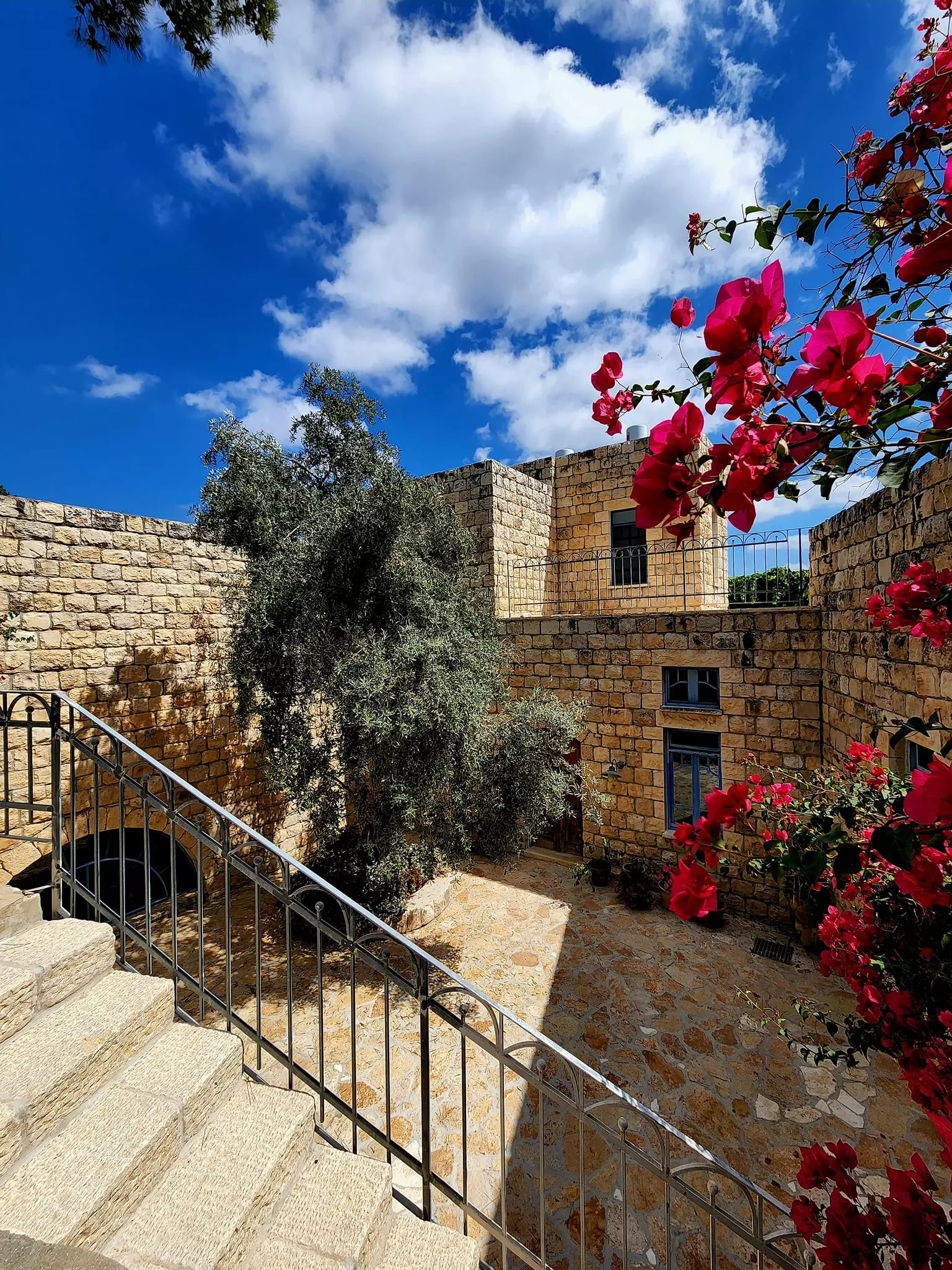
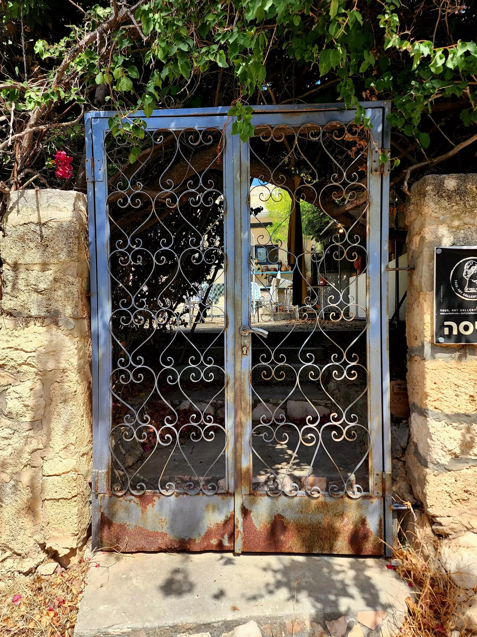
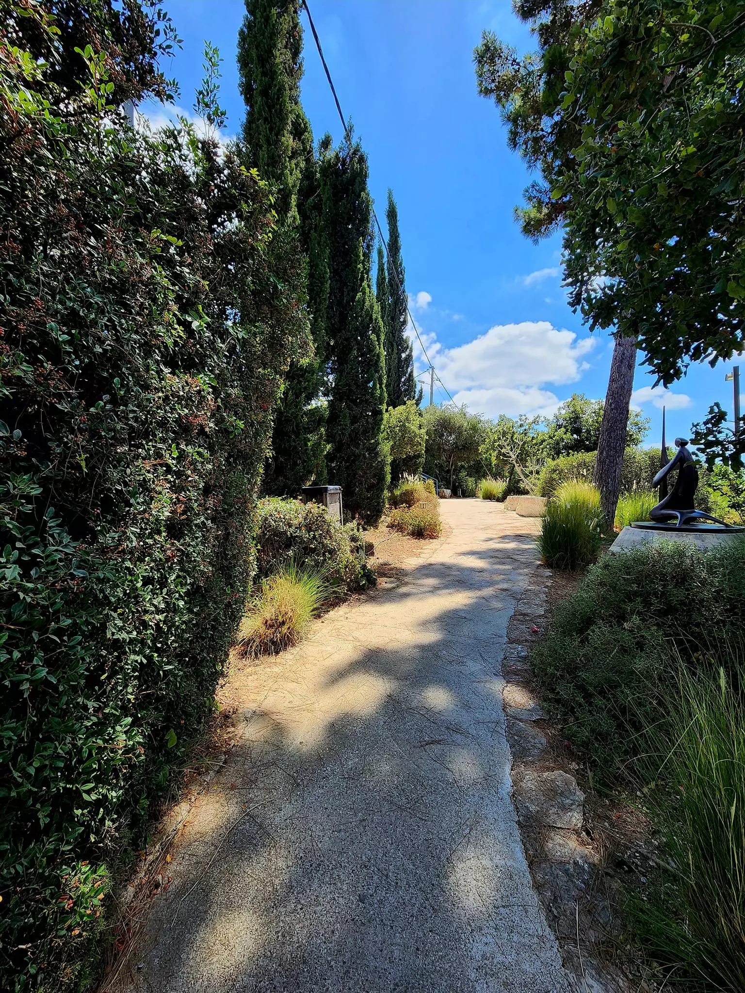
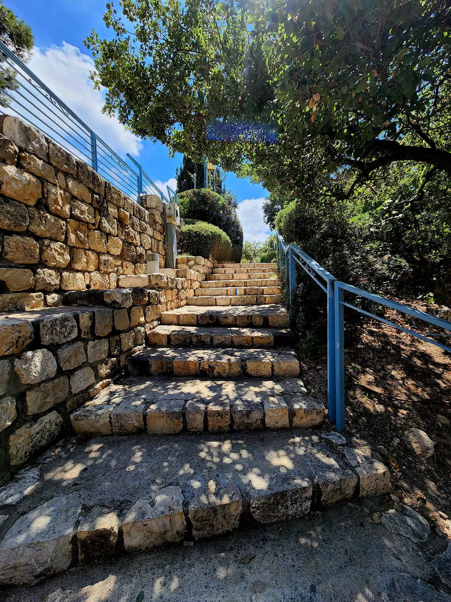
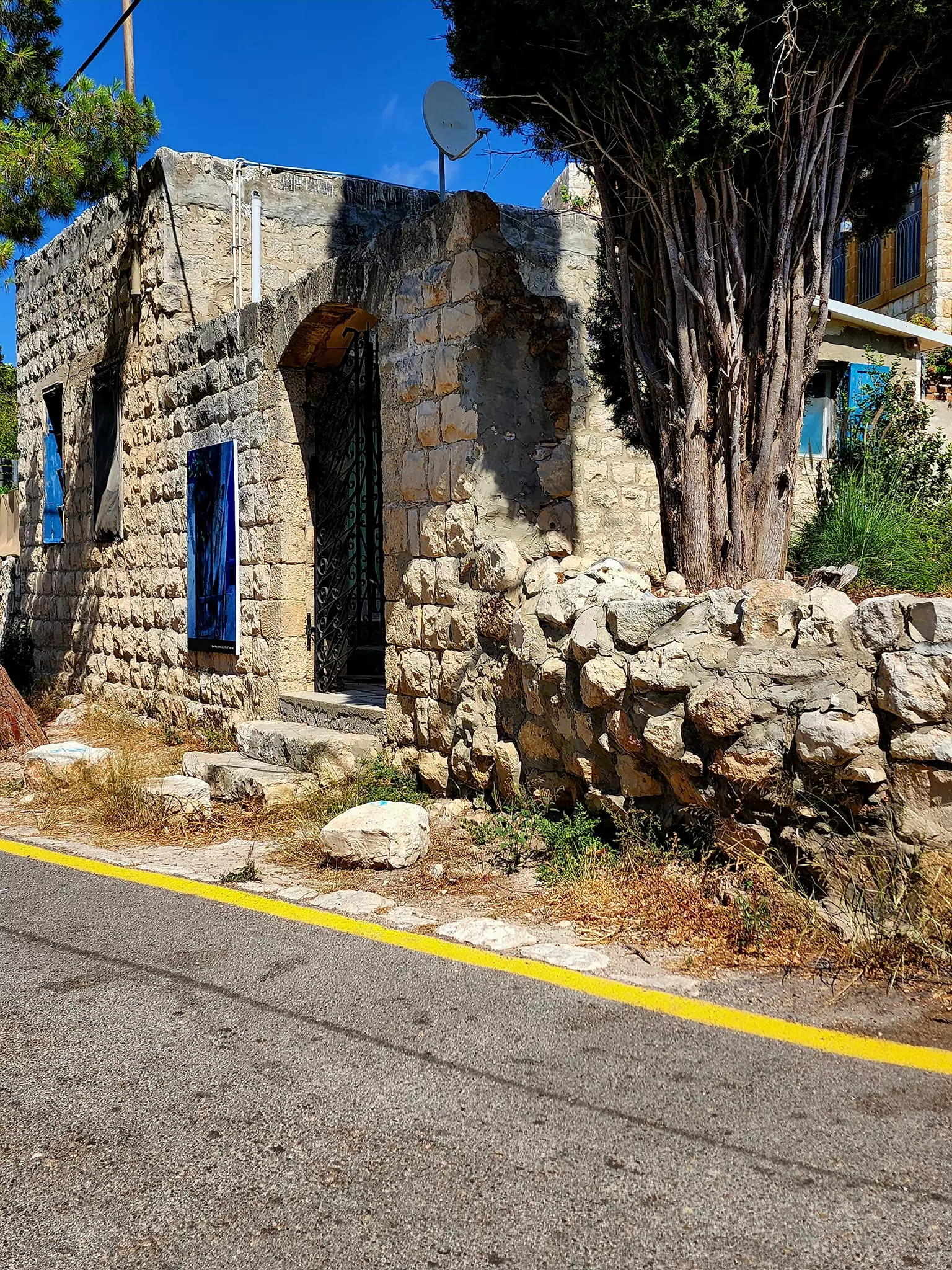
Village Before NakbaThe village lay at the foot of a prominent hill in the middle of the western slopes of Mount Carmel, overlooking the coastal plain and the Mediterranean. It was linked to the coastal highway by a secondary road that was approximately 1 km long. The villagers believed that Ayn Hawd was established by Abu al-Hayja', a major commander under Salah aI-Din (Saladin), who died after the battle of Hittin in 1187. In 1596, Ayn Hawd was a village in the nahiya of Shafa (liwa' of Lajjun) with a population of forty-four. It paid taxes on a number of crops, including wheat and barley, as well as on other types of property, such as goats and beehives. In the late nineteenth century, Ayn Hawd was a small village situated at the end of a spur; it was inhabited by fifty people who cultivated 3 faddans (1 faddan = 100-250 dunums).The village had a rectangular outline, with its houses spread in an east-to-west direction. In the center of the village the predominantly stone houses were clustered closely together; houses built further away from the village center were spaced further apart. As the village expanded it divided into eastern and western quarters (haras). There were a number of springs in the vicinity and also some within the village itself. Ayn Hawd also had a coffee shop and a diwan which served as a meeting place, especially in winter when the requirements of agricultural labor were at a minimum. The residents of Ayn Hawd were Muslims and maintained a mosque in the center of the village. They also had an elementary school for boys that was founded in 1888, during the Ottoman period. They earned their living from livestock breeding and agriculture, which was based on grain and olives. Olive trees covered 845 dunums of the village lands in 1943; some of the olives harvested were processed in a manual olive press. The village was known in the region for its carob, which had a distinctive flavor and aroma and was used to make molasses. The carob trees covered a large area. Eucalyptus and pine trees were also planted on the land. The villagers sold their produce, which included wheat, carob, and sesame, in Haifa and Acre. They also sold building stones, produced in three quarries, and whitewash. In 1944/45 a total of 4,223 dunums was allocated to cereals and 1,503 dunums were irrigated or used for orchards. The khirba of Hajla, to the southeast, contained the foundations of buildings, dressed stones, and rock-hewn cisterns. Village Occupation and Ethnic CleaningA force of 150 Jews struck at Ayn Hawd and the neighboring village of Ayn Ghazal in an attack on the evening of 11 April 1948, according to the Palestinian newspaper Filastin. The attack was repulsed, as was a more serious one the following month. The villagers of Ayn Hawd remained in their village after the fall of Haifa in late April. Ayn Hawd was stormed by Israeli forces in late May 1948 after Arab snipers had allegedly halted traffic on the Tel Aviv-Haifa road. An unnamed informant told a reporter from the Associated Press that Ayn Hawd and Ayn Ghazal had been broken into on 20 May. The residents of Ayn Hawd apparently stayed put after that attack.Ayn Hawd was probably one of a number of villages south of Haifa (including al-Tira, Kafr Lam, and al-Sarafand) that were occupied in a limited operation launched during the 'Ten Days' (the period between the two truces.) If so, it fell to Israeli forces around 15 July 1948 in an operation that was distinguished by the participation of Israeli naval forces. These assisted the land-based attackers by providing covering fire and by bombarding the villages, according to the History of the War of Independence. The inhabitants may have suffered the same fate as those of nearby al-Tira, who were expelled southwards or sent to POW camps, according to Israeli historian Benny Morris. Zionists Colonies on Village LandsThe settlement of Nir Etziyon was established on village land in 1949. Later, in 1954, the settlement of En Hod was established on the village site itself.Village TodayThe village was not destroyed; it has been an artists' colony since 1954, and is designated as a tourist site. The village mosque has been turned into a restaurant/bar, the 'Bonanza'. The lands around the site are cultivated and surrounding forests are used as parks. Those few villagers who did not leave the country as refugees stayed nearby and built a new village, also called Ayn Hawd, which was not legally recognized by the Israeli government and hence was denied all municipal services (including water, electricity, and roads). In the 1970s the Israeli government erected a fence around this new village in order to prevent it from expanding, and in 1986 it threatened to demolish three of its houses. The 130 inhabitants of the new Ayn Hawd have built a new mosque to replace the old one. Muhammad Abu al-Hayja, the son of a leader of the old village, represents the new village in its struggle to win municipal status.SourceDr. Walid al-Khalidi, 1992: All That Remains. |
|||||||||||||||||
| Related Maps | Town Lands' Demarcation Maps خرائط للقضاء توضح حدود القرى والاودية Town's map on MapQuest View from satellite Help us map this town at WikiMapia |
||||||||||||||||
| Related Links | Wikipedia's Page Featured Article Google Search Google For Images Google For Videos |
||||||||||||||||
| More Information | مخطط البلد في كتاب كي لا ننسى في كتاب بلادنا فلسطين المزيد من موقع هوية |
||||||||||||||||
- كتاب قرية عين حوض المهجرة - د. شريف كنعانة وبسام الكعبي
- The History of 'Ayn Hawd
- الاستيلاء على عين حوض كما يرويها الإسرائيليون
- عين حوض وعين هود : تقاطع أم تباعد ؟
- في الذكرى الثانية لباني عين حوض الجديدة الحاج حلمي أب الهيجاء
- نسب آل أبي الهيجاء وقراهم وأماكن استقرارهم قبل النكبة وأماكن انتشارهم بعدها - الحلقة الأولى
- نسب آل أبي الهيجاء وأصلهم وأماكن استقرارهم قبل النكبة وأماكن انتشارهم بعدها الحلقة الثانية
- نسب آل أبي الهيجاء وأصلهم وأماكن استقرارهم قبل النكبة وأماكن انتشارهم بعدها الحلقة الثالثة
- نسب آل أبي الهيجاء وأصلهم وأماكن استقرارهم قبل النكبة وأماكن انتشارهم بعدها الحلقة الرابعة
- نسب آل أبي الهيجاء وأصلهم وأماكن استقرارهم قبل النكبة وأماكن انتشارهم بعدها الحلقة الخامسة
- نسب آل أبي الهيجاء وأصلهم وأماكن استقرارهم قبل النكبة وأماكن انتشارهم بعدها الحلقة السادسة
- نسب آل أبي الهيجاء وأصلهم وأماكن استقرارهم قبل النكبة وأماكن انتشارهم بعدها الحلقة السابعة
- نسب آل أبي الهيجاء وأصلهم وأماكن استقرارهم قبل النكبة وأماكن انتشارهم بعدها الحلقة الثامنة -عين حوض
- نسب آل أبي الهيجاء وأصلهم وأماكن استقرارهم قبل النكبة وأماكن انتشارهم بعدها الحلقة الثامنة -عين حوض
- أهالي عين حوض خلال فترة الاحتلال واللجوء إلى اليامون واستقبال آل أبوالهيجاء لهم الحلقة التاسعة
- عين حوض بعد الاحتلال سنة 1948 الحلقة العاشرة
- عين حوض ( الجديدة ) أو قرية أبو حلمي (1) الحادية عشر
- قري وأماكن اقامة آل أبى الهيجاءفي منطقة جنين وأماكن استقرارهم بعد اللجوء اليها الحلقة الثانية عشر
- قري وأماكن اقامة آل أبى الهيجاءفي منطقة جنين وأماكن استقرارهم بعد اللجوء اليها الحلقة الثالثة عشر
- قري وأماكن اقامة آل أبى الهيجاءفي منطقة رام الله بعد اللجوء اليها الحلقة الرابعة عشر
- قري وأماكن اقامة آل أبى الهيجاءفي منطقة رام الله بعد اللجوء اليها الحلقة الخامسةعشر
- قري وأماكن اقامة آل أبى الهيجاءفي منطقة رام الله بعد اللجوء اليها الحلقة 16
- قري وأماكن اقامة آل أبى الهيجاءفي منطقة رام الله بعد اللجوء اليها الحلقة 17
- اسم قرية عين حوض ، من أين أتى ؟ وكيف استقر وثبت؟ حلقة 18
- نبذة تاريخية عن قرية عين حوض (قضاء حيفا) من كتاب (كي لا ننسى)
- القدس تلعربي: عين حوض.. قرية فلسطينية على الكرمل نهضت من الموت بفضل شيخها أبو حلمي-
- قرية عين حوض - الموسوعة الفلسطينية
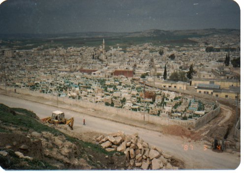
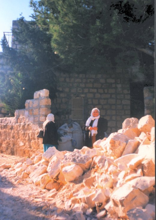
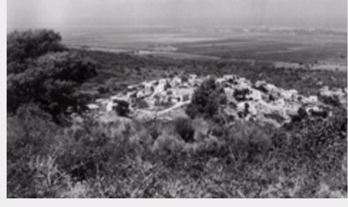
- General View Of 'Ayn Hawd Before Ethnic Cleansing In July 1948
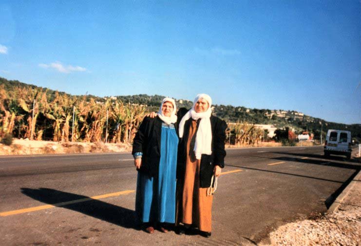
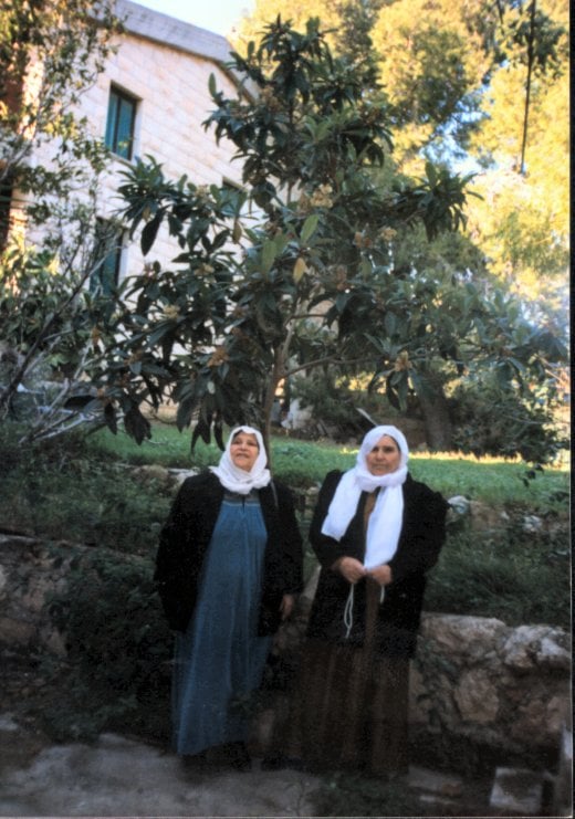
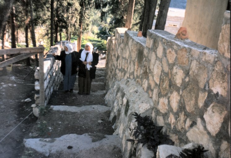
Posted by Rachel Jones 3 - HAIFA as Remembered by IBRAHEEM AL ZEBEN
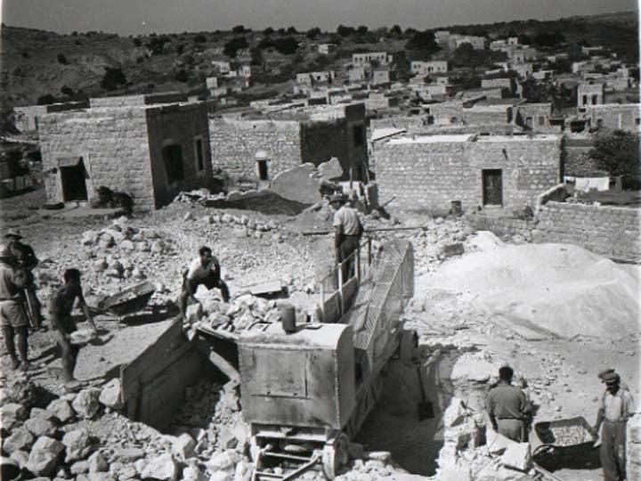
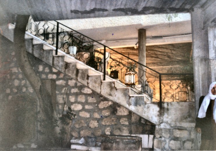
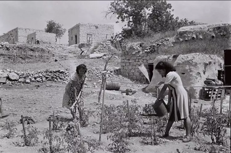
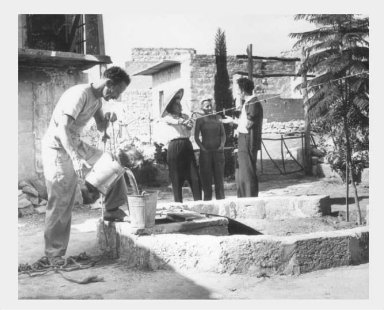
Posted by Abu Firas 1 - Moving Into 'Ayn Hawd, However, Not Its True Owners,1954
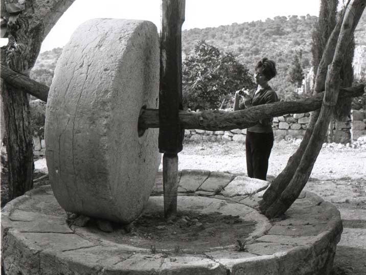
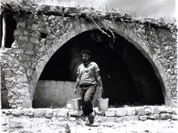
Posted by Rachel Jones - That's How The People Of 'Ayn Hawd Used To Ground Wheat Before They Were Ethnically Clansed In July 1948, 1954
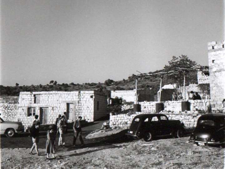
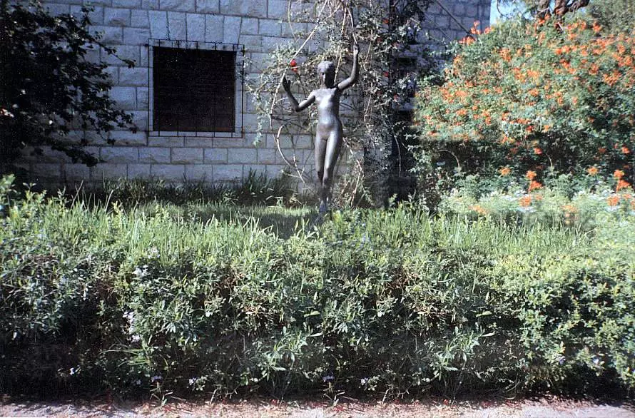
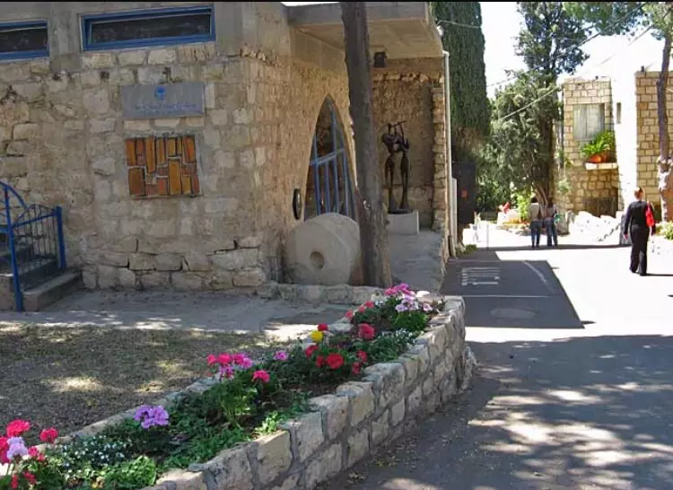
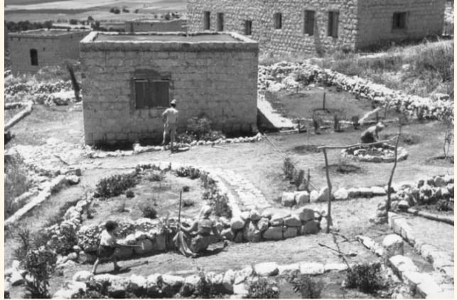
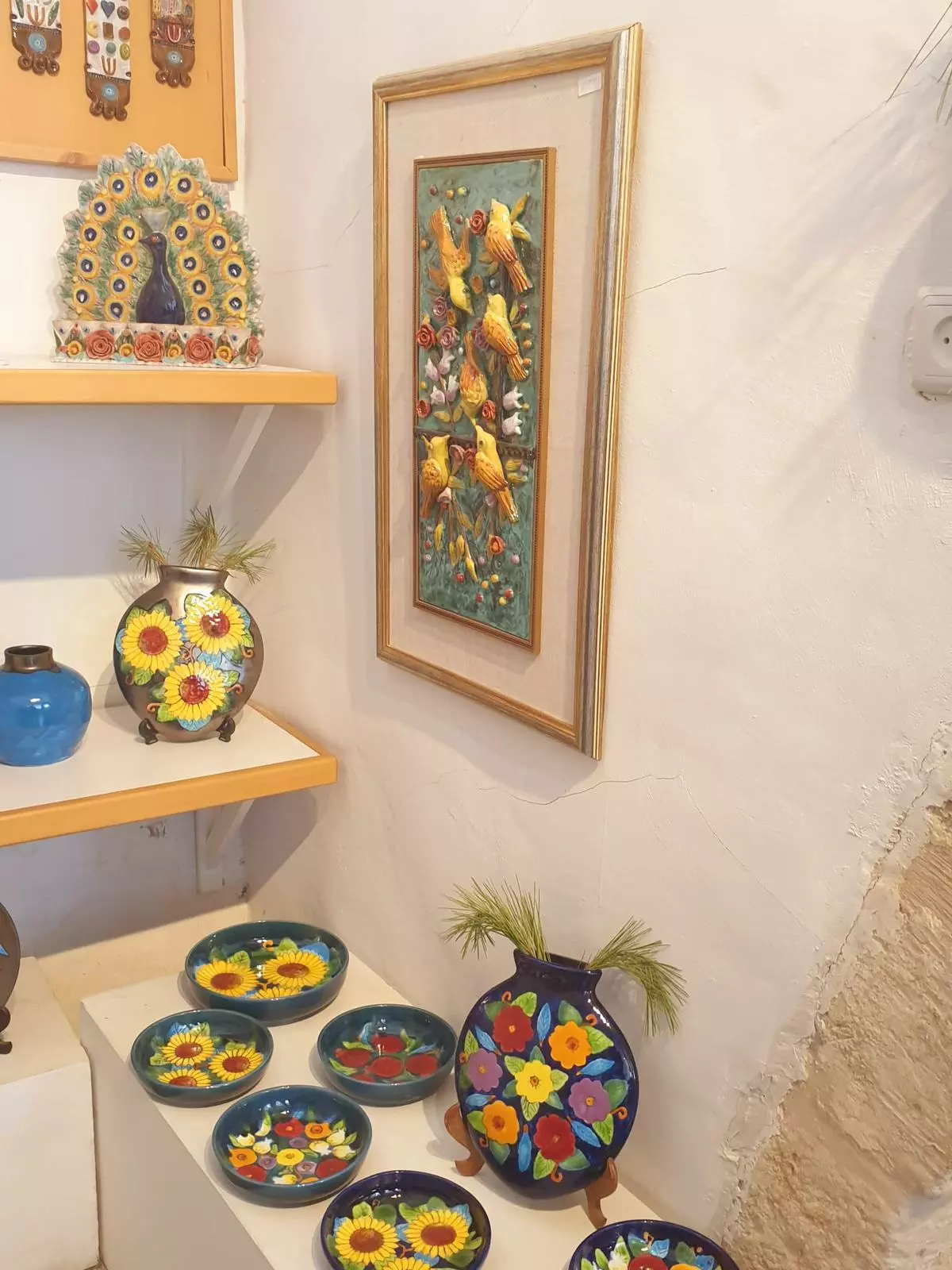
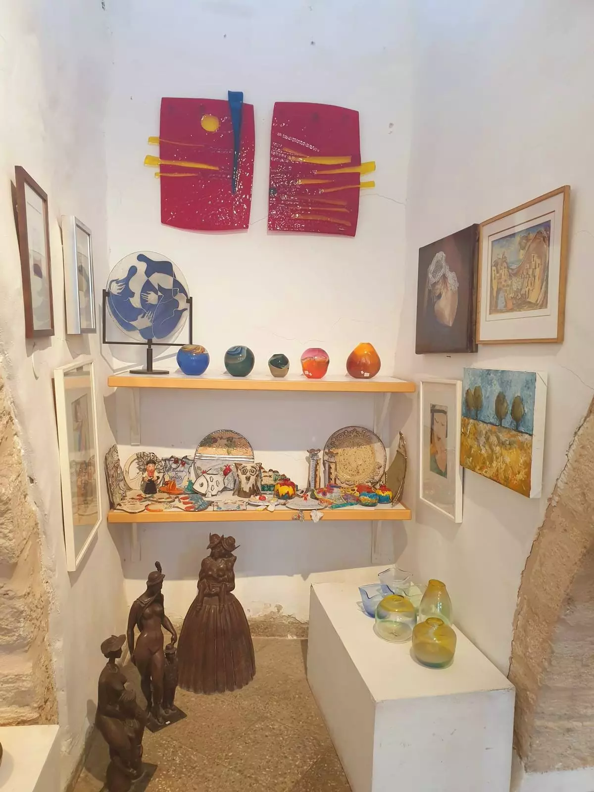
Posted by Rachel Jones 1 - General View Of 'Ayn Hawd As It's Being Renovated By Jewish Artists In1954
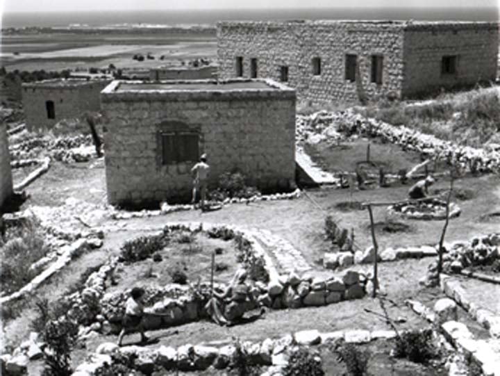
Posted by Rachel Jones - A Picture Of 'Ayn Hawd At It's Being Renovated By Jewish Artists So It Becomes Their Home, 1954
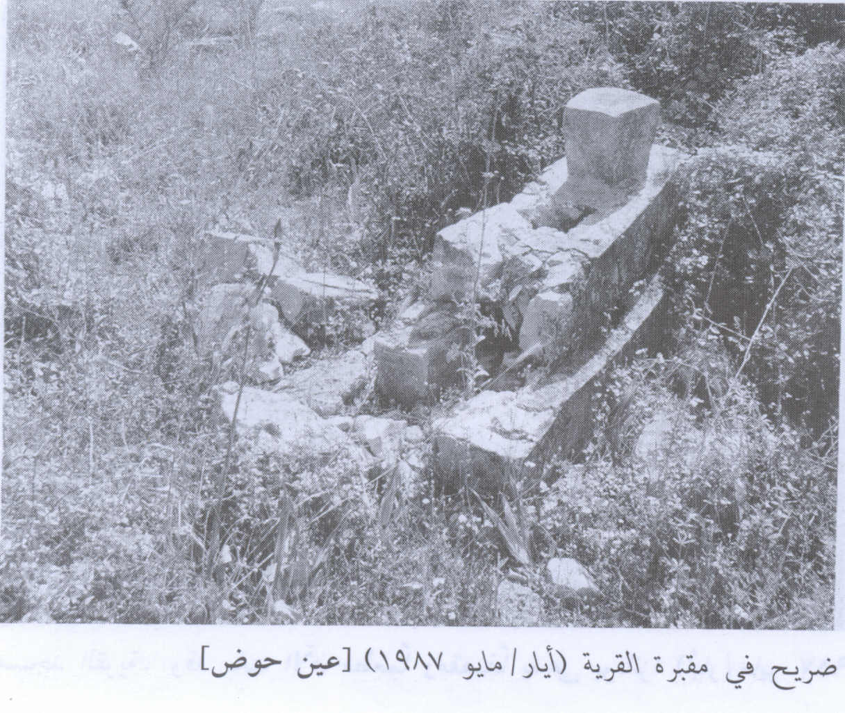
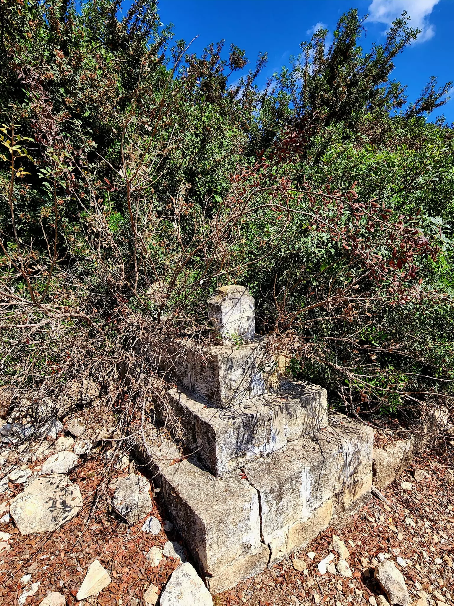
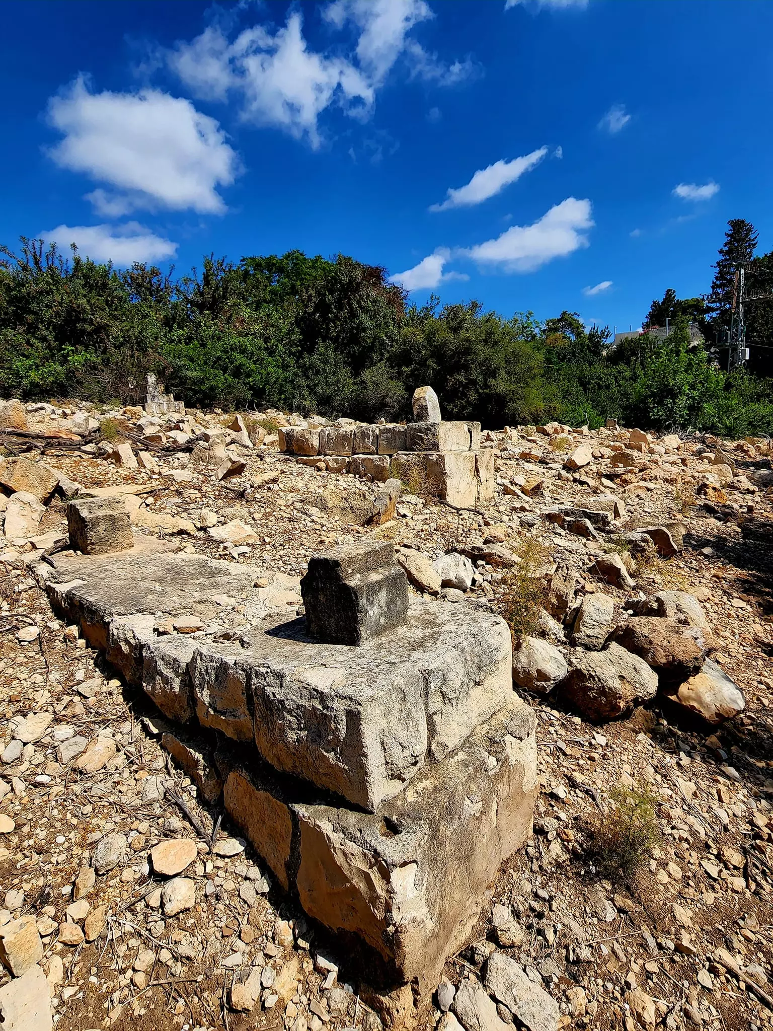
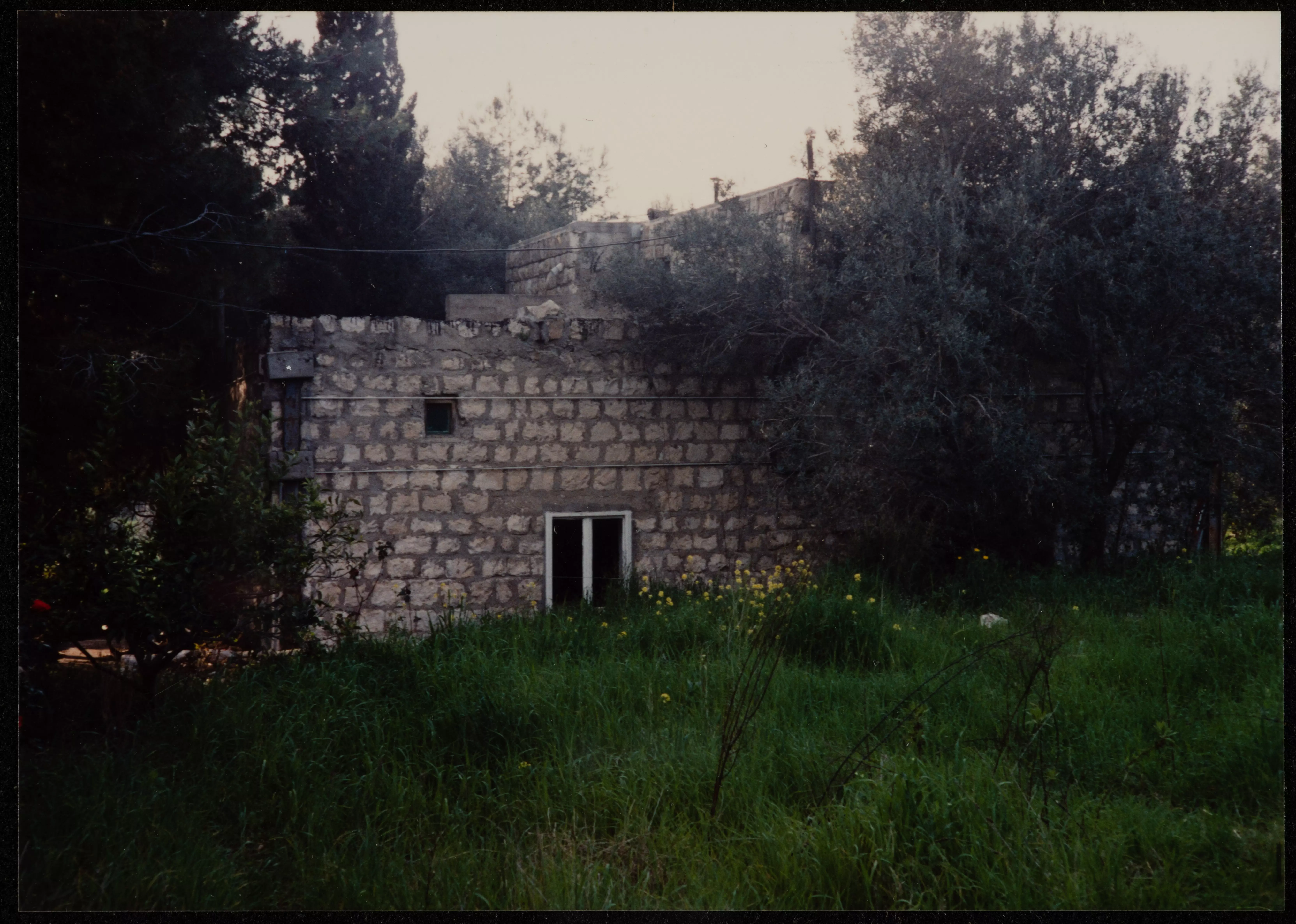
Posted by Rachel Jones - Remains of the village cemetery, 1987
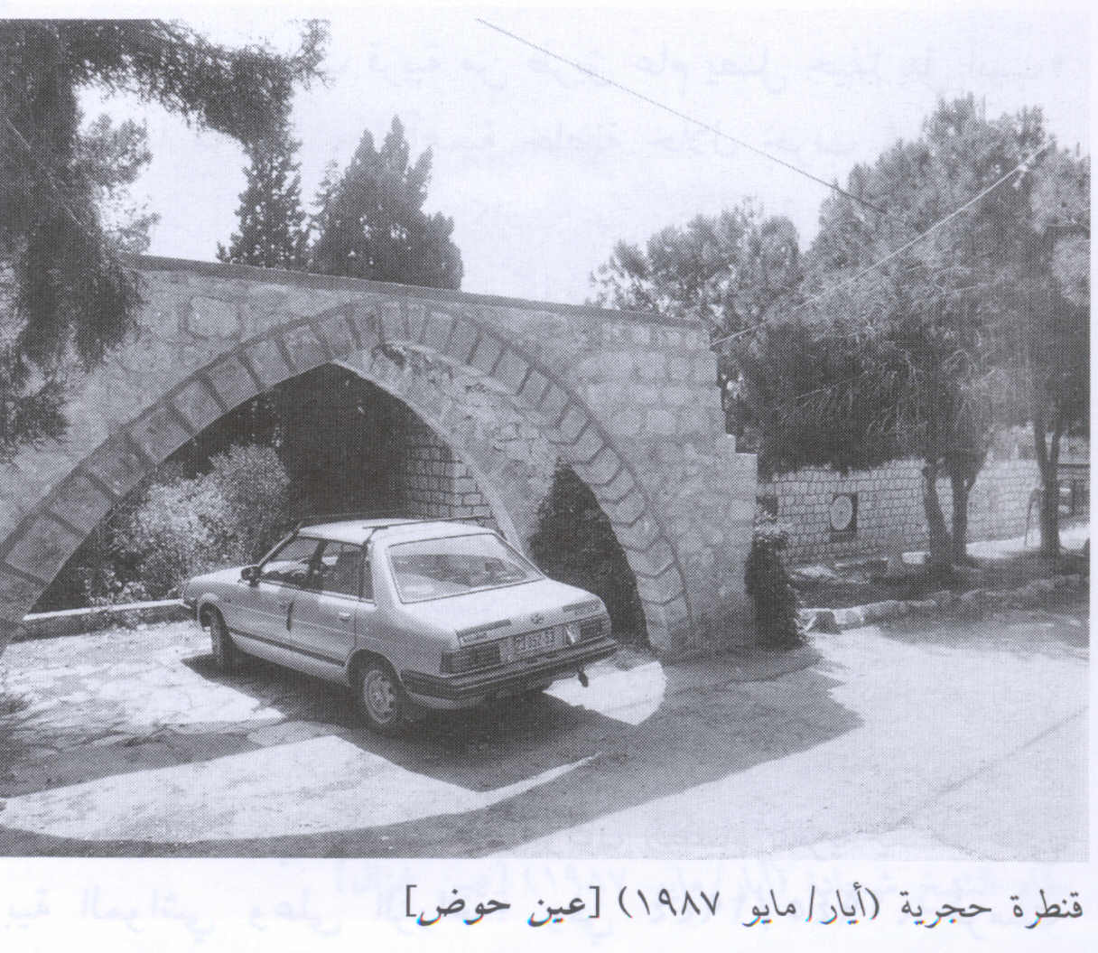
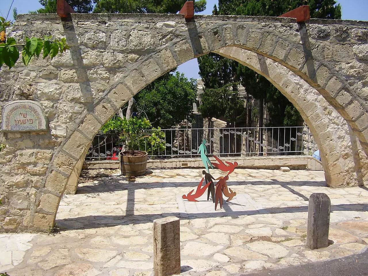
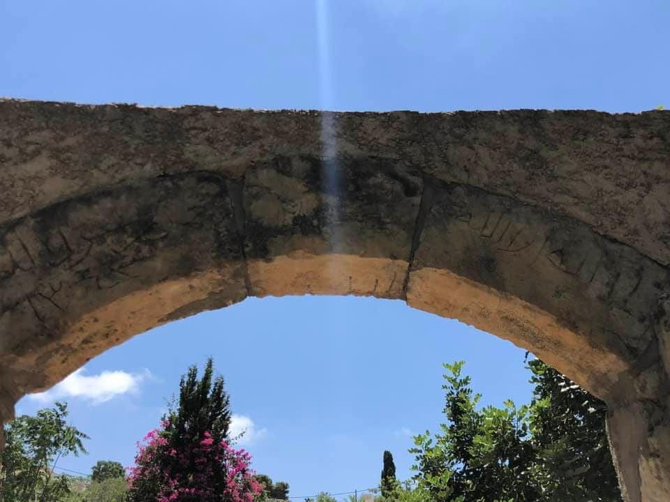
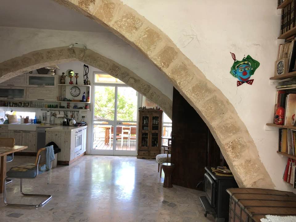
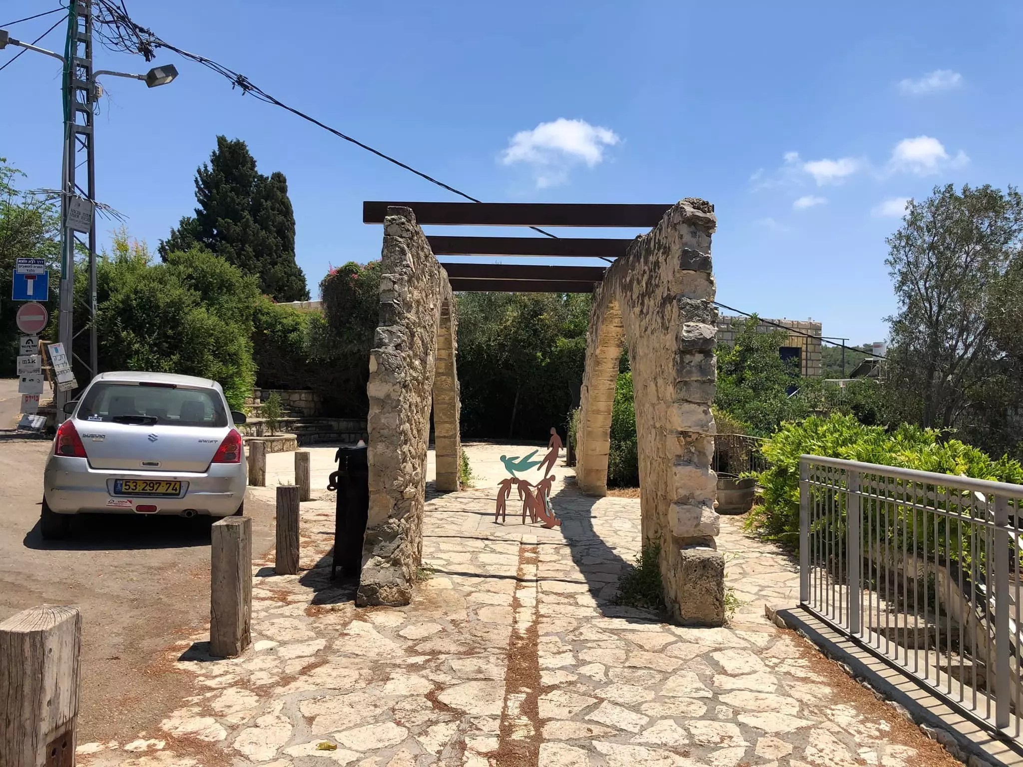
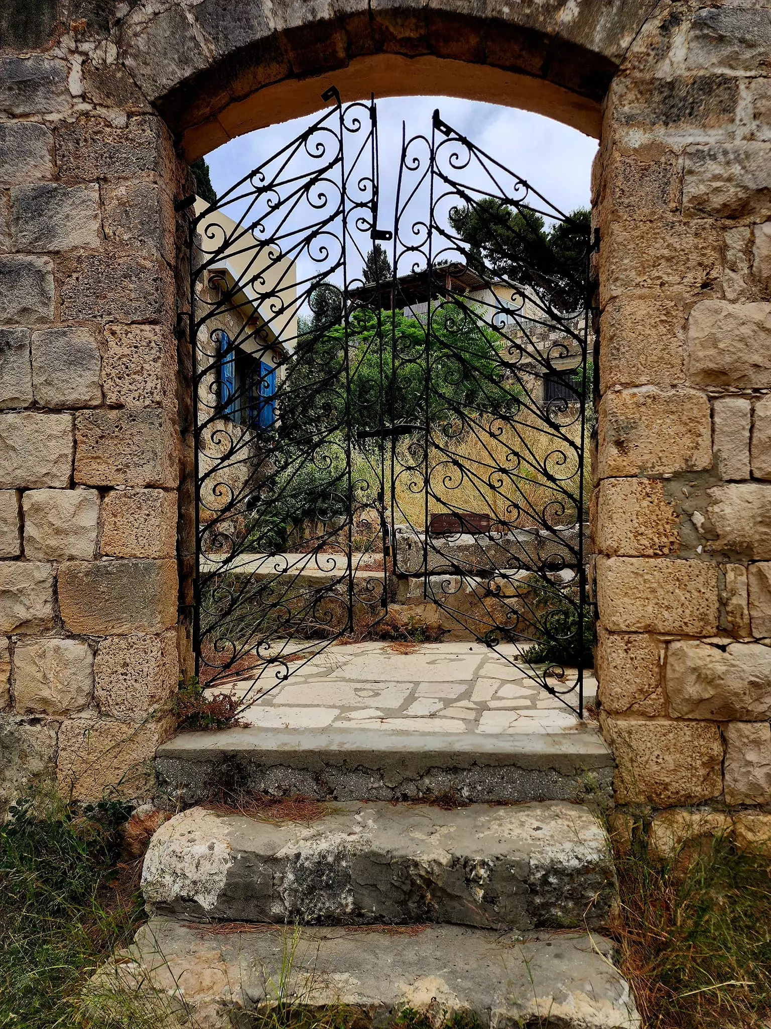
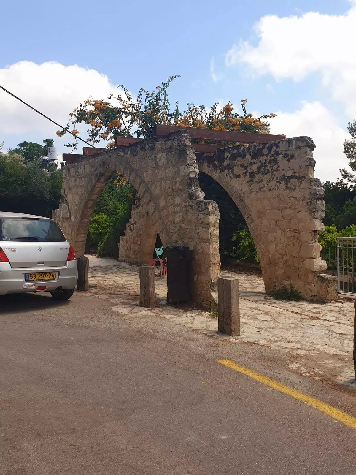
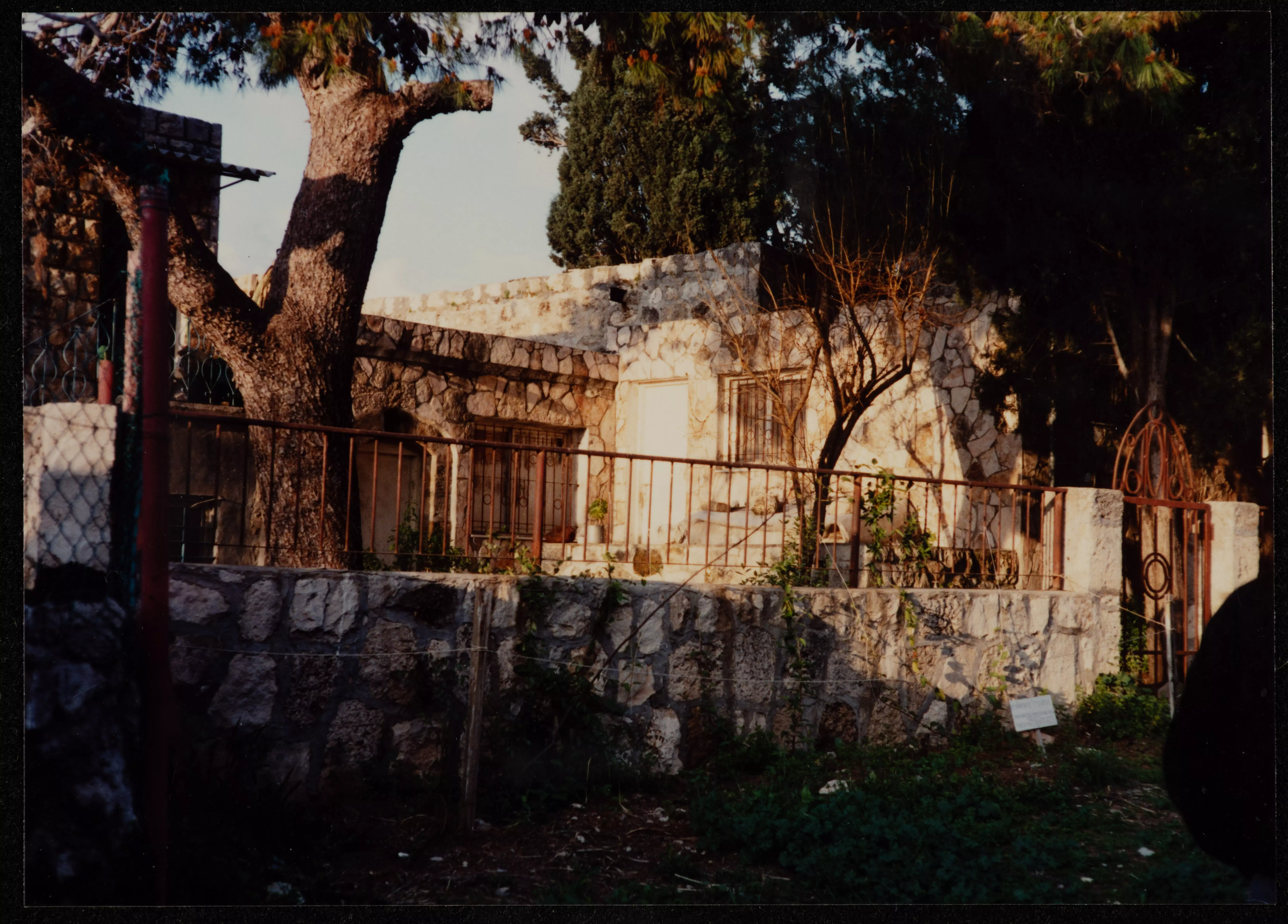
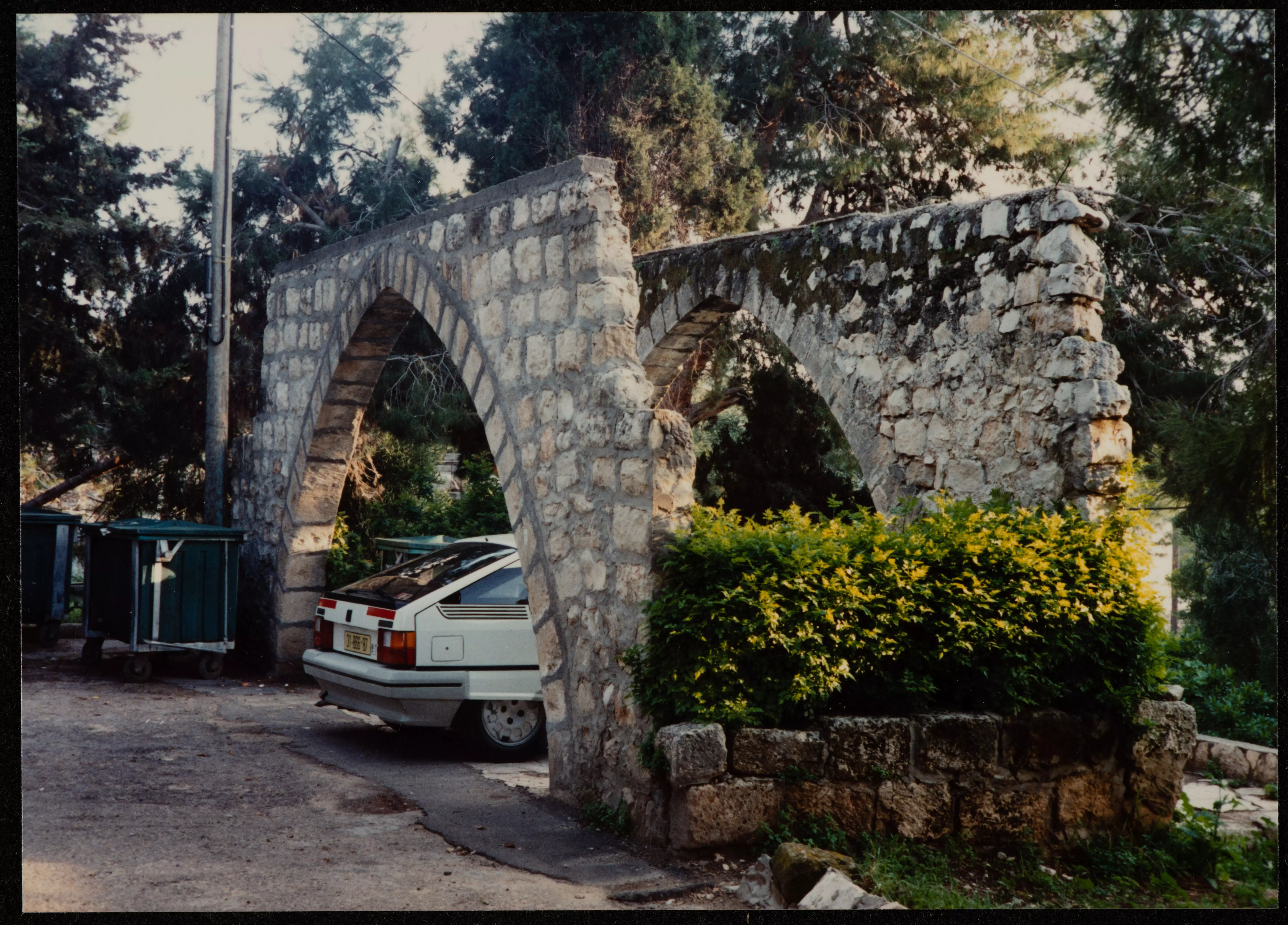
Scanned from "All That Remains" by Dr. Walid Khalidi - Stone Arch In 1987
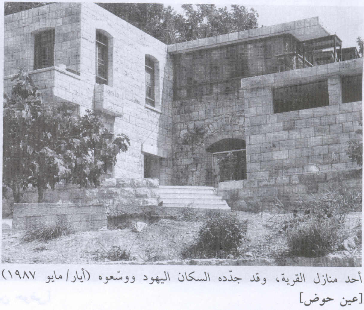
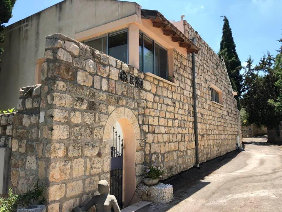
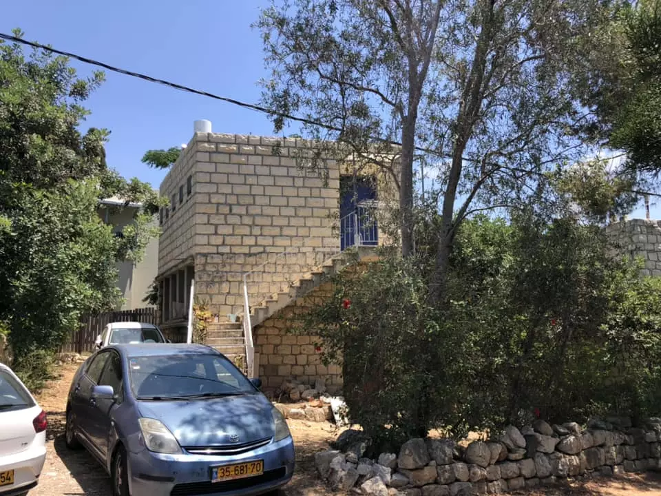
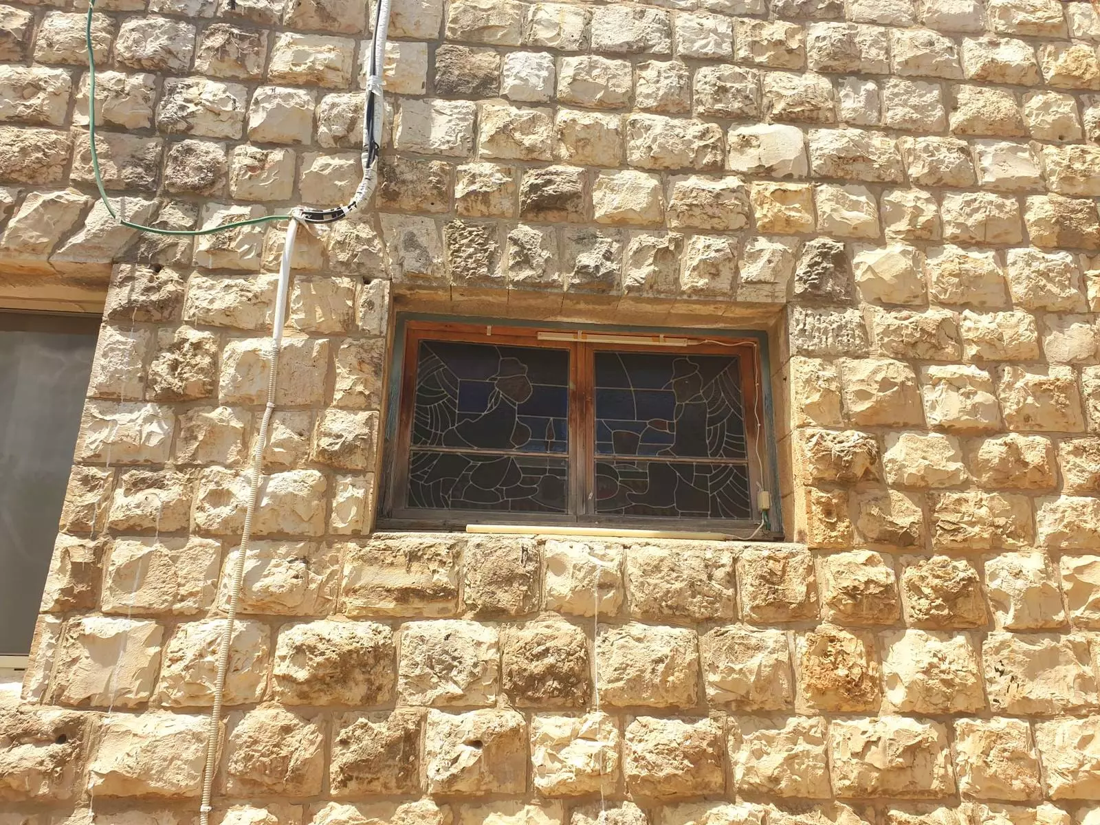
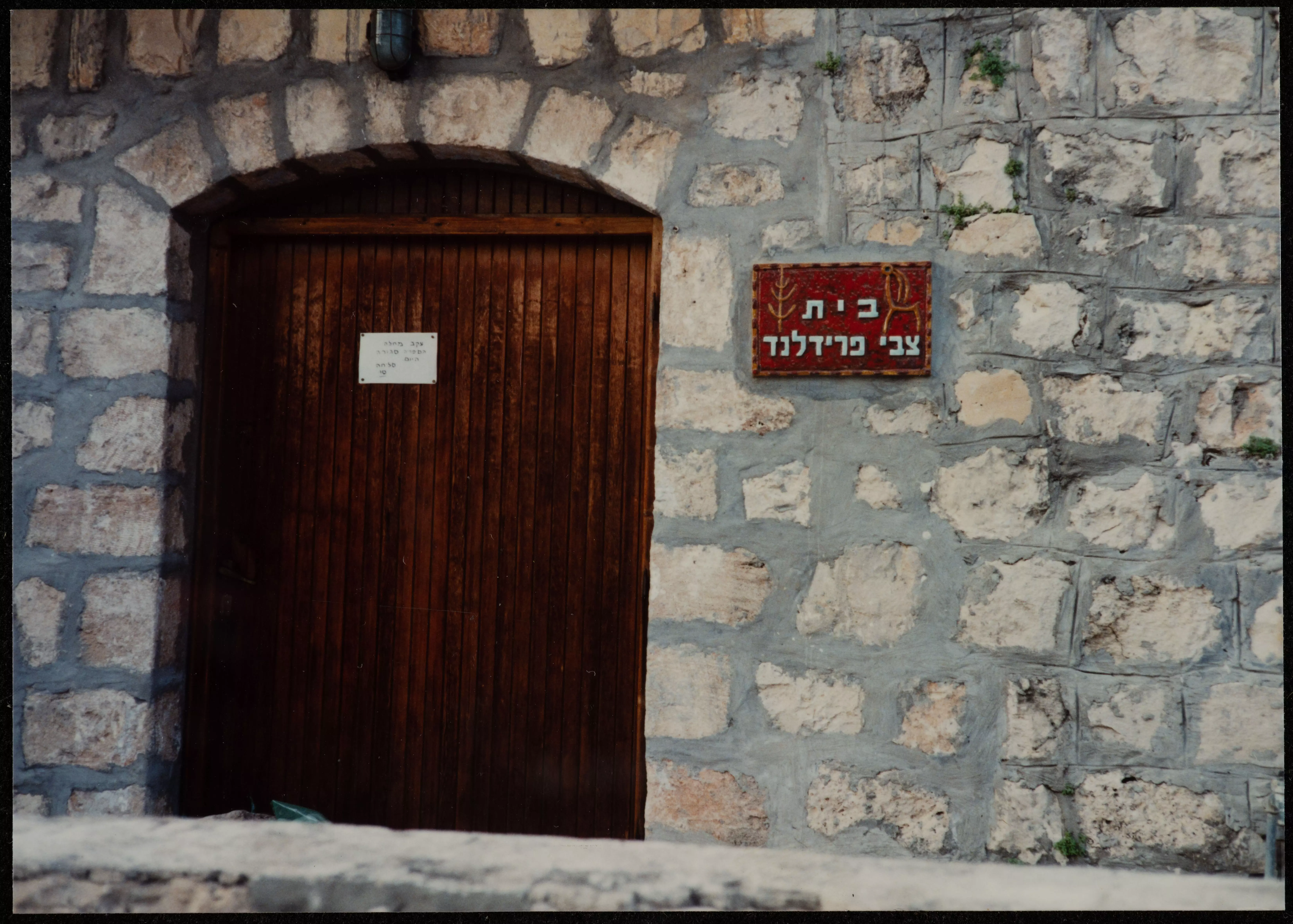
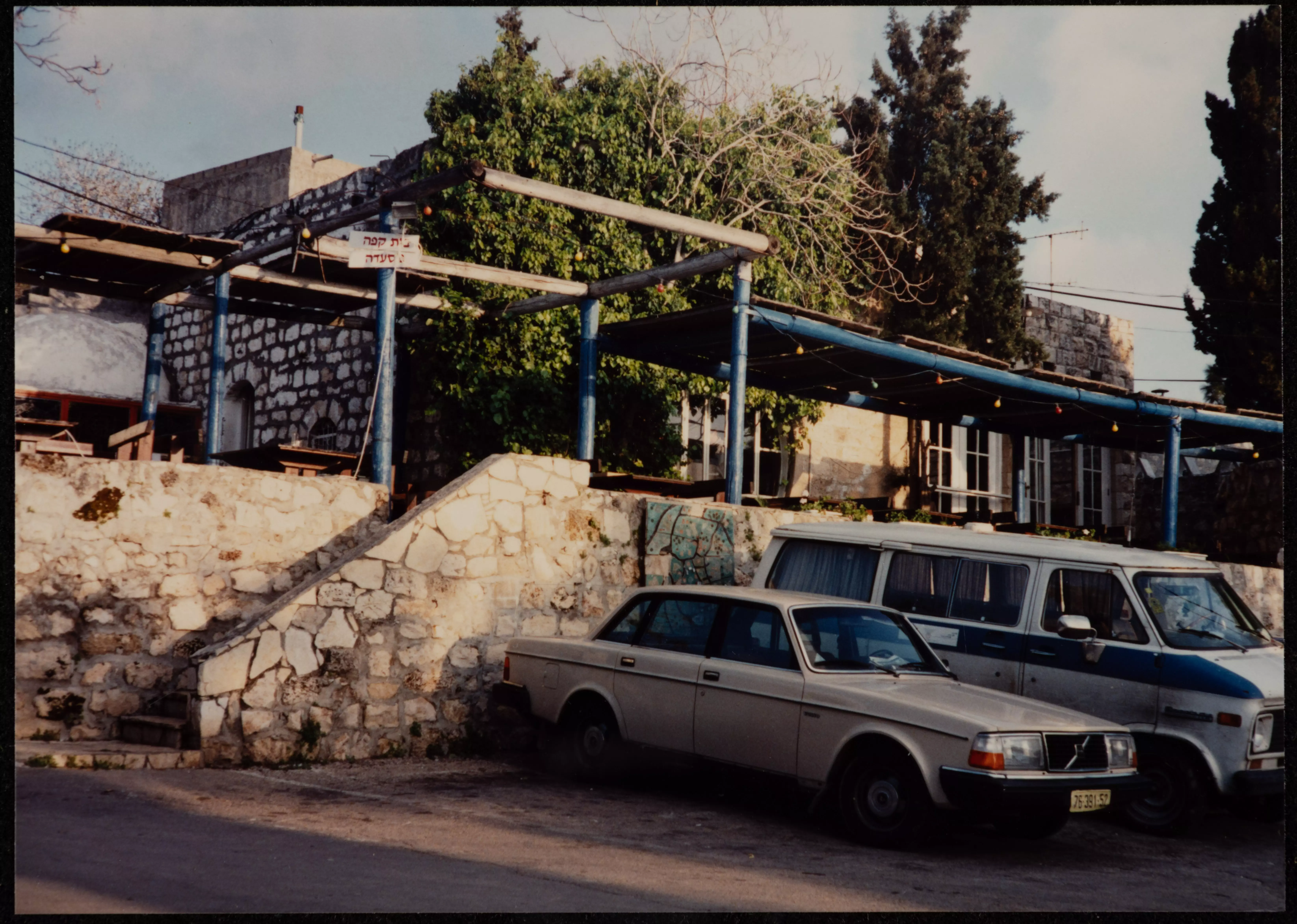
Scanned from "All That Remains" by Dr. Walid Khalidi - A village house renvovated & extended by Jewish Settlers, 1987
Scanned from "All That Remains" by Dr. Walid Khalidi 1 - A Picture Of 'Ayn Hawd At It's Being Renovated ByJewish Artists So It Becomes Their Home( #2), 1954
Posted by Rachel Jones 1 - Irbid (Jordan) Refugee Camp where many of 'Ayn Hawd refugee lives now
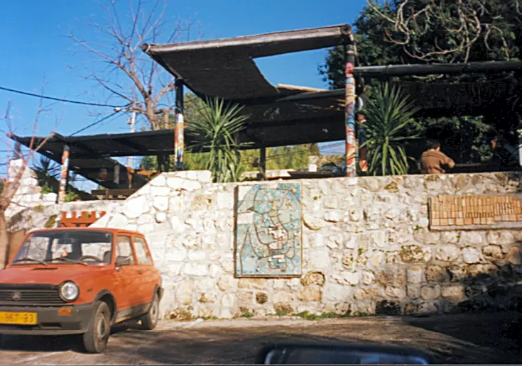
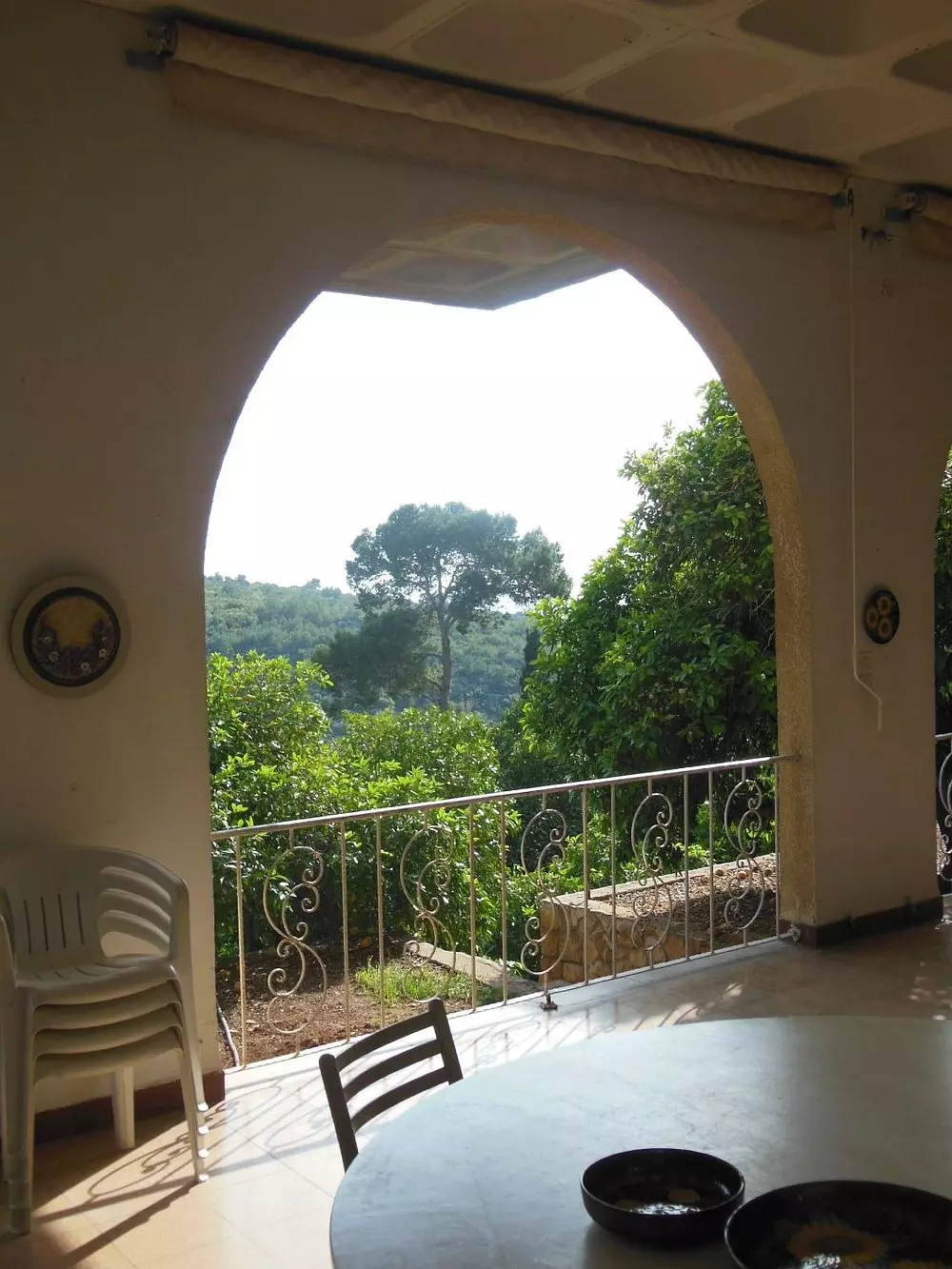
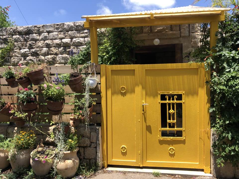
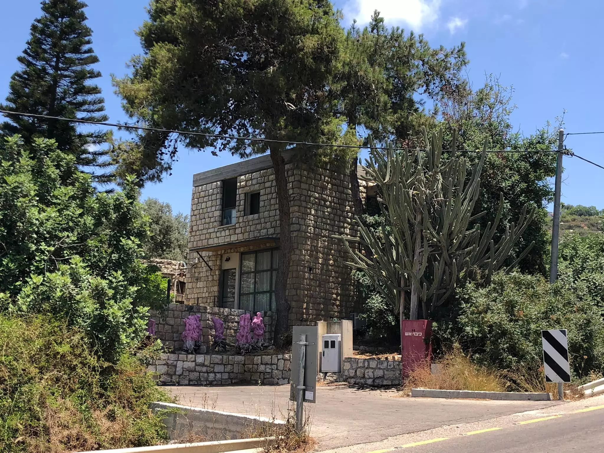
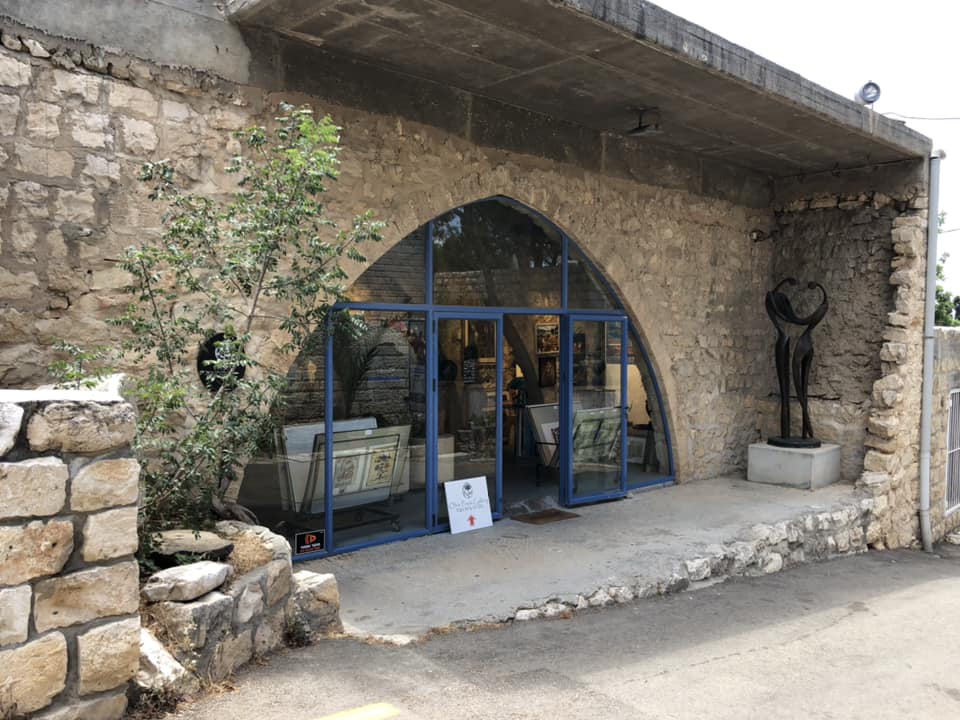
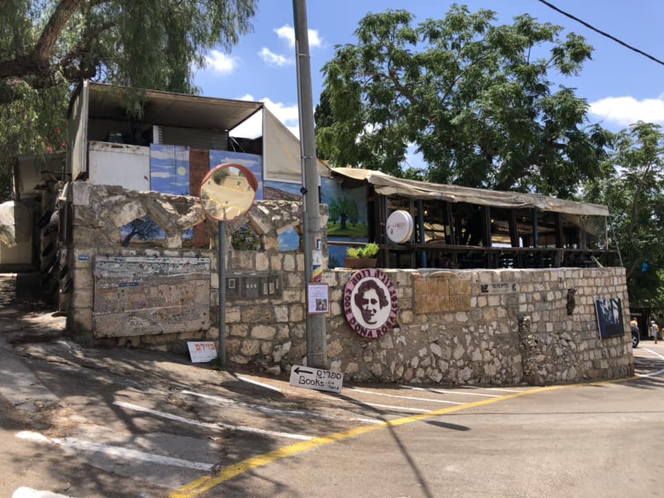
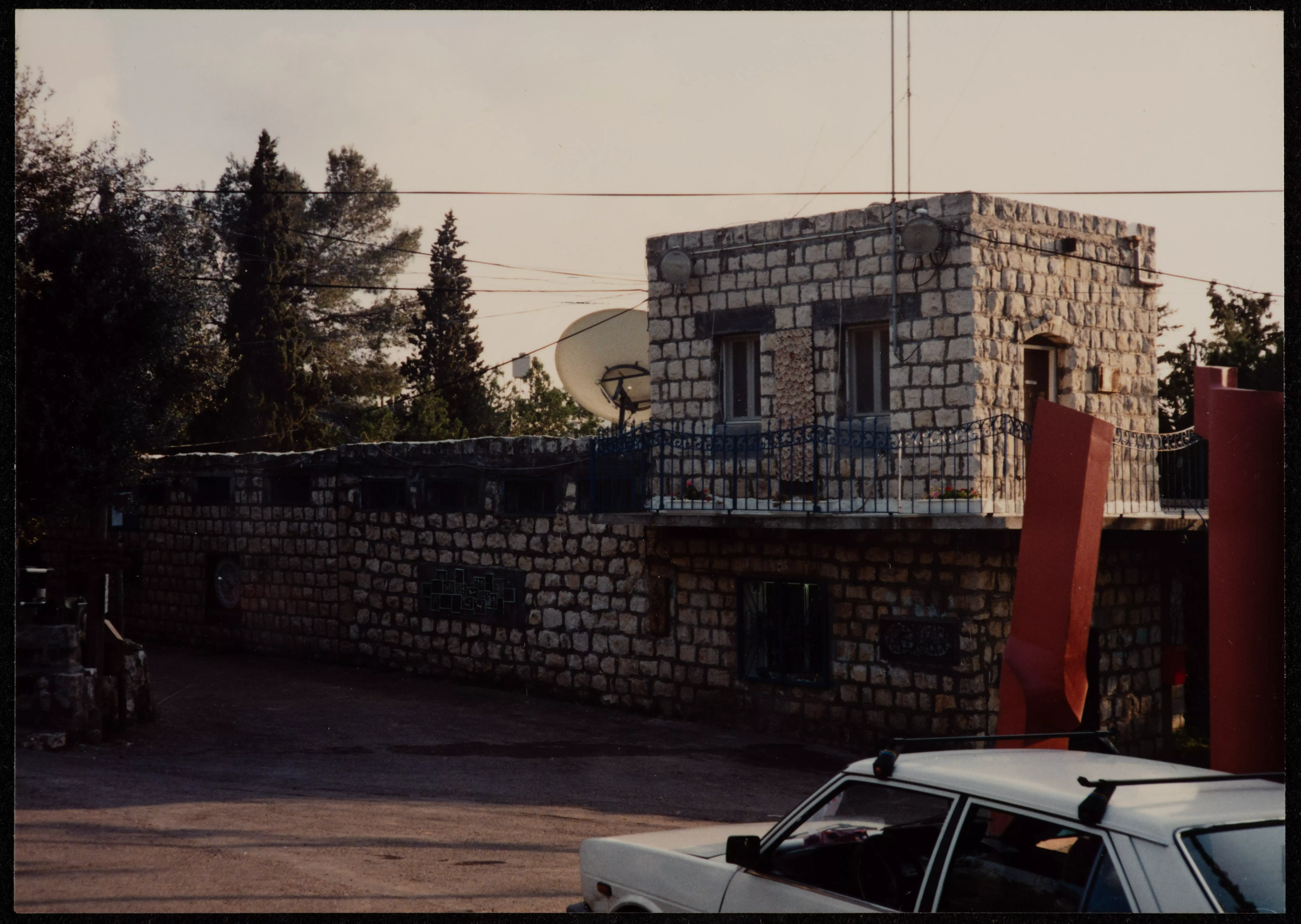
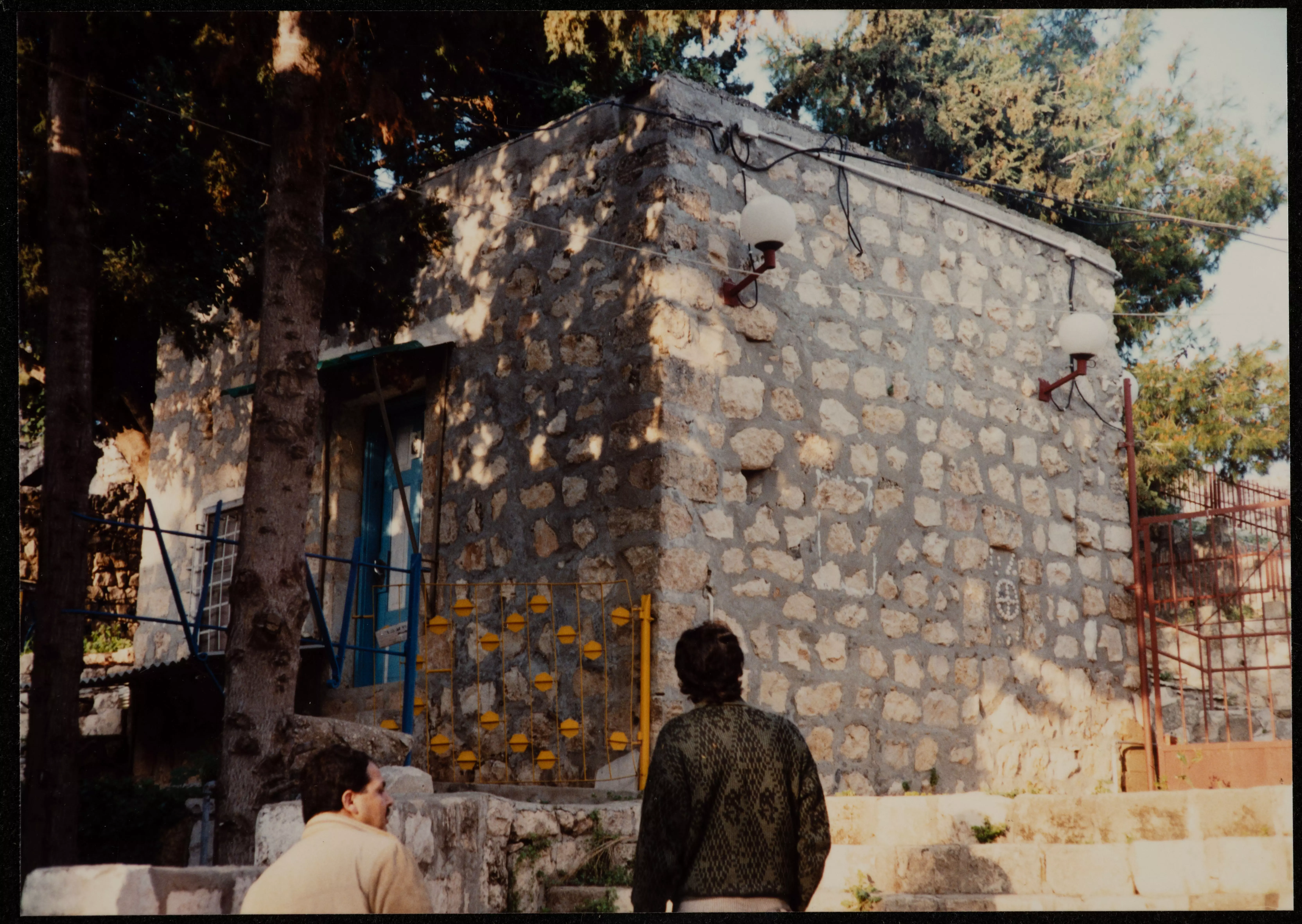
Posted by Abu Firas 1 - Ayn Hawd former mosque now a bar
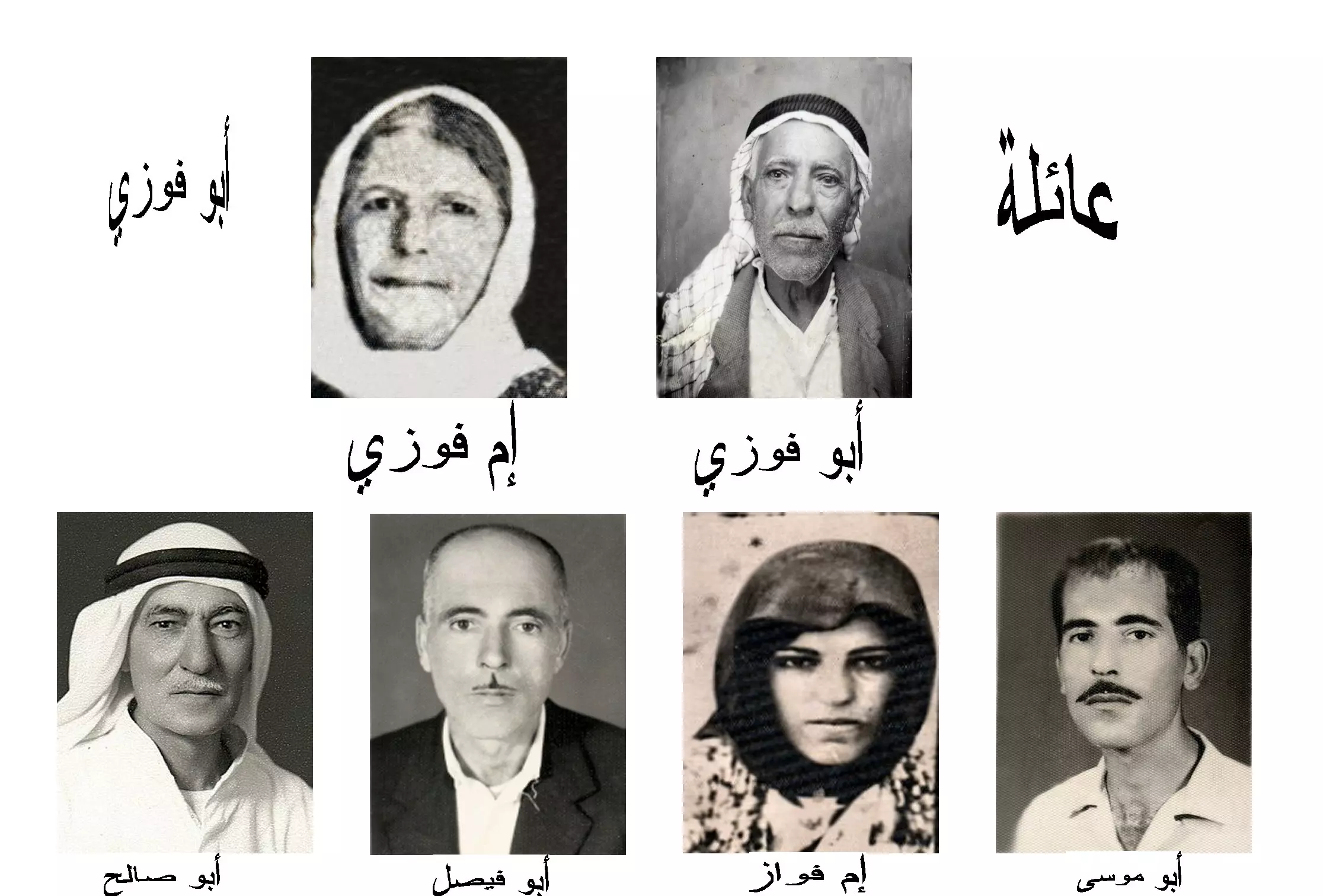
Posted by أبو اليزن السعافين - Ayn Hawd Family (Abu-Fawzi Family)
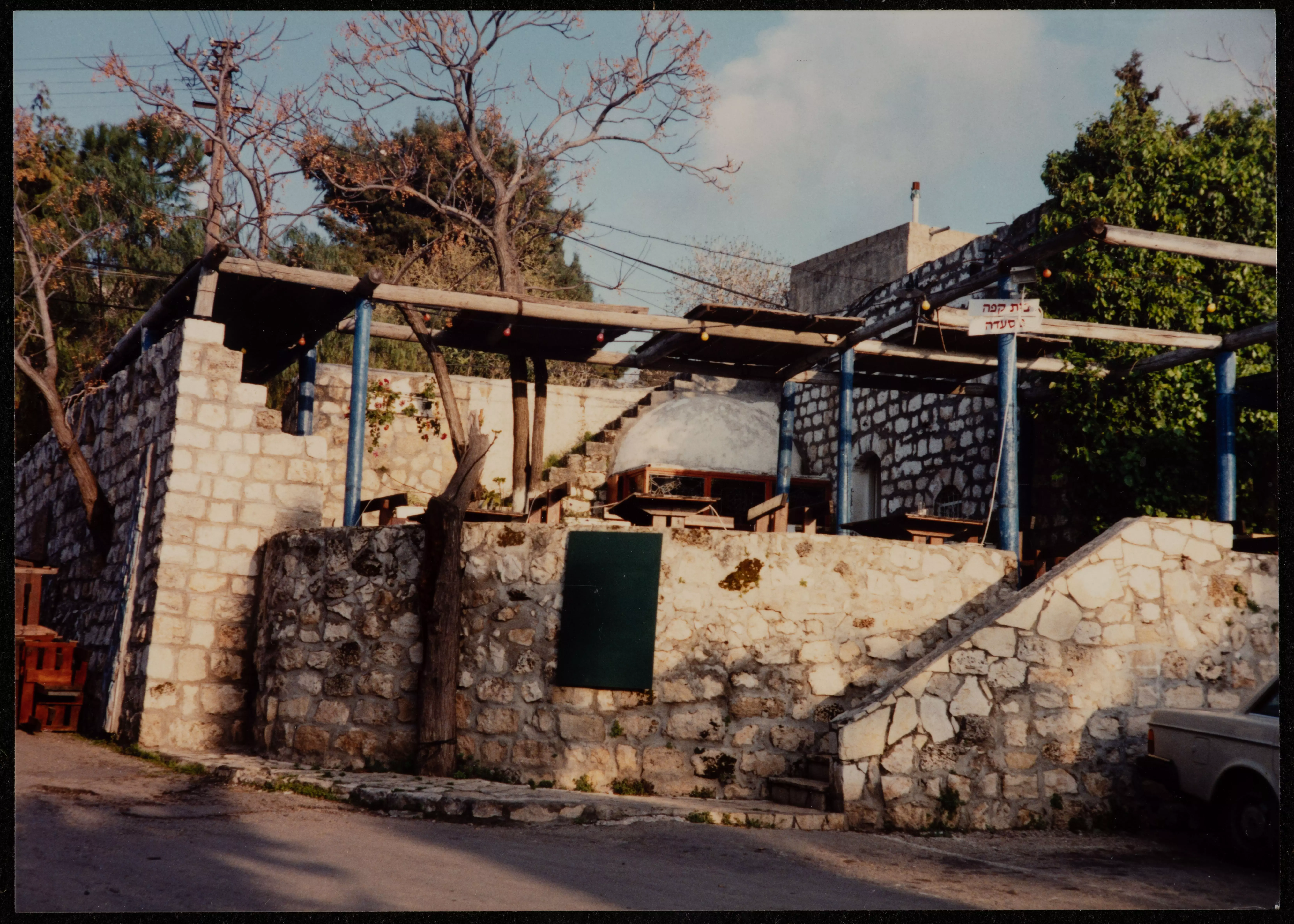
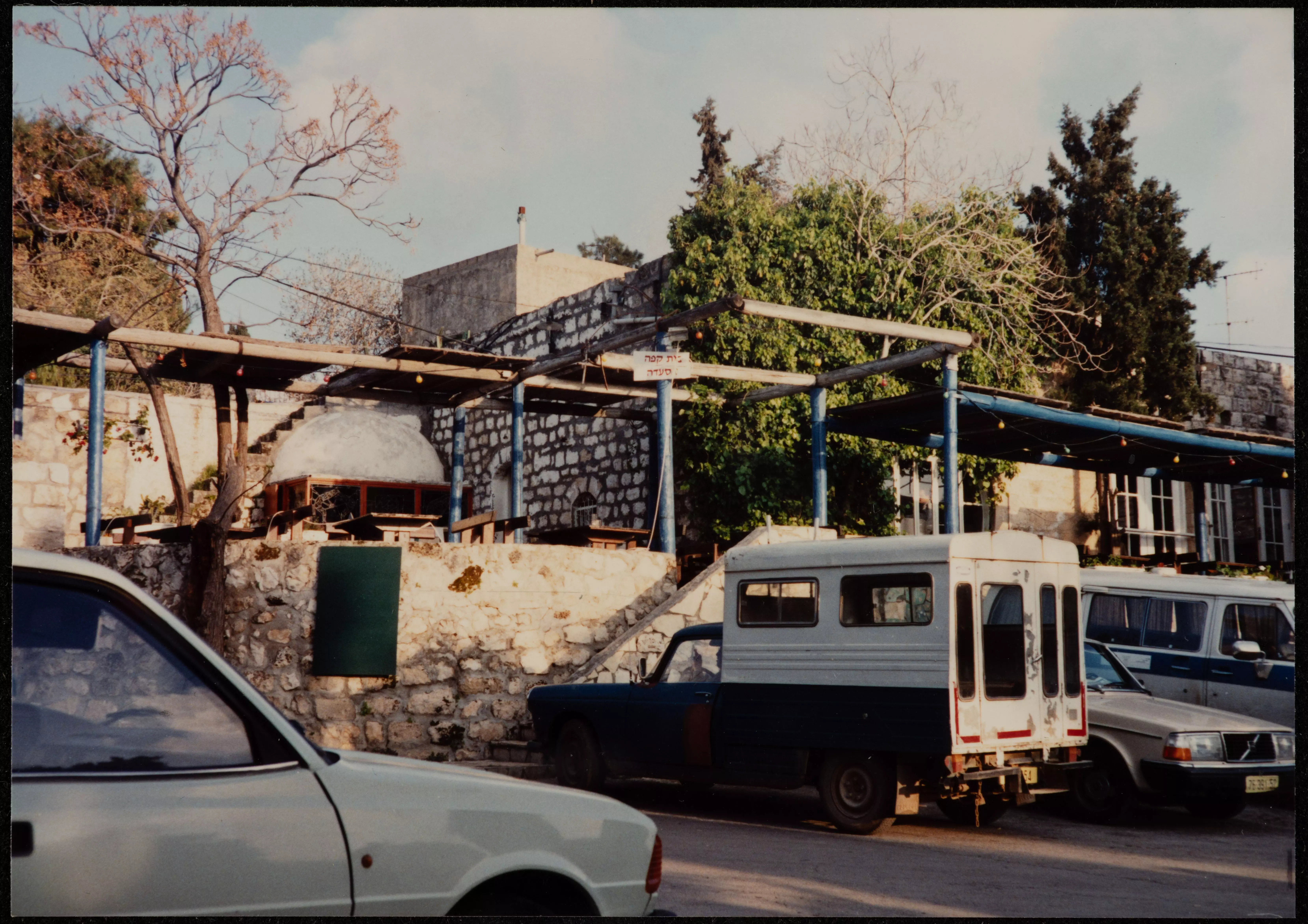
Posted by Abu Firas 1 - Abu Shakeeb cafe house, 2000
Posted by Abu Firas - The stolen Grape Vines -Krom el-Inab- which belongs al-Haj Yusef, 2000
Posted by Abu Firas - The Mosque/Masjid of 'Ayn Hawd , now a bar, 2000
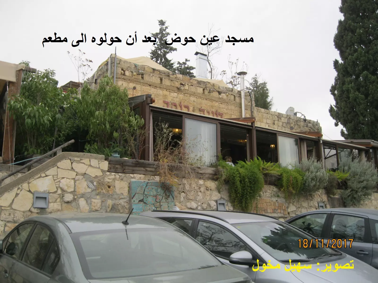
Posted by Abu Firas - 'Ayn Houd's Mosque, now a restaurant and a bar, May 2002--مسجد قرية عين حوض - تحول الى مطعم وخمارة
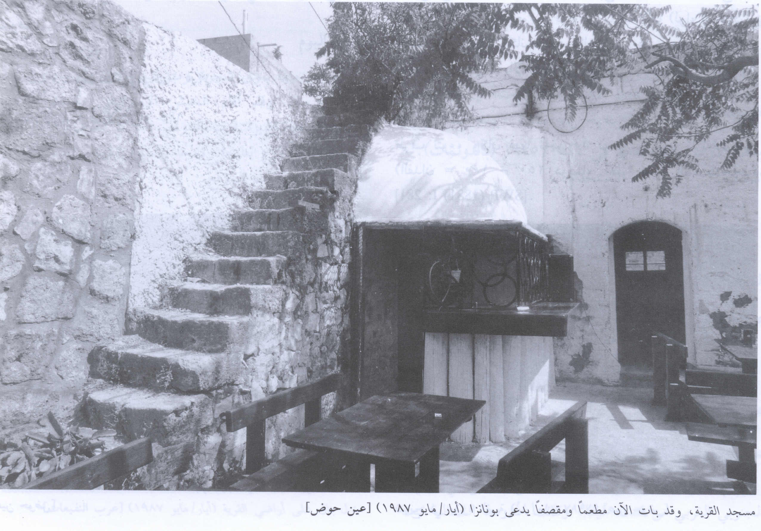
Posted by Aqsa Association-Palestine-1948 2 - Village mosque, now the Bonanza Bar/Restaurant, 1987
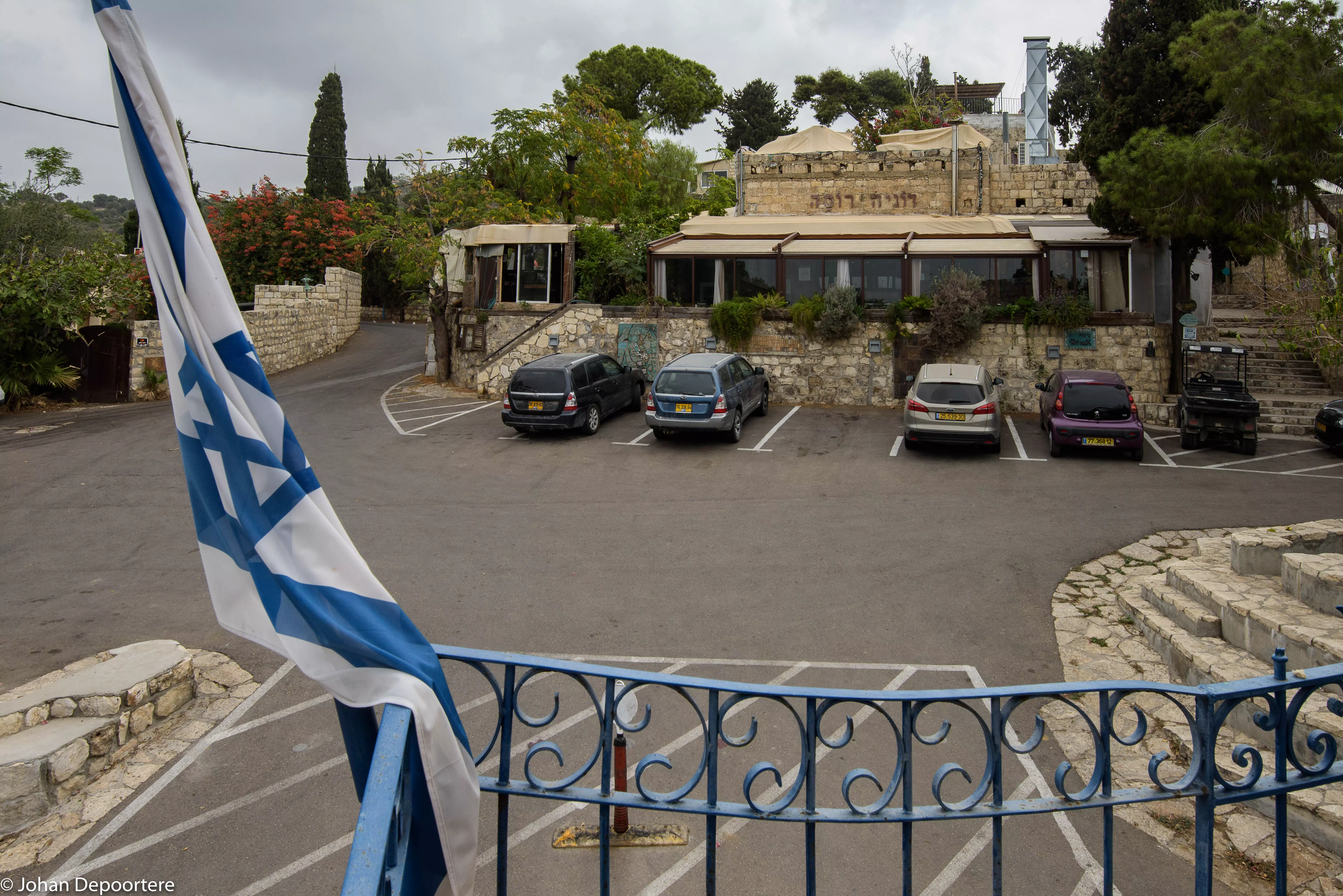
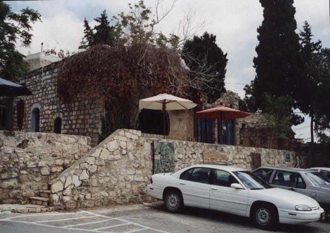
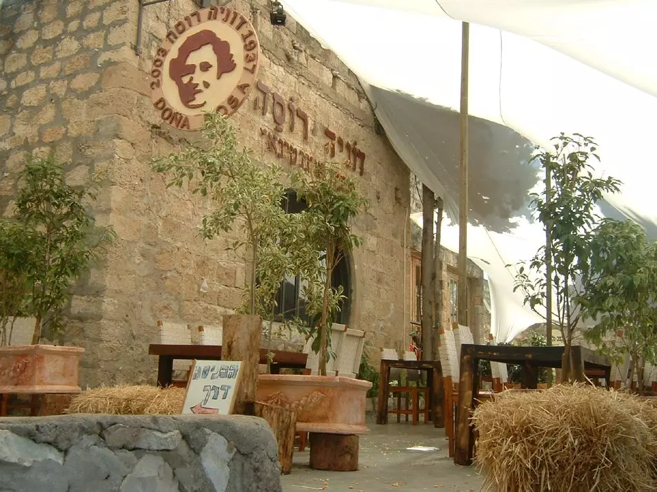
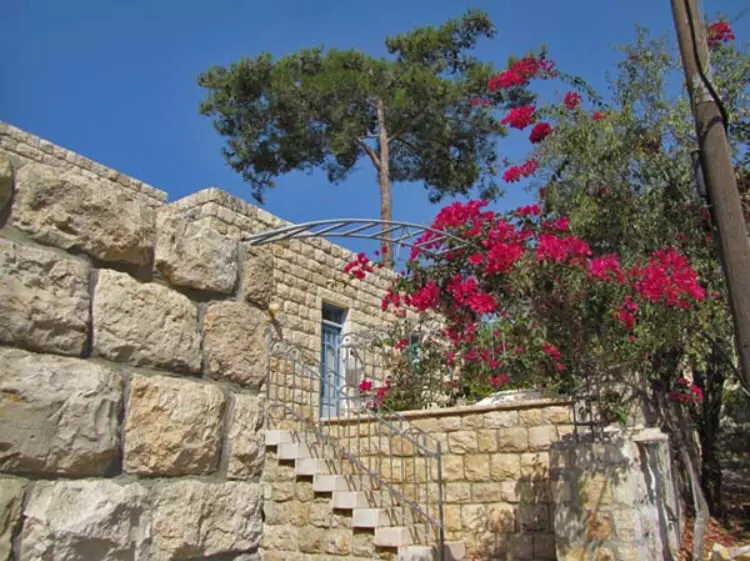
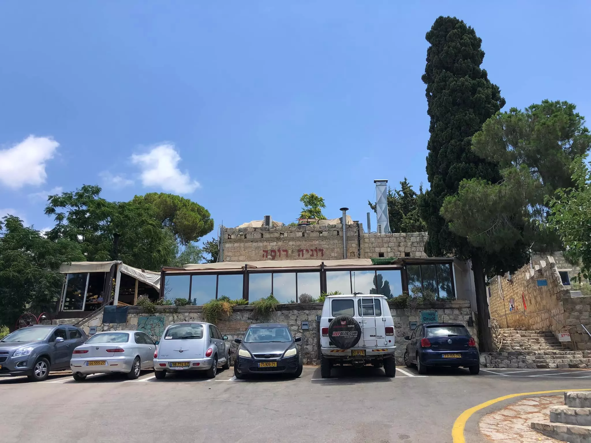
Scanned from "All That Remains" by Dr. Walid Khalidi 1 - The mosque revamped as the Dona Rosa restaurant (2004)
Posted by Jonathan Cook - Ared al-Manazel neighborhood, 2000
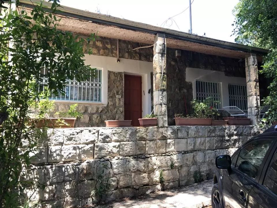
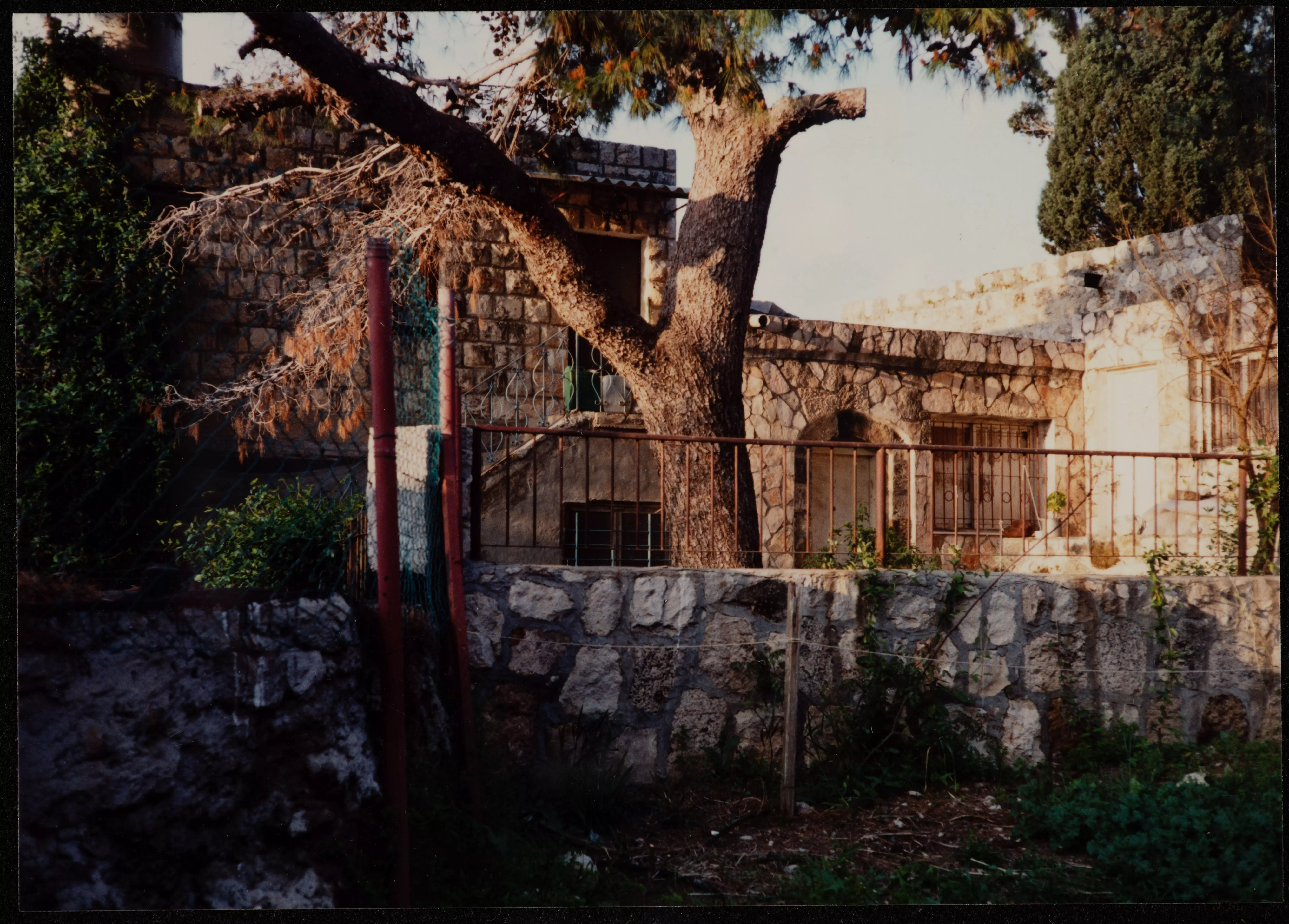
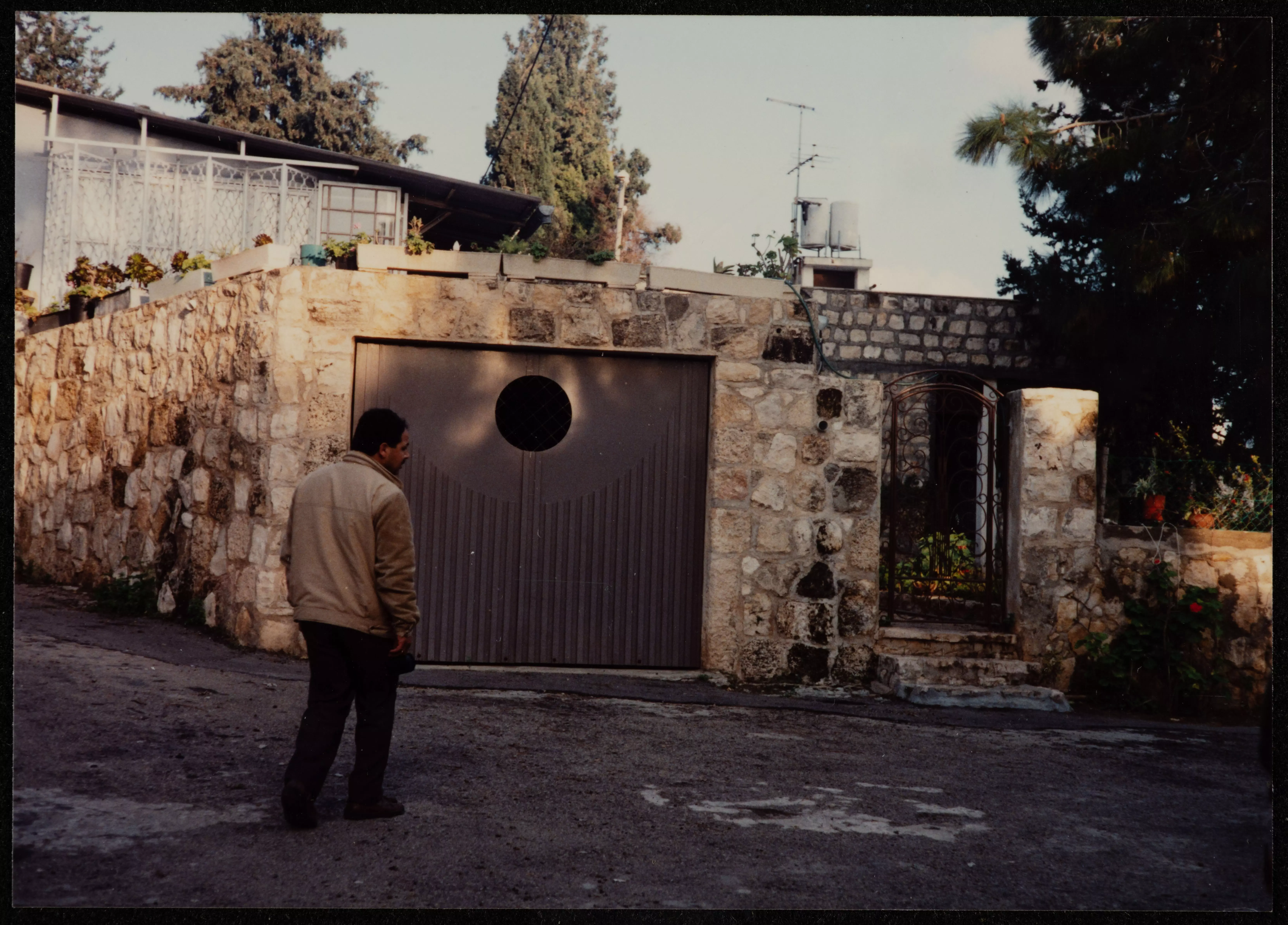
Posted by Abu Firas - The STOLEN/LOOTED house of Abed el-Salam al-Rashed, 2000
Posted by Abu Firas - The STOLEN/LOOTED house of Atah al-Najeeb
Posted by Abu Firas - The STOLEN/LOOTED houses of Dahod & el-Haj Yusef
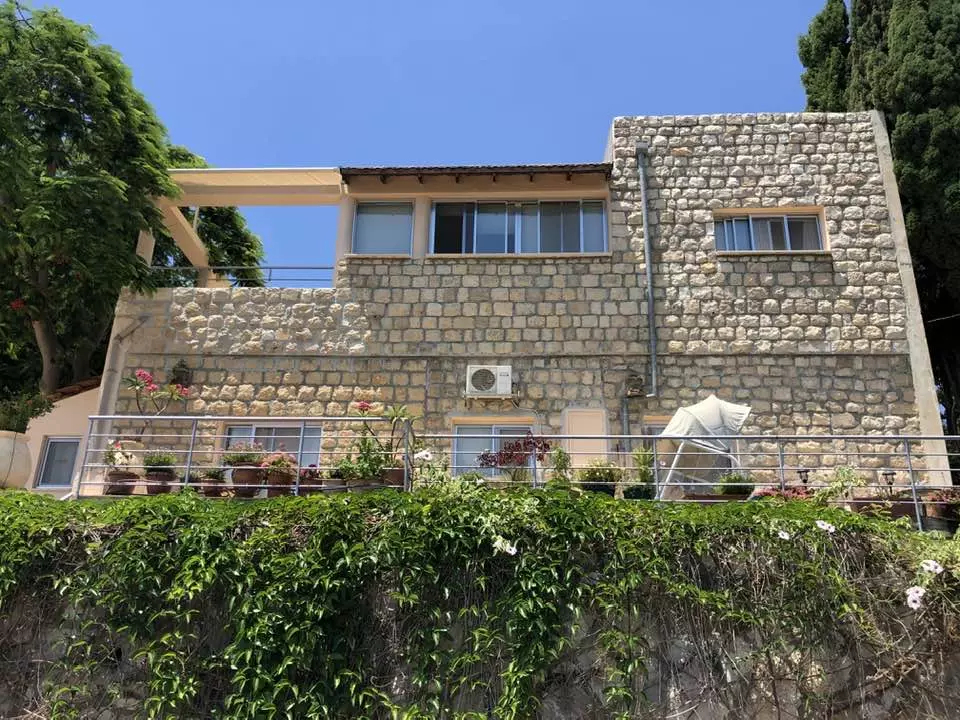
Posted by Abu Firas 1 - Inside the STOLEN/LOOTED house of al-Haj Dahood, 2000
Posted by Abu Firas 1 - The STOLEN/LOOTED house of al-Haj Dahood #4, 2000
Posted by Abu Firas 1 - The STOLEN/LOOTED house of al-Haj Dahood #2, 2000
Posted by Abu Firas 1 - The entrance to the STOLEN/LOOTED house el-Hj Dahood #3, 2000
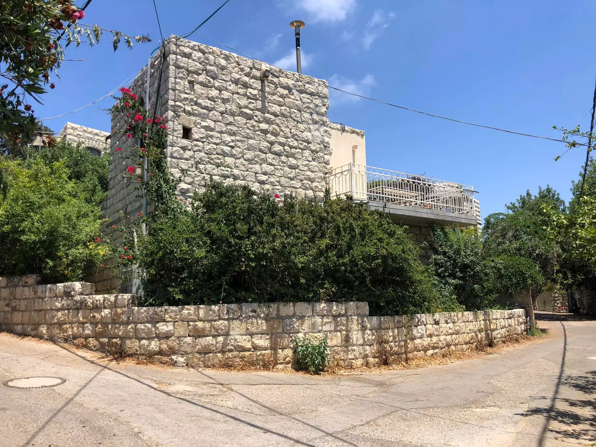
Posted by Abu Firas - The STOLEN/LOOTED house of Ali el-Nemer, 2000
Posted by Abu Firas - In the court yard of the STOLEN/LOOTED house of el-haje Najeeb, 2000
Posted by Abu Firas 1 - The STOLEN/LOOTED house of al-Haj Yusef #1, 2000
Posted by Abu Firas - The STOLEN/LOOTED house of al-Haj Yusef #2, 2000
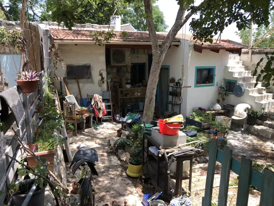
Posted by Abu Firas - The STOLEN/LOOTED house of al-Haj Embada el-Hassan, 2000
Posted by Abu Firas - The STOLEN/LOOTED house of al-Haj Embada el-Hassan #2, 2000
Posted by Abu Firas - The STOLEN/LOOTED house of al-Haj Emtaweh al-Sa'eed, 2000
Posted by Abu Firas - The STOLEN/LOOTED house of al-Haj Fawze Mousa, 2000

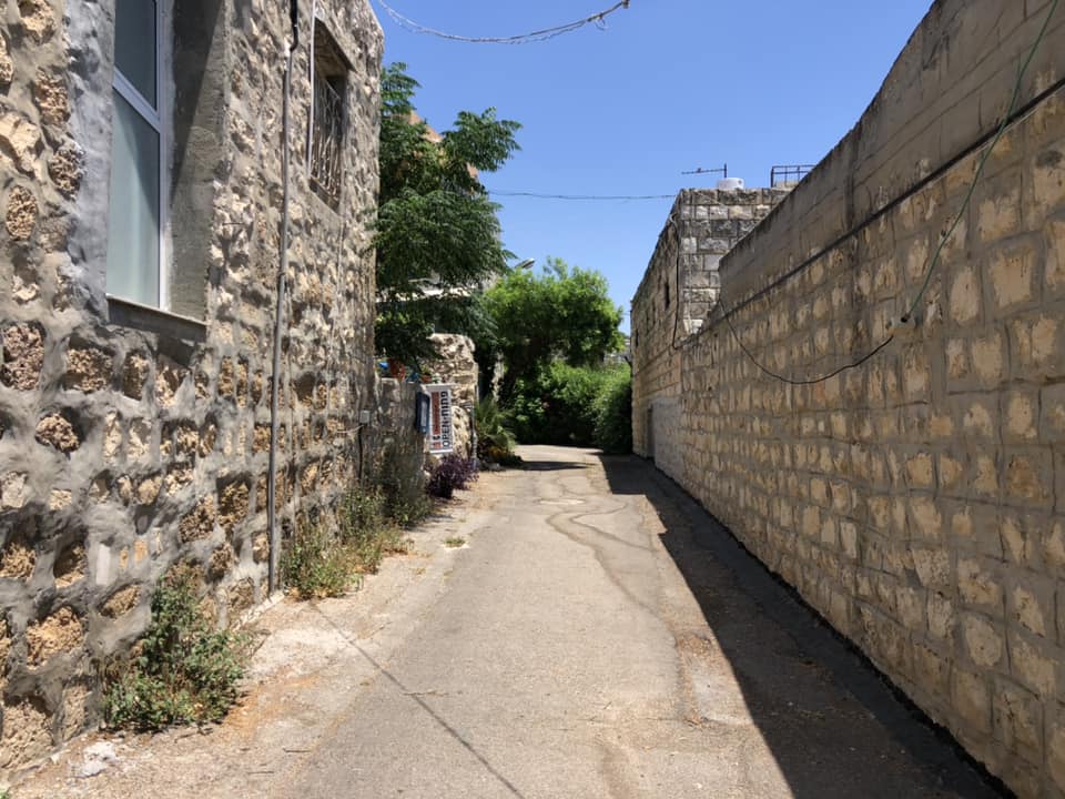
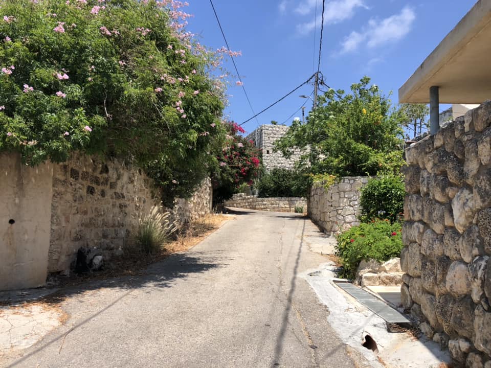
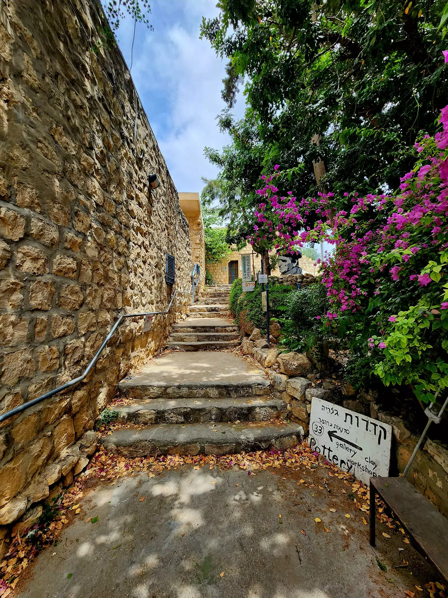
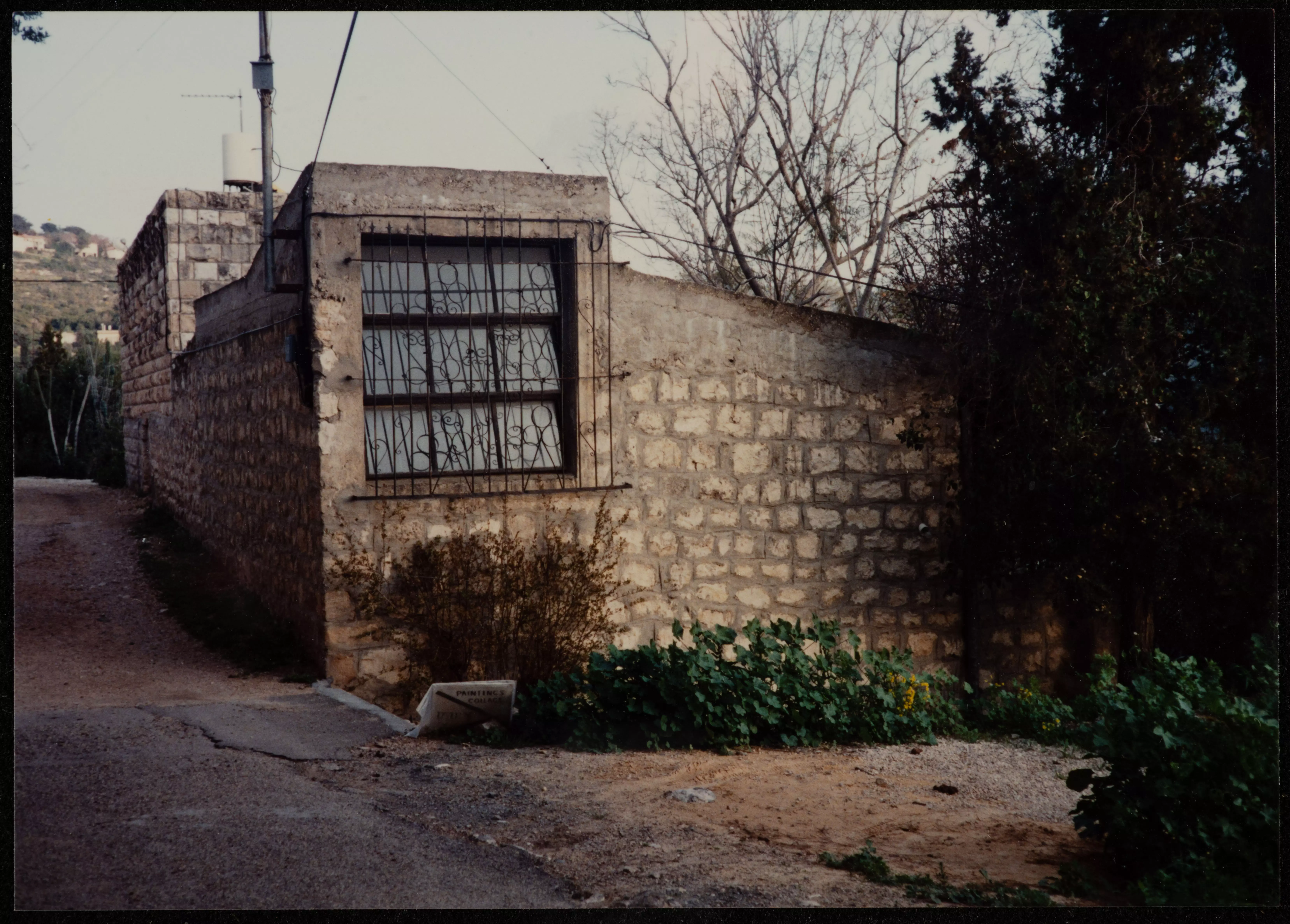
Posted by Abu Firas 3 - The alleyway leading to STOLEN/LOOTED house of Hekmat al-Sa'eed, 2000
Posted by Abu Firas - The entrance to the STOLEN/LOOTED house of al-Haj Musa el-Nemer, 2000
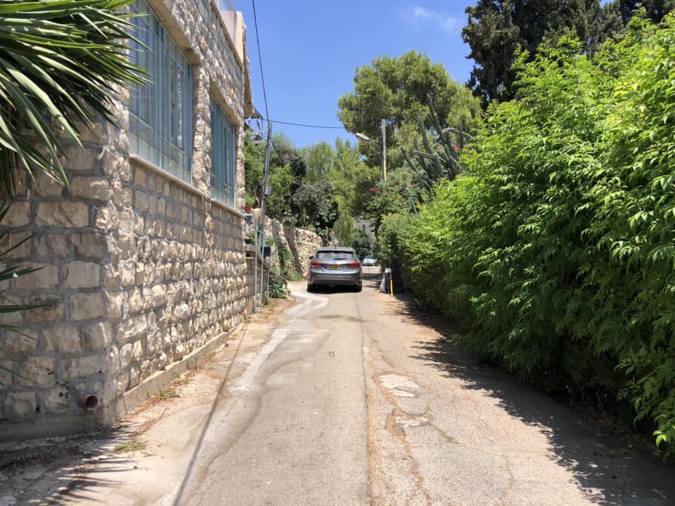
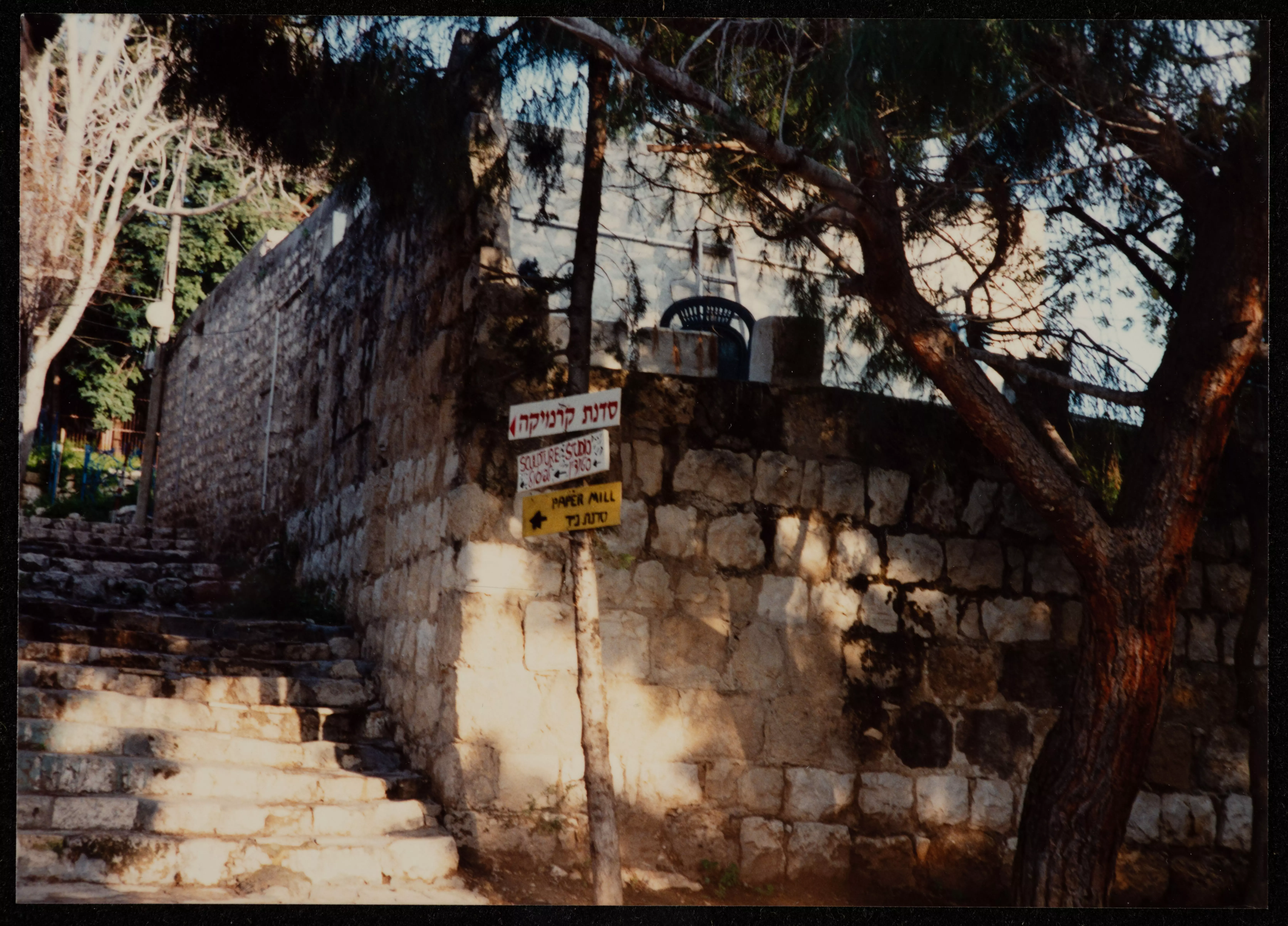
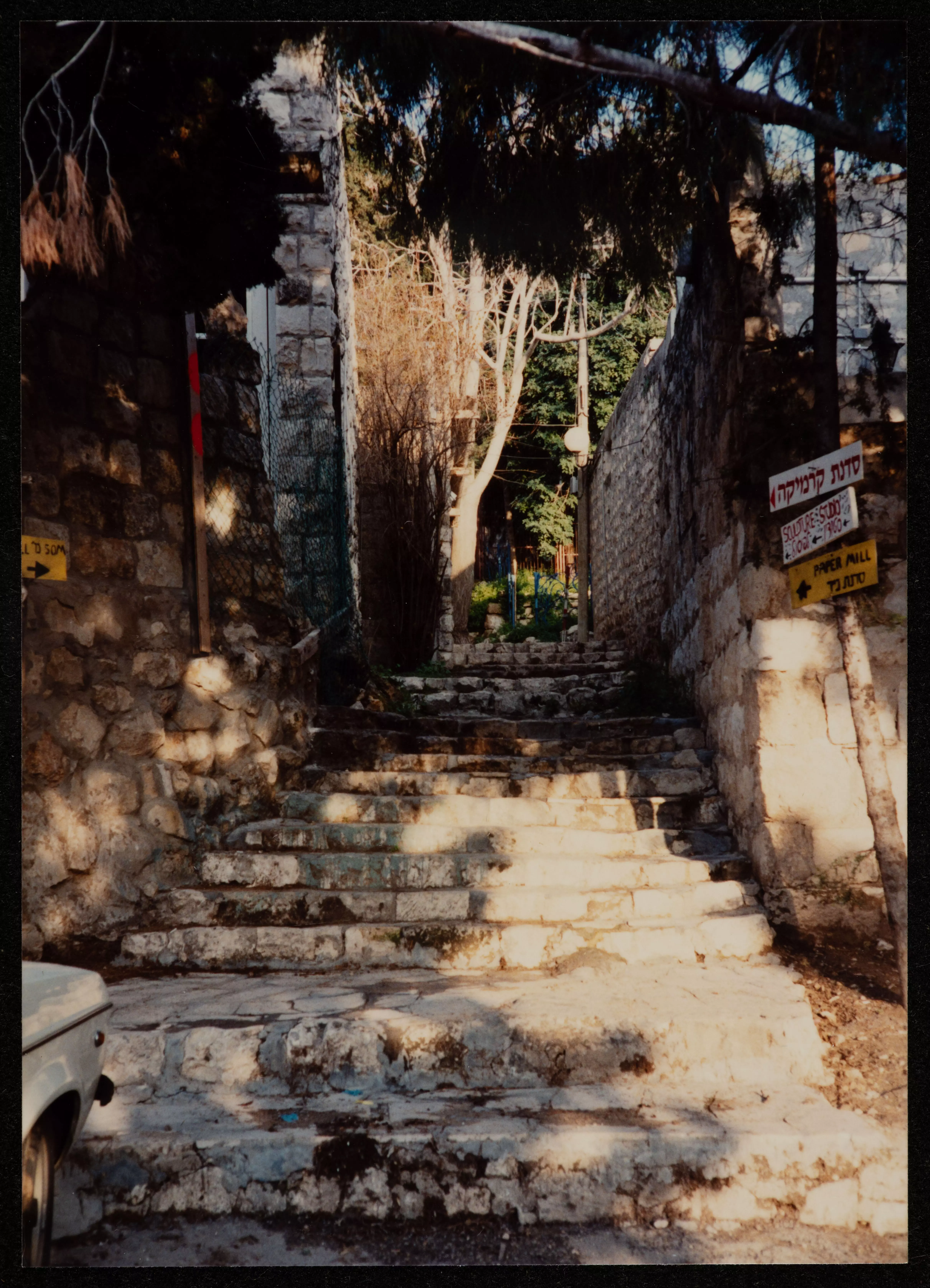
Posted by Abu Firas - The entrance to Wadi al-Falah nearby 'Ayn Hawd, 2000
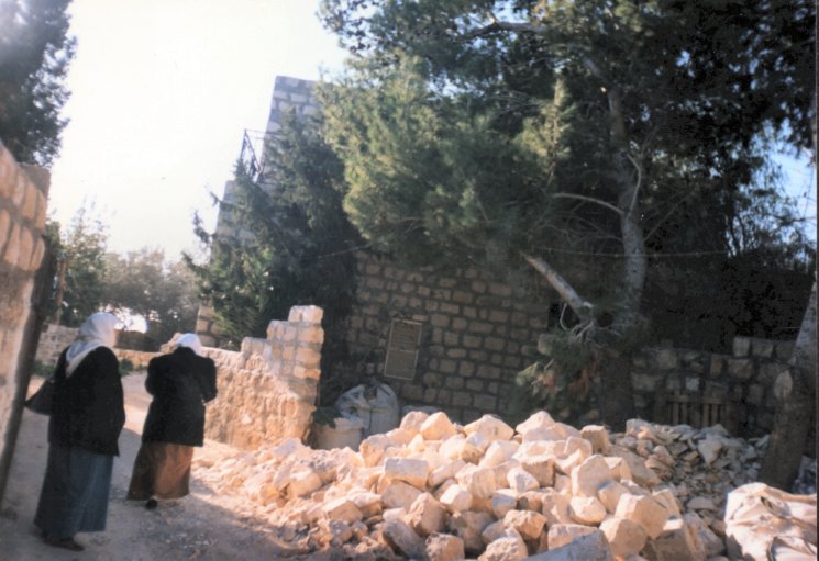
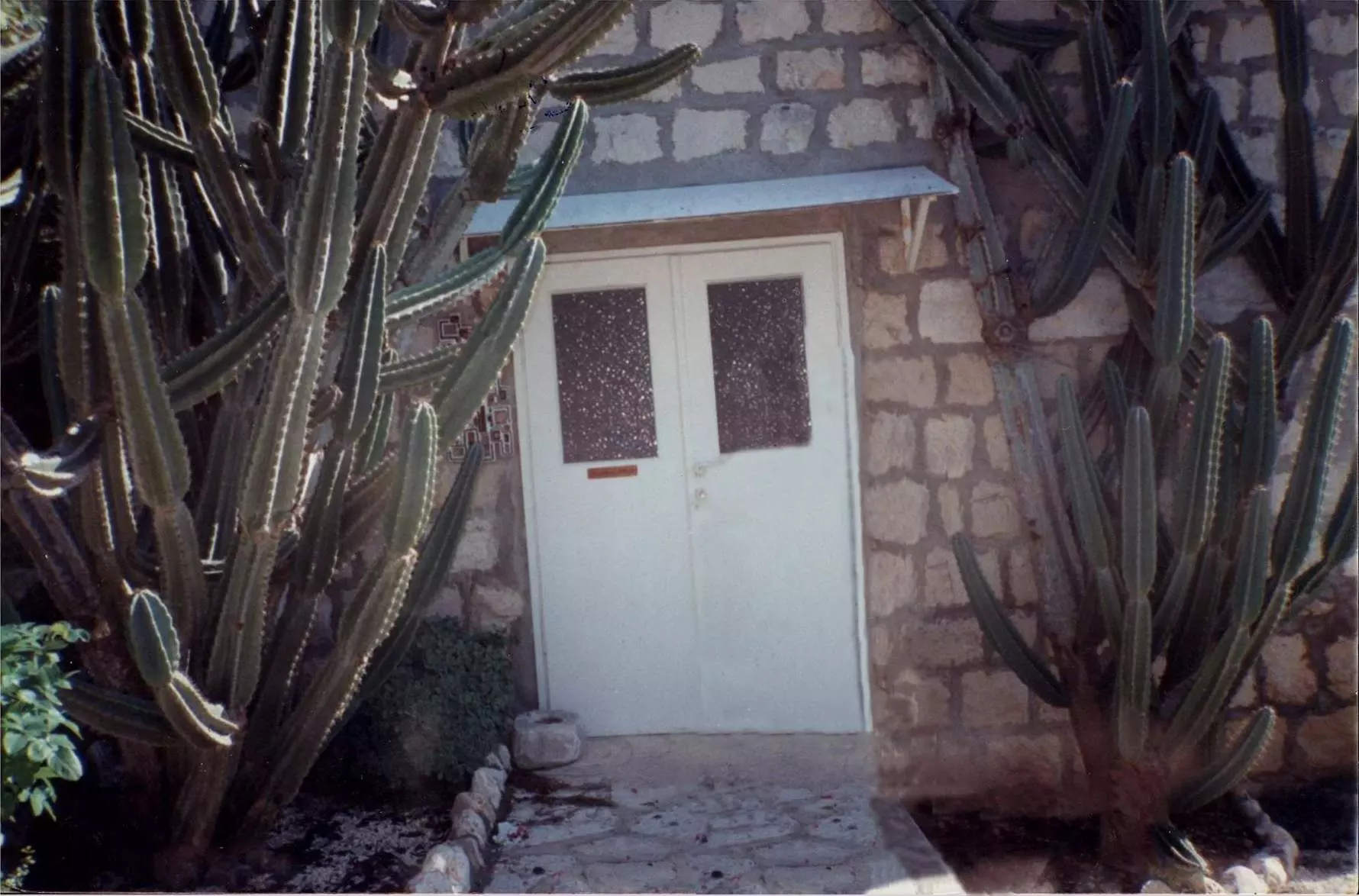
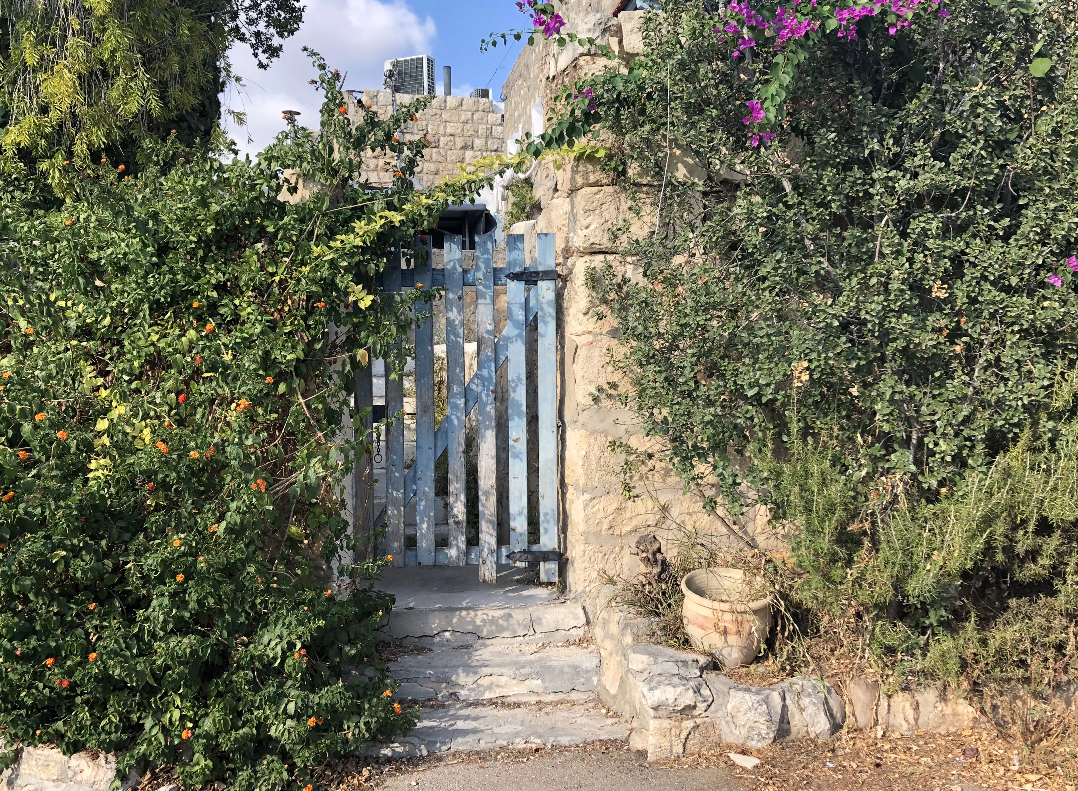
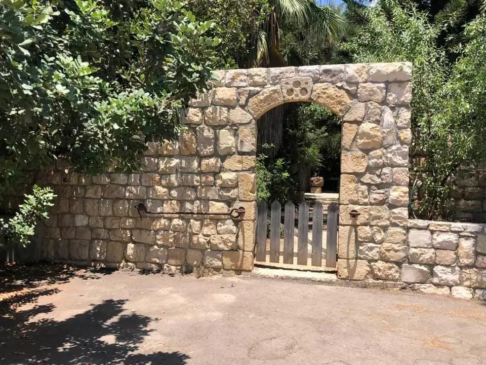
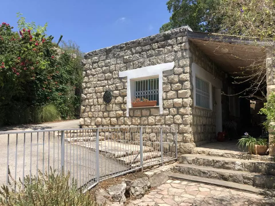
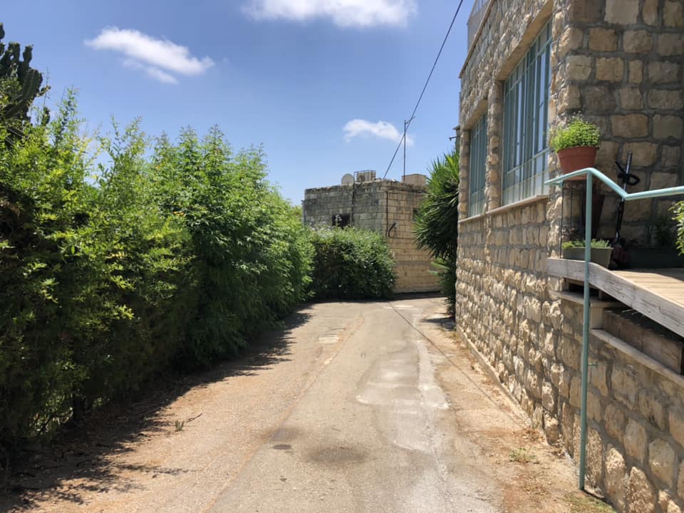
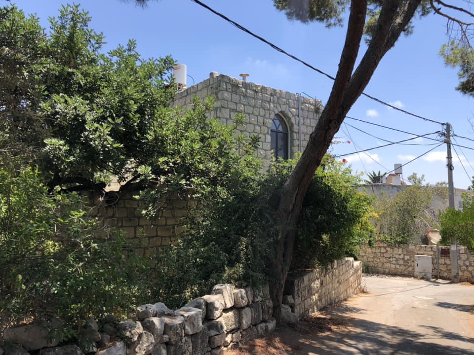
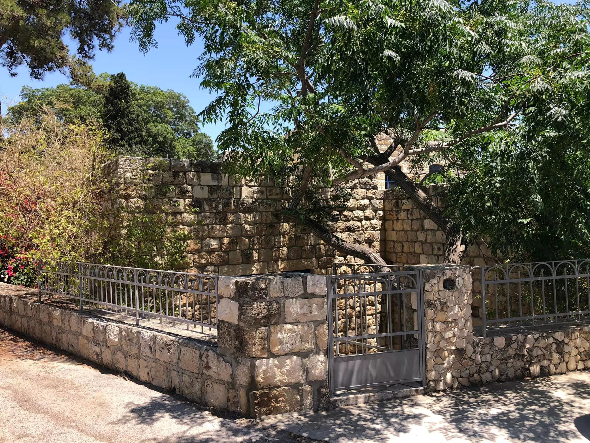
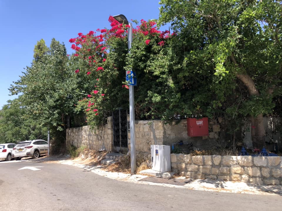
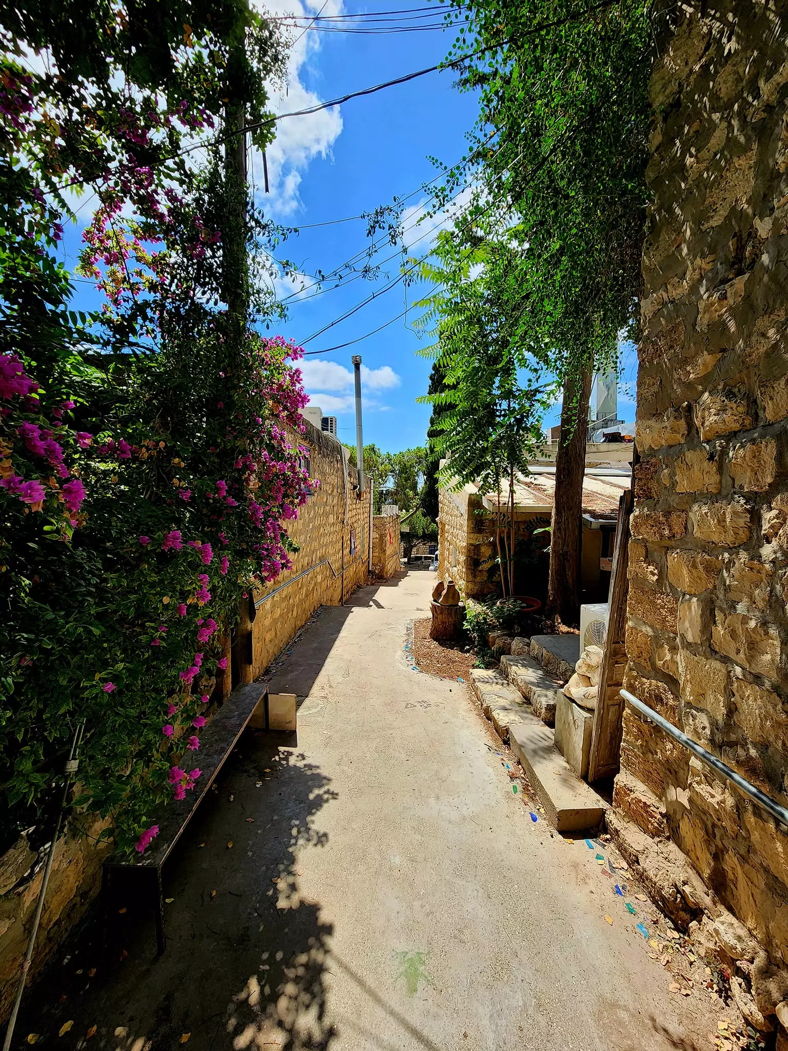
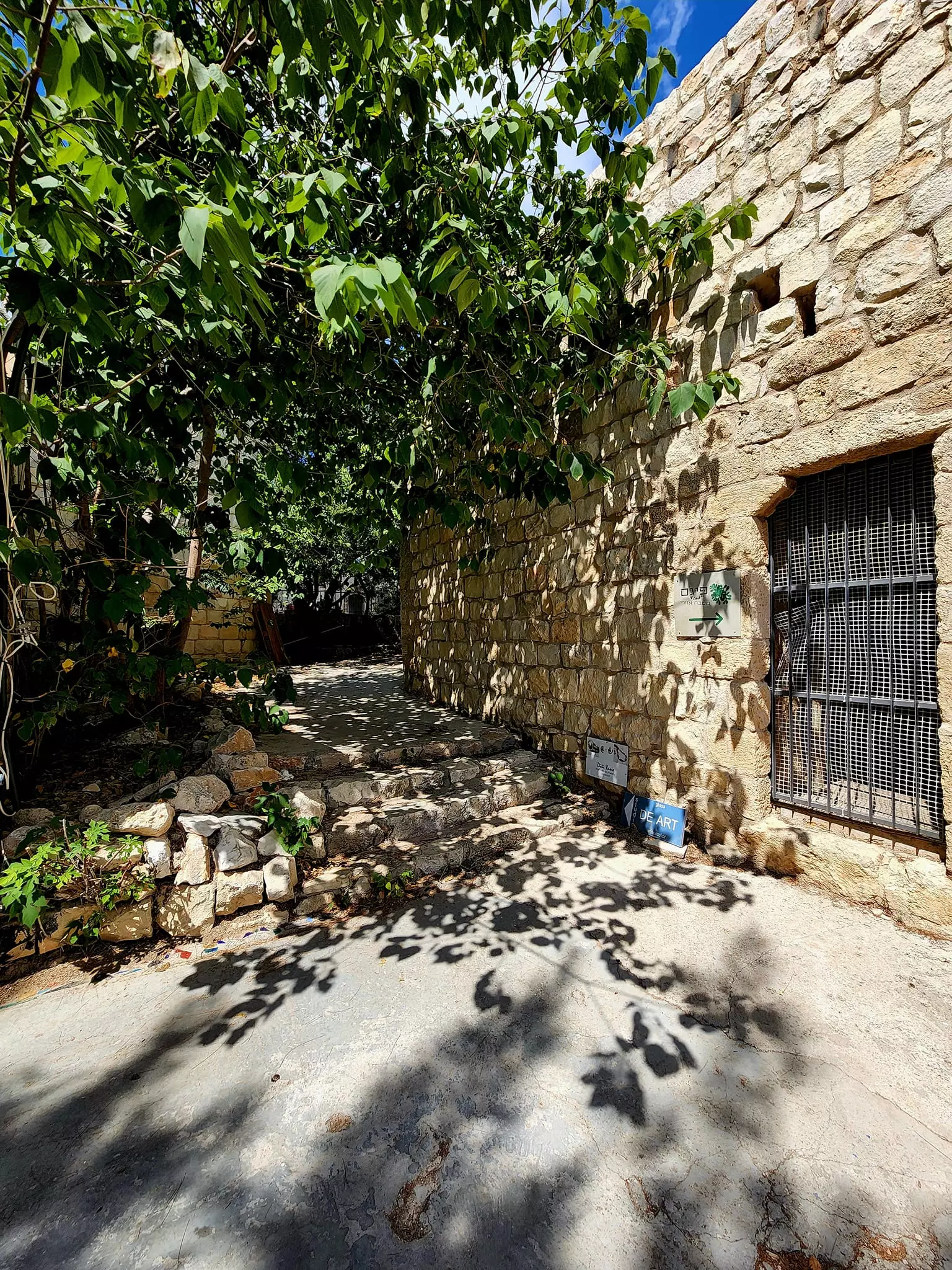
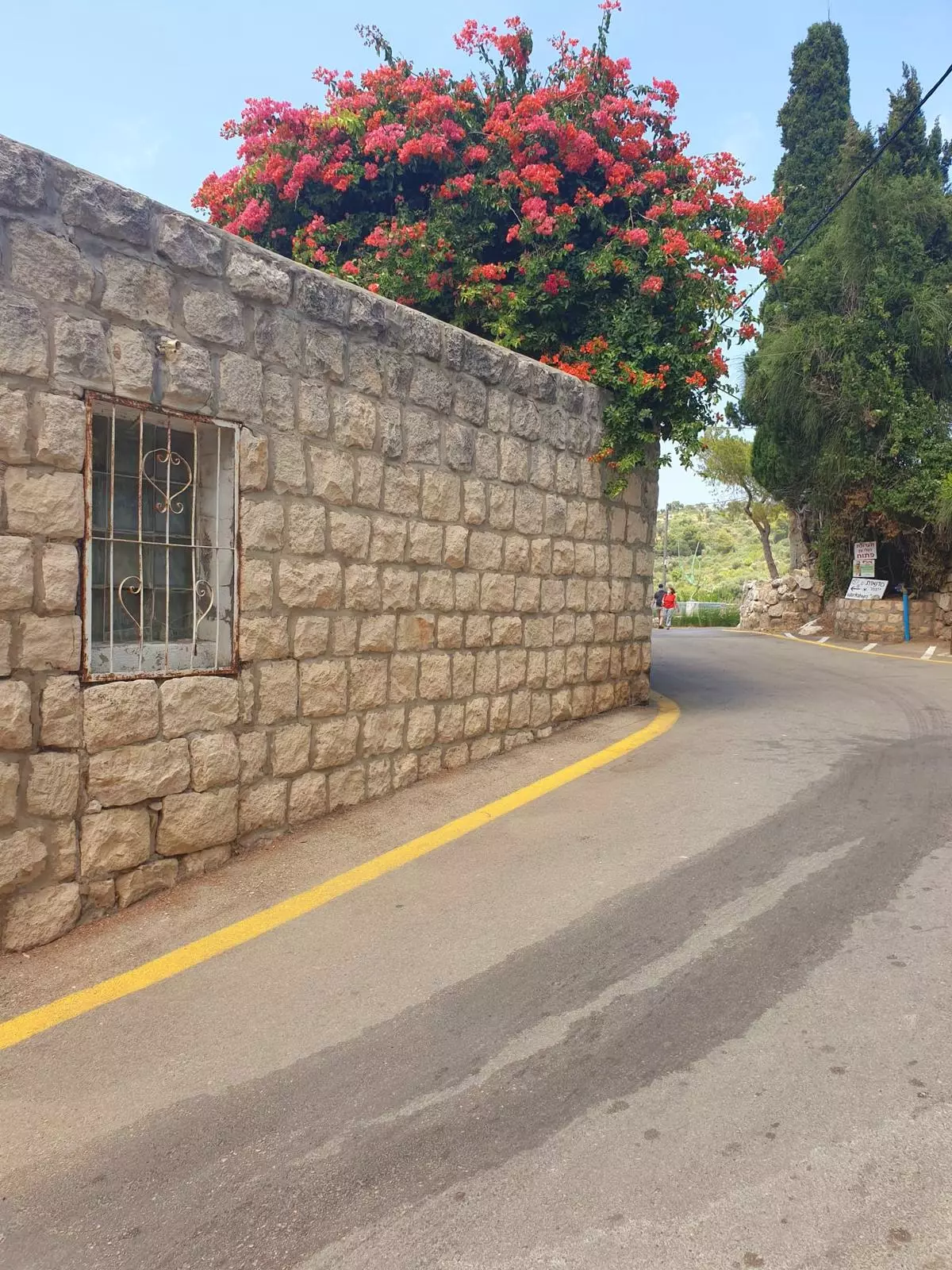
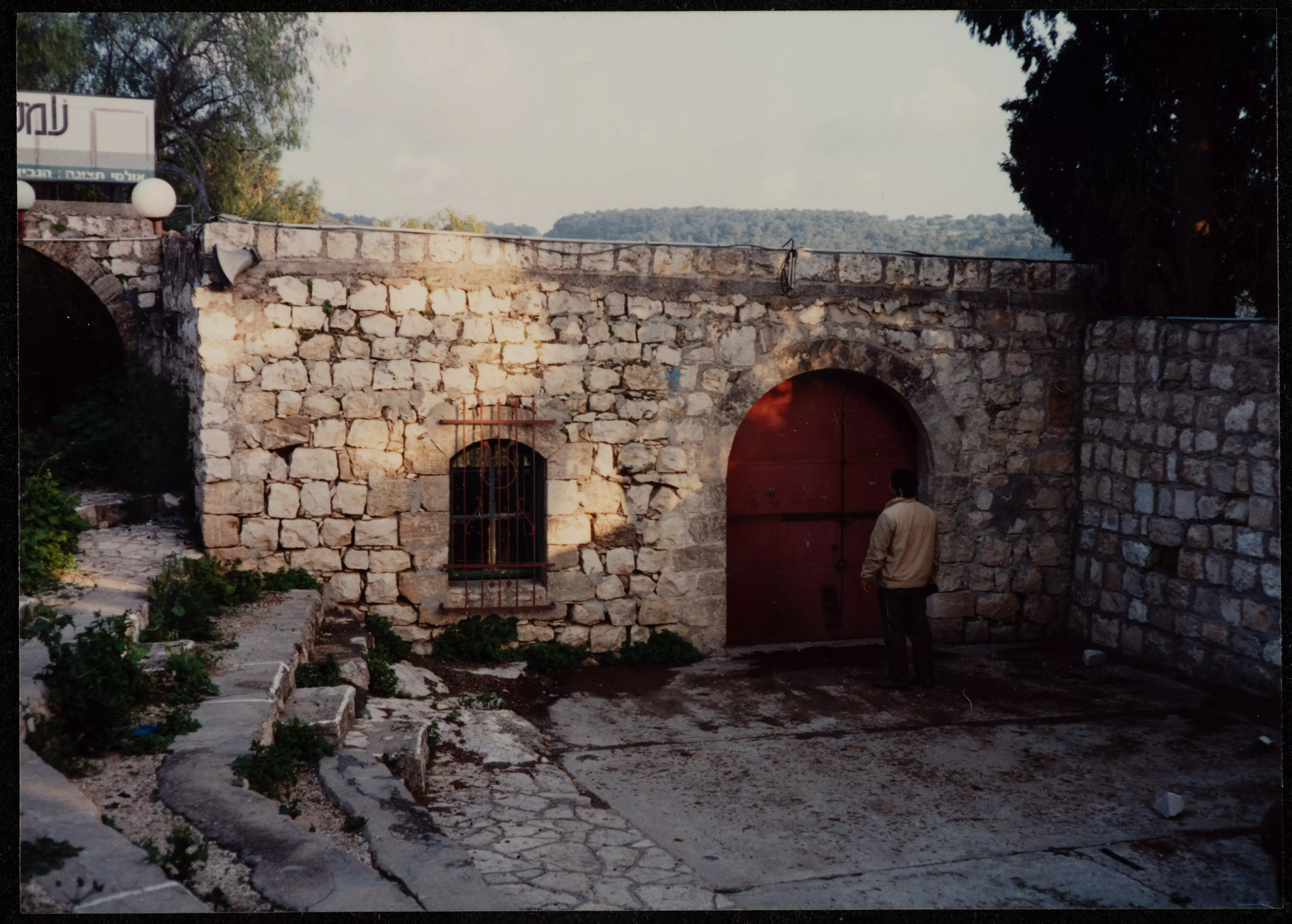
Posted by Abu Firas - The entrance to 'Ayn Hawd, 2000
Posted by Abu Firas - The STOLEN/LOOTED house of al-Haj Abu Nayef, 2000
Posted by Abu Firas - The entrance to the STOLEN/LOOTED house of al-Haj Abu Nayef #2, 2000
Posted by Abu Firas - شكر خاص لجمعية الشباب العرب- بلدنا , حيفا , صورة من فعاليات الجمعية جولة للشبيبة في عين حوض , www.baladnayouth.org
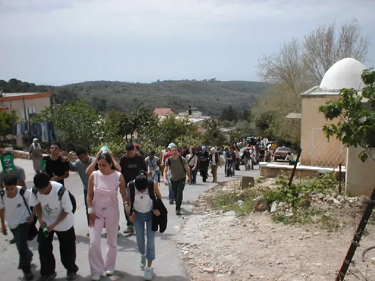
Posted by Makbula Nassar - شكر خاص لجمعية الشباب العرب- بلدنا , حيفا , صورة من فعاليات الجمعية جولة للشبيبة في عين حوض , www.baladnayouth.org
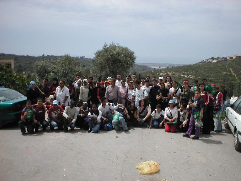
Posted by Makbula Nassar - شكر خاص لجمعية الشباب العرب- بلدنا , حيفا , صورة من فعاليات الجمعية جولة للشبيبة في عين حوض , www.baladnayouth.org
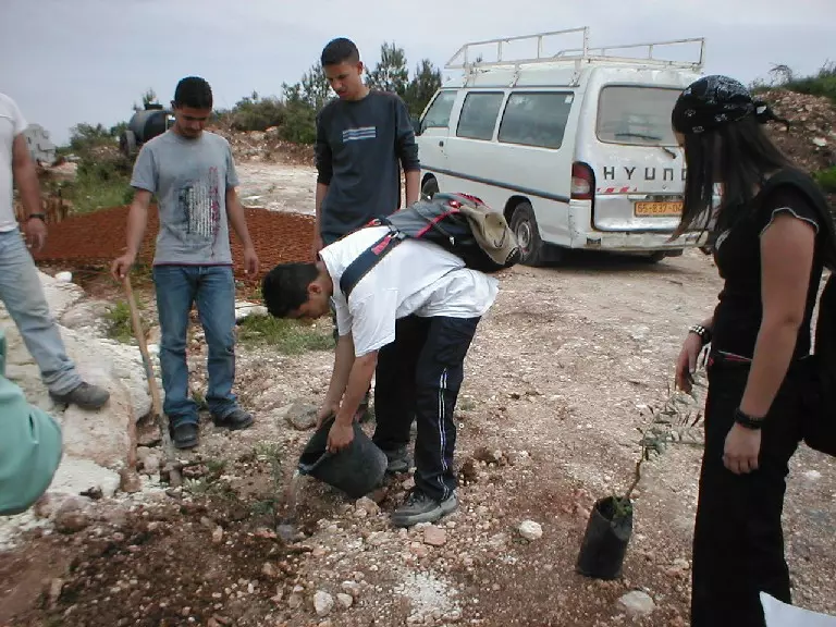
Posted by Makbula Nassar - شكر خاص لجمعية الشباب العرب- بلدنا , حيفا , صورة من فعاليات الجمعية جولة للشبيبة في عين حوض , www.baladnayouth.org
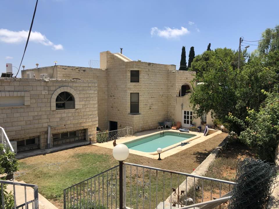
Posted by Makbula Nassar - A LOOTED HOUSE in Ein Houd, now renovated and Israeli Jews living in it
- The entrance to another looted house, now this community is a place where ONLY Jews can live.
- Another Palestinian house which have been stolen by Israeli Jews, it seems it has been renovated since 1948 Nakba
- Another Palestinian house which have been stolen by Israeli Jews, it seems it has been renovated since 1948 Nakba #2
2 - Another Palestinian house which have been stolen by Israeli Jews, it seems it has been renovated since 1948 Nakba #3
- Another Palestinian house which have been stolen by Israeli Jews, it seems it has been renovated since 1948 Nakba #4
- Another Palestinian house which have been stolen by Israeli Jews, it seems it has been renovated since 1948 Nakba #5
- جمعية ديرتنا تزور قرية عين حوض 29 آذار 2008
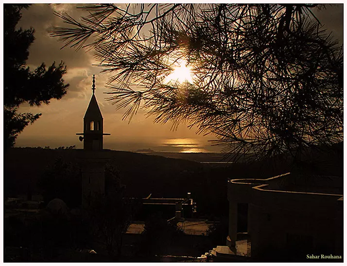
Posted by محمد سلامة يونس - منظر الغروب بعين حوض 2008 - تصوير : سهر روحانا
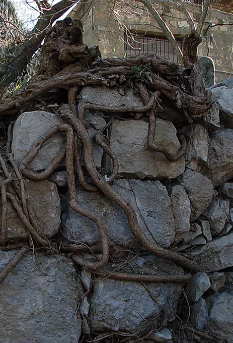
Posted by سهر روحانا - جذور مقطوعة - عين حوض 2009 - تصوير : سهر روحانا
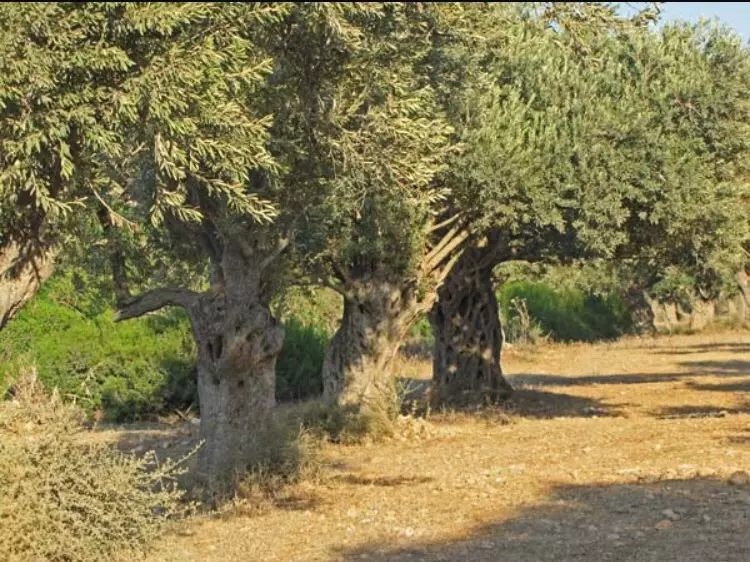
Posted by سهر روحانا - زيتون عين حوض
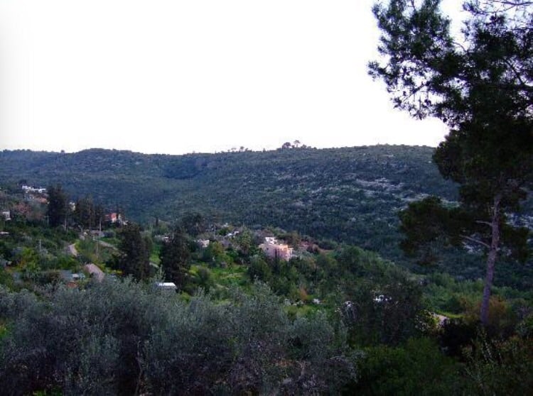
Posted by abu raya - منظر من عين حوض
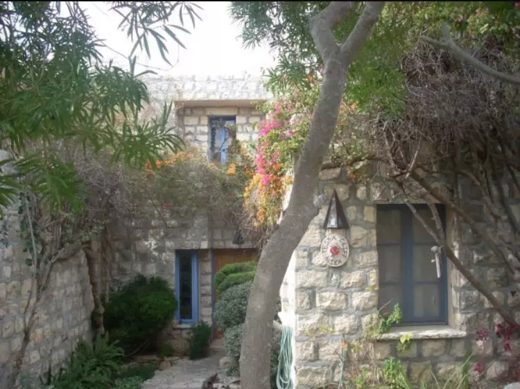
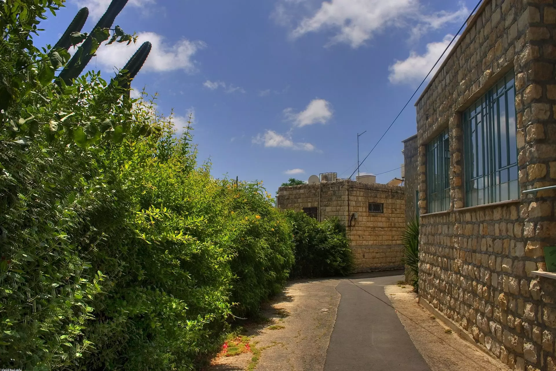
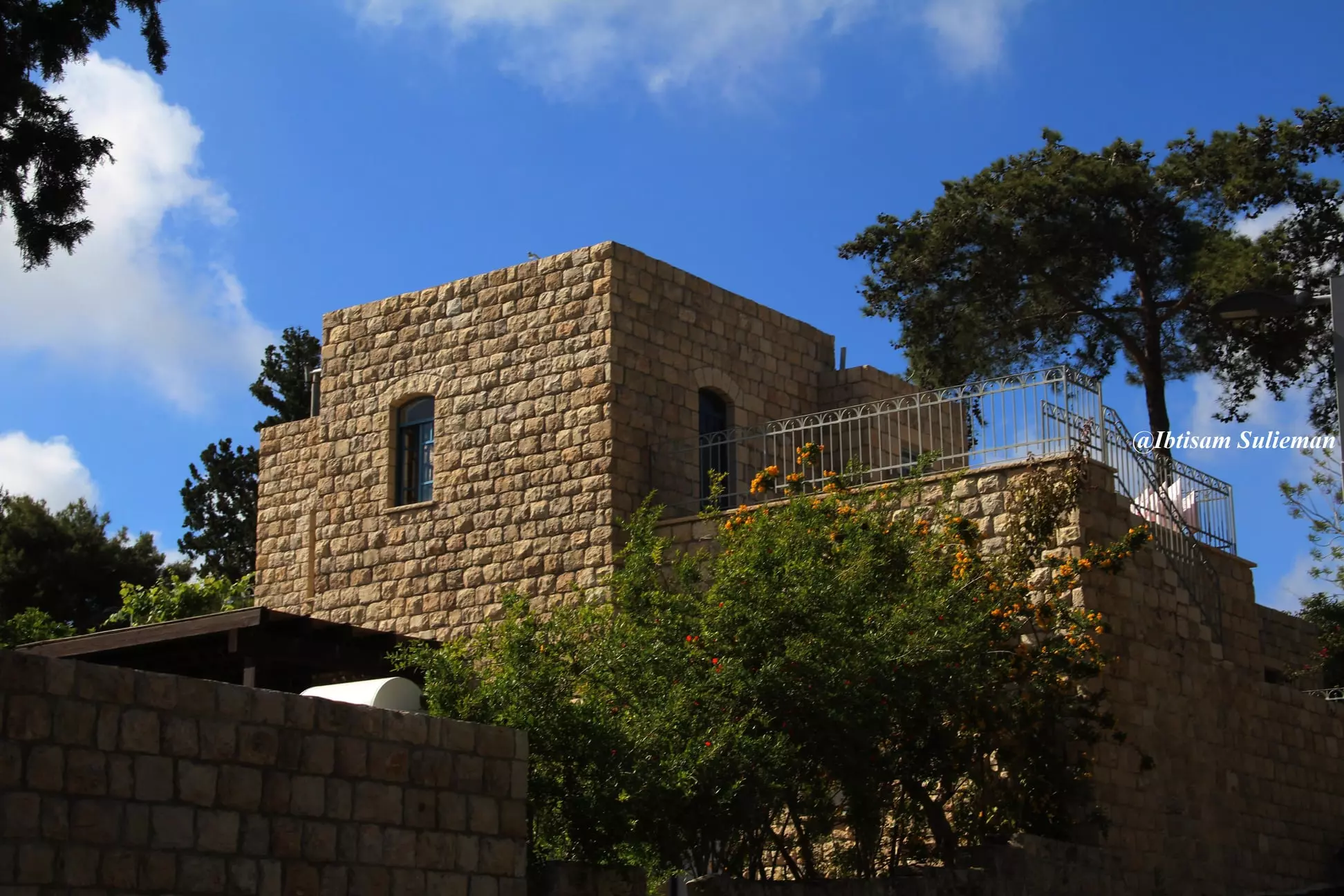
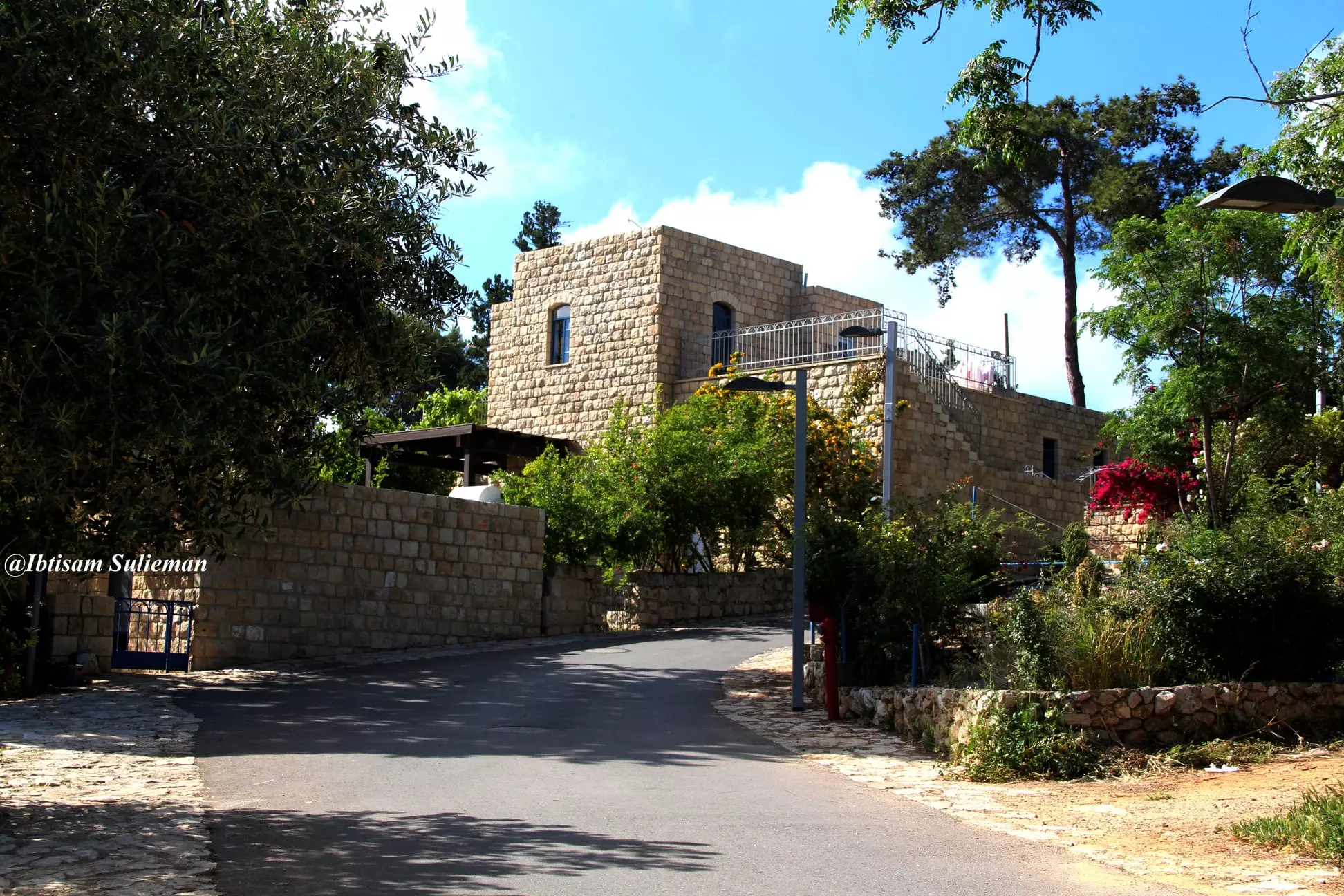
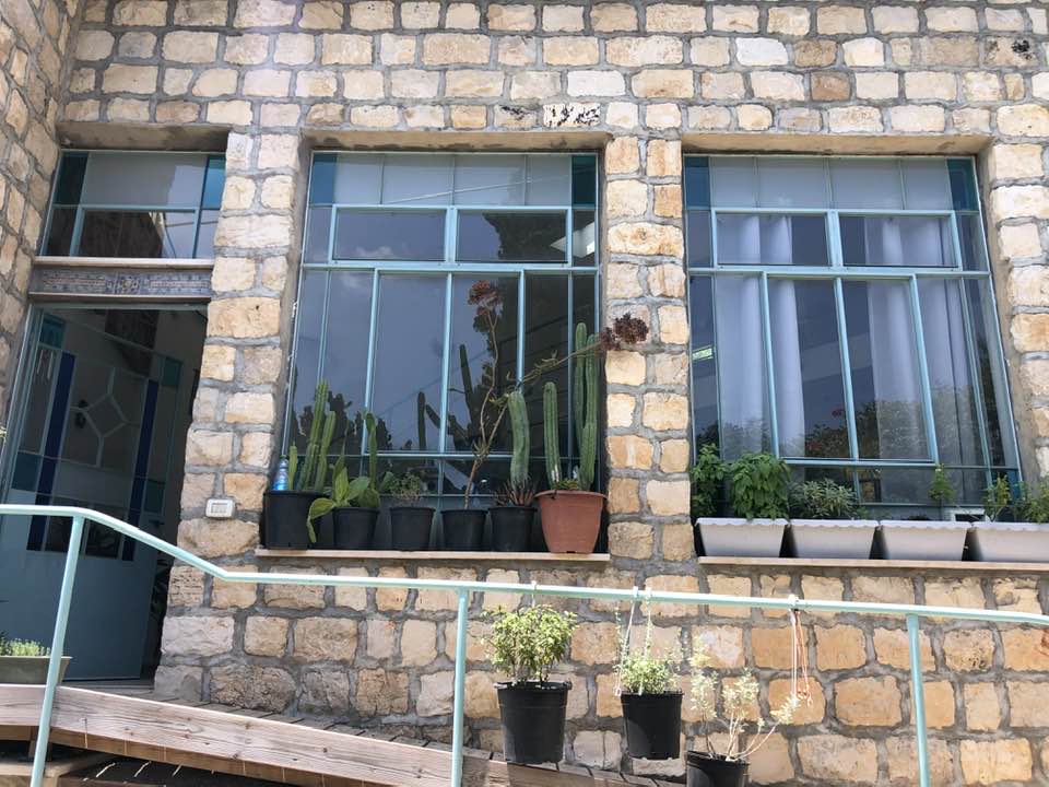
Posted by abu raya - البيوت العربيه في عين حوض
Posted by abu raya - البيوت العربيه في عين حوض
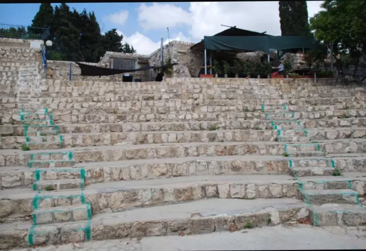
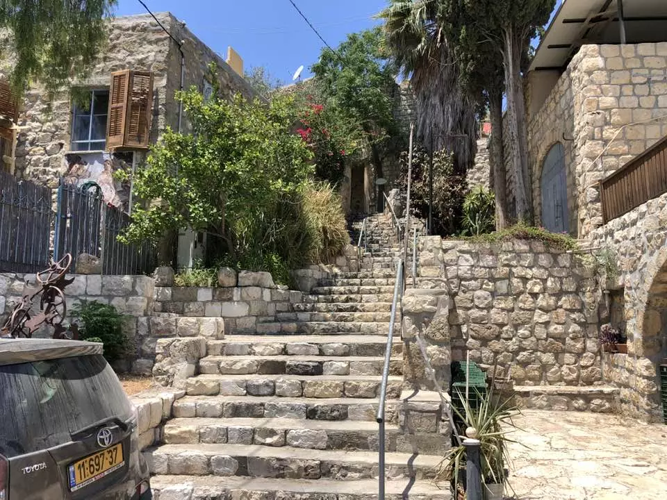
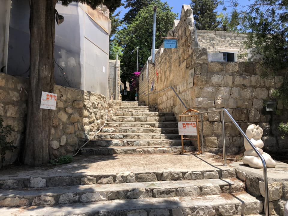
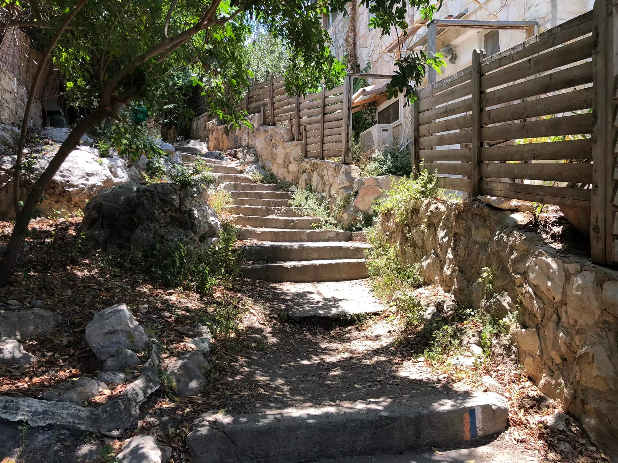
Posted by abu raya - ادراج عين حوض
Posted by abu raya - البيوت العربيه في عين حوض
Posted by abu raya - صوره لعين حوض بعد الاحتلال ويظهر فيها الممستوطنون واستيلاىهم على الاراضي العربيه
Posted by abu raya - بيوت عين حوض
Posted by abu raya - منظر عام لعين حوض قبل النكبه
Posted by abu raya - عين حوض
Posted by abu raya - عين حوض بعد احتلالها
Posted by abu raya - عين حوض بعد احتلالها
Posted by abu raya - مسجد قرية عين حوض المهجرة ، حولوه الى مطعم
Posted by سهيل مخول - مدرسة قرية عين حوض المهجرة اصبحت متاجر
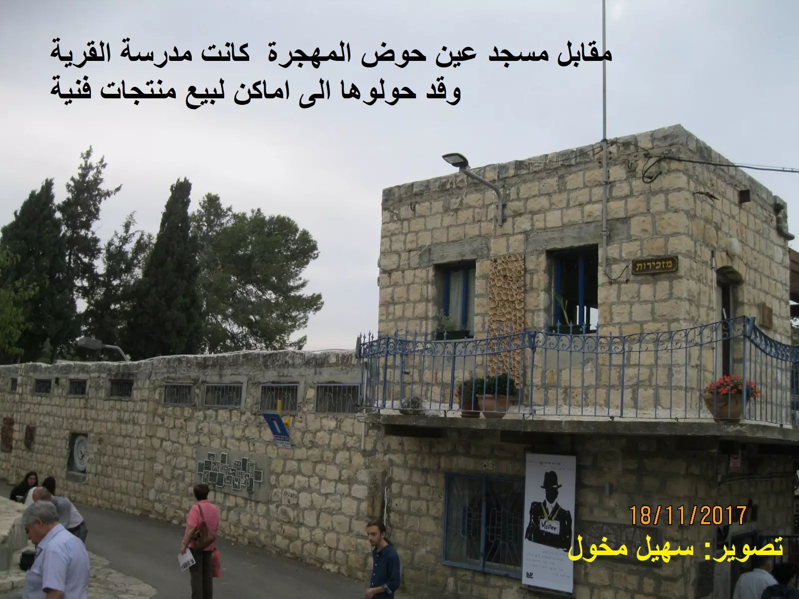
Posted by سهيل مخول - مدرسة قرية عين حوض المهجرة اصبحت متاجر
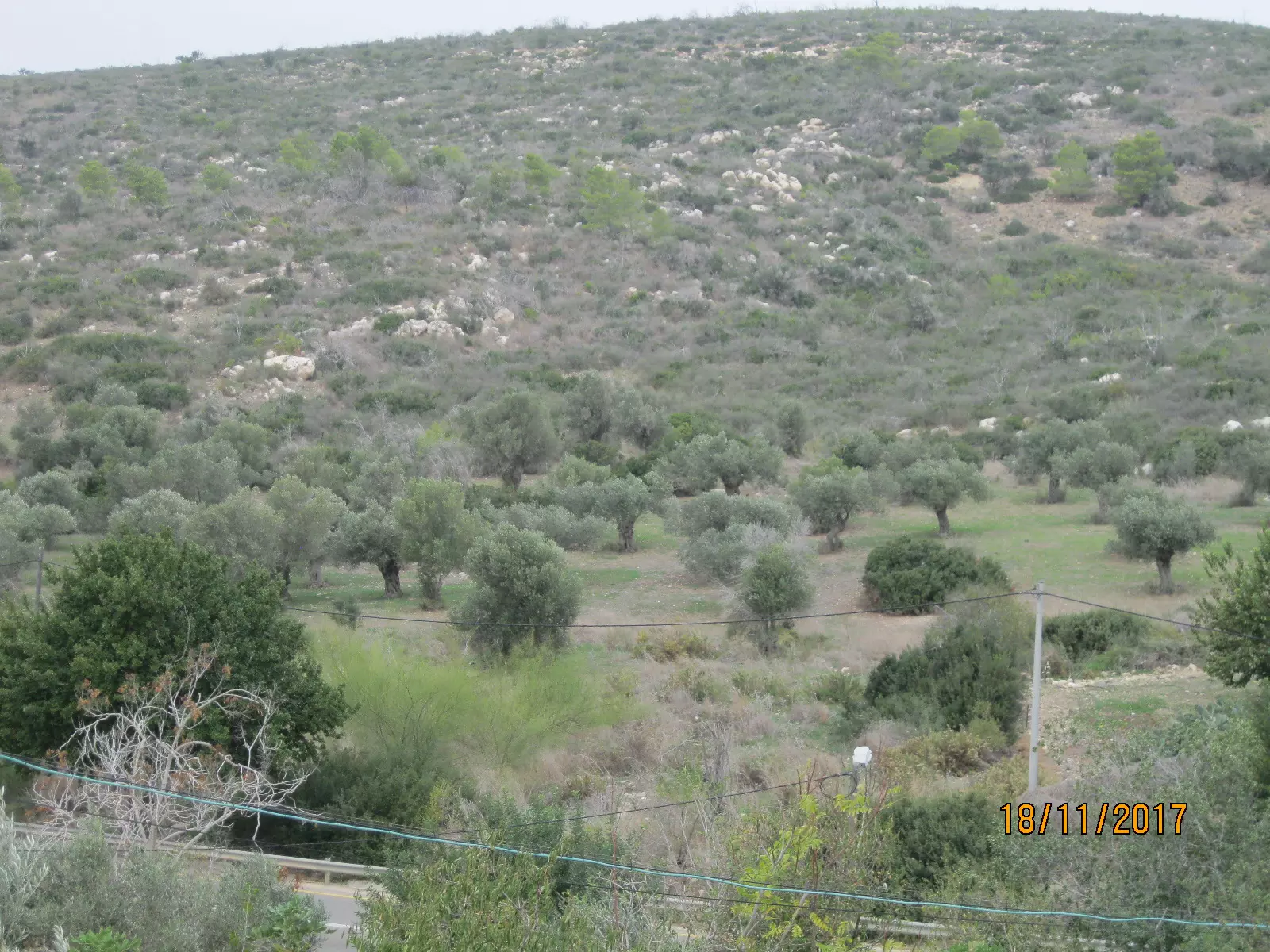
Posted by سهيل مخول - كروم الزيتون في عين حوض المهجرة
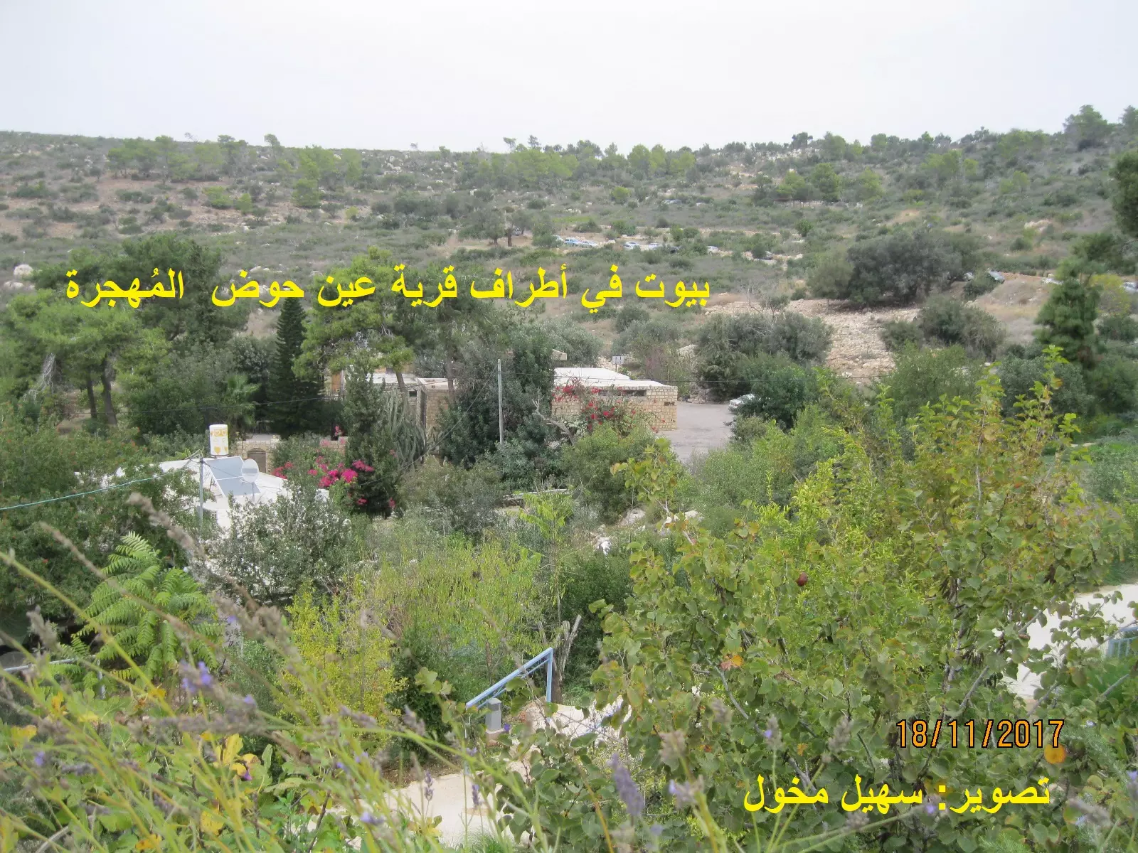
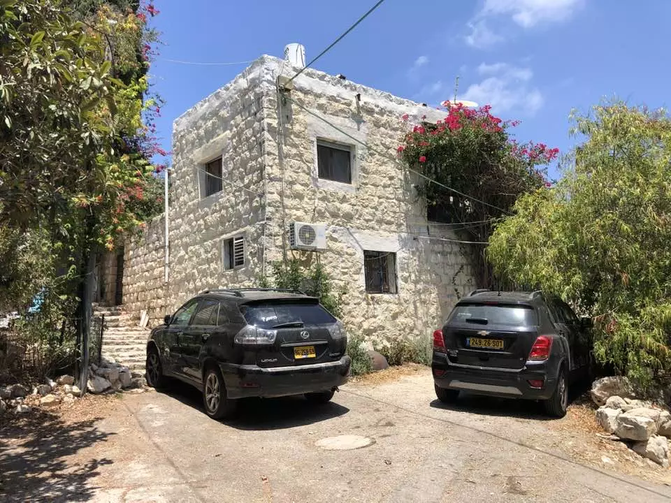
Posted by سهيل مخول - بيوت في أطراف قرية عين حوض المهجرة
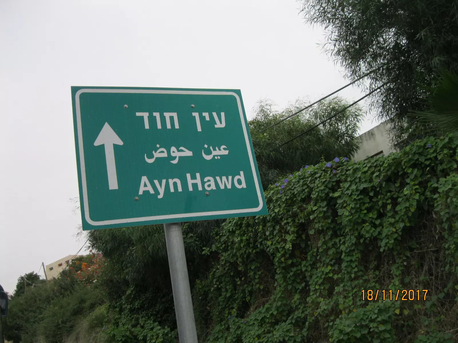
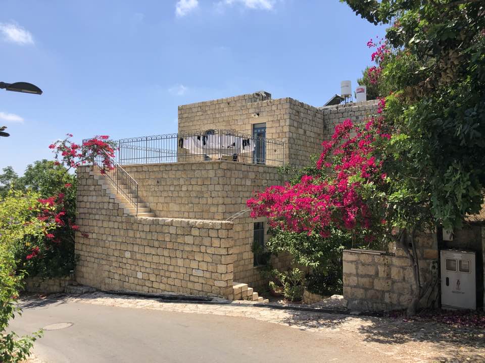
Posted by سهيل مخول - هنا عين حوض المهجرة والمغتصبة
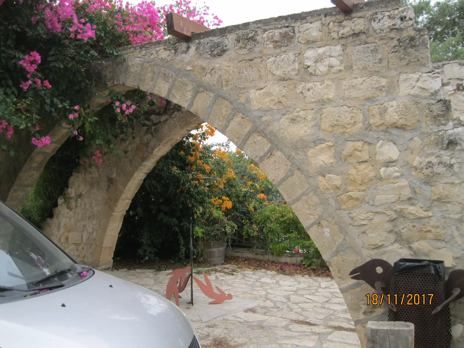
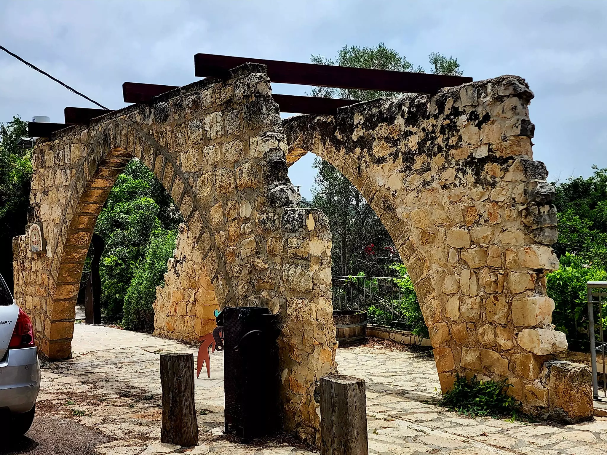
Posted by سهيل مخول - قناطر أحد بيوت عين حوض
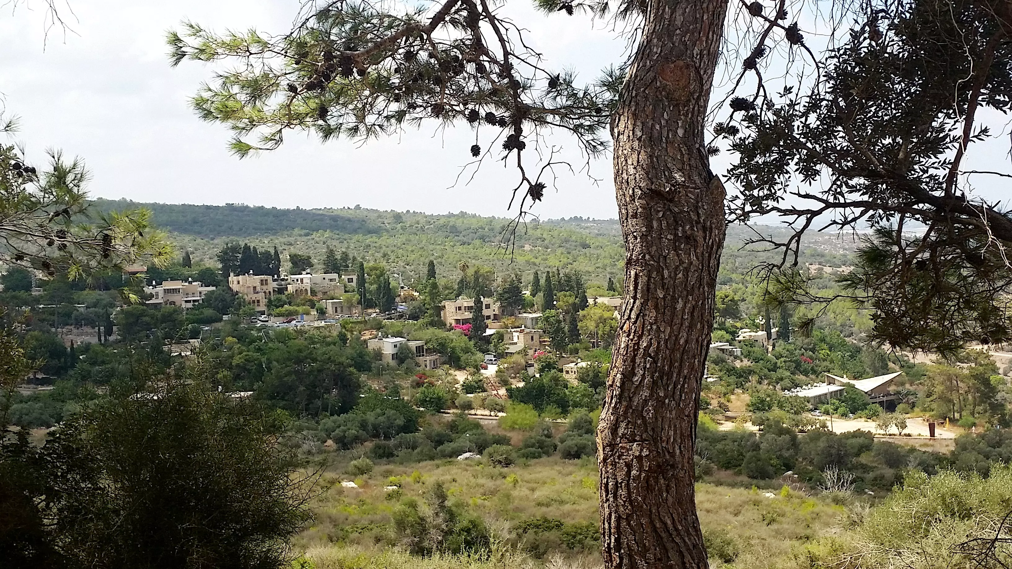
Posted by سهيل مخول - منظر عام لقرية عين حوض المهجرة
- جولة بين بيوت عين حوض المغتصبة
- جولة بين بيوت عين حوض المغتصبة #2
- جولة بين بيوت عين حوض المغتصبة #3

- جولة بين بيوت عين حوض المغتصبة #4
- جولة بين بيوت عين حوض المغتصبة #5
- جولة بين بيوت عين حوض المغتصبة #6
- جولة بين بيوت عين حوض المغتصبة #7
- جولة حديثة في القرية
- جولة حديثة في القرية #2

- جولة حديثة في القرية #3

- جولة حديثة في القرية #4

- جولة حديثة في القرية #5
- جولة حديثة في القرية #6
- جولة بين البيوت المنهوبة من قبل طاعون العصر--Ibtisam Sulieman
- جولة بين البيوت المنهوبة من قبل طاعون العصر--Ibtisam Sulieman #2
- جولة بين البيوت المنهوبة من قبل طاعون العصر--Ibtisam Sulieman #3

- جولة بين البيوت المنهوبة من قبل طاعون العصر--Ibtisam Sulieman #4

- جولة بين البيوت المنهوبة من قبل طاعون العصر--Ibtisam Sulieman #5

- جولة بين البيوت المنهوبة من قبل طاعون العصر--Ibtisam Sulieman #6
- A tour of Palestinian houses that were looted by the most "civilized"
- A tour of Palestinian houses that were looted by the most "civilized" #2
- A tour of Palestinian houses that were looted by the most "civilized" #3
- A tour of Palestinian houses that were looted by the most "civilized" #4

- A tour of Palestinian houses that were looted by the most "civilized" #5
- A tour of Palestinian houses that were looted by the most "civilized" #6
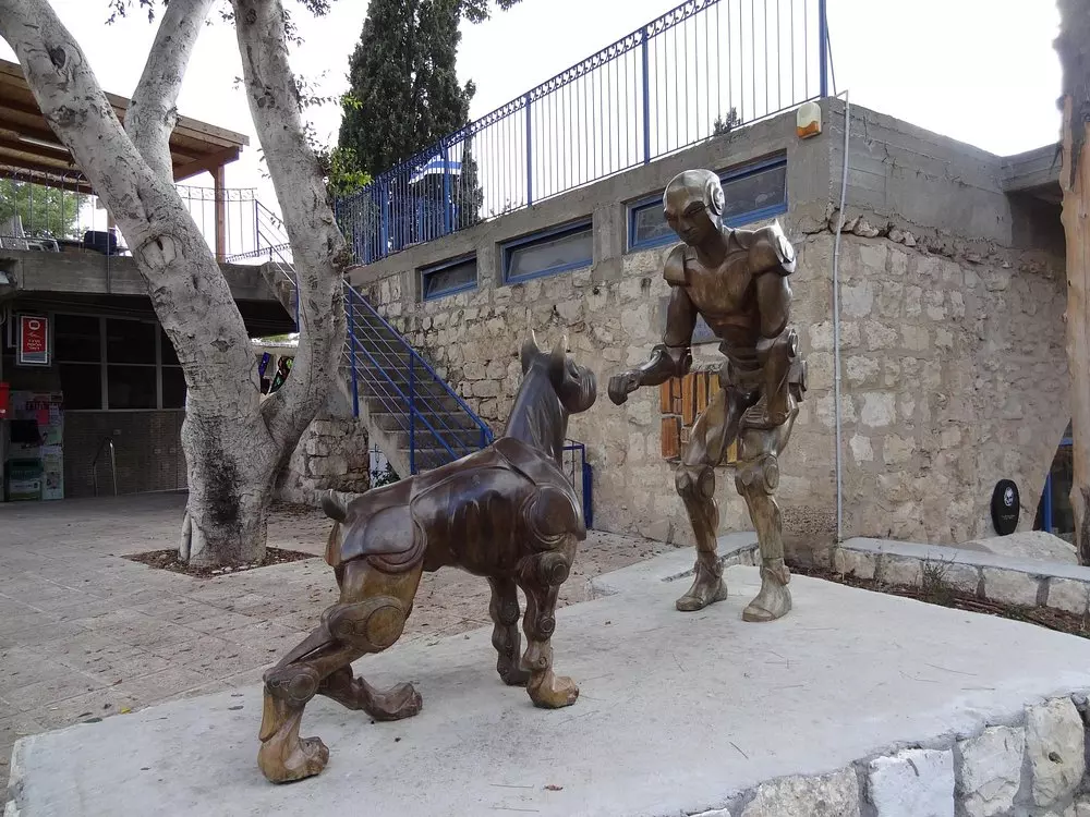
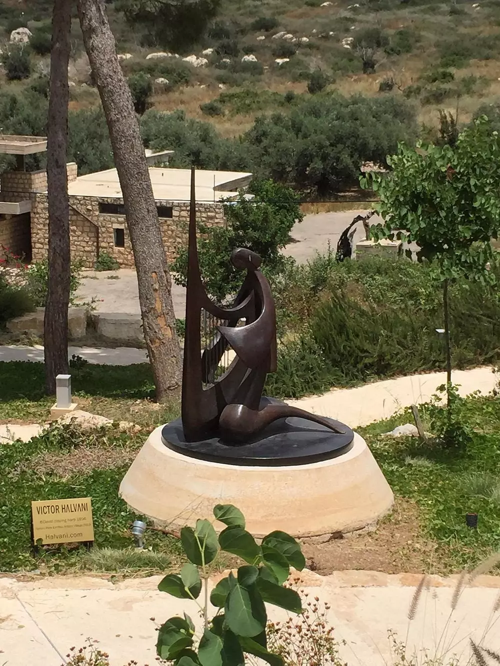
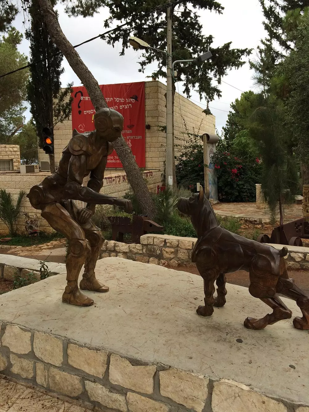
- Let us see what the "MOST CIVILIZED" have looted from the Palestinian people. No, we are not talking about the Germans; we are referring to the "chosen" ones! See for yourself how the most "liberal & progressive" of World Jewry have done to Palestinians' homes: They turned our village into an artists colony; WOW. Soon, Gaza might have a similar fate. Mazeltov. How else will Jews be great again?
- Let us see what the "MOST CIVILIZED" have looted from the Palestinian people. No, we are not talking about the Germans; we are referring to the "chosen" ones! See for yourself how the most "liberal & progressive" of World Jewry have done to Palestinians' homes: They turned our village into an artists colony; WOW. Soon, Gaza might have a similar fate. Mazeltov. How else will Jews be great again? #2
- Let us see what the "MOST CIVILIZED" have looted from the Palestinian people. No, we are not talking about the Germans; we are referring to the "chosen" ones! See for yourself how the most "liberal & progressive" of World Jewry have done to Palestinians' homes: They turned our village into an artists colony; WOW. Soon, Gaza might have a similar fate. Mazeltov. How else will Jews be great again? #3
- Let us see what the "MOST CIVILIZED" have looted from the Palestinian people. No, we are not talking about the Germans; we are referring to the "chosen" ones! See for yourself how the most "liberal & progressive" of World Jewry have done to Palestinians' homes: They turned our village into an artists colony; WOW. Soon, Gaza might have a similar fate. Mazeltov. How else will Jews be great again? #4
- Let us see what the "MOST CIVILIZED" have looted from the Palestinian people. No, we are not talking about the Germans; we are referring to the "chosen" ones! See for yourself how the most "liberal & progressive" of World Jewry have done to Palestinians' homes: They turned our village into an artists colony; WOW. Soon, Gaza might have a similar fate. Mazeltov. How else will Jews be great again? #5
- Let us see what the "MOST CIVILIZED" have looted from the Palestinian people. No, we are not talking about the Germans; we are referring to the "chosen" ones! See for yourself how the most "liberal & progressive" of World Jewry have done to Palestinians' homes: They turned our village into an artists colony; WOW. Soon, Gaza might have a similar fate. Mazeltov. How else will Jews be great again? #6
- Let us see what the "MOST CIVILIZED" have looted from the Palestinian people. No, we are not talking about the Germans; we are referring to the "chosen" ones! See for yourself how the most "liberal & progressive" of World Jewry have done to Palestinians' homes: They turned our village into an artists colony; WOW. Soon, Gaza might have a similar fate. Mazeltov. How else will Jews be great again? #7
- Let us see what the "MOST CIVILIZED" have looted from the Palestinian people. No, we are not talking about the Germans; we are referring to the "chosen" ones! See for yourself how the most "liberal & progressive" of World Jewry have done to Palestinians' homes: They turned our village into an artists colony; WOW. Soon, Gaza might have a similar fate. Mazeltov. How else will Jews be great again? #8
- Let us see what the "MOST CIVILIZED" have looted from the Palestinian people. No, we are not talking about the Germans; we are referring to the "chosen" ones! See for yourself how the most "liberal & progressive" of World Jewry have done to Palestinians' homes: They turned our village into an artists colony; WOW. Soon, Gaza might have a similar fate. Mazeltov. How else will Jews be great again? #9
- Let us see what the "MOST CIVILIZED" have looted from the Palestinian people. No, we are not talking about the Germans; we are referring to the "chosen" ones! See for yourself how the most "liberal & progressive" of World Jewry have done to Palestinians' homes: They turned our village into an artists colony; WOW. Soon, Gaza might have a similar fate. Mazeltov. How else will Jews be great again? #10
- Let us see what the "MOST CIVILIZED" have looted from the Palestinian people. No, we are not talking about the Germans; we are referring to the "chosen" ones! See for yourself how the most "liberal & progressive" of World Jewry have done to Palestinians' homes: They turned our village into an artists colony; WOW. Soon, Gaza might have a similar fate. Mazeltov. How else will Jews be great again? #11
- Let us see what the "MOST CIVILIZED" have looted from the Palestinian people. No, we are not talking about the Germans; we are referring to the "chosen" ones! See for yourself how the most "liberal & progressive" of World Jewry have done to Palestinians' homes: They turned our village into an artists colony; WOW. Soon, Gaza might have a similar fate. Mazeltov. How else will Jews be great again? #12
- Let us see what the "MOST CIVILIZED" have looted from the Palestinian people. No, we are not talking about the Germans; we are referring to the "chosen" ones! See for yourself how the most "liberal & progressive" of World Jewry have done to Palestinians' homes: They turned our village into an artists colony; WOW. Soon, Gaza might have a similar fate. Mazeltov. How else will Jews be great again? #13
- Let us see what the "MOST CIVILIZED" have looted from the Palestinian people. No, we are not talking about the Germans; we are referring to the "chosen" ones! See for yourself how the most "liberal & progressive" of World Jewry have done to Palestinians' homes: They turned our village into an artists colony; WOW. Soon, Gaza might have a similar fate. Mazeltov. How else will Jews be great again? #14
- Let us see what the "MOST CIVILIZED" have looted from the Palestinian people. No, we are not talking about the Germans; we are referring to the "chosen" ones! See for yourself how the most "liberal & progressive" of World Jewry have done to Palestinians' homes: They turned our village into an artists colony; WOW. Soon, Gaza might have a similar fate. Mazeltov. How else will Jews be great again? #15
- Let us see what the "MOST CIVILIZED" have looted from the Palestinian people. No, we are not talking about the Germans; we are referring to the "chosen" ones! See for yourself how the most "liberal & progressive" of World Jewry have done to Palestinians' homes: They turned our village into an artists colony; WOW. Soon, Gaza might have a similar fate. Mazeltov. How else will Jews be great again? #16
- Let us see what the "MOST CIVILIZED" have looted from the Palestinian people. No, we are not talking about the Germans; we are referring to the "chosen" ones! See for yourself how the most "liberal & progressive" of World Jewry have done to Palestinians' homes: They turned our village into an artists colony; WOW. Soon, Gaza might have a similar fate. Mazeltov. How else will Jews be great again? #17
- Let us see what the "MOST CIVILIZED" have looted from the Palestinian people. No, we are not talking about the Germans; we are referring to the "chosen" ones! See for yourself how the most "liberal & progressive" of World Jewry have done to Palestinians' homes: They turned our village into an artists colony; WOW. Soon, Gaza might have a similar fate. Mazeltov. How else will Jews be great again? #18
- Let us see what the "MOST CIVILIZED" have looted from the Palestinian people. No, we are not talking about the Germans; we are referring to the "chosen" ones! See for yourself how the most "liberal & progressive" of World Jewry have done to Palestinians' homes: They turned our village into an artists colony; WOW. Soon, Gaza might have a similar fate. Mazeltov. How else will Jews be great again? #19
- Let us see what the "MOST CIVILIZED" have looted from the Palestinian people. No, we are not talking about the Germans; we are referring to the "chosen" ones! See for yourself how the most "liberal & progressive" of World Jewry have done to Palestinians' homes: They turned our village into an artists colony; WOW. Soon, Gaza might have a similar fate. Mazeltov. How else will Jews be great again? #20
- Let us see what the "MOST CIVILIZED" have looted from the Palestinian people. No, we are not talking about the Germans; we are referring to the "chosen" ones! See for yourself how the most "liberal & progressive" of World Jewry have done to Palestinians' homes: They turned our village into an artists colony; WOW. Soon, Gaza might have a similar fate. Mazeltov. How else will Jews be great again? #21
- Let us see what the "MOST CIVILIZED" have looted from the Palestinian people. No, we are not talking about the Germans; we are referring to the "chosen" ones! See for yourself how the most "liberal & progressive" of World Jewry have done to Palestinians' homes: They turned our village into an artists colony; WOW. Soon, Gaza might have a similar fate. Mazeltov. How else will Jews be great again? #22
- Let us see what the "MOST CIVILIZED" have looted from the Palestinian people. No, we are not talking about the Germans; we are referring to the "chosen" ones! See for yourself how the most "liberal & progressive" of World Jewry have done to Palestinians' homes: They turned our village into an artists colony; WOW. Soon, Gaza might have a similar fate. Mazeltov. How else will Jews be great again? #23
- Let us see what the "MOST CIVILIZED" have looted from the Palestinian people. No, we are not talking about the Germans; we are referring to the "chosen" ones! See for yourself how the most "liberal & progressive" of World Jewry have done to Palestinians' homes: They turned our village into an artists colony; WOW. Soon, Gaza might have a similar fate. Mazeltov. How else will Jews be great again? #24
- Let us see what the "MOST CIVILIZED" have looted from the Palestinian people. No, we are not talking about the Germans; we are referring to the "chosen" ones! See for yourself how the most "liberal & progressive" of World Jewry have done to Palestinians' homes: They turned our village into an artists colony; WOW. Soon, Gaza might have a similar fate. Mazeltov. How else will Jews be great again? #25
- Let us see what the "MOST CIVILIZED" have looted from the Palestinian people. No, we are not talking about the Germans; we are referring to the "chosen" ones! See for yourself how the most "liberal & progressive" of World Jewry have done to Palestinians' homes: They turned our village into an artists colony; WOW. Soon, Gaza might have a similar fate. Mazeltov. How else will Jews be great again? #26
- Let us see what the "MOST CIVILIZED" have looted from the Palestinian people. No, we are not talking about the Germans; we are referring to the "chosen" ones! See for yourself how the most "liberal & progressive" of World Jewry have done to Palestinians' homes: They turned our village into an artists colony; WOW. Soon, Gaza might have a similar fate. Mazeltov. How else will Jews be great again? #27
- Let us see what the "MOST CIVILIZED" have looted from the Palestinian people. No, we are not talking about the Germans; we are referring to the "chosen" ones! See for yourself how the most "liberal & progressive" of World Jewry have done to Palestinians' homes: They turned our village into an artists colony; WOW. Soon, Gaza might have a similar fate. Mazeltov. How else will Jews be great again? #28
- Let us see what the "MOST CIVILIZED" have looted from the Palestinian people. No, we are not talking about the Germans; we are referring to the "chosen" ones! See for yourself how the most "liberal & progressive" of World Jewry have done to Palestinians' homes: They turned our village into an artists colony; WOW. Soon, Gaza might have a similar fate. Mazeltov. How else will Jews be great again? #29
- Let us see what the "MOST CIVILIZED" have looted from the Palestinian people. No, we are not talking about the Germans; we are referring to the "chosen" ones! See for yourself how the most "liberal & progressive" of World Jewry have done to Palestinians' homes: They turned our village into an artists colony; WOW. Soon, Gaza might have a similar fate. Mazeltov. How else will Jews be great again? #30
- Let us see what the "MOST CIVILIZED" have looted from the Palestinian people. No, we are not talking about the Germans; we are referring to the "chosen" ones! See for yourself how the most "liberal & progressive" of World Jewry have done to Palestinians' homes: They turned our village into an artists colony; WOW. Soon, Gaza might have a similar fate. Mazeltov. How else will Jews be great again? #31
- Let us see what the "MOST CIVILIZED" have looted from the Palestinian people. No, we are not talking about the Germans; we are referring to the "chosen" ones! See for yourself how the most "liberal & progressive" of World Jewry have done to Palestinians' homes: They turned our village into an artists colony; WOW. Soon, Gaza might have a similar fate. Mazeltov. How else will Jews be great again? #32
- Let us see what the "MOST CIVILIZED" have looted from the Palestinian people. No, we are not talking about the Germans; we are referring to the "chosen" ones! See for yourself how the most "liberal & progressive" of World Jewry have done to Palestinians' homes: They turned our village into an artists colony; WOW. Soon, Gaza might have a similar fate. Mazeltov. How else will Jews be great again? #33
- Let us see what the "MOST CIVILIZED" have looted from the Palestinian people. No, we are not talking about the Germans; we are referring to the "chosen" ones! See for yourself how the most "liberal & progressive" of World Jewry have done to Palestinians' homes: They turned our village into an artists colony; WOW. Soon, Gaza might have a similar fate. Mazeltov. How else will Jews be great again? #34
- Let us see what the "MOST CIVILIZED" have looted from the Palestinian people. No, we are not talking about the Germans; we are referring to the "chosen" ones! See for yourself how the most "liberal & progressive" of World Jewry have done to Palestinians' homes: They turned our village into an artists colony; WOW. Soon, Gaza might have a similar fate. Mazeltov. How else will Jews be great again? #35
- Let us see what the "MOST CIVILIZED" have looted from the Palestinian people. No, we are not talking about the Germans; we are referring to the "chosen" ones! See for yourself how the most "liberal & progressive" of World Jewry have done to Palestinians' homes: They turned our village into an artists colony; WOW. Soon, Gaza might have a similar fate. Mazeltov. How else will Jews be great again? #36
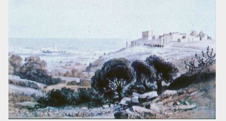
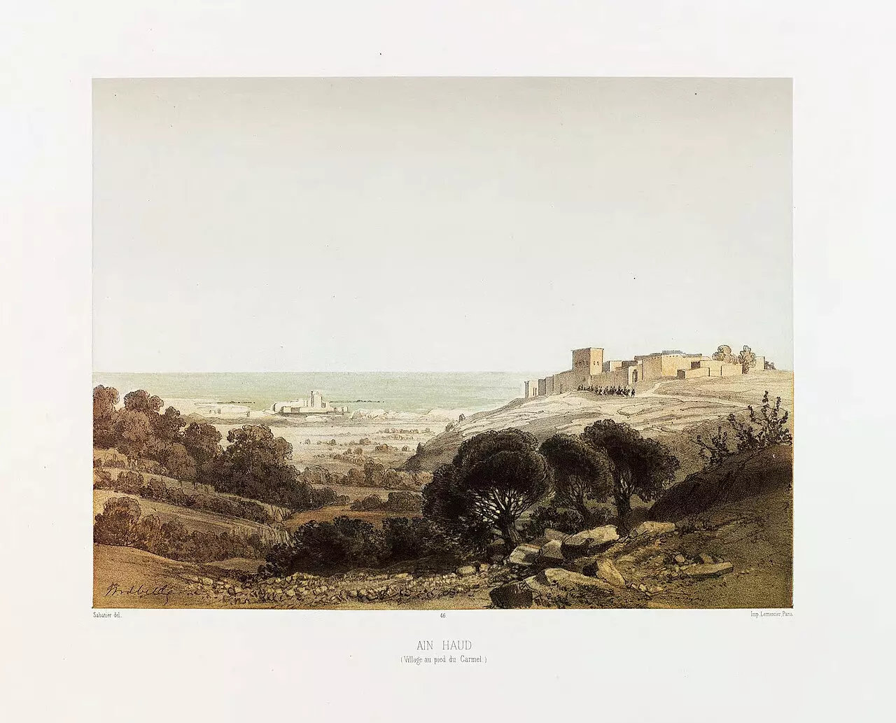
- Ain-Haud in the 1850s, by van de Velde
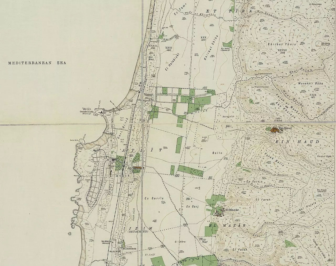
- A map of 'Ayn Hawd and its surroundings as of 1932
- Let us see what the "MOST CIVILIZED" have looted from the Palestinian people. No, we are not talking about the Germans; we are referring to the "chosen" ones! See for yourself how the most "liberal & progressive" of World Jewry have done to Palestinians' homes: They turned our village into an artists colony; WOW. Soon, Gaza might have a similar fate. Mazeltov. How else will Jews be great again?
- Let us see what the "MOST CIVILIZED" have looted from the Palestinian people. No, we are not talking about the Germans; we are referring to the "chosen" ones! See for yourself how the most "liberal & progressive" of World Jewry have done to Palestinians' homes: They turned our village into an artists colony; WOW. Soon, Gaza might have a similar fate. Mazeltov. How else will Jews be great again? #2
- Let us see what the "MOST CIVILIZED" have looted from the Palestinian people. No, we are not talking about the Germans; we are referring to the "chosen" ones! See for yourself how the most "liberal & progressive" of World Jewry have done to Palestinians' homes: They turned our village into an artists colony; WOW. Soon, Gaza might have a similar fate. Mazeltov. How else will Jews be great again? #3

- Let us see what the "MOST CIVILIZED" have looted from the Palestinian people. No, we are not talking about the Germans; we are referring to the "chosen" ones! See for yourself how the most "liberal & progressive" of World Jewry have done to Palestinians' homes: They turned our village into an artists colony; WOW. Soon, Gaza might have a similar fate. Mazeltov. How else will Jews be great again? #4
- Let us see what the "MOST CIVILIZED" have looted from the Palestinian people. No, we are not talking about the Germans; we are referring to the "chosen" ones! See for yourself how the most "liberal & progressive" of World Jewry have done to Palestinians' homes: They turned our village into an artists colony; WOW. Soon, Gaza might have a similar fate. Mazeltov. How else will Jews be great again? #5
- Let us see what the "MOST CIVILIZED" have looted from the Palestinian people. No, we are not talking about the Germans; we are referring to the "chosen" ones! See for yourself how the most "liberal & progressive" of World Jewry have done to Palestinians' homes: They turned our village into an artists colony; WOW. Soon, Gaza might have a similar fate. Mazeltov. How else will Jews be great again? #6
- Let us see what the "MOST CIVILIZED" have looted from the Palestinian people. No, we are not talking about the Germans; we are referring to the "chosen" ones! See for yourself how the most "liberal & progressive" of World Jewry have done to Palestinians' homes: They turned our village into an artists colony; WOW. Soon, Gaza might have a similar fate. Mazeltov. How else will Jews be great again? #7

- Let us see what the "MOST CIVILIZED" have looted from the Palestinian people. No, we are not talking about the Germans; we are referring to the "chosen" ones! See for yourself how the most "liberal & progressive" of World Jewry have done to Palestinians' homes: They turned our village into an artists colony; WOW. Soon, Gaza might have a similar fate. Mazeltov. How else will Jews be great again?
- Let us see what the "MOST CIVILIZED" have looted from the Palestinian people. No, we are not talking about the Germans; we are referring to the "chosen" ones! See for yourself how the most "liberal & progressive" of World Jewry have done to Palestinians' homes: They turned our village into an artists colony; WOW. Soon, Gaza might have a similar fate. Mazeltov. How else will Jews be great again? #2
- Let us see what the "MOST CIVILIZED" have looted from the Palestinian people. No, we are not talking about the Germans; we are referring to the "chosen" ones! See for yourself how the most "liberal & progressive" of World Jewry have done to Palestinians' homes: They turned our village into an artists colony; WOW. Soon, Gaza might have a similar fate. Mazeltov. How else will Jews be great again? #3
- Let us see what the "MOST CIVILIZED" have looted from the Palestinian people. No, we are not talking about the Germans; we are referring to the "chosen" ones! See for yourself how the most "liberal & progressive" of World Jewry have done to Palestinians' homes: They turned our village into an artists colony; WOW. Soon, Gaza might have a similar fate. Mazeltov. How else will Jews be great again? #4
- Let us see what the "MOST CIVILIZED" have looted from the Palestinian people. No, we are not talking about the Germans; we are referring to the "chosen" ones! See for yourself how the most "liberal & progressive" of World Jewry have done to Palestinians' homes: They turned our village into an artists colony; WOW. Soon, Gaza might have a similar fate. Mazeltov. How else will Jews be great again? #5
- Let us see what the "MOST CIVILIZED" have looted from the Palestinian people. No, we are not talking about the Germans; we are referring to the "chosen" ones! See for yourself how the most "liberal & progressive" of World Jewry have done to Palestinians' homes: They turned our village into an artists colony; WOW. Soon, Gaza might have a similar fate. Mazeltov. How else will Jews be great again? #6
- Let us see what the "MOST CIVILIZED" have looted from the Palestinian people. No, we are not talking about the Germans; we are referring to the "chosen" ones! See for yourself how the most "liberal & progressive" of World Jewry have done to Palestinians' homes: They turned our village into an artists colony; WOW. Soon, Gaza might have a similar fate. Mazeltov. How else will Jews be great again? #7
- Let us see what the "MOST CIVILIZED" have looted from the Palestinian people. No, we are not talking about the Germans; we are referring to the "chosen" ones! See for yourself how the most "liberal & progressive" of World Jewry have done to Palestinians' homes: They turned our village into an artists colony; WOW. Soon, Gaza might have a similar fate. Mazeltov. How else will Jews be great again? #8
- Let us see what the "MOST CIVILIZED" have looted from the Palestinian people. No, we are not talking about the Germans; we are referring to the "chosen" ones! See for yourself how the most "liberal & progressive" of World Jewry have done to Palestinians' homes: They turned our village into an artists colony; WOW. Soon, Gaza might have a similar fate. Mazeltov. How else will Jews be great again? #9
- Let us see what the "MOST CIVILIZED" have looted from the Palestinian people. No, we are not talking about the Germans; we are referring to the "chosen" ones! See for yourself how the most "liberal & progressive" of World Jewry have done to Palestinians' homes: They turned our village into an artists colony; WOW. Soon, Gaza might have a similar fate. Mazeltov. How else will Jews be great again? #10
- Let us see what the "MOST CIVILIZED" have looted from the Palestinian people. No, we are not talking about the Germans; we are referring to the "chosen" ones! See for yourself how the most "liberal & progressive" of World Jewry have done to Palestinians' homes: They turned our village into an artists colony; WOW. Soon, Gaza might have a similar fate. Mazeltov. How else will Jews be great again? #11
- Let us see what the "MOST CIVILIZED" have looted from the Palestinian people. No, we are not talking about the Germans; we are referring to the "chosen" ones! See for yourself how the most "liberal & progressive" of World Jewry have done to Palestinians' homes: They turned our village into an artists colony; WOW. Soon, Gaza might have a similar fate. Mazeltov. How else will Jews be great again? #12
- Let us see what the "MOST CIVILIZED" have looted from the Palestinian people. No, we are not talking about the Germans; we are referring to the "chosen" ones! See for yourself how the most "liberal & progressive" of World Jewry have done to Palestinians' homes: They turned our village into an artists colony; WOW. Soon, Gaza might have a similar fate. Mazeltov. How else will Jews be great again? #13
- Let us see what the "MOST CIVILIZED" have looted from the Palestinian people. No, we are not talking about the Germans; we are referring to the "chosen" ones! See for yourself how the most "liberal & progressive" of World Jewry have done to Palestinians' homes: They turned our village into an artists colony; WOW. Soon, Gaza might have a similar fate. Mazeltov. How else will Jews be great again? #14
- Let us see how the "civilized (who landed on us from Europe) managed to turn our looted homes and landscape. Let's see what the most liberal of world Jewry has done. That is how the Jews became great and safe again!
- Let us see how the "civilized (who landed on us from Europe) managed to turn our looted homes and landscape. Let's see what the most liberal of world Jewry has done. That is how the Jews became great and safe again! #2
- Let us see how the "civilized (who landed on us from Europe) managed to turn our looted homes and landscape. Let's see what the most liberal of world Jewry has done. That is how the Jews became great and safe again! #3
- Let us see how the "civilized (who landed on us from Europe) managed to turn our looted homes and landscape. Let's see what the most liberal of world Jewry has done. That is how the Jews became great and safe again! #4
- Let us see how the "civilized (who landed on us from Europe) managed to turn our looted homes and landscape. Let's see what the most liberal of world Jewry has done. That is how the Jews became great and safe again! #5
- Let us see how the "civilized (who landed on us from Europe) managed to turn our looted homes and landscape. Let's see what the most liberal of world Jewry has done. That is how the Jews became great and safe again! #6

- Let us see how the "civilized (who landed on us from Europe) managed to turn our looted homes and landscape. Let's see what the most liberal of world Jewry has done. That is how the Jews became great and safe again! #7
- Let us see how the "civilized (who landed on us from Europe) managed to turn our looted homes and landscape. Let's see what the most liberal of world Jewry has done. That is how the Jews became great and safe again! #8
- Let us see how the "civilized (who landed on us from Europe) managed to turn our looted homes and landscape. Let's see what the most liberal of world Jewry has done. That is how the Jews became great and safe again! #9
- Let us see how the "civilized (who landed on us from Europe) managed to turn our looted homes and landscape. Let's see what the most liberal of world Jewry has done. That is how the Jews became great and safe again! #10
- Let us see how the "civilized (who landed on us from Europe) managed to turn our looted homes and landscape. Let's see what the most liberal of world Jewry has done. That is how the Jews became great and safe again! #11
- Let us see how the "civilized (who landed on us from Europe) managed to turn our looted homes and landscape. Let's see what the most liberal of world Jewry has done. That is how the Jews became great and safe again! #12
- Let us see how the "civilized (who landed on us from Europe) managed to turn our looted homes and landscape. Let's see what the most liberal of world Jewry has done. That is how the Jews became great and safe again! #13
- Let us see how the "civilized (who landed on us from Europe) managed to turn our looted homes and landscape. Let's see what the most liberal of world Jewry has done. That is how the Jews became great and safe again! #14
- Let us see how the "civilized (who landed on us from Europe) managed to turn our looted homes and landscape. Let's see what the most liberal of world Jewry has done. That is how the Jews became great and safe again! #15
- Let us see how the "civilized (who landed on us from Europe) managed to turn our looted homes and landscape. Let's see what the most liberal of world Jewry has done. That is how the Jews became great and safe again! #16
- Let us see how the "civilized (who landed on us from Europe) managed to turn our looted homes and landscape. Let's see what the most liberal of world Jewry has done. That is how the Jews became great and safe again! #17
- Let us see how the "civilized (who landed on us from Europe) managed to turn our looted homes and landscape. Let's see what the most liberal of world Jewry has done. That is how the Jews became great and safe again! #18
- Let us see how the "civilized (who landed on us from Europe) managed to turn our looted homes and landscape. Let's see what the most liberal of world Jewry has done. That is how the Jews became great and safe again! #19
- Let us see how the "civilized (who landed on us from Europe) managed to turn our looted homes and landscape. Let's see what the most liberal of world Jewry has done. That is how the Jews became great and safe again! #20
- Let us see how the "civilized (who landed on us from Europe) managed to turn our looted homes and landscape. Let's see what the most liberal of world Jewry has done. That is how the Jews became great and safe again! #21
- Let us see how the "civilized (who landed on us from Europe) managed to turn our looted homes and landscape. Let's see what the most liberal of world Jewry has done. That is how the Jews became great and safe again! #22
- Let us see how the "civilized (who landed on us from Europe) managed to turn our looted homes and landscape. Let's see what the most liberal of world Jewry has done. That is how the Jews became great and safe again! #23
- Let us see how the "civilized (who landed on us from Europe) managed to turn our looted homes and landscape. Let's see what the most liberal of world Jewry has done. That is how the Jews became great and safe again! #24
- Let us see how the "civilized (who landed on us from Europe) managed to turn our looted homes and landscape. Let's see what the most liberal of world Jewry has done. That is how the Jews became great and safe again! #25
- Let us see how the "civilized (who landed on us from Europe) managed to turn our looted homes and landscape. Let's see what the most liberal of world Jewry has done. That is how the Jews became great and safe again! #26
- Let us see how the "civilized (who landed on us from Europe) managed to turn our looted homes and landscape. Let's see what the most liberal of world Jewry has done. That is how the Jews became great and safe again! #27
- Let us see how the "civilized (who landed on us from Europe) managed to turn our looted homes and landscape. Let's see what the most liberal of world Jewry has done. That is how the Jews became great and safe again! #28
- Let us see how the "civilized (who landed on us from Europe) managed to turn our looted homes and landscape. Let's see what the most liberal of world Jewry has done. That is how the Jews became great and safe again! #29
- Let us see how the "civilized (who landed on us from Europe) managed to turn our looted homes and landscape. Let's see what the most liberal of world Jewry has done. That is how the Jews became great and safe again! #30
- Let us see how the "civilized (who landed on us from Europe) managed to turn our looted homes and landscape. Let's see what the most liberal of world Jewry has done. That is how the Jews became great and safe again! #31
- Let us see how the "civilized (who landed on us from Europe) managed to turn our looted homes and landscape. Let's see what the most liberal of world Jewry has done. That is how the Jews became great and safe again! #32
- Let us see how the "civilized (who landed on us from Europe) managed to turn our looted homes and landscape. Let's see what the most liberal of world Jewry has done. That is how the Jews became great and safe again! #33
- Let us see how the "civilized (who landed on us from Europe) managed to turn our looted homes and landscape. Let's see what the most liberal of world Jewry has done. That is how the Jews became great and safe again! #34
- Let us see how the "civilized (who landed on us from Europe) managed to turn our looted homes and landscape. Let's see what the most liberal of world Jewry has done. That is how the Jews became great and safe again! #35
- Let us see how the "civilized (who landed on us from Europe) managed to turn our looted homes and landscape. Let's see what the most liberal of world Jewry has done. That is how the Jews became great and safe again! #36
- Let us see how the "civilized (who landed on us from Europe) managed to turn our looted homes and landscape. Let's see what the most liberal of world Jewry has done. That is how the Jews became great and safe again! #37
- Let us see how the "civilized (who landed on us from Europe) managed to turn our looted homes and landscape. Let's see what the most liberal of world Jewry has done. That is how the Jews became great and safe again! #38
- Let us see how the "civilized (who landed on us from Europe) managed to turn our looted homes and landscape. Let's see what the most liberal of world Jewry has done. That is how the Jews became great and safe again! #39
- Let us see how the "civilized (who landed on us from Europe) managed to turn our looted homes and landscape. Let's see what the most liberal of world Jewry has done. That is how the Jews became great and safe again! #40
- Let us see how the "civilized (who landed on us from Europe) managed to turn our looted homes and landscape. Let's see what the most liberal of world Jewry has done. That is how the Jews became great and safe again! #41
- Let us see how the "civilized (who landed on us from Europe) managed to turn our looted homes and landscape. Let's see what the most liberal of world Jewry has done. That is how the Jews became great and safe again! #42
- Let us see how the "civilized (who landed on us from Europe) managed to turn our looted homes and landscape. Let's see what the most liberal of world Jewry has done. That is how the Jews became great and safe again! #43
- Let us see how the "civilized (who landed on us from Europe) managed to turn our looted homes and landscape. Let's see what the most liberal of world Jewry has done. That is how the Jews became great and safe again! #44

- Let us see how the "civilized (who landed on us from Europe) managed to turn our looted homes and landscape. Let's see what the most liberal of world Jewry has done. That is how the Jews became great and safe again! #45
- Let us see how the "civilized (who landed on us from Europe) managed to turn our looted homes and landscape. Let's see what the most liberal of world Jewry has done. That is how the Jews became great and safe again! #46
- Let us see how the "civilized (who landed on us from Europe) managed to turn our looted homes and landscape. Let's see what the most liberal of world Jewry has done. That is how the Jews became great and safe again! #47
- Let us see how the "civilized (who landed on us from Europe) managed to turn our looted homes and landscape. Let's see what the most liberal of world Jewry has done. That is how the Jews became great and safe again! #48
- Let us see how the "civilized (who landed on us from Europe) managed to turn our looted homes and landscape. Let's see what the most liberal of world Jewry has done. That is how the Jews became great and safe again! #49
- Let us see how the "civilized (who landed on us from Europe) managed to turn our looted homes and landscape. Let's see what the most liberal of world Jewry has done. That is how the Jews became great and safe again! #50
- Let us see how the "civilized (who landed on us from Europe) managed to turn our looted homes and landscape. Let's see what the most liberal of world Jewry has done. That is how the Jews became great and safe again! #51
- Let us see how the "civilized (who landed on us from Europe) managed to turn our looted homes and landscape. Let's see what the most liberal of world Jewry has done. That is how the Jews became great and safe again! #52
- Let us see how the "civilized (who landed on us from Europe) managed to turn our looted homes and landscape. Let's see what the most liberal of world Jewry has done. That is how the Jews became great and safe again! #53
- Let us see how the "civilized (who landed on us from Europe) managed to turn our looted homes and landscape. Let's see what the most liberal of world Jewry has done. That is how the Jews became great and safe again! #54
- Let us see how the "civilized (who landed on us from Europe) managed to turn our looted homes and landscape. Let's see what the most liberal of world Jewry has done. That is how the Jews became great and safe again! #55
- Let us see how the "civilized (who landed on us from Europe) managed to turn our looted homes and landscape. Let's see what the most liberal of world Jewry has done. That is how the Jews became great and safe again! #56
- Let us see how the "civilized (who landed on us from Europe) managed to turn our looted homes and landscape. Let's see what the most liberal of world Jewry has done. That is how the Jews became great and safe again! #57
- Let us see how the "civilized (who landed on us from Europe) managed to turn our looted homes and landscape. Let's see what the most liberal of world Jewry has done. That is how the Jews became great and safe again! #58

- Let us see how the "civilized (who landed on us from Europe) managed to turn our looted homes and landscape. Let's see what the most liberal of world Jewry has done. That is how the Jews became great and safe again! #59
- The most "liberal" of world Jewry looted our homes, farms, and businesses. Now imagine what their fascists would have done? Genocide. Mazeltov, dear Jews, for this wonderful gift to humanity.
- The most "liberal" of world Jewry looted our homes, farms, and businesses. Now imagine what their fascists would have done? Genocide. Mazeltov, dear Jews, for this wonderful gift to humanity.
- The most "liberal" of world Jewry looted our homes, farms, and businesses. Now imagine what their fascists would have done? Genocide. Mazeltov, dear Jews, for this wonderful gift to humanity. #2
- The most "liberal" of world Jewry looted our homes, farms, and businesses. Now imagine what their fascists would have done? Genocide. Mazeltov, dear Jews, for this wonderful gift to humanity. #3
- The most "liberal" of world Jewry looted our homes, farms, and businesses. Now imagine what their fascists would have done? Genocide. Mazeltov, dear Jews, for this wonderful gift to humanity. #4
- The most "liberal" of world Jewry looted our homes, farms, and businesses. Now imagine what their fascists would have done? Genocide. Mazeltov, dear Jews, for this wonderful gift to humanity. #5
- The most "liberal" of world Jewry looted our homes, farms, and businesses. Now imagine what their fascists would have done? Genocide. Mazeltov, dear Jews, for this wonderful gift to humanity. #6
- The most "liberal" of world Jewry looted our homes, farms, and businesses. Now imagine what their fascists would have done? Genocide. Mazeltov, dear Jews, for this wonderful gift to humanity. #7
- The most "liberal" of world Jewry looted our homes, farms, and businesses. Now imagine what their fascists would have done? Genocide. Mazeltov, dear Jews, for this wonderful gift to humanity. #8
- The most "liberal" of world Jewry looted our homes, farms, and businesses. Now imagine what their fascists would have done? Genocide. Mazeltov, dear Jews, for this wonderful gift to humanity. #9
- The most "liberal" of world Jewry looted our homes, farms, and businesses. Now imagine what their fascists would have done? Genocide. Mazeltov, dear Jews, for this wonderful gift to humanity. #10
- The most "liberal" of world Jewry looted our homes, farms, and businesses. Now imagine what their fascists would have done? Genocide. Mazeltov, dear Jews, for this wonderful gift to humanity. #11
- The most "liberal" of world Jewry looted our homes, farms, and businesses. Now imagine what their fascists would have done? Genocide. Mazeltov, dear Jews, for this wonderful gift to humanity. #12
- The most "liberal" of world Jewry looted our homes, farms, and businesses. Now imagine what their fascists would have done? Genocide. Mazeltov, dear Jews, for this wonderful gift to humanity. #13
- The most "liberal" of world Jewry looted our homes, farms, and businesses. Now imagine what their fascists would have done? Genocide. Mazeltov, dear Jews, for this wonderful gift to humanity. #14
- The most "liberal" of world Jewry looted our homes, farms, and businesses. Now imagine what their fascists would have done? Genocide. Mazeltov, dear Jews, for this wonderful gift to humanity. #15
- The most "liberal" of world Jewry looted our homes, farms, and businesses. Now imagine what their fascists would have done? Genocide. Mazeltov, dear Jews, for this wonderful gift to humanity. #16
- The most "liberal" of world Jewry looted our homes, farms, and businesses. Now imagine what their fascists would have done? Genocide. Mazeltov, dear Jews, for this wonderful gift to humanity. #17
- The most "liberal" of world Jewry looted our homes, farms, and businesses. Now imagine what their fascists would have done? Genocide. Mazeltov, dear Jews, for this wonderful gift to humanity. #18
- The most "liberal" of world Jewry looted our homes, farms, and businesses. Now imagine what their fascists would have done? Genocide. Mazeltov, dear Jews, for this wonderful gift to humanity. #19
- The most "liberal" of world Jewry looted our homes, farms, and businesses. Now imagine what their fascists would have done? Genocide. Mazeltov, dear Jews, for this wonderful gift to humanity. #20
- The most "liberal" of world Jewry looted our homes, farms, and businesses. Now imagine what their fascists would have done? Genocide. Mazeltov, dear Jews, for this wonderful gift to humanity. #21
- Let's see how the most "liberal" of world Jewry has done to Palestinian homes, which they looted after Nakba. Mazeltov; they turned it into an artist colony. It is assumed they will do the same to Gaza once the Genocide ends! How else will the Jews be great again? Aug. 2022
- Let's see how the most "liberal" of world Jewry has done to Palestinian homes, which they looted after Nakba. Mazeltov; they turned it into an artist colony. It is assumed they will do the same to Gaza once the Genocide ends! How else will the Jews be great again? Aug. 2022 #2
- Let's see how the most "liberal" of world Jewry has done to Palestinian homes, which they looted after Nakba. Mazeltov; they turned it into an artist colony. It is assumed they will do the same to Gaza once the Genocide ends! How else will the Jews be great again? Aug. 2022 #3
- Let's see how the most "liberal" of world Jewry has done to Palestinian homes, which they looted after Nakba. Mazeltov; they turned it into an artist colony. It is assumed they will do the same to Gaza once the Genocide ends! How else will the Jews be great again? Aug. 2022 #4
- Let's see how the most "liberal" of world Jewry has done to Palestinian homes, which they looted after Nakba. Mazeltov; they turned it into an artist colony. It is assumed they will do the same to Gaza once the Genocide ends! How else will the Jews be great again? Aug. 2022 #5
- Let's see how the most "liberal" of world Jewry has done to Palestinian homes, which they looted after Nakba. Mazeltov; they turned it into an artist colony. It is assumed they will do the same to Gaza once the Genocide ends! How else will the Jews be great again? Aug. 2022 #6
- Let's see how the most "liberal" of world Jewry has done to Palestinian homes, which they looted after Nakba. Mazeltov; they turned it into an artist colony. It is assumed they will do the same to Gaza once the Genocide ends! How else will the Jews be great again? Aug. 2022 #7
- Let's see how the most "liberal" of world Jewry has done to Palestinian homes, which they looted after Nakba. Mazeltov; they turned it into an artist colony. It is assumed they will do the same to Gaza once the Genocide ends! How else will the Jews be great again? Aug. 2022 #8
- Let's see how the most "liberal" of world Jewry has done to Palestinian homes, which they looted after Nakba. Mazeltov; they turned it into an artist colony. It is assumed they will do the same to Gaza once the Genocide ends! How else will the Jews be great again? Aug. 2022 #9
- Let's see how the most "liberal" of world Jewry has done to Palestinian homes, which they looted after Nakba. Mazeltov; they turned it into an artist colony. It is assumed they will do the same to Gaza once the Genocide ends! How else will the Jews be great again? Aug. 2022 #10
- Let's see how the most "liberal" of world Jewry has done to Palestinian homes, which they looted after Nakba. Mazeltov; they turned it into an artist colony. It is assumed they will do the same to Gaza once the Genocide ends! How else will the Jews be great again? Aug. 2022 #11
- Let's see how the most "liberal" of world Jewry has done to Palestinian homes, which they looted after Nakba. Mazeltov; they turned it into an artist colony. It is assumed they will do the same to Gaza once the Genocide ends! How else will the Jews be great again? Aug. 2022 #12
- Let's see how the most "liberal" of world Jewry has done to Palestinian homes, which they looted after Nakba. Mazeltov; they turned it into an artist colony. It is assumed they will do the same to Gaza once the Genocide ends! How else will the Jews be great again? Aug. 2022 #13
- Let's see how the most "liberal" of world Jewry has done to Palestinian homes, which they looted after Nakba. Mazeltov; they turned it into an artist colony. It is assumed they will do the same to Gaza once the Genocide ends! How else will the Jews be great again? Aug. 2022 #14
- Let's see how the most "liberal" of world Jewry has done to Palestinian homes, which they looted after Nakba. Mazeltov; they turned it into an artist colony. It is assumed they will do the same to Gaza once the Genocide ends! How else will the Jews be great again? Aug. 2022 #15
- Let's see how the most "liberal" of world Jewry has done to Palestinian homes, which they looted after Nakba. Mazeltov; they turned it into an artist colony. It is assumed they will do the same to Gaza once the Genocide ends! How else will the Jews be great again? Aug. 2022 #16
- Let's see how the most "liberal" of world Jewry has done to Palestinian homes, which they looted after Nakba. Mazeltov; they turned it into an artist colony. It is assumed they will do the same to Gaza once the Genocide ends! How else will the Jews be great again? Aug. 2022 #17
- Let's see how the most "liberal" of world Jewry has done to Palestinian homes, which they looted after Nakba. Mazeltov; they turned it into an artist colony. It is assumed they will do the same to Gaza once the Genocide ends! How else will the Jews be great again? Aug. 2022 #18
- Let's see how the most "liberal" of world Jewry has done to Palestinian homes, which they looted after Nakba. Mazeltov; they turned it into an artist colony. It is assumed they will do the same to Gaza once the Genocide ends! How else will the Jews be great again? Aug. 2022 #19
- Let's see how the most "liberal" of world Jewry has done to Palestinian homes, which they looted after Nakba. Mazeltov; they turned it into an artist colony. It is assumed they will do the same to Gaza once the Genocide ends! How else will the Jews be great again? Aug. 2022 #20
- Let's see how the most "liberal" of world Jewry has done to Palestinian homes, which they looted after Nakba. Mazeltov; they turned it into an artist colony. It is assumed they will do the same to Gaza once the Genocide ends! How else will the Jews be great again? Aug. 2022 #21
- Let's see how the most "liberal" of world Jewry has done to Palestinian homes, which they looted after Nakba. Mazeltov; they turned it into an artist colony. It is assumed they will do the same to Gaza once the Genocide ends! How else will the Jews be great again? Aug. 2022 #22
- Let's see how the most "liberal" of world Jewry has done to Palestinian homes, which they looted after Nakba. Mazeltov; they turned it into an artist colony. It is assumed they will do the same to Gaza once the Genocide ends! How else will the Jews be great again? Aug. 2022 #23
- Let's see how the most "liberal" of world Jewry has done to Palestinian homes, which they looted after Nakba. Mazeltov; they turned it into an artist colony. It is assumed they will do the same to Gaza once the Genocide ends! How else will the Jews be great again? Aug. 2022 #24
- Let's see how the most "liberal" of world Jewry has done to Palestinian homes, which they looted after Nakba. Mazeltov; they turned it into an artist colony. It is assumed they will do the same to Gaza once the Genocide ends! How else will the Jews be great again? Aug. 2022 #25
- Let's see how the most "liberal" of world Jewry has done to Palestinian homes, which they looted after Nakba. Mazeltov; they turned it into an artist colony. It is assumed they will do the same to Gaza once the Genocide ends! How else will the Jews be great again? Aug. 2022 #26
- Let's see how the most "liberal" of world Jewry has done to Palestinian homes, which they looted after Nakba. Mazeltov; they turned it into an artist colony. It is assumed they will do the same to Gaza once the Genocide ends! How else will the Jews be great again? Aug. 2022 #27
- Let's see how the most "liberal" of world Jewry has done to Palestinian homes, which they looted after Nakba. Mazeltov; they turned it into an artist colony. It is assumed they will do the same to Gaza once the Genocide ends! How else will the Jews be great again? Aug. 2022 #28
- Let's see how the most "liberal" of world Jewry has done to Palestinian homes, which they looted after Nakba. Mazeltov; they turned it into an artist colony. It is assumed they will do the same to Gaza once the Genocide ends! How else will the Jews be great again? Aug. 2022 #29
- Let's see how the most "liberal" of world Jewry has done to Palestinian homes, which they looted after Nakba. Mazeltov; they turned it into an artist colony. It is assumed they will do the same to Gaza once the Genocide ends! How else will the Jews be great again? Aug. 2022 #30
- Let's see how the most "liberal" of world Jewry has done to Palestinian homes, which they looted after Nakba. Mazeltov; they turned it into an artist colony. It is assumed they will do the same to Gaza once the Genocide ends! How else will the Jews be great again? Aug. 2022 #31
- When the most "liberal & civilized" of the world Jewry looted your home, farm, and business, you need to understand that the word "peace" lost its meaning. As if when someone is selling rape as a consensual sex. This cult understands power -- Oct. 2021
- When the most "liberal & civilized" of the world Jewry looted your home, farm, and business, you need to understand that the word "peace" lost its meaning. As if when someone is selling rape as a consensual sex. This cult understands power -- Oct. 2021 #2
- When the most "liberal & civilized" of the world Jewry looted your home, farm, and business, you need to understand that the word "peace" lost its meaning. As if when someone is selling rape as a consensual sex. This cult understands power -- Oct. 2021 #3
- When the most "liberal & civilized" of the world Jewry looted your home, farm, and business, you need to understand that the word "peace" lost its meaning. As if when someone is selling rape as a consensual sex. This cult understands power -- Oct. 2021 #4
- When the most "liberal & civilized" of the world Jewry looted your home, farm, and business, you need to understand that the word "peace" lost its meaning. As if when someone is selling rape as a consensual sex. This cult understands power -- Oct. 2021 #5
- When the most "liberal & civilized" of the world Jewry looted your home, farm, and business, you need to understand that the word "peace" lost its meaning. As if when someone is selling rape as a consensual sex. This cult understands power -- Oct. 2021 #6
- When the most "liberal & civilized" of the world Jewry looted your home, farm, and business, you need to understand that the word "peace" lost its meaning. As if when someone is selling rape as a consensual sex. This cult understands power -- Oct. 2021 #7
- When the most "liberal & civilized" of the world Jewry looted your home, farm, and business, you need to understand that the word "peace" lost its meaning. As if when someone is selling rape as a consensual sex. This cult understands power -- Oct. 2021 #8
- When the most "liberal & civilized" of the world Jewry looted your home, farm, and business, you need to understand that the word "peace" lost its meaning. As if when someone is selling rape as a consensual sex. This cult understands power -- Oct. 2021 #9
- When the most "liberal & civilized" of the world Jewry looted your home, farm, and business, you need to understand that the word "peace" lost its meaning. As if when someone is selling rape as a consensual sex. This cult understands power -- Oct. 2021 #10
- When the most "liberal & civilized" of the world Jewry looted your home, farm, and business, you need to understand that the word "peace" lost its meaning. As if when someone is selling rape as a consensual sex. This cult understands power -- Oct. 2021 #11
- When the most "liberal & civilized" of the world Jewry looted your home, farm, and business, you need to understand that the word "peace" lost its meaning. As if when someone is selling rape as a consensual sex. This cult understands power -- Oct. 2021 #12
- When the most "liberal & civilized" of the world Jewry looted your home, farm, and business, you need to understand that the word "peace" lost its meaning. As if when someone is selling rape as a consensual sex. This cult understands power -- Oct. 2021 #13
- When the most "liberal & civilized" of the world Jewry looted your home, farm, and business, you need to understand that the word "peace" lost its meaning. As if when someone is selling rape as a consensual sex. This cult understands power -- Oct. 2021 #14
- When the most "liberal & civilized" of the world Jewry looted your home, farm, and business, you need to understand that the word "peace" lost its meaning. As if when someone is selling rape as a consensual sex. This cult understands power -- Oct. 2021 #15
- When the most "liberal & civilized" of the world Jewry looted your home, farm, and business, you need to understand that the word "peace" lost its meaning. As if when someone is selling rape as a consensual sex. This cult understands power -- Oct. 2021 #16
- When the most "liberal & civilized" of the world Jewry looted your home, farm, and business, you need to understand that the word "peace" lost its meaning. As if when someone is selling rape as a consensual sex. This cult understands power -- Oct. 2021 #17
- When the most "liberal & civilized" of the world Jewry looted your home, farm, and business, you need to understand that the word "peace" lost its meaning. As if when someone is selling rape as a consensual sex. This cult understands power -- Oct. 2021 #18
- When the most "liberal & civilized" of the world Jewry looted your home, farm, and business, you need to understand that the word "peace" lost its meaning. As if when someone is selling rape as a consensual sex. This cult understands power -- Oct. 2021 #19
- When the most "liberal & civilized" of the world Jewry looted your home, farm, and business, you need to understand that the word "peace" lost its meaning. As if when someone is selling rape as a consensual sex. This cult understands power -- Oct. 2021 #20
- When the most "liberal & civilized" of the world Jewry looted your home, farm, and business, you need to understand that the word "peace" lost its meaning. As if when someone is selling rape as a consensual sex. This cult understands power -- Oct. 2021 #21
- A rare tour of Ein Hawd's looted homes in the early 1980s. Note how most of the recent renovations were not there. Pay attention to how the looters are the most "liberal" of world Jewry.
- A rare tour of Ein Hawd's looted homes in the early 1980s. Note how most of the recent renovations were not there. Pay attention to how the looters are the most "liberal" of world Jewry. #2
- A rare tour of Ein Hawd's looted homes in the early 1980s. Note how most of the recent renovations were not there. Pay attention to how the looters are the most "liberal" of world Jewry. #3
- A rare tour of Ein Hawd's looted homes in the early 1980s. Note how most of the recent renovations were not there. Pay attention to how the looters are the most "liberal" of world Jewry. #4
- A rare tour of Ein Hawd's looted homes in the early 1980s. Note how most of the recent renovations were not there. Pay attention to how the looters are the most "liberal" of world Jewry. #5
- A rare tour of Ein Hawd's looted homes in the early 1980s. Note how most of the recent renovations were not there. Pay attention to how the looters are the most "liberal" of world Jewry. #6
- A rare tour of Ein Hawd's looted homes in the early 1980s. Note how most of the recent renovations were not there. Pay attention to how the looters are the most "liberal" of world Jewry. #7
- A rare tour of Ein Hawd's looted homes in the early 1980s. Note how most of the recent renovations were not there. Pay attention to how the looters are the most "liberal" of world Jewry. #8
- A rare tour of Ein Hawd's looted homes in the early 1980s. Note how most of the recent renovations were not there. Pay attention to how the looters are the most "liberal" of world Jewry. #9
- A rare tour of Ein Hawd's looted homes in the early 1980s. Note how most of the recent renovations were not there. Pay attention to how the looters are the most "liberal" of world Jewry. #10
- A rare tour of Ein Hawd's looted homes in the early 1980s. Note how most of the recent renovations were not there. Pay attention to how the looters are the most "liberal" of world Jewry. #11
- A rare tour of Ein Hawd's looted homes in the early 1980s. Note how most of the recent renovations were not there. Pay attention to how the looters are the most "liberal" of world Jewry. #12
- A rare tour of Ein Hawd's looted homes in the early 1980s. Note how most of the recent renovations were not there. Pay attention to how the looters are the most "liberal" of world Jewry. #13
- A rare tour of Ein Hawd's looted homes in the early 1980s. Note how most of the recent renovations were not there. Pay attention to how the looters are the most "liberal" of world Jewry. #14
- A rare tour of Ein Hawd's looted homes in the early 1980s. Note how most of the recent renovations were not there. Pay attention to how the looters are the most "liberal" of world Jewry. #15
- A rare tour of Ein Hawd's looted homes in the early 1980s. Note how most of the recent renovations were not there. Pay attention to how the looters are the most "liberal" of world Jewry. #16
Want to browse more? 80,000 pictures were grouped in these gallaries:
| Display Name | Clan/Hamolah | Country of Residence |
| Maya Abualhaija | Abualhaija | Portland, Oregon |
| Hassan Ahmad | - | Palestine |
| سامي أبو الهيجاء | أبو الهيجاء | Amman, Jordan |
| ahmad abo al-hija | - | - |
| رشا ابو الهيجاء | ابو الهيجاء | الاردن, الاردن |
| شذى ابو الهيجاء | ابو الهيجاء | الاردن-عمان |
| شوقي | - | الزرقاء, الزرقاء |
| Ali Kazem Abulhaija | - | Doha, Qatar |
| محمد شكيب ذيب أبو الهيجاء | أبو الهيجاء | - |
| غيث أبو الهيجاء | - | اربد, الأردن |
| jafra | Abu Al-Haija | - |
| nabil | abualhaija | palestine, ramallah |
| Haitham Abu Al-haija | Abu Al-Haija | Dubai, UAE |
| Mohammad Abo Al Heja | Abo Al Heja | Kaboul, Pleastine 1948 |
| Hassan | Abulhaija | Saudia Arabia, Saudia Arabia |
| basel frhan abu alhija'a | abu alhija | damascus, sirya |
| Amjad Abu AlHaija | abulhaija | - |
| Omar abu alhaija | - | Riyadh |
| Mohammed wajeh Abu elhija | abu elhija | MALMض, SWEDEN |
| Rami Abuhaija | abu alhaija | Palestine, Palestine |
| bhaa abu alhyja | - | - |
| musab abu-El-haija | - | - |
| ISSAM ABU ELHIGA | ABU ELHIJA | TX, U.S.A |
| Samer Abu-El-Haija | Abu-El-Haija | Duesseldorf, Germany |
| Thaer Abuelhaija | Abuelhaija | AB, Canada |
| hisham abu alhaija | abu alhaija | u.a.e, uae |
| nassr | abulhaija' | sharjah, UAE |
| Dr.Riad Abu alhaijaa | Abu alhijaa | DAMASCUS, SYRIA |
| Sireen | abu alhaijaa | - |
| Ala younis AboAlHaija | Abo Al Haija | Northen, Jordan |
| ابو ثابت | - | - |
| Dr-AboooD | Abo Al Haija | cairo, egypt |
| ahmad abu al haija'a | ABU AL HAIJA'A | - |
| Dr_CRX | AboAlHaija | Irbid, Jordan |
| Hani abu alhaijaa | Abu-Alhaijaa | Jordan |
| younis abu alhaija | abu alhaija | - |
| abu al-hija | ain howd | jordan, jordan |
| nesreen abu elhija | abu elhaija | irbid, jordan |
| Muhannad Abu Al-Hayja | Abu Al-Hayja | Syria |
| Abu Firas | abulhayja | IRBID, JORDAN |
- على طريق العودة الى عين حوض مع محمد يونس
- Ayn Hawd עין חוד عين حوض Duration: 5 min 24 sec
- بلدة وحكاية | بلدة عين حوض Duration: 5 min 47 sec
- هذا الصباح-عين حوض.. قرية شاهدة على النكبة Duration: 4 min 7 sec
- ما تبقى من مقبرة قرية عين حوض المهجرة قضاء حيفا . Duration: min 11 sec
 Fake Valor: Why Did Zionist Jews Hoist Nazis Flag on Their Ships in the 1930s?
What is new?
-
Facts About Oct. 7th Gaza Raid
-
Remined Us Please:: Who Did Rape Who? Palestinians Raped Israelis? Or, was the other way around?
-
When Prof. Edward Said was invited to debate Bibi Netanyahu in the 1980s, watch what happened!
-
Ezra Klein of the NY Times on the "Jewish Race".
-
Abusing Blood Libel!
-
Zionist FAQ: Isn't it true that Palestinians don't want peace? Palestinians never accepted the two-state solution
- Facts about Haavara (Transfer) Agreement between Ben-Gurion & Hitler
-
Haavara FAQs: Why Did Zionist Jews Hoist Nazis' Flags on Their Ships in the 1930s?
-
Dear ChatGPT: Why did the Jewish Agency suppress news of the Holocaust during WWII?
-
Video Playlist: Jews share their DNA tests to end the conflict for good.
-
A Tale of Two Conflicts: Examining the Definition of Genocide
-
Prof. Abraham Polak And The Suppressed History of the Khazars and European Jewry
-
How Ronald Reagan would have framed the genocide in Gaza if he were still alive?
-
Haavara FAQs: Let us do the math: how many German Jews did The Haavara Agreement save?
-
Zionist FAQs: The Hebron Massacre of 1929, "clearly proves" that Palestinians are antisemitic, how could you deny it?
-
Zionist FAQs: Why Anti-Zionist Is Not Antisemitism?
-
Zionist FAQs: Isn't it true that the KGB create Palestinian Nationalism in the early 1960s?
- Zionist FAQs: Muslims are killing Muslims all the time; why are Israeli Jews being singled out in the media?
- Zionist FAQs: How is Israel an apartheid state when 20% of its citizens are Arabs who enjoy full rights?
-
Haavara FAQs: Analysis of Herzl's Uganda Scheme and how it could have saved millions of Jews.
-
Haavara FAQs: Why did Hayim Greenberg describe American Jewry as "morally bankrupt" in early 1943?
-
Haavara FAQs: What if the Evian Conference was a resounding success? What would have been the impact of saving European Jewry on Zionism?
- Haavara FAQs: What if the six million were saved, how that would have impacted the Zionist project?
-
Haavara FAQs: How did Zionist leaders react when Europe's Jews lingered in the DP camps after WWII ended?
-
Why does the American Jewish community repeat lies that David Ben-Gurion had debunked before he died?
-
Who has the power to rename the Tatar/Khazar Gene Marker to Jewish IV?
-
Zionist FAQs: Why won't Egypt, Syria, and Jordan take their people back? Jews are indigenous to Palestine, and Arabs immigrated after Jews developed the country. Arabs should leave.
-
Haavara FAQs: Did Hitler and the Nazis conflate between Judaism and Zionist? If that wasn't case, then why?
-
Haavara FAQs: Winston Churchill and antisemitism, a collection of articles written Churchill.
-
Haavara FAQs: Broken by country, how many Jews survived vs. killed during the Holocaust?
-
Haavara FAQs: Why did European Jews vote with their feet and to immigrated to the Americas, not Palestine, after WWII?
-
Watch this American Jewish Girl describing Israeli Jews' cognitive dissonance like no other in under two minutes
-
Haavara FAQs: When the Nazis went out of their way to hide the Holocaust, Israeli Jews did the exact opposite by broadcasting their genocide of Gazans. But why?
-
Haavara FAQs: How Zionist Jews went out of their to show their appreciation to Nazism and Fascism?
- Haavara FAQs: Why Zionist leaders were against bombing the death camps & the Railroads leading to them?
-
Haavara FAQs: Hitler's message to the British and American people: If Jews are such noble citizens and you care about them, how come you're not letting them in? I will gladly ship them to you at my expense, even on luxury liners!
-
A shortlist of Zionist and Israeli false flag operations in the name Jews.
-
The Most Moral Army
- The Land of Kapos (Israel): Where the brave are boycotted and Kapos walk free.
- Why did early Zionists often named their communal enterprises "colonial"?
- Zionist Relations with Nazi Germany by Faris Glubb
-
Two NY Times advertisements by Zionists in the early 1943 that exposes Zionists' treason at the height of the calamity
- Facts Not Lies about the Palestinian-Israeli Conflict.
- Site's pictures have been categorized
- Campgain Against Lice
- A Survey of Palestine, the official source about Palestine before Nakba produced by the British Mandate; over 1200 pages.
- Satellite View & Google Earth: Over 6,000 placemarks identifying all destroyed towns, W. Bank & Gaza Strip Towns, & refugee camps.
- PalestineRemembered.com and its Nakba Oral History Project were featured on al-Jazeera Satellite TV.
- Nakba Oral History Video Podcast:
 Over 700 Oral History interviews (including 3,500+ hours of recording) can be viewed online.
 - Palestine Village Statistics Project
- Gaza Jail Break
- النسخة العربية للموقع الان متوفرة
- Videos: Documenting the destroyed villages in video: Tracing all that remains since Nakba.
- Videos: Responding to Zionist Propaganda
- Interview: The ethnic cleansing of Palestine: George Galloway interviews Israeli Historian Ilan Pappe.
- For Palestinians, memory matters. It provides a blueprint for their future By George Bisharat.
- Zionist FAQ now available in Hebrew שאלות שציונים שואלים, עכשיו בעברית
- Video: The Stephen Walt and John Mearsheimer report on the influence of the Israel Lobby on U.S. Foreign Policy
- The Palestinian-Israeli conflict for beginners
